
 California Highways:
Click here for a key to the symbols used. An explanation of acronyms may be found at the bottom of the page.
 Routing
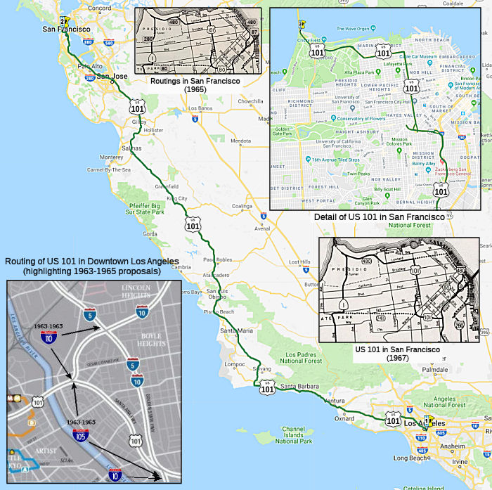 Route 5 near Seventh Street in Los Angeles to Route 1, Funston approach, and the
approach to the Golden Gate Bridge in the Presidio of San Francisco via
Santa Barbara, San Luis Obispo, and Salinas.
Route 5 near Seventh Street in Los Angeles to Route 1, Funston approach, and the
approach to the Golden Gate Bridge in the Presidio of San Francisco via
Santa Barbara, San Luis Obispo, and Salinas.
 Post 1964 Signage History
The road that became US 101 is one of the earliest state routes. It was originally recommended for the state highways map in 1896, and was adopted into the highway system in 1909. Construction began in 1912.
▸In 1963, this segment was segment (a) and (b), and was defined as the route "(a) The junction of Routes 105 and 110 in Los Angeles to Route 80 in San Francisco, passing near Ford Road south of San Jose. (b) Route 80 to Route 480." In this definition, "the junction of Routes 105 and 110 in Los Angeles" refers to the present-day I-10 east/US 101 junction—the plan in 1963 was for those to be short stub interstates I-105 and I-110.
▸In 1968, Chapter 282 changed the definition of both segments. This
reflected two major changes. On the southern end, the stub definitions of
I-105 and I-110 were removed. What had been I-105, the portion of US 101
from the I-10 E junction to I-5, was added to US 101 (I-110, which was the
short stub from (present) US 101 to I-5/I-10, was added to I-10). On the
northern end, the freeway revolt in San Francisco was in flower, and
routes were changing everywhere. Portions of routes were switched between
I-480 and I-280 (and some of I-480 was deleted); changes were made to
I-80. As a result, both segments changed, and the new definition was: "(a)
The junction of Routes 105 and 110 Route 5 near
Seventh Street in Los Angeles to Route 80 near Division Street
in San Francisco, passing near Ford Road south of San Jose. (b) Route 80 near
Division Street in San Francisco to Route 480."
▸In 1991, Chapter 498 changed segment (b) to absorb former Route 480, making it "(b) Route 80 near Division Street in San Francisco to the junction of Route 1, Funston approach, and the approach to the Golden Gate Bridge in the Presidio of San Francisco passing near the intersections of Lombard Street and Van Ness Avenue." This brought Doyle Drive, which had been allocated to Route 480, back into US 101 (where it had been before the 1964 renumbering).
▸ In 1992, Chapter 1243 combined (a) and (b): "(a) Route 5 near Seventh Street in Los Angeles to Route 1, Funston approach, and the approach to the Golden Gate Bridge in the Presidio of San Francisco via Santa Barbara, San Luis Obispo, and Salinas."
Some Post-1964 Notes:
Some additional bit of history:
The following freeway-to-freeway connections were never constructed:
Central California (Santa Barbara through Monterey)
Buelleton Bypass. On June 10, 1965, the Buelleton
Bypass, extending from 0.7 mi S of the Santa Ynez River to 0.7 mi N of
Buelleton, opened. The project eliminated the last section of two-lane,
undivided highway on US 101 in Monterey County. US 101 in Buelleton proper
was previously a four-lane divided roadway running through the center of
town. It was flanked on both sides by frontage roads and interconencted at
grade with Route 246 and several other cross streets. The Route 246/US 101
Separation constructed as a part of the new freeway was one of the major
benefits of an immediate nature for the motorist. There were two
additional interchanges constructed. To the south is the Santa Rosa Road
Overcrossing and to the north, the North Buellton Overcrossing. All three
are diamond interchanges. In addition to these, the construction involved
building a four-lane divided highway with twin 1,000-foot box girder
bridges spanning the Santa Ynez River. The two separate roadways sit on a
common pier wall to allow for expansion at a later date to six lanes,
which can be done easily by the addition of a 12-foot lane to each deck.
Formerly, US, 101 had been restricted to two lanes by the old Santa Ynez
River Bridge. The transition from four- to two-lane traffic at the
old structure had proved a dangerous bottleneck for the high-speed
traffic. The completion of these two structures eliminated another
hazardous condition on the old highway. The portion of the old highway in
Buellton received a complete facelifting also. The former frontage roads
were widened to 42 feet, resurfaced, and restricted to one-way traffic.
Between the frontage roads is a 76-foot mall. This is to be landscaped by
the local businessmen's association in cooperation with the County of
Santa Barbara. When completed, this should give the center of Buellton a
decided parklike quality, which should be a pleasant improvement over the
traffic congestion of former years.
(Source: CHPW, Jul/Aug 1965)
Prunedale Bypass. Improvements on US 101 in the
Prunedale area were identified in the 1960s when a project was initiated
to improve the corridor by constructing a new alignment that bypassed the
community of Prunedale. The California Highway Commission adopted
the US 101 freeway route on June 24, 1964. In April 1973, the Prunedale
Bypass was in the final design phase when it was determined that federal
funding could not be secured, and the project was delayed
indefinitely. In the late 1980s, the Prunedale Bypass was
re-initiated from a Measure B sales tax but lost funding again due to
challenges in court. As a result, the Prunedale Improvement Project
(PIP) in 2015 completed a series of operational and safety improvements,
such as upgrading the existing four-lane facility to a partially
access-controlled facility by constructing ten miles of median barrier,
two new interchanges, and a grade separation for a local street
crossing. The PIP was Phase 1 of the conversion to a fully
access-controlled facility. Phase 2 was planned as the Prunedale
Freeway on either the existing alignment or on the 1964 adopted bypass
alignment. By 2019, Phase 2 of the project was no longer identified in the
TAMC Regional Transportation Plan or any local or regional plans within
San Benito County. On March 26, 2020, the Commission approved Resolution
NIU 20-01 to notify all affected local, regional, and State agencies of
its intent to consider rescinding the freeway adoption. The Department
notified all affected local, regional, and State agencies of the
rescission proposal and asked agencies and the public for any additional
pertinent information that might be helpful to the Commission in making a
final decision. The Department completed the 60-day comment period
on March 19, 2021. Two public comments were received inquiring about the
process to purchase excess lands. The Department provided information
about the process to the interested parties. No other comments were
received from local and regional agencies or the State clearinghouse.
On April 6, 2021, TAMC reaffirmed their support for rescission of the
unconstructed portion of the freeway adoption.
(Source: June 2021 CTC Agenda, Agenda Item
2.3a.(1))
Note: See also the page on Route 82 for the section of former US 101 between San Jose and San Mateo.
Octavia Boulevard Project
 Section 72.1 explicitly abandons as a state highway the portion of current Route 101 between Fell
Street and Turk Street. The portion of current Route 101 between Market
Street and Turk Street ceases to be a state highway unless the alternative
to the Octavia Street Project is approved in November 1999.
Section 72.1 explicitly abandons as a state highway the portion of current Route 101 between Fell
Street and Turk Street. The portion of current Route 101 between Market
Street and Turk Street ceases to be a state highway unless the alternative
to the Octavia Street Project is approved in November 1999.
In November 1998, the voters adopted Proposition E,
which authorized the California Department of Transportation to replace
the Central Freeway with a new four-lane, two-way, single-deck elevated
structure from Mission Street to Market Street and a street-level,
four-lane boulevard along Octavia Street from Market Street to Fell
Street, with two additional lanes for local traffic (the Octavia Boulevard
Plan). Part of the land that was occupied by the Central Freeway and the
freeway ramps (the right-of-way property) was not needed to construct the
Octavia Boulevard Plan. The State Legislature then considered a bill that
would give the right-of-way property to the City. The City would have to
use any monies raised by sale or lease of the unneeded property first to
pay for the Octavia Boulevard Plan and then for transportation
improvements along routes leading to or from Octavia Boulevard. In
November 1999, Prop I was on the ballot. Proposition I is an ordinance
that called for using any proceeds from the sale or lease of the
right-of-way property—if the State gives the property to the
City—to fund the design and construction of the Octavia Boulevard
Plan and to use any remaining monies for transportation improvements along
routes leading to or from Octavia Boulevard.The City's Transportation
Authority would decide which transportation improvements to fund after
consulting with the Central Freeway Citizens' Advisory Committee and
following guidelines listed in the ordinance. Proposition I also would
call for development of residential and mixed residential/commercial uses,
including affordable housing, on the right-of-way property. The ordinance
would prohibit widening the existing elevated freeway structure between
Market and Fell Streets. City and neighborhood representatives would
participate in determining appropriate development of the right-of-way
property. This proposition passed: 54.10% Yes votes ...... 81,061 / 45.80%
No votes.
(Source: Smartvoter)
The Alternative Proposition mentioned, Prop J, would
have repealed Proposition E, authorizing Caltrans to retrofit and widen
the existing lower deck of the Central Freeway to provide a four-lane,
single-deck structure over Market Street from South Van Ness Avenue to Oak
and Fell Streets. The portion of the freeway between the intersection of
Haight and Octavia Streets and the Fell Street off-ramp would be replaced,
and a new on-ramp would be built at Oak Street. The measure also would
have directed the City to hold quarterly meetings on improving
transportation in San Francisco and to develop an annual comprehensive
transit plan. Proposition J provided that it could be amended or repealed
only by a two-thirds vote of the voters. 52.6% voted no and this didn't
pass, meaning that Section 72.1 went into effect, and the portion of US 101 N of Market Street ceased to be a state highway (and US 101 was
rerouted).
(Source: SmartVoter)
The Octavia Street Project took place in 2000, when
the elevated Central Freeway was removed north of Market Street (for a
time, there were the offramps down to Oak and Fell, but were also removed,
dumping traffic onto the new Octavia Blvd.), and the State transferred 22
parcels from under the freeway to the City. The San Francisco Office of
Economic and Workforce Development (OEWD) led the effort, on behalf of the
City, to smooth the transition from freeway to boulevard. The Octavia
Boulevard Project coordinated land use and transportation investments in a
way that secures long-term economic growth.
(Source: Octavia Project)
The history of the construction of the Central Freeway through Hayes Valley—and the controvery associated with it—is discussed in "The Birth And Life Of The Freeway In Hayes Valley".
As for what happened to what remains of the old US 101
in that area... it became a farm. Specifically, at the old on/off ramp
near Laguna Street in early 2010, a number of urban farmers spread
steaming piles of mulch over the edge of the ramps formerly used by cars
to enter and exit the elevated Central Freeway spur above Octavia Street,
arranging the soil in rows for planting vegetables and filler crops. This
has formed the "Hayes Valley Farm". The farm closed in 2013.
(Source: SF.Streetsblog.Org, 2/8/2010)
Central Freeway portion [Route 80 (~SF R4.307R) until the freeway portion ends (~ SF M5.442)]
In October 2022, it was reported that the Central
Freeway portion [from Route 80 in San Francisco (~SF R4.307R) until the
freeway portion ends (~ SF M5.442)] (or a portion of that portion) was
being painted "Coronado Blue". Specifically, work crews are coating the
undergirding of the elevated roadway that connects Market Street to US 101
in a new eye-catching Coronado Blue. Started in June 2021, the project is
expected to be done in May 2024. It’s on budget and will cost a
total $30.9 million. Built in 1955, the entire Central Freeway was damaged
by the 1989 Loma Prieta Earthquake. Only the portion made of concrete west
of Market Street was torn down. The remaining steel stretch was
retrofitted and reconstructed in the early 2000s. A group of activists
want the freeway to be torn down from Market to Bryant streets and
replaced with a grand boulevard and housing. Conducting a study to that
effect is mandated in the city’s Master Plan, the blueprint for its
growth, but it has yet to be completed. A review of the Federal Highway
Administration inspection reports show the freeway is in fair condition.
Inspectors found two issues—known as deck geometry and
underclearance—to be “intolerable” and requiring
“high priority corrective action.” Neither of these is an
indication that the nearly two-mile long viaduct is inherently unsafe, but
those features do not meet modern design standards.
(Source: San Francisco Standard, 10/25/2022)
In December 2022, it was reported that State Sen. Scott
Wiener (D-San Francisco) formally asked the California Department of
Transportation to study the cost and logistics for taking down the Central
Freeway, the Bayshore Viaduct of I-80 between 17th Street and
the Bay Bridge, and I-280 north of US 101. The letter, cosigned by a dozen
advocacy groups, adds momentum to a small but growing campaign to remove
some of the city’s freeways. Caltrans is working on a response to
Wiener. The belief of the proponents is that removal would help Caltrans'
budget, potentially make way for housing and open space, and better
connect Mission Bay with the city center.
(Source: San Francisco Standard, 12/1/2022)
There are some planned freeway routings in the city of San Francisco. California Transportation Commission (CTC) Agenda Item June 2000 2.3a discusses a route from PK (Post Kilometer) 7.6 at South Van Ness to PK R8.2 at Fell Street. July 2000 Agenda Item 2.3a discusses a route from PM R5.0 at Eire Street to PM 5.3 at Golden Gate Avenue.
Golden Gate Bridge (SF 9.899 to MRN L0.261)
![]() Note that the Golden Gate Bridge is not part of US 101. The Golden
Gate is maintained by the Golden Gate Bridge, Highway, and Transportation District. This gap dates back to the original gap in State Highway Maintenance between LRN 1 (the
Redwood Highway) and LRN 2 (El Camino Real). This gap originally included
the City of San Francisco, as state highways prior to 1933 did not
traverse cities. However, the US highway designation did, and US 101 did
include San Francisco, starting from the Hyde Street Pier. The planned
designation of US 101 (which was independent of the state legislative
routes) also included the ferry from Sausalito to the Hyde Street Pier.
Note that the Golden Gate Bridge is not part of US 101. The Golden
Gate is maintained by the Golden Gate Bridge, Highway, and Transportation District. This gap dates back to the original gap in State Highway Maintenance between LRN 1 (the
Redwood Highway) and LRN 2 (El Camino Real). This gap originally included
the City of San Francisco, as state highways prior to 1933 did not
traverse cities. However, the US highway designation did, and US 101 did
include San Francisco, starting from the Hyde Street Pier. The planned
designation of US 101 (which was independent of the state legislative
routes) also included the ferry from Sausalito to the Hyde Street Pier.
(Partial source: Gribblenation Blog (Tom Fearer),
“The Legislative Route gaps of US Route 101 and California State Route 1 on the Golden Gate Bridge”, 11/2021)
In January of 1933 construction of the Golden Gate Bridge began followed
by construction of the San Francisco-Oakland Bay Bridge in July
1933. This, combined with the extension of state highways into
cities, led US 101 to be extended through San Francisco from the pier, and
to include a diversion to the Bay Bridge (where US 101E split off and went
down the East side of the bay, with US 101W on the west). Additionally, in
1933, LRN 56 (Route 1) was extended into San Francisco, although not
across the bay.
(Source: Gribblenation Blog (Tom Fearer), “The Legislative Route gaps of US Route 101 and California State Route 1 on the Golden Gate Bridge”, 11/2021)
The Golden Gate Bridge was completed on April 19, 1937 and was dedicated
on May 28th. Unlike the state-built San Francisco-Oakland
Bay Bridge, construction of the Golden Gate Bridge was financed by the six
Counties of San Francisco Bay and was not a State Highway facility.
The Golden Gate Bridge features a 8,980 foot long hybrid truss-suspension
design. Despite not being a state highway, US 101 appears to have been
aligned across the bridge per AASHTO documents, even if there was not
state maintenance.
(Source: Gribblenation Blog (Tom Fearer), “The Legislative Route gaps of US Route 101 and California State Route 1 on the Golden Gate Bridge”, 11/2021)
This continued with the 1964 renumbering, where the definition for new Route 101 (US 101) excluded the bridge.
 Pre 1964 Signage History
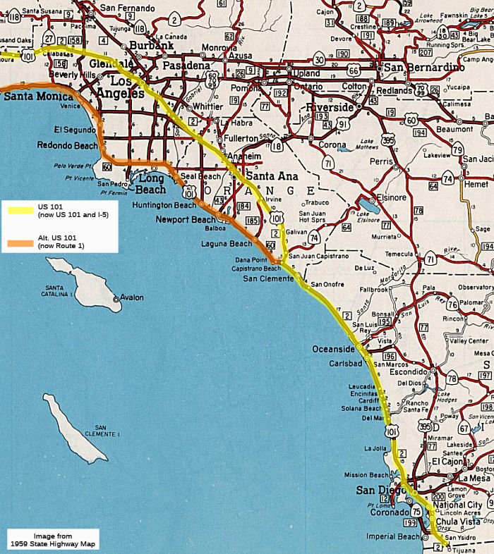 US 101 was part of the original set of planned US routes
in 1926, and was first signed in 1928. The route existed long before the
signing, however. It began at the Mexican border, and ran N through San
Diego along National Avenue, Main St., Harbor Drive, Pacific Drive, Midway
Drive, Morena Blvd, and Pacific Coast Highway (the route from National
City/San Diego N was LRN 2, defined in 1909; it was extended to the
Mexican border in 1931). Both were essentially following a routing
established by El Camino Real. The US 101 routing was later bypassed by
the present-day I-5 (Montgomery Freeway). SignOnSanDiego has noted
there is an oral-history project recording memories of old US 101. There's
a Historic US 101 sign on San Diego Ave. in the Old Town section, near the
Whaley House. Also, street names like "Old Hwy 101" and "Coast Hwy 101"
follow the old route in Solana Beach and Encinitas. Other streets on the
original route included Turquoise Street, Cass Street, Garnet Avenue,
Morena Boulevard, San Diego Avenue, India Street, Harbor Drive, Broadway
in Chula Vista and Beyer Boulevard in Otay Mesa.
US 101 was part of the original set of planned US routes
in 1926, and was first signed in 1928. The route existed long before the
signing, however. It began at the Mexican border, and ran N through San
Diego along National Avenue, Main St., Harbor Drive, Pacific Drive, Midway
Drive, Morena Blvd, and Pacific Coast Highway (the route from National
City/San Diego N was LRN 2, defined in 1909; it was extended to the
Mexican border in 1931). Both were essentially following a routing
established by El Camino Real. The US 101 routing was later bypassed by
the present-day I-5 (Montgomery Freeway). SignOnSanDiego has noted
there is an oral-history project recording memories of old US 101. There's
a Historic US 101 sign on San Diego Ave. in the Old Town section, near the
Whaley House. Also, street names like "Old Hwy 101" and "Coast Hwy 101"
follow the old route in Solana Beach and Encinitas. Other streets on the
original route included Turquoise Street, Cass Street, Garnet Avenue,
Morena Boulevard, San Diego Avenue, India Street, Harbor Drive, Broadway
in Chula Vista and Beyer Boulevard in Otay Mesa.
This alignment, along Torrey Pines and La Jolla Blvd., was once signed as US 101W. The later I-5 alignment, the Rose Canyon Highway, was signed as US 101E.
The original US 101 was replaced relatively quickly in 1933 by the more
modern and direct Pacific Highway featuring bridges and ramps, which kept
the name US 101 despite following a significantly different route than the
original version. City officials debated for several years whether to
build a north-south route along the coast through Pacific Beach and La
Jolla, or to build a more direct route through the rugged and hilly
terrain of Rose Canyon to the east. They eventually chose the coastal
route based on its flatness and scenic beauty, and paving was completed in
1920 of La Jolla Boulevard, Turquoise Street, Cass Street and Garnet
Avenue. But the shorter Rose Canyon route, which some travelers had used
before the Pacific Beach route had been paved, was flattened a bit and
rerouted in 1930 with a big plan on mind. City officials decided to create
a new US 101 by grading and extending Atlantic Street from Barnett Avenue
to the Rose Canyon highway at Balboa Avenue, and re-naming it Pacific
Highway. The road was designated as the new US 101 in San Diego when it
opened in late 1933, and it was connected to the state’s portion of
US 101 that had been completed all the way to just south of Del Mar. In
1935 the city officially changed the names of Atlantic Street, West
Atlantic Street, Rose Canyon Highway, Torrey Pines Mesa Road and Torrey
Pines Road to Pacific Highway. The road was eventually connected to the
South Bay and the border in the 1950s with construction of the Montgomery
Freeway. A few sections of the old Pacific Highway still exist, including
a long stretch from downtown up to Mission Bay Park where you can see the
road’s old-fashioned highway interchanges. The road also still
exists from where it began near present-day Seaport Village through the
northern edge of downtown. A few other sections have survived, such as
North Torrey Pines Road between UC-San Diego and Del Mar, Gilman Drive
between I-5 and the university, and Mission Bay Drive in Pacific Beach. In
contrast, nearly all of the original US 101 has survived, of course,
because it was essentially surface streets. Missing portions, however,
include a chunk that became part of the UCSD campus and a stretch
eliminated to create the National City Mile of Cars. In addition, part of
the original US 101 isn’t open to the public because it’s
within Marine Corps Base Camp Pendleton. There is evidence the original US 101 split into two separate routes for a few years because of congestion
concerns, but details of that are disputed. The western route may have
included Ingraham Street and Foothill Boulevard. And the later version of
US 101 was divided into two routes in North County, between Palomar
Airport Road and Route 76, for the same reason in the 1950s. [Note: It is
unclear how this articles description of the split connects with US 101W
and US 101E]
(Source: San Diego U-T, 8/18/2017)
 From San Diego, the route ran N along Pacific Coast Highway to San Juan Capistrano. This route is now San Diego County Sign Route S21. The old "El Camino
Real" is San Diego County Sign Route S11. This has been bypassed by I-5, and was LRN 2.
Other portions that were onced signed as US 101 include Carlsbad Blvd, San
Diego County Sign Route S6, San Diego County Sign Route S8. This is one of the older freeway segments in
the San Diego area, encompassing the former Carlsbad Freeway, and including a Business Routing for US 101 in Oceanside. A
California Highways and Public Works magazine from 1925 notes that the original pavement was first placed in service around 1912, with 15' wide by 4" thick
concrete. A relocation project occurred in 1924, which widened the
pavement, relocated 7 miles, and eliminated 2 grade crossings.,
From San Diego, the route ran N along Pacific Coast Highway to San Juan Capistrano. This route is now San Diego County Sign Route S21. The old "El Camino
Real" is San Diego County Sign Route S11. This has been bypassed by I-5, and was LRN 2.
Other portions that were onced signed as US 101 include Carlsbad Blvd, San
Diego County Sign Route S6, San Diego County Sign Route S8. This is one of the older freeway segments in
the San Diego area, encompassing the former Carlsbad Freeway, and including a Business Routing for US 101 in Oceanside. A
California Highways and Public Works magazine from 1925 notes that the original pavement was first placed in service around 1912, with 15' wide by 4" thick
concrete. A relocation project occurred in 1924, which widened the
pavement, relocated 7 miles, and eliminated 2 grade crossings.,
Between this point and Oceanside, I-5 buries the old road. Between San Juan Capistrano and Oceanside, the following is a description of how to find the old road (alias, it goes from N to S, while the rest of this paragraph goes from S to N):
South of San Juan Capistrano, you can follow US 101 pretty closely on Camino Capistrano then continuing south on the Old Coast Hwy which then turns into El Camino Real through San Clemente. You will have to get back on the freeway at Christantos. Then you can take Baslone Road and turn right, you will be on the Old Pacific Hwy and if you can do it, when your making the sharp left turn after the Fwy take a look right and you can see the old Expressway thats now buried by I-5. Continue south on the old expressway, over the railroad overpass and past San Onofree Nuclear Power Station until you get to the entrance to the San Onofree State Beach. Pay the ranger and continue on. Now eventually you will have to get on a bycycle to continue further south, when the Expressway gets to area below the Vista Point this is point where I-5 buries the old road all the way to Oceanside.
With respect to the route through the Marine base, US 101 was open
through the base, all the way to San Diego. It was only four lanes divided
through the base, with a 60mph speed limit. The accident rate was high.
Portions of the original road still exist south of Camp Pendleton down to
San Diego, with historic US 101 markers. Within the base, the northern
part of the old road still exists, as a service road to San Onofre State
Beach and the nuclear power plant. Most of the rest was incorporated into,
or obliterated by, I-5, or still exists as a bike trail.
(Source:Oscar Voss)
Note: For a detailed history of past US 101 routings, see Historic U.S. 101 - Los Angeles County, written by Scott Parker, over on AARoads.
From San Juan Capistrano, US 101 ran N through El Toro and Irvine to Santa Ana. From Capistrano Beach, it ran along Laguna Road (since overlain with US 101, and then I-5) to 1st Street, then Main Street (Santa Ana), across Chapman to Lewis running N/NW to roughly what is now Anaheim and Katella (after 1937, this may have been long the completed extension of Manchester) (roughly where it met LRN 174, Manchester, which was overlain by US 101/I-5), Los Angeles St (renamed after 1970 to Anaheim Blvd), across what is now La Palma Parkway (previously Los Angeles St.) and Spadra (renamed in 1967 to Harbor Blvd). It ran N on Spadra/Harbor to Fullerton Road (later renamed Harbor Blvd), and along Fullerton Road (Harbor Blvd) to Whittier Blvd, and W along Whittier Blvd into Los Angeles County to Mission Road. It ran N along Mission Road to Sunset Blvd. This portion of the routing has been bypassed by I-5.The freeway routing was part of LRN 174 from Rosecrans and Firestone (Route 42) to Santa Ana; otherwise, it was LRN 2.
It appears there were, at one time, plans to extend LRN 2 (probably not as US 101) along Whittier Blvd, then a bit to the S to eventually meet Deodara (which became Lambert) to join up with LRN 19 near what became State College. This was to support the eventual post-1964 Route 57.
It may have taken, at one time, a different route through Norwalk, as there is an El Camino Real bell at the intersection of Orr and Day and Imperial. In terms of LRNs, the freeway routing of US 101 S was LRN 2 (defined in 1909) from San Diego to a point S of Anaheim, LRN 174 (defined in 1933) from Anaheim to Route 35, and LRN 166 (defined in 1933) into downtown LA. The surface street routing ("old US 101") was LRN 2 at this point, and was likely signed is "Business US 101". It is present-day Route 72. For a short time, there was also a Bypass US 101 running from the intersection of Firestone Blvd / Manchester Ave. and Los Angeles St, northwest along Firestone (pre-1964 Route 10), N along Lakewood Blvd. (Route 19), W at Anaheim Telegraph Rd (Route 26), N to Whitter Blvd at Calzona St.
 In 1952, the CHC revealed plans for the freeway routing
in the San Juan Capistrano area. The route roughly follows US 101 from
Niguel Road to a point about 1 mi N of Capistrano Beach. It bypasses San
Juan Capistrano to the east. It then proceeds inland from the present
Coast Highway to San Clemente, crossing the Coast Highway new W Avenida de
Los Lobos Marinos in that city. Thence it goes S of the present highway.
The plan was to construct a 4-lane facility expandable to 6 lanes from
Niguel Road to San Clemente, with 6 lanes after that. There would be a
connection with the Pacific Coast Highway from Serra Junction to a point
near Capistrano Beach.
In 1952, the CHC revealed plans for the freeway routing
in the San Juan Capistrano area. The route roughly follows US 101 from
Niguel Road to a point about 1 mi N of Capistrano Beach. It bypasses San
Juan Capistrano to the east. It then proceeds inland from the present
Coast Highway to San Clemente, crossing the Coast Highway new W Avenida de
Los Lobos Marinos in that city. Thence it goes S of the present highway.
The plan was to construct a 4-lane facility expandable to 6 lanes from
Niguel Road to San Clemente, with 6 lanes after that. There would be a
connection with the Pacific Coast Highway from Serra Junction to a point
near Capistrano Beach.
(Source: Los Angeles Times, 12/20/1952 via Joel Windmiller,
2/19/2023)
An August 1941 report issued by the Regional Planning Commission of Los
Angeles County entitled “A Report on the Feasibility of a Freeway
Along the Channel of the Los Angeles River” proposed a
four-lane roadway on each levee from Anaheim Street in Long Beach north to
Sepulveda Boulevard in the San Fernando Valley; excepting between Soto
Street and Dayton Street in downtown Los Angeles, where, due to a lack of
right-of-way along the river, the alignment matches the future alignment
of the US 101 portion of the Santa Ana Freeway. There is no mention in the
report of a master plan of freeways like that issued in 1947, although the
maps showed connections to the already-completed Arroyo Seco Parkway and
the proposed Ramona and Rio Hondo Parkways.
(Thanks to Daniel Thomas for hunting down this
information)
Whittier Blvd and US 101 Bypass
Prior to the freeway routing that became I-5, US 101 ran along Whittier Blvd and up towards Sunset Blvd and East Los Angeles.
By 1915, LRN 2 had been completed from the Los
Angeles/Orange County line to Anaheim to State standards. A 1917 map shows
LRN 2 following Whittier Boulevard, Spadra Road and Los Angeles Street
from the Los Angeles city limit to Anaheim, passing through the
communities of Montebello, Whittier, La Habra and Fullerton. The
route along Whittier Blvd was widened in 1924. In 1925, a new bridge was
constructed over the San Gabriel River, opening in 1926. In 1925, LRN 2/Whittier Boulevard was expanded from Montebello to Workman Mills Road in
Whittier. In 1926, the Rio Hondo Bridge along LRN 2/Whittier Boulevard was
moved 15 feet upstream to a new alignment, allowing the structure to be
twinned. In 1927, the expansion of US 101/LRN 2/Whittier Boulevard from
Michigan Avenue to the Orange County line was completed. By 1935, the
routing of US 101 was approaching Whitter Boulevard via Boyle Avenue in
Los Angeles. From Los Angeles, US 101/LRN 2 followed Whittier
Boulevard to La Habra in Orange County via Montebello and Whittier.
US 101/LRN 2 departed La Habra via Spadra Road towards Anaheim via
Fullerton, passing through Anaheim via Los Angeles Street south towards
Santa Ana.
(Source: Gribblenation Blog (Tom Fearer), "California State Route 72 (former US Route 101 between Los Angeles and Anaheim)", 6/10/2023)
By 1942, work on US 101 Bypass had begun with the
transformation of Sign Route 26.. The 1942 Division of Highways Map shows
Sign Route 26 with a gap originating at the eastern terminus of LRN 173 at
Indiana Street in Los Angeles. Much of what had been Sign Route 26
on Anaheim-Telegraph Road (LRN 166) was designated as US 101 Bypass.
From Anaheim-Telegraph Road, US 101 Bypass followed Lakewood Boulevard
(LRN 168), Firestone Boulevard (LRN 174) and Manchester Boulevard (LRN 174) to Anaheim. Mainline US 101 followed Whittier Boulevard, Spadra
Road and Los Angeles Street between Los Angeles-Anaheim. By the end of
1952, US 101 Bypass would be completed between Rosemead Boulevard and the
Los Angeles Civic Center, with motorists using Lakewood Boulevard and
Firestone Boulevard east of Rosemead Boulevard to Norwalk. By 1953, the
Bypass was complete to Slauson, and by 1954, to Pioneer Blvd near Norwalk.
At this time, mainline US 101 was realigned onto the Santa Ana Freeway
(LRN 166), an interim routing on Pioneer Boulevard and Firestone
Boulevard/Manchester Boulevard (LRN 174) between Los Angeles to
Anaheim. The former mainline of US 101 on LRN 2 was no longer signed
as US 101. In the 1964 renumbering, former US 101 on LRN 2 was renumbered
as Route 72 between I-5 and new Route 245 (Downey Road).
(Source: Gribblenation Blog (Tom Fearer), "California State Route 72 (former US Route 101 between Los Angeles and Anaheim)", 6/10/2023)
In 1937, the final segment of the "Manchester Boulevard
Extension" was dedicated. The Manchester Boulevard Extension
provided a direct link between Downey and Anaheim that followed the
Southern Pacific Railroad. The Manchester Boulevard Extension
bypassed downtown Anaheim and tied into existing alignment of Sign Route 10 (LRN 174) on southern Manchester Boulevard at Miraflores near the
outskirts of Santa Ana. The Manchester Boulevard Extension was
initiated in 1924 by the Greater Manchester Avenue Improvement
Association. The Manchester Boulevard Extension concept was taken
over by the Division of Highways when LRN 174 was added as a State Highway
around 1933. Manchester Boulevard in Anaheim would appear as part of
US 101 Bypass on the 1940 Division of Highways Map and would become part
of mainline US 101 in 1953.
(Source: Gribblenation Blog (Tom Fearer), "Santa Ana Street, Anaheim, California", 9/15/2023)
The Gribblenation Blog (Tom Fearer) "The history of US Route 101 in Los Angeles" provides a lot of detail, including timing for the construction of freeway segments, for US 101 Bypass.
East LA Interchange
The portion in the downtown area (between the Route 110 (former Route 11/US 66) interchange and the Route 60 interchange) was signed, between 1947 and 1958, as US 99/US 101/US 60/US 70.
Scott Parker on AAroads provided an interesting history
of the East LA Interchange:
(Source: Scott Parker on AARoads, "Re: What about the capacity (capacitibility) of the East Los Angeles Interchange?", 7/14/2016)
From about '58 to '67 parts of it were literally carved out of the L.A. river bluffs and local neighborhoods — it, and the various freeway branches extending outward from it could serve as the "poster child" for the concept of constructing freeways through neighborhoods where the cost of property acquisition was relatively miniscule. The basic location was determined by the presence of the original US 101 "Santa Ana" freeway; the section of the interchange's location was opened by 1947. When it was decided to route I-5 between central LA and points to the south along this facility, it became only a matter of choosing just where to place the interchange with the "Golden State" freeway (I-5 north/I-10 east) and the Santa Monica freeway (I-10 west). The basic Interstate portion of the interchange (at that time, US 101 from the interchange north to the west terminus of the San Bernardino Freeway was designated, but never signed as, the original I-105) was completed in late 1962 with the opening of the first section of the Santa Monica/I-10 freeway to the west. Originally, "ghost ramps" essentially continuing the trajectory of the Santa Monica freeway eastward just north of the Santa Ana Freeway could be seen; they became the western terminus of Route 60, the Pomona Freeway, which opened in the spring of 1967. There's not a lot of room for this interchange to grow—the east I-10 to I-5 south and Route 60 connection is located on a bridge structure that begins about a half-mile west as the L.A. River crossing, and continues east until the rising ground of the river bluff is encountered; that segues quickly (a couple hundred yards) to the ramp to south I-5 and then a series of bridges over I-5 and the interchange's easternmost ramps. Without major bridge reconstruction and/or taking of nearby property, there's no place to readily increase capacity here. Westbound is essentially the mirror-image of this; traffic from west Route 60 to west I-10 is down in a trench under I-5 and several local streets before rising up to join the main I-10 lanes and bridge the river westward. The I-10 through lanes are also on a series of bridges, crowded in by industrial facilities or topographical features. Again, not a lot of room to grow—there are businesses, including the LA Times printing plant, situated right along the edges of either the aforementioned eastbound bridge or the westbound trench.
This interchange is a perpetual traffic nightmare; its traffic levels have exceeded its planned capacity several times over — but, as with many urban facilities, the cost (financial and social) of significant expansion is prohibitive. It's lucky that the original concept was squashed by the time interchange construction commenced; that concept saw another freeway extending directly south (a virtual extension of the Golden State freeway) called the Industrial Freeway (Route 258), which continued south to Terminal Island; this, after 1964, morphed into the Route 47 corridor, the northern reaches in central LA of which never progressed beyond an undefined-alignment line on the state planning maps. Route 47 presently only extends north from Terminal Island as mostly a surface facility (much of which follows Alameda Ave.) but only as far as Route 91. The concept of a freeway along that corridor (principally as a relief route for I-710 to the east and I-110 to the west) has been jettisoned; its place as a commercial traffic conveyor has been taken by the freight-rail Alameda Corridor from the port area to the rail yards east of downtown LA.
Scott Parker (Sparker) also added the chronology of construction:
The first sections to be completed, in early 1961, were the ramps forming the direct I-5 connection, from the SE Santa Ana Freeway (at that time still signed as US 101) to the Golden State Freeway (I-5/I-10). The San Bernardino Freeway interchange a couple of miles north on the Golden State had been completed and opened in early 1960 (and, for a while, there was a BGS on westbound I-10 just before that interchange showing the through lanes of the San Bernardino Freeway as I-110; it was gone by 1963). Until the I-5 throughput ramps were opened, the freeway temporarily terminated at Boyle Ave. near Hollenbeck Lake. The I-10 through ramps from the Golden State to the westerly Santa Monica freeway opened right around Christmas of 1961; it simply directed traffic to Santa Fe Avenue (and were temporarily signed as such, minus any I-10 reference). The entire Santa Monica viaduct south of downtown LA was completed to the Harbor Freeway (then US 6/CA 11) in late 1962; the ramps from the SE Santa Ana Freeway to the Santa Monica were opened at that time as well; all signage clearly indicated I-10. The multiplex of I-5 and I-10 was acknowledged by a roadside BGS northbound; the only freestanding signage featuring both I-5 and I-10 shields was southbound immediately after the WB I-10 merge from the San Bernardino Freeway; that signage lasted several years but was gone by the late '60's.
(Source: Scott Parker (Sparker) at AAroads, 8/22/2016)
There is loads and loads of detail on the different routings of US 101 / LRN 2 through Los Angeles—far too many to include here. This discussion over on AAroads summarizes it in gory detail.
Routings Through Los Angeles
It appears that the original routing of LRN 2 was to be
as follows (this was likely not signed as US 101):
(Source: AARoads:Historic U.S. 101 - Los Angeles County)
In 1929, there was an alignment shift downtown:
(Source: Gribblenation Blog - Hollywood Freeway; California State Route 170, US Route 101, US Route 66 and California State Route 2; Scott Parker (Sparker) on AARoads)
In 1930 (before the state highway system signed routes
in cities), the LA City Council requested the routing to be: From the
southern city limit of Los Angeles at Whittier Boulevard, US 101 was to be
signed following Boyle Avenue, Pleasant Avenue, Macy Street (now Cesar
Chavez Avenue), Main Street, Sunset Boulevard and Cahuenga
Boulevard. US 101 was to follow Cahuenga Boulevard via Cahuenga Pass
to San Fernadno Valley and Ventura Boulevard.
(Source: Gribblenation Blog (Tom Fearer), "The history of US Route 101 in Los Angeles", 7/1/2023)
In 1934-35, the alignment shifted again:
(Source: Gribblenation Blog - Hollywood Freeway; California State Route 170, US Route 101, US Route 66 and California State Route 2; Scott Parker (Sparker) on AARoads)
Before the construction of the freeway in Los Angeles, US 101 ran W along Sunset to Cahuenga, N along Cahuenga to Ventura Blvd, and ran out of Los Angeles on Ventura Blvd. Ventura Blvd is the oldest continuously traveled route in the Valley. Originally part of the famed El Camino Real, the dirt path between between California's Spanish missions, it has been known as Camino de las Virgenes and Ventura Road.
Conversion of US 101 to the Hollywood Freeway
Construction of US 101 as freeway through downtown Los Angeles started in 1949, reduced Fort Moore Hill to a stump and converted the section of Broadway between Temple and Sunset from a tunnel to a freeway overpass. This had the side effect of removing the Fort Moore Hill tunnel. The freeway's construction also doomed the Hill Street tunnels, although the second tunnel through Fort Moore Hill would survive until 2004 as storage space for the Los Angeles Unified School District's archives. Information on the tunnels in downtown LA, including pictures, may be found here. Details on the construction may be found in the 1950 and 1951 issues of CHPW.
Public reception of the Hollywood Freeway was not
always positive. Early planning maps showed the Hollywood Parkway (to use
its original name) slicing through a densely populated area. Residents
were understandably unsettled. As early as 1940, the Hollywood
Anti-Parkway League denounced the Cahuenga Pass Parkway, then under
construction, as “un-American.” Later, as planners moved to
extend the parkway toward downtown, opposition became even louder. Movie
stars worried about their Whitley Heights homes. Merchants fretted about a
sweeping concrete viaduct over Franklin Avenue. The Hollywood Bowl
Association feared noise pollution. Some critics suggested that the city
build a rapid transit line instead. Most supported the general idea of a
freeway but disagreed with its routing. Ultimately, the state relented to
local opposition and struck compromises with the mostly white,
middle-class, and politically powerful Hollywood community. Construction
claimed several historic structures, including Charlie Chaplin's and
Rudolph Valentino’s former homes in Whitley Heights, but the state
planted extensive landscaping near the Hollywood Bowl to dampen traffic
noise, and highway engineers bent the freeway around local landmarks like
the First Presbyterian Church, the Hollywood Tower apartments, and
KTTV’s newly constructed television studio. Construction lasted
seven years (1947-54) and cost $55 million. Nearly half went toward
right-of-way acquisition, which involved the relocation of 1,728 buildings
and the demolition of another 90. [See the Source link for some wonderful
pictures]
(Source: KCET Hollywood Versus the Freeway, 3/26/2016)
The Gribblenation Blog (Tom Fearer) "The history of US Route 101 in Los Angeles" provides a lot of detail, including timing for the construction of freeway segments, for US 101 and the Hollywood Freeway, including the Santa Ana and East Los Angeles portions.
 There was once an off-ramp at Boylston Street (~ LA 1.905) on SB 101, as shown in a 1954 map
and a 1962 image posted to the Facebook Group Freeways of Los Angeles.
The units on the west side of Boylston were constructed in 1922. and
remain as of 2023. Based on that, the exit ramp from the US 101 to
Boylston was very narrow, with a sharp exit at the end. Note that there
was no onramp at this point as it would be in the middle of the
interchange; nor was there anything on the NB side of US 101. It appears
to have been removed in a subsequent freeway widening. The original ramp
edges remain as evidence of the ghost ramp.
There was once an off-ramp at Boylston Street (~ LA 1.905) on SB 101, as shown in a 1954 map
and a 1962 image posted to the Facebook Group Freeways of Los Angeles.
The units on the west side of Boylston were constructed in 1922. and
remain as of 2023. Based on that, the exit ramp from the US 101 to
Boylston was very narrow, with a sharp exit at the end. Note that there
was no onramp at this point as it would be in the middle of the
interchange; nor was there anything on the NB side of US 101. It appears
to have been removed in a subsequent freeway widening. The original ramp
edges remain as evidence of the ghost ramp.
(Source: FB Freeways of Los Angeles - 1954 Map 9/13/2023; 1962 Photo 9/13/2023)
The Planned Interchange with the Beverly Hills/Glendale Freeway
A 1954 issue of CHPW confirms that the widening of US 101 near Vermont was in anticipation for the future Route 2 freeway (LRN 162, called, at that time, the "Santa Monica Freeway" as it ran along Santa Monica Blvd, vice LRN 173, the Olympic Freeway (Route 26), which eventually became I-10): "The design finally adopted for the Hollywood Freeway at the crossing. with Vermont Avenue was influenced by the contemplated future construction of the Santa Monica Freeway and also the possibility of rail rapid transit facilities being installed on the future Santa Monica Freeway. This required the lengthening of the Vermont Avenue Bridge and other bridges in the vicinity. The added cost providing for future rail rapid transit facilities was financed by the City of Los Angeles from city funds. Similarly financed from city funds were the bus transfer facilities at Alvarado Street and Vermont Avenue and Western Avenue."
According to Scott Parker on AARoads: Even back in 1953
when it was constructed, the Hollywood Freeway featured the lane
separation near the Melrose exit that was intended to accommodate LH ramps
to and from the Glendale/Beverly Hills Freeway in a similar fashion to the
present I-5/I-710 interchange in the City of Commerce (itself a holdover
from '50's design standards). The Glendale Freeway was completed to its
present Glendale Blvd. terminus back in 1962; plans were active to extend
it to US 101 as late as 1975, but those plans were put on hold when
Adriana Gianturco became Caltrans' chief that year and drastically
curtailed freeway planning and building statewide. Eight years later, when
administrations changed along with agency mission, the Echo Park/Silver
Lake area through which Route 2 would have run had become quite
gentrified, resulting in NIMBY opposition that was echoed within L.A. city
government. At that point the freeway extension was effectively dead. But
the simple truth is that even if that segment connecting to US 101 had
been built, the regional politics had shifted enough that a western
extension through the south part of Hollywood and into Beverly Hills would
be D.O.A. as well. Given the trajectory of the adopted Glendale Freeway
alignment and the configuration of the originally planned US 101/Route 2
interchange, the traffic from Route 2 would have simply segued onto NB US 101—which, unless immediately departing the Hollywood Freeway in its
namesake neighborhood, would have been duplicative of other freeway
service (i.e., Route 134). Given all that, the final decision to scrap the
freeway extension was hardly surprising.
(Source: Scott Parker (Sparker) on AARoads, "Re: CA 2/Glendale Freeway", 2/11/2020)
Cahuenga Pass Parkway
The Cahuenga Pass Parkway concept was developed by City Engineer, Lloyd Aldrich. Aldrich's plan include four lanes in each direction, with separation between opposing traffic flows with the Pacific Electric Railroad tracks in the middle. Bridges connecting the service roads and spanning the parkway were constructed at the Pilgrimage (now John Anson Ford) Theater, Mulholland Drive and Barham Boulevard. At the southern end of the Pass, southbound traffic destined to Highland Avenue would stay to the right, while traffic destined to southbound Cahuenga Boulevard would stay in the left two lanes and travel in a tunnel under the Pacific Electric Railroad tracks. The first unit was opened on June 15, 1940 and extended northerly to the Barham Boulevard ramps. By January 1, 1941, the roadway was extended to terminate in a 90° curve connecting with the older segment of Cahuenga Boulevard near Bennett Drive. Cahuenga Boulevard Parkway, a freeway less than two miles long, was opened just one day after the Arroyo Seco Parkway was dedicated. The next phase of extending the parkway to the intersection of Ventura Boulevard and Vineland Avenue was disrupted by World War II, and was completed by the State in 1949. In 1954, Cahuenga Parkway was altered and incorporated into the Hollywood Freeway. This route was LRN 2, started in 1909.
While the last phase of the Cahuenga Parkway was being
completed, work already was underway on building the Hollywood Freeway.
The last segment of the freeway, built in 1954, connected to the south end
of the original Cahuenga Parkway. The completion of the Hollywood Freeway
necessitated the demolition of the 1940 tunnel connection under the
Pacific Electric Railroad tracks between the Pilgrimage bridge and Odin
Street (you can find a nice history of the Pilgrimage Bridge here). In addition, since the Pacific Electric Railroad had ceased operation in
1944, the area that it had occupied in the median was reconstructed to
accommodate traffic from northbound Highland Avenue. In 1957, when the
Hollywood Freeway was extended northwesterly of Lankershim Boulevard, the
northbound on-ramp, northbound off-ramp and southbound on-ramp at Barham
Boulevard were abandoned. The abandoned ramps have remained preserved
since that time. Despite alterations, much of the original Cahuenga
Parkway remains intact. The original ornamental street lights on the
bridges still look charming. The Pacific Electric Railroad overhead cable
hooks can still be seen on the bridges over the area formerly occupied by
the tracks. And the ornamental design in the corners of Barham Boulevard
bridge remains. [The southbound off-ramp at Barham Blvd. was closed in
2015]
(Source: The historical information above on the
Cahuenga Pass Parkway was derived from "Transportation Topics and Tales: Milestones in Transportation History in Southern California" by John E. Fisher, P.E. PTOE)
 The first unit of completed construction on the freeway
was between Highland Avenue and Barham Boulevard in the Cahuenga Pass,
opened to traffic in 1940. Further construction on the project was delayed
until additional state highway funds could be procured under the
Collier-Burns Highway Act of 1947. On September 4, 1948, Lankershim
Boulevard opens to traffic under a newly completed Hollywood Freeway
overpass as part of the “Barham-to-Vineland” segment of
US-101. The second unit of US 101 was completed in November, 1948
(outbound) and January, 1949 (inbound), from Barham Boulevard to Vineland
Avenue in the San Fernando Valley. Much of the construction involved
overpass accommodation for both the Pacific Electric rail lines and six
lanes of freeway. Pacific Electric lines ran in the median of the freeway
through the Cahuenga Pass until December 28, 1952 when the line was
abandoned in favor of bus service. On December 27, 1950, the 2.5-mile
stretch between Grand Avenue and Silver Lake Boulevard, opened to traffic
following dedication ceremonies. This section of freeway includes the
4-level grade separation structure at the junction point of the Hollywood
Freeway and Arroyo Seco Parkway, although only the highest level of the
4-level was in use at the time. On December 20, 1951, the Hollywood
Freeway opened through the LA Civic Center. At the time, Highway
Commissioner Harrison R. Baker stated that: "This is a short but vital
link of the Hollywood Freeway — in fact it is probably the most
important link in the entire system of freeways. Not only does this link
complete the five miles from Western Avenue but it gives a connection with
the Ramona and Santa Ana Freeways. In addition, this link gives a good
distribution of traffic from these three freeways into Downtown Los
Angeles." The final section of the Hollywood Freeway was opened on April
15, 1954, with dedication ceremonies featuring actor Bob Hope.
The first unit of completed construction on the freeway
was between Highland Avenue and Barham Boulevard in the Cahuenga Pass,
opened to traffic in 1940. Further construction on the project was delayed
until additional state highway funds could be procured under the
Collier-Burns Highway Act of 1947. On September 4, 1948, Lankershim
Boulevard opens to traffic under a newly completed Hollywood Freeway
overpass as part of the “Barham-to-Vineland” segment of
US-101. The second unit of US 101 was completed in November, 1948
(outbound) and January, 1949 (inbound), from Barham Boulevard to Vineland
Avenue in the San Fernando Valley. Much of the construction involved
overpass accommodation for both the Pacific Electric rail lines and six
lanes of freeway. Pacific Electric lines ran in the median of the freeway
through the Cahuenga Pass until December 28, 1952 when the line was
abandoned in favor of bus service. On December 27, 1950, the 2.5-mile
stretch between Grand Avenue and Silver Lake Boulevard, opened to traffic
following dedication ceremonies. This section of freeway includes the
4-level grade separation structure at the junction point of the Hollywood
Freeway and Arroyo Seco Parkway, although only the highest level of the
4-level was in use at the time. On December 20, 1951, the Hollywood
Freeway opened through the LA Civic Center. At the time, Highway
Commissioner Harrison R. Baker stated that: "This is a short but vital
link of the Hollywood Freeway — in fact it is probably the most
important link in the entire system of freeways. Not only does this link
complete the five miles from Western Avenue but it gives a connection with
the Ramona and Santa Ana Freeways. In addition, this link gives a good
distribution of traffic from these three freeways into Downtown Los
Angeles." The final section of the Hollywood Freeway was opened on April
15, 1954, with dedication ceremonies featuring actor Bob Hope.
(Source: LA Metro Library: This Date in Los Angeles Transportation History, 12/20/2018; 12/27/2018; 9/4/2023; Image source: LA Metro Library - This Date in Los Angeles Transportation History, 9/4/2023)
The First Soundwall
The proximity of the Hollywood Bowl also led to the
first soundwall, although it wasn't constructed on US 101. After the
two-mile long Cahuenga Pass Freeway opened in 1940 near the Hollywood
Bowl, concertgoers and residents started complaining about traffic noise.
So, in 1945, the California Department of Public Works conducted a noise
study, which recommended building a 10-foot high wall to block the traffic
noise. But the wall wasn't built and noise complaints grew as the entire
Hollywood Freeway was opened several years later, clogging the road with
183,000 vehicles a day — almost double the volume it was designed to
carry. The state highway department conducted additional studies regarding
the problem of freeway noise at the Bowl and later recommended building an
even taller 30-foot tall wall. These early studies helped lay the
foundation for freeway soundwalls. In 1954, L.A. Mayor Norris Poulsen
appointed a committee to study the noise caused by the 101 Freeway.
According to L.A. City Council records from that time, the city's general
manager recommended developing a sound barrier consisting of high
vegetation to screen the Hollywood Bowl. But instead of building the wall,
city records show officials decided to crack down on cars without
mufflers, hoping they could prevent excessive noise. A new city job was
created: Motor Vehicle Muffler Inspector. The city ordinance creating the
job position noted that the noise caused by the 101 Freeway threatened
"the peace, health and safety of persons living in areas adjacent to [the]
Freeway." Meanwhile, Hollywood was also complaining about freeway noise.
Movie studios worried that it would interfere with filming. In 1956, the
state Department of Public Works conducted a study of freeway noise at the
Columbia Pictures Ranch in Burbank — now Warner Bros. Ranch —
where dozens of movies and television shows have been filmed, including I
Dream of Jeannie and Bewitched. And the complaints kept coming. As more
freeways were built, more people complained about the noise. Then in 1968,
the California Department of Public Works built what is believed to be the
state's first official freeway soundwall on I-680 in Milpitas, near San
Jose.
(Source: LAist, 3/26/2019)
Plans for US 6 Co-Signage
With the planned construction of the "Hollywood Freeway
Extension" along future Route 170, plans were made to reroute US 6 off US 99 (future I-5) and down Route 170 and US 101 into Downtown Los Angeles.
US 6 was briefly signed (as shown by Michael Ballard's site) along the constructed southern end
of the extension in 1962, with signs leading up to and at the interchange
with US 101/Route 134. That signage went away with the truncation of US 6
in 1963. There is no evidence that US 6 was signed along US 101; that was
likely pending complete signage S from I-5 (with temporary signage along
Lankershim while Route 170 was under construction). Said signage never
happened.
(Source: Michael Ballard, email and website, 7/16/2020)
US 101 in the San Fernando Valley
In mid-1962, the Hollywood Freeway was extended to Vineland and Magnolia in N. Hollywood, with traffic using it as far as Magnolia Blvd. Further, a project was started to widen the original Hollywood freeway between Sunset and Pilgrimage Bridge to make it a uniform 8-lanes between downtown and the valley. Also in 1962, the route was made continuous from the Hollywood Freeway to the Golden State Freeway... to the east (the extension to the north was still under construction). This occured with the completion of the projects between the Hollywood Freeway and Buena Vista Street, and between Buena Vista Street and the Golden State Freeway, five miles, completed at a combined construction cost of $10,436,000.
On 11/18/1954, the CHC adopted a 10.9 mi route for the Riverside-Ventura freeway extending from the junction with US 99, the Golden State Freeway, westerly to Sepulveda Blvd.
Construction of the freeway in the San Fernando Valley, between Hazeltine and Woodman, resulted in the displacement of the McKinley Home for Boys, which ran along (and consumed) the southern edge of the Home's property (the Northern edge was along Riverside Dr.). The Home relocated to San Dimas, CA.
Conejo Grade
The present-day path of the Conejo Grade between
Newbury Park and Camarillo was first laid out by William H. Brewer,
principal assistant to Josiah Whitney in the Geological Survey of
California. Brewer’s route was slightly north of present-day US 101.
It began at Moorpark and Olsen roads and then followed Santa Rosa Road
down the steep slope into Santa Rosa Valley in Ventura County. By the
mid-1870s, Brewer’s route was recognized for its directness.
Overland Mail stagecoaches used the road, which is labeled “Old
Butterfield Road” or “Butterfield Grade” on old-time
surveyors’ maps. Butterfield Road did save time in good weather. But
when the rains came, it was incredibly treacherous.
(Source: San Luis Obispo Tribune, 3/25/2017)
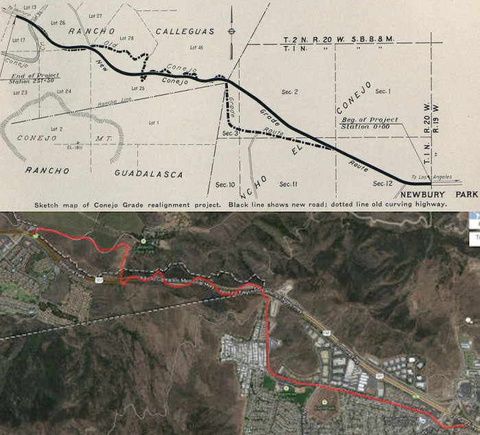 In 1935, an interesting rerouting of US 101 along the
Conejo Grade, traces of which are still visible today. The Conejo Grade
was originally routed in 1912 as one of the first roads to be surveyed by
the State Highway Department. By 1929, when the new Coast Highway (US 101A, signed Route 3, present-day Route 1) route was completed between
Oxnard and Santa Monica, the old route was overcrowded and some of the
sharper turns on the Conejo Grade had become quite dangerous. As a result
traffic showed a preference for the coast route so that about 60% of the
coast traffic followed the Oxnard-Santa Monica Route and only 40% chose
the old route. Truck traffic especially preferred the "sea level" route to
the steep grades, narrow roadbed, and inferior alignment on the Conejo
Grade. The old location, although in general fairly direct, necessarily
had many short radius curves in order to keep construction costs to a
minimum as well as keep within the allowable 6% maximum grade. Three
routes were considered:a North Route, a Middle Route and a South Route.
The "Middle Route" was by far the most direct alignment, but on account of
its directness it required a grade greater than 6% for a portion of the
distance. However, far better alignment could be obtained by adopting this
route, as well as keeping curvature to a much lower figure than on either
of the other routes. Surveys indicated that by using a 7% grade for the
two miles down the west slope of the Conejo Range, the Middle Route could
be used and thus secure the advantages of better alignment and shorter
distance. Note that the land for the Conejo Grade rerouting was donated by
Adolpho Camarillo, founder of Camarillo. More details are in the May 1937 California Highways and Public Works.
In 1935, an interesting rerouting of US 101 along the
Conejo Grade, traces of which are still visible today. The Conejo Grade
was originally routed in 1912 as one of the first roads to be surveyed by
the State Highway Department. By 1929, when the new Coast Highway (US 101A, signed Route 3, present-day Route 1) route was completed between
Oxnard and Santa Monica, the old route was overcrowded and some of the
sharper turns on the Conejo Grade had become quite dangerous. As a result
traffic showed a preference for the coast route so that about 60% of the
coast traffic followed the Oxnard-Santa Monica Route and only 40% chose
the old route. Truck traffic especially preferred the "sea level" route to
the steep grades, narrow roadbed, and inferior alignment on the Conejo
Grade. The old location, although in general fairly direct, necessarily
had many short radius curves in order to keep construction costs to a
minimum as well as keep within the allowable 6% maximum grade. Three
routes were considered:a North Route, a Middle Route and a South Route.
The "Middle Route" was by far the most direct alignment, but on account of
its directness it required a grade greater than 6% for a portion of the
distance. However, far better alignment could be obtained by adopting this
route, as well as keeping curvature to a much lower figure than on either
of the other routes. Surveys indicated that by using a 7% grade for the
two miles down the west slope of the Conejo Range, the Middle Route could
be used and thus secure the advantages of better alignment and shorter
distance. Note that the land for the Conejo Grade rerouting was donated by
Adolpho Camarillo, founder of Camarillo. More details are in the May 1937 California Highways and Public Works.
Note: See the Gribblenation Blog (Tom Fearer) "Former US Route 101 along Santa Barbara Channel (Gaviota Pass to Ventura)" for more detailed history on the development of US 101 in Ventura, including links to maps and CHPW articles. The material here is a combination of material from that blog, as well as my research and observations. Best attempts to note sources has been made; unsourced material is my research and observations.
By 1952, US 101/LRN 2 had moved to the Montalvo Freeway alignment from
the Santa Clara River northward into Ventura. The Montalvo Freeway
was the last limited access component necessary to connect Ventura-Oxnard
with a partially limited access grade.
(Source: Gribblenation Blog (Tom Fearer), “Former US Route 101 along Santa Barbara Channel (Gaviota Pass to Ventura)”, August 2021)
US 101 was originally aligned through downtown Ventura via Main Street. In 1923, it was realigned to diverge from Main Street via Garden Street and Meta Street (now Thompson Boulevard). In 1933, the new alignment of US 101/LRN 2 through Ventura onto Garden Street and Thompson Boulevard was also completed. The new alignment of US 101/LRN 2 connected back with Main Street east of downtown Ventura and followed it towards the Santa Clara River and Oxnard.
By 1955, US 101/LRN 2 from Central Avenue in Ventura the Santa Clara
River had been converted to freeway standards. The freeway segment
of US 101/LRN 2 terminated at the City of Ventura and emptied onto Main
Street just south of Telegraph Road/Thompson Boulevard. By 1957, a design
study was underway to extend the Ventura Freeway through the City of
Ventura where US 101/LRN 2 would be relocated. Freeway conversion through
Ventura was planned for FY60 anf FY61, and would include an interchange
with the already complete Ojai Freeway carrying US 399. This opened in
1962.
(Source: Gribblenation Blog (Tom Fearer), “Former US Route 101 along Santa Barbara Channel (Gaviota Pass to Ventura)”, August 2021)
The bridge over the Ventura River originally dated back to 1912. In 1932,
the existing two lane Ventura River Bridge was slated to be replaced by a
four lane structure to facilitate more efficient travel on US 101/LRN 2. The new Ventura River Bridge would incorporate the piers of the
older structure. The new four lane Ventura River Bridge opened during late
1933. 1934 brought word of construction of a new overhead structure of the
Southern Pacific Railroad west of the Ventura River. The Ventura
Overhead structure was a realignment of existing US 101/LRN 2 from a
obsolete rail subway. The Ventura Overhead required a short
lengthening of the existing seawall and was completed during Fall
1934. In 1962, there was a planned extension of the Ventura Freeway
from the Ventura Overhead to the Santa Barbara County Line. The
planned extension of the Ventura Freeway would relocated US 101/LRN 2
uphill above the Rincon Seawall and Southern Pacific Railroad. The
relocation of US 101/LRN 2 above the Rincon Seawall would be done by the
mid 1960s (and result in the older route become a segment of Route 1 in
1980).
(Source: Gribblenation Blog (Tom Fearer), “Former US Route 101 along Santa Barbara Channel (Gaviota Pass to Ventura)”, August 2021)
Note: In June 2021, the CTC approved the following
SHOPP amendment: 07-Ven-1 21.5 PPNO 4972 ProjID 0716000025 EA 07-31960.
Near the city of Ventura, at Ventura Overhead № 52-0040. Replace
corroded steel spans of bridge and upgrade bridge railing to current
standards. Replace bridge. Note: The bridge will be
replaced rather than repaired, because during project development, it was
determined that it was more cost effective to replace the 87 year old
bridge than to retrofit it. Change the delivery year to FY22-23 because
the design will take more time, and increase construction capital,
support, and R/W capital to support the new design. Revised numbers: Con
Sup $1,650K ⇒ $5,247K; R/W Cap $983K ⇒ $4,378K; Const Cap
$3,565K ⇒ $28,096K; Total $10,438K ⇒ $41,961K.
(Source: June 2021 CTC Agenda, Agenda Item
2.1a.(2d) #40)
Rincon Road Causeway / Rincon Point
The Rincon Road Causeway between Ventura and
Carpinteria was built by 1912 for a cost of $32,000. It was turned
over to the California Highway Commission for completion in 1912, and is
4.4 miles in length. By 1914, contracts had been let for a segment
of LRN 2 from the Rincon Road Causeway to Sea Cliff. By 1915, they were
working on the Rincon Road Seawall, which would protect the highway and
allow routing of traffic away from Casitas Pass. By 1917, the new
alignment along the coast bypassing Casitas Pass was completed and in use.
The Rincon Seawall was reconstructed and expanded in 1924. In 1926, the
Rincon Seawall opened as a replacement of the Rincon Road Causeway between
Sea Cliff and El Rancho Rincon. The Rincon Road Causeway was removed
during the construction of the Rincon Seawall. The Rincon Seawall
reclaimed a 6,400 foot segment of land that was necessary to expand LRN 2.
(Source: Gribblenation Blog (Tom Fearer), “Former US Route 101 along Santa Barbara Channel (Gaviota Pass to Ventura)”, August 2021)
By the late 1950s, the state wanted to increase the
highway’s capacity to six lanes. The Division of Highways proposed
to cut through two hills and reroute the road through Rincon Canyon.
According to state engineers, the new road would be straighter and
therefore safer. The new route would also be around two-tenths of a mile
shorter, which would save fuel. And it could be constructed with minimal
interruption of traffic. Some residents of Carpinteria hated the new
route. At a meeting of the Santa Barbara County Board of Supervisors in
1959, Rincon rancher J. M. Eakins argued that the route would gobble up
some 60 acres of orchards and residential land. He also contended that
changing the airflow through the canyon might invite frost and endanger
the orchards that remained. Three years later, in 1962, the state
was still promoting the inland route, and Eakins was still fighting it.
Another Rincon rancher, R. W. Bates, emphasized aesthetic considerations.
When state engineer E. R. Foley said that the inland route would save
money, Bates asked him what value the state placed on natural beauty.
Foley replied that beauty is impossible to evaluate, so the state assigned
it a value of zero. Bates considered that approach shortsighted. The
inland route bothered Rincon Point residents for a different reason. With
a new US 101 through Rincon Canyon, it appeared that the southbound lanes
of the old US 101 would become a county road. Rincon Point residents
feared that the northbound lanes would become a parking lot for
beachgoers. The Carpinterians favored an alternative approach: a shoreline
route that would widen and straighten US 101 near its current path
(slightly inland) by shaving off the side of Rincon Hill and moving the
railroad tracks. But according to the Division of Highways, this shoreline
route would displace a “tremendous surplus” of soil, estimated
at 4.3 million cubic yards, which would have to be stashed somewhere. With
the inland route, it seems, the soil from the Rincon Hill cuts would be
used to level part of the canyon. Despite the surplus soil and all the
other concerns, the opposition prevailed. Later in 1962, the state
abandoned the inland route in favor of the shoreline route. For funding
reasons, construction on the Rincon 101 didn’t get underway until
1968. The project ended up displacing more soil than initially estimated,
some five million cubic feet. Some people wondered if the soil could be
used to widen the beach at Rincon Point. Instead, much of it got hauled
into Rincon Canyon to create a mesa, which is now the site of several
houses.
(Source: Coastal View, 11/15/2023)
The three mile segment of the Ventura Freeway from Palm Street to Emma Wood State Park began construction on February 28, 1961. This construction included a one mile segment of the Ojai Freeway (Route 33), which replaced a hazardous at-grade intersection that had originally existed. The project was completed in May 1963.
In 1929, US 101/LRN 2 between Carpinteria south over the Ventura County
Line to Benham was realigned. The Carpinteria-Benham realignment of
US 101/LRN 2 included an overhead crossing of the Southern Pacific
Railroad. The new overhead structure was a replacement for a
substandard rail subway and was to be complete by October 1929.
(Source: Gribblenation Blog (Tom Fearer), “Former US Route 101 along Santa Barbara Channel (Gaviota Pass to Ventura)”, August 2021)
Santa Barbara / San Luis Obispo / Monterey / San Benito Counties
The route remained signed as US 101, and legislatively as LRN 2, into San Jose, running through Santa Barbara, San Luis Obsipo, Paso Robles, Salinas, and Gilroy.
In 1954, a three mile segment of US 101/LRN 2 from Punta Gorda (Mussel
Shores) to the Santa Barbara County Line was being converted to a four
lane expressway, and paving was in process on a new expressway bypass of
Carpinteria. TThe Carpinteria Expressway opened during December 1954, and
shifted US 101/LRN 2 north of downtown Carpinteria and the previous
alignment on Carpinteria Avenue.
(Source: Gribblenation Blog (Tom Fearer), “Former US Route 101 along Santa Barbara Channel (Gaviota Pass to Ventura)”, August 2021)
In 1926, work was being done on a new alignment of LRN 2 through
Summerland and Ortega Hill. The new alignment of LRN 2 in Summerland
was to follow Lillie Avenue over a new 6.4% grade over Ortega Hill.
The existing Ortega Hill alignment in Summerland is shown to carry a grade
of 8.8%. Ortega Hill is stated to have been named after Spanish
Captain Jose Francisco Ortega. By 1927, reconstruction of US 101/LRN 2 between Summerland and Carpinteria was nearly complete.
(Source: Gribblenation Blog (Tom Fearer), “Former US Route 101 along Santa Barbara Channel (Gaviota Pass to Ventura)”, August 2021)
In 1948, the Montecito Parkway four-lane expansion of US 101/LRN 2 took
place.expanding the segment from Sheffield Drive north to San Ysidro Road.
1948 also saw the start of the Salsipuedes Street Overhead in Santa
Barbara, which was the beginning phase of a realignment of US 101/LRN 2
off of Gutiterrez Street onto a expressway bypass. This was
completed in late 1948. In 1951, US 101/LRN 2 in Summerland was upgrade to
expressway standards, as an extension of the Montecito Parkway, extending
east to the Ventura County Line through a new grade in Carpinteria. By
late 1956, US 101/LRN 2 through Montecito had been converted to freeway
standards, US 101/LRN 2 through Goleta was in the process of full freeway
conversion, and US 101/LRN 2 from Ellwood to Orella was under an active
contract about to begin for a full freeway conversion.
(Source: Gribblenation Blog (Tom Fearer), “Former US Route 101 along Santa Barbara Channel (Gaviota Pass to Ventura)”, August 2021)
US 101 in Santa Barbara
 Note: See the Gribblenation Blog (Tom Fearer) "Former US Route 101 along Santa Barbara Channel (Gaviota Pass to Ventura)" for more detailed history on the segment between Ventura and Gaviota Pass.
Where noted, some of the material above and in this section is excerpted
and condensed from that blog. Other material in this section was some
shared research between Tom and I, and some was my own research. Such is
the honor among Roadgeek Thieves :-).
Note: See the Gribblenation Blog (Tom Fearer) "Former US Route 101 along Santa Barbara Channel (Gaviota Pass to Ventura)" for more detailed history on the segment between Ventura and Gaviota Pass.
Where noted, some of the material above and in this section is excerpted
and condensed from that blog. Other material in this section was some
shared research between Tom and I, and some was my own research. Such is
the honor among Roadgeek Thieves :-).
Prior to the state taking over maintenance of highways
in cities in 1933, LRN 2 was more of a named road, "Pacific Highway/El
Camino Real". A 1920 ACSC map shows the southbound as: State Street, De La
Vina Street, Micheltorena Street, State Street, Montecito Street, Milpas
Street, Cacique Street, Salinas Street and what is now Old Coast
Highway. The northbound is: Old Coast Highway, Salinas Street,
Cacique Street, Milpas Street, Haley Street, State Street, Mission Street,
De La Vina Street and State Street.
(Source: Gribblenation Blog (Tom Fearer), “Former US Route 101 along Santa Barbara Channel (Gaviota Pass to Ventura)”, August 2021)
In Santa Barbara prior to mid-to-late 1934, the
situation for US 101 appears muddled. The July 1934 CHPW indicated that US 101 entered from the SE along Old Coast Highway, up Salinas to Cacique,
over to Milpas, up to Gutierrez, over to De La Vina, which became
Hollister and exited to the W towards Goleta (although a 1945 map implied it might have been Punto Gordo instead of Cacique; however, the July 1934 CHPW says otherwise). As CHPW said of the early 1934 routing: “The motorist, when entering Santa Barbara from the south
along the present highway, is first confronted by a narrow underpass under
the Southern Pacific tracks, where the grade is steep and the alignment on
a 360-foot radius curve. A short distance farther on, the traveler again
crosses under the railroad, under almost equally dangerous conditions; and
thence proceeds along various city streets around no less than five
right-angle turns, and then follows northerly along de La Vina Street,
Hollister Avenue and out of the city on the north. De la Vina Street is
very narrow and its congested condition has always been an annoyance to
the traveler.”
(Source: GaryA on AARoads, "Re: US 101 on State Street in Santa Barbara", 4/26/2021; DPF research based on that post; July 1934 California Highways and Public Works)
However, earlier ACSC maps from around 1920 had some
slight differences. They show a couplet using Haley and Montecito instead
of Gutierrez, and use of State Street instead of De La Vina between that
couplet and Micheltorena. Between Micheltorena and Mission, State Street
and De La Vina are a couplet, and then the routing continues to the N
along De La Vina.
(Source: DTComposer on AARoads, “Re: US 101 on State Street in Santa Barbara”, 5/28/2021)
In November 1934, the routing changed with a new
trafficway. The section along "Old Coast Highway", Salinas, and Cacique
was bypassed with the adoption of a route closely paralleling the Southern
Pacific railroad. This involved a total construction of 5.9 miles of
highway, together with two steel and timber bridges over Mission Creek, a
reinforced concrete overhead structure over the previous highway, and a
similar type structure to carry a county highway over the new road. The
new alignment has a graded roadbed width of 46 and 56 feet along the new
alignment, and 76 feet in width where contiguous with existing city
streets with surfacing 30 feet wide throughout, and all structures are
being built to accommodate future widening. CHPW noted that “At the
northerly end of the city, where the new road parallels the railroad, it
has been necessary to construct a reinforced concrete girder type overhead
structure to carry a well traveled county road, this structure directly
connecting to an existing timer bridge over the Southern Pacific railrood.
At the northerly end of the work, where a connection is made again with
the present State highway on Hollister Avenue, additional right of way
hall been acquired to permit the future construction of a braided traffic
intersection to effectively handle the ever increasing volume of traffic
in this vicinity.”
(Source: July 1934 California Highways and Public Works. H/T to DTComposer for finding the article)
The resulting new route is shown in the 1934 State Highway map: US 101 entering from the south along the new
alignment S of "Old Coast Highway" to Milpas, NW on Milpas, turn L (SW) on
Gutierrez, curve R (NW) on Rancheria, merge (NW) onto a new alignment via
Greenwell and Modoc, and then onto Hollister (near the current Route 154
junction). By 1945, one map shows Rancheria continuing to San Marcos Pass Road, with US 101 running along Rancheria to San Marcos Pass to Hollister
(although the 1948 State Highway map seems to dispute that). At this time,
LRN 150 (Route 225) ran along Cabrillo Blvd from US 101 on the E end to
Castillo, along Cliff Dr, to Las Posistas, back to join US 101 at Modoc.
Also, by 1948, the expressway was under construction from Milpas to Rancheria. By 1960, Rancheria had been renamed
Hollister.
(Source: GaryA on AARoads, "Re: US 101 on State Street in Santa Barbara", 4/26/2021; DPF research based on that post)
In 1947, US 101/LRN 2 was upgraded from the City Limit
of Santa Barbara 9.3 miles northward to Tecolote Canyon. This new
alignment of US 101/LRN 2 replaced Hollister Avenue through Goleta between
the Hollister Underpass and the newly constructed Ellwood
Overhead. The relocation of US 101/LRN 2 through Goleta was
spurred by interests from the U.S. Marine Corps Station during World War
II. The realignment of US 101/LRN 2 from Santa Barbara to Tecolote
Creek was constructed during three projects, the last concluding during
March 1947.
(Source: Gribblenation Blog (Tom Fearer), “Former US Route 101 along Santa Barbara Channel (Gaviota Pass to Ventura)”, August 2021)
In 1954, plans were started for the removal of the
traffic lights in Santa Barbara. There were four traffic lights . The
state wanted them removed. The city wanted them removed. So the state
conducted a preliminary study. But the city rejected the state's design
for an elevated freeway through Santa Barbara. Then the state rejected the
city's design for a depressed freeway. And for the next three decades more
than a hundred designs were proposed and rejected, more than $3 million
was spent by Caltrans on studies, dozens of environmental impact reports
were written and 18 separate city councils debated the issue. Through it
all the traffic lights remained a frequent source of Angst for weekend
travelers, a daily irritant for residents and a symbol of bureaucratic
delay. It wasn't until 1988 that the project to remove them began. City
officials traditionally have worked hard preserving Santa Barbara's
Spanish architectural heritage, limiting growth, maintaining the
Mediterranean calm of the city. They are accustomed to stalling proposals
until their specifications are met. But the freeway
project—completed in 1991, almost 40 years after it was first
discussed—is a long time to marshal a project to completion. The
city, however, will finally get the freeway it wants. And it's not just
another anonymous swath of concrete cutting through town. The city
contributed $250,000 for arches, ironwork and other flourishes so one of
the freeway under-crossings will look like a Spanish Renaissance bridge
and be a gateway to the city. Although for decades neither the city nor
the state could agree on a plan, both shared an overriding goal—the
elimination of the traffic lights. The state wanted the lights removed
because they represented the only interruption along the 435 miles of US 101 between Los Angeles and San Francisco. The city wanted the lights
removed because the exhaust fumes from idling cars cause pollution and the
accident rate—about 200 a year—is much higher than the average
four-lane urban freeway. Also, cross-traffic backs up for blocks as
residents wait for the light to briefly flash green. The average wait is
four minutes, according to Caltrans, and up to eight minutes on busy
weekends. That makes it the longest traffic signal in the state. For every
Caltrans proposal, the city has offered a counterproposal. Soon after
Santa Barbara rejected the elevated freeway, city officials suggested a
depressed freeway, with the roadbed below street surface and cross-streets
going over the highway. The state was not receptive because of the greater
expense and technical difficulties. So city officials devised a number of
other variations on the proposal, none of which were accepted. Throughout
much of the 1950s and 1960s, the city and state were at odds. Neither side
could agree on a plan. Out of desperation Caltrans even briefly studied a
proposal to avoid the city entirely by rerouting US 101 through the
mountains to the northeast. Eventually, Caltrans took a more conciliatory
approach and Santa Barbara became more amenable to compromise. By 1971,
the City Council and the state agreed on a ground-level freeway proposal
with under-crossings for three main downtown streets. But the next year a
new City Council was elected and it had reservations about the project.
The council studied a depressed freeway again, but eventually returned to
the plan that had been approved. So for the next three years they examined
variations of this proposal until, in the mid-1970s, a compromise was
reached. The plan was finally accepted by both the city and the state. The
city's aesthetic and environmental concerns were satisfied. The state's
budgetary limits were not exceeded. But then the money wasn't there.
Funding for new freeway projects dried up during the mid-1970s to the
early 1980s, Nicholson said. Highway funds didn't keep pace with inflation
and the Administration of Gov. Edmund G. Brown Jr. was reluctant to
allocate funds for road construction. When Brown left office in 1983,
planning for the freeway commenced at last. And during the last few years
the city and state held meetings, refined the design and planned for
construction. Instead of traffic lights and the four-lane highway, an
expanded six-lane freeway will be built. Under-crossings for both
pedestrians and cars will be constructed at Garden and State streets to
connect the waterfront with downtown.
(Source: LA Times, 4/19/1988)
In 1918 the Arroyo Hondo Bridge was completed over the namesake creek
between Gaviota siding and Ellwood siding. The 1918 Arroyo Hondo
Bridge is a 536 foot long open spandrel arch concrete bridge which was
among the earliest of such design built as part of a State Highway. In
1941, US 101/LRN 2 was expanded to four lanes between Las Varas Creek 3.4
miles to Tecolote Creek and Orella siding 1 mile west of Canada del
Refugio. There was also a secondary project to construct a new
bridge over Dos Pueblos Creek which was completed by March 1941. In 1950,
US 101/LRN 2 was expanded to a freeway between Arroyo Hondo and Arroyo
Quemando. The expansion of US 101/LRN 2 between Arroyo Hondo-Arroyo
Quemando led to both existing bridges being converted to southbound
usage.
(Source: Gribblenation Blog (Tom Fearer), “Former US Route 101 along Santa Barbara Channel (Gaviota Pass to Ventura)”, August 2021)
Goleta and the Gaviota Pass
Note: There is good information on the history of the Gaviota Pass (approx SB 47.277) on the Goleta History Website and the Gribblenation Blog “US Route 101 through Gaviota Pass” (Tom Fearer). The following information is summarized from those sources; consult the sources for more detailed information.
The Gaviota Pass is the only real gap in the Santa Ynez
mountain range for miles (the other passes in the area are San Marcos, Route 154, and Refugio,
which is Refugio Road and Forest Road 5N12 between US 101 and Route 246).
The steep and rugged mountains rise about 2,000 feet on each side. The
pass started as a Chumash trail that took them over the crest of the
coastal range for visits to the back country. It was widened for the
Europeans, but the rocky pass was often blocked by boulders that fell off
the cliffs, flooded out, or obstructed by mud and debris. In 1846 during
the Mexican-American War the path through Gaviota Pass played a
significant part as was to be an ambush point to trap the forces of U.S.
Army Lt. Colonel John C. Fremont. Fremont's troops instead diverted
east from Gavoita Pass over the Santa Ynez Mountains and discovered what
is now San Marcos Pass. In 1854, chisels were taken to the rock walls of
Gaviota Pass to widen the trail enough for wagons to fit through. Passage
was still treacherous, and the flow of the creek could still make it
impossible. Traffic continued to increase in the 1860’s as more
ranches developed in the Valley. The earliest travelers made note of the
large overhanging rock on the west side of the pass that resembled an
Indian head, watching over the pass. It’s still there today, hanging
over the southbound lanes. In 1861, dynamite was used to widen the pass
and the first county road was finished with a wooden bridge over the
Gaviota Creek.
(Source: Goleta History, 9/15/2015; Gribblenation Blog “US Route 101 through Gaviota Pass”, June 2021)
Gavoita Pass was signed as part of the American El
Camino Real auto trail starting in 1906. State Maintenance started
with the 1909 bond act; one of the highways approved was a 481.8 mile
highway originating at the City Limits of San Francisco which terminated
in San Diego (LRN 2). Additionally, in 1913 the Pacific Highway was
plotted as a major Auto Trail which had Gaviota Pass along it's planned
route. Also in 1913 the Division of Highways starting planning the
specific route for LRN 2 between Santa Maria and Gaviota Pass. The
route through Zaca Canyon towards Gaviota Pass was chosen over the
alternatives due to it being the most direct line southward from Harris.
In 1915 the State Division of Highways took control of the road,
graveling, straightening and widening it, as well as completing the road
from Harris S to Gaviota Pass. By 1924, LRN 2 had been widened through
Gaviota Pass and by 1926, it became US 101. The wooden bridge over Gaviota
Creek was replaced by a steel suspension bridge in 1927.
(Source: Goleta History, 9/15/2015; Gribblenation Blog “US Route 101 through Gaviota Pass”, June 2021)
In 1931 the road was again widened, straightened, paved
and a new concrete bridge replaced the steel bridge. The road surface
through Gaviota Pass was widened from 21 feet to 36 feet. This alignment
serves as the southbound lane of US 101, and the 1931 Gaviota Creek Bridge
is still present. After World War II attention was turned to improving the
two-lane Coast Highway as this was the only pass on the coast from south
to north and faster moving cars demanded more room on the road.Rather than
further widening the pass by removing massive amounts of rock from the
mountainside, a tunnel was “holed through” on the east side of
the gap, starting in 1952. The tunnel could only be bored out from the
south side because there was no safe way to remove the dirt and rock from
the north end. The lights in the tunnel were the first power lines in
Gaviota Valley. The tunnel is 435 feet long, 35 feet wide and 18 feet
high. The walls contain 18 inches of cement. The Gaviota tunnel was
completed in May 1953. Heavy duty nets designed to catch falling boulders
were placed above the highway in 1992.
(Source: Goleta History, 9/15/2015; Gribblenation Blog “US Route 101 through Gaviota Pass”, June 2021)
During 1933, LRN 56 was extended to a new south
terminus at US 101/LRN 2 at Las Cruces immediately north of Gaviota Pass.
This was signed as Route 1 in 1934.
(Source: Gribblenation Blog “US Route 101 through Gaviota Pass”, June 2021)
In the mid 1930s, there were numerous realignments to
straighten the roadway. In 1934, a realignment between Gaviota and Arroyo
Hondo functioned as an extension of the work completed on US 101/LRN 2 in
Gaviota Pass, eliminating 31 curves along with 0.127 miles of travel
between Gaviota and Arroyo Hondo. In 1935, a realignment from Gavoita Pass
to Nojoqui Creek eliminated 33 curves and 0.877 miles of travel.
(Source: Gribblenation Blog “US Route 101 through Gaviota Pass”, June 2021)
In 1947, it was reported that the original coast highway was relocated for 9.3 mi N of Santa Barbara to Tecolote Canyon. The revised routing replaced the old route through the town of Goleta between the Hollister Underpass and the Elwood Overhead. The old highway became a county road. The new highway is a four-lane divided roadway. The alignment parallels the SP main line for approximately eight miles, and replaced an old road that had 17 curves and grades of up to 6%.
In 1951, there was an expansion of US 101/LRN 2 in
Gaviota Pass to a four lane highway for slightly over 5 miles originating
near Gaviota northward towards Nojoqui Creek. The key piece of the
expansion of US 101/LRN 2 in Gaviota Pass was a tunnel. Construction of
the Gaviota Tunnel portals was completed on May 13th, 1953. The
Gaviota Tunnel was 435 feet in length. IN 1956, the Nojoqui Expressway
segment opened north of Gavoita Pass. The Nojoqui Expressway was a
four lane divided highway originating 1 mile north of Nojoqui Summit
northward 11 miles to a half mile from the Santa Ynez River, and connected
to the four lane alignment of US 101/LRN 2 completed over Nojoqui Summit
during 1951.
(Source: Gribblenation Blog “US Route 101 through Gaviota Pass”, June 2021)
In the Santa Ynez Valley, the route that became LRN 2 did not follow the
routing of the previous Spanish El Camino Real and its 1906 American Auto
Trail successor. There were numerous suggested alignments of LRN 2 as it
was plotted in 1913. Several of the suggested routes diverge west from
Gaviota Pass towards Lompoc and Mission La Purshima. An easterly
suggested route was aligned past Mission Santa Inés near
Solvang. Ultimately a more central route through Santa Ynez Valley
through Buell Ranch onward towards Zaca Canyon was selected as the
alignment of LRN 2. In 1913 the Pacific Highway was plotted as a
major Auto Trail which followed LRN 2 through Santa Ynez Valley. By 1926,
the route was aligned through Buellton; by 1935, US 101/LRN 2 was aligned
on Avenue of the Flags. By 1948, there was a rebuild and expansion of US 101/LRN 2 in Buellton, including an expansion of US 101/LRN 2 on Avenue of
the Flags to expressway standards along with two new steel bridges at
Nojoqui Creek and the Santa Ynez River. The freeway bypass was
budgeted for FY63-64, and completed in June 1965.
(Source: Gribblenation Blog (Tom Fearer), "Former US Route 101 in Buellton", August 2021)
US 101 in Nipomo (~ SLO 1.211 to SLO 8.269)
Note: See the Gribblenation Blog "Former US Route 101 through Nipomo" for more details, including source documents and maps, regarding this segment.
Tom Fearer notes that within the community of Nipomo
the original alignment of US 101 can be found on Thompson Avenue. The
first specific evidence of this on a state highway map is the 1935 map,
and it remained along Thompson Avenue until the mid 1950s. In 1956, a
realignment, including several freeway structures, was announced that
would originate 3 miles north of Santa Maria at Hourihan Grade and ended
approximately another 7.1 miles to the north at Russell Turn. This was
completed in 1957.
(Source: Gribblenation Blog (Tom Fearer), "Former US Route 101 through Nipomo", July 2021)
US 101 in Arroyo Grande and Pismo Beach (~ SLO 12.497 to SLO 17.098)
Note: See the Gribblenation Blog "Former US Route 101 through Pismo Beach and Arroyo Grande" for more details, including source documents and maps, regarding this segment.
Tom Fearer notes that the City of Arroyo Grande has two
historic alignments of US 101: one that follows Branch Street and Bridge
Street over the 1908 Arroyo Grande Creek Bridge and the other that follows
Traffic Way. Within the City of Pismo Beach the original alignment of US 101 is along Price Street. Historically, initial improvement of the
highways in this area, along LRN 2 between Arroyo Grande to Pismo Beach,
occurred during 1914 when the route was in 15 foot wide concrete
slabs. In 1925, it was noted that there was a cooperative plan
between the California Highway and Railway Commissions to eliminate an
at-grade crossing of the Southern Pacific Railroad on LRN 2 in Pismo
Beach, which was the only remaining unpaved segment of LRN 2 between San
Francisco and Los Angeles. This resulted in a new bridging structure
(opened in 1926) crossing Villa Creek towards Hinds Avenue, replacing an
alignment across via the now closed Bello Street Bridge. The roadway was
reconstructed to 20-30' concrete slabs in 1929. A project in 1931 in
Arroyo Grande towards Berros Creek realigned US 101/LRN 2 off of Branch
Street and Bridge Street in downtown Arroyo Grande to a new alignment and
a new bridge over Arroyo Grande Creek via what is now Traffic Way. This
realignment eliminated 32 curves between Arroyo Grande and Los Berros
Creek; after the realignment, former US 101 on Branch Street east of
Traffic Way to Bridge Street was incorporated into LRN 147 (future Route 227).
(Source: Gribblenation Blog (Tom Fearer), "Former US Route 101 through Pismo Beach and Arroyo Grande", July 2021)
In 1949, a four lane segment of US 101/CA 1/LRN 2 from
Pismo Beach north to Miles Station opened. This upgrade from one
mile north of downtown Pismo Beach incorporated the existing highway into
the
southbound lanes towards the Shell Beach area. Through Shell Beach,
US 101/LRN 2 was moved to a bypass of Price Street/Shell Beach Road.
(Source: Gribblenation Blog (Tom Fearer), "Former US Route 101 through Pismo Beach and Arroyo Grande", July 2021)
 In 1951, the CHC adopted a new routing for US 101 in the Five Cities area,
from 0.5 mi S of Arroyo Grande to Pismo Beach, a distance of 5½ mi.
They also declared the route to be a freeway. The non-freeway routing had
deficient traffic capacity, with high accident potential for the movements
in Arroyo Grande. The rural portion S of Arroyo Grande, and between Arroyo
Grande and Pismo Beach, had a number of sections with inadequate passing
sight distance and a high accident rate. The estimated cost at the time
was $2.7mil, including right of way. Start of construction was dependent
on availability of funds. It was planned as a four-lane divided highway,
with provisions for ultimate expansion to a six lane divided facility.
In 1951, the CHC adopted a new routing for US 101 in the Five Cities area,
from 0.5 mi S of Arroyo Grande to Pismo Beach, a distance of 5½ mi.
They also declared the route to be a freeway. The non-freeway routing had
deficient traffic capacity, with high accident potential for the movements
in Arroyo Grande. The rural portion S of Arroyo Grande, and between Arroyo
Grande and Pismo Beach, had a number of sections with inadequate passing
sight distance and a high accident rate. The estimated cost at the time
was $2.7mil, including right of way. Start of construction was dependent
on availability of funds. It was planned as a four-lane divided highway,
with provisions for ultimate expansion to a six lane divided facility.
(Source: The Tribune, 7/23/1951, via Joel Windmiller (email),
11/15/2023)
The freeway conversion between Arroyo Grande and Pismo
Beach was budgeted in 1953, and completed in September 1956. The Arroyo
Grande freeway alignment was completed in 1959; the Pismo Beach freeway
alignment was completed in 1961. Price Street in downtown Pismo Beach is
noted to have been the last surface street alignment of US 101/LRN 2 to
have been bypassed in San Luis Obispo County. The conversion of the
expressway to freeway near Shell Beach was completed in 1965.
(Source: Gribblenation Blog (Tom Fearer), "Former US Route 101 through Pismo Beach and Arroyo Grande", July 2021)
US 101 in San Luis Obispo (~ SLO R24.849 to SLO 30.506)
An interesting side note about San Luis Obispo: It was the location of the first motel. To be more specific, in December 1925, architect Arthur S. Heineman opened a group of cottages that permitted lodgers to drive to their doors. It was originally named the Milestone Motel, but was later called the "Mo-Tel Inn." It was located at 2223 Monterey Street, and accomodated 160 guests. It is next to the current Apple Farm restaurant and motel. For more information, visit the History in San Luis Obispo County site.
In San Luis Obispo, the south section of US 101 began
at the convergence of the current US 101 freeway and South Higuera Dr. In
the southern portion of this section, US 101 exists in three flavors: (1)
the current freeway, (2) South Higuera Drive, and (3) the oldest section,
which extends from near S. Higuera and the freeway north to about a
quarter mile south of the intersection of S. Higuera and Los Osos Valley
Rd., then continuing north on S. Higuera and stops at South Street. The
northern section began at South Street, and continues north on S. Higuera
up until the intersection with Marsh Street. The original LRN 2, which was
designated US 101 in 1925, came north on Higuera up to Chorro St., then
jogged over one block to Monterey St, and contuinued north out of town.
Beginning in 1933, old US 101 was re-routed up Marsh Street, all the way
to Santa Rosa where it turned east for two blocks over to Monterey Road,
thence turning north on Monterey Road and continuing up to the merge with
the current freeway. The 1953 freeway bypass cut off a small section of
the old route in the area of Cuesta Park. From there it follows the
existing freeway route north to the Cuesta Grade section.
(Source: Historic 101, which provides detailed maps and photos)
Tom Fearer notes that originally US 101, upon
descending Cuesta Pass southbound, entered the City of San Luis Obispo via
Monterey Street. From Monterey Street, US 101 utilized Santa Rosa
Street and Higuera Street southbound through downtown San Luis
Obispo. Upon departing downtown San Luis Obispo, US 101 would have
stayed on Higuera Street southward towards Pismo Beach and Arroyo
Grande. Beginning in 1934, US 101 picked up Route 1 at the
intersection of Monterey Street/Santa Rosa Street where the two would
multiplex to Pismo Beach. Circa 1923, LRN 2 (future US 101) used Monterey
Street, Chorro Street and Higuera Street headed southbound through SLO,
with major highways departing LRN 2 at Broad Street southward and Santa
Rosa Street northward. It is unclear when through route of LRN 2
shifted from Chorro Street to Santa Rosa Street. However, by 1931, LRN 56
(Route 1) was using Santa Rosa St to enter SLO meeting US 101 at Monterey
St and continuing along Higuera towards Pismo Beach; by 1933, LRN 147
(future Route 227) was using Broad Street and terminating at US 101 at
Higuera.
(Source: Gribblenation Blog (Tom Fearer), "Former US Route 101 and California State Route 1 in San Luis Obispo", July 2021)
In 1948, a new four lane alignment of US 101/Route 1/LRN 2 from Miles Station 6.6 miles north to Marsh Street in San Luis
Obispo opened. This new segment realigned both highways northbound
onto an alignment that entered downtown San Luis Obispo via Marsh
Street. Northbound US 101/Route 1/LRN 2 multiplexed on Marsh Street
onto Santa Rosa Street towards the split at Monterey Street. At
Monterey Street, US 101/LRN 2 departed towards Cuesta Pass whereas Route 1/LRN 56 stayed on Santa Rosa Street towards Morro Bay. This shift
saw LRN 147 (Route 227) truncated to a new terminus at the intersection of
Broad Street and Marsh Street. The freeway bypass realignment
occured in 1952-1953, from Marsh Street 2.3 miles to San Luis Obispo
Creek. This alignment removed US 101/Route 1/LRN 2 off the surface streets
of downtown San Luis Obispo onto a new limited access grade that entered
San Luis Obispo on a multiplex to the Santa Rosa Street exit, where Route 1 would split towards Morro Bay via LRN 56. Northbound US 101
continued on LRN 2 towards an existing expressway segment in Cuesta
Pass. LRN 147 was extended via a one-couplet on Higuera Street and
Marsh Street to a new terminus at US 101/Route 1/LRN 2.
(Source: Gribblenation Blog (Tom Fearer), "Former US Route 101 and California State Route 1 in San Luis Obispo", July 2021)
At the end of December 1962, the SLO Telegram-Tribune
noted the following about highway construction in the SLO area:
(Source: SLO Tribune, 12/28/2018)
US 101 in Santa Margarita (~ SLO 37.472) and Atascadero (~ SLO 41.821 to SLO 49.264)
Note: See the Gribblenation Blog "Former US Route 101 through Atascadero and Santa Margarita" for more details, including source documents and maps, regarding this segment.
The original routing of US 101 generally followed the
road named “El Camino Real” through both Santa Magarita and
Atascadero. Based on analysis of maps by Tom Fearer as noted in the blog
citation, it appears this route dates back to the original signage of the
El Camino Real auto trail in 1906, and continuing through its
establishment as LRN 2 and later as US 101. In 1929, there were numerous
upgrades to El Camino Real: expansion of the road surface to 20' concrete
from the Southern Pacific Railroad siding of Cuesta 1.9 miles north to the
outskirts Santa Margarita, construction of a 38' wide timber bridge
immediately north of Santa Margarita eliminating a dangerous curve, and
another 20' concrete section from north of Atascadero 9.6 miles north to
Paso Robles. A similar upgrade was made between San Margarita and
Atascadero in 1932. In 1952, this was converted to 4 lanes between
Atascadero and Templeton. In 1955, construction of the bypass alignment
around Santa Margarita and Atascadero was started; it was completed in
1957, tying into the existing expressway on both ends (and bypassing the
surface routing of "El Camino Real").
(Source: Gribblenation Blog (Tom Fearer), “Former US Route 101 through Atascadero and Santa Margarita”, July 2021)
US 466 was announced in 1933, with an implication that
it would run along LRN 33 (1934-1964 Route 41, current Route 46) to US 101, and then down US 101 to 1934-1964 Route 46 (current Route 41) in
Atascadero. However, that was omitted by the Division of Highways
response, who instead kept US 466 on not only the Morro Bay to Atascadero
section of LRN 125 (then Route 46/now Route 41), but an unsigned routing
of LRN 125 from Atascadero to Creston and Shandon and LRN 33. It wasn't
until 1957 that US 466 was officially aligned along US 101 to Paso
Robles/Templeton and the LRN 33 (then Route 41/now Route 46) routing. When
the bypass of Santa Margarita and Atascadero was completed, US 466
remained on El Camino Real. Initially, westbound US 466/LRN 125 entered
downtown Atascadero on West Mall and jogged south on El Camino Real to
Morro Road. The bypass of Santa Margarita saw LRN 58 (1934-1964
Route 178/current Route 58) extended through Santa Margarita on El Camino
Real to the new alignment of US 101/LRN 2. US 466 was truncated to Baker
in 1964, the same year that saw the Route 41/Route 46 numbering switch W
of Shandon, and the change from Route 178 to Route 58.
(Source: Gribblenation Blog (Tom Fearer), “Former US Route 101 through Atascadero and Santa Margarita”, July 2021)
With the elimination of US 466, post-1964 Route 41 was
signed on former US 101 in downtown Atascadero on El Camino Real between
West Mall and Morro Road. The Salinas River Bridge carrying Route 41 on
Acacia Road was destroyed in March 1995 due to flooding; this led to Route 41 being realigned over the Salinas River Viaduct by 2003.
(Source: Gribblenation Blog (Tom Fearer), “Former US Route 101 through Atascadero and Santa Margarita”, July 2021)
US 101 in Templeton (~ SLO 51.105)
Note: See the Gribblenation Blog "Former US Route 101 through Templeton" for more details, including source documents and maps, regarding this segment.
In Templeton (~ SLO 51.105), Main Street and possibly Old County Road is a former routing of US 101.
LRN 2 was legislatively authorized in the 1909 bond
act, and would become US 101 in 1926. Early LRN 2/American El Camino
Real/Pacific Highway passed through Templeton on Main Street as of 1917.
By 1951, US 101/LRN 2 had been converted to four lanes between Atascadero
and Templeton. This four lane segment is noted to be a component of
a larger divided highway project planned to extend through Templeton to
Paso Robles. US 101/LRN 2 had been expanded to four lanes
immediately south of Paso Robles through Templeton by summer 1953.
The "Templeton Bypass" realigned US 101/LRN 2 onto a new expressway grade
that replaced Main Street. This resulted in a significant decline in
overall sales throughout Templeton after the opening of the Templeton
Bypass. The Templeton Bypass connected to the previously
completed four lane expressway segment south of the community in 1951.
(Source: Gribblenation Blog “Former US Route 101 through Templeton” (Tom Fearer), June 2021)
In 1958, US 466 was routed off of LRN 125 between
Atascadero and Shandon (a routing that was never signed) onto LRN 33 out
of Templeton (future Route 46, 1934-1964 Route 41). In 1963, US 101/US 466
was converted to freeway. Interchange structures on modern US 101 show the
Main Street Interchange was completed in 1966 and the Las Tables Road
Interchange in 1967. Following the completion of the Las
Tables Road Interchange US 101 was converted to full freeway standards in
Templeton.
(Source: Gribblenation Blog “Former US Route 101 through Templeton” (Tom Fearer), June 2021)
History of US 101 in Paso Robles (~ SLO 58.696)
Note: Much of the information in this subsection is summarized from the Gibblenation Blog “Former US Route 101 and California State Route 41 through Paso Robles” (Tom Fearer). See the blog for additional details.
As originally configured the surface alignments of US 101 and Route 41 (renumbered in 1964 as Route 46) converged in downtown
Paso Robles. US 101 originally was aligned through Paso Robles via
Spring Street. 1934-1964 Route 41 entered the City of Paso Robles
via Union Road and 13th Street where it intersected US 101 at Spring
Street. US 101 and 1934-1964 Route 41 (Route 46) departed Paso
Robles southbound via a multiplex which split near Templeton.
(Source: Gribblenation Blog “Former US Route 101 and California State Route 41 through Paso Robles” (Tom Fearer), June 2021)
As noted earlier, a north/south state highway through
Paso Robles was first authorized in the 1909 bond act and became LRN 2;
this became US 101 in 1926. The future Route 41 (LRN 33) was added in the
1916 bond act. During 1933, LRN 33 was extended to a new terminus west of
Paso Robles at LRN 56 (Route 1) in Cambria. LRN 33 became Route 41
in the 1934 state route signage. In Paso Robles, the new Route 41
multiplexed US 101 on Spring Street in downtown Paso Robles from 13th
Street southward. Between 1952 and 1953, the section of US 101 was
widened to four lanes. It opened as freeway from Paso Robles to San Miguel
in 1955. In 1957, work was progressing on a realignment of US 101/LRN 2 on
the Paso Robles Bypass, which was 5.1 miles in length and would tie into
the existing divided highway segments on both ends of the City. The
Paso Robles Bypass Project included a tie-in with the the recently
completed realignment of 1934-1964 Route 41/LRN 33 from Huerhuero Creek
east to the Estrella River. It opened in 1958.
(Source: Gribblenation Blog “Former US Route 101 and California State Route 41 through Paso Robles” (Tom Fearer), June 2021)
 In 1952, the CHC announced the adoption of a freeway
routing for the 6 mi segment of US 101 between Paso Robles and San Miguel.
This segment carries a heavy volume of Camp Roberts traffic. The plan is
for a four-lane divided highway, either using a new routing just W of the
existing routing, or on the existing routing using the existing roadbed as
the NB lanes. This segment connects with previously adopted routings in
Paso Robles and the town of San Miguel. It starts at 36th
street in Paso Robles, makes a wide swing to the W of the existing
highway, although with far fewer and gentler curves, as far as San Marcos
Creek. From San Marcos Creek to approx. 0.5 mi S of San Miguel, the new
route is adjacent to the existing highway.
In 1952, the CHC announced the adoption of a freeway
routing for the 6 mi segment of US 101 between Paso Robles and San Miguel.
This segment carries a heavy volume of Camp Roberts traffic. The plan is
for a four-lane divided highway, either using a new routing just W of the
existing routing, or on the existing routing using the existing roadbed as
the NB lanes. This segment connects with previously adopted routings in
Paso Robles and the town of San Miguel. It starts at 36th
street in Paso Robles, makes a wide swing to the W of the existing
highway, although with far fewer and gentler curves, as far as San Marcos
Creek. From San Marcos Creek to approx. 0.5 mi S of San Miguel, the new
route is adjacent to the existing highway.
(Source: The Tribune, 6/12/1952, via Joel Windmiller, 2/23/2023)
In June 1958, US 466 was routed off of LRN 125 between
Atascadero and Shandon. LRN 125 between Atascadero-Shandon was
substandard in design, and despite being part of US 466 since 1933 was
never signed as such. The new alignment of US 466 would see it briefly
multiplex 1934-1964 Route 41/LRN 33 west of Shandon to Paso Robles via 24th
Street and US 101/LRN 2 south to Atascadero via Spring Street. US 466 was
truncated to end in Baker in 1964.
(Source: Gribblenation Blog “Former US Route 101 and California State Route 41 through Paso Robles” (Tom Fearer), June 2021)
San Miguel (~ SLO 66.01)
In the Gribblenation Blog “Former US Route 101 in San Miguel”, Tom Fearer explores the history of the community of San Miguel, and the original routing of US 101
in the area. The main state highway in the area, LRN 2, was established in
1909, with a routing along Mission Street. The routing is shown on the
1917 CSAA map of the area. After the US highway system was established in
1926, this segment became part of US 101. The route remained unchanged
until the late 1950s, when the San Miguel Bypass was constructed as a 3.1
mile long realignment of US 101 south of San Miguel north to the southern
boundary of Camp Roberts. It opened to traffic as the new alignment
of US 101 in late November 1957.
(Source: Gribblenation Blog (Tom Fearer), “Former US Route 101 in San Miguel”, January 2021)
Bradley (~ MON R6.704)
 In the Gribblenation Blog “Former US Route 101 in Bradley”, Tom Fearer explores the history of the community of Bradley, and the original routing of US 101 in
the area. The main state highway in the area, LRN 2, was established in
1909, with a routing along Bradley Road. Early maps from 1913 and 1917
show this routing; it became part of US 101 with the designation of the US highway system in 1926. Heading southbound US 101 originally crossed the
Salinas River to Dixie Street. From Dixie Street US 101 swung via a
couple of 90° turns via Pleyto Street to Meadow Avenue. By
1929, a new alignment and bridge over the Salinas River was being
considered. The original Bradley Bridge was constructed in 1888 by
Monterey County. The new Bradley Bridge was completed in 1930.
In the Gribblenation Blog “Former US Route 101 in Bradley”, Tom Fearer explores the history of the community of Bradley, and the original routing of US 101 in
the area. The main state highway in the area, LRN 2, was established in
1909, with a routing along Bradley Road. Early maps from 1913 and 1917
show this routing; it became part of US 101 with the designation of the US highway system in 1926. Heading southbound US 101 originally crossed the
Salinas River to Dixie Street. From Dixie Street US 101 swung via a
couple of 90° turns via Pleyto Street to Meadow Avenue. By
1929, a new alignment and bridge over the Salinas River was being
considered. The original Bradley Bridge was constructed in 1888 by
Monterey County. The new Bradley Bridge was completed in 1930.
(Source: Gribblenation Blog (Tom Fearer), “Former US Route 101 in Bradley”, January 2021; Image source: May/June 1965 CHPW)
By 1965, plans were underway to convert US 101 in the
area to a freeway. In August 1965, US 101 from San Miguel to Camp Roberts
had been realigned to a freeway. Completion of the new bypass of
Bradley was anticipated to be complete by summer of 1966.
(Source: Gribblenation Blog (Tom Fearer), “Former US Route 101 in Bradley”, January 2021)
San Ardo (~ MON R21.904) to San Lucas (~ MON R32.851)
In the Gribblenation Blog “Former US Route 101 from San Lucas to San Ardo”, Tom Fearer explores the history of the communities of San Ardo and San Lucas, and the
original routings of US 101 in the area. The main state highway in the
area, LRN 2, was established in 1909. Early LRN 2, which was part of the
signed auto trail the American El Camino Real, ran along what is
now Cattleman Road from the outskirts of King City southward to San Ardo,
as shown on the 1917 CSAA map. There was a planned rerouting east of the
Southern Pacific Railroad that never was constructed. The route was also
part of the 1913 Pacific Highway. In 1926, US 101 was
designated. At that time, US 101/LRN 2 headed southbound passed through
San Ardo via Railroad Street and Jolon Street. It then followed Jolon
Street via a bridge over the Salinas River. The route was realigned in
1929 when the Cattleman Road Bridge was constructed, replacing the 15'
wide original bridge constructed in 1907.
(Partial source: Gribblenation Blog (Tom Fearer),
“Former US Route 101 from San Lucas to San Ardo”, January 2021; this page previously noted that Cattleman Road was former US 101)
 By the mid-1960s, planning had started for the conversion
of US 101 to a freeway in the area, from San Ardo south to Bradley.
The San Lucas-San Ardo segment of US 101 was stated to be in the design
phase for a freeway upgrade. This upgrade first showed on a map in 1966
(as planned); the upgrade was completed during the early 1970s and first
on the 1975 Caltrans State Map.
By the mid-1960s, planning had started for the conversion
of US 101 to a freeway in the area, from San Ardo south to Bradley.
The San Lucas-San Ardo segment of US 101 was stated to be in the design
phase for a freeway upgrade. This upgrade first showed on a map in 1966
(as planned); the upgrade was completed during the early 1970s and first
on the 1975 Caltrans State Map.
(Source: Gribblenation Blog (Tom Fearer), “Former US Route 101 from San Lucas to San Ardo”, January 2021; Image source: Jul/Aug 1962 California Highways and Public Works)
Over on AARoads, Scott Parker noted the following
regarding San Ardo: The main reason for the US 101 relocation west of the
Salinas River from San Ardo to San Lucas was the presence of a large
oilfield along US 101 in that area; back when the revised route was
adopted in the early '60's the concept of disturbing an oilfield was
unheard of in CA state government circles. That oilfield remained in
full operation into the '90's.
(Source: Scott Parker (SParker) on AARoads, "Re: Old US Route 101 King City", 4/19/2020)
San Lucas (~ MON R32.851)
The original alignment of US 101 was carried on LRN 2
(created in 1909). Surveyed in 1910, by 1917 the route was routed on Main
Street in San Lucas. Future Route 198 originally followed Mary Street via
LRN 10 (extended to San Lucas in 1915) into San Lucas and Main Street. By
1925, LRN 2 had been rerouted and shifted west of the Southern Pacific
Railroad in San Lucas onto what is now Cattlemen Road. This led to
LRN 10 being extended through San Lucas via Main Street to a new terminus
at Lockwood-San Lucas Road and Cattleman Road. This aligned LRN 10
directly with the 1915 Salinas River Bridge located on Lockwood-San Lucas
Road. In 1926, LRN 2 was signed as US 101; in 1934, LRN 10 was signed as
Route 198.
(Source: Gribblenation Blog (Tom Fearer), "Former US Route 101 and California State Route 198 in San Lucas", November 2022)
Beginning in 1965, work began to realign US 101 to a
freeway grade between San Ardo north to King City. This also included a
1.1-mile realignment of Route 198 to the US 101 freeway in San Lucas.
Right of way acquisition for both US 101 and Route 198 realignments began
at that time. is stated to be planned to commence during 1965. In 1972, US 101 was shifted to a new freeway west of Cattlemen Road and Route 198 was
extended directly to it via an interchange structure south of San
Lucas. Former Route 198 in San Lucas was partially severed after the
highway was realigned, as Mary Street no longer directly connects traffic
from Route 198 to Main Street. The Southern Pacific Railroad
crossing from Main Street to Cattlemen Road/Lockwood-San Lucas Road was
removed.
(Source: Gribblenation Blog (Tom Fearer), "Former US Route 101 and California State Route 198 in San Lucas", November 2022)
King City (~ MON R41.71R)
In the Gibblenation blog "Old US Route 101 in King City and the 1903 Southern Pacific Railroad Depot", Tom Fearer explores the history of King City, and the original routing of US 101 in that community. As noted above, the main
state highway in the area, LRN 2, was established in 1909. The original
planned alignment of LRN 2 required crossing the Salinas River at King
City. The plan was to use the existing wooden highway bridge over the
Salinas River in King City, but this was destroyed in a flood and was
replaced in 1919. Until the 1919 Salinas River Bridge was completed
traffic headed south from Salinas to King City would have had to use Metz
Road. King City was one of the last parts of LRN 2 to be paved when
the San Lorenzo Creek Bridge, on 1st Street in King City opened
to traffic around 1924. By 1926, this was part of US 101; northbound the
original alignment through King City was on 1st Street,
Broadway Street, and the 1914 Salinas River Bridge.
(Source: Gribblenation Blog (Tom Fearer), “Old US Route 101 in King City and the 1903 Southern Pacific Railroad Depot”, February 2020)
In 1956, the new Salinas River Bridge in King City
opened. It was intended to carry the NB lanes of US 101, with the 1919
bridge carrying SB traffic. The 1956 Salinas River Bridge originated at
Canal Street and spanned 1.8 miles northbound across the Salinas
River. US 101 at the time was planned as an expressway, but was
still using Broadway Street and 1st Street in King City. In the
1961-1962 timeframe, planning was underway for a new 19.7 mile freeway
alignment of US 101 within Monterey County. The final freeway route
adoption of US 101 was selected in June 1962. Construction was planned for
the 1967-68 fiscal year, and included replacement of the 1919 Salinas
River Bridge to make the new alignment fully conform to freeway standards.
Upon the completion of the King City bypass route, the former
surface route in downtown King City was added to County Sign Route G13 and County Sign Route G15.
1st Street became an extension of County Sign Route G15 whereas County Sign Route G13 was
extended over Broadway Street.
(Source: Gribblenation Blog (Tom Fearer), “Old US Route 101 in King City and the 1903 Southern Pacific Railroad Depot”, February 2020)
Greenfield (~ MON 53.37)
The original alignment of US 101 in Greenfield was
aligned directly through the community on El Camino Real. LRN 2 between
Greenfield and King City had been laid out as a 15-foot-wide highway
during October 1912; surveys for the route of LRN 2 from Greenfield to
Camphora were completed by July 1914. By 1917, the route was completed. By
the end of the 1950s, expressway conversion had commenced. The widening of
US 101/LRN 2 to four-lane expressway standards from 1.8 miles north of the
Salinas River to 2 miles south of Greenfield was budgeted for the 1957-58
Fiscal Year, and there was a second expressway project planned beginning 1
mile north of Greenfield to the Salinas River near Soledad. Design and
right-of-way acquisition for the US 101 freeway bypass of Greenfield
occurred in late 1959. The freeway bypass opened in 1961.
(Source: Gribblenation Blog (Tom Fearer), "Former US Route 101 on El Camino Real in Greenfield", August 2022)
Soledad (~ MON 61.392 to ~MON 63.259)
Surveys for the location of LRN 2 (future US 101) from
Greenfield to Camphora via Soledad were complete around 1914. By
1917, LRN 2 was aligned on today's Nestles Road to an at-grade crossing of
the Southern Pacific Railroad and Front Street, entering Soledad
northbound over the Salinas River via Nestles Road and Front Street.
Around 1932, construction planning began for a railroad grade separation
along US 101/LRN 2 in Soledad, including a 1.2-mile realignment of US 101/LRN 2 in Soledad. Construction started in early 1936 and was completed
later that year. The opening of the Salinas Underpass in September 1936
included a new alignment for US 101/LRN 2 on a southern extension of Front
Street to the Salinas River Bridge. In 1938, a new Salinas River Bridge
opened; this replaced a previous timber span constructed during 1914 that
was heavily damaged by a truck crash in 1934 and by a fire during 1935.
The roadway was widened to expressway standards in 1957-1958. The freeway
alignment of US 101 in Soledad opened in 1960. Much of former US 101 on
Front Street in Soledad was retained as an extension of LRN 120 and
provided a State Highway connection to the western annex of Pinnacles
National Monument. LRN 120 became the western segment of Route 146 in
1964.
(Source: Gribblenation Blog (Tom Fearer), "Former US Route 101 through Soledad", October 2022)
Gonzales (~ MON 69.11 to MON 72.679)
Modern US 101 is aligned around Gonzales via a freeway
bypass that swings east of downtown. The original alignment of US 101 in Gozales was aligned directly through the community on Alta
Street. The original alignment dates back at least as far as 1917,
as Gonzales can be seen on the 1917 California State Automobile
Association Map along LRN 2 via Alta Street. The route was
reconstructed in 1933, as the existing highway was too narrow and
breaking apart too quickly. In 1954, US 101/LRN 2 was expanded to
expressway standards from Chualar south to Gonzales; 1957 saw the segment
from Soledad to Gonzales budgeted for conversion to four lane expressway
standards. By late 1961, construction of the freeway bypass of Gonzales
was underway; it was completed in 1963.
(Source: Gribblenation Blog (Tom Fearer), "Former US Route 101 on Alta Street in Gonzales", September 2022)
Chualar (~ MON 77.054)
Chualar can be seen on the 1917 CSAA Map along LRN 2,
which enters Chualar via what was likely part of Chualar River Road onto
Grant Street to avoid the Southern Pacific Railroad switching yard and
reservation. There were various reconstructions as the route was improved
by the state. By 1935, US 101/LRN 2 was aligned through Chualar via Grant
Street. By 1952, plans were underway to expand US 101/LRN 2 from
Spence Underpass to Chualar to a four-lane expressway; this opened on
November 30, 1951. The new northbound lanes of US 101/LRN 2 between
Spence Underpass-Chualar were used to provide relief to traffic while the
southbound lanes were being modernized. In 1956/1957, a freeway alignment
of US 101/LRN 2 through Chualar was under construction. This was
completed in 1958 and the former corridor of US 101 on Grant Street was
converted to a frontage road of the new Chualar Freeway. The freeway
alignment runs through what was once a Southern Pacific Railroad switching
yard.
(Source: Girbblenation Blog (Tom Fearer), "Former US Route 101 on Grant Street in Chualar", June 2022)
City of Salinas (~ MON 85.083 to MON R90.913)
The initial route of LRN 2 (later signed as US 101) and
the El Camino Real through Salinas was as follows headed northbound
towards San Juan Bautista: (1) Abbott Street to John Street; (2) John
Street to Main Street in downtown Salinas; (3) Main Street through
downtown Salinas to the San Juan Grade. The early phase of the expressway
upgrades of US 101/LRN 2 are first mentioned in the January/February 1952
California Highway and Public Works Guide. The construction of the
expressway segment of US 101/LRN 2 (called the Salinas Freeway) within the
City of Salinas started in Spring 1952. By Summer 1953 the first phase of
the Salinas Freeway was nearly complete between the Spence Underpass (near
Hartnell Road) and Market Street. Traffic on US 101/LRN 2 would have been
routed on a temporary alignment via Market Street to the existing highway
on North Main Street north of downtown Salinas. It was likely around this
time that northbound traffic began to utilize Monterey Street from Market
Street to reach North Main Street under the Union Pacific (at the time
Southern Pacific) underpass. Conversely this would have transitioned
southbound traffic at the Union Pacific underpass on North Main Street to
Market Street. The Salinas Freeway bypass of Abbott Street, John Street,
and South Main Street effectively extended LRN 117 (post 1961 Route 68) to
US 101/LRN 2 via John Street. By Spring 1954, work was progressing on the
expansion of US 101/LRN 2 on the Salinas Freeway to from Market Street to
North Main Street. This new alignment of US 101/LRN 2 the Salinas Freeway
effectively bypassed downtown. The completion of the Salinas Freeway to
North Main Street effectively extended LRN 118 (later signed as Route 183)
to US 101/LRN 2 at the new interchange north of downtown Salinas. By 1961,
there was an adopted routing for the freeway between North Main Street to
Espinosa Drive; this routing opened in Summer 1965.
(Source: Gribblenation Blog: "Old US Route 101 in Salinas")
San Juan Grade and its Replacement (~ MON R90.913 to MON 98.464)
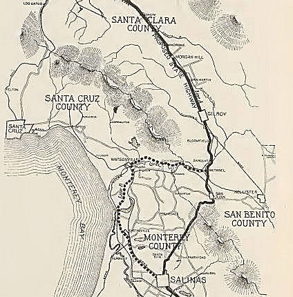 The graphic to the
right, posted on Facebook, shows the "proposed" highway route from Salinas
to San Jose in 1913. The city of Watsonville tried hard to get it through
their town, but it ended up going through San Juan Bautista, and later
through Prunedale. Note that this map shows the highway going over the San
Juan Grade.
The graphic to the
right, posted on Facebook, shows the "proposed" highway route from Salinas
to San Jose in 1913. The city of Watsonville tried hard to get it through
their town, but it ended up going through San Juan Bautista, and later
through Prunedale. Note that this map shows the highway going over the San
Juan Grade.
(Source: Don Wilson on Facebook, 7/7/2019)
Old Stage Road was originally a spur of El Camino Real
from Salinas Valley over the Gabilan Range. It was originally a main route
for travel. Old Stage Road even by the conventions of the 1910s was
woefully inadequate for usage by automobiles. The terrain of the
Gabilan Range between San Juan Bautista and Salinas Valley was so rugged
that an alternate route from Gilroy to Salinas by way of Watsonville and
Castroville was considered when LRN 2 was being adopted as a state highway
after 1909. The rationale for selecting the routing of the San Juan Grade
through the Gabilan Range (referenced as San Juan Mountain) was
three-fold, as noted in the January 1913 California Highway Bulletin: (1)
the route through the Gabilan Range was the most direct route between
Salinas Valley-Santa Clara Valley, (2) was within seven miles of the San
Benito County seat of Hollister and (3) had an estimated gradient ranging
from 2-6%. The existing route over Old Stage Road is noted to be
direct, and it would be desirable for LRN 2 to follow nearby over a better
grade. By 1915, LRN 2 had been completed over the San Juan Grade
from the Monterey County Line north to San Jaun Bautista.
(Source: Gribblenation Blog (Tom Fearer), The Pinecate Rocks of US Route 101, 1/2023)
San Juan Road and San Juan Grade road were an routing of US 101 through San Juan Bautista (since bypassed). This is based on topological maps at http://sunsite.berkeley.edu/histopo/. Following the link to the Monterey Bay region, one can find two 15 minute topographic quadrangle maps for San Juan Bautista. The first, from 1917 reissued in 1932, shows the San Juan Grade road as "state highway" and does NOT show a road near the current alignment of US 101. The second, from 1939 reissued in 1958, shows US 101 near or on the current US 101 alignment. It may very well be that San Juan Grade Road and San Juan Road were an early alignment of US 101 from Salinas through San Juan Bautista; there is some logic in this based on the US highway system approach of running through the small towns in the area.
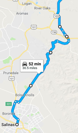 The map to the right shows approximately the pre-1932 routing in blue; contrast
this with the current US 101 routing shown with pale yellow. Note that it
appears the 1915 routing replaced an even older routing, which if you look
at a map closely, approximates the route along Old Stage Road from near
Penvir up to San Juan Bautista.
The map to the right shows approximately the pre-1932 routing in blue; contrast
this with the current US 101 routing shown with pale yellow. Note that it
appears the 1915 routing replaced an even older routing, which if you look
at a map closely, approximates the route along Old Stage Road from near
Penvir up to San Juan Bautista.
Tom Fearer did some more research on this, which he
reported on the Gribblenation blog. Specifically, there used to be a state
highway alignment running from US 101 south on San Juan Highway, through
San Juan Bautista, south over the San Juan Grade to Salinas, which was a
very old alignment of US 101, replaced by 1932. The San Juan Grade was
built in 1915 which presumably replaced Old Stage Road from Salinas to San
Juan Bautista. Presumably this was part of alignment adopted as LRN 2 from
San Francisco south to San Diego in 1909. This history can be seen on 1931
edition of the California Highways and Public Works Journal. By 1926 the
San Juan Grade became part of US 101. The San Juan Grade alignment can be
seen clearly on the 1930 State Highway Map. The San Juan Grade was
replaced by 1932 with the modern alignment of US 101 to the west at a
lower elevation through the Gabilan Range which can be seen on the State
Highway Map from said year. The San Juan Grade remained a unsigned state
highway (similar to routes like Route 14U—essentially, a route not
yet relinquished and thus still maintained) at least until 1936 when it
appears to have been relinquished. The state maintained roadways on the
San Juan Grade are apparent on the 1935 San Benito and Monterey County
maps while it no longer present on the 1936 State Highway Map. From San
Juan Bautista, US 101 would have continued south of modern Route 156 along
The Alameda which is now the north terminus of County Sign Route G1. County Sign Route G1 quickly
branches off of The Alameda onto San Juan Canyon Road which climbs up to
Fremont Peak. The Alameda branches off onto Old Stage Road and San Juan
Grade Road; US 101 used the latter. Some additional history on the San
Juan Grade, and its predecessor, the Old Stage Road, may be found in Tom's
blog "Old Stage Road; the "real" El Camino Real and predecessor route to US Route 101 on the San Juan Grade".
(Source: Gribblenation: US_101 San Juan Grade)
The replacement for the San Juan Grade (known as the
"Prunedale Cutoff") is partly in Monterey County and partly in San Benito
County. The general location is on the coast route (US 101), about 100
miles south of San Francisco. The southerly end is two miles north of
Salinas and it passes through the villages of Santa Rita, Prunedale, and
Dumbarton. Its northerly terminus is at its junction with the existing
State highway three miles north of the mission town of San Juan Bautista
(i.e., this new segment runs from N of Salinas towards Gilroy, including
the junctions with Route 156 and Route 129). Instead of crossing the
Gabilan range of mountains, the new 1931 cut-off passes over mesas and
through a series of valIeys in the foothills of that range. There is a
saving in distance of 1.2 miles. The highest elevation reached is 550
feet, whereas the San Juan grade route is at an elevation of 1050 feet.
Contrasted with the San Juan Grade over the mountains, where frequent
sharp curves allow only a sight distance of 75 feet, the 1931 highway with
its long radius curvature and low gradient will permit motorists to travel
at all points at the highest speed. The CHPW noted that the old grade
would remain as part of the State highway system (which it did for a
time). The new highway construction project follows partly along the route
of the old "Camino Real" between Monterey and San Benito counties. It
passes through a narrow gorge known as the "Pinecate Rocks" in San Benito
County, interesting because in the bandit days of California, it was the
scene of many stage holdups. Footholes in a prominent rock are still
evident where bandits scaled it to hold up stages from a point of vantage.
Twelve acres additional right of way was obtained at "The Rocks" to
preserve for all times the beauties of this romantic spot. The CHPW
article noted that the new route is so located that connecting highways
could be constructed to bring the San Francisco Bay district much closer
to several cities of Monterey County. They noted that by the construction
of a highway between four and five miles long between the new road and
Castroville (which later became Route 156), several miles in distance and
much time will be saved to travelers between San Francisco and the
Monterey Peninsula. It noted that Monterey County is already building an
improved highway connecting the new route with Watsonville (eventual Route 129), and Watsonville will then be brought within nine miles of the coast
highway. It noted that the new alignment consists of a graded width of 40
feet in cuts and 38 feet on fills. The Portland cement concrete pavement
is 20 feet wide, is being laid in two 10-foot strips. Expansion joints are
placed every 60 feet with weakened plane joints at 20-foot intervals. It
is reinforced throughout against corner breaking and edge cracking. The
10-foot strips are 7 inches think in the center and 9 inches at the edge.
Where the roadbed conditions are more unstable, the pavement is thickened
to 9 inches in the center and 11 inches at the edges. Several wooden
bridges with concrete decks are included in the drainage structure.
Smaller drainage structures consist principally of concrete boxes and
corrugated iron pipes. The cost of the project will be nearly $1.000,000
and the new road would be open by Summer 1932.
(Source: CHPW, October 1931)
San Juan Baustista Y (~ SBT 2.712 to SBT 3.145)
As noted above, the San Juan Grade was the original
routing of US 101 in this area. The July 1914 California Highway Bulletin
noted surveys for the San Juan Grade were complete in San Benito County
and in Monterey County, with LRN 2 from the Monterey County Line to San
Juan Bautista in the process of construction as an unpaved road. A
contract to construct LRN 2 in paved Portland Cement north of San Juan
Bautista was awarded on July 6, 1914. The year of 1931 featured the
construction of the Prunedale Cutoff that replaced the San Juan Grade as
the new alignment of US 101/LRN 2. The Prunedale Cutoff alignment of US 101 bypassed San Juan Bautista by way of the communities of Santa Rita,
Prunedale and Dumbarton, and was opened to traffic during the summer of
1932. The San Juan Grade was retained as a spur of LRN 2 east of US 101 on the Prunedale Cutoff. In 1935, planning was on going for a new
route for LRN 22 (future Route 156, which meets US 101) west of San Juan
Bautista to US 101/LRN 2 at the Prunedale Cutoff. This new route would
include a new Y junction (the San Juan Bautista Y). The original
route of LRN 22 on Rocks Road is referred to as "a winding county road"
that was immediately improved temporarily with an oiled earth application
upon being adopted in 1933. The new routing of LRN 22 west of San
Jaun Bautista is noted to negate the need for traffic to use the original
routing of US 101 via the San Juan Grade. The San Juan Bautista Y
was in line for future beautification that would include mission style
walls, a campanile and a cross. The completion of new routing for LRN 22
west of San Juan Bautista led to the relinquishment by 1936 of the San
Juan Grade from the State Highway System. The beautification of the
Y was completed by 1938.
(Source: Gribblenation Blog (Tom Fearer), "Former US Route 101 and California State Route 156 at San Juan Bautista Y", 12/2022)
In 1959, the new San Juan Interchange opened as a
replacement for intersection of US 101/LRN 2 and Route 156/LRN 22 at San
Juan Bautista Y. At the time, the San Juan Bautista Y had the
highest rate of accidents of any state highway segment in San Benito
County. The cross and campanile of San Juan Bautista Y were
preserved so they could be enjoyed by the traveling public.
(Source: Gribblenation Blog (Tom Fearer), "Former US Route 101 and California State Route 156 at San Juan Bautista Y", 12/2022)
S of Sargent / Betabel Siding (~ SBT 5.251 to SBT R6.679)
In the 1870s, the Southern Pacific Railroad plotted a
siding known as Betabel near the confluence of the Pajaro River and San
Benito River. Betabel and Y Road were ultimately incorporated as part of
the American El Camino Real which began being signed as an Auto Trail
starting in 1906. This eventually became part of the Pacific
Highway, later LRN 2 and US 101. The Prunedale Cutoff was opened to
traffic on July 20, 1932 and bypassed the San Juan Grade, San Juan
Bautista and the bridge over the San Benito River to the west. The
older alignment of US 101 was initially retained as a spur of LRN 2.
Then, in 1935, a new routing for LRN 22 (Route 156) west of San Juan
Bautista was constructed. This route went to US 101/LRN 2 at the Prunedale
Cutoff and new Y junction (the San Juan Bautista Y). The new
routing of LRN 22 west of San Jaun Bautista negated the need for traffic
to use the original routing of US 101 via the San Juan Grade. The
completion of LRN 22 west of San Juan Bautista led to the relinquishment
of the San Juan Grade and the San Benito River Bridge from the State
Highway System. This led to the bypass of Y Road.
(Source: Gribblenation Blog (Tom Fearer), "Former US Route 101 on Y Road near Betabel siding", 6/1/2023)
Sargent (~ SBT R7.506)
State Highways in Sargent began with the 1909 First
State Highway Bond Act, which funded the Pacific Highway: a 481.8-mile
highway originating at the City Limits of San Francisco that terminated in
San Diego (LRN 2). In 1926, this became US 101. US 101 from Gilroy south
to the San Benito County Line at the Pajaro River was aligned on Monterey
Road through Sargent. In 1942, there were improvements along US 101/LRN 2
in the Gilroy area. The original Pajaro River Bridge near Sargent
was replaced, and the route bypassed the site of Sargent via the new
alignment. In 1949/1950, US 101/LRN 2 was widened south of Gilroy to the
Sargent Overhead. This project included a second Sargent Overhead
(completed during 1950) and widening of US 101/LRN 2 north to Gilroy to
divided highway standards. This project ultimately would bypass
Monterey Road from the Sargent Overheads to the vicinity of Route 25 with
the older highway becoming a frontage of US 101/LRN 2.
(Source: Gribblenation Blog (Tom Fearer), "Former US Route 101 through Sargent", 5/14/2023)
 The route between Gilroy and San Jose approximates the original routing. The original routing still exists and is designated as Business Route 101,
and is "Monterey" Road. Post-1964, it was also part of Route 82.
The route between Gilroy and San Jose approximates the original routing. The original routing still exists and is designated as Business Route 101,
and is "Monterey" Road. Post-1964, it was also part of Route 82.
Monterey Road began as a stage coach route in the 1850s, which connected
San Jose to Monterey. The towns of Morgan Hill and Gilroy grew up as stage
stops along the route. The road includes portions of the historic El
Camino Real (Royal Road) which was a 600 mile road that once connected
California's twenty-one Spanish missions. In 1909, the road became part of
the state highway system (LRN 2); signage would have started around 1926.
Following World War II, motor courts (motels) with attached cabins began
to appear, often with a U-shaped design featuring a central landscaped
area or swimming pool. Although many of these motor court style motels are
now gone, many still remain in San Jose, with a number of them along Monterey Road. By the early 1980s, US 101 was redirected to a new freeway to the east. Monterey Road
continues as an arterial road from San Jose (as a continuation of South
First Street where it crosses Alma Avenue) to the south county.
(Source: Ohare Devin in California Historic Highways on FB, 2/16/2019)
Gilroy was part of the American El Camino Real that began being
signed as an Auto Trail starting in 1906. In 1913, this became part of the
Pacific Highway. By 1917, CSAA maps were showing early LRN 2/American El
Camino Real/Pacific Highway on Monterey Street in Gilroy, with the western
terminus of LRN 32 (what would become Route 152) entering the city via Old
Gilroy Street. In 1933, LRN 32 was extended west from Gilroy via Hecker
Pass to Watsonville; it was signed as Route 152 in 1934. US 101/Route 152
multiplexed in downtown Gilroy on Monterey Street between Old Gilroy
Street/7th Street to 1st Street by 1935. By 1959, US 101 from Ford Road in San Jose south through Gilroy was being studied for
a potential freeway upgrade that would tie into the existing four lane
expressway segment south of Gilroy to the San Benito County line, which
was completed in 1951. By 1961 a freeway alignment had been adopted, and
the freeway upgrade was completed by 1972. This resulted in US 101 being
moved off of Monterey Street onto the modern freeway bypass. Route 152 was
shifted onto the new freeway between Exit 356/10th Street and
Exit 357/Leavesley Road. Route 152 followed Leavesley Road west to
Monterey Street where it jogged south to reach 1st Street. This
was completed by 1975.
(Source: Gribblenation Blog (Tom Fearer), “Former US Route 101 and California State Route 152 in Gilroy”, Feb. 2021)
The former terminus of the Bayshore Freeway (Blossom Hill Road (nee Ford
Road) junction with Route 82 (Monterey Road)) still shows some vestige of
the former Y interchange that fed the Bayshore into the older routing.
Here one can see where the freeway makes a sudden turn to the left at this
point, even though the Blossom Hill interchange is now a mere diamond.
This old interchange was removed in 1982, for the Caltrans bridge log
shows the bridges for the current CA 82/US 101 separation having been
built then.
(Thanks to Chris Sampang for this information)
In San Jose, the routing followed the present El Camino route that is present-day Route 82. This was signed as US 101 and was LRN 2. The present-day freeway routing was signed as Bypass US 101, and was LRN 68, defined in 1923. Construction began on LRN 68 in 1924, it was completed in 1929. The portion from 10th St. N was LRN 2.
In 1942, southbound Bypass US 101 did not continue down Bayshore Highway past Fourth Street (near the current I-880/US 101 junction) but went down Fourth, Reed, and Second to rejoin US 101 (First Street, now Route 82) near the current I-280/Route 82 junction. The Bayshore Highway continued only southeast from Fourth Street to McKee Road, where it became 30th Street (but reconnected to Monterey Highway). 30th Street has since been relegated to a non-continuous frontage road next to the Bayshore Freeway.
At the Rengstorff exit and around Mountain View, one can still see the old white-on-green BYP US 101 signs (with BYP greened out).
The segments of Grant Street in Santa Clara and Santa Clara Street/Market Street in San Jose appear to have been bypassed after 1968, as noted in this map. In Santa Clara, while what was named as late as 1968 as "Clay Street" east of Lincoln Street (now part of "El Camino Real" and was part of the pre-1964 US 101) remains on the route, the original alignment along what was then "Grant Street" (now part of a northwest extension of The Alameda from Camino Drive) was bypassed to make way for an expansion of Santa Clara University. Part of the original Grant Street/US 101/Route 82 between Franklin Street and Market Street has been supplanted by a pedestrian pathway through university property. Also, apparently in 1968, the US 101-era routing of Santa Clara Street directly to Market Street (instead of the modern Montgomery/Autumn and San Carlos path) in downtown San Jose was in use for Route 82 at the time.
There was evidently a study regarding double-decking US 101 up the pennisula, including all the way down to San Jose.
The June 1925 issue of CHPW noted that the Bay Shore Highway, from San Francisco to San Jose, was added to the state highway system. This changed the description of LRN 2 from "the county line of the city and county of San Francisco to and through the county of San Mateo" to "from San Francisco to the city of San Jose."
On US 101 near Moffet Blvd there are some bus cutouts. According to a posting on misc.transport.road, these were there to allow people to pick up soldiers, but their use is now discouraged, and they will be removed when the interchange is reconstructed.
East Palo Alto
In March 2021, there was an interesting article on what
was lost during construction of the freeways. The article noted that Route 101 had stoplights and no median strip and was considered one of the most
dangerous in the country, earning the nickname “Bloody
Bayshore.” The Division of Highways (forerunner of Caltrans)
transformed it into a freeway in stages between 1947 and 1958, eliminating
head-on crashes, according to the San Francisco Chronicle. Before that
time, Palo Alto and East Palo Alto were much more linked up. In fact,
there was a thriving downtown East Palo Alto along the four-lane highway,
including the art deco Auten’s Restaurant with a rocket-like tower
at the corner of Bayshore and University Avenue. Because Palo Alto banned
alcohol sales due to land restrictions placed by Stanford University,
restaurants and bars gravitated to the East Palo Alto side of San
Francisquito Creek. Auten’s special dinner boasted a top sirloin
steak, soup, salad, ice cream and coffee for $1.85. It was demolished for
freeway construction in the mid-1950s, along with a service station and a
Spanish-style house on University appraised at $14,430, a high price in
those days. After the freeway came through, the west side of East Palo
Alto became known as Whiskey Gulch. There was also a connection between
the freeway and racism, as noted by College of San Mateo historian Alan
Hynding in his book “From Frontier to Suburb”:
(Source: Climate Online, 3/16/2021)
“…(T)he Bayshore Freeway isolated the town from other communities to the west. As business investors, apprehensive about the black population and the high incidence of poverty and crime, avoided the area, the employment problem worsened. Like Watts and other West Coast black enclaves, East Palo Alto had become a suburban ghetto of deteriorating neighborhoods, where unemployment ran at about 40 percent … Poverty, unemployment and a heavy turnover in the population left the town without any real economic or political base, and without much civic pride.”
Construction also took a portion of the Charles Weeks
Poultry Colony, a chicken farm established in the 1920s as one of six such
communes, known as runnymeads (there were similar communes in Winnetka
(Los Angeles), CA). In Redwood City, the Bayshore ran along what is now
Veterans Boulevard, south of the current path. The Peninsula Celebration
Association had built a rodeo grounds for a two-day rodeo, part of the
annual Fourth of July festivities. Photos show a grandstand at the side of
the old highway, along with a racetrack, a hot dog booth, and a Wheel of
Chance. Construction of the freeway cut the grounds in two, and rodeo
ended in 1963. Proceeds from the sale of the land were placed in a fund to
support the annual parade and fireworks, which continues to this day. In
San Mateo, widening of the Bayshore and the need for an interchange with
Route 92 spelled the end for Henry’s Garage, which included an auto
wrecking business, service station, and tavern. Also demolished was the
private San Mateo Airport, which had been in the area since at least 1947
but had never gotten title to its land.
(Source: Climate Online, 3/16/2021)
Bypass 101
There are also quite a few old alignments of Bypass
101 still existing:
(Source: Chris Sampang)
San Mateo and S of San Francisco
According to the San Mateo Daily Journal and theFeb
1925 CHPW, the predecessor to the Bayshore Freeway in the San Mateo
area was the old Bayshore Highway. Parts of this highway (El Camino Real,
once called the County Road) had already been built by the 1920s. The
initial contract was approved by the California Highway Commission in
1924, providing for the grading of a 5.2 mile section between South San
Francisco and Burlingame. These first 5.2 miles cost approximately
$400,000 to construct. Another source indicates that construction actually
began on Aug. 7, 1912, when Burton A. Towne, chairman of the State Highway
Commission, stood in front of a line of local officials and turned over
dirt that would soon be replaced by the first section of paved state
highway in California. The ceremony took place on El Camino Real near
Uncle Tom’s Cabin, a popular restaurant that dated back to the
horse-and-buggy era. The job, consisting of a paved road between South San
Francisco and Burlingame, was the first construction project of the
California Department of Transportation. In 1927, San Bruno could boast
about having the most traveled section of highway in California. State
Highway Commission personnel recorded the number of cars that used state
roads in July of that year and found that 29,338 vehicles ran over the San
Bruno section. Indiana Street in Los Angeles was second at 22,385. San
Bruno was the starting point because it wasn't incorporated: “The
decision to start here seems to have been influenced by the efforts of the
tri-county committee demanding that work commence with El Camino Real and
the fact that San Bruno was as yet unincorporated,” local historian
Joan Levy wrote. San Bruno incorporated in 1914. The tri-county committee
consisted of representatives from San Francisco and San Mateo and Santa
Clara counties. No state highway work could be done in incorporated
cities, which left San Francisco out when it came to the spending of the
$18 million approved in 1909 in Sacramento through California’s
first highway bond act.
(Source: San Mateo Daily Journal, 11/6/2017)
 In
1926, this was incorporated into the new US Highway system as part of US 101. As the Bayshore Freeway began to be designated as US 101, El Camino
Real became known as the US 101 BYP. In 1931, the highway was completed to
Redwood City. The southern section to San Jose was finished in 1937. The
route of the old Bayshore began at 10th and Market in San
Francisco. It extended past the intersection at today's Cesar Chavez and
Potrero. It continued along what is now Bayshore Boulevard, which
parallels today's freeway until it intersects with Third Street. From
Third Street, the Bayshore Highway proceeded through “Boneyard
Hill”, continuing around San Bruno Mountain south of Brisbane,
extending through South San Francisco along what is now Airport Boulevard.
Airport Boulevard crosses under the freeway at the north end of San
Francisco International Airport. Cutting through the rich dairy land which
once comprised much of Millbrae, the Bayshore Highway rolled through what
is now a runway at SFO, then past today's hotel row in Burlingame,
stopping at Broadway in Burlingame. At that point, the highway followed
essentially the same route as today's Bayshore Freeway, until it reached
Redwood City. There, today's Veteran's Boulevard served as the highway
course, extending south to Marsh Road in Menlo Park. Beyond Palo Alto, the
old highway followed much the same configuration as the present US 101.
The first overpass over the Bayshore emerged at Peninsula Avenue, with the
interchanges at Ralston Avenue, Holly Street and Whipple Avenue
constructed later. By 1940, traffic congestion on El Camino Real led to
construction of a a 27-mile freeway from San Francisco to Palo Alto. By
1948, most of initial construction of the Bayshore Freeway from San
Francisco to Broadway-Burlingame had been completed. The second phase of
construction extended the freeway into San Mateo. By July 11, 1957, the
Candlestick causeway had been built over the water linking San Francisco
with San Mateo County. This section of the freeway was constructed through
the marshland from Candlestick Point and Oyster Point in South San
Francisco, including excavating a mountain and filling the marsh east of
Brisbane with landfill. Overall, 4,007,000 cubic yards of fill was used.
Full details of the fill project may be found in the Nov/Dec 1955 issue of CHPW. In 1964, with the great renumbering, the Bayshore Freeway gained the sole designation of US 101, while El Camino
Real became Route 82.
In
1926, this was incorporated into the new US Highway system as part of US 101. As the Bayshore Freeway began to be designated as US 101, El Camino
Real became known as the US 101 BYP. In 1931, the highway was completed to
Redwood City. The southern section to San Jose was finished in 1937. The
route of the old Bayshore began at 10th and Market in San
Francisco. It extended past the intersection at today's Cesar Chavez and
Potrero. It continued along what is now Bayshore Boulevard, which
parallels today's freeway until it intersects with Third Street. From
Third Street, the Bayshore Highway proceeded through “Boneyard
Hill”, continuing around San Bruno Mountain south of Brisbane,
extending through South San Francisco along what is now Airport Boulevard.
Airport Boulevard crosses under the freeway at the north end of San
Francisco International Airport. Cutting through the rich dairy land which
once comprised much of Millbrae, the Bayshore Highway rolled through what
is now a runway at SFO, then past today's hotel row in Burlingame,
stopping at Broadway in Burlingame. At that point, the highway followed
essentially the same route as today's Bayshore Freeway, until it reached
Redwood City. There, today's Veteran's Boulevard served as the highway
course, extending south to Marsh Road in Menlo Park. Beyond Palo Alto, the
old highway followed much the same configuration as the present US 101.
The first overpass over the Bayshore emerged at Peninsula Avenue, with the
interchanges at Ralston Avenue, Holly Street and Whipple Avenue
constructed later. By 1940, traffic congestion on El Camino Real led to
construction of a a 27-mile freeway from San Francisco to Palo Alto. By
1948, most of initial construction of the Bayshore Freeway from San
Francisco to Broadway-Burlingame had been completed. The second phase of
construction extended the freeway into San Mateo. By July 11, 1957, the
Candlestick causeway had been built over the water linking San Francisco
with San Mateo County. This section of the freeway was constructed through
the marshland from Candlestick Point and Oyster Point in South San
Francisco, including excavating a mountain and filling the marsh east of
Brisbane with landfill. Overall, 4,007,000 cubic yards of fill was used.
Full details of the fill project may be found in the Nov/Dec 1955 issue of CHPW. In 1964, with the great renumbering, the Bayshore Freeway gained the sole designation of US 101, while El Camino
Real became Route 82.
In Brisbane (up to the Bayshore district of Daly City),
the Bayshore Freeway takes a direct north-south path between the Cow
Palace exit and the SF county line; Bayshore Boulevard swings to the left
here because until the early 1960s, that was the actual SF Bay shoreline
in what is called the Brisbane Lagoon. When the Bayshore Freeway was
constructed here, part of the SF Bay was filled in for the freeway lanes
(and is now occupied by the freeway and by the Sierra Point Parkway); the
Brisbane Lagoon now is seperated from the rest of the Bay.
(Source: Chris Sampang)
There is also, according to Chris, the possibility that Mission Road between Colma (originally known as Lawndale) and South San Francisco was once part of US 101. Chris did an analysis of a 1933 and a 1942 map posted by Mark Furqueron. In the 1933 map, US 101W takes a route that includes an intersection with Grand Avenue; the current El Camino Real alignment does not touch Grand Avenue. This is made clear in the 1942 map, suggesting that the current alignment of current Route 82 in South San Francisco was constructed between 1933 and 1942. As the Mission Road alignment first shown as bypassed a 1936 Gousha map, it's possible that this new routing around Colma Creek was constructed between 1933 and 1936, but not before 1933 at least. In the 1942 map, Mission Road intersects El Camino Real in "Baden Station", near the present junction of Westborough Boulevard/Chestnut Avenue with Route 82. This would mean that Chestnut Avenue's bridge over Colma Creek may have once been part of the US 101 routing, or a different bridge may have existed (Mission Road now ends in a T intersection with Chestnut). According to the CalTrans bridge log, the original Colma Creek bridge at the Mission/El Camino junction in Colma was built in 1913, and revamped in 1927 (thus suggesting that Mission Road may have only been a temporary routing before the Colma Creek bypass was finished).
According to the Millbrae Spur Project: In the 1920s, San Francisco and San Mateo Counties proposed a faster through route between San Jose and San Francisco. The Junipero Serra Highway went through the congested downtown area of southern San Francisco, west to Daly City, and ended in Colma. In the late 1930s, the route (now US 101) was extended to Sneath Lane in San Bruno. It then connected to El Camino Real via Sneath Lane. In the mid-1950s a section was added extending the route to Crystal Springs Road, at which point one traveled east to El Camino or west to Skyline Boulevard. The CHC intended to complete this road through Millbrae to Millbrae Avenue, and create a connector to the Bayshore. However Millbrae housing development conflicted with the proposed highway construction. In early 1955 the proposed route of the Junipero Serra Highway was reoriented in San Bruno to go to Skyline Boulevard and south to Ralston Avenue in Belmont. This was considerably west of the original route; it no longer divided the Peninsula cities. In the 1960s the route was again modified, and the proposed highway was absorbed into I-280.
Evidently, the route south from San Bruno was chosen for the first commemorative contract with groundbreaking on August 7, 1912. Why was it chosen? All the clout was in the San Francisco Bay area at the time - San Francisco, San Mateo, Santa Clara & Alameda Counties. There was a strong desire for a San Francisco to Los Angeles route, and they wanted it in place before the Panama Pacific International Exhibition planned for 1915. The Highway Commission announced they would not build in incorporated cities. El Camino was "shovel ready" and San Bruno was not yet incorporated.
San Francisco Routings
Here are some specifics on the routings (Tom Fearer also traces the routing in San Francisco in his blogs on the subject):
A good history of the route in the San Francisco Bay Area may be found in the article "History Traces the Bayshore from Highway to Freeway", from the San Mateo Community Journal. There was also an article in the San Francisco Chronicle on the building of the "Bayshore". That article noted:
The Bayshore construction project saw the first 2-mile stretch, from Broadway in Burlingame to Peninsula Avenue in San Mateo, completed in the summer of 1947, and it was followed in January 1948 by the 5-mile stretch north of Broadway to Colma Creek in South San Francisco. The first San Francisco stretch of the new freeway was a 2-mile stretch of elevated road running near Bryant Street to what was then Army Street. For the opening, Mayor Elmer E. Robinson donned goggles and severed a galvanized steel chain with an acetylene torch. Immediately, both ends saw traffic jams that could delay trips for an hour. Not everyone was thrilled with the change. Some residents felt restricted by a 6-foot fence built to keep pedestrians off the freeway. Buses could no longer stop along the route through Burlingame and drop off passengers “practically at their front door.” San Mateo, for its part, was unhappy with the newfound speed and formally requested that limits be set at 35 mph through the city’s section of freeway. The Division of Highways took bids starting April 4, 1954, on the last stretch of the freeway between San Francisco and the Peninsula, which included the 3-mile-long Candlestick Cove causeway to Sierra Point, bypassing the dangerous Tunnel and Boneyard hills, two hot spots which had contributed to the road’s “Bloody Bayshore” nickname. By 1958, with construction complete, the highway finally provided commuters a signal-free route between San Francisco and San Jose.
(Source: SF Chronicle, 7/11/2017)
The Hyde Park Ferry across San Francisco Bay has a large "Historic US 101" sign on it. At one point, ferries were considered part of the state highway system. Tom Fearer, in his blog Hyde Street Pier and the original surface alignment of US Route 101 in San Francisco, provides a good summary of the early routings in San Francisco and the connection the the Hyde Pier and Hyde Park Ferry.
The Central Freeway
In San Francisco, US 101 was routed on the Central Freeway, which starts at I-80 and ended on the northbound (lower deck) side at Franklin and Golden Gate. It then went via Golden Gate to its current routing on Van Ness. The southbound upper deck started at Turk and Gough, using Turk from Van Ness. In 1958, the 1.3-mile-long extension of the Central Freeway from South Van Ness Avenue to Turk Street was under construction, with completion expected for 1959. This section was a two-level elevated viaduct with the three southbound lanes carried above the three northbound lanes. It wasdamaged in the Loma Priata earthquake and it was only open to Fell and Oak at Laguna. US 101 exited the Central Freeway at Mission/Van Ness. In 1996, this segment was closed down to take out the double deck portion.
The history of the construction of the Central Freeway through Hayes Valley—and the controvery associated with it—is discussed in "The Birth And Life Of The Freeway In Hayes Valley". This also includes a discussion of the Embarcadero Freeway.
The Central Freeway had four sets of "ghost ramp" stubs off it:
The Mission Freeway
At one point, there was more freeway planned for US 101: it would have been the Mission Freeway: A freeway that looks like it ran down Mission Street from US 101 in Daly City to the present-day US 101 near Oak and Fell. This was more proposed freeway than anything actual; it certainly was not part of the state highway system by 1963. It appears that a portion of it (as San Jose Avenue) existed for about a mile or two north of I-280, with a couple of interchanges. It is more likely that this stretch is the remains of San Jose Avenue, which was built as a divided road beside the original (1860's-1870's) Southern Pacific main line (an article on this stretch may be found here).Later, the Ocean Shore RR and streetcar lines joined in, and starting in the early 1900's SP gradually abandoned the line after building the one Caltrain uses now. The RR(s) originally built the cut; the City later widened it and built roadways. Pictures from the 1950's and early 1960's show the overpasses built with a narrow space between pillars in the center (where the railroad/streetcar tracks were) paved over as a passing lane, with wider spaces on either side for the main road. In the 1960's or 1970's, the bridges were replaced for seismic and road reconstruction purposes with the full-width spans seen today. The only actual interchange is at Glen Park (Diamond St. - Monterey Blvd.) where it was built as part of the Southern Freeway project (I-280). Note that portions of this are currently maintained by the City of San Francisco, although the portion south of Rousseau is Caltrans.
 Alternate Routes
Between the mid-1930s and 1964, there was also an Alternate US 101. This ran along the 1934 state signed Route 3 between San Juan Capistrano and El Rio (near Ventura), and is present-day Route 1. This was LRN 60, defined in 1919. In Southern California, this ran along Pacific Coast Highway, Palisades Beach Road (PCH in Santa Monica), Olympic Blvd (Route 26), Lincoln Blvd, Sepulveda Blvd, and PCH.
The Los Alimitos Traffic Circle was the point where Route 1/Former Route 3/US 101A/US 91 and Route 19/US 91 came together. The Los Alamitos Traffic
Circle was located at the junction of State Street, Bennett Avenue and
Hathaway Avenue. 1934 Route 3 followed the entirety of LRN 60, which
by proxy took it through Los Alamitos Traffic Circle in Long Beach.
CA 3 was renumbered as US 101A in 1935; the 1964 renumbering changed it to
the current Route 1. Also meeting in the traffic circle was Route 19/LRN 168, which in 1947 was cosigned with US 91. US 91 would also be extended
along US 101A to meet US 6. The Los Alamitos Traffic Circle originally
only had what is now the inner circle. The inner circle transitioned
the implied connection of Route 3/LRN 60 from Hathaway Avenue to State
Street (both were renamed by 1944 to Pacific Coast Highway). LRN 168
joined the traffic circle via Bennett Avenue, which is now Lakewood
Blvd. In 1942, the traffic circle was expanded and widened, with the
original plan being to have six highways enter it (however, only three
were constructed). The expansion added an outer ring which had been built
by the city of Long Beach and Los Angeles County. The original inner
Los Alamitos Traffic Circle was expanded to increase capacity on US 101A/LRN 60. In 1993, Caltrans reconfigured Los Alamitos Traffic Circle to
modern roundabout conventions. Route 19 was relinquished in the city
of Long Beach via AB 2132 Chapter 877 in 1998.
(Source: Gribblenation Blog (Tom Fearer), "Los Alamitos Traffic Circle; current California State Route 1/former US Route 101 Alternate and US Route 91", 2/7/2022)
A second Alternate US 101 (US 101E) existed in the San Franciso Bay area. This alternate diverged from US 101 in downtown San Jose, at approximately Alameda and Santa Clara. It ran along Santa Clara, and then along 13th St N to what is now Old Oakland Road. Later it followed the route of what was then Route 17 (original Route 13; LRN 69 (defined in 1933); present-day I-880) into Oakland. Briefly, the US 101 routing was signed as US 101W, and the Alternate US 101 routing was signed as US 101E. The US101E routing may have been the original 1926 US 101 routing. It appears the 101W and 101E designations disappeared with the opening of the Golden Gate Bridge.
There is a report that a 1934 Gousha map shows US 101E following US 50 from Oakland to Hayward, then along the route that is now Route 238 southward, not along the Route 17 alignment.
 Status
Former US 101 in San Diego, Orange, and Los Angeles County
Note: Although US 101 no longer formally exists south of downtown Los Angeles (although portions of the former routing are Route 72 and I-5), this section tracks significant activity along the former routing.
In February 2017, there was a report on the impact of roundabouts on
Former US 101 in the Community of Bird Rock near La Jolla. La Jolla Blvd,
once a stretch of US 101 as it wound from La Jolla to Pacific Beach,
handles an estimated 22,000 vehicles a day. This stretch of highway once
was traditionally straight, with left turn bays and street parking. Since
it has been converted to five single-lane roundabouts linked by two
relatively narrow 10-foot driving lanes, with angled parking on the west
side that doesn’t impede the southbound flow of traffic thanks to an
extra cushion for backing out, traffic flow has paradoxically improved.
Instead of waiting 24 seconds for a pedestrian to cross 72 feet of road,
drivers now only wait 3-4 seconds, or don’t have to wait at all.
Businesses that feared the loss of customers arriving in cars actually
improved their trade about 35 percent, new stores were built, noise levels
were reduced 77 percent, and the value of land within walking distance
climbed. Far more people started walking and bicycling. But, most
interestingly, motorists started driving 19 mph on 2.5 miles of La Jolla
Boulevard, instead of 40-45 mph, then stopping and stopping again. Today
motorists are getting to their destinations in less time, because they
aren’t stopping. The pity is that it’s so hard for communities
to accept the short-term pain of ripping out stoplights and stop signs,
the angst of assessments, disruptive construction. Easier to accept the
familiar squalor engendered by mind-numbing stoplights and barren streets.
Bird Rock, on the other hand, was ripe for the radical embrace of
roundabouts at the turn of the century because it was so fed up with being
La Jolla’s poor relative united by an ugly and dangerous speedway.
(Source: San Diego U-T, 2/17/2017)
In February 2017, it was reported that there is a growing movement to
transform former US 101 (Coast Highway) in North San Diego County into
something more bicycle and pedestrian friendly. From Del Mar to Oceanside,
cities are looking to slow traffic, widen bike lanes and implement other
changes that encourage people to get out of their cars and use alternate
forms of transportation. Solana Beach finished an overhaul its portion of
Coast Highway in 2013, completing a $7 million project that converted the
road to narrower lanes with wide sidewalks, gathering spaces and buffered
bike lanes. Encinitas made changes in Leucadia, reducing traffic lanes and
adding “sharrows” — large white markers painted on the
asphalt — to remind drivers to slow down and share the lane. Del Mar
and Oceanside are studying similar changes, hoping to better accommodate
bicyclists and pedestrians and create a more vibrant environment for
businesses and residents along the coast. However, there are (as they say)
bumps in the road. After a re-striping pilot program was launched in 2016
in Oceanside — reducing parts of Coast Highway from two to four
lanes, and adding wider bike lanes — more than 400 people signed a
petition against the changes. Del Mar is another town where the idea has
run into trouble. City planners have proposed reducing northbound Camino
del Mar — the name for Coast Highway in that city — from two
lanes to one between Carmel Valley Road and Fourth Street. That prompted a
letter-writing campaign from residents early this year. A few supported
the plan, but most said the narrower road would worsen congestion and
force more traffic onto the parallel residential street of Stratford
Court. A back-up freeway isn’t the vision that many city planners
have for the historic road. Instead of escorting drivers out of town, they
see the coastal route as a way to invite people in, to stop and shop, ride
bicycles, enjoy the beach, and maybe meet some new people or old friends.
Leaders of the region’s robust cycling community say slowing traffic
and improving bike lanes along former US 101 will ultimately improve the
quality of life for all.
(Source: San Diego U-T, 2/17/2017)
Sixth Street Viaduct (~ LA S0.332)
In February 2016, US 101 was shut down for 40 hours to remove the Sixth Street Viaduct (approx LA S0.332). A chemical reaction inside the iconic 84-year-old bridge is causing it to slowly crumble, and crews have been working for months to begin the demolition process. A portion of the bridge passes over US 101 and cannot be removed with traffic zooming underneath. Construction on a $449-million replacement for the 6th Street Viaduct is expected to last until 2019.
In December 2016, an update was provided on the
reconstruction of the Sixty Street Viaduct. The Downtown News reports that
the project is now expected to cost an additional $36 million—and
take eight months longer to complete. The newspaper cites city documents
that show the project, previously planned to cost $446.6 million has a new
estimate: $482.2 million. The bulk of the $36 million (about $21 million)
is associated with a newly extended construction schedule. Partly to blame
for the delay, she said, are restrictions associated with the railroad
tracks that run directly through the project area. (There are nine tracks
on each side of the river used by five different rail entities. This
element of the project was always expected to be complex.) The replacement
bridge was supposed to be up in late 2019. Now, the project is expected to
be complete by the end of 2020.
(Source: Curbed LA, 12/22/2016)
In April 2021, it was reported that a 2.5-mile section
of US 101 from the I-10/US 101 split to the I-5/I-10/US 101 interchange
just east of downtown Los Angeles was shut down for a weekend at the
beginning of May 2021 to allow for the construction of two arches. The
construction of the arches is part of the $558 million Sixth Street
Viaduct Replacement Project. The closure will also allow Caltrans to
repair guard rails, signs and pavement in the area, and fill potholes,
while a contractor will repair broken slabs in the southbound lanes. As of
the end of the May 2021 closure, the Los Angeles Department of
Public Works reported that the city has now completed six of the 20
monumental arches on the Sixth Street Viaduct. Of those 20, two pair are
60-feet tall, one pair (over the 101 Freeway) are 40-feet tall, and seven
pair are 30-feet tall. The Viaduct includes ten sets of LED-lit,
color-changeable arches that will make up “The Ribbon of
Light” design of the bridge. The arches are 10 feet wide, with a
typical arch span of 300 feet. Each arch takes 260 cubic yards of concrete
to construct or about 65 trucks of concrete. In order to keep the concrete
cool enough, it is delivered to the site, then injected with liquid
nitrogen to keep it close to ambient temperature. This reduces the
potential for concrete cracking.
(Source: CBS LA, 5/1/2021; Streetsblog LA, 5/12/2021)
In October 2021, there was another freeway
closure—this time to remove falsework. The arches over US 101 are
now fully supported and no longer require any additional support from
falsework under the bridge.
(Source: KTLA, 10/20/2021)
In May 2022, a good description of the design was
posted. From the east, it straddles the I-5 before hitting the US-101,
where the first pair of arches rise 40ft to form what feels like a
gateway. Then come five pairs of 30ft arches, passing a low-rise warehouse
district, then hitting the first set of railway tracks that flank the
river. Here two pairs of arches rise to 60ft, forming a symbolic echo of
the original structure. Drivers may be stuck in snarl-ups, but at least
the views – of the towers of downtown to the west, of the San
Bernardino mountains to the east – will be elegantly framed by
Maltzan’s gymnastic arcs, which somehow have LA in their DNA,
recalling the sinuous supports of LAX airport’s space-age Theme
Building. Those on bikes, meanwhile, will have the pleasure of spiralling
down a corkscrew ramp to a new 12-acre park, that will begin construction
beneath the viaduct in Summer 2022. The original bridge had a
problem: the sand that was used in the mix turned out to have a
lethally high alkali content, reacting with the cement to cause expansion
and cracking. By the 2010s, officials calculated the bridge stood a 70%
chance of collapsing in a major earthquake within the next 50 years. The
new structure has a wider deck incorporating cycle lanes and more generous
sidewalks, with its concrete arches now safely supported on seismic
absorbers – allowing it to move up to 30 inches in any direction.
(Source: The Guardian, 5/25/2022)
In June 2022, it was reported that the new viaduct was
opening July 9. The $588-million structure, which spans 3,500 feet across
the L.A. River between Boyle Heights and the Arts District in Downtown Los
Angeles, opened to the public in a two-day celebration on Saturday, July 9
and Sunday, July 10.
(Source: Sixth Street Viaduct Website)
LinkUS (Link Union Station) Project (~ LA 0.528)
 In February 2018, it was reported that LA Union Passenger
Terminal / LA Union Station (LAUS) is considering plans to add a new
southern entrance/exit for Metrolink and Amtrak trains and build a new
expanded passenger concourse. The Link Union Station project (Link US)
will transform the historic LAUS from a “stub-end,” or
dead-end station, to a “run-through” station by extending
tracks south over US 101, resulting in reduced passenger wait times. The
estimated $2 billion-plus project would also add a new loop track to
improve operational flexibility for rail service. Project officials say
these modifications will "significantly enhance the station’s
efficiency and enable LAUS to continue to serve as a major hub for local,
regional, and interstate transportation." The new concourse would replace
the current tunnel under the Metrolink, Amtrak and Gold Line train tracks.
The current tunnel is showing signs of age, is prone to overcrowding, and
lacks passenger amenities.
In February 2018, it was reported that LA Union Passenger
Terminal / LA Union Station (LAUS) is considering plans to add a new
southern entrance/exit for Metrolink and Amtrak trains and build a new
expanded passenger concourse. The Link Union Station project (Link US)
will transform the historic LAUS from a “stub-end,” or
dead-end station, to a “run-through” station by extending
tracks south over US 101, resulting in reduced passenger wait times. The
estimated $2 billion-plus project would also add a new loop track to
improve operational flexibility for rail service. Project officials say
these modifications will "significantly enhance the station’s
efficiency and enable LAUS to continue to serve as a major hub for local,
regional, and interstate transportation." The new concourse would replace
the current tunnel under the Metrolink, Amtrak and Gold Line train tracks.
The current tunnel is showing signs of age, is prone to overcrowding, and
lacks passenger amenities.
(Source: ENR California, 2/8/2018)
In January 2019, it was reported that an Environmental
Impact Report (EIR) and an Environmental Impact Statement (EIS) were being
prepared pursuant to the California Environmental Quality Act (CEQA) and
the National Environmental Policy Act (NEPA) for the Link US project to
comply with state and federal environmental requirements, respectively.
The Link US Draft Environmental Impact Report (EIR) would be available for
public review from January 17 to March 4, 2019. Both of the build
alternatives include up to 10 run-through tracks over US 101. With respect
to US 101, the Draft EIR notes that the project would include the following
bridges, viaducts, and structural improvements:
(Source: Link Union Station DRAFT - Environmental Impact Report State Clearinghouse No. 2016051071 January 2019; Link Union Station Project Page)
With respect to the US 101 viaduct, the DEIR notes:
In the interim condition, a new viaduct over the El Monte Busway and US 101 would be constructed with a deck wide enough to support two run-through tracks in the interim condition, up to six regional/intercity rail tracks in the full build-out condition, and up to 10 run-through tracks in the full build-out condition with HSR (common viaduct/deck).
The US 101 viaduct within Caltrans ROW would be approximately 283 feet wide, 736 feet long, with a deck elevation that varies between 294 feet and 313 feet in height. The height of the structure would vary from 17 feet to 36 feet in height, depending on location. The US 101 viaduct would be supported by two abutments and on nine bents located at the south end of LAUS, between the El Monte Busway and US 101, at the freeway median, and on the south side of US 101 ROW. Bents supporting the US 101 viaduct would also be located within the median and sidewalks of the newly realigned portion of Commercial Street at the location of the crossing. The close spacing of the columns along this segment would require Vignes Street between Commercial Street and Ducommun Street to be permanently closed to vehicular traffic.
The width of the US 101 viaduct would taper down and become narrower as the structure crosses US 101 and continues east toward Vignes Street. The US 101 viaduct would meet the vertical clearance requirements of the El Monte Busway and US 101 (16.5 feet minimum clearance) and the loading requirements per Metrolink, Amtrak, and CHSRA standards. Metro may apply aesthetic treatments to the US 101 viaduct in coordination with Caltrans and the City of Los Angeles.
The DEIR also notes the following improvements to be made to US 101:
US 101 Main Line
- Increased median width and shoulder widths for enhanced horizontal clearance
- Increased horizontal stopping sight distance
- Restriping main line for enhanced curvature
- Increased lane widths
- Increased weaving distance with maximized lengths between southbound Los Angeles Street on-ramp and southbound Commercial Street off-ramp
- Increased tangent length between reversing curves for improved drivability (greater distance between curves allows the driver to see the upcoming horizontal curve, prepare for the curve ahead, and adjust driving/steering accordingly)
Alameda Street Off-Ramp (Northbound)
- Increased deceleration length
- Standard ramp exit with diverge angle (provides a safety zone for drivers making last-minute decisions)
- Increased shoulder width for enhanced horizontal clearance
Commercial Street Off-Ramp and On-Ramp (Southbound)
In June 2019, it was reported that Metro's Board of
Directors this morning finalized environmental review of the Link Union
Station project, which will upgrade the 80-year-old station with new
“run-through” tracks over US 101.
(Source: Curbed LA, 6/27/2019)
In August 2019, the CTC accepted the Final
Environmental Impact Report and Statement of Overriding Considerations and
approve the Project for future consideration of funding. The Project will
construct new lead tracks and will convert the station into a
“run-through track station” instead of a “stub-end track
station” to accommodate a modified expanded passageway, new
passenger platforms on an elevated rail yard, tracks over the US 101
freeway, new rail communications, and other safety enhancements. The
Project is located on Alameda Street in the City of Los Angeles, Los
Angeles County. The Project is estimated to cost $950,398,000 and is fully
funded with Transit and Intercity Rail Capital Program Funds
($423,335,000), Proposition 1A High Speed Rail Funds ($398,391,000), and
Local Funds ($128,672,000).
(Source: August 2019 CTC Agenda/Minutes, Agenda
Item 2.2c.(5))
In December 2020, the CTC approved the following
Transit and Intercity Rail Capital Program (SB1 Augmentation for PTA)
allocation: $67,336,000 for PS&E for (2018: 27) Southern
California Optimized Rail Expansion (SCORE) (Link US). Design work
includes a retaining/sound wall in the throat of Los Angeles Union
Station, two new run- through tracks from Platform 4 to the mainline
tracks on the west bank of the LA River, a new viaduct to
accommodate up to nine run-through tracks over the US 101 freeway,
Main Street Quiet Zone Ready improvements, utility relocation and street
improvements, and pedestrian and bicycle improvements. Outcome/Outputs:
Reduction of greenhouse gas emissions, increased ridership through
improved frequency and expanded service by providing 30-minute
bi-directional commuter rail services on the highest ridership segments of
the Metrolink system, including system-wide supporting infrastructure
improvements, as well as improved integration with other transit and rail
services, including Amtrak, OCTA bus, AVTA and LA Metro bus and rail
services. Includes access of services for priority populations throughout
Metrolink’s service area. (Future consideration of funding approved
under Resolution E-19-78; August 2019.)
(Source: December 2020 CTC Agenda, Agenda Item
2.6g.(1b) #1)
In May 2022, it was reported that in a vote taken at
the end of May, the Metro Board of Directors approved a funding agreement
with California High Speed Rail Authority for the initial phase of Union
Station's $2.3-billion makeover and expansion. The project, called Link
Union Station, expands upon a longtime plan to construct run-through
tracks at the southern end of the passenger rail hub, allowing trains to
cross over the US-101 freeway. This would eliminate Union Station's
historic stub-end layout, which forces all trains to enter and exit
through the five-track throat to the north of the station platforms. The
vote by the Board adopts an agreement with the High-Speed Rail Authority
for roughly $423.3 million in funding for the first phase of the project,
as well as a $297.8 million preconstruction budget. That money will go
towards the construction of a new viaduct over the freeway and two initial
run-through tracks. Not included in the initial phase are some of the
pricier items in the scope of Link Union Station, including additional
run-through tracks, a new passenger concourse, and raising the main
platform area to provide clearance above the freeway.
(Source: Urbanize LA, 5/31/2022)
In January 2024, it was reported that the planned
makeover by Metro of Union Station - called Link Union Station - which
call for building new run-through at the southern end of the station,
allowing trains to cross above the US 101 Freeway, while also expanding an
existing passenger tunnel and adding new amenities, has the challenge of a
growing budget that exceeds available funding: in June 2023, the price tag
of Link Union Station had ballooned to an estimated $1.93 billion, more
than double the $950 million Metro had secured for construction. Since
then, Metro appears to have adjusted its plans in an effort to move the
project forward. After value engineering, plans how call for a reduction
in the number of new-build platforms which would have access to the
run-through tracks from seven to four. Those platforms would serve eight
different tracks which would converge onto just two tracks crossing the
freeway - also a reduction from the original plan which had called for at
least four. Even with value engineering, the project would still be split
into phases. The initial wave of construction would focus on Union
Station's Platform 3, which would be shortened and modified for the
approach to the tracks across the freeway. Plans also call for active
transportation improvements such as new sidewalks and bike lanes along
Commercial Street on the south side of the freeway, as well as work within
a BNSF yard, "quiet zone" improvements at the North Main Street grade
crossing, and the addition of a sound wall adjacent to the William Mead
Home public housing complex. Some work on the project has already begun -
specifically, utility relocations along Center and Commercial Streets.
That work is ongoing and will continue through Summer 2025. Metro
currently expects environmental clearances for Link Union Station to be
processed in Fall 2024, with final design beginning afterward and
continuing through Summer 2026. Early construction could commence for the
project by Fall 2025, with heavy construction set to begin by Summer 2026.
A completion date for the project is not specified.
(Source: Urbanize LA, 1/10/2024)
Downtown LA Cap Park (~ LA 1.015)
![[101 Slot Park]](images/101-slot-park.jpg) Caltrans is also talking another park proposal. This would be a massive park and development project atop
what is known as the Slot, the below-grade section of US 101 that runs
between the Civic Center and Chinatown (approx LA 1.015). According to Caltrans, the idea would be to cap about a half-mile of US 101 just
east of Route 110. Curently, there are no firm plans for the cap, nor a
cost estimate. The project was developed in 2008 by 24 interns with
international design firm EDAW. They worked here for two weeks and
produced a design for Park 101, a revolutionary urban design solution to
create a leafy oasis in the downtown urban core. The next step for the
Park 101 Steering Committee is to obtain sponsorship and funding.
Caltrans is also talking another park proposal. This would be a massive park and development project atop
what is known as the Slot, the below-grade section of US 101 that runs
between the Civic Center and Chinatown (approx LA 1.015). According to Caltrans, the idea would be to cap about a half-mile of US 101 just
east of Route 110. Curently, there are no firm plans for the cap, nor a
cost estimate. The project was developed in 2008 by 24 interns with
international design firm EDAW. They worked here for two weeks and
produced a design for Park 101, a revolutionary urban design solution to
create a leafy oasis in the downtown urban core. The next step for the
Park 101 Steering Committee is to obtain sponsorship and funding.
In September 2013, City Council members voted 14-0 to approve the motion introduced by Councilman Jose Huizar (PDF) on July 30 to seek funding from private, federal and state grants for the Downtown Park 101 Freeway cap park project, which would connect the Civic Center with Olvera Street, Chinatown and Union Station.
In June 2017, an update was provided on the Downtown
Park. A PowerPoint presentation from the Friends of Park 101, the nonprofit working to make the park happen, was released that shows off some preliminary ideas about how the final product
might look with renderings and programming by SWA Group. The slides show
each block within the cap park having a different theme. “The
Hill” section would have a viewing deck and native plants; “LA
Courtyards” would feature a pavilion and shaded terraced seating,
plus a playground. “The Plaza” section would have trees,
flexible open space to host more sprawling public events, and some kind of
water feature. “The Mercado” is geared toward hosting cultural
events and outdoor markets, and would have decorative pavers on the
ground. Urbanize LA has reported the cost to build the park is estimated
to be about $180 million. In its proposal, Friends of Park 101 suggest
maintenance could be paid for by developing six adjacent city- and
county-owned properties with a variety of uses, from adding storefronts to
building mixed-use properties. The so-called cap park—which would
extend between Hill and Los Angeles streets over the freeway—is
included in both the Union Station Master Plan and the Downtown LA
Community Plan update, adding legitimacy to the proposal.
(Source: Curbed LA, 6/20/2017)
At the end of May 2018, Curbed LA posted some images about how the completed park might look, including an animated GIF.
In February 2022, it was announced that as part of
Gavin Newsom’s $1.1 billion Clean California initiative, Caltrans is
awarding funding for beautification projects along the state highway
system. One project is the U.S. Route 101 Lankershim to Beaudry
Beautification (~ LA 1.735 to LA 10.36). The project will
beautify the landscape areas of the on/off-ramps, and slopes along US 101
in Los Angeles County from Lankershim Blvd to N. Beaudry Ave. A
decorative sculpture and rock design, California native plants and new
decorative colored concrete will be installed. Overhead signs will
be enhanced by removal of barbed wire and installation of dimpled sleeves
on columns, and irrigation will be upgraded for water conservation and
theft prevention. Estimated cost: $3.151 million. Estimated
completion date is April 3, 2023.
(Source: SCVNews, 2/17/2022)
Hollywood Freeway Central Park
There's a plan afoot to build a park atop the Hollywood Freeway in Hollywood. This would roughly be over the freeway between Western and Franklin (approx LA 5.829 to LA 7.136). Details are on Curbed-LA. The plan is called Hollywood Freeway Central Park. The project hopes to start the environmental impact review process in the first quarter of 2012, with the Bureau of Engineering as the lead agency (previously, Caltrans was the lead agency). The project also says that a working group with members from Bureau of Engineering, the Community Redevelopment Agency of Los Angeles, Councilmember Eric Garcetti's office, and the Friends of the Hollywood Central Park has been meeting since May 2011 to prepare for the EIR.
In August 2014, Friends of Hollywood Central Park, the
group spearheading the plan, indicated that they have started the first
official step—the environmental review process. The 38-acre park
would run over about a mile of highway, from Santa Monica Boulevard
(approx LA 5.558) to Bronson Avenue (approx LA 6.641), and hopefully
create a street-level urban park that reunites communities separated by
the Hollywood Freeway more than sixty years ago. The notice about the
environmental review says the park will be open seven days a week, 24
hours a day, with potential features including "pedestrian meadows, small
retail facilities (such as bike shops, seasonal markets, and art
galleries, restaurants, an amphitheater, a community center, playgrounds,
dog parks, and interactive community areas." Development of the park is
expected to go in phases, from north to south, starting above Sunset with
"an amphitheater, parking, terraces, restaurants, a bed and breakfast inn,
a grass area, and a dog park." The environmental process kicks off in
September 2014 with a public scoping session to collect ideas on what
people want to see reviewed. The EIR process is expected to be finished by
2015, at which point a plan will be presented to the public for review.
(Source: Curbed LA, 8/21/14)
Tony Curtis Mural
 In October 2011, the Tony Curtis mural on SB US 101 at Sunset (approx LA 6.241) was removed. This was done
by the artist after 16-years of re-touching the mural after numerous
vandal attacks, and after a recent repainting of the mural. It was painted
by George Sportelli of Whittier, who indicated in October 2011, “I
decided about a year or two ago that I needed to relocate this mural
because I didn't intend to spend the rest of my life cleaning graffiti off
of it.” Originally painted in 1995 by Sportelli as part of Caltrans
Transportation Art Program, the mural has stood as an easy reminder to
motorists that they are passing through Hollywood or the city's creative
nature. The current mural will be installed on a building at the Shiloh
Horse Rescue near Las Vegas which is owned by Curtis' widow, Jill Curtis.
A replica mural has been relocated to the exterior of Liquor to Go-Go on
the corner of Hollywood Boulevard and Bronson.
In October 2011, the Tony Curtis mural on SB US 101 at Sunset (approx LA 6.241) was removed. This was done
by the artist after 16-years of re-touching the mural after numerous
vandal attacks, and after a recent repainting of the mural. It was painted
by George Sportelli of Whittier, who indicated in October 2011, “I
decided about a year or two ago that I needed to relocate this mural
because I didn't intend to spend the rest of my life cleaning graffiti off
of it.” Originally painted in 1995 by Sportelli as part of Caltrans
Transportation Art Program, the mural has stood as an easy reminder to
motorists that they are passing through Hollywood or the city's creative
nature. The current mural will be installed on a building at the Shiloh
Horse Rescue near Las Vegas which is owned by Curtis' widow, Jill Curtis.
A replica mural has been relocated to the exterior of Liquor to Go-Go on
the corner of Hollywood Boulevard and Bronson.
(Source: Caltrans Blog; LAMagazine
10/22/2011)
Universal Studios Improvements (approx LA 9.223 to LA 10.36)
In 2006, NBC/Universal proposed a series of new plans for developments and improvements at the Universal Studios property. These plans include an extensive package of transportation proposals they say are designed to enhance mobility throughout Universal City and the community. The improvements under consideration include: a shuttle system from Universal Village and throughout Universal City to the MTA station; construction of a North/South "Great Street" through Universal Village connecting Forest Lawn Drive to Coral Drive; freeway and access improvements including possible construction of a southbound entrance to US 101 from Universal City. Also under consideration are a single-purpose urban interchange (SPUI) near Campo de Cahuenga connecting to US 101, and other system improvements to the US 101 corridor and the Route 134 interchange. Barham corridor improvements including the modification of the intersection at Forest Lawn Drive and Barham Boulevard and the possible widening of the Barham Bridge at the L.A. River; the enhancement of the pedestrian crossing at Lankershim Boulevard and Campo de Cahuenga, and various traffic signal system upgrades and intersection enhancements.
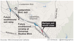 In December 2014, it was reported that local residents were upset about a
portion of the Universal Studios plan: specifically, the fact that the SB
US 101 off-ramp at Barham Blvd would be removed, due to interference with
a new SB US 101 on-ramp planned from Universal City directly onto US 101.
With the ramp closed, southbound drivers trying to get off US 101 will
have to exit north of Barham at Lankershim Boulevard or drive two miles
south to the next offramp at Highland Avenue, a major artery for the
Hollywood Bowl that backs up during performances. As part of the
NBCUniversal Evolution plan — which was approved by both the city
and county — a new southbound US 101 onramp would be built on
Universal Studios Boulevard, allowing departing park guests to get
directly onto the freeway, bypassing the neighborhood. The California
Department of Transportation determined that the Barham offramp had to
close. Otherwise cars accelerating from the new onramp and those
decelerating to make the Barham exit would create a dangerous stretch of
"weaving and merging," according to the project's environmental impact
report. The new Universal Studios Boulevard onramp is now under
construction and expected to open by early 2016. The Barham offramp will
close before the new ramp opens. The Barham Boulevard onramp to southbound
US 101 will remain open. More than 1,500 people have signed an online
petition protesting the offramp's closure. Essentially, there will be less
traffic in the area, but residents will have to get off the freeway one
stop before or after the Barham exit, which could be a little
inconvenient. And since this is LA, naturally, there are residents who are
proclaiming the closure "an abomination." In January 2015, the residents
filed a lawsuit claiming that NBCUniversal and Caltrans broke state law by
inadequately studying the environmental effect of the closure plan. The
lawsuit seeks to halt the Barham closure until further study is done.
In December 2014, it was reported that local residents were upset about a
portion of the Universal Studios plan: specifically, the fact that the SB
US 101 off-ramp at Barham Blvd would be removed, due to interference with
a new SB US 101 on-ramp planned from Universal City directly onto US 101.
With the ramp closed, southbound drivers trying to get off US 101 will
have to exit north of Barham at Lankershim Boulevard or drive two miles
south to the next offramp at Highland Avenue, a major artery for the
Hollywood Bowl that backs up during performances. As part of the
NBCUniversal Evolution plan — which was approved by both the city
and county — a new southbound US 101 onramp would be built on
Universal Studios Boulevard, allowing departing park guests to get
directly onto the freeway, bypassing the neighborhood. The California
Department of Transportation determined that the Barham offramp had to
close. Otherwise cars accelerating from the new onramp and those
decelerating to make the Barham exit would create a dangerous stretch of
"weaving and merging," according to the project's environmental impact
report. The new Universal Studios Boulevard onramp is now under
construction and expected to open by early 2016. The Barham offramp will
close before the new ramp opens. The Barham Boulevard onramp to southbound
US 101 will remain open. More than 1,500 people have signed an online
petition protesting the offramp's closure. Essentially, there will be less
traffic in the area, but residents will have to get off the freeway one
stop before or after the Barham exit, which could be a little
inconvenient. And since this is LA, naturally, there are residents who are
proclaiming the closure "an abomination." In January 2015, the residents
filed a lawsuit claiming that NBCUniversal and Caltrans broke state law by
inadequately studying the environmental effect of the closure plan. The
lawsuit seeks to halt the Barham closure until further study is done.
(Source: LA Times, 12/21/2014; LACurbed
12/22/2014, LA Times 1/5/2015)
In October 2015, it was reported that the southbound
Barham offramp was permanently closing early. This was one of the expected
casualties of the $1.6-billion NBCUniversal Evolution expansion; the ramp
had to close to make way for a new onramp that will feed Universal guests
directly onto southbound US 101. The ramp was scheduled to close in spring
of 2016; with construction ahead of schedule, Caltrans was able to close
it early. NBCUniversal says the new onramp will take 70 percent of
Universal Studios traffic off local streets. Even so, nearby residents are
pissed—now, US 101 commuters can either exit early at Lankershim and
drive local streets or drive farther south and deal with the traffic at
Highland Avenue in Hollywood. Both options are less than ideal for those
used to having an offramp close by.
(Source: LA Curbed, 10/15/2015)
TCRP Project #48 is a study to improve the US 101 corridor between Route 170 (approx LA 11.77L) and Route 23 (approx VEN 0.696). Many of these ideas will never happen. There is also a proposal for short term measures, such as adjusting city streets.
The SAFETEA-LU act, enacted in August 2005 as the reauthorization of TEA-21, authorized $320,000 for High Priority Project #1955: Improvements to US 101 ramps between Van Nuys Blvd (approx LA 15.926) and Winnetka Ave (approx LA 23.268).
San Diego Freeway Interchange (approx LA 17.149L)
In September 2000, the California Transportation Commission considered a proposal (TCRP Project 51) to add an auxiliary lane and widen the ramp through the I-405/US 101 freeway interchange in Sherman Oaks. For phases 1 and 2, the request was for $4 million, with a total estimated cost of $34 million.
There is also work afoot to address another problem at that interchange—specifically, the connector between southbound I-405 and the northbound US 101. This might involve construction of an elevated two-lane connector. There are five options currently under consideration, some of which could affect nearby homes or take out part of the Sepulveda Basin wildlife refuge. The connection between two freeways is now just one lane and often backs up on I-405. The project would build a two-lane connector across the Sepulveda Dam spillway, and could possibly include changes to southbound I-405 and the southbound US-101 interchange, and the Burbank Boulevard on-and-off-ramps.
Note that in the San Fernando Valley, portions of the route are labelled as east/west instead of (or sometimes, in addition to) being north/south. Presumably, this is to simplify directions for local travellers, who don't see the route as running North/South
Encino Pedestrian Overcrossing (07-LA-101 20.0)
The following project was included in the final adopted 2018 SHOPP in March 2018: PPNO 4915. 07-Los Angeles-101 20.0. US 101 Near Encino, at Encino Pedestrian Overcrossing. Replace pedestrian overcrossing. Begin Con: 9/19/2019. Total Project Cost: $13,851K.
In August 2019, the CTC approved the following
allocation: $11,010,000. 07-LA-101 20.0. US 101 Near Encino, at the Encino
Pedestrian Overcrossing № 53-1289. Outcome/Output: Replace
pedestrian overcrossing with a new overcrossing that will provide a
standard vertical clearance.
(Source: August 2019 CTC Agenda, Agenda Item
2.5b.(1) Item #43)
In March 2022, the CTC adopted the 2022 SHOPP, which
included the following as a new SB1 capital amendment: 07-LA-101 20.0.
PPNO 07-4915; ProjID 0715000277; EA 31790. US 101 In the city of Los
Angeles, near the neighborhood of Encino, at the Encino Pedestrian
Overcrossing № 53-1289. Remove pedestrian overcrossing. Programmed
Funding (× $1000): PS&ED $0; PS&E $500; R/W Sup $100; Con Sup
$1,500; R/W Cap $501; Const $3,160; Total $5,761. Begin Const 2/15/2023.
(Source: March 2022 CTC Agenda, Agenda Item 4.25
(SHOPP Adoption), Attch. C (New 2022 SHOPP SB1 Capital Project
Amendments), Item #1)
Also in March 2022, the CTC approved the following
pre-construction SB1 SHOPP allocation: 07-LA-101 20.0. PPNO 07-4915;
ProjID 0715000277; EA 31790. US 101 In the city of Los Angeles, near the
neighborhood of Encino, at the Encino Pedestrian Overcrossing №
53-1289. Remove pedestrian overcrossing. (Categorically Exempt)
(Concurrent Amendment under Resolution G-22-29, Amendment 22H-000; March
2022.) Allocation: PS&E $500,000; R/W Sup $100,000.
(Source: March 2022 CTC Agenda, Agenda Item
2.5b.(2b) #12)
In June 2022, the CTC approved an allocation of
$5,233,000 for the following project: 07-LA-101 20.0. PPNO 07-4915; ProjID
0715000277; EA 31790. US 101 In the city of Los Angeles, near the
neighborhood of Encino, at the Encino Pedestrian Overcrossing №
53-1289. Remove pedestrian overcrossing. Allocation: CON ENG $1,500,000;
CONST $3,160,000.
(Source: June 2022 CTC Agenda, Agenda Item
2.5b.(3))
In September 2022, the US 101 was closed for portions
of a weekend while the Encino Pedestrian Overcrossing was removed. The
overcrossing was built in 1959 over US 101, but the bridge no longer met
necessary “vertical clearance.” Caltrans officials do not plan
to reconstruct a new pedestrian pathway to replace the bridge — as
was initially proposed — following a years-long review process that
took input from residents who live nearby. Many said they did not want to
see a new bridge built, but instead preferred walkability improvements
along Louise Avenue, which crosses above US 101 about a quarter-mile east
of Encino Avenue. Caltrans is currently working on plans to upgrade nearby
crossing points along the corridor, including at Louise Avenue, to ensure
pedestrians and bicyclists have improved and safer access across US 101.
(Source: LA TImes, 9/27/2022)
In March 2019, the CTC was informed about the following emergency
allocations: (1) $8,050,000 Los Angeles 07-LA-101 27.3/36.2. US 101 In the
city of Los Angeles, from Valley Circle to Reyes Adobe Road. The Woolsey
Fire began on November 8, 2018 in Chatsworth. The fire has burned the
existing wood posts, signs, damaged the guardrail and support slopes, and
fire debris is collecting in the drainage systems. This project will clean
fire debris, repair drainage systems, guardrail, signs, and slopes. (2)
$1,935,000 Ventura 07-Ven-101 8.9/9.8. US 101 In and near Thousand Oaks,
from 1.0 mile north of Wendy Drive to 1.0 mile south of Camarillo Springs
Road. The Hill Fire began on November 8, 2018 near Hill Canyon Road and
has burned over 4,500 acres. The fire has burned the existing wood posts,
signs, and damaged a weight station structure. This project will remove
fire debris, repair drainage systems, guardrail, signs, slopes, and
structure.
(Source: March 2019 CTC Minutes, Agenda Item 2.5f.(1) Item 12, 17)
Lost Hills Bridge (approx LA 31.921)
In March 2015, groundbreaking occurred for the new Lost
Hills Bridge in western Calabasas. When it’s completed in 2017, the
new Lost Hills bridge will have five traffic lanes, two bike paths and a
sidewalk, making the passage across the 101 Freeway safer for pedestrians,
cyclists and drivers. The Lost Hills interchange is a main access point
for drivers traveling to western Calabasas and Malibu. The bridge carries
almost 30,000 vehicles each day and is considered too small for the high
demand. The project includes the construction of a curving on-ramp in the
northeast quadrant of the interchange, and a sound wall and earthen berms
to reduce traffic noise for residents of Saratoga, a community immediately
north of the freeway and west of Lost Hills Road. Two-thirds of the cost
of the $30-million project will be covered by the county’s Measure R
transportation bond funds.
(Source: The Acorn, 3/26/2015)
In September 2016, it was reported that northbound
off-ramp for Exit 33, Lost Hills Road, has been completely rebuilt and has
reopened. Instead of a standard diamond interchange like before, it is now
a long ramp that veers to the right, meeting Lost Hills Road quite a ways
north of the freeway.
(Source: Quillz at AAroads, 9/4/2016)
Liberty Canyon Wildlife Bridge (approx LA 32.795)
 In September 2015, it was reported that state agencies, elected officials and wildlife
advocates urged the state to provide a much-needed link for wildlife near
Calabasas via a 165-foot-wide, 200-foot-long overpass across US 101 near
Liberty Canyon Road. This "wildlife bridge" would connect the Santa Monica
Mountains on the south with the Simi Hills and Santa Susana Mountains. It
would be an ambitious overtaking, as the highway has 10 lanes of pavement,
including exit lanes, at that point. Scientists long ago identified
Liberty Canyon as the optimal location to build a wildlife passage because
of the large swaths of protected public land on either side of the
freeway. In September, the Mountains Recreation and Conservation Authority
released a long-awaited study by Caltrans concluding that a wildlife
overpass was feasible. The projected cost would be $33 million to $38
million, according to the report. Proponents said they plan to seek most
of the money from public coffers. In the past, large carnivores have found
US 101 to be a formidable barrier. Since National Park Service biologists
began researching mountain lions in the Santa Monica Mountains in 2002,
motorists have struck and killed a dozen of the big cats in the study
area, including a male puma hit on US 101 near Liberty Canyon two years
ago. The report was the necessary first step toward a final design.
Caltrans is expected soon to begin preparing the required environmental
document, to be funded by a $1-million grant from the State Coastal
Conservancy. The public would be asked to weigh in during this phase,
which would run through 2017. The National Wildlife Federation and the
Santa Monica Mountains Fund have launched an initiative to raise funds for
the engineering design and construction expenses. The overpass would
feature drought-tolerant vegetation placed so that it helps funnel
wildlife across. Hikers, mountain bikers and equestrians would also be
able to use the structure.
In September 2015, it was reported that state agencies, elected officials and wildlife
advocates urged the state to provide a much-needed link for wildlife near
Calabasas via a 165-foot-wide, 200-foot-long overpass across US 101 near
Liberty Canyon Road. This "wildlife bridge" would connect the Santa Monica
Mountains on the south with the Simi Hills and Santa Susana Mountains. It
would be an ambitious overtaking, as the highway has 10 lanes of pavement,
including exit lanes, at that point. Scientists long ago identified
Liberty Canyon as the optimal location to build a wildlife passage because
of the large swaths of protected public land on either side of the
freeway. In September, the Mountains Recreation and Conservation Authority
released a long-awaited study by Caltrans concluding that a wildlife
overpass was feasible. The projected cost would be $33 million to $38
million, according to the report. Proponents said they plan to seek most
of the money from public coffers. In the past, large carnivores have found
US 101 to be a formidable barrier. Since National Park Service biologists
began researching mountain lions in the Santa Monica Mountains in 2002,
motorists have struck and killed a dozen of the big cats in the study
area, including a male puma hit on US 101 near Liberty Canyon two years
ago. The report was the necessary first step toward a final design.
Caltrans is expected soon to begin preparing the required environmental
document, to be funded by a $1-million grant from the State Coastal
Conservancy. The public would be asked to weigh in during this phase,
which would run through 2017. The National Wildlife Federation and the
Santa Monica Mountains Fund have launched an initiative to raise funds for
the engineering design and construction expenses. The overpass would
feature drought-tolerant vegetation placed so that it helps funnel
wildlife across. Hikers, mountain bikers and equestrians would also be
able to use the structure.
(Source: LA Times, 9/2/2015, Image source: Adapted from a Living Habitats/NWF Image in CBS LA, 10/21/2020)
In January 2016, it was reported that Caltrans and the
National Wildlife Federation were hosting meetings to inform residents
about the options for a new wildlife crossing in Liberty Canyon. Barbara
Marquez, senior environmental planner for Caltrans, said plans to augment
an existing tunnel under the freeway were rejected. Environmentalists are
calling for safe passage over the freeway that would allow animals to
expand their territory from the Simi Hills and Sierra Madre Mountain
ranges in the north to the Santa Monica Mountains in the south. Two
options for the project, one costing an estimated $50 million, are being
considered. The first would include a 165-foot-wide by 200-foot-long
bridge across the freeway just west of Liberty Canyon Road. Noise barriers
and vegetation would help block noise and light from the freeway and
surrounding developments and blend the overpass into the existing
landscape. A second, more expensive alternative that received support from
the Old Agoura Homeowners Association would be similar to the first, and
would place the crossing over the freeway as well as at Agoura Road to the
south. “The slope between the end of the bridge and Agoura Road
would be built up before descending to join existing ground,” a
Caltrans report stated. “The expectation is that the crossing
extension would help alleviate wildlife impacts and mortality on Agoura
Road.” Environmental studies on the wildlife crossing will continue
until June 2017. Design issues will be evaluated with public input. The
last phase, June 2017 to April 2019, will finalize the design plans,
obtain construction bids, and acquire property rights and environmental
permits. The hope is that the bridge will be finished and ready for
wildlife crossings by November 2021.
(Source: TO Acorn, 1/21/2016)
In March 2016, it was reported that opposition was
starting to the Liberty Canyon crossing bridge. On 2/25/2016, the City of
Calabasas hosted a meeting titled “101 Freeway Wildlife Crossing:
How Does It Benefit You, Your Business and the City?” About 200
people came to Founders Hall to hear details about the financing, timing
and feasibility of the proposed catwalk and how it will benefit the local
mountain lion population and other wildlife. Most people cheered the
prospect of having a state-of-the-art wildlife crossing in their
community, but some aren’t so keen on the idea, saying the benefits
to wildlife are unproven and the money could be better spent elsewhere.
Panelists told the audience that the wildlife corridor will not divert any
funds from transportation, road repairs and other public uses. Much of the
cost will be met through private and corporate donations. Only those
public funds earmarked for wildlife protection will be used for the
project.
(Source: TO Acorn, 3/3/2016)
In October 2016, it was reported that advocates have
launched a campaign to raise private donations for the wildlife span over
10-lane US 101 in Agoura Hills that would provide safe passage to mountain
lions and other wildlife moving between the Santa Monica Mountains and
inland habitat. The effort got a jump-start from the Annenberg Foundation
in mid-October when the philanthropy announced a challenge grant that will
match every dollar, up to $1 million total, donated by other foundations.
A 2015 Caltrans report presented two alternatives for the US 101 crossing,
which would rise immediately west of Liberty Canyon Road. A bridge
that’s 165 feet wide and 200 feet long would cost $30 million to $35
million. A longer span over the freeway and Agoura Road — the choice
of wildlife advocates — would cost $50 million to $60 million. Given
California’s highway construction backlog, Judge said proponents are
seeking state conservation money, rather than transportation funds. Last
year, they obtained a $1-million grant from the California State Coastal
Conservancy. Backers want to raise $10 million from public and private
sources by the end of next year to advance the project, which they hope to
build by 2021.
(Source: LA Times, 10/19/2016)
In May 2018, it was reported that the Project Report
and the Environmental Document have been completed for the wildlife
crossing at Liberty Canyon (W of Liberty Canyon Road) over US 101, marking
a major milestone for the initiative. The project now moves into final
design and engineering (the “blueprints” phase) and is slated
to begin construction in late 2020. The planned wildlife crossing at
Liberty Canyon is a public/private partnership between Caltrans, the
National Park Service (NPS), the National Wildlife Federation (NWF), the
Santa Monica Mountains Conservancy, the Resource Conservation District of
the Santa Monica Mountains, the Mountains Recreation and Conservation
Authority, the California State Coastal Conservancy and The Santa Monica
Mountains Fund. The project responds to more than two decades of NPS
research on the conservation needs of LA’s mountain lions and
ecosystems and advances long-standing local efforts to establish habitat
connectivity for wildlife across US 101. A total of 8,859 comments were
received in response to the draft Environmental Document, with only 15
opposed. Additionally, California Department of Transportation gave
approval May 1 for the plan. The unpaved bridge across US 101 will feature
a natural landscape design to encourage mountain lions, bobcats and other
wildlife to safely cross the highway and expand their habitat from the
Simi Hills in the north to the Santa Monica Mountains and the Pacific
Ocean in the south. Construction costs will be paid through private
fundraising efforts led by the National Wildlife Federation. The group
hopes to raise $10 million in starter money by the end of 2018. No public
funds will be used. Caltrans chose the second of two proposals for the
bridge. Project Alternative 2 calls for the construction of a
165-foot-wide by 200-foot-long vegetated bridge across US 101 with an
extension over Agoura Road, a city street that runs parallel to the
freeway on the south side. The first alternative had no bridge over Agoura
Road.
(Source: BusinessWire, 5/3/2018; TOAcorn,
5/10/2018)
In August 2019, it was reported that the $87 million
bridge entered its final design phase in July 2019, and is on track for
groundbreaking within two years and completion by 2023, according to
engineer Sheik Moinuddin, project manager with the California Department
of Transportation. Construction will take place mostly at night and won't
require any lengthy shutdowns of the 101 freeway, officials said.
Moinuddin said Caltrans considers it a "special" project that the agency
hopes will inspire others like it across the state. One of the reasons
it's special is that 80% of the money to build it will come from private
sources. More than $13.5 in private funding has already been raised.
Officials are considering offering naming rights to the bridge if an
entity or individual - perhaps a Hollywood studio or star - ponies up a
significant donation. The remaining 20% will come from public funds
already allocated toward conservation projects, officials said.
(Source: CBS News, 8/21/2019; LATimes,
8/20/2019)
In October 2020, it was reported that newly released
plans indicated that the Liberty Canyon Wildlife crossing, which will
eventually be the largest of its kind in the world, is scheduled to break
ground in 2021. The crossing is being built to give wildlife a way to
traverse US 101, and avoid being struck by any of the hundreds of
thousands of vehicles that pass through the area daily. The 165-foot-wide
crossing will stretch 10 feet over 10 lanes of US 101 at Liberty Canyon
Road, according to the National Wildlife Federation. Once it’s
built, the surface will be landscaped to help the structure blend into the
surrounding mountain habitat. The plans call for the top of the structure
to eventually be covered in nearly an acre of native vegetation so that it
can support wildlife and provide habitat, shelter, food and water that
different species need to survive. Living Habitats, which designed the
project, is collecting seeds, acorns and mushrooms that will be grown in a
special project nursery, and planted at the site to allow habitat to grow
vegetation naturally throughout the site from the soil up, according to
the National Wildlife Federation. Native oak and willow trees sourced from
the area will also be planted around the crossing, which will include
nearly nine acres of space along the two adjoining slopes of the
structure. The crossing, which previous reports said would cost $87
million to build, is a public-private partnership involving Caltrans, the
National Park Service, the Santa Monica Mountains Conservancy, Resource
Conservation District of the Santa Monica Mountains and the National
Wildlife Federation.
(Source: CBS LA, 10/21/2020)
In January 2021, a presentation to the CTC gave an
update on this project. The project is estimated to cost $87 million, is
mainly privately funded, and represents an unprecedented partnership
between public agencies and private organizations including Caltrans, the
National Park Service, the Santa Monica Mountains Conservancy, the
Mountains Recreation & Conservation Authority, the Resource
Conservation District of the Santa Monica Mountains, and the National
Wildlife Federation. The project is currently funded through the majority
of design with a combination of conservation grants and private donations.
Pending efforts to secure remaining construction funding, the project is
anticipated to break ground in Fall 2021 and to be completed at the end of
2023 or early 2024.
(Source: January 2021 CTC Agenda, Agenda Item 4.7)
 In May 2021, it was reported that a record $25 million
conservation challenge grant from Wallis Annenberg and the Annenberg
Foundation to the National Wildlife Federation's #SaveLACougars campaign to build a wildlife crossing in the Los Angeles area will help
the project break ground later in 2021. The wildlife crossing at Liberty
Canyon over US 101 — which will be the largest wildlife crossing in
the world — will reconnect a long-fragmented ecosystem, a
biodiversity hotspot, and help protect the endangered mountain lion
population and other wildlife that make their home in the Santa Monica
Mountains. The wildlife crossing at Liberty Canyon is unprecedented in
many ways. It is the first urban crossing of its scale – spanning
210 feet over ten lanes of highway and pavement, along with an access road
– and is the first significantly funded through private donations
along with public support. The #SaveLACougars campaign to build the crossing will serve as a model for urban wildlife
conservation efforts across the globe. With this donation, the campaign
has raised over $44 million to date, and needs to secure an estimated $35
million to unlock the Annenberg Challenge Grant and to break ground in
November 2021.
In May 2021, it was reported that a record $25 million
conservation challenge grant from Wallis Annenberg and the Annenberg
Foundation to the National Wildlife Federation's #SaveLACougars campaign to build a wildlife crossing in the Los Angeles area will help
the project break ground later in 2021. The wildlife crossing at Liberty
Canyon over US 101 — which will be the largest wildlife crossing in
the world — will reconnect a long-fragmented ecosystem, a
biodiversity hotspot, and help protect the endangered mountain lion
population and other wildlife that make their home in the Santa Monica
Mountains. The wildlife crossing at Liberty Canyon is unprecedented in
many ways. It is the first urban crossing of its scale – spanning
210 feet over ten lanes of highway and pavement, along with an access road
– and is the first significantly funded through private donations
along with public support. The #SaveLACougars campaign to build the crossing will serve as a model for urban wildlife
conservation efforts across the globe. With this donation, the campaign
has raised over $44 million to date, and needs to secure an estimated $35
million to unlock the Annenberg Challenge Grant and to break ground in
November 2021.
(Source: PR News Wire, National Wildlife Federation Press Release, 5/14/2021)
In January 2022, the CTC approved for future
consideration of funding 07 – Los Angeles County. Liberty
Canyon Wildlife Habitat Connectivity Project. Construct a vegetated
bridge crossing and other
improvements on US 101. (MND) (EEM). The Project will construct a
vegetated bridge across US 101 in the City of Agoura Hills with the
crossing spanning the US 101 and Agoura Road at the Liberty Canyon Road
exit in Los Angeles County. The California Department of Transportation
(Caltrans) is the California Environmental Quality Act lead agency for the
Project. On April 12, 2018, Caltrans adopted the Mitigated Negative
Declaration for the Project and found that the Project would not have a
significant effect on the environment after mitigation. On December 17,
2021, Caltrans confirmed that the Mitigated Negative Declaration remains
valid and that there are no new identified impacts requiring mitigation.
Caltrans also confirmed that the preferred alternative set forth in the
final environmental document is consistent with the Project scope of work
programmed by the Commission.Stage 1 of the Project is estimated to cost
$60,500,000 and is fully funded through construction with Environmental
Enhancement and Mitigation Program Funds ($500,000), Wallis Annenberg and
Annenberg Foundation Funds ($25,000,000), California Wildlife Conservation
Board Funds ($25,000,000), Assembly Bill 128 Funds ($7,000,000), John
Logan Foundation Funds ($1,000,000), Corporate Donations ($1,000,000), and
Private Donors ($1,000,000). Construction is estimated to begin in Fiscal
Year 2022-23.
(Source: January 2022 CTC Agenda, Agenda Item
2.2c.(6))
In April 2022, ground was broken for the wildlife
crossing. More than 5,000 individuals, foundations, agencies and
businesses from around the world contributed expertise and donations that,
as of Earth Day 2022, totaled more than $87 million — including a
$25-million challenge grant from Wallis Annenberg and the Annenberg
Foundation. Because the project spans an interstate, Caltrans will oversee
design and construction — but the transportation agency is not
providing funding. The 200-foot-long, 165-foot-wide bridge will be the
largest of its kind in the world. As envisioned by architects and
Caltrans, cougars will move — unseen by motorists — over a
reinforced concrete-and-steel crossing landscaped with irrigated native
vegetation, including oak and willow trees. Sound walls and light
deflectors will dampen the noise and headlights of the hundreds of
thousands of vehicles that pass through the area daily. Fencing up to 12
feet high would funnel wildlife including mountain lions, bobcats, deer,
coyotes, skunks, badgers, squirrels, mice and lizards over the passage. To
reduce roadkill, fencing would also extend several miles in both
directions from the project footprint. Completion is scheduled for 2025.
(Source: LA Times, 4/22/2022)
Palo Comado Canyon Interchange (approx LA 33.693)
 In February 2012, it was reported that Caltrans and the City of Agoura Hills propose to construct
improvements at the US 101/Palo Comado Canyon Road interchange (PM
33.0/34.4), in Los Angeles County within in the City of Agoura Hills (this
is the "Chesboro Road" offramp). The project would include widening the
Palo Comado Canyon Road and Palo Comado Canyon Road Overcrossing over US 101 and modification of the interchange ramps in order to improve traffic
circulation, safety, and bicycle/pedestrian access. The need for this
project was first identified by Agoura Hills in their 1992 General Plan.
The Plan’s Circulation Element discusses the need for widening of
the US 101/Palo Comado Canyon Road overcrossing due to congested freeway
access and poor circulation. Discussion of the need for this project was
carried forth to the City’s 2010 General Plan. The Southern
California Association of Governments (SCAG) included the project in
Addendum #3 to their 2008 Regional Transportation Plan (RTP) and Draft
Amendment #08-34 to the 2008 Regional Transportation Improvement Program
(RTIP). The current (2012) overcrossing structure was built in 1963. It
provides two 12-foot lanes and 4-foot shoulders in each direction. A
5-foot sidewalk is provided on the west side of the overcrossing. The
minimum vertical clearance is 15.1 feet, which is located in the northeast
corner of the structure over the northbound US 101 number four lane. The
interchange is configured with tight diamond ramps on the northbound side
and hook ramps on the southbound side. The southbound hook ramps connect
with Dorothy Drive and Chesebro Road at a four-point intersection south of
US 101. A short section of Chesebro Road directly opposite the hook ramps
provides access from the ramps to Palo Comado Canyon Road. The southbound
off-ramp is a one-lane exit that widens to two lanes at its termini. The
southbound on-ramp is a one-lane ramp throughout. The northbound ramps
connect directly to Palo Comado Road. The northbound on-ramp has two lanes
starting from the Palo Comado Road intersection and tapers to a one-lane
on-ramp before joining the freeway. The northbound off-ramp begins as one
lane and widens to two lanes at its termini. The interchange does not
currently have any signalized intersections. The proposed new interchange
(as of January 2012) would include widening Palo Comado Canyon Road from
two to four lanes between Driver Avenue and Chesebro Road. Just north of
the overcrossing, Driver Avenue becomes Palo Comado Canyon Road; just
south of the overcrossing, Palo Comado Canyon Road becomes Chesebro Road.
The Palo Comado Canyon Road Overcrossing would be widened from one lane in
each direction to provide two lanes in each direction, along with a
dedicated left-hand turn lane, for a total of five striped lanes. A Class
II bike lane and sidewalks would be provided on both sides of the
overcrossing. The construction would maintain the existing layout of the
interchange ramps; however, the northbound on- and off-ramps would be
slightly re-configured, with an additional lane being provided on the
northbound off-ramp at the Palo Comado Canyon Road intersection. The
intersection of the northbound ramps and Palo Comado Road would be
signalized; the remaining intersections would remain un-signalized.
Details are found in the draft initial study. At an initial community meeting on the project, local residents expressed
concern about whether there was sufficient traffic to justify the changes.
In February 2012, it was reported that Caltrans and the City of Agoura Hills propose to construct
improvements at the US 101/Palo Comado Canyon Road interchange (PM
33.0/34.4), in Los Angeles County within in the City of Agoura Hills (this
is the "Chesboro Road" offramp). The project would include widening the
Palo Comado Canyon Road and Palo Comado Canyon Road Overcrossing over US 101 and modification of the interchange ramps in order to improve traffic
circulation, safety, and bicycle/pedestrian access. The need for this
project was first identified by Agoura Hills in their 1992 General Plan.
The Plan’s Circulation Element discusses the need for widening of
the US 101/Palo Comado Canyon Road overcrossing due to congested freeway
access and poor circulation. Discussion of the need for this project was
carried forth to the City’s 2010 General Plan. The Southern
California Association of Governments (SCAG) included the project in
Addendum #3 to their 2008 Regional Transportation Plan (RTP) and Draft
Amendment #08-34 to the 2008 Regional Transportation Improvement Program
(RTIP). The current (2012) overcrossing structure was built in 1963. It
provides two 12-foot lanes and 4-foot shoulders in each direction. A
5-foot sidewalk is provided on the west side of the overcrossing. The
minimum vertical clearance is 15.1 feet, which is located in the northeast
corner of the structure over the northbound US 101 number four lane. The
interchange is configured with tight diamond ramps on the northbound side
and hook ramps on the southbound side. The southbound hook ramps connect
with Dorothy Drive and Chesebro Road at a four-point intersection south of
US 101. A short section of Chesebro Road directly opposite the hook ramps
provides access from the ramps to Palo Comado Canyon Road. The southbound
off-ramp is a one-lane exit that widens to two lanes at its termini. The
southbound on-ramp is a one-lane ramp throughout. The northbound ramps
connect directly to Palo Comado Road. The northbound on-ramp has two lanes
starting from the Palo Comado Road intersection and tapers to a one-lane
on-ramp before joining the freeway. The northbound off-ramp begins as one
lane and widens to two lanes at its termini. The interchange does not
currently have any signalized intersections. The proposed new interchange
(as of January 2012) would include widening Palo Comado Canyon Road from
two to four lanes between Driver Avenue and Chesebro Road. Just north of
the overcrossing, Driver Avenue becomes Palo Comado Canyon Road; just
south of the overcrossing, Palo Comado Canyon Road becomes Chesebro Road.
The Palo Comado Canyon Road Overcrossing would be widened from one lane in
each direction to provide two lanes in each direction, along with a
dedicated left-hand turn lane, for a total of five striped lanes. A Class
II bike lane and sidewalks would be provided on both sides of the
overcrossing. The construction would maintain the existing layout of the
interchange ramps; however, the northbound on- and off-ramps would be
slightly re-configured, with an additional lane being provided on the
northbound off-ramp at the Palo Comado Canyon Road intersection. The
intersection of the northbound ramps and Palo Comado Road would be
signalized; the remaining intersections would remain un-signalized.
Details are found in the draft initial study. At an initial community meeting on the project, local residents expressed
concern about whether there was sufficient traffic to justify the changes.
In December 2012, it was reported that a feasibility study and environmental impact report have been done and public meetings held on proposed plans to widen Palo Comado between Driver Avenue and Chesebro Road. In response to these, the Agoura Hills City Council decided in November 2012 not to move forward with putting the engineering design phase of the project out to bid after 12 residents from the Old Agoura neighborhood spoke at the council's Nov. 14 meeting. They plan to revisit the issue in January 2013.
The SAFETEA-LU act, enacted in August 2005 as the reauthorization of TEA-21, authorized $4,000,000 for High Priority Project #3099: Modify and reconfigure Kanan Road interchange (approx LA 35.029) along US 101 in Agoura Hills.
Reyes Adobe Bridge (approx LA 36.178)
![[Reyes Adobe]](maps/101-reyes.jpg) In August 2008, it was announced that work would begin in October on the
demolition of the narrow Reyes Adobe Road bridge over Route 101, and its
replacement with a new overpass. The final $8.4 million package of
federal, state and regional transportation funds is being secured, and
officials expect the Agoura Hills City Council will approve going out to
bid on the project in September 2008. The project will replace a bridge
built in 1965 that has three lanes squeezed into space for two, no room
for bikes, and a sidewalk on only one side of the road. However, right of
way restrictions will prevent them from moving frontage roads a block away
from the freeway ramp intersections in a major circulation reconfiguration
(as was done at Kanan Road). As a result, the signal for Canwood Street on
the north side of the freeway will have to remain within a dozen yards of
the northbound half of the diamond interchange. The project will cost
$11.3 million, with most of that coming from impact fees paid by
developers to the city. About $3.9 million is coming from the federal
treasury under two special congressional appropriations, $2.1 million from
a grant from the Los Angeles County Metropolitan Transportation Authority,
and the rest from the city of Agoura Hills.
In August 2008, it was announced that work would begin in October on the
demolition of the narrow Reyes Adobe Road bridge over Route 101, and its
replacement with a new overpass. The final $8.4 million package of
federal, state and regional transportation funds is being secured, and
officials expect the Agoura Hills City Council will approve going out to
bid on the project in September 2008. The project will replace a bridge
built in 1965 that has three lanes squeezed into space for two, no room
for bikes, and a sidewalk on only one side of the road. However, right of
way restrictions will prevent them from moving frontage roads a block away
from the freeway ramp intersections in a major circulation reconfiguration
(as was done at Kanan Road). As a result, the signal for Canwood Street on
the north side of the freeway will have to remain within a dozen yards of
the northbound half of the diamond interchange. The project will cost
$11.3 million, with most of that coming from impact fees paid by
developers to the city. About $3.9 million is coming from the federal
treasury under two special congressional appropriations, $2.1 million from
a grant from the Los Angeles County Metropolitan Transportation Authority,
and the rest from the city of Agoura Hills.
(Source: VC Star, 8/24/2008)
Lindero Canyon Bridge (approx LA 37.526)
In April 2013, it was reported that the new Lindero
Canyon Bridge will feature artwork from a Westlake Villiage artist. The
Westlake City Council in consultation with Caltrans, which is in charge of
the construction, commissioned sculptor Joe Wertheimer to design an
imprint for concrete on both sides of the bridge. Wertheimer, who works
out of a studio on Via Colinas in Westlake Village, said the project is
unique, as nobody has spanned a freeway. The original drawing of the scene
features mountains and trees as a backdrop to a lake with sailboats and
birds. This was then broken down into 1-inch scale,transferred to a 1-foot
scale. This was then drawn on each panel. During this process, the five
panels were lined up; the artist would sculpt one, two and three at a time
and then slide it down and add another panel, and that was the process for
eight months. The 42 panels were coated in plaster and used to make molds.
When completed, the work will be 360 feet long and 6 feet tall. It will be
created by pouring concrete into the form and then peeling off the front
molds to leave a raised relief. The $5 million project will add a traffic
lane in each direction, retrofit seismic upgrades and improve the
aesthetics of the interchange. The bridge project is being funded
primarily using Measure R funds from the Los Angeles County Metropolitan
Transportation Authority. Work is anticipated to begin in mid-June 2013,
and the project is expected to take about 10 months to complete, he said,
and once completed will help alleviate traffic backups at the intersection
during peak commuter hours. The upgraded bridge will feature an
11-foot-wide lighted pedestrian walkway on the east side. Each corner of
the bridge will be defined with a stone pilaster with a bronze sailboat
similar to the city’s entry monuments.
(Source: VC Star, 4/20/13)
In May 2015, it was reported that the new Lindero
Canyon Bridge was open for traffic, providing two additional traffic
lanes, a protected bike and pedestrian path and decorative motifs
showcasing the Westlake Village lifestyle. The $7.5 million bridge and
interchange renovations are part of an overall program to improve local
roads and pedestrian pathways throughout Westlake Village. The
bridge’s center median was removed to provide an additional lane in
each direction, and an 11-foot-wide lighted pedestrian and cycling path
was added on the east side of the structure. Artist Joe Wertheimer
sculpting a 300-foot-long mural on the bridge’s exterior depicting a
scene of the city with its lake and hillsides. The bridge mural is the
first of its kind for a freeway bridge in the state.
(Source: The Acorn, 5/14/2015)
In December 2015, it was reported that the American
Public Works Association recently recognized the City of Westlake
Village’s newly reconstructed Lindero Canyon Road Overpass with a
2015 APWA “Best” award in the transportation category for
cities under 50,000 in population. The new bridge features an additional
travel lane in each direction, an off-road pedestrian/bike path, seismic
upgrades, sustainable landscaping and a decorative mural. The mural,
sculpted by Joe Werthheimer, serves as a gateway to the city from the 101
Freeway.
(Source: TO Acorn, 12/17/2015)
Our Future 101 Project: HOV Lanes: Route 23/Thousand Oaks (approx VEN 0.684) to Route 33/Ventura
 In January 2014, it was reported that Ventura County was beginning a study regarding
the possibility of adding toll (i.e., HOT or "express lanes") to US 101 in
Ventura County. But even if the Ventura County Transportation
Commission’s $111,000 feasibility study finds that installing
High-Occupancy Toll lanes along the 101 Freeway is doable, it would take
at least a decade before motorists could actually use them. The results of
the feasibility study should be available by the end of 2014, at which
time they will be discussed at a public VCTC meeting.
In January 2014, it was reported that Ventura County was beginning a study regarding
the possibility of adding toll (i.e., HOT or "express lanes") to US 101 in
Ventura County. But even if the Ventura County Transportation
Commission’s $111,000 feasibility study finds that installing
High-Occupancy Toll lanes along the 101 Freeway is doable, it would take
at least a decade before motorists could actually use them. The results of
the feasibility study should be available by the end of 2014, at which
time they will be discussed at a public VCTC meeting.
(Source: The Acorn)
In August 2017, it was reported that the wheels are
beginning to turn on a $750-million plan to add lanes to US 101 between
Thousand Oaks and Ventura, but construction could be over a decade away.
In July 2017, the Ventura County Transportation Commission formally
requested bids for preliminary engineering design and environmental
consulting services on the project, which would add a carpool, or HOV,
lane as well as auxiliary lanes to northbound and southbound US 101
between Route 23 and Route 33. Auxiliary lanes run between interchanges,
giving drivers more time to merge in or out. Most of the widening could be
done on land that’s already owned by Caltrans, said Darren Kettle,
executive director of VCTC, the regional transportation planning agency
that controls the use of government funds for the county’s
transportation projects. “I think we could shoehorn in a lane on the
inside and add auxiliary lanes on the outside,” Kettle said.
“Generally speaking, the project is not that complicated.”
Still, the roughly 28-mile-long effort comes with a hefty price tag: $750
million to $800 million, Kettle estimates. Some of the money will come
directly from the state, which two decades ago changed how local projects
are funded.
(Source: Simi Valley Acorn, 8/23/2017)
In April 2019, scoping meetings were announced to
obtain public input on this project. The plan is to add HOV lanes, and
potentially auxiliary lanes, along US 101 between Route 23 in Thousand
Oaks and Route 33 in Ventura.
(Source: District 7 Tweet, 4/18/2019)
In October 2022, the VCTC published the "Our Future 101" website, which provided more information on the project. Although much of the site, at this time, is high-level and
nebulous, it does note that the Project Development Team has chosen three
Alternatives to move into the next step. These alternatives are: Alternative
1 – No Build; Alternative 2 – Add an HOV/Express
Bus Lane in each direction; Alternative 3 – Add an
HOV/Express Bus Lane in each direction, with design variations In general,
the alternatives were structured to gain the greatest improvement in
traffic conditions and safety levels relative to the costs involved. It
also notes that while adding a general purpose lane was not one of the
alternatives included in the early planning phase, a general purpose lane
alternative was evaluated in the alternatives analysis phase. The
width of a general purpose lane alternative is similar to the width of
Alternatives 2 and 3, and as such, the physical impacts and cost of a
general purpose lane alternative is similar to Alternatives 2 and 3, a
general purpose lane does not move as many people as quickly or reliably
as an HOV lane alternative. For those reasons it was eliminated from
further consideration. It noted that early planning phase construction
cost estimates range from $575 million to $2 billion depending on the
alternative.These cost estimates will be refined as the project
progresses. VCTC is currently estimating that construction will be
complete by 2040. If full funding is available sooner, then construction
will start sooner. The actual construction period can only be determined
once the construction funding plan is determined.
(Source: Our Future 101, 10/2022)
Route 23/US 101 Interchange Improvements (approx VEN 3.155)
In May 2009, using money from the ARRA (Stimulus Package), Ventura County commissioners agreed to give $6.5 million to Thousand Oaks to begin the design process for the widening of the interchange of US 101 and Route 23. The Thousand Oaks City Council recently decided to loan the project money from the city's General Fund so the process could begin this year and to reimburse the General Fund when (if?) the state funding comes through in 2010-11. In late July 2009, the city reached a cooperative agreement with the California Department of Transportation to take over the design. The proposed improvements will add one lane on US 101 in each direction between the Los Angeles/Ventura County line and Moorpark Road by widening the freeway, restriping, reconstructing the median, and realigning a portion of the center line. Soundwalls will be constructed between Hampshire Road and Conejo School Road on the northbound side and between Manzanita Lane and Hampshire Road on the southbound side. The city hopes that the design process will be completed by May 2012 at the latest and that Caltrans will be able to take back the project at that point to begin the construction process. However, the construction phase is still unfunded at this point and additional federal funds will be required to complete the work by 2016 as laid out in the preliminary schedule.
In late September 2011, it was reported that the Thousand Oaks City Council on Tuesday considered loaning $20 million out of city reserves to cover the pending CTC portion of the funding. The city's loan would be contingent on the state transportation commission agreeing to pay it back using the money the panel planned to award the project in 2016. If an agreement between the city and state is reached, the $20 million would be used as required matching funds for a federal transportation stimulus grant. Thousand Oaks and VCTC plan to jointly apply for a $20 million grant in October. The grant requires a minimum 20 percent local match. Construction could get under way in late 2012 or early 2013. It would add a new lane on US 101 in each direction and two lanes on the ramps that narrow to one lane would be extended. Design work on the interchange is expected to be completed early next year. The work, which includes rights of way for utility relocation, cost $6 million and was funded with federal stimulus money.
In January 2012, it was reported that the City of Thousand Oaks lost out on $19.5 million in funding it was seeking through the U.S. Department of Transportation's TIGER III grant program. This is anticipated to delay the start of construction for several years, unless funding is obtained in the 2012 transportation bills. In March 2012, officials from the Ventura County Transportation Commission and the City of Thousand Oaks traveled to Washington, D.C., ahead of the March 19 deadline to reapply for a $20-million Transportation Investment Generating Economic Recovery (TIGER) grant. If the city’s request is approved, construction would start in early 2013 and finish in about two years.
In October 2012, it was reported that the Thousand Oaks City Council voted unanimously Oct. 9, 2012 to advance up to $17.7 million from its capital fund reserves to jump-start the estimated $42-million US 101/Route 23 interchange project, pending the granting of anticipated state and federal funds. Even with the council’s approval of the loan, work can’t begin until the state agrees to the arrangement. City and county officials have been trying unsuccessfully for years to obtain state and federal funds to pay for the interchange expansion, which would add a travel lane in each direction for drivers connecting to US 101 from Route 23 or vice versa. Thousand Oaks and VCTC tried twice before to obtain a $20-million federal Transportation Investment Generating Economic Recovery (TIGER) grant. Both applications were denied. Also in October, the California Transportation Commission unanimously approved the use of $11.9 million to partially fund the $42 million project. The $11.9 million is money left over from the widening of the US 101/Rice Avenue interchange project in Oxnard. It comes from funds that must be used to aid the movement of freight. The project will add one lane in each direction of Highway 101 between the Ventura County/Los Angeles County line and Moorpark Road. Sound walls will also be built.
On March 1, 2013, the Ventura County Transportation
Commission, a body representing all 10 cities in the county, approved a
critical loan repayment agreement between the City of Thousand Oaks and
the state that could get the long-awaited construction effort underway by
the end of 2013. The project, which is estimated to cost $42 million,
would add a travel lane in each direction for drivers connecting to US 101
from Route 23 and vice versa. It’s been discussed for more than a
decade but the county has been unsuccessful up until now in finding the
funds to pay for it. Under the agreement, Thousand Oaks will put up $15.7
million to get the work started, money that would be repaid by 2016 from
the state’s Transportation Improvement Program. The Thousand Oaks
City Council voted unanimously in November 2012 to advance the money from
its capital fund reserves before millions in state funding becomes
available.
(Source: TO Acorn, 3/8/2013)
In December 2013, it was reported that Caltrans planned to award the construction contract in January 2014. The roadwork will add a travel lane in each direction for drivers connecting to US 101 from Route 23 and vice versa. Sound walls will be constructed on the north side of the interchange between Hampshire and Conejo School roads and on the south side between Manzanita Lane and Hampshire. Caltrans plans to award the construction contract to Security Paving Co, Inc. of Sylmar, which submitted a $24.7-million bid in September.
In January 2013, the CTC approved an AB 3090 cash reimbursement in order to use local funds to replace $20,000,000 in fiscal year (FY) 2015-16 Regional Improvement Program (RIP) funds for construction of the Los Angeles County Line to Route 23 – US 101 Improvements - Phase 1 project (PPNO 2291). The City and VCTC propose reimbursement of $15,764,000 in FY 2015-16, with the remaining $4,236,000 returning to Ventura County’s share balance. This project will improve Route 101 from the Los Angeles County line to Moorpark Road, including improvements to the interchange of Route 101 and Route 23.
In December 2015, it was reported that a decision to
redesign a sound wall along US 101 in Thousand Oaks could push back the
scheduled completion date of the US 101/Route 23 interchange expansion by
weeks, if not months. Started in February 2014, work to expand the
juncture of two of Ventura County’s busiest freeways was originally
expected to last around two years. Now it’s looking more like
two-and-a-half. The original plan was to save the existing retaining
walls; but once excavation began, that proved to be significantly
expensive because of the grading difference. The adjustments, approved by
the Thousand Oaks City Council, are waiting for the go ahead from the
Ventura County Transportation Commission and CalTrans before they can take
place, an approval process that could take weeks or months. The sound wall
in question is on the south side of US 101 along southbound Hampshire
Road. The wall is being moved to provide the greatest possible reduction
in freeway noise to a nearby residential area on Willow Lane, according to
city report. This change saw the total cost of the expansion, now in its
21st month, swell from $33.6 million to $37.5 million, a
difference of nearly $4 million.
(Source: TO Acorn, 12/3/2015)
In February 2016, it was reported that the City of
Thousand Oaks was asking Caltrans to make good on its promise to plant new
trees in the place of those removed during the expansion of the US 101 -
Route 23 interchange. The state agency had planned to hold off on the
proposed planting work until after drought conditions improve and the use
of potable water is no longer restricted for landscape purposes. Thousand
Oaks noted that the project Environmental Document identified the tree
removal as a biological impact that required mitigation through
installation of replacement trees based on the standards of the City of
Thousand Oaks Oak Tree Ordinance. Caltrans removed at least 16 mature oak
trees in accordance with project plans—and may have removed even
more. No timeline for when the replacement landscaping will be planted was
offered. As part of its 2015 Drought Action Plan, the state’s
transportation department has been evaluating all plantings that are
irrigated with potable water, including those that were promised as a
condition of project approval.
(Source: TO Acorn, 2/18/2016)
In April 2016, it was reported that construction on the
US 101/Route 23 freeway interchange in Thousand Oaks, originally slated to
finish in spring 2016, was now expected to end in August. The Caltrans-led
expansion of the county’s busiest interchange is in its 26th
month. Work was delayed in late 2015 when engineers discovered a soundwall
intended for the south side of US 101 near Hampshire Road could not be
built as originally designed. The soundwall redesign increased the
anticipated cost of the expansion from $33.6 million to $37.5 million in
December, forcing the cash-strapped state agency to come up with an
additional $4 million. The taxpayers of Thousand Oaks are still waiting to
be paid back for the project by Caltrans and the Ventura County
Transportation Commission. So far, the city has somewhere between $11
million and $12 million invested, or roughly 37 percent of the total
expense.
(Source: Moorpark Acorn, 4/15/2016)
In June 2016, it was noted that the completion date had
been pushed to the fall. Ramp metering system installation and drainage
and irrigation work are nearing completion. About 50 percent of remaining
soundwall and retaining wall construction has been completed. Over the
next few months, construction activities will include profile grinding,
striping work and landscaping. In response to area residents’ safety
concerns, Caltrans has examined the Moorpark Road northbound on-ramp and
will be adding signage and a ramp meter, which will help control the flow
of traffic entering the freeway and also ease some of the merging issues
drivers are facing.
(Source: TO Acorn, 6/23/2016)
In October 2016, it was reported that Ventura
County’s largest freeway undertaking in recent history is finally
coming to an end after 32 months of construction. Caltrans, along with the
City of Thousand Oaks and Ventura County Transportation Commission, hosted
a dedication ceremony Nov. 1, 2016 to mark the completion of the US 101-Route 23 Interchange Improvement Project, a nearly $40-million effort
to ease congestion at one of the region’s most notorious
bottlenecks. The endeavor involved adding a travel lane in each direction
for drivers connecting to US 101 from Route 23, re-striping off-ramps and
interchange lanes from one lane to two, and constructing sound-walls on
both sides of US 101. Among the final items crossed off the
project’s checklist: completion of a soundwall on the southbound
side of US 101 at Hampshire Road that needed to be redesigned
mid-construction and the re-striping of sections of northbound US 101 to
help ease confusion regarding exit-only lanes.
(Source: Moorpark Acorn, 10/28/2016)
In January 2012, construction will begin on improvements to the Wendy Drive interchange (approx VEN 7.884). This is based on the fact that in August 2011, the city of Thousand Oaks secured $10.7 million in federal money for the $13.5 million, 18-month project to widen northbound and southbound ramps. The rest of the funding consists of $605,000 in gas tax money and $2.9 million in developer fees, although it will be several years before the city receives the developer money. Plans to alleviate congestion at the interchange include adding a travel lane in each direction on the bridge,adding a lane on the westbound on-ramp and the eastbound off-ramp, as well as updating signals, planting landscaping, adding decorative railing and light fixtures on the bridge, and installing a northbound bike lane on Wendy. The bike lane will run between two vehicle lanes to keep cyclists from riding past cars coming on or off the freeway that are not required to stop. This design is the first of its kind and has garnered the support of cyclists and Caltrans. Along with temporary ramp closures, the entire freeway in both directions will be shut down for several nights to install steel girders across the highway. The first full closure will come nine months into construction, with a second full closure at the one-year mark. Traffic will be detoured onto local streets. One lane on the bridge also will be closed during construction to allow for the span's widening. In early December 2011, the Thousand Oaks City Council awarded a $1.2 million construction management contract to AECOM Technical Services, Inc. of Los Angeles and a $8.4 million construction contract to Valencia-based C.A. Rasmussen, Inc. The construction bid came in $1.1 million less than the city's estimate. Updates on the project may be found on a website maintained by the City of Thousand Oaks.
In May 2005, the CTC considered relinquishment of right of way in the City of Camarillo, on Petit Street, 0.1 mile west of Calleguas Creek, consisting of frontage roads (7-Ven-101-PM 12.9).
In February 2009, the CTC approved relinquishment of right of way in the city of Camarillo along Route 101 from Route 34 (Lewis Road) to Arneill Road, consisting of relocated or reconstructed city streets, frontage roads, and parking facilities (7-Ven-101-PM 13.8/14.2).
In January 2018, the CTC authorized relinquishment of right of way in the
city of Camarillo along Route 101 on Ventura Boulevard and Carmen Drive
(07-Ven-101-PM 14.7/15.1), consisting of collateral facilities. The City,
by freeway agreement dated February 12, 1997, agreed to accept title upon
relinquishment by the State. The 90-day notice period expired December 6,
2017.
(Source: CTC Agenda, January 2018, Agenda Item 2.3c)
There are plans to construct a new interchange at Springville Drive in Camarillo, CA (approx VEN 16.787). According to the Ventura County Star in December 2009, the Camarillo City Council finally agreed to move forward with a new US 101 interchange project near Springville Road. The council voted unanimously to establish a “benefit area” to raise money for the $51 million Springville Interchange project. About $23 million is needed for a new bridge, on- and off-ramps and road extensions, said City Manager Jerry Bankston. The rest is for additional improvements in the Springville and north Camarillo Airport areas. Property owners in the benefit area will pay one-time road and bridge improvement fees to the city, which will sell bonds to finance the interchange up-front. The council also approved the formation of a Community Facilities District within the benefit area. The district would include 47 acres owned by Robert D. Selleck of Selleck Properties. “Without the district, we could not have raised the (bridge fee) money, especially under these tough economic times,” Selleck said. Mayor Kevin Kildee said the interchange is necessary to improve traffic flow throughout the city, especially with the recent expansion of Camarillo Premium Outlets and future growth at CSU Channel Islands. The project will include an interchange with a six-lane bridge over the freeway, new on- and off-ramps and a connection to an extended Verdulera Street. Ponderosa Drive will be widened to four lanes from Las Posas Road to the new interchange. Ventura Boulevard will also be extended east and west of Springville. The California Department of Transportation has approved permits for the project, and the city plans to start construction at the beginning of 2010.
Rice Avenue Interchange (approx VEN 20.073)
The SAFETEA-LU act, enacted in August 2005 as the reauthorization of TEA-21, authorized $2,640,000 for High Priority Project #1565: Interchange improvements at Rice Avenue and US 101 in the City of Oxnard (approx VEN 20.073).
In February 2009, the CTC approved for future consideration of funding a project in Ventura County to reconstruct the interchange at Route 101 and Rice Avenue and improve traffic operations, enhance safety and increase capacity. The project is programmed in the Trade Corridor Improvement Fund (TCIF) and includes local funds and federal demonstration funds. The total estimated project cost is $86,899,000. It is estimated to begin construction in Fiscal Year 2008-09. The scope as described for the preferred alternative is consistent with the project scope set forth in the approved project TCIF baseline agreement. In May 2009, the Ventura County Transportation Commission approved the allocation of $5 million for improvements to the Rice Road-US 101 interchange in Oxnard, using regional ARRA funds. The project is expected to be completed in middle 2012. In February 2012, the CTC adjusted the project funding to reflect construction savings.
In October 2013, the CTC relinquished right of way in the city of Oxnard adjacent to Route 1 and US 101 on Wagon Wheel Road, consisting of collateral facilities (07-Ven-1-PM 21.0, 05-Ven-101-PM 22.5/R23.0).
In March 2016, the CTC allocated additional funding for a project on Route 101 in Ventura County in the cities of Oxnard and Ventura, from Route 232 to Montalvo Spur Overhead (roughly Vineyard to N of the Santa Clara River, approx VEN 21.985 to VEN R24.637) that will widen the roadway and bridges along this route.
![[TCRP 47]](maps/101-tcrp-47.jpg) In Ventura, the current 5-lane bridge (3 lanes EB, 2 lanes WB) over the
Santa Clara River (approx VEN R23.291) will be replaced with a new 12 lane
bridge. The current Route 1 flyover that currently brings that traffic
into the left-lane lane of US 101 will become a right-lane entrance that
is standard. This is TCRP Project #47. In October 2006, the city of
Ventura requested additional funding for environmental documentation. The
goal of the Route 101, California Street Off-Ramp project is to improve
the traffic flow, sight distance, and increase ramp storage to mitigate an
existing problem of traffic backing up to the freeway. The project also
creates a connection between California Street and the downtown business
district. The project is projected to be completed in FY 2009/2010,
although according to the Los Angeles Times, the widening should be
completed in mid August 2007. Work began in 2002 and was to be completed
in four years. Problems and design revisions delayed the project and
pushed construction costs from $72 million to $85 million. The project was
constructed by Sacramento-based MCM Construction Inc., a leading bridge
builder in California who has erected spans over Malibu Lagoon on Pacific
Coast Highway, built the Riverside Freeway (Route 91) and I-5 interchange
near Knott's Berry Farm and installed bridges across I-210 between Fontana
and San Dimas. The project was subject to numerous restrictions. Between
Dec. 15 and June 1, crews couldn't use heavy equipment in the streambed.
Wildlife authorities imposed the restriction to protect a rare songbird
that, despite the nearby traffic and development, nests in the willows and
alders along the river. The presence of the imperiled southern steelhead
trout, which migrates up the river in winter months, hampered progress on
the bridge. In 2004, the heaviest rainfall in Southern California in over
100 years swept away the project's scaffolding and support equipment.
Average daily traffic flows are forecast to reach 214,000 trips daily
while peak traffic flows are expected to reach 18,000 vehicles per hour by
2025, according to Caltrans and the county Transportation Commission. In
September 2011, the CTC received a request to update the project schedule
and funding plan and to re-allocate $120,000 in previously allocated TCRP
funds. This project originally included $606,000 in TCRP funds for the
Environmental (PA&ED) phase. In October 2006, the Commission approved
an additional allocation of $120,000 for environmental work. The project
was subsequently suspended after several technical issues with drainage
and storm water runoff were revealed. Now that a solution to the issues
has been identified, the City would like to proceed with completion of the
environmental work. The previously allocated $120,000 in TCRP funds is
currently unexpended and set to expire in October 2011. The City requests
that these funds be reallocated so the project can move forward. The City
also requests that the funding plan be updated to reflect the addition of
$2,750,000 in Congestion Mitigation and Air Quality (CMAQ) funds for the
project.
In Ventura, the current 5-lane bridge (3 lanes EB, 2 lanes WB) over the
Santa Clara River (approx VEN R23.291) will be replaced with a new 12 lane
bridge. The current Route 1 flyover that currently brings that traffic
into the left-lane lane of US 101 will become a right-lane entrance that
is standard. This is TCRP Project #47. In October 2006, the city of
Ventura requested additional funding for environmental documentation. The
goal of the Route 101, California Street Off-Ramp project is to improve
the traffic flow, sight distance, and increase ramp storage to mitigate an
existing problem of traffic backing up to the freeway. The project also
creates a connection between California Street and the downtown business
district. The project is projected to be completed in FY 2009/2010,
although according to the Los Angeles Times, the widening should be
completed in mid August 2007. Work began in 2002 and was to be completed
in four years. Problems and design revisions delayed the project and
pushed construction costs from $72 million to $85 million. The project was
constructed by Sacramento-based MCM Construction Inc., a leading bridge
builder in California who has erected spans over Malibu Lagoon on Pacific
Coast Highway, built the Riverside Freeway (Route 91) and I-5 interchange
near Knott's Berry Farm and installed bridges across I-210 between Fontana
and San Dimas. The project was subject to numerous restrictions. Between
Dec. 15 and June 1, crews couldn't use heavy equipment in the streambed.
Wildlife authorities imposed the restriction to protect a rare songbird
that, despite the nearby traffic and development, nests in the willows and
alders along the river. The presence of the imperiled southern steelhead
trout, which migrates up the river in winter months, hampered progress on
the bridge. In 2004, the heaviest rainfall in Southern California in over
100 years swept away the project's scaffolding and support equipment.
Average daily traffic flows are forecast to reach 214,000 trips daily
while peak traffic flows are expected to reach 18,000 vehicles per hour by
2025, according to Caltrans and the county Transportation Commission. In
September 2011, the CTC received a request to update the project schedule
and funding plan and to re-allocate $120,000 in previously allocated TCRP
funds. This project originally included $606,000 in TCRP funds for the
Environmental (PA&ED) phase. In October 2006, the Commission approved
an additional allocation of $120,000 for environmental work. The project
was subsequently suspended after several technical issues with drainage
and storm water runoff were revealed. Now that a solution to the issues
has been identified, the City would like to proceed with completion of the
environmental work. The previously allocated $120,000 in TCRP funds is
currently unexpended and set to expire in October 2011. The City requests
that these funds be reallocated so the project can move forward. The City
also requests that the funding plan be updated to reflect the addition of
$2,750,000 in Congestion Mitigation and Air Quality (CMAQ) funds for the
project.
Mussel Shoals to Casitas Pass Road Widening/HOV (PM VEN 39.8 to SB 2.2)
![[Mussel Shoals]](maps/101-mussel.jpg) In 2007, the CTC recommended funding (from the Corridor
Mobility Improvement Account [CMIA]) to construct HOV lanes from Mussel
Shoals to Casitas Pass Rd ($151,470K requested; $131,600K recommended). In
March 2009, the CTC approved for future consideration of funding a project
spanning Ventura and Santa Barbara Counties to construct HOV lanes in each
direction and roadway improvements near the community of Mussel Shoals in
Ventura County to Casitas Pass Road in Santa Barbara County. The project
is programmed in the Corridor Mobility Improvement Account (CMIA) and the
2008 State Transportation Improvement Program (STIP). Total estimated cost
is $151,470,000. Construction is estimated to begin in Fiscal Year
2010-11. Specifically, six miles of car-pool lanes will be added, and the
project shuld begin in winter 2011. In November 2010, it was noted that
the project will also include a bike path that is separate from the
highway lanes, a new walkway under the highway between La Conchita and the
beach, and the closing of the left turn lanes in and out of La Conchita
and Mussel Shoals. Caltrans officials say they would have preferred the
bike path to be on the mountain side, but the California Coastal
Commission asked them to move it because it wants to encourage development
of a network of coastal trails that stretch from Oregon to the Mexican
border. Putting the bike lanes on the southbound side means a smaller
shoulder on that side of the road — 10 feet, down from 19 feet now
— which means there won't be room for surfers, fishermen and
beachgoers to park their cars. The southbound shoulder near La Conchita is
designated now as emergency parking only, but the rule is rarely enforced.
Caltrans is also including sound walls at the request of Mussel Shoals
homeowners. The agency asked people living in all of the small communities
along US 101 whether they wanted sound walls, and Mussel Shoals was the
only community that voted for them. The walls will be from 8 to 14 feet
tall. In November 2010, it was reported that there was some opposition to
the plan—less due to the widening than the location of the bicycle
path on the ocean side of the roadway. They claim that that location would
reduce access, be vulnerable to erosion and create parking problems.
However, the Coastal Commission sided with Caltrans and kept the bike lane
where it was.
In 2007, the CTC recommended funding (from the Corridor
Mobility Improvement Account [CMIA]) to construct HOV lanes from Mussel
Shoals to Casitas Pass Rd ($151,470K requested; $131,600K recommended). In
March 2009, the CTC approved for future consideration of funding a project
spanning Ventura and Santa Barbara Counties to construct HOV lanes in each
direction and roadway improvements near the community of Mussel Shoals in
Ventura County to Casitas Pass Road in Santa Barbara County. The project
is programmed in the Corridor Mobility Improvement Account (CMIA) and the
2008 State Transportation Improvement Program (STIP). Total estimated cost
is $151,470,000. Construction is estimated to begin in Fiscal Year
2010-11. Specifically, six miles of car-pool lanes will be added, and the
project shuld begin in winter 2011. In November 2010, it was noted that
the project will also include a bike path that is separate from the
highway lanes, a new walkway under the highway between La Conchita and the
beach, and the closing of the left turn lanes in and out of La Conchita
and Mussel Shoals. Caltrans officials say they would have preferred the
bike path to be on the mountain side, but the California Coastal
Commission asked them to move it because it wants to encourage development
of a network of coastal trails that stretch from Oregon to the Mexican
border. Putting the bike lanes on the southbound side means a smaller
shoulder on that side of the road — 10 feet, down from 19 feet now
— which means there won't be room for surfers, fishermen and
beachgoers to park their cars. The southbound shoulder near La Conchita is
designated now as emergency parking only, but the rule is rarely enforced.
Caltrans is also including sound walls at the request of Mussel Shoals
homeowners. The agency asked people living in all of the small communities
along US 101 whether they wanted sound walls, and Mussel Shoals was the
only community that voted for them. The walls will be from 8 to 14 feet
tall. In November 2010, it was reported that there was some opposition to
the plan—less due to the widening than the location of the bicycle
path on the ocean side of the roadway. They claim that that location would
reduce access, be vulnerable to erosion and create parking problems.
However, the Coastal Commission sided with Caltrans and kept the bike lane
where it was.
(Source: VC Star, 10/26/2010)
Environmental and design studies are underway to add extra capacity to the clogged corridor along a six mile stretch between the Mobil Pier and Casitas Pass Road. The general idea is to add a carpool lane in both directions using the existing median area. In addition to the extra lane, shoulder and median widths may be enlarged. In addition, the non-freeway portions in La Conchita and Mussel Shoals would be converted to full freeway standard and the left and u-turn openings closed off. Operational improvements include the addition of traffic cameras, pavement speed sensors and changeable message signs. Proper sound walls and retaining walls would be built as well as metal guardrail replaced with concrete barriers. In July 2010, the Ventura County Planning Commission voted unanimously to grant a permit for the project and funding has been obtained through $150 million in transportation bonds. Construction could begin in late 2011.
In August 2011, the CTC approved schedule and funding changes to the HOV lane project near Mussel Shoals. The project was delayed due to a number of issues, including (a) Coastal Zone permitting requirements – Considerable coordination with the California Coastal Commission (CCC) was necessary in order to obtain coastal development permits for the project. This delayed the design phase by over a year. (b) Right of Way (R/W) easement requirements – The proposed pedestrian undercrossing at La Conchita passes through Union Pacific Railroad (UPRR) R/W. Easements required for the undercrossing were declined by the UPRR and the Department began the condemnation process. A Resolution of Necessity was approved at the June 2011 Commission meeting. Negotiations for the compensation of the easement with UPRR are on-going. These changes move the start of construction out a year to February 2012, with construction completion scheduled for August 2016.
In August 2011, the CTC approved $131,600,000 in state-administered CMIA funds for construction of HOV lanes on US 101 from near Mussel Shoals, in Ventura County to just south of Casitas Pass Road in Santa Barbara County. In March 2012, the CTC reduced the original CMIA allocation for construction on Route 101 by $50,307,000, from $116,300,000 to $65,993,000, for the HOV Lanes, Mussel Shoals to Casitas Pass Road project (PPNO 3918) in Ventura and Santa Barbara Counties.
In May 2012, ground was broken for the first HOV lanes on US 101 in Southern California, expected to be completed in late 2015. These go in both directions from Mobil Pier Road in Ventura County to Casitas Pass Road in Santa Barbara County. Most of the $102 million project is in Ventura County, with a small portion in Santa Barbara County. The project also will include a southbound bike path and a pedestrian undercrossing in La Conchita. After the project is finished, ground will be broken in 2016 for a carpool lane along Highway 101, from Carpinteria to Santa Barbara.
In January 2016, the CTC approved $59,486,000 for a Proposition 1B - State Administered Multi-Funded TFA/STIP Project on US 101 related to the Casitas Pass & Linden Avenue Interchanges. In Carpinteria, from Carpinteria Creek Bridge to Linden Avenue. Reconstruct two interchanges (Casitas Pass Road and Linden Avenue) and extend Via Real Frontage Road. Future Consideration of Funding approved under Resolution E-10-90; November 2010.
In May 2016, it was reported that the California
Transportation Foundation named a project that constructed bicycle lanes
next to US 101 between Ventura and Santa Barbara counties as the Bicycle
Pedestrian Project of the Year at its annual awards luncheon in
Sacramento. The project, dedicated by the state Assembly as the Ralph
Fertig Memorial Bike Path, was a joint effort between the Santa Barbara
County Association of Governments, Caltrans and the Ventura County
Transportation Commission. The new path provides a route of travel that's
separated from but adjacent to US 101 and on the ocean side of the
freeway. The old bike route forced cyclists between parked cars and
freeway travel lanes along the Rincon area of US 101. See-through railing
on the new path was designed to preserve views of the ocean while
protecting users from the freeway traffic. Granite Construction was the
contractor and MNS Engineers Inc. was construction manager. Construction
funding was awarded by the California Transportation Commission with
voter-approved Proposition 1B funds. It was constructed along with a US 101 widening project and in completed in 2015.
(Source: VC Star, 5/26/2016)
 In April 2019, it was reported that one of the conditions for the Casistas
Pass and Lincoln Avenue Interchanges was construction of the
much-anticipated Rincon Multi-Use Trail that will connect the city of
Carpinteria to Rincon County Park. The new community asset is scheduled
for completion before the end of 2020 as a condition of the Caltrans
Linden-Casitas Interchange Project. City permitting for the project to
widen and improve the freeway through Carpinteria included improving
coastal access for cyclists and pedestrians. The route will begin at the
intersection of Route150 and Carpinteria Avenue, descending from the
bluffs over CalTrans property near the freeway corridor before veering
toward the ocean, across a newly constructed bridge over the Union Pacific
Railroad tracks and end in Santa Barbara County’s Rincon Park. The
new segment of trail will also be a connector with the Carpinteria Coastal
Vista Trail from the Carpinteria Bluffs. Upon completion of other
segments, the Coastal Vista Trail will provide contiguous pathways from
Santa Claus Lane to Rincon Point. The trail completion timeline was
initially aligned with Linden-Casitas Interchange Project completion.
However, that project will be completed ahead of schedule this year, and
the Rincon Multi-Use Trail remains on track for the originally scheduled
2020 completion. As part of the new MOU, SBCAG allocated $250,000 for
updated environmental studies and design work from the Regional Surface
Transportation Program.
In April 2019, it was reported that one of the conditions for the Casistas
Pass and Lincoln Avenue Interchanges was construction of the
much-anticipated Rincon Multi-Use Trail that will connect the city of
Carpinteria to Rincon County Park. The new community asset is scheduled
for completion before the end of 2020 as a condition of the Caltrans
Linden-Casitas Interchange Project. City permitting for the project to
widen and improve the freeway through Carpinteria included improving
coastal access for cyclists and pedestrians. The route will begin at the
intersection of Route150 and Carpinteria Avenue, descending from the
bluffs over CalTrans property near the freeway corridor before veering
toward the ocean, across a newly constructed bridge over the Union Pacific
Railroad tracks and end in Santa Barbara County’s Rincon Park. The
new segment of trail will also be a connector with the Carpinteria Coastal
Vista Trail from the Carpinteria Bluffs. Upon completion of other
segments, the Coastal Vista Trail will provide contiguous pathways from
Santa Claus Lane to Rincon Point. The trail completion timeline was
initially aligned with Linden-Casitas Interchange Project completion.
However, that project will be completed ahead of schedule this year, and
the Rincon Multi-Use Trail remains on track for the originally scheduled
2020 completion. As part of the new MOU, SBCAG allocated $250,000 for
updated environmental studies and design work from the Regional Surface
Transportation Program.
(Source: CoastalView.Com, 4/23/2019; Image source: Noozhawk 11/16/2021)
In January 2020, it was reported that the 7- mile
stretch of the US 101 between Carpinteria and Summerland (Linden and
Casitas Pass project) should be open in late March 2020. The widening on
the southbound lanes will be followed by the northbound lanes with
completion in 2022 and 2023.
(Source: KEYT, 1/14/2020)
In March 2020, it was reported that crews are on track
to complete the overpasses and Linden Avenue roundabout in late
spring/early summer of this year, according project spokesperson Kirsten
Ayars. The completion date for the project was initially accelerated, but
the Thomas Fire and subsequent debris flow had an impact, including the
time-consuming task of removing sediment that lodged in the utility
pathways through the new Carpinteria Creek bridge, Ayars added. Moving
forward, Ayars pointed to the upcoming US 101 widening from Bailard Avenue
to the city limits of Carpinteria at the western edge of the Salt Marsh,
slated to begin in April and continue into 2023. Concurrent highway
widening work will take place in Summerland, followed by a Padaro Lane
segment, for an eventual three-lane highway running from Bailard Avenue in
Carpinteria to Sheffield Drive in Montecito in approximately three
years’ time. Ayers noted that landscaping work has been scheduled to
occur as the added lanes are being built, which she said is a significant
time saving element to the overall project.
(Source: CoastalView.Com, 3/3/2020)
The 2020 STIP, approved by the CTC at the March 2020
meeting, programmed the following related to this project:
(Source: March 2020 CTC Agenda, Item 4.7, 2020 STIP
Adopted 3/25/2020)
| PPNO | Project | Prior | 20-21 | 21-22 | 22-23 | 23-24 | 24-25 |
| 0482Y | Casitas Pass & Linden I/Cs, mit planting (split 1/16, incr at vote) | 3,726K | 0 | 0 | 0 | 0 | 0 |
| 0482W | Casitas Pass & Linden I/Cs, mit monitor (split 1/16 vote) | 75K | 0 | 0 | 0 | 0 | 0 |
In November 2021, it was reported that community
members have been protesting the revised Rincon multi-use trail project.
The project has been a subject of public discussion over the past several
years, after first appearing on the county and city’s desk nearly a
decade ago. Its 2,800 linear feet stretches across county, city and
CalTrans property, at 16-feet wide – all concrete – and with
protective fencing and railings. Of the proposed trail, 850 feet is under
Carpinteria’s jurisdiction. The goal of the project, as expressed by
city officials over the past several years, is to improve bicycle and
pedestrian safety and to prevent people from crossing the railroads
tracks, which is illegal. It also would offer cyclists another route down
the coast, other than the shoulder of US 101—which is legal, but
unsafe. The current version of the trail offers a similar alignment
to its predecessor that was originally found “technically unfeasible
to build”; the current design changes where and how the trail would
cross the railroad. Current projections show an average of 70,000 uses of
the trail a year. The trail would start from Carpinteria Avenue just east
of the intersection with Route 150 and proceed east about 2,800 feet,
terminating at the west end of the Rincon Beach parking lot. It would be
about 16 feet wide with a “travel lane” in each direction and
3-foot shoulders on each side, and include a 6-foot-wide shallow concrete
ditch along the inside of the trail to capture and convert stormwater to
onsite drainage facilities, protective fencing along the trail, and a new
14-foot-wide clear-span pre-fabricated bridge crossing over the Union
Pacific Railroad alignment, according to the staff report.The controversy
for the project lies in its plan to potentially destroy a launch site,
prominently used by paragliders and hang gliders. After lengthy public
comment and discussion, the board unanimously voted to move the project
forward to the Carpinteria Planning Commission. The project is
budgeted at $12 million, with funding coming from federal and state
transportation dollars, according to Matt Roberts, Carpinteria Parks and
Recreation public facilities director. However, some aspects of the
funding still need to be identified. The anticipated start of
construction is in 2023, but the project still needs to get coastal
development permits from the City of Carpinteria and Santa Barbara County.
(Source: CoastalView, 11/4/2021; Noozhawk 11/16/2021)
In January 2022, it was reported that the Carpinteria
Planning Commission passed the Rincon Trail Project at its 1/18/22
meeting, choosing from four proposals an option that was not favored by
the soaring community – who showed up strong to the public hearing
to voice concern for the future of their launching point on the bluffs,
“Little Diamondhead.” Despite the pushback from the glider
pilots, and some similar questions from Commissioner John Callender about
the decision-making process, the Environmental Impact Report (EIR) was
certified and the planning commission accepted Alternative 3, the proposal
option preferred by a majority of city staff. The motion was passed in a
3-1 vote, with commissioner Callender opposed. Though the report offered
four alternatives for the planning commissioners to choose from, the
choice ultimately came between Alternative 3 and Alternative 4, with the
soaring community at the center of discussion. Alternative 3 would require
the least amount of “earthwork,” city staff said, and
Alternative 4 could pose some problems with rerouting walkers and hikers
in order to avoid the gliders’ fly-zone. Choosing the option that
would appease the soaring community would also detract from one of the
path’s main purposes – providing a scenic trail to enjoy the
coast’s unique terrain. Along with certifying the EIR, the approval
checks all the boxes for the project to move forward with conditional use
and coastal development permits to start on the 850-foot stretch of trail
between the city and Rincon Beach Park. The rest of the multi-use trail
lies in Santa Barbara County, which is slated to begin as soon as the
project is passed by Carpinteria City Council.
(Source: Coastal View, 1/26/2022)
In May 2023, it was reported that the Carpinteria City
Council ruled 3-1 to pursue alternative three – an altered version
of the proposed Rincon Multi-Use Trail project that sparked controversy
for impacts to paragliding and safety concerns – during a special
meeting. The Rincon Multi-Use Trail Project was originally conceived
as a solution to the current gap between the Pacific Coast Bikeway and the
Carpinteria bluffs in the California Coastal Trail. The project gained
controversy, however, following the Planning Commission’s Jan. 18,
2022 approval of the project’s environmental impact report and
Conditional Use Permit and Coastal Development Permit. The completion of
this project is mandatory for the city of Carpinteria to be in accordance
with its Coastal Land Use Plan and the conditions of approval for the
Caltrans Casitas Pass and Linden Avenue project. The original
environmental impact report outlined four alternatives for the project to
take, and said that the third option, the “steeper slopes / reduced
earthwork alternative” – has the least significant
environmental impact.
(Source: Coastal View, 5/17/2023)
In his 2006 Strategic Growth Plan, Governor Schwartzenegger proposed widening US 101 in Santa Barbara and Ventura County.
In 2007, the following requests for funding from the Corridor Mobility Improvement Account (CMIA) were made, but not recommended for funding: widening and adding Intelligent Traffic Systems from Milpas to Cabrillo Hot Springs in Santa Barbara County ($28,613K requested); and the addition of HOV lanes from Casitas Pass Rd to Milpas St in Santa Barbara County ($12,600K requested).
HOV Lanes / Carpenteria to Santa Barbara (approx SB 1.623 to SB 12.755)
![[101 Work in Santa Barbara]](maps/101-santabarbara.jpg) In July 2008, work began on a series of projects to improve the flow of US 101 in Santa Barbara. This includes a $53 million
project to widen the freeway between Montecito and Santa Barbara. As of
August, the extent of the work had included the removal of trees and
bushes along the roadway, restriping some of the lanes and putting in
concrete barriers. The speed limit has also been reduced along the route
to 55 mph. The two lanes will remain open during the day, but at night,
when construction is being done, the highway will be reduced to one lane
each way. The more significant work of widening US 101 all the way to the
Ventura County line depends on voters' in Santa Barbara County approving a
renewal of a transportation sales tax in November. Voters rejected the
renewal once before. Ventura County voters have twice rejected a similar
measure, but local officials are mulling over a third try in the coming
years. In three years there are plans to begin widening the highway from
Mussel Shoals, past La Conchita and north past the Rincon. But before that
begins, there will likely be several phases of construction in Santa
Barbara County. The first phase would add a lane in both directions
between Milpas Street in Santa Barbara south to Montecito's Hot Springs
Road.
In July 2008, work began on a series of projects to improve the flow of US 101 in Santa Barbara. This includes a $53 million
project to widen the freeway between Montecito and Santa Barbara. As of
August, the extent of the work had included the removal of trees and
bushes along the roadway, restriping some of the lanes and putting in
concrete barriers. The speed limit has also been reduced along the route
to 55 mph. The two lanes will remain open during the day, but at night,
when construction is being done, the highway will be reduced to one lane
each way. The more significant work of widening US 101 all the way to the
Ventura County line depends on voters' in Santa Barbara County approving a
renewal of a transportation sales tax in November. Voters rejected the
renewal once before. Ventura County voters have twice rejected a similar
measure, but local officials are mulling over a third try in the coming
years. In three years there are plans to begin widening the highway from
Mussel Shoals, past La Conchita and north past the Rincon. But before that
begins, there will likely be several phases of construction in Santa
Barbara County. The first phase would add a lane in both directions
between Milpas Street in Santa Barbara south to Montecito's Hot Springs
Road.
(Source: VC Star, 8/20/2008)
In June 2009, the CTC recieved notice of the preparation of a draft EIR. The project under consideration would construct a new HOV lane on Route 101 between Bailard Avenue in the city of Carpinteria and Milpas Street in the city of Santa Barbara. The project is not fully funded. The project is programmed in the 2008 State Transportation Improvement Program (STIP) for Plans, Specifications, and Estimates in the amount of $12,585,000. Santa Barbara County voters, through the passage of Measure A in November 2008, dedicated $140,000,000 of regional sales tax funds toward the construction of this project. The total cost of the project is estimated to be between $380 million and $600 million. Assuming the availability of funding, construction is estimated to begin in Fiscal Year 2013-14. In addition to the no build alternatives, there are three alternatives under consideration. All build alternatives propose to add one HOV lane in each direction, resulting in a six-lane freeway within the project limits. Alternative 1 proposes to add the HOV lane while balancing outside and inside (median) landscaping impacts. Alternative 2 proposes to add the HOV lanes while maximizing the amount of median planting within the project limits. Alternative 3 proposes to add the HOV lanes within the existing median with minor incidental outside widening.
In March 2011, the CTC received notice of an amendment that proposes to extend the limits of this project to the south by 0.6 mile. This would change the southern project limits from 0.4 mile south of Carpenteria Creek Bridge to 0.2 mile south of Bailard Avenue. The proposed change would incorporate improvements to storm water treatment facilities at the Bailard Avenue interchange.
![[101 HOV Carpinteria]](maps/101-carphov.jpg) In April 2012, Caltrans released the draft EIR for the project. The project involves an 11-mile stretch of freeway, and would add HOV lanes between Sycamore Creek, north of
Salinas Street, in Santa Barbara and Bailard Avenue in Carpinteria. During
peak traffic periods, the extra lanes would be restricted to vehicles with
two or more passengers. The HOV lanes would be open to all vehicles
outside of the morning and afternoon commute times. The project also would
have “substantial adverse visual impacts” and require
amendments to the local coastal plans for the cities of Santa Barbara and
Carpinteria, due to the proximity of several wetlands locations. Three
build alternatives—Alternatives 1, 2, and 3—and a No-Build
Alternative are proposed for this project. Alternative 1 proposes to widen
to the median in some locations and widen to the outside in other
locations to balance inside and outside resources. Alternative 2 proposes
widening to the outside to maximize available areas for median
landscaping. Alternative 3 proposes widening to the inside, which means
building all new paved lanes within the existing available median. All
build alternatives would be built mainly within the existing public
right-of-way with only slight variations between all three. Projected
costs for each build alternative vary and depend on which configuration is
selected for the Cabrillo Boulevard Interchange. Current proposed costs
for the alternatives with the various Cabrillo Boulevard Interchange
configurations are: Alternative 1 ranges from $285 million to $340
million; Alternative 2 ranges from $305 million to $355 million; and
Alternative 3 ranges from $270 million to $325 million. All of the
alternatives will widen the freeway to provide for a six-lane facility
within the project limits, and will add a part-time, continuous access HOV
lane in each direction on US 101 extending from Carpinteria Creek in the
City of Carpinteria to Cabrillo Boulevard in the City of Santa Barbara.
They would also (a) improve the southbound shoulder ditches near the
Bailard Avenue interchange to provide graded, flat-bottom swales to be
used for stormwater treatment, (b) replace bridge structures at Arroyo
Paredon (Parida), Toro Canyon, Romero (Picay), Oak, and San Ysidro creeks,
(c) widen bridge structures at Franklin and Santa Monica creeks, (d) widen
traffic undercrossing structures at South Padaro Lane and Evans Avenue,
(e) build a southbound auxiliary lane between the Sheffield Drive on-ramp
and the Evans Avenue off-ramp, (f) replace the interchange at Sheffield
Drive, which includes reconfiguring the southbound highway lanes and
ramps, including a reconstructed bridge that would be 118 feet wide and
would contain a single concrete barrier, (g) reconstruct the highway to
remove a nonstandard-crest vertical curve north of Sheffield Drive near
the Romero (Picay) Creek Bridge, which implies lowering the freeway
profile a maximum of 2 feet to accomplish the reconstruction, (h) rebuild
the interchange at Cabrillo Boulevard/Hot Springs, and (i) signals,
landscaping, soundwalls, retaining walls, as appropriate. Specifics for
each alternative are: Alternative 1— selectively widen
inside and outside within available right-of-way, maximizing opportunities
to retain and refine high value resources including scenic views, wetlands
and median/outside landscaping, add median landscaping, where appropriate:
from Carpinteria Creek to Linden Avenue; near the South Padaro Lane
interchange; Nidever Road to Garapato Creek; and near the North Padaro
Lane interchange, build one additional retaining wall to maximize median
planting, on the southbound shoulder at the right-of-way line ending at
the Santa Claus Lane southbound on-ramp (500 feet in length); Alternative
2— add a lane to the outside in order to maximize median
landscaping in the median where right-of-way is available, provide median
landscaping, where appropriate: from Carpinteria Creek to Reynolds Avenue;
and from Santa Monica Road to the Evans Avenue interchange, build three
additional retaining walls to maximize median planting: one on the
southbound shoulder at the right-of-way line ending at the Santa Claus
Lane southbound on-ramp (500 feet in length); one on the northbound
shoulder near Greenwell Creek (700 feet in length); and one on the
northbound shoulder near the northbound off-ramp to Summerland (300 feet
in length.); Alternative 3 — build all new paved lanes
within the existing available median, with the goal of maximizing the
outside planting, provide a single barrier in the median, separating the
two inside paved shoulders, between Carpinteria Creek and Olive Mill Road.
This largely retains the existing outside edge of pavement within these
areas and no additional retaining walls are needed. The Cabrillo Boulevard
interchange would be rebuilt under all three build alternatives. There are
five mutually exclusive interchange configurations—F, F Modified, J,
M, and M Modified—being considered under each of the three build
alternatives. Two of the five configurations (F Modified and M Modified)
would provide northbound access largely in the same way that it exists now
with two northbound exits. One of the configurations would remove the
off-ramp at Hermosillo Road (configuration M), and two configurations
would consolidate the northbound off-ramp traffic at the Hermosillo Road
off-ramp (configurations F and J). The estimated costs of the five
Cabrillo Boulevard interchange configurations include all work from 0.1
mile south of the Hermosillo Road Exit (PM 10.9) to the northern project
limit. The configuration costs are as follows: configuration F is
approximately $40 million; configuration F Modified is approximately $50
million; configuration J is approximately $85 million; and configurations
M and M Modified are each approximately $90 million. Interchange concepts
that include railroad involvement (configurations J, M, and M Modified)
are estimated to cost from $35 million to $50 million more than those that
do not (configurations F and F Modified).
In April 2012, Caltrans released the draft EIR for the project. The project involves an 11-mile stretch of freeway, and would add HOV lanes between Sycamore Creek, north of
Salinas Street, in Santa Barbara and Bailard Avenue in Carpinteria. During
peak traffic periods, the extra lanes would be restricted to vehicles with
two or more passengers. The HOV lanes would be open to all vehicles
outside of the morning and afternoon commute times. The project also would
have “substantial adverse visual impacts” and require
amendments to the local coastal plans for the cities of Santa Barbara and
Carpinteria, due to the proximity of several wetlands locations. Three
build alternatives—Alternatives 1, 2, and 3—and a No-Build
Alternative are proposed for this project. Alternative 1 proposes to widen
to the median in some locations and widen to the outside in other
locations to balance inside and outside resources. Alternative 2 proposes
widening to the outside to maximize available areas for median
landscaping. Alternative 3 proposes widening to the inside, which means
building all new paved lanes within the existing available median. All
build alternatives would be built mainly within the existing public
right-of-way with only slight variations between all three. Projected
costs for each build alternative vary and depend on which configuration is
selected for the Cabrillo Boulevard Interchange. Current proposed costs
for the alternatives with the various Cabrillo Boulevard Interchange
configurations are: Alternative 1 ranges from $285 million to $340
million; Alternative 2 ranges from $305 million to $355 million; and
Alternative 3 ranges from $270 million to $325 million. All of the
alternatives will widen the freeway to provide for a six-lane facility
within the project limits, and will add a part-time, continuous access HOV
lane in each direction on US 101 extending from Carpinteria Creek in the
City of Carpinteria to Cabrillo Boulevard in the City of Santa Barbara.
They would also (a) improve the southbound shoulder ditches near the
Bailard Avenue interchange to provide graded, flat-bottom swales to be
used for stormwater treatment, (b) replace bridge structures at Arroyo
Paredon (Parida), Toro Canyon, Romero (Picay), Oak, and San Ysidro creeks,
(c) widen bridge structures at Franklin and Santa Monica creeks, (d) widen
traffic undercrossing structures at South Padaro Lane and Evans Avenue,
(e) build a southbound auxiliary lane between the Sheffield Drive on-ramp
and the Evans Avenue off-ramp, (f) replace the interchange at Sheffield
Drive, which includes reconfiguring the southbound highway lanes and
ramps, including a reconstructed bridge that would be 118 feet wide and
would contain a single concrete barrier, (g) reconstruct the highway to
remove a nonstandard-crest vertical curve north of Sheffield Drive near
the Romero (Picay) Creek Bridge, which implies lowering the freeway
profile a maximum of 2 feet to accomplish the reconstruction, (h) rebuild
the interchange at Cabrillo Boulevard/Hot Springs, and (i) signals,
landscaping, soundwalls, retaining walls, as appropriate. Specifics for
each alternative are: Alternative 1— selectively widen
inside and outside within available right-of-way, maximizing opportunities
to retain and refine high value resources including scenic views, wetlands
and median/outside landscaping, add median landscaping, where appropriate:
from Carpinteria Creek to Linden Avenue; near the South Padaro Lane
interchange; Nidever Road to Garapato Creek; and near the North Padaro
Lane interchange, build one additional retaining wall to maximize median
planting, on the southbound shoulder at the right-of-way line ending at
the Santa Claus Lane southbound on-ramp (500 feet in length); Alternative
2— add a lane to the outside in order to maximize median
landscaping in the median where right-of-way is available, provide median
landscaping, where appropriate: from Carpinteria Creek to Reynolds Avenue;
and from Santa Monica Road to the Evans Avenue interchange, build three
additional retaining walls to maximize median planting: one on the
southbound shoulder at the right-of-way line ending at the Santa Claus
Lane southbound on-ramp (500 feet in length); one on the northbound
shoulder near Greenwell Creek (700 feet in length); and one on the
northbound shoulder near the northbound off-ramp to Summerland (300 feet
in length.); Alternative 3 — build all new paved lanes
within the existing available median, with the goal of maximizing the
outside planting, provide a single barrier in the median, separating the
two inside paved shoulders, between Carpinteria Creek and Olive Mill Road.
This largely retains the existing outside edge of pavement within these
areas and no additional retaining walls are needed. The Cabrillo Boulevard
interchange would be rebuilt under all three build alternatives. There are
five mutually exclusive interchange configurations—F, F Modified, J,
M, and M Modified—being considered under each of the three build
alternatives. Two of the five configurations (F Modified and M Modified)
would provide northbound access largely in the same way that it exists now
with two northbound exits. One of the configurations would remove the
off-ramp at Hermosillo Road (configuration M), and two configurations
would consolidate the northbound off-ramp traffic at the Hermosillo Road
off-ramp (configurations F and J). The estimated costs of the five
Cabrillo Boulevard interchange configurations include all work from 0.1
mile south of the Hermosillo Road Exit (PM 10.9) to the northern project
limit. The configuration costs are as follows: configuration F is
approximately $40 million; configuration F Modified is approximately $50
million; configuration J is approximately $85 million; and configurations
M and M Modified are each approximately $90 million. Interchange concepts
that include railroad involvement (configurations J, M, and M Modified)
are estimated to cost from $35 million to $50 million more than those that
do not (configurations F and F Modified).
(Source: Noozhawk.com, 4/2/2012; CaltransDraft
EIR)
In December 2014, it was reported that the CTC approved for future consideration of funding a project that will construct HOV lanes on both sides of US 101 from Carpenteria Creek in the City of Carpenteria to Cabrillo Boulevard in the City of Santa Barbara. The project is not fully funded. The project is programmed in the 2014 State Transportation Improvement Program. The total estimated cost is $467,900,000 for capital and support. Depending on the availability of funds, construction is estimated to begin in Fiscal Year 2018-19. The scope, as described for the preferred alternative, is consistent with the project scope programmed by the Commission in the 2014 State Transportation Improvement Program. The resolution indicates that Alternative 1 was selected, with the F Modified configuration for the Cabrillo Road/Hot Springs Road interchange.
In December 2016, it was reported that nearly a year
after a judge ruled that part of its final environmental impact report was
inadequately done, Caltrans on Thursday night presented its revised draft
EIR for the US 101 widening project between Santa Barbara and Carpinteria.
The phase will add a high-occupancy vehicle lane in each direction of the
freeway along the 10.9-mile stretch between the Andree Clark Bird Refuge
in Santa Barbara and just south of Bailard Avenue in Carpinteria. Under
the plan, the interchanges at Sheffield Drive in Montecito and at Cabrillo
Boulevard and Hot Springs Road in Santa Barbara will also be
reconstructed, eliminating the area’s left-hand offramps. The EIR
revision came after a lawsuit challenged the document, arguing that
Caltrans failed to adequately analyze the impacts to local intersections
and cumulative traffic impacts from the project. The original EIR was
approved in August 2014, and Superior Court Judge Thomas Anderle ordered
the revision this past January. Only the intersections section of the
original EIR had to be redone. The revised draft EIR is available on
Caltrans’ website, and the final EIR is expected to be ready in the
spring. “This project is going to be the last freeway lanes that
we’re going to build in this part of the corridor in any of our
lifetimes,” said Scott Eades, Caltrans’ US 101 corridor
manager. “We’re not designing this project to build another
lane at some point in the future. Literally, we’re designing this
project to be the ultimate capacity for this corridor.” The total
estimated cost of the project is $350 million. Intersection mitigations
are expected to contribute anywhere between $1 million and $8 million to
that. According to Caltrans, the project is funded by $140 million of
Measure A funds and $22 million of gas tax money and bond funds. The
remaining funding is anticipated to come from other state and federal
transportation funds.
(Source: Santa Barbara Noozhawk, 12/15/2016)
In March 2018, it was reported that the CTC awarded
$226 million toward the HOV widening project. The money will come from
Senate Bill 1 state gas tax funding and will go toward the project that
eventually will bring a high-occupancy vehicle lane between Santa Barbara
and Ventura County. The 16-mile 101 HOV Widening Project from Santa
Barbara to Mussel Shoals in Ventura County is more than half complete as
of April 2018, according to the Santa Barbara County Association of
Governments. This allocation is the first of two steps to fully fund
construction of the sections from Bailard Avenue in Carpinteria to the
Sheffield Interchange in Montecito. The commission is expected to vote on
an additional $183 million request from SBCAG for SB 1 funding in May. If
awarded the money, construction on the next three segments of the US 101
HOV project, from Bailard Avenue in Carpinteria to past the Sheffield
Interchange in Montecito, can begin in late 2019. The project is funded
through the voter-approved Measure A sales tax and additional state and
federal funding. About 10 miles remain to be constructed. Phase one from
Milpas to Hot Springs was completed in 2012. Phase two from Mussel Shoals
to Carpinteria was completed in 2015. Phase three, the Linden &
Casitas Pass Interchanges Project, is under construction in Carpinteria
and is scheduled to be complete in 2019, a year earlier than scheduled.
The remaining fourth phase has five segments, which could begin in 2020 or
2021: (4A) Segment 4A will complete the US 101 widening in Carpinteria;
(4B) Segment 4B will continue the widening from the western Carpinteria
city limits to the north Padaro Interchange; (4C) Segment 4C will continue
the widening through Summerland and Ortega Hill and include reconstruction
of the Sheffield Interchange in Montecito; and (4D and 4E) the final two
segments, 4D through Montecito and 4E for reconstruction of the Hot
Springs/Cabrillo Interchange, are planned for construction following
segments 4A through 4C. Funding from the new state gas tax, the Road
Repair and Accountability Act of 2017, is critical to maintaining the US 101 construction schedule.
(Source: Santa Barbara Noozhawk, 3/30/2018)
The 2018 STIP, approved at the CTC March 2018 meeting, appears to restore $8.855M in R/W funding for PPNO 7101 Carpenteria Crk-Sycamore Crk, widen (RIP) [oddly, this is done in the San Joaquin County allocation]. PM SB 1.4/12.3. In and near Carpinteria and the city of Santa Barbara, from 0.2 miles south of Bailard Avenue to Sycamore Creek. Construct HOV lanes. The entry for Santa Barbara County, however, shows that this has been split into two projects: PPNO 7101A HOV lanes, Carpinteria-Summerland, Segs 4A-4C, and PPNO 7101B HOV lanes, Montecito-SB, Segs 4D-4E. All really only have planning funds; there are no construction funds.
In April 2018, it was reported that a judge from the
Santa Barbara Superior Court ruled in favor of moving forward on the South
Coast 101 HOV Lanes Project. The court upheld a Revised Environmental
Impact Report (EIR) which focuses specifically on the topic of
intersections analysis. The ruling by Santa Barbara County Superior Court
Judge Thomas Anderle removes the final remaining hurdle on the South Coast
101 HOV Lanes Project. The project proposed includes new high occupancy
vehicle (HOV) lanes in each direction of US 101 between Bailard Avenue in
the City of Carpinteria and Sycamore Creek (north of Salinas Street) in
the City of Santa Barbara. The project would also reconstruct two
interchanges at Sheffield Drive and Cabrillo Boulevard/Hot Springs Road,
including replacing the left-side ramps with new right-side ones.
(Source: KEYT, 4/17/2018)
In June 2018, the CTC approved a request to amend the
2018 STIP regarding this project. SBCAG and the Department propose that
the South Coast 101 HOV Lanes – Carpinteria through Summerland
Segments 4A-4C (PPNO 7101A) project, in Santa Barbara County be split into
three projects for delivery. The project is part of Santa Barbara 101
Multimodal Corridor that is being delivered by the Department and SBCAG in
phases. At its March 2018 meeting, the Commission adopted the 2018 STIP
that split the original project into two segments (PPNO 7170A and PPNO
7170B), additional funds were programmed to Carpinteria (PPNO 7101A) which
identified Segments 4A, 4B, and 4C. The final phase, PPNO 7101B is not
fully funded. Three phases have already been delivered along the corridor
with various funds. The splitting of the segments into individual projects
as follows: Segment 4A Carpinteria (PPNO 7101C); Segment 4B Padaro (PPNO
7101D) and Segment 4C Summerland (PPNO 7101E) will facilitate the
successful delivery and coordination of the various programs, funding and
partners and is consistent with all of SBCAG’s submittals. This
project is a candidate for the Construction Manager/General Contractor
delivery method, and this action will further align the project for an
innovative delivery of improvements for the corridor. The project is fully
funded and all benefits and outputs remain the same. The splitting of PPNO
7101A into three segments is as follows:
(Source: CTC Agenda, June 2018 Agenda Item 2.1b(2))
 In August 2018, the CTC approved a request that the South Coast 101 HOV Lanes – Carpinteria
through Summerland Segments 4A-4C (PPNO 7101A) project, and Carpinteria
Creek – Sycamore Creek (PPNO 7101) in Santa Barbara County be split
into three projects for delivery. The project is part of the Santa Barbara
101 Multimodal Corridor that is being delivered by the Department and
SBCAG in phases. At its March 2018 meeting, the Commission adopted the
2018 STIP that split the original project (PPNO 7101) into two segments
(PPNO 7101A and PPNO 7101B), additional funds were programmed to
Carpinteria (PPNO 7101A) which identified Segments 4A, 4B, and 4C. This
project is also funded with San Joaquin County shares, however the project
was not properly split and retained the original PPNO 7101under San
Joaquin share adoption. The San Joaquin County shares from (PPNO 7101) are
included in (PPNO 7101A). The proposal is to split the South Coast 101 HOV
Lanes (PPNO 7101A) project as follows: Segment 4A Carpinteria (PPNO
7101C); Segment 4B Padaro (PPNO 7101D) and Segment 4C Summerland (PPNO
7101E). This split will facilitate the successful delivery and
coordination of the various programs, funding and partners and is
consistent with all of SBCAG’s submittals. This project is a
candidate for the Construction Manager/General Contractor delivery method,
and this action will further align the project for an innovative delivery
of improvements for the corridor. The project is fully funded and all
benefits and outputs remain the same.
In August 2018, the CTC approved a request that the South Coast 101 HOV Lanes – Carpinteria
through Summerland Segments 4A-4C (PPNO 7101A) project, and Carpinteria
Creek – Sycamore Creek (PPNO 7101) in Santa Barbara County be split
into three projects for delivery. The project is part of the Santa Barbara
101 Multimodal Corridor that is being delivered by the Department and
SBCAG in phases. At its March 2018 meeting, the Commission adopted the
2018 STIP that split the original project (PPNO 7101) into two segments
(PPNO 7101A and PPNO 7101B), additional funds were programmed to
Carpinteria (PPNO 7101A) which identified Segments 4A, 4B, and 4C. This
project is also funded with San Joaquin County shares, however the project
was not properly split and retained the original PPNO 7101under San
Joaquin share adoption. The San Joaquin County shares from (PPNO 7101) are
included in (PPNO 7101A). The proposal is to split the South Coast 101 HOV
Lanes (PPNO 7101A) project as follows: Segment 4A Carpinteria (PPNO
7101C); Segment 4B Padaro (PPNO 7101D) and Segment 4C Summerland (PPNO
7101E). This split will facilitate the successful delivery and
coordination of the various programs, funding and partners and is
consistent with all of SBCAG’s submittals. This project is a
candidate for the Construction Manager/General Contractor delivery method,
and this action will further align the project for an innovative delivery
of improvements for the corridor. The project is fully funded and all
benefits and outputs remain the same.
(Source: August 2018 CTC Agenda Item 2.1a.(2))
In December 2018, it was reported that Granite
Construction Incorporated (NYSE: GVA) announced that it has been selected
by the California Department of Transportation (Caltrans) as the
Construction Manager/General Contractor (CM/GC) for the estimated $410
million US 101 Carpinteria to Santa Barbara Project. The US 101 Project is
the final phase of a larger program to increase safety, mobility, and
provide congestion relief along US 101 in Santa Barbara and Ventura
Counties. Scope includes adding 10.9 miles of high occupancy vehicle lanes
between Carpinteria and Santa Barbara.
(Source: Digital Journal, 12/17/2018)
In March 2020, the CTC approved an allocation of
$51,030,000 for the State-Administered Multi-Funded SB 1 TCEP/STIP South
Coast 101 HOV Lanes – Carpinteria (Segment 4A) (PPNO 7101C) project,
on the State Highway System, in Santa Barbara County. Specifically, the
CTC resolved that $42,600,000 be allocated from the Budget Act of 2018,
Budget Act Item 2660-301-3291 for construction and $8,430,000 for
construction engineering for 05-SB-101 PM 1.4/R4.8: South Coast 101 HOV
Lanes - Carpinteria (Segment 4A). On US 1010 in Santa Barbara County, in
Carpinteria from 0.2 miles south of Bailard Avenue to 0.5 miles south of
S. Padaro Lane. Construct HOV lanes.
(Source: March 2020 CTC Agenda, Agenda Item
2.5s.(7))
The 2020 STIP, approved at the March 2020 CTC meetings,
had a number of allocations and continued programming from the prior STIP,
as follows. Surprisingly, some were listed with San Joaquin County's
allocations (shown as (SJ); Santa Barbara allocations are shown as (SB)).
(Source: March 2020 CTC Agenda, Item 4.7, 2020 STIP
Adopted 3/25/2020)
| PPNO | Project | Prior | 20-21 | 21-22 | 22-23 | 23-24 | 24-25 |
| 7101A (SJ) | Carpenteria Crk-Sycamore Crk, widen (RIP), in SB Co (18S-04) | Close | 0 | 0 | 0 | 0 | 0 |
| 7101A (SB) | HOV lanes, Carpinteria-Summerland, Segs 4A-4C (RIP)(SCCP)(TCEP) | Close | 0 | 0 | 0 | 0 | 0 |
| 7101B (SB) | HOV lanes, Montecito-SB, Segs 4D-4E (RIP) | 5,207K | 0 | 0 | 0 | 0 | 0 |
| 7101B (SB) | HOV lanes, Montecito-SB, Segs 4D-4E (RIP) | -2,700K | |||||
| 7101B (Interregional) | HOV lanes, Montecito-SB, Segs 4D-4E (IIP). This was changed to a "close" of this PPNO. | 600K | 0 | 0 | 0 | 0 | 0 |
| 7101C (SJ) | HOV Lns-Carpinteria (Segment 4A) SB Co (18S-04) | 5,240K | 0 | 0 | 0 | 0 | 0 |
| 7101C (SB) | HOV lanes, Carpinteria Seg 4A (RIP)(TCEP)(18S-04) | 13,910K | 0 | 0 | 0 | 0 | 0 |
| 7101C (Interregional) | HOV Lns-Carpinteria (Segment 4A) SB Co (18S-04) | 2,495K | 0 | 0 | 0 | 0 | 0 |
| 7101D (SJ) | HOV Lns-Padaro (Segment 4B) SB Co (18S-04) | 3,613K | 0 | 0 | 0 | 0 | 0 |
| 7101D (SB) | HOV lanes, Padaro Seg 4B (RIP)(SCCP)(18S-04) | 10,995K | 5,250K | 0 | 0 | 0 | 0 |
| 7101D (Interregional) | HOV Lns-Padaro (Segment 4B) SB Co (18S-04) | 3,475K | 0 | 0 | 0 | 0 | 0 |
| 7101E (SB) | HOV lanes, Summerland Seg 4C (RIP)(SCCP)(18S-04) | 2,990K | 3,400K | 0 | 0 | 0 | 0 |
| 7101E (Interregional) | HOV Lns-Summerland (Segment 4C) SB Co (18S-04) | 430K | 0 | 0 | 0 | 0 | 0 |
In August 2020, the CTC approved a Senate Bill 1 (SB1)
– Solutions for Congested Corridor Program (SCCP) project amendment
to update the funding plan, for the Santa Barbara Multimodal Corridor,
South Coast 101 High Occupancy Vehicle (HOV) - Summerland Segment 4C (PPNO
7101E) and Santa Monica Road and Via Real Intersection Improvements (PPNO
2985) projects in Santa Barbara County. The amendment would reduce the
SCCP funding for the Santa Monica Road Via Real Interchange improvements
(PPNO 2985) project due to project cost savings, and use those savings to
increase the SCCP and local funding and add Highway Infrastructure Program
(HIP) funds for the South Coast 101 HOV - Summerland Segment 4C (PPNO
7101E) to fund the cost increase. The amendment would also split out
follow-up landscape mitigation and monitoring projects (although some of
the concurrent actions related to that were withdrawn in August and likely
pushed to October 2020. The savings on the Santa Monica Road/Via Real
Intersection came about becaue the project was programmed anticipating a
round-about would be the preferred alternative. During the design phase, a
different preferred alternative was determined to be more viable. The
preferred alternative maintains the same level of benefits but, does not
require as many linear feet of sidewalks because it has a smaller
footprint, resulting in construction cost savings of $2,040,000. On the
other side of the equation, the increase on Summerland Segment were due to
retaining wall construction costs. Geotechnical studies were completed
during design phase for Summerland HOV Segment 4C project, which indicated
the need for a retaining wall to protect the highway. The preliminary
geotechnical information was inconclusive, and full studies during design
were completed showing an additional engineering element was needed. This
segment of the highway is directly adjacent to a cut slope above the Union
Pacific Railroad tracks. The wall is necessary to provide stability to the
mainline of the highway as well as address safety issues associated with
rock and debris falling onto the tracks below. The project cost increased
$19,548,000 for a total of $139,848,000 including follow-up landscape and
monitoring. This increased cost will be shared between Local Measure A
funds ($14,408,000), SCCP funds ($2,040,000), and HIP funds ($3,100,000).
The retaining wall is necessary to protect the investment and address
potential safety issues along the highway.
(Source: August 2020 CTC Agenda, Agenda Item
2.1s.(1))
In October 2020, the CTC approved for future
consideration of funding the following project for which a Final Revised
Environmental Impact Report (FREIR) has been completed: US 101 in Santa
Barbara County. Add high occupancy vehicle (HOV) lanes to a portion
of US 101 in Santa Barbara County. (05-SB-101, PM 1.4/12.3) (PPNO 7101)
This project is located in Santa Barbara County on US 101 between the
cities of Carpinteria and Santa Barbara. The Department proposes to add
part-time HOV lanes, and work includes reconstruction of two interchanges
at Sheffield Drive and Cabrillo Boulevard. The primary purpose of the
project is to reduce existing congestion and delays on US 101. The project
is currently programmed in the 2020 State Transportation Improvement
Program (STIP) and the total estimated cost of the project is
$815,750,000. The project has funding from the following programs: STIP,
State Highway Operation Protection Program (SHOPP), Senate Bill 1 (SB 1)
Local Partnership Program, SB 1 Solutions for Congested Corridors Program,
and SB 1 Trade Corridor Enhancement Program. Construction is estimated to
begin Fiscal Year 2020-2021. The scope, as described for the preferred
alternative, is consistent with the project scope programmed by the
California Transportation Commission (Commission) in the 2020 STIP.
(Source: October CTC Agenda, Agenda Item 2.2c.(3))
In October 2020, it was reported that the second
portion of a five-segment construction project to add peak-period carpool
lanes along US 101 between Santa Barbara and Carpinteira is set to begin
in November 2020. In addition to the new freeway lanes, the US 101:
Summerland project will include new bridges and undercrossings at
Evans Avenue and Sheffield Drive, along with highway ramp and drainage
improvements. On Oct. 22, the California Transportation Commission voted
to allocate approximately $89 million of construction funds for the
project from the Senate Bill 1 Solutions for Congested Corridors Program
(SCCP), Regional Gas Tax Program and State Highway Operations and
Protection Program (SHOPP). The project construction and landscaping costs
are approximately $113 million, according to officials. The US 101:
Summerland project includes locally-inspired design elements that will
highlight the unique community of Summerland at the Evans Avenue
Undercrossing. There will be important drainage improvements and the much
anticipated third lane in each direction throughout Summerland that will
create peak-period carpool lanes to help address ongoing traffic
congestion. The project will also create new right-hand on- and off-ramps
at the Sheffield Drive Interchange. Additionally, improvements are planned
for the on- and off-ramps on Evans and Wallace Avenues and adding two new
sound walls. During Summer 2020, Caltrans and SBCAG applied for state
funding for the two remaining segments in Montecito and Santa Barbara to
complete construction in the area. The CTC will vote on SB1 funding awards
at its November 2020 meeting. Possibly connected to this item or possibly
separate: In October 2020, the CTC approved an allocation of $47,000,000
for 05-SB-101 R7.3/9.6 PPNO 05-7101E ProjID 0518000109 EA 0N703 South
Coast 101 HOV-Summerland (Segment 4C). US 101 In Santa Barbara
County, in and near Summerland from 0.2 miles north of Padaro Lane
Overcrossing to San Ysidro Creek Bridge. Construct HOV lanes. These appear
to be STIP/SB1 SCCP funds.
(Source: Santa Barbara News Press, 10/25/2020; October 2020 CTC Agenda, Agenda Item 2.5s.(4))
In December 2020, it was reported that Caltrans has
awarded Granite Construction Segment 4C (Summerland) of the US 101 Santa
Barbara to Carpinteria Construction Manager/General Contractor (CM/GC)
project. The US 101 Segment 4C Santa Barbara to Carpinteria project is the
final phase of a larger program to increase safety, mobility, and provide
congestion relief along US 101 in Santa Barbara and Ventura Counties.
Segment 4C adds 1.7 miles of high occupancy vehicle (HOV) lanes in Santa
Barbara County to reduce traffic congestion between Santa Barbara and
Ventura. The scope of work for the US 101 Segment 4C project includes the
construction of a new HOV lane in each direction, reconstruction of the
existing highway, and rebuilding two interchanges. The project improves
motorist sight distance and enhances aesthetics throughout the corridor.
Granite’s material facilities in Santa Barbara County will supply
aggregates and asphalt concrete for the project.
(Source: Construction Review Online, 12/10/2020)
In May 2021, the CTC received notice that Santa Barbara
County and the Department propose to amend the funding and schedule for
the South Coast YS 101 HOV Lanes – Carpinteria (Segment 4A)
Mitigation project (05-SB-101 1.400/R4.800 PPNO 7101X) in Santa Barbara
County. The intent of this project is to provide resources for biological
staff to complete their mandated annual reports confirming mitigation
success during the five-year monitoring period as required in the
regulatory permits issued by the Regional Water Quality Control Board
(RWQCB). After this monitoring project was programmed, the RWQCB began a
new process of charging annual fees for the review and concurrence of the
reports generated by Department staff. This new requirement means that the
project now needs Right of Way capital funds to pay for the nominal costs
of the annual fees. The project will be adjusted by reducing the Regional
Improvement Program (RIP) funds for construction support programming by
$7,000 and reprogramming these savings to Right of Way Capital to cover
the five years of annual RWQCB’s permit fees. Additionally, the
installation of the mitigation areas has been delayed in order to avoid
conflicts with the parent roadway project construction. Therefore, the
need for this reporting has been pushed back two fiscal years to
correspond with the first annual fee requirement. As a result, the
Department is requesting re-programming of funds from Fiscal Year 2021-22
to 2023-24. This STIP amendment was approved at the June 2021 CTC meeting.
(Source: May 2021 CTC Agenda, Agenda Item
2.1b.(15); June 2021 CTC Agenda, Agenda Item 2.1a.(17))
In May 2021, the CTC approved an allocation of
$67,520,000 for the State-Administered Multi-Funded Senate Bill 1 (SB 1)
Solutions for Congested Corridors Program (SCCP)/State Transportation
Improvement Program (STIP) South Coast 101 HOV-Padaro (Segment 4B) project
(PPNO 05-7101D; ProjID 0518000113; EA 0N702; 05-SB-101 4.4/R7.7). South
Coast 101 HOV-Padaro (Segment 4B). US 101 in Santa Barbara
County, near Carpinteria and Summerland from 0.9 miles south of S. Padaro
Lane Undercrossing to 0.6 miles north of Padaro Lane Overcrossing.
Construct HOV lanes. CON ENG $12,250,000 (SCCP/20-21) + $4,210,000
(RIP/20-21); CONST $51,060,000. (Future consideration of funding approved
under Resolution E-20-10; October 2020.) (Contribution from other sources:
$27,600,000.) (EA 0N702/PPNO 05-7101D combined with SHOPP EA 1C822/PPNO
05-2426A for construction under EA 0N72U/Project ID 0520000169 using
Construction Manager/General Contractor (CM/GC) method). (RIP Savings of
$1,040,000 to be programmed as follows: $400,000 PS&E; $600,000 CON
Support in FY 22-23 for Highway Planting (PPNO 7102Y) and $35,000 CON
Support in FY 23-24; and $5,000 RW Capital in FY 23-24 for mitigation
monitoring (PPNO 7102X).) (RIP RW savings, $4,385,000 to be credited as:
$2,665,000 to San Joaquin RIP shares, and $1,720,000 to Santa Barbara RIP
shares.) (Concurrent SB 1 SCCP programming amendment under Resolution
SCCP-P-2021-03 will increase SCCP CON by $1,500,000 from savings of PPNO
2893; May 2021.) (As part of this allocation, the Department is requesting
to extend the completion of CONST and CON ENG an additional 14 months
beyond the 36 month deadline.) ALLOCATION IS CONTINGENT UPON
APPROVAL OF A BUDGET REVISION BY THE DEPARTMENT OF FINANCE.
(Source: May 2021 CTC Agenda, Agenda Item 2.5s.(8))
In May 2021, it was reported that work on the next
phase of the widening of Highway 101 from Carpinteria to Santa Barbara
begins June 6. It will be a stretch of just over seven miles from Padaro
Lane to Summerland. Funding is also in the works for the final piece from
Montecito to Santa Barbara, but decisions on that allocation will still
have to be made by state and regional agencies. The project involves
adding an additional lane in each direction, to east the on going
congestion in critical commute times during the week and on weekends. The
current work in Carpinteria is part of a multi phased project involving
new bridges, sound walls, highway reconstruction and landscaping. A
section of the new construction will be dedicated in honor or World War I
veterans. It will be called the Blue Star Memorial Highway and will
represent all branches of the armed forces. 108 new oak trees will be
planted in their honor. There will also be a new bike lane in the months
ahead from Santa Claus Lane to Carpinteria Ave. Caltrans and The Santa
Barbara County Association of Governments (SBCAG) also announced a solid
funding boost for the final phase of the project. It will be $50-million
towards the improvements between San Ysidro Rd. and Olive Mill Rd.
beginning Fall of 2022.
(Source: KEYT, 5/24/2021)
In August 2021, the CTC amended the following project
in the STIP: Santa Barbara US 101 Multi-modal Corridor Project –
Segment 4D North project (PPNO 7101W, EA 0N743). 05-SB-101 9.900/10.600.
In Santa Barbara County on Route 101, 0.1 miles south of the San Ysidro
Avenue Overcrossing to 0.1 miles north of the Olive Mill Overcrossing.
Construct HOV Lanes. Updated financials ($ × 1,000): Const Cap:
$11,872 ⇒ $11,980; Const Sup $0 ⇒ $2,436; Total $11,872
⇒ $14,416.
(Source: August 2021 CTC Agenda, Agenda Item
2.1a.(2))
In October 2021, the CTC approved the following
locally-administered SB 1 Local Partnership Program (LPP) (Formulaic)
Allocation: $3,681,000. 05-SB-101 9.1/12.3. PPNO 05-7101B; ProjID
0518000131; EA 0N70B. South Coast 101 HOV Lanes - Montecito to
Santa Barbara (Segments 4D-4E). US 101 In and near Montecito
and Santa Barbara, from Sheffield Drive to Sycamore Creek. Construct
HOV lanes. Allocation: R/W $3,681,000.
(Source: October 2021 CTC Agenda, Agenda Item
2.5s.(4))
In August 2022, it was reported that the Montecito
Planning Commission (MPC) completed their review of the US 101 Highway
project through Montecito, sending their recommendations and comments to
the Santa Barbara County Planning Commission (SBPC). This was the final
hearing in a series of three conceptual reviews at MPC. SBPC will consider
the project at two hearings scheduled for both November and December of
2022. The Montecito segment of the project (4D) includes widening 1.4
miles of both directions of the freeway, from just before the Romero Creek
bridge to Olive Mill Road to accommodate a part-time High Occupancy
Vehicle (HOV) lane. The existing roadway pavement on the freeway will be
replaced with 40-year concrete pavement, and the project includes the
installation of median barriers, guardrails, fencing, retaining walls, and
new landscaping, reconstruction of the freeway bridges over Cabrillo
Boulevard plus a new southbound on-ramp, and replacement of the bridges
over Romero Creek, San Ysidro Creek, and Oak Creek. The project also
includes the removal of 158 oak trees (to be replaced at a 3:1 or 2:1
ratio) and 20 other native trees (to be replaced at a 1:1 ratio). Safety
improvements of the project include increased stopping sight distance,
exterior shoulders for disabled and emergency vehicles, new safety
barriers, enhanced pavement markings and signs, and safety lighting at
ramps. New components of the project will result in reduced maintenance,
according to project reps. As in previous hearings, Planning Commissioners
continued to take great issue with the removal of sound walls from the
project, which were removed earlier this year after analysis showed an
increase in water rise during a 100-year flood event, using the
County’s Recovery Mapping that was adopted in response to the 1/9
Debris Flow. The Recovery Mapping is based on a 100-year rain flow event,
with additional conditions that all culverts and bridges are blocked, as
well as a burned watershed area, which contributes to a broader flow of
water over the area. According to Santa Barbara County Flood Control reps,
the freeway has flooded seven times since 1960, and was closed for two
weeks following the 1/9 Debris Flow in 2018. Flood Control reps are
adamant that they do not support sound walls in Montecito as part of this
project, despite new resiliency measures including larger (or new) debris
basins, creek nets, and enhanced bridges. Commissioners also considered
the timing of two parallel projects as part of the highway construction:
the Olive Mill roundabout, slated to begin construction in November, as
well as the San Ysidro roundabout, slated to begin construction in Spring
2023. Construction on the freeway project is expected to begin in Summer
2023, and will take 2.5 years to complete. Commissioners asked the team to
try and avoid repeat on- and off-ramp closures, and to stagger the
roundabout and freeway construction in the most efficient way
possible. Commissioners formulated a handful of recommendations to
be sent to the Planning Commission. They stated that if the new watershed
study that is being undertaken allows for sound walls, Caltrans shall
construct sound walls that will accommodate the passage of water, and that
Caltrans shall include the sound walls in their funding request. They also
stated that the project shall be designed and constructed such that future
sound walls can be accommodated (i.e. the footings for sound walls shall
be installed). Also related to the sound walls, the Commission asked that
if sound walls are not constructed as part of the project, the four-foot
wall extending from a retaining wall in front of the Miramar Resort on the
south side of the freeway shall be modified or removed to avoid sound
reflectivity. Other recommendations included asking that the Olive Mill
roundabout be operational prior to the construction on the freeway; tree
removal be minimized and on-site replanting shall be prioritized; and
reclaimed water shall be used for dust mitigation for highway construction
and landscaping shall be irrigated with recycled water, where feasible. An
additional comment was that the freeway bridges be constructed to
accommodate a 100-year storm event to ensure that the proposed bridges
will not be a limiting factor that prevents sound walls from being built
in the future. In place of the sound walls, a black coated chain link
fencing, planted with vines and landscaping, is proposed; Caltrans has
agreed to provide landscape maintenance for five years after the project
is built.At the request of MPC chair Ron Pulice, Ayars reported that
neighborhood chatter related to removal of the southbound on-ramp at
Posilipo is not considered part of this project. While the entrance at
Posilipo will be enhanced during construction, neighbor discussions hoping
for the entrance’s removal are happening outside of the scope of the
project, and any project to consider removal of the entrance would require
significant planning and public input.
(Source: Montecito Journal, 8/30/2022)
In August 2022, the CTC approved a request to add
supplemental funding to the US 101 Multimodal Corridor - Montecito to
Santa Barbara - Segment 4D/4E Project in Santa Barbara County and program
an additional $68,000 of their available 2020 Formulaic Program funding to
the Right-of-Way phase in Fiscal Year 2022-23. This project will construct
high occupancy vehicle lanes and rehabilitate roadway. The anticipated
benefits of this project include reduction in congestion and delays,
improved safety, and encourage a modal shift to transit and carpooling.
(Source: October 2022 CTC Agenda, Agenda Item 4.27)
In October 2022, it was reported that a $75 million
federal loan will help cash-flow needs for the massive US 101 corridor
project, adding a third lane from Santa Barbara to Carpinteria. The U.S.
Department of Transportation has closed more than $38 billion in
Transportation Infrastructure Finance and Innovation Act loans, and the
recent federal infrastructure bill provided more capital for the program.
Its Build America Bureau provided a 4.02% interest, $75 million loan to
build 7.5 miles of high-occupancy vehicle lanes in Santa Barbara County
for the US 101 corridor project. The loan funding will help the agency
leverage Measure A dollars and provide the cash flow to keep construction
moving forward. SBCAG won’t necessarily need to draw down the full
loan amount of $75 million, but it gives the agency cash flow to keep
construction contracts going as soon as sections of the project are ready.
Construction is underway on the highway section between Carpinteria and
Summerland. The 2.5-mile segment between Montecito and Santa Barbara is
still unfunded to the tune of $256 million. Local funding for the project
has come from the voter-approved Measure A half-cent sales tax measure.
(Source: Noozhawk, 10/10/2022)
In October 2022, the CTC approved the following
allocation from Non-Budget Act Item 2660-801-3290 funds for the following
locally-administered SB 1 LPP (Formulaic) project: $68,000. 05-SB-101
9.1/12.3. PPNO 05-7101B; ProjID 0518000131; EA 0N70B. South Coast 101
HOV Lanes-Montecito to Santa Barbara (Seg4D-4E). In and near
Montecito and Santa Barbara, from Sheffield Drive to Sycamore Creek.
Construct HOV lanes. This is a CMGC project. Allocation: R/W $68,000.
Previous allocation of $3,681,000 for R/W was approved under Resolution
LPP-A-2122-08 in October 2021. This is a second allocation for $68,000
which will bring the total R/W allocation for this project to $3,749,000.
Future consideration of funding approved under Resolution E-20-10; October
2020. Contribution from other sources: $9,330,000.
(Source: October 2022 CTC Agenda, Agenda Item
2.5s.(2) #1)
 In May 2023, the CTC approved for future consideration of
funding the following project for which a Final Environmental Impact
Report (FEIR) and Addendums have been completed: US 101 in Santa Barbara
County (05-SB-101, PM 1.4/12.3). Modify US 101 to provide a
In May 2023, the CTC approved for future consideration of
funding the following project for which a Final Environmental Impact
Report (FEIR) and Addendums have been completed: US 101 in Santa Barbara
County (05-SB-101, PM 1.4/12.3). Modify US 101 to provide a full-time
access High Occupancy Vehicle (HOV) lane in each direction of US 101, in Santa Barbara County. (PPNO 7101) The project is located on US 101
at postmile 1.4 to 12.3, in Santa Barbara County. The Department proposes
to modify US 101 to provide a full-time access HOV lane in
each direction of US 101. The project is currently programmed in the 2018
State Transportation Improvement Program (STIP) for a total of
$24,035,000, which includes Right of Way (Support and Capital).
Construction is estimated to begin 2022-2023. The scope, as described for
the preferred alternative, is consistent with the project scope as
programmed by the Commission in the 2018 STIP. A copy of the FEIR has been
provided to Commission staff. The Commission approved the project for
future consideration of funding on October 21, 2020, under Resolution
E-20-101. The project was divided into five segments, Segments A-E, and
the scope was updated to include modifications to the mainline, ramps,
sound walls, retaining walls, guardrails, curbs, concrete barriers, dikes,
and drainage systems. The Department subsequently completed Addendums to
the FEIR pursuant to CEQA. The Department has approved this project for
construction. This approval and the Addendums will satisfy the
environmental requirements for this stage of the planning process.
(Source: May 2023 CTC Agenda, Agenda Item 2.2c.(5); Image source: Noozhawk, 7/3/2023)
In May 2023, the CTC approved the following allocation
for a locally-administered STIP project: $11,868,000. 05-SB-101 9.9/10.6.
PPNO 05-7101W; ProjID 0521000164; EA 0N743. Santa Barbara U.S. 101
Multi-modal Corridor Project - Segment 4D North. In Santa Barbara
County on Route 101, 0.1 miles south of the San Ysidro Avenue Overcrossing
to 0.1 miles north of the Olive Mill Overcrossing. Construct HOV Lanes.
(Local contribution for PA&ED, PS&E, RW Capital and R/W Sup as
part of STIP project EA 0N70B). CEQA - MND, 08/26/2014; Re-validation
04/05/2023 NEPA - FONSI, 08/26/2014; Re-validation 04/05/2023. Right of
Way Certification: 04/14/2023. Future consideration of funding approved
under Resolution E-20-101; October 2020. Cost increase of $714,000 to be
contributed by Santa Barbara County regional shares. Project combined with
SHOPP project EA 1C843/PPNO 05-2426W for construction under EA 0N74U -
Project ID 0522000025. Contribution from other sources: $10,367,000.
Concurrent addendum for the previously approved Future Consideration of
Funding under Resolution E-23-75; May 2023. The CONST RIP amount of
$2,665,000 is the San Joaquin County regional shares contribution to this
project.. Allocation: COVID-RIP/22-23 ⇒ CON ENG $2,436,000, CONST
$108,000. RIP/22-23 ⇒ CON ENG $0 $48,000
CONST $5,945,000 $6,611,000. RIP/22-23 ⇒
CONST $2,665,000.
(Source: May 2023 CTC Agenda, Agenda Item 2.5c.(4))
In July 2023, it was reported that the California
Transportation Commission has awarded $132.4 million to the Santa Barbara
portion of the massive US 101 project. $145 million is required to
fully fund the remaining construction that ends at Sycamore Creek in Santa
Barbara. The Montecito portion of the project is currently under
construction, and so are parallel projects including the San Ysidro Road
roundabout.
The $132.4 million award will fund the following components of the US 101
Carpinteria to Santa Barbara project:
(Source: Noozhawk, 7/3/2023)
In June 2023, the CTC approved the following
State-Administered STIP allocation: $40,000. 05-SB-101 R7.3/9.6. PPNO
05-7103X; ProjID 0520000146; EA 0N7C2. South Coast 101 HOV-Summerland
(Segment 4C) Mitigation Monitoring. In Santa Barbara County, in and
near Summerland from 0.2 miles north of Padaro Lane Overcrossing to San
Ysidro Creek Bridge. Mitigation monitoring for 05-0N703. CEQA - EIR,
08/26/2014; Re-validation 12/22/2022. NEPA - FONSI, 08/26/2014;
Re-validation 12/22/2022. Right of Way Certification: 05/03/2021. As part
of this allocation request, the Department is requesting to extend the
completion of CON ENG an additional 36 months beyond the 36 month
deadline. Future consideration of funding approved under Resolution
E-20-101; October 2020. Allocation: CON ENG $40,000.
(Source: June 2023 CTC Agenda, Agenda Item 2.5c.(1))
In June 2023, the CTC adopted the 2022 Solutions for
Congested Corridors Program, which included the following program: Santa
Barbara U.S. 101 Multimodal Corridor Project - Three Creeks in Santa
Barbara County ($132,400,000) is a community-driven and complex
multimodal project which provides improved non-vehicular and vehicular
mobility options between the regularly congested Counties of Santa Barbara
and Ventura. This project includes completing a gap on US 101 with
continuous high occupancy vehicle lanes (segments 4D, 4E), peak-hour
passenger rail service, enhanced regional and local transit service, and
the completion of the California Coastal Trail to increase biking and
walking. This suite of improvements will rebuild the community’s
only highway and economic lifeline by making it efficient, safe, and
equitable, and reconnecting local neighborhoods that have been
historically disenfranchised from active transportation choices. This
project will also provide improved interregional accessibility for small
communities along US 101, commuters that travel from Ventura to Santa
Barbara, freight trucks, and travelers. In the staff recommendations
released on June 8, 2023, the recommended funding amount for this project
was reported inaccurately as $107.4 million by Commission staff, which is
$25 million less than the original request. Therefore, the recommended
funding amount has been increased to $132.4 million to fully fund the
project.
(Source: June 2023 CTC Agenda, Agenda Item 4.4)
In January 2024, the CTC approved an amendment to the
Local Partnership Formulaic Program that impacted the US 101 Multimodal
Corridor – High Occupancy Vehicle Segment 4E South project in Santa
Barbara County by programming an additional $158,000 to the Construction
phase in fiscal year 2023-24 for a total programmed amount of $2,742,000.
This project will reduce congestion and delays, improve travel time,
provide for High Occupancy Vehicle Lane continuity in southern Santa
Barbara County, and is a critical north-south connector when alternative
parallel routes, like Interstate 5, are closed for emergencies.
Anticipated project benefits include critical safety benefits, improved
truck traffic flow, and reduced emissions for the corridor which serves
as: a Strategic Interregional Corridor, a critical commuter route, an
evacuation route, and is designated by the Federal Highway Administration
as a Critical Urban Freight Corridor. The funds were available because at
the October 2023 Commission meeting, the Commission deallocated project
cost savings of $158,000 from two projects in Santa Barbara County. The
savings were available to the Santa Barbara County Association of
Governments for reprogramming and allocation until October 31, 2024.
(Source: January 2024 CTC Agenda, Agenda Item 4.16)
Carpinteria Improvements (approx SB 2.622 to SB 4.446)
![[Carpinteria]](maps/101-carpinteria.jpg) In June 2008, the CTC received a
notice of preparation for roadway improvements on a portion of Route 101
near Carpinteria in Santa Barbara County. The project is not fully funded.
The project is programmed in the 2008 State Transportation Improvement
Program (STIP) for project development, right of way and construction
support for $50,468,000. Total cost of the project is estimated to be
$100,451,000. Construction is estimated to begin in Fiscal Year (FY)
2013-14, depending on the availability of funds. There are five
alternatives being considered for the project.
In June 2008, the CTC received a
notice of preparation for roadway improvements on a portion of Route 101
near Carpinteria in Santa Barbara County. The project is not fully funded.
The project is programmed in the 2008 State Transportation Improvement
Program (STIP) for project development, right of way and construction
support for $50,468,000. Total cost of the project is estimated to be
$100,451,000. Construction is estimated to begin in Fiscal Year (FY)
2013-14, depending on the availability of funds. There are five
alternatives being considered for the project.
In February 2009, the CTC received the Draft EIR on the above project for review. The alternatives changed slightly:
In November 2010, the CTC approved for future consideration of funding a project in Santa Barbara County that will make operational improvements to Route 101 in the city of Carpinteria by reconstructing the Linden Avenue and Casitas Pass Road interchanges, reconfiguring on and off ramps, replacing Route 101 bridges over Carpinteria Creek and reconstructing bike paths. The project is not fully funded. The project is programmed in the 2010 State Transportation Improvement Program for project development only. Construction is estimated to begin in Fiscal Year 2013-14. Total estimated project cost is $101,171,000 for capital and support. Resources that may be impacted by the project include; land use, farmlands, biological resources, visual resources, water quality, and noise. Potential impacts associated with the project can all be mitigated to below significance through proposed mitigation measures.
In July 2020, it was reported that after 25 years, the
bridges have been completely replaced at Linden Avenue and Casitas Pass
Road. Each bridge has additional vehicle lanes, along with bike lanes that
connect to a larger city bicycle network for safe riding to downtown, the
beach and south to the Rincon. There, a Class One bike lake provides a
safe route to Ventura. The bridge improvements were necessary to complete
the freeway expansion from two lanes in each direction to three lanes in
each direction. The old bridges were outdated and did not provide the room
to widen the highway. The project also includes more signal lights in a
city that, for years, only had three signalized intersections. Now there
are eight locations for lights. They will be flashing red for the the
first week of operation, then go into their normal cycle. The Casitas Pass
bridge has room for a center parkway that will have palm trees for a
welcoming overcrossing into the downtown corridor. The work was completed
five months ahead of schedule.
(Source: KEYT, 7/9/2020)
In December 2018, it was reported that (as part of the Route 192 bridge
reconstruction project), Construction crews were working on the Olive Mill
Road overpass on US 101 (~ SB 10.537) near the Montecito Inn, which had
its railings destroyed and washed away by the Jan. 9, 2018 debris flow.
New bridge rails have been completed on the eastern side of the overpass
and crews were working on the western side.
(Source: SB Noozhawk, 12/5/2018)
In September 2010, the CTC approved relinquishment of right of way in the city of Santa Barbara along Route 101, on Hot Springs Road, Old Coast Highway, and Coast Village Road, consisting of collateral facilities (5-SB-101-PM 11.3).
Cabrillo Interchange (approx SB 11.402)
In May 2012, it was reported that the Cabrillo
Interchange reconstruction was creating controversy. The preferred
Caltrans alternative, known as “F modified,” that takes away
the left hand ramps, but installs a new northbound off ramp at Cabrillo
Boulevard. Some residents have seized on this being the best option the
community is likely to get, given that it’s the only one that keeps
traffic away from Coast Village Road. Others believe that a better
alternative could still be worked out with Caltrans. Hermosillo Road
residents demanded to know why the Montecito board had sent a letter to
Caltrans with wording that some residents felt implied support of using
Hermosillo Road as the primary exit. The residents demanded the board take
a stance on preventing Hermosillo Road from becoming the new beach
thoroughfare. Some feared that losing the ramps without building a new
right hand ramp would send tourists, airbuses, and other vehicles
ill-suited to the roundabout through Coast Village Road.
(Source: Daily Sound, 5/17/2012)
In January 2013, it was reported that a group called Common Sense 101 was protesting the plans in Montecito and proposing a "Plan B". They have a
link to their proposal, but it is mostly graphics and does not contain a specific written description of the changes. Their proposal supposedly takes less time, costs less
money, and keeps the freeway open. It is unclear whether it addresses all
of the same goals.
(Source: Pacific Business Times, Common Sense 101)
In December 2013, it was reported that Caltrans had rejected the proposal from Common Sense 101, and that they want to move forward with the original proposed South Coast Highway 101 HOV Project.
Cacique Street Improvements (approx SB 12.672)
In December 2009, the CTC approved for future consideration of funding a project that will construct operational improvements to the existing four-lane Route 101 including additional lanes, new and reconfigured ramps, replacement/widening of Milpas Street Undercrossing and Sycamore Creek Bridge, new Cacique Street Undercrossing, and bicycle/pedestrian facilities in the city of Santa Barbara. The Department and the Federal Highway Administration originally approved the FEIR/FONSI in 2004. In November 2007, the Commission allocated $53,043,000 programmed in the 2006 State Transportation Improvement Program (STIP). At that time, the landscape scope of work was split to form a parent project (PPNO 0478) and a child project (PPNO 0478Y). The revalidation of the document is needed for the landscaping project (PPNO 0478Y), acknowledges the addition of scope that was added in 2005, and corrects inaccuracies in the Notice of Determination that was filed in 2004. The landscape project is programmed in the 2008 STIP for $3,065,000, capital and support. Construction is estimated to begin in Fiscal Year 2009-10.
In April 2012, it was reported that Caltrans opened the
gate between two sides of Cacique Street previously blocked by US 101. A
two-lane road with bike lanes now flows under the raised highway, better
connecting drivers, cyclists, and walkers of the lower Eastside
neighborhood with nearby business and the beach, and allowing them to
bypass the tricky Milpas roundabout. The corridor opened in conjunction
with the completion of new third lanes on US 101 between Milpas Street and
Hot Springs Road. These first-phase improvements, four years of
construction and $57 million in the making, included the overhaul of two
major interchanges, work on six new or improved bridges, and the Montecito
roundabout. It was the largest Caltrans project in Santa Barbara since the
crosstown route was completed in the early 1990s. The voter-approved
Measure D, a local sales tax that helps pay for such traffic-improvement
ventures, contributed $13 million toward the $57-million price tag.
(Source: Santa Barbara Independent, 4/4/2012)
In October 2011, the CTC approved relinquishment of right of way in the city of Santa Barbara, adjacent to Route 101 and underlying the Milpas Street roundabout, consisting of collateral facilities (05-SB-101-PM 12.75).
The SAFETEA-LU act, enacted in August 2005 as the reauthorization of TEA-21, authorized $800,000 for High Priority Project #246: Operations and management improvements, including Intelligent Transportation System (ITS) technologies on US 101 in Santa Barbara County.
In May 2005, the CTC considered relinquishment of right of way in the City of Santa Barbara, between Lawrence Street to 0.6 mile westerly of State Street, consisting of reconstructed and relocated city streets, frontage roads, and cul-de-sacs. (5-SB-101-PM R12.8/R14.2)
San Jose Creek Bridge № 51-0163L/R Replacement (05-SB-101 PM 21.4/21.9)
 The following project was included in the final adopted 2018 SHOPP in March 2018: PPNO 2649. 05-Santa Barbara-101 21.6. US 101 In Goleta, at San Jose Creek Bridge № 51-0163L/R. Replace
bridges to maintain standards of safety and reliability. Begin Con:
6/15/2022. Total Project Cost: $16,960K.The existing San Jose Creek Bridge
was built in 1946 and widened in 1989.The existing structure is about
100-feet long and 114-feet wide and has three spans with 58 columns placed
in the creek channel. The bridge has six12-foot-wide lanes, two
8-foot-wide inside shoulders, two 8-foot-wide outside shoulders, and a
22-foot-wide center median.
The following project was included in the final adopted 2018 SHOPP in March 2018: PPNO 2649. 05-Santa Barbara-101 21.6. US 101 In Goleta, at San Jose Creek Bridge № 51-0163L/R. Replace
bridges to maintain standards of safety and reliability. Begin Con:
6/15/2022. Total Project Cost: $16,960K.The existing San Jose Creek Bridge
was built in 1946 and widened in 1989.The existing structure is about
100-feet long and 114-feet wide and has three spans with 58 columns placed
in the creek channel. The bridge has six12-foot-wide lanes, two
8-foot-wide inside shoulders, two 8-foot-wide outside shoulders, and a
22-foot-wide center median.
In April 2020, it was reported that the public comment
period for a proposal to replace the San Jose Creek Bridge on US 101 near
Route 217 in Goleta was opening. The bridge replacement is aimed to ensure
reliability of the highway would be designed as a single-span bridge that
would meet current standards. The project would replace the existing
bridges with a new single bridge structure. The new bridge will be in the
same location as the existing bridge. The proposed project also includes a
standard bicycle pedestrian path on the north side of Route 217, according
to Caltrans officials. According to the proposed mitigated declaration,
building the new bridge would involve the following:removing the existing
bridge structure and building a new bridge structure, removing the
existing slope pavement on the creek banks, installing rock slope
protection, replacing traffic barriers to meet current safety standards
and minor earthwork. The total cost estimate for project construction is
about $19,515,000, with an estimated escalated cost of about $22,982,000.
Project construction is expected to start in the 2022-2023 fiscal year,
and end in the 2024-2025 fiscal year. Project construction is expected to
take about 280 working days spread between two construction seasons.
Typical construction season occurs between June to October.
(Source: Initial Draft EIR; Santa Barbara News Press)
The 2020 SHOPP, approved in May 2020, included the
following Bridge Preservation item of interest (carried over from the 2018
SHOPP): 05-Santa Barbara-101 PM 21.4/21.9 PPNO 2649 Proj ID
0516000073 EA 1H430. US 101 in Goleta, from Route 127 to 0.3 mile
north of San Jose Creek Bridge № 51-0163L/R. Replace bridges.
Programmed in FY21-22, with construction scheduled to start in June 2022.
Note: Construction capital and construction support phases are not
authorized. Total project cost is $17,064K, with $9,384K being
capital (const and right of way) and $7,680K being support (engineering,
environmental, etc.).
(Source: 2020 Approved SHOPP a/o May 2020)
In December 2020, the CTC approved for future
consideration of funding the following project for which a Mitigated
Negative Declaration (MND) has been completed: US 101 in Santa Barbara
County (05-SB-101, PM 21.3/21.9). Replace San Jose Creek Bridges on US 101
in Santa Barbara County. (PPNO 2649) This project is located on US 101 in
Santa Barbara County. The Department proposes to replace northbound and
southbound San Jose Creek bridges to address the presence of reactive
aggregates in the existing structure. The new bridge design would be a
single-span structure and will be located at the existing location. This
project is not fully funded and is currently programmed in the 2020 SHOPP
for a total of $17,064,000, of which $12,720,000 is currently through G-13
Contingency. Construction is estimated to begin in 2023. The scope, as
described for the preferred alternative, is consistent with the project
scope programed by the Commission in the 2020 SHOPP.
(Source: December 2020 CTC Agenda, Agenda Item
2.2c.(1))
In December 2020, the CTC approved the following SHOPP
SB1 Support Phase allocation: $2,730,000 for PS&E and $72,000 ($70,000
programmed) for R/W Sup for 05-SB-101 PM 21.4/21.9. PPNO 05-2649 ProjID
0516000073 EA 1H430. US 101 In Goleta, from Route 217 to 0.3 mile north of
San Jose Creek Bridge № 51-0163L/R. Replace bridges. (Concurrent
consideration of funding under Resolution E-20-117; December 2020.)
(Source: December 2020 CTC Agenda, Agenda Item
2.5b.(2b) #7)
In May 2021, the CTC amended this project in the
SHOPP: 05-SB-101 21.4/21.9 PPNO 2649 ProjID 0516000073 EA 1H430. US 101 In Goleta, from Route 217 to 0.3 mile north of San Jose Creek Bridge
№ 51-0163L/R. Replace bridges. Amended to adjust cost.
Increase in construction capital ($9,240K → $19,948K) is due to
refinement of cost estimate which includes an increased amount of steel
and concrete box girders in the bridges, drainage work, and erosion
control, and an increased roadway estimate along with an added
detour. Increase in construction support ($3,480K → $3,801K)
is due to the additional work previously mentioned increasing the working
days from 220 to 650. The increase in R/W Capital ($144K →
$168K) is due to a revised R/W estimate. Revised total: $28,117K.
(Source: May 2021 CTC Agenda, Agenda Item 2.1a.(1d)
#25)
In August 2022, the CTC amended this project in the
SHOPP: 05-SB-101 21.4/21.9. PPNO 05-2649; ProjID 0516000073; EA 1H430. US 101 In Goleta, from Route 217 to 0.3 mile north of San Jose Creek Bridge
№ 51-0163L/R. Replace bridges. Allocation Changes ($
× 1,000): Con Sup $0 ⇨ $3,801; Const Cap: $0 ⇨ $19,948;
Total $4,368 ⇨ $28,117. Concurrent CONST and CON ENG allocation
under Resolution FP-22-10; August 2022. Note: Fully program previously
unfunded phases of this G13 Contingency project.
(Source: August 2022 CTC Agenda, Agenda Item
2.1a.(1d) #14)
In August 2022, the CTC approved the following
construction phase allocation: $25,281,000. 05-SB-101 21.4/21.9. PPNO
05-2649; ProjID 0516000073; EA 1H430. US 101 In Goleta, from Route 217 to
0.3 mile north of San Jose Creek Bridge № 51-0163L/R. Outcome/Output:
Replace bridges. Programmed allocation: CON ENG $3,801,000; CONST
$19,948,000. CEQA - MND, 9/23/2020; Re-validation 6/28/2022. NEPA - FONSI,
9/23/2020; Re-validation 6/28/2022. Future consideration of funding
approved under Resolution E-20-117; December 2020. As part of this
allocation request, the Department is requesting to extend the completion
of CONST and CON ENG an additional 11 months beyond the 36 month deadline.
Nine month time extension for CONST and CON ENG approved under Waiver
22-73; June 2022. Concurrent Amendment under SHOPP Amendment 22H-003;
August 2022.
(Source: August 2022 CTC Agenda, Agenda Item
2.5b.(1) #38)
In July 2023, it was reported that construction for the
project to replace the US 101 bridge over San Jose Creek was beginning. US 101 will remain open during construction — which will consist of the
northbound and southbound bridges being demolished and replaced in
separate phases.
(Source: Noozhalk, 7/11/2023)
In October 2015, the CTC authorized relinquishment of right of way in the city of Goleta (City) at Cathedral Oaks Road (05-SB-101-PM 26.8), consisting of collateral facilities. The City, by cooperative agreement dated November 21, 2005, Amendment № 1 to Agreement № 05-CA-0178, dated December 17, 2008, Amendment № 2 to Agreement, dated September 14, 2009, and Amendment № 3 to Agreement, dated September 25, 2012, agreed to accept title upon relinquishment by the State. The City is expected to waive the 90-day notice requirement at their September 15, 2015 council meeting. The 90-day notice period will expire October 4, 2015.
Roadway Improvements - Goleta Area (approx SB 26.898)
 In March 2007, the CTC considered for future
consideration of funding Route 101 in Santa Barbara County – Roadway
improvements near Goleta. This project in Santa Barbara County will
replace an existing overcrossing and construct roadway improvements
associated with the new overcrossing. The project is fully funded in the
2006 State Highway Operation and Protection Program (SHOPP). The total
estimated project cost is $6,880,000. It is estimated to begin
construction in Fiscal Year 2008-09.
In March 2007, the CTC considered for future
consideration of funding Route 101 in Santa Barbara County – Roadway
improvements near Goleta. This project in Santa Barbara County will
replace an existing overcrossing and construct roadway improvements
associated with the new overcrossing. The project is fully funded in the
2006 State Highway Operation and Protection Program (SHOPP). The total
estimated project cost is $6,880,000. It is estimated to begin
construction in Fiscal Year 2008-09.
In August 2011, the CTC approved $640,000 and $100,000 in SHOPP funding for repairs in Goleta, at Cathedral Oaks Overcrossing Bridge #51-0331, and at Cathedral Oaks Overhead Bridge #51-C0344 that construct replacement planting at two structures.
In his 2006 Strategic Growth Plan, Governor Schwartzenegger proposed widening US 101 in Santa Barbara and Ventura County.
In January 2024, Caltrans released the draft 2024 SHOPP, which contained
the following project: 05-Santa Barbara-101 30.1/R48.8. PPNO 05-3072;
ProjID 0521000172; EA 1P130. US 101 Near Santa Barbara, from Dos Pueblos
Creek Undercrossing to Route 1. Rehabilitate pavement, replace sign
panels, upgrade guardrail, and improve wildlife crossing. Includes federal
Wildlife Crossings Pilot Program (WCPP) Grant amount of $8,000,000.
Proposed ($ × 1000): PA&ED: $2,646; PS&E: $4,339; R/W $108;
R/W Sup $185; Con $50,924; Con Sup: $7,824; Total: $66,026. Begin Con:
3/22/2028.
(Source: 2024 Draft SHOPP v4.0, 1/31/2024)
Refugio Road Bridge (SB R36.0/R37.0)
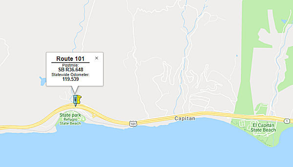 In March 2019, it was reported that Caltrans was starting public meetings on a bridge
replacement project involving two bridges on US 101 along the Gaviota
Coast: Both the north and southbound bridges at the Refugio Road
undercrossing, eight miles west of Goleta, need to be replaced. The
projected cost is $51 million and the proposed timeline is 2023 to 2026.
It appears the project was part of the 2014 SHOPP, according to a May 2014 Project Scope Summary Report. The bridges, which were built in 1974, feature continuous reinfored concrete box girders on single column bents
with driven concrete piles and open end diaphragm abutments. Cracking was
noted in 1995, and there is the presence of Alkali-Silica Reactivity. The
new bridges will match the existing in terms of length and profile, but
will be 6'4" wider to provide standard inside shoulders and upgraded
railing. They will also have a constant depth, as opposed to the variable
depth of the current bridges. There are two alternatives proposed in the
2014 report: a two-span CIP PT box girder structure and a three-span CIP
PT box girder structure. The three span structure is recommended because
it reduces the permanent impact to the Canada Del Refugio Creek channel by
eliminating the existing bents on the bank of the creek.
In March 2019, it was reported that Caltrans was starting public meetings on a bridge
replacement project involving two bridges on US 101 along the Gaviota
Coast: Both the north and southbound bridges at the Refugio Road
undercrossing, eight miles west of Goleta, need to be replaced. The
projected cost is $51 million and the proposed timeline is 2023 to 2026.
It appears the project was part of the 2014 SHOPP, according to a May 2014 Project Scope Summary Report. The bridges, which were built in 1974, feature continuous reinfored concrete box girders on single column bents
with driven concrete piles and open end diaphragm abutments. Cracking was
noted in 1995, and there is the presence of Alkali-Silica Reactivity. The
new bridges will match the existing in terms of length and profile, but
will be 6'4" wider to provide standard inside shoulders and upgraded
railing. They will also have a constant depth, as opposed to the variable
depth of the current bridges. There are two alternatives proposed in the
2014 report: a two-span CIP PT box girder structure and a three-span CIP
PT box girder structure. The three span structure is recommended because
it reduces the permanent impact to the Canada Del Refugio Creek channel by
eliminating the existing bents on the bank of the creek.
(Source: Refugio Road Project Scope Summary Report, May 2014; KEYT, 2/28/2019; KEYT, 3/12/2019)
In June 2019, the CTC approved the following long lead
project amendment: 05-SB-101 R36.6 R36.0/R37.0
PPNO 2448 ProjID 0513000018. US 101 Near Goleta, at from
0.6 mile south and 0.4 mile north of Refugio Road Undercrossing
№ 51-0215L/R. Replace bridges. Note: When previously presented this
long lead project did not have costs associated to PS&E and
construction support. Change in R/W support is due to significant impacts
to cultural resources determined in PA&ED which require additional
studies. Additional R/W capital is due to the requirement of Fish Passages
previously not required. Updated total cost: $46,929K.
(Source: June 2019 CTC Minutes, Agenda Item
2.1a.(1) Long Lead Amendment Item 4)
In March 2020, the CTC approved a request for
supplemental funds related to this project. This project is located on US 101 near the City of Goleta, in Santa Barbara County. The project
will replace the right and left Refugio Road Undercrossing Bridges over
Cañada del Refugio Creek, and upgrade existing barriers on the
northbound on-ramp to current standards with see-through railing. The
bridges were built in 1974, and the Department has concluded that they are
structurally deficient. In addition, the project will replace the
interchange lighting system due to observed conduit degradation. The
project will also modify the Cañada del Refugio Creek channel lining
within the Department Right-of-Way (R/W) and the existing adjacent
drainage easement to remove a partial barrier to fish passage and enhance
habitat conditions.The PA&ED phase was allocated in June 2017 for
$2,200,000; with the available G-12 authority, the total allotment for the
PA&ED phase is $2,620,000, of which $2,366,000 has been expended as of
March 2020. The Department requested supplemental funds in the amount of
$990,000 to complete the PA&ED phase and deliver this project by the
planned delivery in 2022-23 and advertise and award the project contract
in time for the 2024 construction season. The programmed budget for the
PA&ED phase was based on the required permits and environmental
analysis that recommended a Mitigated Negative Declaration/Categorical
Exclusion (MND/CE) in 2015. These documents included the need for a
Coastal Zone permit for significant modifications to existing
infrastructure, the requirement for other permits that would be expected
to take significantly longer periods of time to obtain, and potential
effects to a cultural site. These requirements also include the need to
process documents that will present a higher risk of delays, including
additional studies, data recovery, and consultation with the State
Historic Preservation Officer (SHPO) and Native American tribes due to
cultural site impacts and impacts to federal and state protected species.
Later during the PA&ED phase, the Department concluded that the
project’s impacts to an existing cultural site would be irreversible
and could not be fully mitigated, and in November 2018 the Department
elevated the required environmental document from an MND/CE to an
Environmental Impact Report/Environmental Assessment (EIR/EA). This
higher-level document requires the issuance of a Notice of Preparation
(NOP), a scoping meeting, and greater coordination between state and
federal agencies. A public hearing will be required upon the release of
the Draft EIR/EA.
(Source: March 2020 CTC Agenda, Agenda Item
2.5e.(2))
The 2020 SHOPP, approved in May 2020, included the
following Bridge Restoration item of interest (carried over from the 2018
SHOPP): 05-Santa Barbara-101 PM R36.0/R37.0 PPNO 2448 Proj ID 0513000018
EA 1C950. US 101 near Goleta, from 0.6 mile south and 0.4 mile north of
Refugio Road Undercrossing № 51-0215L/R and Canada del Refugio
№ 51-0030S. Replace two bridges and upgrade bridge railing on one
bridge. Programmed in FY22-23, with construction scheduled to start in
November 2023. Total project cost is $48,942K, with $35,262K being capital
(const and right of way) and $13,680K being support (engineering,
environmental, etc.).
(Source: 2020 Approved SHOPP a/o May 2020)
In March 2021, the CTC approved for future
consideration of funding the following project: 05-SB-101, PM R36.0/R37.0.
Refugio Road Undercrossing Bridges Replacement Project. Replace
the Refugio Road Bridges on US 101 in Santa Barbara County. (FEIR) (PPNO
2448) (SHOPP). This project is located in Santa Barbara County. The
project would replace the existing Refugio Road undercrossing bridges at
post mile 36.6 on US 101, at Refugio State Beach. The project would also
remove the concrete-grouted rock slope protection from the bed of
Cañada del Refugio Creek to remove a fish passage barrier, upgrade
the nonstandard bridge railings on the Cañada Del Refugio northbound
on-ramp bridge, replace the degraded lighting system through the project
limits, and rehabilitate a pedestrian pathway. This project is currently
programmed in the 2020 State Highway Operation and Protection Program
(SHOPP) for a total of $48,942,000 which includes Construction (capital
and support) and Right of Way (capital and support). Construction is
estimated to begin in Fiscal Year 2023-24. The scope, as described for the
preferred alternative, is consistent with the project scope programmed by
the Commission in the 2020 SHOPP. A Final Environmental Impact Report
(FEIR) has been completed. Resources that may be impacted by the
project include cultural resources and tribal cultural resources, air
quality, and biological resources. Potential impacts associated with the
project can all be mitigated to below significance with the exception of
cultural resources and tribal cultural resources, for which a Statement of
Overriding Considerations was prepared.
(Source: March 2021 CTC Agenda, Agenda Item
2.2c.(7))
Also in March 2021, the CTC approved the following
pre-construction SHOPP SB1 support phase allocation(s): (2b) #5.
$6,630,000 (PS&E); $320,000 (R/W Sup). 05-SB-101 R36.0/R37.0. PPNO
05-2448; ProjID 0513000018; EA 1C950. US 101 Near Goleta, from 0.6 mile
south and 0.4 mile north of Refugio Road Undercrossing № 51-0215L/R
and Canada del Refugio № 51-0030S. Replace two bridges and upgrade
bridge railing on one bridge. (Concurrent consideration of funding under
Resolution E-21-37; March 2021.) Prog. year 22-23. Media reports
showed this as the CTC allocating $6 million to replace two bridges near
the Refugio Overcrossing on US 101 in Santa Barbara County, although the
total was closer to $7 million ($6.950 million, if you add the PS&E
and R/W Sup allocations).
(Source: March 2021 CTC Agenda, Agenda Item
2.5b.(2b) #5; Paso Robles Daily News, 3/26/2021)
In June 2021, the CTC approved the following amendment
to the 2020 SHOPP: 05-SB-101 R36.0/R37.0 PPNO 2448 ProjID 0513000018 EA
05-1C950. US 101 Near Goleta, from 0.6 mile south and 0.4 mile north of
Refugio Road Undercrossing № 51-0215L/R and Canada del Refugio
№ 51-0030S. Replace two bridges and upgrade bridge railing on one
bridge. Note: Increase construction capital to include fish passage and
landscape items to fulfill environmental permit requirements and to cover
increases in pavement, lighting, railing and incidental quantities.
Increase construction support due to additional work that adds 300 working
days and another 750 days for plant propagation and mitigation work. Con
Sup $4,900K $11,200K; Const Cap $34,640K
$42,500K; Total $48,942K $63,102K.
(Source: June 2021 CTC Agenda, Agenda Item
2.1a.(1d) #30)
In June 2022, the CTC amended this project in the SHOPP
as follows: 05-SB-101 R36.0/R37.0. PPNO 05-2448; ProjID 0513000018; EA
1C950. US 101 Near Goleta, from 0.6 mile south and 0.4 mile north of
Refugio Road Undercrossing № 51-0215L/R and Canada del Refugio
№ 51-0030S. Replace two bridges and upgrade bridge railing on one
bridge. Note: Split two mitigation projects, landscape and plant
propagation project EA 1C951/PPNO 05-2448Y and biological monitoring
project EA 1C952/PPNO 05-2448X, from parent project EA 1C950/PPNO 05-2448.
Amendment ($ × 1,000): Const Cap $42,500 ⇒ $40,900; TOTAL
$63,102 ⇒ $61,502.
(Source: June 2022 CTC Agenda, Agenda Item
2.1a.(1d) #32)
In April 2023, the California Coastal Commission had
the following agenda item: Application No. 4-22-0459 (Caltrans).
Application of Caltrans to replace the Northbound and Southbound US 101
bridges at Refugio Creek with new clear span bridges with five traffic
lanes, standard bridge railings and shoulders, fish passage improvements,
pedestrian path upgrades, and restoration of public parking on Refugio
Rd., near Refugio State Beach in unincorporated Santa Barbara County. The
more detailed description of the project was: Replace the existing
two-span Refugio Road Undercrossing Bridges with new clear span bridges,
standard bridge railings and shoulder, the degraded lighting system in the
project area, as well as the railings on northbound on-ramp bridge over
Cañada del Refugio Creek; maintain a Class III bicycle lane in both
directions; reconstruct portions of Refugio Road, including restoration of
a portion of public parking that was lost due to installation of
unpermitted “No Parking” signs; and improvement of
existing pedestrian trail along Refugio Road that leads to the
Refugio State Beach entrance; improve steelhead trout migration in
Cañada del Refugio Creek by removing existing rock slope protection;
and relocate existing underground water line and aboveground fiber optic
cable. The staff recommendation noted that the design of the new bridges
will eliminate the need for columns, which are presently adjacent to the
creek. It was noted that Caltrans proposes to mitigate for all impacts to
coastal scrub on-site through restoration, establishment and enhancement
of local coastal scrub communities totaling over 6 acres (3:1
ratio). Mitigation efforts will include container plantings and
hydroseeding as well as targeted weed control and removal. Caltrans will
perform mitigation for habitat and wetland impacts pursuant to its
proposed Mitigation and Monitoring Plan. To ensure that the mitigation
meets the proposed performance standards, the project is conditioned to
require Caltrans to comply with the approved Habitat Mitigation and
Monitoring Plan and to provide annual monitoring reports to the Executive
Director for five years following implementation. Lastly, Caltrans has
agreed to a condition to contribute $75,000 to the County of Santa
Barbara toward the planning, design, and construction of the Paradiso del
Mare (Paradiso) trail to mitigate for the temporal loss of free parking on
Refugio Road that resulted from unpermitted installation of
“No Parking” signs. The Paradiso trail will be a segment of
the California Coastal Trail located approximately 9 miles south of the
project site. Commission staff worked with Caltrans, the Coastal
Conservancy, and the County of Santa Barbara to identify this shovel-ready
public access project.
(Source: April 2023 California Coastal Commission Agenda)
In August 2023, the CTC approved the following project
for future consideration of funding: 05-SB-101, PM R36.0/R37.0. Refugio
Road Undercrossing Bridges Replacement Project. Remove and replace
the existing Refugio undercrossing bridges, remove the concrete-grouted
rock slope protection to remove a fish passage barrier, upgrade the
nonstandard bridge railings from the Cañada Del Refugio northbound
on-ramp bridge, replace the degraded lighting system, and rehabilitate the
pedestrian pathway beneath the bridge, in Santa Barbara County. The
project is located on US 101, from PM R36.0 to PM R37.0, in Santa Barbara
County. The Department proposes to remove and replace the existing Refugio
undercrossing bridges, remove the concrete-grouted rock slope protection
to remove a fish passage barrier, upgrade the nonstandard bridge railings
from the Cañada Del Refugio NB on-ramp bridge, replace the degraded
lighting system, and rehabilitate the pedestrian pathway beneath the
bridge. The project is currently programmed in the 2022 SHOPP for a total
of $61,502,000, which includes Right of Way (Capital) and Construction
(Capital). Construction is estimated to begin in 2023-24. The scope, as
described for the preferred alternative, is consistent with the project
scope as programmed by the Commission in the 2022 SHOPP. A copy of the
FEIR has been provided to Commission staff. The Commission approved the
project for future consideration of funding on March 25, 2021, under
Resolution E-21-37. Since the approval of the FEIR, there have been
changes to the project and an Addendum was prepared pursuant to CEQA.
These changes include adjusting the footprint of the access road through a
landowner’s property, widening the inside shoulder of NB US 101 from
5-feet to 10-feet, replacing two 18-inch culverts and adding two
archeological monitoring areas (AMA-2 and AMA-3) to the plans and
specifications to cover the work, adding stairs to connect historical
parking on Refugio Road with the reconstructed pedestrian path, and adding
a secondary access ramp from Refugio Road to Refugio Beach to improve
accessibility. In addition, Southern California steelhead is now a
candidate species pursuant to the California Endangered Species Act, and
the Environmental Commitments Record has been updated to include measures
from the project specifications, permits, Biological Opinions, and Coastal
Mitigation and Monitoring Plan. The changes are minor and do not result in
new or increased environmental impacts. The project changes do not meet
the criteria outlined in CEQA Guidelines Section 15162 and Section 15163
to prepare a Subsequent or Supplemental FEIR. The Department subsequently
completed an Addendum to the FEIR pursuant to CEQA. The Department has
approved this project for construction. This approval and the Addendum
will satisfy the environmental requirements for this stage of the planning
process.
(Source: August 2023 CTC Agenda, Agenda Item 2.2c.(2) Item 4)
In October 2023, the CTC approved the following SHOPP
construction phase allocation: $60,971,000. 05-SB-101 R36.0/R37.0. PPNO
05-2448; ProjID 0513000018; EA 1C950. US 101 Near Goleta, from 0.6 mile
south to 0.4 mile north of Refugio Road Undercrossing № 51-0215L/R
and Canada del Refugio № 51-0030S. Outcome/Output: Replace two
bridges and upgrade bridge railing on one bridge. CEQA - EIR, 2/5/2021;
Re-validation 6/30/2023. NEPA - FONSI, 2/5/2021; Re-validation 6/30/2023.
Future consideration of funding approved under Resolution E-21-37; March
2021. As part of this allocation request, the Department is requesting to
extend the completion of CONST and CON ENG an additional 15 months
beyond the 36 month deadline. Four month allocation time extension for
CONST and CON ENG approved under Waiver 23-72; June 2023. SB 1 Baseline
Agreement approval under Resolution SHOPP-P-2021-07B; June 2021.
Allocation (Allocated / Programmed (if different)): CON
ENG $11,200,000; CONST $40,900,000 / $49,771,000 (21.7%
increase). The Construction Capital estimate is greater than the
programmed amount due to the increase in concrete prices as shown in
recent bids. The main component of this project is the replacement of two
bridges which will require a comprehensive method for demolition of the
existing bridges. The demolition plan originally assumed a more
efficient method of removal. However, given the presence of a creek,
removal requires a more controlled method of removal. After review
of the final Structures
PS&E submittal in December 2022, it was noted that concrete prices
have gone up as shown in recent bids. The Department updated the EE
bid items including structure concrete, bridge and structure concrete,
bridge polymer fiber to the current market conditions. These items
as well as other bid items for steel piling and prestressing concrete were
updated resulting in the structures estimate increasing by $7,179,000.
Some of the other significant cost increases are attributed to
mobilization, traffic control related items, and the resident
engineer’s office. The remaining increase is due to minor unit
price cost increases of other bid items.
(Source: October 2023 CTC Agenda, Agenda Item 2.5d.(1))
In December 2016, it was reported that the Director of the State
Department of Transportation (Caltrans) has informed the Santa Barbara
County Board of Supervisors (Board) that US 101 along the Gaviota Coast is
California's newest officially designated State Scenic Highway. The
designated segment travels through one of the longest remaining rural
coastlines in Southern California along 21 miles of US 101 from the City
of Goleta's western boundary (SB 27.728) to Route 1 at Las Cruces (SB
R48.766). This landmark designation was made possible by a partnership
between the Gaviota Coast Conservancy, County of Santa Barbara Planning
and Development Department, Third District Supervisor Doreen Farr and
Caltrans Landscape Architecture Division. The County's coastal visual
policies and California State Park's natural and cultural preservation
mandates have protected the scenic quality along the Gaviota Coast for
decades, and will be further enhanced under this new designation. The
Gaviota Coast State Scenic Highway includes spectacular views of the
Pacific Ocean, grassy rolling hills, and the Santa Ynez Mountains. The
route also adjoins three stunning California State Parks: Gaviota and
Refugio State Parks, and El Capitán State Beach.
(Source: Edhat, 12/19/2016)
The following project was included in the final adopted 2018 SHOPP as "Long Lead Projects" in March 2018: PPNO 2448. 05-Santa Barbara-101 R36.6. Route 101 Near Goleta, at Refugio Road Undercrossing № 51-0215L/R. Replace bridges. * PA&ED phase(s) is authorized. No construction start date. Total Project Cost: $36,960K.
Gaviota Realignment (approx SB 44.841 to SB 46.351)
In March 2014, the CTC approved for future consideration of funding a project in Santa Barbara County near the town of Gaviota that will realign the northbound side of Route 101, including replacing the existing curve, widening the shoulders, and constructing other modifications.
In January 2016, the CTC approved SHOPP funding on US 101 in Gaviota, from 0.7 mile north of Beckstead Overcrossing to 0.8 mile south of Gaviota Tunnel. Outcome/Output: Realign highway, replacing multiple sharp curves with a single curve that will provide improved visibility around the curve. The project will reduce the number and severity of collisions.Future Consideration of Funding approved under Resolution E-14-07; March 2014. $6,979,000
In April 2016, it was reported that a project to
re-align the northbound lanes and straighten a curve along US 101 from
north of Mariposa Reina to south of the Gaviota State Roadside Rest Area
was beginning. For the duration of this project, motorists going
northbound on US 101 will be unable to turn left onto Gaviota Beach Road
to access Gaviota State Park and the Hollister Ranch or turn left onto
northbound US 101 from Gaviota Beach Road. Northbound motorists may detour
at the Route 1 Interchange north of the tunnel before returning
southbound. The contractor for this $6.6 million dollar project is Souza
Construction of San Luis Obispo, CA. This project is expected to completed
in December 2016, weather permitting.
(Source: Edhat, 4/14/2016)
Gaviota Pass Wildlife Connectivity and Vehicle Collision Reduction Project (~ SB 45.447 to SB R49.795)
 In December 2023, it was reported that Caltrans has been awarded $8 million to implement the
Gaviota Pass Wildlife Connectivity and Vehicle Collision Reduction
Project, aimed at mitigating wildlife-vehicle collisions and fostering
connectivity between protected State Park lands flanking US 101. This
initiative is part of the broader U.S. Department of
Transportation’s Federal Highway Administration (FHWA) grant
program, which recently allocated $110 million across 19 wildlife crossing
projects in 17 states, including four Indian Tribes. The Gaviota Pass
Wildlife Project, proposed near US101 from south of the Gaviota State Park
to just south of the US 101/Route 1 Interchange in Santa Barbara County,
addresses wildlife connectivity barriers by enhancing an existing culvert
and deploying 2.5 miles of wildlife fencing. These measures intend to
create safer road conditions for drivers while preserving vital animal
habitats. The funding for this endeavor stems from President Biden’s
Bipartisan Infrastructure Law (BIL), which earmarks a total of $350
million over five years for the Wildlife Crossings Pilot Program.
In December 2023, it was reported that Caltrans has been awarded $8 million to implement the
Gaviota Pass Wildlife Connectivity and Vehicle Collision Reduction
Project, aimed at mitigating wildlife-vehicle collisions and fostering
connectivity between protected State Park lands flanking US 101. This
initiative is part of the broader U.S. Department of
Transportation’s Federal Highway Administration (FHWA) grant
program, which recently allocated $110 million across 19 wildlife crossing
projects in 17 states, including four Indian Tribes. The Gaviota Pass
Wildlife Project, proposed near US101 from south of the Gaviota State Park
to just south of the US 101/Route 1 Interchange in Santa Barbara County,
addresses wildlife connectivity barriers by enhancing an existing culvert
and deploying 2.5 miles of wildlife fencing. These measures intend to
create safer road conditions for drivers while preserving vital animal
habitats. The funding for this endeavor stems from President Biden’s
Bipartisan Infrastructure Law (BIL), which earmarks a total of $350
million over five years for the Wildlife Crossings Pilot Program.
(Source: Edhat, 12/7/2023)
The project was based on a wildlife study that analyzed
the spatial and temporal patterns of wildlife movements and roadkill
occurrences along US 101 through the Study Area using systematic camera
monitoring and roadkill surveys, along with assessments of existing
infrastructure and surrounding land use. The final report, the Gaviota
Pass Highway 101 Wildlife Connectivity Assessment (WCA), was prepared by
ICF Jones and Stokes, Inc. with the purpose of gaining a better
understanding of wildlife movement conditions within the Study Area and
identifying opportunities to improve wildlife connectivity and reduce
wildlife vehicle collisions. The WCA study focused on medium and large
mammals, or Target Species, including American badger, American black
bear, bobcat, coyote, feral pig, gray fox, mountain lion, mule deer,
opossum, raccoon, red fox, ringtail, striped skunk, and western spotted
skunk.
(Source: US 101 Gaviota Pass Wildlife Connectivity Study, 12/29/2023)
Nojoqui Creek Bridge (№ 51-0018 L/R) (05-SB-101 55.9/R56.2)
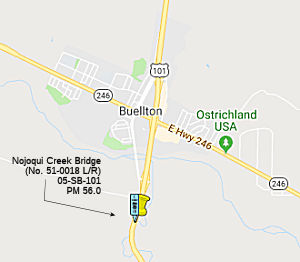 In October 2018, the CTC approved for future
consideration of funding the following project for which a Mitigated
Negative Declaration (MND) has been completed: US 101 in Santa Barbara
County (05-SB-101, PM 56.0). Upgrade railings and construct improvements
on an existing bridge on US 101 near the city of Buellton. (PPNO 2561)
This project is located on US 101, south of Buellton in Santa Barbara
county at the Nojoqui Creek Bridge (№ 51-0018 L/R). The project
proposes to replace the bridge rails. The proposed project would also
widen both bridges as well as widen current shoulder standards. Four
columns and footings to support the widened structure would also be
constructed. This proposed project addresses the nonstandard left and
right shoulders of the bridges and the need to upgrade the bridge rails
not approved with current crash-worthiness measures under the Structure
Replacement and Improvements Needs Report and the Office of Structures
Maintenance. The proposed project is estimated to cost approximately $9.9
million. This project is fully funded and is currently programmed in the
2018 SHOPP for approximately $9.5 million. Construction is estimated to
begin in Fiscal Year 2019-20. The scope, as described for the preferred
alternative, is consistent with the project scope programmed by the
Commission in the 2018 SHOPP.
In October 2018, the CTC approved for future
consideration of funding the following project for which a Mitigated
Negative Declaration (MND) has been completed: US 101 in Santa Barbara
County (05-SB-101, PM 56.0). Upgrade railings and construct improvements
on an existing bridge on US 101 near the city of Buellton. (PPNO 2561)
This project is located on US 101, south of Buellton in Santa Barbara
county at the Nojoqui Creek Bridge (№ 51-0018 L/R). The project
proposes to replace the bridge rails. The proposed project would also
widen both bridges as well as widen current shoulder standards. Four
columns and footings to support the widened structure would also be
constructed. This proposed project addresses the nonstandard left and
right shoulders of the bridges and the need to upgrade the bridge rails
not approved with current crash-worthiness measures under the Structure
Replacement and Improvements Needs Report and the Office of Structures
Maintenance. The proposed project is estimated to cost approximately $9.9
million. This project is fully funded and is currently programmed in the
2018 SHOPP for approximately $9.5 million. Construction is estimated to
begin in Fiscal Year 2019-20. The scope, as described for the preferred
alternative, is consistent with the project scope programmed by the
Commission in the 2018 SHOPP.
(Source: October 2018 CTC Agenda Item 2.2c.(1))
In May 2020, the CTC approved the following allocation:
$8,873,000. 05-SB-101 PM 55.9/R56.2. PPNO 05-2561. ProjID 0514000061. EA
1F790. US 101 near Buellton, from 0.1 mile south of Nojoqui Creek Bridge
№ 51-0018L/R to 0.3 mile south of Santa Rosa Road Overcrossing. Outcome/Output:
Bridge rail replacement and widening to provide standard railing and
shoulder width. CON ENG $2,018,000; CONST $6,265,000.
(Source: May 2020 CTC Agenda, Agenda Item 2.5b.(1)
#15)
In May 2021, it was reported that work to widen the
bridge on US 101 near Buellton at Nojoqui Creek and replace railing along
the highway was now underway and drivers may experience slight delays.
Caltrans says the project comes with a price tag of $5.9 million, fully
funded by Senate Bill 1, which is the Road Repair and Accountability Act
of 2017. The project is expected to be complete in spring 2022.
(Source: KSBY 5/20/2021)
In July 2023, it was reported that a long-term closure
of both a northbound and southbound lane of US 101 about a mile and a half
south of Buellton was starting. The right, or #2, lanes in both directions
from the Nojoqui Creek bridge to south of the Santa Rosa Road overcrossing
will be closed until mid-January 2024 as a Caltrans contractor begins a
bridge-widening project. There will be five-foot shoulders through the
construction zone for bicyclists. The project will widen the northbound
and southbound bridges by 10 feet. The bridges will have updated rails
providing new shoulders across the bridges and a safer crossing for
bicyclists.
(Source: KSBY, 7/17/2023)
In August 2019, it was reported that SB1 funds were allocated to a bridge
improvement project on State Route 1 in Santa Barbara County: $4.8 million
bridge project will revamp the San Antonio Creek Bridge (SB 67.09 Bridge
51-0009R; SB 67.41, Bridge 51-008) on US 101 near Route 1 near the City of
Lompoc in Santa Barbara County. The project was allocated $1.7 million.
(Source: SLO Chamber of Commerce, 8/26/2019)
Route 135 Bridge (05-SB-101 70.6/71.2)
In June 2020, the CTC approved an additional $180,000
in Capital Outlay Support (COS), for the following SHOPP Bridge
Replacement project: 05-SB-101 70.7/71.2 PPNO 05-2522 ProjID 0514000003 EA
1F500 US 101 in Los Alamos, at Route 101/135 Separation №51
-0073L/R; also on Route 135 (PM 0.1). Outcome/Output: Replace bridges. The
project will construct a new single span bridge by bridging the median gap
between the former structures. The US 101 structure approaches, bridge
rails, metal beam guardrail, and end treatments will be replaced and
sidewalk with pedestrian railing as needed has also been added to the
project along Route 135 to improve pedestrian connectivity. The project
will accommodate planned traffic staging during construction and maintain
two lanes open to traffic in each direction on US 101. This project was
programmed for delivery in 2019-20, and the Department is requesting an
allocation time extension concurrently with this COS supplemental funds
request. The PS&E phase was allocated in August 2017 for $1,800,000,
and with the available G-12 authority, the total allotment for the
PS&E phase is $2,180,000. The Original Project Scope Study Report
(PSSR) was developed in June 2015. At the time the project was programmed,
the structures work only included replacing the superstructures and
retrofitting the bent columns. Since the original programming, it was
discovered that the project site had liquefaction potential and the
project will now replace the bridges completely instead of only replacing
the superstructures.
(Source: June 2020 CTC Agenda, Agenda Item
2.5e.(1))
In August 2020, the CTC approved the following SHOPP
amendment: 05-SB-101 PM 70.7/71.2 70.6/71.2 PPNO
2522 ProjID 0514000003 EA 1F500. US 101 In Los Alamos, at from
0.3 mile south to 0.3 mile north of Route 101/135 Separation
№ 51-0073L/R; also on Route 135 (PM 0.1). Replace bridges. Change
Const Cap from $14,600K to $13,590K. Note: Split landscape mitigation from
this project into EA 1F501/PPNO 05-2522Y.
(Source: August 2020 CTC Agenda, Agenda Item
2.1a.(1d) #6)
Related to the above, in August 2020, the CTC approved
the folllowing financial allocation for construction and construction
support related to the amendment: $19,614,000. 05-SB-101 PM 70.6/71.2.
PPNO 05-2522. Proj ID 0514000003 EA 1F500. US 101 In Los Alamos, from 0.3
mile south to 0.3 mile north of Route 101/Route 135 Separation №
51-0073L/R; also on Route 135 (PM 0.1). Outcome/Output: Replace bridges to
address the deteriorated deck.
(Source: August 2020 CTC Agenda, Agenda Item
2.5b.(1) #25; Santa Ynez Star, 8/30/2020)
In January 2021, it was reported that construction
crews were set to commence work on the bridge replacement project on US 101 in Los Alamos beginning in February 2021. This project will include
intermittent full daytime and overnight closures of Route 135 for bridge
demolition and the installation of girders. These closures are
expected to take place in May, July and October of 2021 and January and
April of 2022. Motorists may exit US 101 in both directions at Cat
Canyon Road to reach Los Alamos. The contractor for this $10 million
project is Cal Portland Construction of Santa Maria, CA. The project is
set to be completed by summer of 2022.
(Source: KSBY, 1/13/2021, EdHat 1/31/2021)
In March 2022, it was reported that the project to
reconstruct the bridges on US 101 at the interchange with Route 135 in Los
Alamos continues with demolition of the southbound bridge beginning March
15, 2022. Travelers on the SB US 101 will encounter a traffic
switch onto a new bridge in the center median beginning Friday, March 11,
2022 until July 2022 while construction proceeds on new traffic lanes.
(Source: Noozhawk, 3/8/2022)
In August 2022, it was reported that the project to
reconstruct the bridges on US 101 at the interchange with Route 135 in Los
Alamos will continue with the demolition of the northbound bridge
beginning Tuesday, Sept. 6, 2022. This roadwork will result in a
24-hour closure of Route 135 between Bell/Main Street to San Antonio
Boulevard. In addition, travelers on northbound US 101 will encounter a
traffic switch onto a newly constructed bridge in the center median
beginning Aug. 31 for the next four months while construction proceeds on
new traffic lanes.
(Source: Noozhawk, 8/29/2022)
In May 2023, it was reported that the project to
reconstruct the bridges on US 101 at the interchange with Route 135 in Los
Alamos has been completed. This bridge project included the demolition and
reconstruction of two bridges on US 101 near Route 135.
(Source: Edhat Santa Barbara, 5/28/2023)
Santa Maria Widening (approx SB 84.352 to SB 90.77)
There are plans to widen US 101 to 6-lane freeway from 0.4 km south of Santa Maria Way Undercrossing to Route 135/US 101 Separation in Santa Maria . This was on the July 2005 CTC agenda. In February 2006, the CTC considered adding funding. The proposal noted that the widening would be within the existing 46 to 56-foot median area. The existing inside shoulders would be removed and the entire median area paved to include two 12-foot traveled lanes, two 10-foot inside shoulders and a type 60 concrete median barrier placed in the area between the inside shoulders for the entire length of the project. There are also five locations where soundwalls are to be constructed.
![[Union Valley]](maps/101-unionvalley.jpg) In December 2008, the CTC reviewed a draft EIR regarding construction of a new interchange for Santa Maria and
the community of Orcutt. The interchange would be constructed between
Clark Avenue overcrossing and Santa Maria Way undercrossing and extend
Route 58 (note: The CTC document said Route 58, but Route 58 isn't in that
area—it ends at Route 1 in Santa Margarita) approximately 1.6 miles
in length in the community of Orcutt. The project is not fully funded. The
project is programmed in the 2008 State Transportation Improvement Program
(STIP) with Regional Improvement Program and Regional Surface
Transportation Program funds for $12,782,000. The total cost of the
project is estimated to be $36,100,000. Construction is estimated to begin
in Fiscal Year 2013-14. There are four alternatives identified in the
draft EIR:
In December 2008, the CTC reviewed a draft EIR regarding construction of a new interchange for Santa Maria and
the community of Orcutt. The interchange would be constructed between
Clark Avenue overcrossing and Santa Maria Way undercrossing and extend
Route 58 (note: The CTC document said Route 58, but Route 58 isn't in that
area—it ends at Route 1 in Santa Margarita) approximately 1.6 miles
in length in the community of Orcutt. The project is not fully funded. The
project is programmed in the 2008 State Transportation Improvement Program
(STIP) with Regional Improvement Program and Regional Surface
Transportation Program funds for $12,782,000. The total cost of the
project is estimated to be $36,100,000. Construction is estimated to begin
in Fiscal Year 2013-14. There are four alternatives identified in the
draft EIR:
In March 2012, the CTC approved for future consideration of funding the Union Valley Parkway extension. This project in Santa Barbara County will extend the Union Valley Parkway east to west approximately 1.6 miles and construct an interchange with US 101 just south of the City of Santa Maria. The project is not fully funded. It is expected that the necessary funding will be come from the Santa Barbara County’s formula State-Local Partnership Program shares. The project is programmed in the 2010 State Transportation Improvement Program (STIP). The total project cost is $24,430,000 for capital and support. Depending on the availability of funding, construction is estimated to begin in Fiscal Year 2011-12. The scope, as described for the preferred alternative, is consistent with the project scope programmed by the Commission in the 2010 STIP. Funding was authorized in April 2012, contingent on the passing of the budget act.
In February 2013, it was reported that Stage 1 work continues on the Union Valley Parkway interchange. It includes earthwork, ramp and road construction and construction of bridge abutments. Pile-driving work on the east abutment and in the median has been completed. Work continues on the west side of the freeway. Crews have graded the new southbound on- and off-ramps, and they soon will be paving both ramps. The southbound ramps will be used as a detour during nighttime closures when the bridge falsework is built. The $10.3 million project is scheduled to be completed by early 2014. It is the final piece of the Union Valley Parkway that will connect US 101 to Orcutt, Route 135 and the Santa Maria Public Airport.
Santa Maria Bridge (SB PM 91.0 to SLO PM 0.8)
The SAFETEA-LU act, enacted in August 2005 as the reauthorization of TEA-21, authorized $2,720,000 for High Priority Project #1092: Widen the Santa Maria River Bridge on US 101 between Santa Barbara County and San Luis Obispo County.
In 2007, the following requests for funding from the Corridor Mobility Improvement Account (CMIA) were made, but not recommended for funding: Operational improvements Phase 1b in San Luis Obispo county ($5,432K requested); widening of the Santa Maria River Bridge ($58,540K requested).
In July 2010, the CTC approved for future consideration of funding a project that will construct roadway improvements including bridge widening and an additional northbound and southbound lane on Route 101 near the city of Santa Maria. The specific limits of this project are from SBA PM 91.0 to SLO PM 0.8. The project is programmed in the Corridor Mobility Improvement Account and the 2010 State Transportation Improvement Program. Construction is estimated to begin in Fiscal Year 2009-10. Total estimated project cost is $49,302,000 for capital and support. The scope as described for the preferred alternative is consistent with the project scope set forth in the project baseline agreement.
In February 2013, it was reported that Stage 2 work continues on the river bridge with the southbound deck currently being poured. The concrete decking is about halfway finished. The southbound side of the bridge will hold two lanes and a pedestrian and bike lane when completed. The $34.8 million project is scheduled for completion by the summer of 2014.
Willow Road, Nipomo (SLO 6.4)
In January 2010, the CTC approved a new public road connection at Willow Road to US 101, in the community of Nipomo, at Post Mile (PM) 6.4, in San Luis Obispo County. The proposed project includes the extension of Willow Road across US 101 to Thompson Road with the intention to provide a much needed east-west arterial connection to Route 1 and the Callender area. The project will also relieve future traffic demand at the adjacent Tefft Street and Los Berros Road/Thompson Road interchanges. The Nipomo area is served by three interchanges on US 101: Hutton Road (Route 166) on the south, Tefft Street in the central area, and Los Berros Road/Thompson Road on the north. Recent traffic forecasts for the Nipomo area predict that the existing Tefft Street interchange and the existing Los Berros Road/Thompson Road interchanges will be inadequate to serve projected development during peak traffic periods. Motorists would be subjected to recurring congestion and delays due to increasing traffic on US 101 and on the existing local street network. Of the three interchanges, only the Tefft Street interchange is located centrally to existing and planned developments. Los Berros Road/Thompson Road and Hutton Road (Route 166) are located at the fringe of future development.
In October 2009, the CTC approved for future consideration of funding a project that will construct the extension of Willow Road and connect it with US 101 in the community of Nipomo, south San Luis Obispo County. The proposed project includes the extension of Willow Road east from its existing terminus approximately 1,000 feet west of Pomeroy Road to Thompson Avenue; construction of a frontage road between Willow Road and Sandydale Drive; and construction of a new US 101/Willow Road interchange. In March 1999 a Tier I Final Environmental Impact Report (FEIR) for the project was adopted by the County Board of Supervisors and a preferred alignment and interchange were selected. The FEIR specified that subsequent design refinements for the road extension, interchange, and frontage road would be evaluated in a Tier 2 construction level environmental document. The County prepared the FSEIR to satisfy the requirements for evaluating the preferred alternative in a Tier 2 construction level environmental document. The FSEIR was prepared for the entire US 101/Willow Road Interchange Project. However, for construction and financing purposes, the County split the project into two phases as follows:
In May 2016, the CTC approved a STIP amendment to program an AB 3090 cash reimbursement project (PPNO 0690B) in order to use local funds for construction of the US 101/Willow Road Interchange project (PPNO 0690A) in San Mateo County. The San Mateo County Transportation Authority requested reimbursements over a three-year period beginning in Fiscal Year (FY) 2017-18. If the proposal is adopted by the Commission, SMCTA further proposes to advance project delivery with the use of $8,000,000 in local sales tax (Measure A) funds for construction support, and request reimbursements in FYs 2017-18, 2018-19 and 2019-20. In August 2016, they modified this to request reimbursements over a two-year period beginning in Fiscal Year (FY) 2019-20. SMCTA also proposed to revise the funding plan to advance project delivery with the use of $8,000,000 in local sales tax (Measure A) funds for construction support, and request reimbursements in FYs 2019-20 and 2020-21.
In January 2020, the CTC approved an AB 3090
reimbursement of $4,000,000 for PPNO 04-0690B. 04-SM-101 1.6. AB 3090
Reimbursement - US 101/Willow Road Interchange Reconstruction project.
(Source: January 2020 CTC Agenda, Agenda Item
2.5c.(5))
The 2020 STIP, approved at the March 2020 CTC meeting,
closed out PPNO 0690A Willow Rd interchange reconstructn, ph1
(14S-21)(14S-35). It also continued the programmed allocation for PPNO
0690B AB 3090 reimb (Willow Rd IC reconst ph1 )(14S-35), of $4,000K in
prior year programming, and $4,000K in FY20-21.
(Source: March 2020 CTC Agenda, Item 4.7, 2020 STIP
Adopted 3/25/2020)
US 101 Barriers - Los Berros Road to Traffic Way (05-SLO-101 7.816/12.565)
In September 2012, construction started on on a K-rail
median barrier designed to prevent head-on collisions and plunges into
deep ravines along a 5-mile stretch of US 101 south of Arroyo Grande. The
$2.8 million barrier will run from the Los Berros Road undercrossing near
Nipomo (approx SLO 7.816) to the undercrossing where vehicles enter
southbound US 101 from Traffic Way (approx SLO 12.565). All but one of the
at-grade highway crossings through that stretch will remain open; one
crossing that serves a private driveway just south of El Campo will be
blocked by the barrier. Caltrans initiated the project in response to a
rising number of traffic collisions at the at-grade highway crossings. The
barrier is also designed to prevent vehicles from crossing the median into
oncoming traffic or plunging into ravines between the north- and
southbound lanes. As initially proposed, the barrier would have blocked
cross traffic at all of the highway crossings, including one at Laetitia
Vineyard Drive. But it was particularly aimed at closing the El Campo Road
crossing, where the accident rate had been steadily climbing. The crash
frequency at El Campo Road rose from three in 1998 to 10 in 2008,
according to Caltrans statistics released in 2010. At that time, a total
of 185 collisions resulting in three fatalities and 101 injuries had been
reported along the five-mile stretch of highway. But residents along El
Campo Road, the operators of Laetitia Vineyard & Winery and Arroyo
Grande city officials objected to closing those two crossings. People
living along El Campo Road and operators of Laetitia Vineyard & Winery
said blocking those intersections would require residents and winery
visitors and workers to drive miles out of their way. Arroyo Grande
officials said the closures also would send more traffic through the city
as drivers sought to turn around. As a result, Caltrans agreed to add
flashing yellow lights to cross-traffic warning signs and to leave all but
one of the crossings open. It appears the warning beacons may have helped,
based on Caltrans’ recent crash statistics: In the seven months
prior to installing the beacons, seven multiple-vehicle crashes were
reported along the five-mile stretch. In the first seven months after they
were installed, only one multiple-vehicle crash has occurred.
(Source: Santa Maria Times)
In March 2019, it was reported that the San Luis Obispo Council of Governments (SLOCOG) staff is recommending that four intersections between Los Berros Road and Traffic Way (~ SLO 7.866 to SLO 12.548) along US 101 should close. At a packed public
outreach meeting on March 21, staff discussed the results of the second
phase of the board's $30,000 two-step assessment process to understand the
implications of restricting left turns on this stretch of the highway.
Stephen Hanamaikai, transportation planner, said the study looked at the
impact of closing four intersections—El Campo Road (SLO 11.827), a
private un-named road, Tower Grove Drive (SLO 9.658), and Hemi Road (SLO
9.11)—with concrete median barriers. "The main findings were that by
eliminating those turning movements at those crossings, it would greatly
improve safety along that stretch of the 101 and reduce the possibility of
high severity collisions," Hanamaikai said. The report also stated that
the closures would only increase travel time for the surrounding community
by about two to seven minutes. Hanamaikai said staff will be taking their
findings to the April 3 SLOCOG board meeting and will recommend that the
board support the closure. The two-step assessment was initiated after
community members called for urgent short-term and long-term solutions to
El Campo Road following the death of Cal Poly student Jordan Grant. On
Oct. 7, 2018, Grant was fatally struck by a BMW that was in the process of
making an unsafe left turn at the intersection.
(Source: New Times SLO, 3/28/2019; SLOCOG El Campo Road Page)
In April 2019, it was reported that the San Luis Obispo
Council of Governments, San Luis Obispo County’s
transportation-governing board, recommended stopping left-hand turns at
four intersections along the roadway — including El Campo Road
— to cut down on unsafe crossings in the area. The recommendation
will now go to the San Luis Obispo County Board of Supervisors for
approval at its meeting on April 23.
(Source: SLO Tribune, 4/5/2019)
In May 2019, the California Department of
Transportation (Caltrans) has put a stop to the proposed project due to
recently filed legal challenge. The stoppage comes from a legal challenge
to stop the project filed in Sacramento County against Caltrans. Due to
the legal challenge, a judge filed a temporary stay until the case is
litigated completely. Caltrans says there is no timeline for when the
project will resume, if at all. But less than a week later, a judge lifted
a temporary stay of the project. That stay was put in place after Vintage
Wine Estates, which owns Laetitia Vineyard and Winery, filed a legal
challenge to stop the project. The winery business objected to the
intersection of US 101 and Tower Grove Dr., also known as Laetitia
Vineyard Dr., being included in the project and alleged that Caltrans did
not prepare an environmental impact report or provide enough notice of the
project for public review. News of Vintage Wine Estate’s legal
filing prompted the family of Jordan Grant, a Cal Poly student who was
killed in a crash at the intersection of US 101 and El Campo Rd., to call
for a boycott of Laetitia wine. After the injunction, he Grants reportedly
met with the CEO of Vintage Wine Estates and all parties agreed to work
together to improve safety along that stretch of US 101. They plan to push
for changes, including an eventual overpass at El Campo Rd., that would
increase safety while allowing access to the winery. In the meantime,
Vintage Wine Estates President Terry Wheatley said in the interest of
public safety, the Caltrans project should “move forward as soon as
possible,” and the company withdrew its legal filing. The Grants are
no longer pushing for a boycott of Laetitia, rather encouraging people to
support the business.
(Source: KEYT 3, 5/10/2019; KSBY, 5/17/2019)
Brisco Road Study (approx SLO 13.752)
In September 2015, it was reported that the Brisco Road on- and off-ramps to NB US 101 were being closed as part of a traffic study. The problem was that these ramps, as well as nearby intersections, experience severe congestion at peak travel times. The notoriously congested and outdated intersection has been overwhelmed by the growth in Arroyo Grande over the past decades. The City of Arroyo Grande was investigating two project alternatives to alleviate this congestion.
In order to better understand the impacts of closing
the on and off-ramps at Brisco Road and US 101, a trial ramp closure began
on September 29, 2015 and was scheduled to last until December 2015,
although that was later extended to July 11, 2016. Traffic was to be
monitored during that time and used to improve the design plans. The city
has examined alternatives for the Brisco Road interchange since 1999, when
it identified a need to fix traffic congestion at the busy interchange.
The project has faced delay after delay as the city and Caltrans attempt
to reach an agreement on how best to update the interchange while still
maintaining the city's traffic patterns.
(Source: City of Arroyo Grande; TheTribune,
9/23/2016; KEYT, 9/29/2016)
In February 2017, it was reported that the freeway
access at Brisco Road on US 101 in Arroyo Grande was open again, and
traffic was already chaotic. What started as a five-week closure to study
traffic impacts in September 2015 was extended numerous times over the
past year as residents and council members lauded the closure, saying it
eased the notoriously bad traffic at the intersection. But it apparently
couldn’t last forever — especially after Caltrans said as much
— and the ramps were slated to reopen in mid-December 2016. The
reopening was delayed after Caltrans asked the city to add new striping on
and around the ramps, and then it was delayed even more by the Winter 2017
rains. When that exit (and entrance) was closed off, the cars flowed
easily down Branch Street (heading south) and then under the freeway on to
Brisco Road toward El Camino Real. No more cars turning right on red
lights when the opposing traffic had a green arrow; no huge traffic lines
backed all the way up the hill on Branch Street because of the odd
intersections that encompass that little area. That evidently returned
with the reopening.
(Source: SLO Tribune, 1/15/2017; SLOTribune
2/25/2017)
The 2018 STIP, approved at the CTC March 2018 meeting, appears to show that the 2016 STIP allocated $6.624M in construction funding for PPNO 4856B Rt 101 Brisco Rd I/C improvements/Aux Lane. PM SLO 13.11/4.6. In Arroyo Grande, from Grand Avenue to Camino Mercado. Construct auxiliary lanes and interchange improvements. The purpose of the project is to provide congestion relief, alleviate queuing, and improve the traffic operations of the regional and local street system in the vicinitey of the US 101. The purpose is also to continue to accomodate accessto existing and planned development.
The 2020 STIP, approved at the CTC March 2020 meeting,
adjusted the programming for PPNO 4856B "Rt 101 Brisco Rd I/C
improvements/Aux Lane" from FY20-21 to FY21-23.
(Source: March 2020 CTC Agenda, Item 4.7, 2020 STIP
Adopted 3/25/2020)
In January 2024, the CTC approved relinquishment of right of way,
consisting of collateral facilities, in the City of Arroyo Grande (City)
along US 101 on Oak Park Boulevard, West Branch Street, and El Camino Real
(05-SLO-101-PM 14.5/14.7). The City, by Resolution No. 5326 adopted
September 12, 2023, agreed to waive the 90-day notice requirement and
accept title upon relinquishment by the State.
(Source: January 2024 CTC Agenda, Agenda Item 2.3c)
In August 2008, Caltrans released a bid to widen the highway and construct retaining walls and drainage systems in San Luis Obispo County in and near Pismo Beach at various locations from 0.2 KM North of Route 227 (~ SLO 13.372) to 0.2 KM South of the US 101/Route 1 separation (~ SLO 16.795).
In May 2023, the CTC relinquished right of way, consisting of collateral
facilities, in the City of Pismo Beach (City) along US 101 on North Oak
Park Boulevard and El Camino Real (05-SLO-101-PM 14.5/14.7, 1 segment).
The City received a 90-day notice on August 8, 2022 and the 90-day notice
period expired on November 6, 2022.
(Source: May 2023 CTC Minutes, Agenda Item 2.3c)
In December 2009, the CTC vacated right of way in the city of Pismo Beach along Route 101 at 0.13 mile west of North 4th Street, consisting of highway right of way no longer needed for State highway purposes (05-SLO-101-PM 15.7).
Five Cities Multimodal Transportation Network Enhancement Project (05-SLO-101, PM 16.0/R22.5)
The 2018 STIP, approved at the CTC March 2018 meeting, appears to allocate $10.337M in FY20-21 and FY22-23 for PPNO 2653 Pismo Beach, Southbound Traffic System Mangement Components.
In May 2018, the SLOCOG and Caltrans rolled out the US 101 Pismo Congestion Relief Project for public comment. Officials are
hoping the massive traffic jam from Avila Beach to Pismo Beach, can be
solved with a part-time, managed lane, stretching for four miles from
Spyglass Drive (~ SLO R19.83) to the Pismo Railroad Overhead (~ SLO
16.198). They are proposing to use the area near the center median, which
is currently grass, and convert that into a part-time lane, typically
would be used Monday through Friday between 3:00 p.m. and maybe 6:00 p.m.
Caltrans is also tossing around the idea of reconfiguring the on-and-off
ramps at Mattie Road and extending the Truck Climbing Lane near Spyglass
Drive. Officials still need to design the project along with an
environmental studies process and public review. Construction wouldn't be
completed until 2026 with an up to almost $25 million-dollar price tag.
(Source: KEYT, 5/18/2018)
The 2020 STIP, approved at the CTC March 2020 meeting,
adjusted the programming for PPNO 2653 "Pismo Beach, Southbound TSM
Components (SB1)" as follows:
(Source: March 2020 CTC Agenda, Item 4.7, 2020 STIP
Adopted 3/25/2020)
| PPNO | Project | Prior | 20-21 | 21-22 | 22-23 | 23-24 | 24-25 |
| 2653 | Pismo Beach, Southbound TSM Components (SB1) | 0 | 5,337K | 0 | 5,000K | 0 | 0 |
| 2653 | Pismo Beach, Southbound TSM Components (SB1) | 0 | -5,337K | 0 | -5,000K | 0 | 0 |
| 2653 | Pismo Beach, Southbound TSM Components (SB1) | 0 | 6,455K | 0 | 6,553K | 0 | 0 |
 In December 2022, the CTC approved for future
consideration of funding the following project for which a Final
Environmental Impact Report (FEIR) has been completed: US 101 in San Luis
Obispo County (05-SLO-101, PM 16.0/R22.5). Widen the inside shoulder of US 101 through Pismo Beach to provide a part-time travel lane. (PPNO
05-2653). The project is located on US 101 between postmile 16.0 and R22.5
in San Luis Obispo County. The Department proposes a seven-year pilot
project to convert the existing truck climbing lane to a general use lane
and replace inside shoulder with a part-time travel lane. The project is
fully funded and currently programmed in the 2022 State Transportation
Improvement Program (STIP) for a total of 73,615,000 which includes
Construction (capital). Construction is estimated to begin 2024-25. The
scope, as described for the preferred alternative, is consistent with the
project scope as programmed by the Commission in the 2022 STIP. Resources
in the project area that may be impacted by the project include
aesthetics, cultural resources, noise, and air quality. Potential impacts
associated with the project can all be mitigated to below significance
with the exception of aesthetics, cultural resources, noise, and air
quality, for which a Statement of Overriding Considerations was prepared.
As a result, an FEIR was prepared for the project.
In December 2022, the CTC approved for future
consideration of funding the following project for which a Final
Environmental Impact Report (FEIR) has been completed: US 101 in San Luis
Obispo County (05-SLO-101, PM 16.0/R22.5). Widen the inside shoulder of US 101 through Pismo Beach to provide a part-time travel lane. (PPNO
05-2653). The project is located on US 101 between postmile 16.0 and R22.5
in San Luis Obispo County. The Department proposes a seven-year pilot
project to convert the existing truck climbing lane to a general use lane
and replace inside shoulder with a part-time travel lane. The project is
fully funded and currently programmed in the 2022 State Transportation
Improvement Program (STIP) for a total of 73,615,000 which includes
Construction (capital). Construction is estimated to begin 2024-25. The
scope, as described for the preferred alternative, is consistent with the
project scope as programmed by the Commission in the 2022 STIP. Resources
in the project area that may be impacted by the project include
aesthetics, cultural resources, noise, and air quality. Potential impacts
associated with the project can all be mitigated to below significance
with the exception of aesthetics, cultural resources, noise, and air
quality, for which a Statement of Overriding Considerations was prepared.
As a result, an FEIR was prepared for the project.
(Source: December 2022 CTC Agenda, Agenda Item
2.2c.(7))
In March 2023, the CTC approved for future
consideration of funding the following project for which a Final
Environmental Impact Report (FEIR) has been completed: US 101 in San Luis
Obispo County. Widen the inside shoulder of US 101 through Pismo Beach to
provide a part-time travel lane, in San Luis Obispo County. (PPNO 2653)
(05-SLO-101, PM 16.0/R22.5). The project is located on US 101 from
postmile 16.0 to R22.5, in San Luis Obispo County. The Department proposes
to widen the inside shoulder of US 101, from San Luis Creek to the
railroad overhead in Pismo Beach, to serve as a travel lane strictly
during periods of heavy traffic volumes. At present, the California
Vehicle Code prohibits general purpose travel on the shoulder of state
highways. This project is being proposed as a pilot project, which after
seven-years in operation, the Department will pursue legislative approval
to amend the Vehicle Code, to make the part-time travel lane a permanent
feature. The project is currently programmed in the 2022 State
Transportation Improvement Program (STIP) for a total of $73,615,000 which
includes Right of Way (support and capital) and Construction (capital).
Construction is estimated to begin 2024-25. The scope, as described for
the preferred alternative, is consistent with the project scope as
programmed by the Commission in the 2022 STIP.
(Source: March 2023 CTC Agenda, Agenda Item 2.2c.(9))
In May 2023, the CTC received notice of a forthcoming
amendment that proposes to amend the 2022 STIP to move $1,056,000 in RIP
funds from Fiscal Year 2023-24 to 2024-25 and update its title to
‘Five Cities Multimodal Transportation Network Enhancement
Project’ for the US 101 Southbound Pismo Congestion Relief project
(PPNO 2653), in San Luis Obispo County. This project is in San Luis Obispo
County, between the Pismo Overhead Railroad Bridge and the San Luis Creek
overcrossing. It will convert the existing truck climbing lane to a
general-purpose lane and replace inside shoulder with a part-time travel
lane. The purpose of the project is to improve southbound operations
on US 101 during weekday afternoon peak hours, seasonal (i.e., Summer)
peak hours, and weekend peak traffic events. In December 2014, SLOCOG
adopted its 2014 US 101 Corridor Mobility Master Plan (Corridor
Plan). The Corridor Plan identified the project area as the most
congested segment on the US 101 corridor in San Luis Obispo County. The
Corridor Plan also identified the need for better access to park-and-ride
lots. It documents extensive public outreach taking place, including
multiple local jurisdictional meetings, several workshops, and an
interactive web page. The two most frequently referenced issues were
the southbound truck lane drop near Spyglass Drive and the lack of bicycle
connectivity between downtown Pismo Beach and Five Cities Drive. A
Class I mixed-use bike path on the US 101 bridge over Pismo Creek exists
to serve bicyclists and pedestrians. In January 2015, SLOCOG and the
Department entered into a cooperative agreement to produce a Project Study
Report - Project Development Support to study six alternatives. In April
2021, the project development team identified Alternative 2 as the
preferred build option. Alternative 2 will construct a left shoulder
part-time travel lane, beginning just south of the San Luis Obispo Creek
Bridge near the Avila Beach Drive off-ramp, and convert the truck climbing
lane to a general-purpose lane. The US 101 mainline southbound lanes are
operating at or near capacity during weekday afternoon peak hours,
seasonal peak hours, and weekend peak traffic events. The mainline
southbound semi-congested to congested flow is further compounded by ramp
merge and diverge movements and by merging at the truck lane drop.
Part-time travel lanes are a Federal Highway Administration Transportation
System Management and Operations strategy that can address congestion and
system reliability issues within a right of way constrained transportation
system in a cost-effective way. A part-time travel lane is viewed as
an operational improvement project because the shoulder is converted into
a lane for general purpose travel only part time when there is demand.
During development of the Final Environmental Document, it took six months
to get concurrence from the Department’s Cultural Studies Office
along with California State Historic Preservation Officer’s approval
of the cultural/archeological components to the Environmental Impact
Report. This excessive delay in review times was due to these two State
offices being severely understaffed. This delay has caused the need to
shift construction to 2024-25. In June 2023, the CTC approved the
STIP amendment.
(Source: May 2023 CTC Agenda, Agenda Item 2.1b.(19); June 2023 CTC
Agenda, Agenda Item 2.1a.(21))
In July 2023, it was reported that the San Luis Obispo
Council of Governments received a $65 million grant from the California
Transportation Commission to fund the Five Cities Multimodal
Transportation Network Enhancement Project. The primary focus is adding a
travel lane on the southbound side. That added lane would run north of the
Avila Beach Drive offramp and to near Price Street, extending for about
four and a half miles. The lane would only be open from 2pm. to 7pm but
that would change if other highway closures impact traffic on US 101.
Outside of those hours, there's a partnership with Caltrans and CHP to
enforce the prohibition of use outside of that 2pm to 7pm time period. The
$65 million grant will also fund a mobility hub that will feature an
electric vehicle charging station and transit stop, and a shared-use bike
and pedestrian path in Shell Beach. The main project—the expansion
of southbound US 101—is in the middle of the design phase and
construction is expected to start in January 2025. Construction is
expected to take one year and drivers should expect road closures during
that time. The total cost of the project is estimated at 85 million.
(Source: KSBY, 7/6/2023)
In December 2023, it was reported that Pismo Beach
could give the California Coastal Commission full authority over
construction improvements on the segment of US 101 that runs through the
city. The Caltrans and San Luis Obispo Council of Governments (SLOCOG)
project aims to mitigate traffic by widening the inside shoulder of US 101
South in Pismo Beach. The widening will serve as a travel lane strictly
during periods of heavy traffic. The project is proposed as a seven-year
pilot project. It's a pilot because the state prohibits general purpose
travel on the shoulder of state highways, so the part-time travel lane
could revert to a 14-foot wide full-time shoulder if the law doesn't
change. The project also aims to install lane control signals, build
a new park-and-ride lot at Mattie Road and Price Street, improve drainage
pipes, and do new construction on median barriers. However, the city first
needs to apply for a coastal development permit from the California
Coastal Commission since it's located within the coastal zone. To
streamline permitting, Caltrans and SLOCOG asked the city to consolidate
the process for all three agencies to submit to the commission.
(Source: New Times SLO, 12/7/2023)
PPNO 2830 Avila Beach Drive Interchange (05-SLO-101 PM 21.1/21.1)
The 2018 STIP, approved at the CTC March 2018 meeting, appears to allocate $700K in Advance Project Development Element (APDE) funding for PS&E in FY19-20 for PPNO 2830 Avila Beach Drive Interchange (~ SLO R21.166)
The 2020 STIP, approaved at the CTC March 2020 meeting,
appears to continued the programmed funding for this project.
(Source: March 2020 CTC Agenda, Item 4.7, 2020 STIP
Adopted 3/25/2020)
In October 2020, the CTC accepted the Mitigated
Negative Declaration for the Avila Beach Drive at US 101 Interchange
Improvement Project (Project) in San Luis Obispo County and approved the
Project for future consideration of funding. The County of San Luis Obispo
Department of Public Works is the California Environmental Quality Act
lead agency for the Project. The Project will construct multimodal access
improvements, including interchange modifications on US 101, roundabout
intersection improvements, and the construction of a Park-and-Ride lot
located on the southwest portion of the interchange. The Project is
located at the interchange on Avila Beach Drive and US 101, approximately
0.5-miles west of the City of Pismo Beach, San Luis Obispo County. The
Project is estimated to cost $11,108,000 and is funded through design with
Congestion Mitigation and Air Quality Improvement Funds ($2,833,000),
Regional Improvement Program Funds ($429,364), Demonstration Funds
($199,636), and Local Funds ($258,000). They will seek $7,388,000
from the Solutions for Congested Corridors Program to complete their
funding plan through construction. Construction is estimated to begin in
Fiscal Year 2022-23.
(Source: October 2020 CTC Agenda, Agenda Item
2.2c.(10))
In October 2020, the CTC approved a
locally-administered STIP allocation of $700,000 for PS&E for San Luis
Obispo 05-SLO-101 PM 21.1/21.1. PPNO 05-2830 ProjID 0515000038 EA 1G480. US 101 Avila Beach Drive Interchange. Construct operational
improvements and a park-and-ride lot. A roundabout is proposed to be
constructed at the intersection of the US 101 southbound ramps, Avila
Beach Drive, and Shell Beach Road. Operational and-or additional safety
enhancements will be considered for the US 101 northbound ramps-Monte Road
intersection. (CEQA - MND, 02/26/2020) (NEPA - CE, 05/22/2020) (Concurrent
consideration of funding approved under Resolution E-20-109; October
2020.)
(Source: October 2020 CTC Agenda, Agenda Item
2.5c.(2))
In August 2023, the CTC approved the following
locally-adminstered STIP allocation: $6,810,000. 05-SLO-101 20.9/21.3.
PPNO 05-2830; ProjID 0515000038; EA 1G480. US 101 Avila Beach Dr.
Interchange Improvements. In San Luis Obispo County, construct a
roundabout, park-and-ride lot, sidewalks/shared use paths, bike lanes, and
transit stop. CEQA - MND, 04/24/2020. NEPA - CE, 05/22/2020. Right of Way
Certification: 06/01/2023. Contribution from other sources: $5,417,000.
Future consideration of funding approved under Resolution E-20-109;
October 2020. Time Extension for FY 22-23 CONST expires on September 30,
2023. Allocation: CONST $6,810,000. It was reported that the proposed
improvements consist of three main components: a roundabout at the
southbound ramp intersection, modifications to the northbound off-ramp,
and a Park & Ride lot and Regional Transit Authority (RTA) bus stop at
the southwest corner of Avila Beach Drive and Shell Beach Road, providing
46 parking spaces. In addition, multi-modal transportation improvements
will be included in the design consisting of pedestrian sidewalks and
crosswalks to promote safe access, class-II bike lanes at the roundabout
approach and departure, a multi-use pathway located below US 101 adjoining
to the sidewalks and class-II bike lanes allowing bicyclists and
pedestrians to safely bypass the roundabout and US 101 underpass. Phase
one of the project began back in 2016. If all goes as planned, work is
expected to begin in the beginning of 2024. According to the San Luis
Obispo County Public Works Department, the project is predicted to be
finished by the end of summer 2025.
(Source: August 2023 CTC Agenda, Agenda Item 2.5c.(2); KSBY 8/21/2023)
In December 2011, the CTC approved for future consideration of funding a project in San Luis Obispo County that will widen the Los Osos Valley Road overcrossing (~ SLO 25.928) and the adjacent bridge crossing over San Luis Obispo Creek in the city of San Luis Obispo. The project is programmed in the 2010 State Transportation Improvement Program (STIP) and includes local funds. The total estimated project cost is $19,584,000 for capital and support. Construction is estimated to begin in Fiscal Year 2014-15. The scope, as described for the preferred alternative, is consistent with the project scope programmed by the Commission in the 2010 STIP. A copy of the MND has been provided to Commission staff. The project will mitigate potential impacts to biological, paleontological, and cultural resources and impacts to aesthetics, water quality, noise, and air quality to a less than significant level. Potential impacts to biological resources in the project area will be mitigated in accordance with the Biological Opinion rendered by the U.S. Fish and Wildlife Service. Potential impacts to paleontological resources will be mitigated by implementing a paleontological resource plan. Potential impacts to water quality will be mitigated through implementing BMPs and a storm water pollution prevention plan. Potential noise impacts will be mitigated by including construction sound control measures and limiting night work. Potential impacts to aesthetics will be mitigated by implementing a lighting plan and a landscape plan. Potential impacts to cultural resources will be mitigated by stop work requirements if a cultural resource is found.
In August 2014, the CTC authorized relinquishment of right of way in the city of San Luis Obispo (City) along Route 101 at Los Osos Valley Road (~ SLO 25.94), consisting of a nonmotorized transportation facility (Bob Jones City-to-Sea Trail). The City, by resolution dated June 10, 2014, waived the 90-day notice requirement and agreed to accept title upon relinquishment by the State.
In October 2020, the CTC authorized relinquishment of right of way,
consisting of collateral facilities, in the City of San Luis Obispo along
Route 101 on Los Osos Valley Road (05-SLO-101-PM 25.90/25.91). The
City, by letter dated August 19, 2020, agreed to waive the 90-day notice
requirement and by Resolution № 11153 (2020 Series) dated August 19,
2020, agreed to accept title upon relinquishment by the State.
(Source: October 2020 CTC Agenda, Agenda Item 2.3c)
PPNO 2831 Prado Rd Overcrossing and NB Ramp Improvmnt, ~ PM SLO 26.851
The 2018 STIP, approved at the CTC March 2018 meeting, appears to allocate $6M in FY20-21 for construction on PPNO 2831 Prado Rd Overcrossing and NB Ramp Improvmnt, ~ PM SLO 26.851.
The 2020 STIP, approved at the CTC March 2020 meeting,
adjusted the responsible organization and programming for this, so it is
now under SLO County with the title "Rt 101/Prado Rd O/C and NB Ramp,
improvmnts". The programmed funding has shifted from FY20-21 to FY21-22.
(Source: March 2020 CTC Agenda, Item 4.7, 2020 STIP
Adopted 3/25/2020)
The Cuesta Grade is a 7% grade around Cuesta Peak into San Luis Obispo (~ SLO 35.132). It was the site of a major construction project on US 101. This project added truck climbing lanes, improving drainage, stabilizing retaining walls, and widening shoulders, and was the third major reconstruction of the grade. The first one, in 1937, reduced the number of curves along the route from 71 to 12; the second one, in 1990-91, focused on the northern approach to the Grade.
In December 2011, the CTC also approved for future consideration of funding a project in San Luis Obispo County on US 101 that will build a concrete median barrier, remove the existing metal-beam guardrail and temporary railing, and replace the sand-filled barrel array with a crash-cushion system. The project will also extend the existing southbound left-turn lane and add northbound and southbound acceleration lanes at the intersection of US 101 and Tassajara Creek Road (~ SLO 36.8). The project is programmed in the 2010 State Highway Operation and Protection Program (SHOPP). The total estimated cost is $6,988,000. Construction is estimated to begin in Fiscal Year 2012/13. The scope, as described for the preferred alternative, is consistent with the project scope programmed by the Commission in the 2010 SHOPP. A copy of the MND has been provided to Commission staff. The project will mitigate potential impacts to biological resources and aesthetics to a less than significant level. Potential impacts to biological resources will be mitigated through the use of ESA fencing and the use of Caltrans standard bird protection specifications. In addition, median barrier openings will be placed to reduce animal entrapment on the highway. Potential impacts to aesthetics will be mitigated by implementing a landscape plan for the project.
In September 2014, an Assembly Concurrent Resolution (ACR 145, Resolution Chapter 175, 9/11/2014) directed Caltrans to determine the cost of erecting signs at the Route 41 intersection (~ SLO 45.569) to the Faces of Freedom Veterans Memorial. The memorial is the result of the efforts of the Atascadero Veterans Memorial Foundation, created in April 2006, with a goal of building a world class veterans memorial on the California central coast.
In December 2004, the CTC considered a resolution to relinquish right of way in the City of Atascadero, at San Ramon Road (5-SLO-101-PM 49.3), consisting of reconstructed and relocated city streets and frontage roads. The City, by cooperative agreement dated July 27, 2004, waived the 90-day notice requirement and agreed to accept title upon relinquishment by the State.
US 101/Route 46 West Interchange Modification Project (05-SLO-101, PM 53.8/54.5 05-SLO-46, PM R21.5/R22.0)
 The 2018 STIP, approved at the CTC March 2018 meeting, appears to allocate $900K in Advance Project Development Element (APDE) funding for PS&E in FY21-22
for PPNO 2559 Rt 101/46W IC improvements, roundabouts. (~ SLO 54.096)
The 2018 STIP, approved at the CTC March 2018 meeting, appears to allocate $900K in Advance Project Development Element (APDE) funding for PS&E in FY21-22
for PPNO 2559 Rt 101/46W IC improvements, roundabouts. (~ SLO 54.096)
The 2020 STIP, approved at the CTC March 2020 meeting,
appears to continue the programmed funding for this project.
(Source: March 2020 CTC Agenda, Item 4.7, 2020 STIP
Adopted 3/25/2020)
In June 2023, the CTC approved for future consideration
of funding 05-SLO-101, PM 53.8/54.5 05-SLO-46, PM R21.5/R22.0. US 101/Route 46 West Interchange Modification Project. Interchange
improvements at the US 101 / Route 46 interchange, in San Luis Obispo
County. (MND and MND Addendum) (PPNO 2559) (STIP). The project is located
on US 101 at postmile 53.8 to postmile 54.5, and Route 46 at postmile
R21.5 to postmile R22.0, in San Luis Obispo County. The Department
proposes to improve the US 101/Route 46 west interchange. The project is
currently programmed in the 2020 STIP for a total of $19,109,000, which
includes $1,300,000 for the Plans, Specifications, and Estimates phase.
Construction began in 2020-21 The scope, as described for the preferred
alternative, is consistent with the project scope as programmed by the
Commission in the 2020 STIP. A copy of the MND and Addendum has been
provided to Commission staff. The project will result in less than
significant impacts to the environment after mitigation. The following
resource areas may be impacted by the project: aesthetic and biological
resources. Avoidance, minimization, and mitigation measures will reduce
any potential effects to the environment. These measures include, but are
not limited to, implementing a landscape and revegetation plan to address
affected oak trees and vegetation replanting or removal, replanting oak
trees at a 10:1 ratio, limiting project lighting to minimize light and
glare impacts, and aesthetic treatments to the wall along the south side
of SR 46 West and the retaining wall associated with the existing
drainage. As a result, a MND and addendum was completed for this project.
An Addendum was prepared to address changes in new regulations concerning
project analysis of air quality, energy, noise, traffic, and biology
(wetland jurisdiction requirements; as well as the status of listed
species). The project also incorporated a revised roundabout design, which
will create a modified Type L-1 interchange with two
single-circulating-lane roundabouts at the ramp intersections. The reduced
footprint of the revised project resulted in a smaller disturbance area
and will require less property acquisition than the original project
design. The Department subsequently completed an Addendum to the MND
pursuant to CEQA.
(Source: June 2023 CTC Agenda, Agenda Item 2.2c.(1) Item 6)
In June 2023, the CTC approved the following
locally-adminstered STIP allocation: $1,300,000. 05-SLO-46 R22/R22. PPNO
05-2559; ProjID 0520000170; EA 45131. Route 101/46 West Interchange
Improvement Phase 3. In Paso Robles, at the junction of Route 101
and Route 46 West. Reconfigure intersection of Route 101 southbound on-
and off- ramps. CEQA - MND, 06/01/2023. NEPA - FONSI, 06/01/2023. Time
extension for FY 21-22 PS&E expires June 30, 2023. Concurrent Future
Consideration of Funding under Resolution E-23-94; June 2023. Allocation:
PS&E $1,300,000.
(Source: June 2023 CTC Agenda, Agenda Item 2.5c.(2))
In October 2018, the CTC authorized relinquishment of right of way in the
city of El Paso de Robles (City) along Route 101 adjacent to Riverside
Avenue (05-SLO-101-PM 57.1), consisting of collateral facilities. The City
by freeway agreement dated April 6, 2010, agreed to accept title upon
relinquishment by the State. The City, by Resolution № 10-024 dated
March 2, 2010, and letter dated June 15, 2018 agreed to waive the 90-day
notice requirement and accept title upon relinquishment by the State.
(Source: October 2018 CTC Agenda Item 2.3c)
Route 46 Intersection Improvements (05-SLO-101 56.8/57.9)
In July 2010, the CTC approved for future consideration of funding a project that will construct roadway improvements including intersection improvements and lane additions in the city of Paso Robles near the intersection with Route 46 (~ SLO 57.895). The project is programmed in the 2010 State Transportation Improvement Program and includes local funds. Construction is estimated to begin in Fiscal Year 2010-11. Total estimated project cost is $14,060,000 for capital and support. Specifically, the City of El Paso de Robles and the San Luis Obispo Council of Governments (SLOCOG) in cooperation with Caltrans are working on a project to provide operational and access improvements along US 101 and at the US 101/Route 46 E interchange within the limits of the City of El Paso de Robles. The proposed project improvements include the relocation of the existing isolated 16th Street southbound US 101 off-ramp to 17th Street (~ SLO 57.158) and the construction of a new 17th Street southbound US 101 on-ramp, creating a new public road access to US 101. This new connection, just south of the US 101/Route 46 E interchange, will help reduce congestion and decrease delays on the local street grid and improve operations on the US 101/Route 46 E interchange. At the US 101/Route 46 E interchange Route 46 E is a four-lane expressway and US 101 is a four-lane freeway facility. Improvements to alleviate congestion for the westbound Route 46 to southbound US 101 left turn movement are needed since ramp capacity is often exceeded during the peak hours. The excess demand causes a traffic queue past the northbound US 101 off-ramp intersection and into the westbound Route 46 E through lane. In order to provide additional capacity to the southbound US 101 on-ramp, the proposed project includes re-striping on Route 46 E and widening of the on-ramp to provide dual left turn movement onto southbound US 101 from westbound Route 46 E. To avoid weaving problems along this section of US 101, the project also includes the construction of an auxiliary lane on southbound US 101 from Route 46 to the new proposed exit ramp at 17th Street. The 16th Street exit ramp is an isolated single lane exit ramp that has two separate connections to Riverside Avenue approximately 210-feet apart. These two separate connections can result in driver confusion and the potential for wrong way movements. The limited freeway connections within the Route 46 corridor along US 101 contribute to greater congestion and longer delays on the local street grid. Relocating the existing exit ramp to the 17th Street/Riverside Avenue intersection accommodates the addition of an entrance ramp to southbound US 101 and improves the existing isolated exit ramp condition while relieving congestion on the local street system.
In May 2023, the CTC approved the following allocation
for a locally-administered STIP project: $1,547,000. 05-SLO-101 56.8/57.9.
PPNO 05-3086; ProjID 0520000076; EA 1M820. US 101 & State Route 46 NB Off Ramp Improvements. This project on US 101 proposes
operational improvements to the US 101 northbound off ramp to Route 46
East in the City of Paso Robles, in San Luis Obispo County. Improvements
will increase the off-ramp capacity by adding a lane to the ramp and the
US 101/Route 46 Connector Bridge, Bridge № 49-0228G. Allocation:
PA&ED $1,547,000.
(Source: May 2023 CTC Agenda, Agenda Item 2.5c.(2))
Wellsona Road Interchange / Paso Robles (~ SLO 61.888)
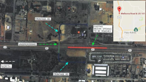 In November 2016, concern was expressed about the
Wellsona Road interchange N of Paso Robles. There have been 16 crashes at
the intersection since 2012, 12 of which have resulted in injuries or
fatalities, according to CHP data. Many of the crashes involved drivers
crossing the road too soon, leaving them exposed to traffic traveling
about 65 mph. Over the years, residents have pushed for changes at the
intersection, where a truck stop and an RV park attract slower-moving
vehicles and give drivers additional reasons to cross in front of highway
traffic. Caltrans representatives, traffic engineers and local officials
say solutions aren’t as clear-cut as they might seem. Anurag Pande,
an associate professor at Cal Poly’s College of Engineering, said
the setup of the intersection and the nature of US 101 make quick,
substantial fixes nearly impossible. At this spot, US 101 is no longer a
freeway, which means intersections replace overpasses and on- and
off-ramps. To drivers, the road appears clear and open and no different
from the adjacent stretches to the north and south. This conditions
drivers to expect they will be able to maintain a consistent, fast rate of
speed. The solution would be to build an overpass, but Ron De Carli,
executive director of the San Luis Obispo Council of Governments, said
“the project is needed,” but building such a structure would
cost about $30 million, money San Luis Obispo County doesn’t have.
Further, the Wellsona intersection isn’t the highest priority for
San Luis Obispo County roadway fixes. Other projects, including those to
alleviate traffic congestion on US 101 near Pismo Beach and on Route 227
near San Luis Obispo, are much closer toward the top of the list of local
needs. An average of 70,000 vehicles per day drive past Pismo Beach, while
15,000 travel through the Wellsona intersection. Caltrans is planning some
upgrades it says it hopes will reduce the frequency of crashes at the
intersection. Caltrans District 5 spokesman Jim Shivers wrote in an email
that the agency plans to make improvements to the intersection by the end
of 2016 or early 2017, including roadside lights, truck-crossing signs
with flashing beacons and redone striping in a 2-mile area on both sides
of the road.
In November 2016, concern was expressed about the
Wellsona Road interchange N of Paso Robles. There have been 16 crashes at
the intersection since 2012, 12 of which have resulted in injuries or
fatalities, according to CHP data. Many of the crashes involved drivers
crossing the road too soon, leaving them exposed to traffic traveling
about 65 mph. Over the years, residents have pushed for changes at the
intersection, where a truck stop and an RV park attract slower-moving
vehicles and give drivers additional reasons to cross in front of highway
traffic. Caltrans representatives, traffic engineers and local officials
say solutions aren’t as clear-cut as they might seem. Anurag Pande,
an associate professor at Cal Poly’s College of Engineering, said
the setup of the intersection and the nature of US 101 make quick,
substantial fixes nearly impossible. At this spot, US 101 is no longer a
freeway, which means intersections replace overpasses and on- and
off-ramps. To drivers, the road appears clear and open and no different
from the adjacent stretches to the north and south. This conditions
drivers to expect they will be able to maintain a consistent, fast rate of
speed. The solution would be to build an overpass, but Ron De Carli,
executive director of the San Luis Obispo Council of Governments, said
“the project is needed,” but building such a structure would
cost about $30 million, money San Luis Obispo County doesn’t have.
Further, the Wellsona intersection isn’t the highest priority for
San Luis Obispo County roadway fixes. Other projects, including those to
alleviate traffic congestion on US 101 near Pismo Beach and on Route 227
near San Luis Obispo, are much closer toward the top of the list of local
needs. An average of 70,000 vehicles per day drive past Pismo Beach, while
15,000 travel through the Wellsona intersection. Caltrans is planning some
upgrades it says it hopes will reduce the frequency of crashes at the
intersection. Caltrans District 5 spokesman Jim Shivers wrote in an email
that the agency plans to make improvements to the intersection by the end
of 2016 or early 2017, including roadside lights, truck-crossing signs
with flashing beacons and redone striping in a 2-mile area on both sides
of the road.
(Source: SLO Tribune, 11/19/2016)
In October 2017, it was reported that Caltrans is
planning an underpass near Wellsona Road and US 101 — located just
north of Paso Robles and just south of San Miguel — where grape grower Richard Sauret was killed on 10/1/2017 when his truck collided with a southbound vehicle while he was turning left. The $13 million underpass
will be located just south of the intersection, and will be funded by the
State Highway Operation and Protection Program, said Jim Shivers, a
spokesman for Caltrans District 5. Caltrans informed San Luis Obispo
County officials of the plan in an August 2017 letter. A median will be
installed on US 101 in the middle of the intersection, and all left turns
will be eliminated. Construction on the underpass is expected to begin by
2022, although there’s no current timeline for the project and
funding has not yet been secured. The San Paso Truck Stop and the Vines RV
Resort on either side of the road mean slow, heavy vehicles frequently
cross the highway in front of traffic, increasing the risk of high-speed
collisions. In 2016, Ron De Carli, executive director of the San Luis
Obispo Council of Governments, estiamted that building an overpass would
cost about $30 million. [Note: There's an interesting implication here: to
construct an underpass, as opposed to an overpass, means the highway must
be closed for the excavation; this means there will be a temporary detour
of US 101 to the side frontage roads for the duration of construction.]
(Source: SLO Tribune, 10/16/2017)
In July 2018, it was reported that the San Luis Obispo
County Board of Supervisors allowed plans for the Paso Robles Truck Center
— slated for vacant property near the intersection of Wellsona Road
and US 101 — to continue without expensive road improvements
requested by Caltrans. The Wellsona Road intersection between Paso Robles
and San Miguel is among the most notorious in the county, along with the
Cholame “Y” Route 41-Route 46 interchange to the east. More
than 20 collisions have occurred within 30 feet of the intersection since
2011, according to the CHP. Four of these collisions resulted in seven
fatalities. To combat wrecks, Caltrans plans to build a $13 million
underpass just south of the intersection, which will allow vehicles to
exit US 101 using ramps instead of an at-grade intersection. Construction
is expected to begin in 2022 and wrap up by 2024. In the meantime, Steve
Ormonde — who previously operated a truck-repair facility on Golden
Hills Road in Paso Robles — is seeking the go-ahead to build the
Paso Robles Truck Center just north of the San Paso Truck Stop. The
25,000-square-foot facility has been in the works since 2014, but
negotiations with Caltrans over road improvements have slowed the approval
process. The Board of Supervisors voted 4-1 to allow the project to move
forward — even without extending a northbound acceleration lane,
which allows trucks turning left from Wellsona Road onto US 101 more time
to merge onto the road. The intersection has a limit of 2,300 trips per
day before infrastructure improvements are required. The new facility
would add 304 new trips, bringing the total to 2,206 trips. Extending the
lane would likely cost about $200,000, a large expense for an improvement
that won’t be needed when Caltrans finishes the underpass in six
years.
(Source: SLO Tribune, 7/26/2018, updated 8/3/2018)
In August 2018, the CTC amended the following into the
2018 SHOPP: 05-SLO-101 61.9 PPNO 2766 Project 0518000052 EA 1J780. US 101
Near Wellsona, at the intersection of Route 101 and Wellsona Road. Improve
safety by constructing an undercrossing. Est. cost: $23,881,000. Est.
construction start: 10/17/2022.
(Source: August 2018 CTC Agenda Item 2.1a.(1))
 In March 2020, the CTC approved the following project for
future consideration of funding: US 101 (05-SLO-101, PM 61.7/62.1) in San
Luis Obispo County. Construct an undercrossing and frontage road in San
Luis Obispo County. (PPNO 2766) This project is located near Wellsona, at
the intersection on US 101 and Wellsona Road in San Luis Obispo County.
This project will reduce the number and severity of collisions at the
intersection of US 101 and Wellsona Road. This project will construct an
undercrossing south of Wellsona Road at postmile 61.88 and add new
frontage roads to connect the undercrossing to Wellsona Road. This project
is fully funded and currently programmed in the 2018 SHOPP for a total of
$23,881,000 which includes Construction (capital and support) and Right of
Way (capital and support). Construction is estimated to begin in
2021-2022. The scope, as described for the preferred alternative, is
consistent with the project scope programmed by the Commission in the 2018
SHOPP. The CTC also approved the following financial allocation:
05-SLO-101 PM 61.9. PPNO 2766. ProjID 0518000052. EA 1J780. US 101 near
Wellsona, at the intersection of Route 101 and Wellsona Road. Improve
safety by constructing an undercrossing. (Concurrent consideration of
funding under Resolution E-20-17; March 2020.) Financial allocation:
PS&E $3,386,000 R/W Sup $546,000.
In March 2020, the CTC approved the following project for
future consideration of funding: US 101 (05-SLO-101, PM 61.7/62.1) in San
Luis Obispo County. Construct an undercrossing and frontage road in San
Luis Obispo County. (PPNO 2766) This project is located near Wellsona, at
the intersection on US 101 and Wellsona Road in San Luis Obispo County.
This project will reduce the number and severity of collisions at the
intersection of US 101 and Wellsona Road. This project will construct an
undercrossing south of Wellsona Road at postmile 61.88 and add new
frontage roads to connect the undercrossing to Wellsona Road. This project
is fully funded and currently programmed in the 2018 SHOPP for a total of
$23,881,000 which includes Construction (capital and support) and Right of
Way (capital and support). Construction is estimated to begin in
2021-2022. The scope, as described for the preferred alternative, is
consistent with the project scope programmed by the Commission in the 2018
SHOPP. The CTC also approved the following financial allocation:
05-SLO-101 PM 61.9. PPNO 2766. ProjID 0518000052. EA 1J780. US 101 near
Wellsona, at the intersection of Route 101 and Wellsona Road. Improve
safety by constructing an undercrossing. (Concurrent consideration of
funding under Resolution E-20-17; March 2020.) Financial allocation:
PS&E $3,386,000 R/W Sup $546,000.
(Source: March 2020 CTC Agenda, Agenda Item
2.2c.(1), 2.5b.(2a) #13)
The 2020 SHOPP, approved in May 2020, included the
following Collision Reduction item of interest (carried over from the 2018
SHOPP): 05-San Luis Obispo-101 PM 61.9 PPNO 2766 Proj ID 0518000052 EA
1J780. US 101 near Wellsona, at the intersection of Route 101 and Wellsona
Road. Improve safety by constructing an undercrossing. Programmed in
FY21-22, with construction scheduled to start in October 2022. Total
project cost is $23,881K, with $15,290K being capital (const and right of
way) and $8,591K being support (engineering, environmental, etc.).
(Source: 2020 Approved SHOPP a/o May 2020)
In October 2020, it was reported that the SLO county
Board of Supervisors unanimously approved a freeway agreement with the
state, advancing a $12.2 million Caltrans project to build an underpass at
the Wellsona Road-US 101 intersection between Paso Robles and San Miguel.
Supervisors in July 2018 also advanced plans for a truck-repair facility
at the intersection, further increasing the number of large vehicles that
will drive through the area.
(Source: The Tribune, 10/24/2020)
In June 2021, the CTC amended this project in the
SHOPP: 05-SLO-101 61.9 PPNO 2766; ProjID 0518000052 EA 05-1J780. US 101
Near Wellsona, at the intersection of Route 101 and Wellsona Road. Improve
safety by constructing an undercrossing. Note: Increase right of way
capital due to an increase in the required acquisitions and the State's
share in cost to relocate utilities in conflict. Increase
construction capital with completion of the environmental document since
there is an identified future need for mitigation cost. R/W Cap $1,271K
$1,820K; Const Cap $14,019K $15,019K;
Total $23,881K $25,430K.
(Source: June 2021 CTC Agenda, Agenda Item
2.1a.(1d) #38)
In December 2023, the CTC approved for future
consideration of funding the following project for which a MND and an
Addendum have been completed: Wellsona Safety Improvements Project. US 101 in San Luis Obispo County. Construct an undercrossing south of
Wellsona Road and add new frontage roads to connect the undercrossing to
Wellsona Road, in San Luis Obispo County. (05-SLO-101, PM 61.7/62.1; PPNO
05-2766). The project is located on US 101 from PM 61.7 to PM 62.1, in San
Luis Obispo County. The Department proposes to construct an undercrossing
south of Wellsona Road and add new frontage roads to connect the
undercrossing to Wellsona Road. The project is currently programmed in the
2020 SHOPP. The total programmed amount, which includes Right of Way
(Support and Capital), and Construction (Support and Capital) is
$25,430,000. Construction began in 2022-23. The scope, as described in the
preferred alternative, is consistent with the project scope, as programmed
by the Commission in the 2020 SHOPP. A copy of the MND has been provided
to Commission staff. The Commission approved the project for future
consideration of funding on March 25, 2020, under Resolution E-20-17.
Since the approval of the MND, there have been changes to the project and
an Addendum was prepared pursuant to CEQA. These changes include updates
the project description and impacts to Right of Way due to adjusting the
curve of the new frontage road. The design change was within the original
study limits and specialists concurred that their studies did not need any
revisions or updates. The project changes do not meet the criteria
outlined in CEQA Guidelines Section 15162 to prepare a Subsequent MND. The
Department subsequently completed an Addendum to the MND pursuant to CEQA.
The Department has approved this project for construction. This approval
and the Addendum will satisfy the environmental requirements for this
stage of the planning process.
(Source: December 2023 CTC Agenda, Agenda Item 2.2c.(2))
In January 2024, the CTC revised the following project
in the 2022 SHOPP: 05-SLO-101 61.9 61.7/62.2. PPNO
05-2766; ProjID 0518000052; EA 1J780. US 101 Near Wellsona, at the
intersection of Route 101 and Wellsona Road. Near Paso
Robles, from 0.7 mile north of Exline Road to 1.0 mile south of Monterey
Road. Improve safety by constructing an undercrossing. Note:
Update postmile and location description to better reflect the project
limits. Split landscape mitigation planting into project EA 1J781/PPNO
05-2766Y from parent project EA 1J780/PPNO 05-2766. Allocation Changes ($
× $1000) Const Cap $15,019 $14,019;
REVISED TOTAL $$24,430.
(Source: January 2024 CTC Agenda, Agenda Item 2.1d #12)
In June 2016, the CTC approved $55,567,000 for a project on US 101 Near Paso Robles, from 0.4 mile south of San Marcos Creek Bridge (~ SLO 63.581) to the Monterey County line; also in Monterey County (PM R0.0 to R2.0). Outcome/Output: Rehabilitate 32 lane miles of roadway by reconstructing roadway to improve the ride quality and extend the service life of the existing pavement. Project also includes constructing new bridges, retaining walls, installing new and/or upgrading guardrail, reconstructing drainage systems and installing new lighting at on/off ramps. Future Consideration of Funding approved under Resolution E-13-83; December 2013
In August 2020, it was reported that a highway improvement project along
eight miles of US 101 in the San Miguel area was completed. The project
area ran from north of Monterey Road (~ SLO 65.247) to south of the East
Garrison overcrossing (~ MON R1.855) near Camp Roberts in Monterey County.
This project realigned the highway to accommodate a new southbound on-ramp
at South Mission Street. The highway and nearby ramps were also re-paved
and the profile of US 101 at Camp Roberts was lowered to increase the
bridge clearance height. Drainage systems, guardrails, and lighting were
also improved. The contractor for this $53 million project was Security
Paving of Sylmar.
(Source: KSBY, 10/3/2020)
San Antonio River Bridge (№ 44-0141 L/R) (05-Mon-101, PM R6.6)
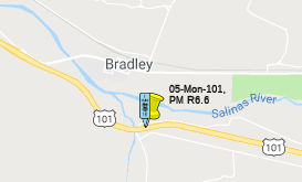 In October 2018, the CTC approved for future consideration of funding the following project
for which a Mitigated Negative Declaration (MND) has been completed: US 101 in Monterey County (05-Mon-101, PM R6.6). Seismic retrofit of two
existing bridges on US 101 near the town of Bradley. (PPNO 2565). This
project is located on US 101, south of Bradley in Monterey County. The
project proposes to seismic retrofit the San Antonio River Bridge (№
44-0141 L/R). The proposed project would seismic retrofit the two
structures of the San Antonio Bridge with pipe seat extenders, cable
restrainers, the top and bottom of each pier with steel plates and
threaded rods and rebuild Abutment # 8 diaphragm, wing wall and barrier
railing. The project also proposes to remove and replace concrete slope
paving and add rock slope protection to Piers 5 and 7. This proposed
project addresses the need to prevent the collapse of the bridge
structures during maximum credible seismic events. The proposed project is
estimated to cost approximately $14.2 million. This project is fully
funded and is currently programmed in the SHOPP for approximately $14.2
million. Construction is estimated to begin in fiscal year 2020-21. The
scope, as described for the preferred alternative, is consistent with the
project scope programmed by the Commission in the 2018 SHOPP.
In October 2018, the CTC approved for future consideration of funding the following project
for which a Mitigated Negative Declaration (MND) has been completed: US 101 in Monterey County (05-Mon-101, PM R6.6). Seismic retrofit of two
existing bridges on US 101 near the town of Bradley. (PPNO 2565). This
project is located on US 101, south of Bradley in Monterey County. The
project proposes to seismic retrofit the San Antonio River Bridge (№
44-0141 L/R). The proposed project would seismic retrofit the two
structures of the San Antonio Bridge with pipe seat extenders, cable
restrainers, the top and bottom of each pier with steel plates and
threaded rods and rebuild Abutment # 8 diaphragm, wing wall and barrier
railing. The project also proposes to remove and replace concrete slope
paving and add rock slope protection to Piers 5 and 7. This proposed
project addresses the need to prevent the collapse of the bridge
structures during maximum credible seismic events. The proposed project is
estimated to cost approximately $14.2 million. This project is fully
funded and is currently programmed in the SHOPP for approximately $14.2
million. Construction is estimated to begin in fiscal year 2020-21. The
scope, as described for the preferred alternative, is consistent with the
project scope programmed by the Commission in the 2018 SHOPP.
(October 2018 CTC Agenda Item 2.2c.(1))
In August 2016, the CTC approved for future consideration of funding a project for which a Final Environmental Impact Report (FEIR) has been completed: US 101 (05-Mon-101, PM R41.5/49.8) in Monterey County that will clear the clear recovery zone by removing 321 trees and a guardrail between the cities of King City and Greenfield. The project is programmed in the 2014 State Highway Operation and Protection Program. The total programmed amount is $4,158,000 for capital and support. Construction is estimated to begin in Fiscal Year 2016- 17. The scope, as described for the preferred alternative, is consistent with the project scope programmed by the Commission in the 2014 State Highway Operation and Protection Program.
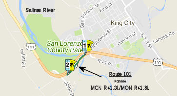 In August 2017, the CTC approved for future consideration
of funding 05-Mon-101, PM R41.3/R41.8 Salinas River Bridges Seismic
Retrofit Project: This seismic retrofit project in Monterey County will
improve serviceability and stability of the Salinas River Bridge
Structures on US 101 near King City during moderate earthquakes and to
address non-standard features of the northbound bridge. The project will
be funded from State Highway Operation and Protection Program (SHOPP)
funds and is programmed in the 2016 SHOPP for an estimated $44.85 million
(Project Approval, Project Development, Construction capital, Construction
Support, and Right of Way capital and support). Construction is
tentatively scheduled to begin in Fiscal Year 2018-19. The scope, as
described for the preferred alternative, is consistent with the project
scope programmed by the Commission in the 2016 SHOPP. A copy of the MND
has been provided to Commission staff. The project will result in less
than significant impacts to the environment after mitigation. The
following resource areas may be impacted by the project: biological
resources, recreational facilities, and noise. Avoidance and minimization
measures will reduce any potential effects on the environment. These
measures include, but are not limited to, a bat exclusion plan shall be
prepared and implemented, surveys for bats shall be conducted prior to any
vegetation removal, and no night work that requires overhead lighting or
will create noise exceeding Monterey County standards shall be permitted.
As a result, an MND was completed for this project.
In August 2017, the CTC approved for future consideration
of funding 05-Mon-101, PM R41.3/R41.8 Salinas River Bridges Seismic
Retrofit Project: This seismic retrofit project in Monterey County will
improve serviceability and stability of the Salinas River Bridge
Structures on US 101 near King City during moderate earthquakes and to
address non-standard features of the northbound bridge. The project will
be funded from State Highway Operation and Protection Program (SHOPP)
funds and is programmed in the 2016 SHOPP for an estimated $44.85 million
(Project Approval, Project Development, Construction capital, Construction
Support, and Right of Way capital and support). Construction is
tentatively scheduled to begin in Fiscal Year 2018-19. The scope, as
described for the preferred alternative, is consistent with the project
scope programmed by the Commission in the 2016 SHOPP. A copy of the MND
has been provided to Commission staff. The project will result in less
than significant impacts to the environment after mitigation. The
following resource areas may be impacted by the project: biological
resources, recreational facilities, and noise. Avoidance and minimization
measures will reduce any potential effects on the environment. These
measures include, but are not limited to, a bat exclusion plan shall be
prepared and implemented, surveys for bats shall be conducted prior to any
vegetation removal, and no night work that requires overhead lighting or
will create noise exceeding Monterey County standards shall be permitted.
As a result, an MND was completed for this project.
South Salinas Corridor Project 05-MON-101-PM 77.0/85.6.
This project is one of the
projects under consideration for the funds received from sale of the ROW
purchased for the freeway routing of the Prunedale Bypass, the adoption of
which was undone in June 2021. The project (EA 05-0H330 ProjID 0513000133)
proposes to improve safety and relieve future traffic congestion by
eliminating multiple highway crossings, constructing a new interchange at
Harris Road and providing necessary frontage roads to allow farmers to
access their lands. Includes frontage roads along US 101 South of Salinas
(Abbott Street on/off ramp) and related intersection improvements. This
segment of US 101 is currently a four-lane expressway with an inadequate
frontage road system with twelve at-grade intersections and numerous
private driveways within the project limits. The project study
area and surrounding areas have experienced a substantial amount of
development, which is expected to continue in the future. This
continued growth, coupled with a growth in commute and interregional
traffic, has resulted in substantial congestion. In addition to the
congestion, safety is also a concern. There is a lack of controlled access
along the corridor which results in conflicts between fast moving through
traffic and slower moving vehicles, such as agricultural vehicles, which
turn off and onto the expressway. Cost Range: $112,000,000 to
$250,000,000.
(Source: June 2021 CTC Agenda, Agenda Item
2.3a.(1); June 2021 CTC Agenda, Agenda Item 4.27)
Salinas/Airport Blvd Improvements (~ MON 85.675)
The SAFETEA-LU act, enacted in August 2005 as the reauthorization of TEA-21, authorized $1,936,000 for High Priority Project #1335: Construct new interchange and related road improvements on US 101 near Airport Blvd, Salinas.
In September 2009, the CTC approved for future consideration of funding a project to reconstruct the existing two-lane structure with a four-lane overcrossing, add left turn lanes, reconstruct all access ramps within the project limits, and construct roadway improvements in and near Salinas from 0.6 mile south to 0.2 mile north of the Airport Boulevard Overcrossing on Route 101. The project is fully funded in the 2008 State Transportation Improvement Program, and includes federal and local funds. The total estimated project cost is $36,603,000, capital and support. Construction is estimated to begin in Fiscal Year 2010-11.
In August 2013, the CTC authorized relinquishment of right of way in the city of Salinas along Route 101 on Airport Boulevard, De La Torre Street, and Moffett Street, consisting of collateral facilities. It also authorized relinquishment of right of way in the county of Monterey adjacent to Route 101 on De La Torre Street, consisting of collateral facilities.
In October 2011, the CTC approved $687,000 for landscape mitigation at the Airport Blvd. interchange in south Salinas.
South County Freeway Conversions (~ MON 85.679 to MON R88.243)
The 2018 STIP, approved at the CTC March 2018 meeting, appears to allocate $21,169K for PPNO 3100, South County Freeway Conversions. According to the Monterey COG, this project will construct frontage roads along US‐101 south of Salinas (Abbott Street on/off‐ramp, ~ MON 84.409) and make related intersection improvements. Traffic on US 101 in South County is increasingly impacting the highway as well as adjoining interchanges. The lack of frontage roads means that agricultural trucks must use the highway to make local trips, adding to traffic congestion and forcing U‐turns and other tricky maneuvers on US 101. Antiquated interchanges all along US 101 will not be able to accommodate traffic in the near future. The purpose of this project is to improve safety and relieve future traffic congestion by eliminating multiple highway crossings while providing the necessary frontage roads to allow farmers access to their lands.
In March 2020, the CTC approved the 2020 STIP, which
adjusted the programmed funding for PPNO 3300 "South County Freeway
Conversions" from $21,169K to 8,611K, and changed the title to "So Co
Freeway Conversions, Main St-Airport Blvd", which would be MON 85.679
(Airport Blvd) to MON R88.243 (Main St)
(Source: March 2020 CTC Agenda, Item 4.7, 2020 STIP
Adopted 3/25/2020)
In January 2023, it was reported that the
Transportation Agency for Monterey County (TAMC) announced that the
Federal Highway Administration has earmarked $1 million for the “US 101 Auxiliary Lane – South of Salinas” project. The earmark,
sponsored by Congressman Jimmy Panetta and Sen. Alex Padilla, is included
in the Consolidated Appropriations Act for Fiscal Year 2023. The
project will extend the US 101 northbound acceleration lane at Spence
Road. Construction should start in 2023. The project is expected to be
completed in 2024. The acceleration lane is an initial safety improvement
in the overall “US 101 South of Salinas” project, which
proposes to address safety concerns and improve traffic flow along 5.5
miles of US 101, from Airport Boulevard to the Main Street over-crossing
in Chualar. The auxiliary lane will provide space for trucks to safely
accelerate from Spence Road onto US 101 and provide a deceleration lane
for traffic exiting to Eckhardt Road. The “US 101 South of
Salinas” project is a Measure X funded project with $30 million
allocated to it, and is identified in the countywide “Transportation
Safety and Investment Plan” approved by Monterey County voters in
2016. Of a total construction cost of $3,247,000 for the auxiliary lane,
$317,000 of Measure X is leveraging $1.93 million of state funding in
addition to the $1 million federal earmark.
(Source: King City Rustler, 1/16/2023)
In June 2014, the CTC approved for future consideration of funding a project located at the juncture of US 101 and Sanborn Road (~ MON 86.139) in the southern portion of the City of Salinas in Monterey County. The project will construct a series of improvements to address operational traffic and circulation issues at this interchange. Project components include: extending the raised median of Sanborn Road to preclude left turns at Elvee Drive, improving the right-turn lane on westbound Sanborn Road to Work Street, extending Elvee Drive to Work Street, constructing a new bridge at the existing Monterey County Water Resources Agency (MCWRA) Reclamation Ditch crossing, signalizing the Sanborn Road/Northbound loop off-ramp/Fairview Avenue intersection, constructing a ramp meter on the Northbound US 101 on-ramp from Fairview Avenue, widening Elvee Drive and reconstructing/rehabilitating its existing pavement to handle truck traffic, installing curb, gutter, sidewalk, and street lighting along Elvee Drive, and planting approximately 50 trees.
Market Street / Mobray Way On Ramp - 05-Monterey-101 87.4/87.8
The following project was included in the final adopted 2018 SHOPP in March 2018: PPNO 2635. 05-Monterey-101 87.4/87.8. On US 101 In and near Salinas, from 0.1 mile north of East Market Street to 0.1 mile south of Sherwood Drive. Lengthen the onramp to improve merging conflicts. Begin Con: 2/23/2022. Total Project Cost: $9,545K.
In October 2019, the CTC approved the following
pre-construction allocation: 05-Mon-101 87.4/87.8 PPNO 2635 Proj ID
0516000018 EA 1H050 US 101 In and near Salinas, from 0.1 mile north of
East Market Street to 0.1 mile south of Sherwood Drive. Lengthen the
onramp to improve merging conflicts. PS&E $1,900,000 R/W Sup $190,000.
(Source: October 2019 CTC Agenda, Agenda Item
2.5b.(2a) #22)
The 2020 SHOPP, approved in May 2020, included the
following Collision Reduction item of interest (carried over from the 2018
SHOPP): 05-Monterey-101 PM 87.4/87.8 PPNO 2635 Proj ID 0516000018 EA
1H050. US 101 in and near Salinas, from 0.1 mile north of East Market
Street to 0.1 mile south of Sherwood Drive. Lengthen the onramp to improve
merging conflicts. Programmed in FY21-22, with construction scheduled to
start at the end of February 2022. Total project cost is $10,195K, with
$5,405K being capital (const and right of way) and $4,790K being support
(engineering, environmental, etc.).
(Source: 2020 Approved SHOPP a/o May 2020)
In May 2022, the CTC approved the following
construction phase SHOPP allocation: $7,692,000. 05-Mon-101 87.4/87.8.
PPNO 05-2635; ProjID 0516000018; EA 1H050. US 101 In and near Salinas,
from 0.1 mile north of East Market Street to 0.1 mile south of Sherwood
Drive. Outcome/Output: Lengthen the onramp to improve merging conflicts
and reduce the number and severity of collisions. Programmed Allocation:
CON ENG $2,000,000; CONST $5,400,000.
(Source: May 2022 CTC Agenda, Agenda Item 2.5b.(1)
#10)
In January 2017, the CTC authorized relinquishment of right of way in the county of Monterey along Route 101 between Russell Road and Echo Valley Road (05-Mon-101 PM R91.6/98.8), consisting of superseded highway and collateral facilities. The County, by freeway agreement dated August 28, 2007 agreed to accept title upon relinquishment by the State. The 90-day notice period expired November 23, 2016.
Prunedale Bypass/Prunedale Freeway (~ MON R91.886 to ~ MON 98.377)
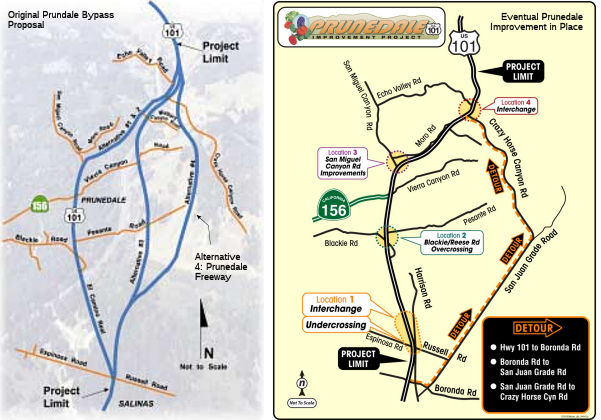 There were once plans for a "Prunedale Freeway" to provide an alternative to the safety
and capacity problems that exist on the current route, which serves as the
"Main Street" of the Prundale urbanized area north of Salinas. In November
2000, Caltrans narrowed the field of alternatives to the following
(construction planned for 2007):
There were once plans for a "Prunedale Freeway" to provide an alternative to the safety
and capacity problems that exist on the current route, which serves as the
"Main Street" of the Prundale urbanized area north of Salinas. In November
2000, Caltrans narrowed the field of alternatives to the following
(construction planned for 2007):
As of February 2004, it appears that Alternative 4 East (the new-terrain routing from Espinosa Road/Russell Road in Salinas north to near Echo Valley Road in Prunedale) has been chosen. As a result, it is likely that the US 101/Route 156 expressway between the south Route 156/US 101 interchange and Echo Valley Road will become solely Route 156. There is no info as to what the southern portion of the El Camino Real expressway from Espinosa Road to Route 156 will be.
There is also an unconstructed-adopted segment from Salinas to Route 156; 12 miles parallel to the traversable route. When (if ever) completed, this portion of US 101 will become Route 156.
Preliminary roadwork on the 13-mile Prunedale
Improvement Project (PIP) began on Monday, Feb. 14, 2011; the work
includes removal of some trees near Espinosa and Russell Roads in Salinas
(see below). The PIP addresses traffic safety issues along US 101, from
Espinosa/Russell Roads in Salinas north to Crazy Horse Canyon/Echo Valley
Roads. The project includes construction of three new interchanges
/overpasses and a continuous median barrier from Crazy Horse Canyon to
Russell/Espinosa. These safety measures will eliminate dangerous left
turns, reduce delays on US 101, provide safer access for local business
and residents and provide congestion relief for the thousands of vehicles
that travel through the corridor every day. The contract for construction
on the PIP was awarded to Granite Construction Company and MCM
Construction, a joint venture from Watsonville, on Jan. 25. Major roadwork
is scheduled to begin in the spring and be completed in late 2014. The
project was actually completed in January 2016, with the completion of the
the San Juan Road Interchange Project.
(Source: Prunedale Improvement Project Blog)
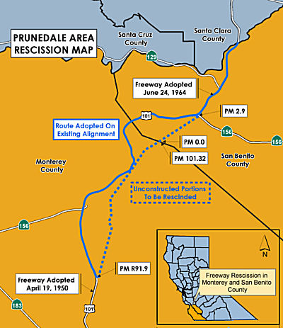 In October 2017, there was an update regarding the Prunedale Freeway, which evidently
never happened. Back when the bypass seemed like a good idea,
well-intentioned locals did what they could to make the bypass a reality.
They occasionally chartered and filled buses bound for Sacramento so that
Monterey County would be duly represented at key transportation committee
hearings. A part-time lobbyist was contracted to do Monterey
County’s bidding. Eventually, the state declared that Monterey
County and other rural counties could compete with the big urban counties
if they could show a willingness to put their own money where their needs
were. If Monterey County could prove that its citizens were willing to pay
a “fair share” to build the bypass, the state would pony up
the rest. The formula is referred to as being a “self-help”
county. What followed was a series of local ballot measures — four
of them, in all — asking voters in Monterey County to impose tax
increases on themselves to help pay for a package of
roads-and-transportation projects. The Prunedale Bypass was always a star
attraction for those measures. The first of those ballot initiatives,
Measure B, was approved by voters in 1989. It was considered a signature
achievement — a tax increase approved by taxpayers. County officials
started collecting millions of dollars in additional sales tax, and they
set it all aside for highway projects like the bypass. But the vote was
eventually ruled unconstitutional. County officials thought they needed a
simple majority to pass the tax increase, when in fact the measure
required 67 percent of the vote. To its embarrassment, the county was
forced to reimburse county residents in an awkward and cumbersome process.
When it became evident the money would never come, transportation
officials gave up on the bypass. They went with Plan B, completed in 2015.
This was the "Improve Existing Alignment" option. The results of Plan B
are what motorists see now when traveling along US 101 through Prunedale.
Interchanges were built and side-road access points were simply sealed
off. That alternative was cheaper by at least half.
In October 2017, there was an update regarding the Prunedale Freeway, which evidently
never happened. Back when the bypass seemed like a good idea,
well-intentioned locals did what they could to make the bypass a reality.
They occasionally chartered and filled buses bound for Sacramento so that
Monterey County would be duly represented at key transportation committee
hearings. A part-time lobbyist was contracted to do Monterey
County’s bidding. Eventually, the state declared that Monterey
County and other rural counties could compete with the big urban counties
if they could show a willingness to put their own money where their needs
were. If Monterey County could prove that its citizens were willing to pay
a “fair share” to build the bypass, the state would pony up
the rest. The formula is referred to as being a “self-help”
county. What followed was a series of local ballot measures — four
of them, in all — asking voters in Monterey County to impose tax
increases on themselves to help pay for a package of
roads-and-transportation projects. The Prunedale Bypass was always a star
attraction for those measures. The first of those ballot initiatives,
Measure B, was approved by voters in 1989. It was considered a signature
achievement — a tax increase approved by taxpayers. County officials
started collecting millions of dollars in additional sales tax, and they
set it all aside for highway projects like the bypass. But the vote was
eventually ruled unconstitutional. County officials thought they needed a
simple majority to pass the tax increase, when in fact the measure
required 67 percent of the vote. To its embarrassment, the county was
forced to reimburse county residents in an awkward and cumbersome process.
When it became evident the money would never come, transportation
officials gave up on the bypass. They went with Plan B, completed in 2015.
This was the "Improve Existing Alignment" option. The results of Plan B
are what motorists see now when traveling along US 101 through Prunedale.
Interchanges were built and side-road access points were simply sealed
off. That alternative was cheaper by at least half.
(Source: Voices of Monterey Bay, 10/15/2017)
So what of the land acquired for the bypass? After all,
the state had acquired hundreds of acres of right-of-way for the bypass.
In particular, with the bypass a dead deal, the state needed to dispose of
353 acres of old right-of-way property. A law was proposed that would have
insured that any money the state earns by selling the land — maybe
up to $10 million — would be used for other highway projects in
Monterey County, However, the governor vetoed that bill, using the funds
to pay off transportation bonds.
(Source: Voices of Monterey Bay, 10/15/2017)
In December 2019, the CTC had on its agenda a Notice of
Intent to Consider Rescinding Freeway Adoption Resolution NIU 19-01 and
map authorizing a rescission of a portion of the freeway adoption for US 101 in the Counties of Monterey and San Benito. What this would do is
rescind a portion of the 1964 Route Adoption for the unconstructed freeway
alignment between Espinosa Road and Route 156 in Monterey and San Benito
Counties. The TAMC, SBCOG, and San Benito County have confirmed the
adopted route is no longer part of any local or regional plans and it is
appropriate for the Department to rescind the unconstructed portion of the
freeway alignment. Once the route rescission is approved, the
Department’s responsibility is to dispose of the excess land.
Deficiencies on US 101 in the Prunedale area were recognized in the 1960s
when a project was initiated to improve the corridor by constructing a new
alignment that bypassed the community of Prunedale. On June 15, 1964, the
Department’s State Highway Engineer made a recommendation to the
California Highway Commission (CHC) to adopt the US 101 freeway route. The
Route Adoption was passed by the CHC resolution on June 24, 1964. In April
1973, the Prunedale Bypass Project (PBP) was in the final design phase
when it was determined that federal funding could not be secured, and the
project was delayed indefinitely. In the late 1980s, the PBP was
re-initiated from a Measure B sales tax but was challenged and overturned
in court and lack of funding again halted the PBP. As a result, in 2015,
the Prunedale Improvement Project (PIP) completed a series of operational
and safety improvements such as upgrading the existing four-lane facility
to partially access controlled with construction of ten miles of median
barrier, two new interchanges, and an overcrossing. The PIP was considered
to be Phase 1 of conversion to a full access controlled freeway. Phase 2
was envisioned as the Prunedale Freeway on either the existing alignment
or on the 1964 adopted bypass alignment. As of 2019, the Phase 2 project
is no longer identified in the TAMC Regional Transportation Plan.
Similarly, for San Benito County, there are no local or regional planning
studies existing or underway that would have a bearing on existing route
adoption. Ultimately, there is little likelihood for any construction to
occur on the unconstructed portions of the adopted route from the affected
agencies; therefore, rescission is appropriate. Rescission of the
unconstructed freeway adoption for US 101 from Espinosa Road to Route 156
from the State Highway System will allow the sale of excess lands. The
unneeded right-of-way will make available excess land allowing for further
community development, promoting economic growth, and relieving the
Department from ongoing maintenance costs, including weed abatement and
public dumping, and liability concerns. In March 2020, it appears the item
from December 2019 concerning rescission of 05-Mon-101 PM R91.9/101.3,
05-SBt-101 PM 0.0/2.9 was again on the agenda.
(Source: December 2019 CTC Agenda, Agenda Item
2.3a, March 2020 CTC Agenda, Agenda Item
2.3a)
In June 2021, the CTC approved recission of the
following freeway adoption: 05-Mon-101 PM R91.9/101.3 05-SBt-101 PM
0.0/2.9. A portion of US 101 from Espinosa Road to Route 156 in the
counties of Monterey and San Benito. The rescission of the unconstructed
freeway adoption for US 101 from Espinosa Road to Route 156 from the State
Highway System will allow the sale of excess land purchased for the
Prunedale Bypass. Monterey County has requested proceeds from the
sales of the excess land to be diverted to Monterey County’s local
alternative transportation improvement program (LATIP), per State of
California Government Code 14528.8. The two projects identified are as
follows:
(Source: June 2021 CTC Agenda, Agenda Item
2.3a.(1); June 2021 CTC Agenda, Agenda Item 4.27)
Russell/Espinosa Road Interchange (Part of the Prunedale Improvement Project) (~ MON 92.193)
![[New Road Connection]](maps/101-prunesala.jpg) In November 2007, the CTC considered the addition of a public road connection to US 101 at Sala Road
(~ MON 92.193). This new interchange will essentially replace an existing
at grade connection located to the south at Russell/Espinosa Roads and it
is expected to improve both safety and operations on US 101. The Russell
Road/Espinosa Road connection currently has a collision rate higher than
the statewide average for similar facilities. The project is expected to
be open to traffic in the Fall of 2012. Specifically, in the vicinity of
Russell and Espinosa Roads, the plan is to construct a new section of
access controlled four-lane freeway from 0.2 miles north of the Boronda
Road interchange to approximately Martines Road. The alignment of US 101
would be elevated to accommodate modifications to the existing at grade
connection of Russell and Espinosa Roads. Undercrossing structures would
be constructed to facilitate the connection of Russell and Espinosa Roads
to enhance local circulation. Since no freeway access would be allowed at
this location, a new interchange at Sala Road will be needed. This segment
of mainline US 101 would be constructed primarily to standard freeway
geometrics except where it conforms to existing conditions at the northern
end of the segment. Design exceptions for all nonstandard features have
been approved. Median width would range from 21 to 70 feet and median
barrier would be constructed from the undercrossing structure at Russell
and Espinosa Roads to existing concrete median barrier at Martines Road. A
new interchange and local road, Sala Road, would be constructed
approximately 0.62 miles north of Russell/Espinosa Road. To facilitate
merge/diverge traffic movements, auxiliary lanes would be constructed
along the new freeway segment between the northern ramps at the Boronda
Road interchange and this new interchange. The new interchange at Sala
Road would connect to Harrison Road to the east via Sala Road. The
interchange would consist of three directional ramps and a westbound to
southbound loop-ramp. No ramp would be constructed in the southwest
quadrant. Initially, the overcrossing structure would accommodate two
lanes with left-turn channelization. However, the structure would be
constructed with consideration for the future widening to four lanes with
left turn channelization.
In November 2007, the CTC considered the addition of a public road connection to US 101 at Sala Road
(~ MON 92.193). This new interchange will essentially replace an existing
at grade connection located to the south at Russell/Espinosa Roads and it
is expected to improve both safety and operations on US 101. The Russell
Road/Espinosa Road connection currently has a collision rate higher than
the statewide average for similar facilities. The project is expected to
be open to traffic in the Fall of 2012. Specifically, in the vicinity of
Russell and Espinosa Roads, the plan is to construct a new section of
access controlled four-lane freeway from 0.2 miles north of the Boronda
Road interchange to approximately Martines Road. The alignment of US 101
would be elevated to accommodate modifications to the existing at grade
connection of Russell and Espinosa Roads. Undercrossing structures would
be constructed to facilitate the connection of Russell and Espinosa Roads
to enhance local circulation. Since no freeway access would be allowed at
this location, a new interchange at Sala Road will be needed. This segment
of mainline US 101 would be constructed primarily to standard freeway
geometrics except where it conforms to existing conditions at the northern
end of the segment. Design exceptions for all nonstandard features have
been approved. Median width would range from 21 to 70 feet and median
barrier would be constructed from the undercrossing structure at Russell
and Espinosa Roads to existing concrete median barrier at Martines Road. A
new interchange and local road, Sala Road, would be constructed
approximately 0.62 miles north of Russell/Espinosa Road. To facilitate
merge/diverge traffic movements, auxiliary lanes would be constructed
along the new freeway segment between the northern ramps at the Boronda
Road interchange and this new interchange. The new interchange at Sala
Road would connect to Harrison Road to the east via Sala Road. The
interchange would consist of three directional ramps and a westbound to
southbound loop-ramp. No ramp would be constructed in the southwest
quadrant. Initially, the overcrossing structure would accommodate two
lanes with left-turn channelization. However, the structure would be
constructed with consideration for the future widening to four lanes with
left turn channelization.
Route 156 West Corridor/Castroville Blvd Interchange (05-Mon-101, PM 94.6/96.8 05-Mon-156, PM R1.6/T5.2)
 The 2018 STIP, approved at the CTC March 2018 meeting, appears to allocate $19,800K for
the Castroville Blvd Interchange (~ MON R1.819). The Monterey COG
described the project as build a new interchange at Castroville Boulevard
and Route 156, with connections to Blackie Road to improve access for
commercial traffic. There is a related project, also funded in the STIP,
that extends Blackie Road to connect to a new interchange at Route 156 and
Castroville Boulevard. The COG notes that Route 156 at Castroville
Boulevard is the top collision location in Monterey County. In addition,
Route 156 is the major link connecting the San Francisco Bay area and
North Monterey County to the Monterey Peninsula. With its present narrow
configuration, it currently operates over capacity, with substantial
delays and safety concerns, particularly during special events on the
Monterey Peninsula. This congestion affects travel to and from the
Peninsula as well as travel between US 101 and Route 1 for local
residents. In addition, the traffic impedes access to the Oak Hills
neighborhood. This project will direct truck traffic away from Merritt
Street in Castroville and from the accident‐ridden Route 183/Route 156 interchange. It will also help relieve traffic congestion on Route 156
while improving safety and local traffic circulation in North Monterey
County. The extension of Blackie Road provides traffic congestion relief
and improves safety for Oak Hills and other local communities.
The 2018 STIP, approved at the CTC March 2018 meeting, appears to allocate $19,800K for
the Castroville Blvd Interchange (~ MON R1.819). The Monterey COG
described the project as build a new interchange at Castroville Boulevard
and Route 156, with connections to Blackie Road to improve access for
commercial traffic. There is a related project, also funded in the STIP,
that extends Blackie Road to connect to a new interchange at Route 156 and
Castroville Boulevard. The COG notes that Route 156 at Castroville
Boulevard is the top collision location in Monterey County. In addition,
Route 156 is the major link connecting the San Francisco Bay area and
North Monterey County to the Monterey Peninsula. With its present narrow
configuration, it currently operates over capacity, with substantial
delays and safety concerns, particularly during special events on the
Monterey Peninsula. This congestion affects travel to and from the
Peninsula as well as travel between US 101 and Route 1 for local
residents. In addition, the traffic impedes access to the Oak Hills
neighborhood. This project will direct truck traffic away from Merritt
Street in Castroville and from the accident‐ridden Route 183/Route 156 interchange. It will also help relieve traffic congestion on Route 156
while improving safety and local traffic circulation in North Monterey
County. The extension of Blackie Road provides traffic congestion relief
and improves safety for Oak Hills and other local communities.
In April 2018, it was reported that a new interchange
is being pursued at Castroville Boulevard and Route 156, where there is
currently a stop light. An interchange would end t-bone accidents,
rear-end collisions and make it safer by getting trucks out of
Castroville, with a new Route 156 connection to Blackie Road. This could
take five years.
(Source: Mercury News, 4/5/2018)
In March 2020, the CTC approved the 2020 STIP, which
adjusted the programmed funding for PPNO 0057D "Castroville Blvd
Interchange", from $19,800K to $27,675K.
(Source: March 2020 CTC Agenda, Item 4.7, 2020 STIP
Adopted 3/25/2020)
In June 2020, the CTC approved the following
allocation: $18,100,000 for the Right of Way capital phase for 05-Mon-156
R1.6/1.4 PPNO 05-0057D ProjID 0518000120 EA 31601 Castroville
Boulevard Interchange. Route 156 in Monterey County at Castroville
Boulevard from Post Mile R1.6 to 1.4. Build a new interchange at
Castroville Boulevard and Route 156. The project scope requires the
acquisition of 15 parcels and extensive offsite environmental
mitigation and utilities. The signalized intersection at Castroville
Boulevard and Route 156 is the only signal along the route west of
US 101. Because of that, drivers may be unprepared for traffic that has
completely stopped due to a red signal. The accident rate at the
Castroville Boulevard intersection on Route 156 is over twice the
rate of what would be expected of a similar intersection in
California. Additionally, the frequent stoppage of traffic due to the
signal causes congestion. Traffic has been known to back-up in both
directions for miles during the Summer and for weekend events on the
peninsula.
(Source: June 2020 CTC Agenda, Agenda Item
2.5c.(8))
In December 2020, it was reported that the first phase
of the long-awaited Route 156 corridor improvement project was fully
funded and ready for construction after being approved for $20 million in
state gas tax funding by the California Transportation Commission.
According to the Transportation Agency for Monterey County, the state
transportation commission gave the thumbs to allocating SB 1 trade
corridor enhancement program funds for the $55.2 million Castroville
Boulevard interchange project. The funding was part of a $2 billion
package approved for 56 projects across the state aimed at federally
designated trade corridors of national and regional significance with a
“high volume of freight movement” such as Route 156, which
supports the county’s $4.4 billion-per-year agricultural industry by
serving a key route for truck traffic. The state funding means the
Castroville Boulevard interchange project now has the entire $29.5 million
needed to move forward with construction in the next two years. It is part
of the overall $380 million Route 156 improvement project that includes a
proposed $75 million four-lane expressway between the new Castroville
Boulevard interchange and US 101 in Prunedale, and a new $250 million
interchange at Route 156 and US 101. The project includes constructing a
new Castroville Boulevard interchange including an overpass and three
roundabouts to the east of the existing four-way stoplight and expanding
the highway to four lanes from the stoplight intersection to the new
location. It will be constructed to operate in conjunction with both the
current highway route and the proposed four-lane expressway. In addition
to the $20 million in state SB 1 funding, the interchange project is being
funded by about $27.7 million in state Transportation Improvement Program
funding, $5 million in developer fees and $2.25 million in voter-approved
Measure X funding. The project was originally slated to receive $30
million in Measure X funding but Hale said the state funding allowed
Transportation Agency for Monterey County to redirect those funds to the
Blackie Road extension, which would connect Castroville’s industrial
area to the new Castroville Boulevard interchange and allow truck traffic
to avoid Route 183 through downtown Castroville and the interchange at US 101 and Route 183.
(Source: Monterey Herald, 12/3/2020)
In June 2021, it was reported that
this project is one of the projects under consideration for the funds
received from sale of the ROW purchased for the freeway routing of the
Prunedale Bypass, the adoption of which was undone in June 2021. This
project (EA 05-31600, ProjID 0500000497) proposes to remove and
reconstruct the current interchange. The new interchange
configuration will include a fully functioning interchange and a new
flyover structure which will connect eastbound Route 156 traffic to
northbound US 101. This project also proposes to convert US 101 from
a four-lane expressway to a four-lane freeway within the project
limits. This segment of US 101 experiences congestion in both the
northbound and southbound directions on a regular basis, especially on
weekends. Heavy weekend traffic is generated by tourism from the Bay
Area to the Monterey Peninsula and Big Sur. There are safety
concerns and operational deficiencies due to poor weaving distances and
at-grade intersections. The operational deficiencies exacerbate the
congestion problems. The project proposes to improve safety and address
numerous operational deficiencies on US 101 by improving weaving
distances, removing at-grade intersections, and constructing a new
frontage road. Cost Range: $300,000,000 to $425,000,000.
(Source: June 2021 CTC Agenda, Agenda Item
2.3a.(1); June 2021 CTC Agenda, Agenda Item 4.27)
In December 2021, there was an update on the status of
this project: A planned westbound connector at the intersection of Route 156 and US 101 will extend the current onramp an additional 1,800 feet and
will include a ramp meter. Caltrans is conducting preliminary engineering
to determine the size and cost of the project.
(Source: BenitoLink, 12/8/2021)
In May 2023, it was reported that the Transportation
Agency for Monterey County announced that the Route 156/Castroville
Boulevard project is not expected to be ready to list by the June 30 2023
funding deadline. Ready to list means a project has met certain criteria
by the time funding is allocated. The project, which was approved under
Monterey Counties Measure X in 2016, is being held up by PG&E utility
relocation work that will not be completed until December. Now, to make
sure the project avoids losing funding, the California Transportation
Commission is calling for at-risk funding allocation. This funding would
be conditional and would only go through if Caltrans got approval to
develop the land from PG&E. The project has been in the works for more
than a decade. It would get rid of the only traffic light on Route 156 and
replace it with a roundabout. The project was originally expected to cost
$29.5 million, with funding coming from both state and local sources. Now,
that price tag has ballooned by $18 million and is estimated to cost $47.5
million. The TAMC has proposed that the additional funding come from
additional Measure X funds and California's Trade Corridor Enhancement
Program. In their June meeting, the California Transportation Commission
approved an environmental impact report for the project. A 12-month time
extension was also approved to request the $20 million Trade Corridor
Enhancement Program funding. The extension provides time for PG&E to
complete the utility relocation work and for Caltrans to finish
right-of-way certification.
(Source: KSBW, 5/24/2023; KSBW, 7/3/2023)
In June 2023, the CTC had on its agenda the following
project, which was deleted from the agenda before the meeting: 05-Mon-101,
PM 94.6/96.8 05-Mon-156, PM R1.6/T5.2. Route 156 West Corridor.
Widen Route 156 between US 101 and Castroville Boulevard and rebuild the
US 101/Route 156 interchange, in Monterey County. (FEIR Addendum) (PPNO
0057D) (TCEP) (STIP). The project is located on US 101 from postmile
94.6 to postmile 96.8 and SR 156 from postmile R1.6 to postmile T5.2, in
Monterey County. The Department proposes to widen Route 156 from 2 lanes
to 4 lanes and convert US 101 from an expressway to a freeway. The
project is currently programmed in the 2020 State Transportation
Improvement Program (STIP) and Transportation Corridor Enhancement
Program (TCEP) for a total of $13,294,000 which includes Right of Way
(Capital) and Construction (Capital). Construction is estimated to begin
in 2024-25. The scope, as described for the preferred alternative, is
consistent with the project scope as programmed by the Commission in the
2020 STIP/TCEP. A copy of the FEIR has been provided to Commission
staff. The Commission approved the project for future consideration of
funding on August 6, 2013, under Resolution E-13-65. The project has
been divided into three segments and various design modifications have
been made such as shifting the alignment of SR 156 West southward to
accommodate the new design of the grade-separated interchange and the
acquisition of approximately 9.79 acres of additional property. The new
alignment would result in additional impacts to jurisdictional waters
and wetlands. Additionally, after further coordination with CDFW, it was
determined that habitat for California tiger salamander and Santa Cruz
long-toed salamander would be impacted by the project. As a result,
additional avoidance, minimization, and mitigation measures were added
to the project. The Department subsequently completed an Addendum to the
FEIR pursuant to CEQA. The Department has approved this project for
construction. This approval and the Addendum will satisfy the
environmental requirements for this stage of the planning process.
(Source: June 2023 CTC Agenda, Agenda Item 2.2c.(2) Item 4)
In October 2023, the CTC approved for consideration of
funding the following project for which a FEIR and an Addendum have been
completed: US 101 and Route 156, in Monterey County. Widen Route 156 from
2-lanes to 4-lanes between US 101 and Castroville Boulevard and rebuild
the US 101/Route 156 interchange, in Monterey County. (05-Mon-101, PM
94.6/96.8; 05-Mon-156, PM R1.6/T5.2; PPNO 0057D). The project is currently
programmed in the 2020 State Transportation Improvement Program (STIP) for
a total of $484,294,000, which includes Right of Way (Support and Capital)
and Construction (Support and Capital). Construction is estimated to begin
in 2026-27. The scope, as described for the preferred alternative, is
consistent with the project scope as programmed by the Commission in the
2020 STIP. A copy of the FEIR has been provided to Commission staff. The
Commission approved the project for future consideration of funding on
August 6, 2013, under Resolution E-13-65. Since the approval of the FEIR,
there have been changes to the project and an Addendum was prepared
pursuant to CEQA. These changes include revisions to the design, land use,
and refinements to impacts and mitigation associated with the following
resources: natural communities and habitats, jurisdictional waters,
biological species, visual/aesthetics, and noise. The project would not
result in substantial increases in the severity of significant effects,
would not involve substantial changes in regulatory circumstances, did not
identify new alternatives, and proposed similar avoidance, minimization,
and mitigation measures when compared to the 2013 FEIR. The project
changes do not meet the criteria outlined in CEQA Guidelines Section 15162
and Section 15163 to prepare a Subsequent or Supplemental FEIR. The
Department subsequently completed an Addendum to the FEIR pursuant to
CEQA. The Department has approved this project for construction. This
approval and the Addendum will satisfy the environmental requirements for
this stage of the planning process.
(Source: October 2023 CTC Agenda, Agenda Item 2.2c.(4))
San Juan Road Improvements (Part of the Prunedale Improvement Project) (MON PM 100.0/101.3)
In April 2006, the CTC received the notice of the preparation of an Environmental Impact Report for construction of a new interchange near San Juan Bautista in Monterey County (PM 100.0/101.3). The project is currently programmed as “environmental only.” The following alternatives are being considered: (·) Alternative 1A: Spread Diamond Interchange – Located approximately midway between Dunbarton Road to the south and San Juan Road to the north; (·) Alternative 1B: Compact Diamond Interchange – Same location as Alternative 1A, with interchange ramps and frontage road closer to alignment of highway; (·) Alternative 2: Compact Diamond Interchange – Located near the San Juan Road/ Route 101 intersection, with frontage road on east side of Route 101; (·) Alternatives 4, 5, 9A and 9B: Same general location as Alternative 2, with variations on the interchange configuration and the frontage road alignment; (·) No Build. The potential impacts include floodplain encroachment, drainage, hazardous waste, and visual impacts. Proposed mitigations include avoidance of service station acquisition, visual resource mitigation, and new alternative north of the floodplain and Elkhorn Slough.
In 2007, the following requests for funding from the Corridor Mobility Improvement Account (CMIA) were made, but not recommended for funding: San Juan Rd interchange in Monterey County ($50,800K requested).
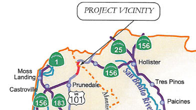 In September 2010, the CTC approved for future consideration of funding a project in Monterey and San
Benito Counties that will construct an interchange on Route 101 and modify
existing local roads near the Monterey/San Benito County line. The project
is programmed in the Trade Corridors Improvement Fund and the 2010 State
Transportation Improvement Program and includes local funds. Construction
is estimated to begin in Fiscal Year 2012-13. Total estimated project cost
is $90,600,000 for capital and support. The scope as described for the
preferred alternative is consistent with the project scope set forth in
the proposed project baseline agreement. The project will mitigate
potential impacts to water quality, aesthetics, and riparian habitat. The
project will also require construction activities in the habitat of the
California tiger salamander, the Southwestern pond turtle, and the
California red-legged frog, all of which are federally listed threatened
and endangered species. The project contains mitigation measures to reduce
impacts to these species to a less than significant level.
In September 2010, the CTC approved for future consideration of funding a project in Monterey and San
Benito Counties that will construct an interchange on Route 101 and modify
existing local roads near the Monterey/San Benito County line. The project
is programmed in the Trade Corridors Improvement Fund and the 2010 State
Transportation Improvement Program and includes local funds. Construction
is estimated to begin in Fiscal Year 2012-13. Total estimated project cost
is $90,600,000 for capital and support. The scope as described for the
preferred alternative is consistent with the project scope set forth in
the proposed project baseline agreement. The project will mitigate
potential impacts to water quality, aesthetics, and riparian habitat. The
project will also require construction activities in the habitat of the
California tiger salamander, the Southwestern pond turtle, and the
California red-legged frog, all of which are federally listed threatened
and endangered species. The project contains mitigation measures to reduce
impacts to these species to a less than significant level.
 In May 2011, the CTC approved a new public road connection at San Juan Road to US 101, near the Monterey/San Benito
county line, in the county of San Benito. San Juan Road, Cole Road and
Dunbarton Road are the primary local roads to be modified by this project.
San Juan Road is a two-lane undivided county road that connects to US 101
from the west to form a T-intersection. Acceleration lanes to both
directions of US 101 are provided off of San Juan Road. Cole Road is a
two-lane undivided county road that connects to southbound US 101 from the
west to form a skewed-intersection. To access northbound US 101, Cole Road
extends through a median crossing. Dunbarton Road intersects US 101 on the
southern end of the project limits and serves as the primary southbound
connection in that vicinity. An analysis, conducted on existing traffic
volumes in June of 2008, found that during peak traffic periods the US 101
intersections of San Juan Road, Dunbarton Road, and Cole Road each
operates at a Level of Service “F”. Traffic volume increases
have led to fewer gaps in traffic for the motorist to merge onto the
highway. Currently, vehicles from both directions of travel on US 101 can
directly access Dunbarton Road, and Cole Road west of US 101. San Juan
Road can be accessed directly only from southbound US 101. To get onto San
Juan Road from northbound US 101, a motorist has to either turn onto
Dunbarton Road (North) or make a U-turn at Cole Road. With two lanes of
highway traffic in each direction, access to these roads is especially
difficult. During a three-year study period between September 1, 2004 and
August 31, 2007, it was found that most highway segments and intersections
within the proposed project limits had collision rates higher than the
statewide average for similar facilities. In particular, these studies
show, the San Juan Road intersection has a collision rate 300 percent
higher than the statewide average. The southbound US 101 traffic
approaching Cole Road and San Juan Road are on a 6 percent grade which
tends to increase stopping sight distances. The proposed project would
construct a combination compact half diamond/one-quadrant cloverleaf
interchange. San Juan Road, on the west side of US 101, would be realigned
and extended to the north where it then turns and crosses US 101 as an
overcrossing. Cole Road would be extended southerly until it connects to
San Juan Road at a T-intersection. On the east side of US 101, a new
frontage road would be constructed off of San Juan Road towards the south.
This new frontage road would be constructed parallel to US 101 and end
with a cul-de-sac at Marilyn Lane. Marilyn Lane and Ballantree Lane are
private roads to be connected to this frontage road. Access to Dunbarton
Road (North) from US 101 would be removed. Dunbarton Road (North) would
become a frontage road ending with a cul-de-sac. The north end of
Dunbarton Road (South) would only allow right in and right out traffic
movement. The existing median crossover at Cole Road would be removed. The
gaps in the median barrier on US 101, within the project limits, would be
closed with a concrete barrier. After the completion of the project, it is
proposed that the local roads constructed as part of the project be
relinquished to Monterey County and San Benito County within their
respective areas. The current capital cost estimate for the project is
$46.2 million. This project will be funded using a combination of the
Statewide Transportation Improvement Program which includes the Regional
Improvement Program and the Interregional Improvement Program, local
matching funds from TMAC, American Reinvestment and Recovery Act of 2009
Funds (Federal Stimulus) and Trade Corridor Improvement Funds in the
2012-2013 fiscal years.
In May 2011, the CTC approved a new public road connection at San Juan Road to US 101, near the Monterey/San Benito
county line, in the county of San Benito. San Juan Road, Cole Road and
Dunbarton Road are the primary local roads to be modified by this project.
San Juan Road is a two-lane undivided county road that connects to US 101
from the west to form a T-intersection. Acceleration lanes to both
directions of US 101 are provided off of San Juan Road. Cole Road is a
two-lane undivided county road that connects to southbound US 101 from the
west to form a skewed-intersection. To access northbound US 101, Cole Road
extends through a median crossing. Dunbarton Road intersects US 101 on the
southern end of the project limits and serves as the primary southbound
connection in that vicinity. An analysis, conducted on existing traffic
volumes in June of 2008, found that during peak traffic periods the US 101
intersections of San Juan Road, Dunbarton Road, and Cole Road each
operates at a Level of Service “F”. Traffic volume increases
have led to fewer gaps in traffic for the motorist to merge onto the
highway. Currently, vehicles from both directions of travel on US 101 can
directly access Dunbarton Road, and Cole Road west of US 101. San Juan
Road can be accessed directly only from southbound US 101. To get onto San
Juan Road from northbound US 101, a motorist has to either turn onto
Dunbarton Road (North) or make a U-turn at Cole Road. With two lanes of
highway traffic in each direction, access to these roads is especially
difficult. During a three-year study period between September 1, 2004 and
August 31, 2007, it was found that most highway segments and intersections
within the proposed project limits had collision rates higher than the
statewide average for similar facilities. In particular, these studies
show, the San Juan Road intersection has a collision rate 300 percent
higher than the statewide average. The southbound US 101 traffic
approaching Cole Road and San Juan Road are on a 6 percent grade which
tends to increase stopping sight distances. The proposed project would
construct a combination compact half diamond/one-quadrant cloverleaf
interchange. San Juan Road, on the west side of US 101, would be realigned
and extended to the north where it then turns and crosses US 101 as an
overcrossing. Cole Road would be extended southerly until it connects to
San Juan Road at a T-intersection. On the east side of US 101, a new
frontage road would be constructed off of San Juan Road towards the south.
This new frontage road would be constructed parallel to US 101 and end
with a cul-de-sac at Marilyn Lane. Marilyn Lane and Ballantree Lane are
private roads to be connected to this frontage road. Access to Dunbarton
Road (North) from US 101 would be removed. Dunbarton Road (North) would
become a frontage road ending with a cul-de-sac. The north end of
Dunbarton Road (South) would only allow right in and right out traffic
movement. The existing median crossover at Cole Road would be removed. The
gaps in the median barrier on US 101, within the project limits, would be
closed with a concrete barrier. After the completion of the project, it is
proposed that the local roads constructed as part of the project be
relinquished to Monterey County and San Benito County within their
respective areas. The current capital cost estimate for the project is
$46.2 million. This project will be funded using a combination of the
Statewide Transportation Improvement Program which includes the Regional
Improvement Program and the Interregional Improvement Program, local
matching funds from TMAC, American Reinvestment and Recovery Act of 2009
Funds (Federal Stimulus) and Trade Corridor Improvement Funds in the
2012-2013 fiscal years.
In August 2017, the CTC authorized relinquishment of 05-Mon-101-PM-100.3/101.3 Right of way along Route 101 from Dunbarton Road to the San Benito County line, in the county of Monterey, consisting of superseded highway and collateral facilities. The County, by freeway agreement dated April 12, 2011, agreed to accept title upon relinquishment by the State. The 90-day notice period expired July 19, 2017. This evidently was the original routing bypassed by the above project.
In January 2020, the CTC authorized relinquishment of right of way in the
county of San Benito (County) along Route 101 (05-SBt-101-PM 0.00/0.62)
from the Monterey County line to Cole Road, consisting of collateral
facilities. The County by freeway agreement dated April 12, 2011, agreed
to accept the relinquishment and by letter signed August 5, 2019, agreed
to waive the 90-day notice requirement and accept title upon
relinquishment by the State. The 90-day notice period expired November 27,
2019.
(Source: January 2020 CTC Agenda, Agenda Item 2.3c)
San Benito Wildlife Crossing (~ SBT 1.477)
In February 2020, it was reported that the Land Trust
of Santa Cruz County announced it would acquire 2,600 acres of Rocks
Ranch. The trust’s Executive Director Stephen Slade said that Rocks
Ranch is a “must protect” project because it would enable
wildlife to safely cross US 101 and connect the Santa Cruz Mountains with
the Gabilan Range. Wildlife found at Rocks Ranch include bobcats, golden
eagles, and California red-legged frogs. There are also signs of Native
American cultural artifacts, such as bedrock mortars. There is no cost
estimate for the San Benito wildlife crossing. The Rocks Ranch land
connects with US 101 on its northern end, approximately SBT 0.269 to SBT
1.951, based on the map on the Land Trust Assessment Page. Rocks Ranch owner Ben Bingaman, who will keep 60 acres near US 101 that are part of the four nodes under zoning dispute
related to Measure K, said he had been in discussion with the land trust
for about two years. The property is currently used for cattle grazing. He
said he will continue to run cattle on the property for 10 years, which
will be reevaluated at that time.
(Source: BenitoLink, 2/21/2020)
In December 2022, the nonprofit Land Trust of Santa
Cruz County spent $17 million to buy Rocks Ranch, a 2,600-acre property
near San Juan Bautista that developers have eyed in recent years for
subdivisions, hotels and other projects. Instead, the group is working on
a plan with Caltrans to build a wildlife crossing so that mountain lions,
deer, bobcats, badgers, foxes and other animals can traverse four lanes of
speeding traffic on US 101 without being hit by cars. That area is a
hotspot for wildlife-vehicle collisions that not only rack up roadkill but
can injure or kill motorists. The freeway also can block animals from
roaming to breed, find food and settle into new habitat areas. Planning is
still in the early stages for the crossing, which would be the first such
natural bridge built over any freeway in Northern California. The idea is
to connect two places that are still relatively wild: the Gabilan Range
— which runs roughly from Pinnacles National Park to Fremont Peak
near Hollister — and the Santa Cruz Mountains. At the head of the
plan is Rocks Ranch, which has 2.5 miles of frontage on US 101, just south
of Route 156. Caltrans planners are studying several spots along the
property where under crossings could be built below the freeway. But an
overpass would also work ell in several of them. Caltrans should be
finished with a feasibility study by the end of this year, she said. The
agency is applying for several grants to fund engineering and
environmental studies over the next three years, with construction planned
for 2028 if funding can be secured. An overcrossing would probably be 120
to 160 feet wide. It would be constructed of concrete and covered with
grass, brush, rocks, logs and possibly even trees. Fencing would be built
along parts of the freeway to help keep animals off the road and direct
them to the overpass. Planners are also studying a proposal to build a
similar wildlife overpass at Route 152 east of Gilroy, near Pacheco Pass.
(Source: $Santa Cruz Sentinel/BANG, 6/13/2023)
US 101 Improvements Project: Monterey Road to Route 129 (SCR 4.9/SCL 5.0)
 In August 2018, the CTC accepted the Final Environmental Impact Report and Statement of
Overriding Considerations for the US 101 Improvements Project (Project) in
Santa Clara County and approved the Project for future consideration of
funding. The Project will reconstruct the existing US 101/Route 25
interchange; widen US 101 to a 6-lane freeway between Monterey Street and
Route 129; add auxiliary lanes in each direction on US 101 between
Monterey Street and Route 25; extend Santa Teresa Boulevard from Castro
Valley Road to the US 101/Route 25 interchange; improve the southbound US 101 off-ramp at Route 129; construct frontage roads; grade-separate the
Union Pacific Railroad crossing on Route 25 just west of Bloomfield
Avenue; and will construct bicycle facilities. On June 6, 2013 the Santa
Clara Valley Transportation Authority Congestion Management and Planning
Committee adopted the Final Environmental Impact Report, including the
Statement of Overriding Considerations. The Final Environmental Impact
Report determined that impacts related to growth, farmland, and
visual/aesthetics would be significant and unavoidable. These imacts were:
In August 2018, the CTC accepted the Final Environmental Impact Report and Statement of
Overriding Considerations for the US 101 Improvements Project (Project) in
Santa Clara County and approved the Project for future consideration of
funding. The Project will reconstruct the existing US 101/Route 25
interchange; widen US 101 to a 6-lane freeway between Monterey Street and
Route 129; add auxiliary lanes in each direction on US 101 between
Monterey Street and Route 25; extend Santa Teresa Boulevard from Castro
Valley Road to the US 101/Route 25 interchange; improve the southbound US 101 off-ramp at Route 129; construct frontage roads; grade-separate the
Union Pacific Railroad crossing on Route 25 just west of Bloomfield
Avenue; and will construct bicycle facilities. On June 6, 2013 the Santa
Clara Valley Transportation Authority Congestion Management and Planning
Committee adopted the Final Environmental Impact Report, including the
Statement of Overriding Considerations. The Final Environmental Impact
Report determined that impacts related to growth, farmland, and
visual/aesthetics would be significant and unavoidable. These imacts were:
The Santa Clara Valley Transportation Authority Congestion Management and Planning Committee found that there were several benefits that outweigh the unavoidable adverse impacts of the project. These overriding benefits include economic, legal, social, and technological considerations that outweigh the identified significant effects on the environment. The Santa Clara Valley Transportation Authority Congestion Management and Planning Committee cited the following substantial public benefits:
On July 17, 2018, the Santa Clara Valley Transportation Authority confirmed that the Final Environmental Impact Report remains valid and that there are no new identified impacts requiring mitigation. The Santa Clara Valley Transportation Authority also confirmed that the preferred alternative set forth in the final environmental document is consistent with the Project scope of work programmed by the Commission.
The Project will be constructed in phases, with the
first phase encompassing the reconstruction of US 101/Route 25
Interchange, which is estimated to cost $65,000,000, and will be funded
with with Trade Corridor Enhancement Funds ($4,200,000) and Local Funds
($60,800,000). Construction is estimated to begin in Fiscal Year 2020-21.
Additionally, in August 2018, the CTC approved an allocation of $4,200,000
for the locally-administered Senate Bill 1 (SB 1) Trade Corridor
Enhancement Program (TCEP) US 101/Route 25 Interchange – Phase 1
project (PPNO 0462G), in Santa Clara County
(August 2018 CTC Agenda Item 2.2c.(12), Agenda Item
2.5s(4))
 In June 2021, it was reported that the updated US 101/Route 25 interchange is still being designed. The goal of the project
is to increase the length of the southbound US 101 offramp by more than
1,000 feet, in order to prevent vehicles from stacking on US 101 during
peak commute hours. Traffic signals would be installed where the offramp
meets Route 25, and traffic would turn east over a newly constructed
four-lane overpass that spans US 101. Once crossing the overpass, which
would be located slightly north of the current overcrossing, another
signalized intersection will be constructed where the northbound off-ramp
meets Route 25. The overall project, which also includes widening US 101
from Monterey Road to Route 129 as well as extending Santa Teresa
Boulevard to Route 25, will be built in phases due to limited funding. The
first phase, which includes the new overpass, is expected to cost
$100 million, to Adam, funded by Senate Bill 1 and the 2016 voter-approved
Measure B. The project is currently in the design phase, and an addendum
is being drafted for the 2013 VTA Board-approved Environmental Impact
Report for the overall US 101 widening project. Construction on the
overpass could begin in summer 2023 and wrap up in early 2026. The
existing interchange was constructed in 1988 as a temporary way to prevent
drivers from turning left on US 101 to Route 25. Since then, traffic has
increased heavily, with vehicles looking to turn onto Route 25 spilling
onto the US 101 shoulder and backing up to the Monterey Road onramp. In
addition, the current configuration of the interchange has seen
“higher than average accident rates” compared to statewide
collision rates. The project would eliminate US 101 access from Castro
Valley and Mesa roads, which are popular spots for commuters looking to
avoid the bottleneck that occurs when the highway goes down from three
lanes to two at Monterey Road.
In June 2021, it was reported that the updated US 101/Route 25 interchange is still being designed. The goal of the project
is to increase the length of the southbound US 101 offramp by more than
1,000 feet, in order to prevent vehicles from stacking on US 101 during
peak commute hours. Traffic signals would be installed where the offramp
meets Route 25, and traffic would turn east over a newly constructed
four-lane overpass that spans US 101. Once crossing the overpass, which
would be located slightly north of the current overcrossing, another
signalized intersection will be constructed where the northbound off-ramp
meets Route 25. The overall project, which also includes widening US 101
from Monterey Road to Route 129 as well as extending Santa Teresa
Boulevard to Route 25, will be built in phases due to limited funding. The
first phase, which includes the new overpass, is expected to cost
$100 million, to Adam, funded by Senate Bill 1 and the 2016 voter-approved
Measure B. The project is currently in the design phase, and an addendum
is being drafted for the 2013 VTA Board-approved Environmental Impact
Report for the overall US 101 widening project. Construction on the
overpass could begin in summer 2023 and wrap up in early 2026. The
existing interchange was constructed in 1988 as a temporary way to prevent
drivers from turning left on US 101 to Route 25. Since then, traffic has
increased heavily, with vehicles looking to turn onto Route 25 spilling
onto the US 101 shoulder and backing up to the Monterey Road onramp. In
addition, the current configuration of the interchange has seen
“higher than average accident rates” compared to statewide
collision rates. The project would eliminate US 101 access from Castro
Valley and Mesa roads, which are popular spots for commuters looking to
avoid the bottleneck that occurs when the highway goes down from three
lanes to two at Monterey Road.
(Source: SanBenito.Com, 6/17/2021; For more information: VTA Project Page; Image source: SanBenito.Com)
In June 2022, it was reported that
the Santa Clara Valley Transportation Authority Board of Directors
approved a document that completes another step in the years-long process
to construct a new overcrossing at the US 101/Route 25 interchange. The
board unanimously approved the addendum to an environmental report for a
US 101 widening project that was previously approved in 2013. The addendum
focuses on the first phase of the US 101/Route 25 interchange, and
determined that mitigation measures in place for the project would not add
any new or significant environmental effects. Located just south of Gilroy
city limits, the current interchange, built in 1988, was originally meant
to be a temporary way to prevent drivers from turning left on US 101 to
Route 25. However, the interchange has proven inadequate as the population
has grown over the decades, and traffic on southbound US 101 backs up past
Monterey Street during daily commute hours, as drivers attempting to
navigate onto Route 25 into San Benito County line up on the
freeway’s shoulder. While still being designed, the project would
increase the length of the southbound US 101 offramp by more than 1,000
feet, with the goal of preventing vehicles from stacking on US 101 during
peak commute hours. Traffic signals would be installed where the offramp
meets Route 25, and traffic would turn east over a newly constructed
four-lane overpass that spans US 101. Once crossing the overpass, which
would be located slightly north of the current overcrossing, another
signalized intersection will be constructed where the northbound off-ramp
meets Route 25. The overall project, which also includes widening US 101
from Monterey Street in Gilroy to Route 129 in San Benito County as well
as extending Santa Teresa Boulevard to ROute 25, will be built in phases
due to limited funding. The project is expected to cost at least $500
million in today’s dollars. The first phase, which includes
the new overpass, is expected to cost $100 million. Construction is
tentatively planned to begin in mid-2024 and take three years to complete.
With the June 2 approval, the VTA will continue seeking right-of-way
approvals on properties surrounding the project. That includes acquiring
and demolishing the Garlic Shoppe and Rapazzini Winery, which are in the
path of the proposed northbound US 101 off- and on-ramps, according to the
VTA’s addendum. The first phase of construction would also block off
highway access on Castro Valley and Mesa roads, two popular merging points
for commuters looking to bypass the congested Monterey Street onramp.
Traffic would detour through Gilroy to the Monterey Street onramp until
the Santa Teresa Boulevard extension to the new interchange is completed,
which currently has no timeline.
(Source: Gilroy Dispatch, 6/10/2022)
In Spring 2003, widening was completed on a four-lane section of US 101 between Cochran Road in Morgan Hill (~ SCL R17.819) and Bernal Road in San Jose (~ SCL R27.03), bringing it to four lanes in each direction including one HOV lane. This added 7.5 miles more of commute lane operating the usual 5-9 and 3-7 period from Morgan Hill all the way to Redwood City.
Morgan Hill to Palo Alto Express Lanes (04-SCl-101, PM 16.00/52.55)
In July 2011, legislation was approved to permit the VTA to construct express lanes in locations outside its authority. As background: In 2004, a bill was approved to create express lanes on US 101 in San Mateo and Santa Clara counties. Starting in 2015, motorists would be able to opt to pay to travel in the lanes, a tool to ease congestion that is currently used in other parts of California. However, under this law, the express lanes were to be monitored by the Santa Clara Valley Transportation Authority, whose jurisdiction ends at the San Mateo County border. The VTA would have been unable to construct and maintain the express lane along the 6-mile stretch of US 101 between Redwood City and the county border. The new legislation permits VTA to construct and maintain that 6-mile stretch.
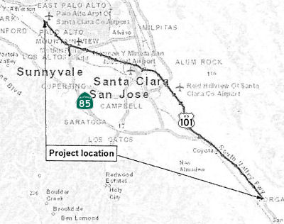 In October 2015, the CTC approved for future consideration of funding the US 101 Express Lanes
Project. This project in Santa Clara County will construct express lanes
on US 101 in both directions from East Dunne Avenue in Morgan Hill to the
Santa Clara/San Mateo County Line in Palo Alto (04-SCl-101, PM
16.00/52.55) and restripe a portion of Route 85 in Mountain View
(04-SCl-85, PM 23.0/R24.1). The project is not fully funded. The project
is programmed in the Santa Clara Valley Transportation Authority’s
Federal Transportation Improvement Program with local funds. The total
estimated cost is $431,000,000 for capital and support. Depending on the
availability of funds, construction is estimated to begin in Fiscal Year
2017/18.
In October 2015, the CTC approved for future consideration of funding the US 101 Express Lanes
Project. This project in Santa Clara County will construct express lanes
on US 101 in both directions from East Dunne Avenue in Morgan Hill to the
Santa Clara/San Mateo County Line in Palo Alto (04-SCl-101, PM
16.00/52.55) and restripe a portion of Route 85 in Mountain View
(04-SCl-85, PM 23.0/R24.1). The project is not fully funded. The project
is programmed in the Santa Clara Valley Transportation Authority’s
Federal Transportation Improvement Program with local funds. The total
estimated cost is $431,000,000 for capital and support. Depending on the
availability of funds, construction is estimated to begin in Fiscal Year
2017/18.
In October 2016, it was reported that Caltrans is
beginning to study a plan Thursday to link "managed lanes" on US 101 in
Santa Clara County to new ones in San Mateo County. Possibilities includes
converting existing carpool (HOV) lanes to express lanes and adding new
express lanes on US 101 between Whipple Road and the I-380 interchange in
San Mateo County. It could also include reconstructing ramp connections to
US 101 and installing electronic toll collection.
(Source: NBC Bay Area, 10/29/2016)
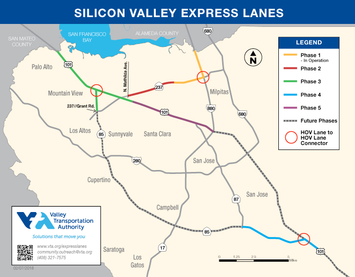 The 2018 STIP, approved at the CTC March 2018 meeting, also appears to create a number of PPNOs for this project. On US 101, there is PPNO 2015E US 101/Route 85 Silicon Valley Express Lns Program-Ph3; PPNO 2015J US 101
Silicon Valley Express Lns Program-Ph5-ETS; and PPNO 2015H US 101 Silicon
Valley Express Lns Program-Ph5-Civil. According to the VTA page on the program, the US 101 portion will convert 36 miles on US
101 to express lanes and add a second express lane for the majority of the
corridor from Dunne Avenue in Morgan Hill to the San Mateo County line.
The second express lane will provide a two-lane facility within urbanized
segments. The US 101 express lanes will connect with the Route 85 express
lanes in San Jose and convert US 101/Route 85 HOV direct connectors in
Mountain View to express lane connectors. Based on the map from VTA (see
above), Phase 3 runs from ~ SCL 43.909 (Lawrence Expwy) to the San Mateo
County Line. Phase 5 runs from I-880 to Lawrence Expwy (~ SCL 38.352 to
SCL 43.909). On Route 85, there is PPNO 2015F Route 85 Silicon Valley
Express Lns Program-Ph4-Civil; and 2015G Route 85 Silicon Valley Express
Lns Program-Ph4-ETS. According to the VTA page on the program, the Route 85 portion will convert approximately
24 miles of existing High Occupancy Vehicle (HOV or carpool) lanes to
express lanes and will add a second express lane between Route 87 and
I-280 in the median. The project will also convert the existing HOV direct
connector in south San Jose from US 101 to Route 85 to an express lane
connector. Based on the map from VTA (see above), Phase 4 includes the
portion on US 101 from 101 SCL R25.292 to SCL R26.873.
The 2018 STIP, approved at the CTC March 2018 meeting, also appears to create a number of PPNOs for this project. On US 101, there is PPNO 2015E US 101/Route 85 Silicon Valley Express Lns Program-Ph3; PPNO 2015J US 101
Silicon Valley Express Lns Program-Ph5-ETS; and PPNO 2015H US 101 Silicon
Valley Express Lns Program-Ph5-Civil. According to the VTA page on the program, the US 101 portion will convert 36 miles on US
101 to express lanes and add a second express lane for the majority of the
corridor from Dunne Avenue in Morgan Hill to the San Mateo County line.
The second express lane will provide a two-lane facility within urbanized
segments. The US 101 express lanes will connect with the Route 85 express
lanes in San Jose and convert US 101/Route 85 HOV direct connectors in
Mountain View to express lane connectors. Based on the map from VTA (see
above), Phase 3 runs from ~ SCL 43.909 (Lawrence Expwy) to the San Mateo
County Line. Phase 5 runs from I-880 to Lawrence Expwy (~ SCL 38.352 to
SCL 43.909). On Route 85, there is PPNO 2015F Route 85 Silicon Valley
Express Lns Program-Ph4-Civil; and 2015G Route 85 Silicon Valley Express
Lns Program-Ph4-ETS. According to the VTA page on the program, the Route 85 portion will convert approximately
24 miles of existing High Occupancy Vehicle (HOV or carpool) lanes to
express lanes and will add a second express lane between Route 87 and
I-280 in the median. The project will also convert the existing HOV direct
connector in south San Jose from US 101 to Route 85 to an express lane
connector. Based on the map from VTA (see above), Phase 4 includes the
portion on US 101 from 101 SCL R25.292 to SCL R26.873.
In May 2019, the CTC approved the following allocation
for a locally-administered STIP project: $10,589,000. 04-SCL-101 38.3/45.
US 101 Silicon Valley Express Lanes Program - Phase 5 Civil. Convert
existing HOV lanes to Express Lanes and add a second Express Lane in each
direction on US 101 from near Route 237 in Sunnyvale to I-880 in San Jose.
PPNO 04-2015H. PS&AE Funding. ProjID 0417000233.
(Source: May 2019 CTC Minutes, Agenda Item 2.5c.(2)
Item 2)
In December 2019, the CTC had the following allocation
on its agenda: 04-SCl-101 38.3/45.9. PPNO 2015J Proj ID 0417000233 EA
1K553. US 101 Silicon Valley Express Lanes Program - Phase 5 ETS. On US 101 from near Route 237 in Sunnyvale to I-880 in San Jose. Develop and
install Electronic Tolling System (ETS) infrastructure. PS&E
$10,188,000.
(Source: December 2019 CTC Agenda, Agenda Item
2.5c.(1) #1)
The 2020 STIP, approved by the CTC
in March 2020, contained the following programming related to this:
(Source: March 2020 CTC Agenda, Item 4.7, 2020 STIP
Adopted 3/25/2020)
| PPNO | Project | Prior | 20-21 | 21-22 | 22-23 | 23-24 | 24-25 |
| 2015E | Rt 101/85 Silicon Valley Express Lns Program-Ph3 (SCCP) | 14,268K | 0 | 0 | 0 | 0 | 0 |
| 2015F | Rt 85 Silicon Valley Express Lns Program-Ph4-Civil | 600K | 0 | 0 | 0 | 0 | 0 |
| 2015F | Rt 85 Silicon Valley Express Lns Program-Ph4-Civil | 2,300K | 0 | 0 | 0 | 0 | 0 |
| 2015G | Rt 85 Silicon Valley Express Lns Program-Ph4-ETS | 8,600K | 0 | 0 | 0 | 0 | 0 |
| 2015H | Rt101 Silicon Valley Express Lns Program-Ph5-Civil (APDE) | 10,589K | 0 | 0 | 0 | 0 | 0 |
| 2015H | Rt101 Silicon Valley Express Lns Program-Ph5-Civil | 0 | 4,754K | 0 | 3,207K | 0 | 0 |
| 2015J | Rt 101 Silicon Valley Express Lns Program-Ph5-ETS | 10,188K | 0 | 0 | 0 | 0 | 0 |
In May 2021, the CTC received notice that VTA proposes
to delete STIP construction (CON) funds from the Silicon Valley Express
Lanes Program – Phase 5 Civil project (PPNO 2015H) and reprogram
those funds to cover the Right of Way (RW) and construction funding
shortfall for the I-280 Soundwalls – Route 87 to the Los Gatos Creek
project (PPNO 0503J) in Santa Clara County. Currently $3,207,000 in
Regional Improvement Program (RIP) STIP funds are programmed in Fiscal
Year 2022-23 to the CON phase for the Silicon Valley Express Lanes Program
- Phase 5 Civil project. Based upon the latest design, the
construction cost for this project is estimated to be approximately $100
million. Last year, VTA applied for funding from the SB-1 Cycle 2
Programming for the Silicon Valley Express Lanes Program – Phase 5
Civil project, however, the project did not receive SB-1 funds. Due
to the unavailability of alternate funding, the CON phase remains
partially-funded, and STIP guidelines do not allow partially-funded
components. Therefore, VTA is requesting to delete CON funds and reprogram
those funds to cover the cost increase for the I-280 Soundwalls
project. Separately, the project is requesting a time extension for
allocation of already programmed RW funds for the Silicon Valley Express
Lanes Program – Phase 5 Civil project. The I-280 Soundwalls –
Route 87 to Los Gatos Creek project (PPNO 0503J) is currently programmed
in STIP for Environmental, Design, RW and CON phases. Due to the
COVID-19 impacts, both the RW and CON schedules have been delayed.
As a result of these delays and the escalation in costs based upon the
updated design information have resulted in cost increases for both RW and
CON. Therefore, VTA is requesting to re-program $3,207,000 RIP STIP
funds from the Silicon Valley Express Lanes Program – Phase 5 Civil
project to cover cost increases for the I-280 Soundwalls project as
follows: $644,000 for RW and $2,563,000 for CON.
(Source: May 2021 CTC Agenda, Agenda Item 2.1b.(1))
In June 2021, the CTC approved a request from the Santa
Clara Valley Transportation Authority to delete $3,207K in STIP
construction funds from the Silicon Valley Express Lanes Program - Phase 5
Civil project (US 101 SCL 38.300/45.900 PPNO 2015H EA 04-1K553) and
reprogram those funds to cover Right of Way and Construction funding
shortfall for the I-280 Soundwalls – Route 87 to Los Gatos Creek
project (I-280 SCL 2.500/3.200 PPNO 0503J EA 04-44840K) in Santa Clara
County.
(Source: June 2021 CTC Agenda, Agenda Item
2.1a.(3))
In May 2022, the CTC approved the following STIP
allocation: $4,754,000. 04-SCl-101 38.3/45.9. PPNO 04-2015H; ProjID
0417000233; EA 1K553. Silicon Valley Express Lanes Program - Phase 5
Civil. US 101 In the cities of Sunnyvale and San Jose. Convert
existing HOV Lanes to Express Lanes and construct a second Express Lane in
each direction on US 101 from near Route 237 in Sunnyvale to I-880 in San
Jose. Allocation: R/W $4,754,000.
(Source: May 2022 CTC Agenda, Agenda Item 2.5c.(2)
#1)
In May 2023, the CTC received notice of a forthcoming
STIP amendment that would delete the Construction (CON) phase for the the
Silicon Valley Express Lanes Program - Phase 5 Civil project (PPNO 2015H)
programmed with COVID-RIP funds of $7,099,000 in Fiscal Year 2023-24,
increase the CON phase funding programmed with Regional Improvement
Program (RIP) funds by $6,064,000 and delay CON to 2024-25. The Silicon
Valley Express Lanes Program - Phase 5 Civil project from near Route 237,
in the City of Sunnyvale to I-880, in the City of San Jose, will convert
existing high-occupancy vehicle lanes on US 101 to express lanes and add a
second express lane in each direction. VTA requested a construction year
change due to the following delays from unforeseen and extraordinary
circumstances beyond the implementing agency’s control. The funding
exchange is to ensure COVID-RIP funds are allocated by June 30, 2024. At
the June 2023 CTC meeting, the STIP amendment was approved.
(Source: May 2023 CTC Agenda, Agenda Item 2.1b.(12); June 2023 CTC
Agenda, Agenda Item 2.1a.(14))
In May 2010, Caltrans began a $24 million repaving of the 15-mile stretch
of US 101 from Route 85 in South San Jose (~ SCL R26.893) to the San Jose
airport (~ SCL 39.977). Crews will remove the top three inches of highway,
installing rubberized asphalt that will allow water to seep through the
pavement and drain off to the side of the road. It's a type of pavement
that greatly reduces visibility problems in the rain when water sprays off
tires. Caltrans hopes to repave nearly all eight lanes and 67 ramps by
Labor Day 2010. That will be the first of $300 million worth of upgrades
planned for US 101 through 2012. About $120 million is coming from state
bonds approved by voters in 2006, and gas taxes, local sales taxes and
stimulus funds will cover the rest. In Fall 2010, workers will begin
rebuilding the Tully Road interchange and adding an extra southbound lane
from Story Road to Capitol Expressway — a $60 million project
expected to take two years. In 2011, a third project will lengthen carpool
lanes and add merging lanes from the Route 85/US 101 interchange in
Mountain View to Palo Alto, a $103 million effort. Lastly, merging lanes
and updated metering equipment will be added from Palo Alto to Menlo Park
for an additional $113 million.
(Source: San Jose Mercury News, 5/6/10)
Yerba Buena Road (~ SCL 30.998) to I-280 (~ SCL 34.805) Widening
The SAFETEA-LU act, enacted in August 2005 as the reauthorization of TEA-21, authorized $4,000,000 for High Priority Project #2245: US 101 Corridor Improvements – I-280 to the Capitol-Yerba Buena Interchange.
In 2007, the CTC considered a number of requests for funding from the Corridor Mobility Improvement Account (CMIA). one request was funded: construction of auxiliary lanes from Route 85 to Embarcadero in Santa Clara County ($84.93M). Requests to widen the route from Yerba Buena to I-280/I-680 in Santa Clara County, and to widen the route from Route 25 to Monterey Rd in Santa Clara County were not recommended for funding. In August 2010, the CTC amended the CMIA baseline agreement for the US 101 Improvements (I-280 to Yerba Buena Road) project (PPNO 0460C) to update the project delivery schedule. Construction will now begin in September 2010 and complete in June 2013, with project close-out completing in June 2014.
In June 2011, it was reported that the California Transportation Commission has recommended allocating $24 million in state bonds for a $31.1 million project to realign the ramps and ease the merging issues that occur at the Capitol Expressway. Among the likely improvements: The ramp to north US 101 from Yerba Buena Road will be widened to two lanes with a metering light installed; a new ramp to north US 101 from the road between Yerba Buena and the expressway will be added, allowing traffic from Yerba Buena to enter the freeway before Capitol rather than merging with expressway ramp traffic; and the southbound US 101 off-ramp to Yerba Buena will be widened to two lanes and realigned to exit directly from US 101.
Tully Road Interchange Improvements (~ SCL 32.947)
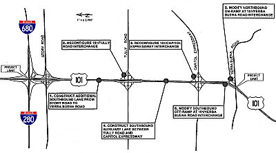 In October 2009, the CTC approved for future consideration of fuinding a project in Santa Clara
County that will construct one additional lane in the southbound direction
from south of the Story Road Interchange to south of the Capitol
Expressway Interchange, modify the Route 101/Tully Road Interchange to a
partial cloverleaf interchange, and rebuild the existing Tully Road
Overcrossing. The project is programmed in the Corridor Mobility
Improvement Account and the 2008 State Highway Operation and Protection
Program, and includes Federal Demonstration funds and local funds. Total
estimated project cost is $62,975,000, capital and support. Construction
is estimated to begin in Fiscal Year 2009-10. The scope as described for
the preferred alternative is consistent with the project scope set forth
in the approved project baseline agreement.
In October 2009, the CTC approved for future consideration of fuinding a project in Santa Clara
County that will construct one additional lane in the southbound direction
from south of the Story Road Interchange to south of the Capitol
Expressway Interchange, modify the Route 101/Tully Road Interchange to a
partial cloverleaf interchange, and rebuild the existing Tully Road
Overcrossing. The project is programmed in the Corridor Mobility
Improvement Account and the 2008 State Highway Operation and Protection
Program, and includes Federal Demonstration funds and local funds. Total
estimated project cost is $62,975,000, capital and support. Construction
is estimated to begin in Fiscal Year 2009-10. The scope as described for
the preferred alternative is consistent with the project scope set forth
in the approved project baseline agreement.
In January 2011, it was reported that work was beginning on the Tully Road interchange reconstruction. The first step was demolishing sections of the overpass that opened in the 1950s. The project is expected to cost $45 million and take 16 months. The project will include replacing some of the cloverleaf ramps with diagonal exits similar to those at Lawrence Expressway and US 101; addition of a merging lane on southbound US 101 between Tully and Capitol; addition of an additional lane southbound between Story Road and the expressway; and replacing and widening the Tully Road bridge with an additional lane in each direction, widening the shoulders to eight feet and raising the bridge to allow trucks to more easily pass underneath. Construction was to have begun in late 2011, but the state's budget delays pushed back the start until 2011. However, the delay and the recession resulted in a bid $10 million under the projected cost.
In June 2012, it was reported that Caltrans announced the completion of a $45 million project to relieve traffic congestion at Tully Road and US 101 in San Jose. The project constructed an additional lane on southbound US 101 from south of Story Road to north of the Capitol Expressway, and added a southbound merging lane from Tully Road to Capitol Expressway. In addition to the added lanes, the entire highway interchange at Tully Road was replaced and enhanced with traffic signals and wider off-ramps.
In June 2009, the CTC approved relinquishment of right of way in the city of San Jose along Route 101 near Alum Rock Avenue on N 31st Street (4-SCl-101-PM R35.8), consisting of a relocated or reconstructed city street and an adjoining nonmotorized transportation facility, namely a pedestrian walkway.
In September 2015, Mr. Roadshow was asked about the possiblity of
upgrading the I-880/US 101 interchange (~SCL 38.268) in San Jose; in
particular, this would involve creating flyovers in all directions
(including SB I-880 to NB US 101). Roadshow reported that the Valley
Transportation Authority estimates it would cost $1 billion to upgrade
this interchange. This is the most expensive highway project on the list
of 84 potential improvements in Santa Clara County by 2040.
(Source: San Jose Mercury News, 9/21/2015)
Highway Widening: Route 87 (~SCL 39.876) to Trimble Road (~ SCL 40.689)
In June 2001, the CTC had on its agenda addition of a northbound lane through San Jose, Route 87 (~SCL 39.876) to Trimble Road (~ SCL 40.689) in Santa Clara county. There are also plans to widen the route to 3-lanes + HOV each direction from Burnett Road to Route 85. In June 2002, plans were unveiled to widen the route from Marsh Road to Ralston Avenue in Belmont. The widening between Bernel Road to Burnett Road (four to eight lanes) is TCRP Project #3, requested by the Santa Clara Valley Transportation Authority. Per SB 1318, 9/28/10, this project was authorized for $25,000,000.
The addition of the northbound lane from Route 87 to Trimble Road is TCRP Project #5, again requested by the Santa Clara Valley Transportation Authority. According to a poster on m.t.r, in May 2003 new southbound lanes between Route 85 and Cochrane Road were completed making US 101 8 lanes (with variations of 10 lanes in certain spots) between San Francisco, all the way down to Morgan Hill for nearly 70 consecutive miles.
Route 87 SB Interchange Improvements: Route 87 (~SCL 39.876) to Trimble Road (~ SCL 40.689)
In September 2021, it was reported that construction
was starting on the $75 million job from Trimble Road to 87. It will
enable drivers to go from SB US 101 to SB Route 87 from the two right
lanes rather than just one. Work could take four years. In addition, the
project will:
(Source: SJ Mercury News, 9/27/2021)
In September 2022, it was reported that the road work
to add a second exit lane (that is, you can now exit from the right-most
through lane of SB US 101, in addition to the exit-only lane) to the US 101-Route 87 southbound interchange in San Jose seems to be complete.
(Source: AARoads, "[San Jose, CA] US-101S to CA-87S two-lane exit completed", 9/13/2022)
In June 2006, the CTC considered relinquishment of right of way in the city of San Jose, at Channing Avenue and Seaboard Avenue (04-SCL-101-PM 40.5), consisting of reconstructed and relocated city streets, frontage roads and cul-de-sacs.
Trimble Road / De La Cruz Road Interchange (~ SCL 40.714)
 In November 2018, it was reported that there are plans to redesign the
Trimble Road / De La Cruz Road Interchange (~ SCL 40.714) now that the
lawsuit over the Measure B transportation tax has been thrown out. The
project is in the design phase and VTA anticipates that it will be fully
funded once Measure B funds are available. Design is anticipated to be
completed in summer 2020 and construction in late 2022.
In November 2018, it was reported that there are plans to redesign the
Trimble Road / De La Cruz Road Interchange (~ SCL 40.714) now that the
lawsuit over the Measure B transportation tax has been thrown out. The
project is in the design phase and VTA anticipates that it will be fully
funded once Measure B funds are available. Design is anticipated to be
completed in summer 2020 and construction in late 2022.
(Source: Mercury News - Mr. Roadshow, 11/27/2018; Image source: The Bay Link, 3/5/2021)
In December 2020, it was reported that the CTC approved
$25 million for improvements to the US 101/De La Cruz/Trimble interchange
just north of the Mineta San Jose International Airport in Santa Clara
County.
(Source: The Bay Link, 12/3/2020)
In February 2021, it was reported that construction
would begin in Summer 2021 on the US 101/De La Cruz Interchange project.
This is a 2016 Measure B-funded project being done by VTA and the City of
San Jose, in cooperation with the California Department of Transportation
(Caltrans). The purpose of this project is to improve traffic flow and
enhance safety for vehicles merging onto southbound US 101 from the De La
Cruz Boulevard/Trimble Road interchange, and to upgrade mobility and
safety for bicyclists and pedestrians traveling over the highway and by
the interchange ramps adjacent to the San Jose International Airport. The
problem is that the 60-year-old interchange does not meet current design
standards in an area that continues to experience increased
growth-producing higher traffic volumes during normal conditions.
Increased congestion along the Trimble Road/De La Cruz Boulevard
overcrossing is due to the lane reductions from six-lanes to four-lanes on
the north and south sides of the overcrossing. Safety is also a main
concern for bicyclists that must merge and share lanes with vehicles
across the bridge structure with a minimal buffer between the walkway and
the roadway. The proposed improvements will include, but are not limited
to the following:
(Source: VTA Blog, 2/25/2021; The Bay Link, 3/5/2021)
In May 2021, the CTC approved an allocation of
$25,000,000 for the locally-administered SB 1 LPP (Competitive) US 101/De La Cruz Boulevard/Trimble Road Interchange Improvements project
(PPNO 0462J; ProjID 0400000740; EA 26470). 04-SCl-101 40.4/41.0. US 101/De La Cruz Boulevard/Trimble Road Interchange Improvements.
In the City of San Jose, on De La Cruz Boulevard/Trimble Road, construct
improvements including on and off ramp improvements at US 101 (from the
interchange to 0.3 miles in each direction). The project proposes to
reconstruct the US 101/De La Cruz Blvd/Trimble Rd interchange to help
alleviate traffic congestion, improve traffic operations and safety,
enhance accessibility for pedestrians and bicyclists, and increase the
capacity of the overcrossing arterial and some of the interchange ramps.
The total length of of the project is 1.9 miles. CONST $25,000,000.
(Source: May 2021 CTC Agenda, Agenda Item 2.5s.(2))
The SAFETEA-LU act, enacted in August 2005 as the reauthorization of TEA-21, authorized $4,000,000 for High Priority Project #943: US 101 Operational Improvements in San Jose.
Matilda Monster (Route 237/US 101 Interchange, (04-SCl-237, PM 2.7/3.3, 04-SCl-101, PM 45.2/45.8))
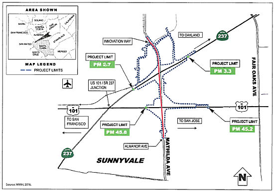 In August 2018, it was reported that the VTA will approve the final pieces of a funding package
in September 2018 to begin construction of a new $48 million interchange
for the Mathilda Monster at US 101 and Route 237. Work could begin by late
December 2018, and, if all goes well, be done by the end of 2019. This
includes widening Mathilda to three lanes, new stop lights and better
ramps. Design is complete, however there is a $17 million deficit with the
delay in Measure B funding. That half-cent sales tax is hung up in a
lawsuit.
In August 2018, it was reported that the VTA will approve the final pieces of a funding package
in September 2018 to begin construction of a new $48 million interchange
for the Mathilda Monster at US 101 and Route 237. Work could begin by late
December 2018, and, if all goes well, be done by the end of 2019. This
includes widening Mathilda to three lanes, new stop lights and better
ramps. Design is complete, however there is a $17 million deficit with the
delay in Measure B funding. That half-cent sales tax is hung up in a
lawsuit.
(Source: Mercury News, 8/14/2018)
In August 2018, the CTC approved for future
consideration of funding the following project for which a Final
Environmental Impact Report (FEIR) has been completed: Route 237 and US 101 in Santa Clara County (04-SCl-237, PM 2.7/3.3, 04-SCl-101, PM
45.2/45.8). Construct roadway improvements on a portion of Route 237 and
US 101 in the city of Sunnyvale. (PPNO 0462H) This project proposes to
improve Mathilda Avenue in the city of Sunnyvale in Santa Clara County,
from the Almanor Avenue/Ahwanee Avenue Interchange to Innovation Way. The
project proposes to improve the on and off ramps at the Route 237/Mathilda
Avenue and US 101/Mathilda Avenue Interchanges. Also proposed in the
project are new retaining walls, reconstruction of sound walls,
signalization of intersections, new left-turn lanes, modifications to
bicycle and pedestrian facilities, storm water treatment facilities,
street lighting, ramp metering, signage and light rail crossing
facilities. The proposed project is estimated to cost in total
approximately $42 million. Funding sources are anticipated to be from
various local funds. The project is estimated to begin construction in
2018. Additionally, the August CTC meeting approved an allocation of
$17,000,000 for the locally-administered Senate Bill 1 (SB 1) Local
Partnership Program (LPP) (Competitive) Mathilda Avenue Improvements at
Route 237 and US 101 project (PPNO 0462H), in Santa Clara County.
(Source: August 2018 CTC Agenda Item 2.2c.(11),
Agenda Item 2.5s.(2))
HOT/Carpool Lanes - Route 237 (~ SCL 46.21) or Redwood City (~ SM 6.619) to I-380 (~ SM R20.695) and South San Francisco (~ SM 22.711) to San Francisco (~ SM 26.107/SF 0.0)
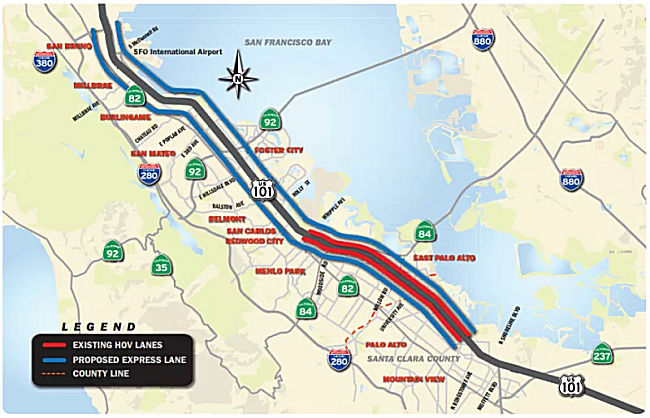 In June 2015, it was reported that the City/County Association of Governments
(C/CAG) has decided to move forward with securing $16.5 million in grants
to study the feasibility of adding auxiliary, carpool and toll lanes to
ease traffic on US 101. The C/CAG board approved two resolutions Thursday,
June 11, 2015 to apply for Measure A highway funds to study adding
auxiliary lanes from Oyster Point in South San Francisco north to San
Francisco and carpool/toll lanes from Whipple Avenue in Redwood City to
the I-380 interchange. Traffic is so bad on US 101, that Assemblyman Kevin
Mullin, D-South San Francisco, introduced legislation in February 2015 to
develop a strategy to tame traffic as the rebounding economy has led to
slower commutes. Mullin’s AB378 makes congestion relief on the
48-mile stretch of highway between San Francisco and San Jose a priority.
The bill declares that the corridor is the most economically productive
and important stretch of highway in the state and that its transportation
capacity is “grossly insufficient” to serve the “growing
number of commuters.”
In June 2015, it was reported that the City/County Association of Governments
(C/CAG) has decided to move forward with securing $16.5 million in grants
to study the feasibility of adding auxiliary, carpool and toll lanes to
ease traffic on US 101. The C/CAG board approved two resolutions Thursday,
June 11, 2015 to apply for Measure A highway funds to study adding
auxiliary lanes from Oyster Point in South San Francisco north to San
Francisco and carpool/toll lanes from Whipple Avenue in Redwood City to
the I-380 interchange. Traffic is so bad on US 101, that Assemblyman Kevin
Mullin, D-South San Francisco, introduced legislation in February 2015 to
develop a strategy to tame traffic as the rebounding economy has led to
slower commutes. Mullin’s AB378 makes congestion relief on the
48-mile stretch of highway between San Francisco and San Jose a priority.
The bill declares that the corridor is the most economically productive
and important stretch of highway in the state and that its transportation
capacity is “grossly insufficient” to serve the “growing
number of commuters.”
(Source: SM Daily Journal, 6/18/2015)
In October 2015, it was reported that the San Mateo
County Transportation Authority allocated $22 million to help fund the
environmental review phase of four other projects along the San
Mateo’s segment of US 101. Projects include extending an HOV or
commuter lane from Whipple Avenue to the San Mateo County and San
Francisco border, as well as consideration of an auxiliary lane dedicated
to those exiting US 101 somewhere between I-380 and the northern border of
the county.
(Source: San Mateo Daily Journal, 10/2/2015)
In November 2015, it was reported that the C/CAG board
is seeking $9.4 million from the Metropolitan Transportation Commission to
conduct the preliminary environmental and design work needed before any
potential construction can actually take place on the corridor. C/CAG has
also requested another $8.5 million from the San Mateo County
Transportation Authority for the environmental phase of the project. The
plan now is to bring the lanes south from the Santa Clara County border
north to I-380 in San Bruno.
(Source: San Mateo Daily Journal, 11/27/2015)
In July 2016, it was reported that a shuffling of
federal funds, once committed to a series of projects that are
languishing, are being redirected to the express lane effort through San
Mateo County to the San Francisco city line. Caltrans still needs to
approve the idea, however regional transportation officials endorsed the
$8.9 million funding shift. That won’t be nearly enough to build the
lanes, but it will get the project started by paying for the planning,
engineering and required environmental studies. It replaces about $9.6
million that was set aside for the study back in May by the CTC, but
subsequently pulled due to a drop in state gas tax revenue. Additionally,
in August 2016, an additional $3 million in private funds was received
from the San Mateo County Economic Development Association, or SAMCEDA.
The Bay Area Council has been working with transportation leaders to push
for carpool or express lanes on US 101 into San Francisco. Caltrans has
agreed, he said, to begin engineering and design work for the US 101 lanes
as environmental studies are being done. That should cut the time to
complete the work from as much as 10 years to as little as five. The big
challenge is finding the money to build the lanes. State and federal funds
for transportation projects are declining, which puts more pressure on Bay
Area counties and the region to pay for its own improvements while hoping
the state comes up with a transportation funding plan. Engineers will
consider a variety of options, including converting an unrestricted lane
into a carpool lane, a move that would be unpopular with single-occupant
drivers. Or they might combine and connect a series of short lanes between
on- and off-ramps and by building on shoulders.
(Source: SF Gate, 7/13/2016; SanMateo
Daily Journal, 7/18/2016; San Mateo Daily Journal, 8/16/2016)
In June 2017, an update was provided on the
environmental review related to the widening of US 101 in San Mateo
County. Widening the freeway by adding express lines incentivizes the
movement from single occupancy cars to higher occupancy vehicles, but also
does exactly the opposite, creating more space for more single occupancy
vehicles – Caltrans is expecting the number of vehicles on US 101 to
jump from between 4 and 7 percent in just the next three years. Most of
the update addressed how ten through lanes can be squeezed into the
limited space available, a strong hint that county and state officials
favor widening the highway rather than addressing congestion by providing
better bus and carpool services. “An auxiliary lane begins and ends
at on and off ramps, it doesn’t go through… we actually will
literally pave through the interchange and connect the auxiliary lanes to
create a through lane,” explained the presenter. “We are
actually looking at re-aligning the freeway, taking the center line and
moving it, typically to the west, and what that allows us to do is create
more width.” Caltrans officials are at least allowing an option that
would avoid widening the highway but still provide increased capacity by
converting an existing lane in each direction to an express lane to be
studied the project’s environmental impact report, although the
focus of the planning work so far indicates they aren’t serious
about that option. Converting existing lanes to express lanes rather than
widening US 101 would save about $200 million, money that could be spent
on boosting SamTrans’s bus service, further Caltrain upgrades beyond
electrification, and other transportation demand management programs in
San Mateo County. But officials were silent at the meeting on the details
of how transit could help alleviate traffic congestion, or how to pay for
better transit, only stating that a separate study of highway bus service
had just begun. The current $11.5 million environmental impact report for
express lanes on US 101 in San Mateo County is expected to be finished in
January 2018.
(Source: SF Streets Blog, 6/2/2017)
The 2018 STIP, approved at the CTC March 2018 meeting, appears to allocate $33.5M for PPNO 0658D, Managed Lanes, 22 mi (Matadero Creek-Rt 380) (SCL 051.37 to ~ SM R20.695). R/W was programmed prior to FY18-19 for $16M; construction support for $17.5M appears to be in FY20-21.
In April 2018, it was reported the that effort to bring
express lanes to the stretch of US 101 that runs through San Mateo County
has taken a step toward the design phase despite persisting concern about
charging tolls to drive on those lanes. C/CAG voted 10-6 on April 12, 2018
to approve a memorandum of understanding and cooperative agreements for
the managed lanes project, which is currently in the final stages of the
environmental review process. The $514 million proposal, which has been in
the works for years, would create a new express lane in each direction on
US 101 from Whipple Avenue in Redwood City to I-380 in San Bruno for
carpoolers and those willing to pay. The 14-mile stretch of highway could
include up to seven zones with fluctuating tolls based on demand, though
rates have yet to be determined. Solo drivers would pay full price,
two-person carpools and clean energy vehicles may see a discount and
carpools of three or more along with buses and motorcycles would ride
free. The plan includes connecting existing auxiliary lanes to create a
new lane while squeezing every possible inch of available space. The far
left lane in each direction would then be converted into a managed lane
with commensurate signs and real-time surveillance equipment installed.
(Source: San Mateo Daily Journal, 4/20/2018)
In May 2018, it was reported that largest of the
CTC’s SB 1 awards for the Bay Area is a $233 million commitment to
Caltrans and the Santa Clara Valley Transportation Authority (VTA) through
the Solutions for Congested Corridors program to establish express lanes
along both directions of US 101 between Route 237 in Mountain View through
San Mateo County to I-380 near San Francisco International Airport. Other
partners in development of the US 101 express lanes include the
City/County Association of Governments of San Mateo County, SamTrans and
the San Mateo County Transportation Authority.
(Source: MTC News Release, 5/16/2018)
In May 2018, it was reported that the California
Transportation Commission has approved $351 million for a number of
improvements, including adding express lanes on US 101 from Route 237 to
I-380 (discussed in more detail below), and rebuilding the US 101/Route 237 interchange at Mathilda Avenue (~ SCL 45.826), and other projects. The
“Mathilda Monster” in Sunnyvale — a dubious nickname for
the 101-237 interchange for more than three decades, where several ramps
and numerous traffic signals cause gridlock and constant lane changing in
a few hundred feet — may finally be tamed. Construction could begin
by the end of the year and finish by 2021.
(Source: East Bay Times, 5/18/2018)
In the SB1 Project List, as of June 2018, under the Solutions for Congested Corridors Program program, the following appears: San Mateo and Santa Clara US 101 Managed Lanes Project: Construct a continous managed lane in each direction on US 101 from Route 237 to I-380 by converting existing High Occupancy Vehicle (HOV) lanes to Express Lanes between Route 237 and Whipple Avenue and constructing new managed lanes where they currently do not exist between Whipple Avenue and I-380. It will also convert the existing HOV lanes on HOV lane direct connector ramps. $233,200,000.
In July 2018, it was reported that, in parallel with
the final stages of the environmental review phase, San Mateo officials
were determining the agency or combination of agencies that will own and
operate it the express lanes, as well as the potential toll rates for the
proposed express lanes and the revenue they could generate. Several board
members, for example, were surprised and less than thrilled to learn that
they will only be choosing between no project or express lanes moving
forward. Past alternatives, such as carpool lanes, are now off the table.
While toll policies haven’t been decided and prices would fluctuate,
Leo Scott, a consultant with Gray-Bowen-Scott, said estimates suggest
tolls would average nearly $1 per mile on the stretch of US 101 in San
Mateo County, which is on the cheaper end compared to express lanes
elsewhere in the nation. The immediate decision facing the board is what
agency will own and operate San Mateo County’s express lanes if
they’re installed. Scott said the decision is needed now because the
owner determines the operator and the operator’s input is needed
during the design phase, which is “progressing rapidly.” The
owner would own the tolling equipment and related highway infrastructure,
set policy and rates and pay for the operation and maintenance of the
facility, among other duties. They’re also responsible for
liabilities. The operator, on the other hand, would manage day-to-day
operations and maintenance. The board can create its own agency to own and
operate the facility or it could outsource the operator role to the Santa
Clara Valley Transportation Authority. Another option is to hand the reins
over to the Metropolitan Transportation Commission, in which case it would
both own and operate the express lanes, per MTC’s policy. The
environmental review for Managed Lanes is expected to wrap up in October
and the design phase in the summer of 2019, while the entire project is
scheduled to be complete by 2021.
(Source: San Mateo Daily Journal, 7/16/2018)
In August 2018, it was reported that there was some
opposition to the lanes. Santa Clara County Board of Supervisors President
Joe Simitian said the proposal to add toll lanes to major freeways emerged
when he sat on a transportation committee as a state senator. He had a bad
feeling about the lingering financial effects the fees would have on
residents who already had a hard time balancing the expenses of living in
Silicon Valley. “I was concerned that folks who were beginning to
look at freeways as revenue sources may squeeze out those who could not
afford additional fees,” Simitian said. “There was a potential
to create two Californias – one for folks who are prosperous and one
for folks of modest means. Those who couldn’t afford the fees would
be stuck with a second-tier infrastructure.” The financial model
behind the toll lanes adds up in Simitian’s mind, but that
doesn’t mean he supports it.
(Source: Los Altos Town Crier, 8/8/2018)
In August 2018, it was also reported that Foster City
Council has come out against the idea of putting toll lanes on US 101
— and Mountain View Mayor Lenny Siegel and San Mateo County
Supervisor David Canepa share that view. In a letter sent Wednesday (Aug.
15) to Caltrans, the San Mateo County Board of Supervisors and the San
Mateo County City/County Association of Governments, Mayor Sam Hindi wrote
that council doesn’t want to see the agency allow single-occupancy
vehicles to pay to use express lanes. Hindi also said charging to drive in
fast lanes would further burden poor residents whose housing costs have
continued to rise. Hindi suggested that Caltrans accommodate more
high-capacity vehicles in additional carpool lanes instead. Siegel, the
Mountain View mayor, sent a letter to Caltrans about the toll lanes,
saying the project would slam Mountain View with traffic from all of the
solo drivers. He’s concerned the toll lanes may entice tech workers
to pay to drive in express lanes rather than take the bus.
(Source: Palo Alto Daily Post, 8/20/2018)
In August 2018, the CTC approved an advanced allocation
of $47,468,000 for the locally-administered multi-funded SB 1 SCCP/STIP
Silicon Valley Express Lanes Program – Phase 3 project (PPNO 2015E),
programmed in FY 2019-20. All advanced funding will be deducted from
future year capacity. This project is located on US 101 from Route 237 to
the Santa Clara/San Mateo county line and on Route 85 from Route 237 to
the Route 85/US 101 interchange: The project will (1) Convert existing
single carpool lanes to express lanes at the following locations:[a] US 101 from near Route 237 north to Route 85 (in Mountain View) [b] Route 85
from Route 237 north to US 101 (in Mountain View) including the existing
US 101/Route 85 carpool lane-to-carpool lane direct connector ramps and
(2) Convert existing double carpool lanes to double express lanes on US 101 from Route 85 (in Mountain View) to the San Mateo County line in Palo
Alto. 04-SCl-101/85 45.9/52.5 - 22.3/23.9.
(Source: August 2018 CTC Agenda Item 2.5s.(8))
In September 2018, the governor signed legislation
authorizing the Santa Clara Transportation Valley Transportation Authority
(VTA) to apply to the commission pursuant to the provisions to conduct,
administer, and operate HOT lanes or other toll facilities on US 101 and a
specified portion of Route 280 in the City and County of San Francisco if
the San Francisco County Transportation Authority (SFCTA) approves the
facilities before VTA submits an application to the commission for
approval. The bill would require VTA to conduct, administer, and operate
the facility in coordination with SFCTA. The bill would require SFCTA, in
collaboration with the department and VTA, to develop the expenditure plan
and would require the governing board of SFCTA to review and approve the
expenditure plan and any updates.
(Source: AB 2865, Chapter 501, 9/18/2018)
In December 2018, it was reported that local
policymakers are divided as to who should own and operate tolled express
lanes proposed for US 101, and the choice is often described as that
between local and regional control. The two remaining options on the table
are to have San Mateo County own the express lanes and have the Santa
Clara Valley Transportation Authority operate them, or to hand over
ownership and operation duties to the Bay Area Infrastructure Financing
Authority, a joint powers authority between the Metropolitan
Transportation Commission and the Bay Area Toll Authority. BAIFA manages
other express lanes, including I-680 in Contra Costa County. The owner and
operator decision is up to both the San Mateo County Transportation
Authority, which oversees the county’s sales tax revenue earmarked
for transportation, and the City/County Association of Governments. C/CAG
is a joint powers authority comprised of board members representing each
city and the county that works on quality of life issues such as air
quality and transportation, among others.
(Source: San Mateo Daily Journal, 12/17/2018)
In December 2018, the CTC approved for future consideration of funding the U.S. Highway 101 Managed Lanes Project,04-SCL-101, PM 50.6/52.6, 04-SM-101, PM 0.0/21.8. This project is located on US 101 within cities of San Carlos, Millbrae, Burlingame, San Mateo, Menlo Park, Palo Alto and Belmont in San Mateo and Santa Clara Counties. The project proposes to provide continuous traffic management in each direction on US 101 in Santa Clara County by providing express lanes and transportation options within the project corridor and region. Transportation options include encouragement of carpooling, public transit and new technology and/or design features to assist traffic management. The funding for the proposed project is anticipated from various resources including Federal Earmark funds, Local Measure funds, Regional Toll revenue, Senate Bill 1 funds, State Transportation Improvement Program funds and private sector funds. The proposed project is estimated to cost approximately $514.3 million, is fully funded and programmed for that amount. Construction is estimated to begin in Fiscal Year 2019-20. A copy of the FEIR has been provided to Commission staff. Resources that may be impacted by the project include visual/aesthetics, cultural, hydrology, water quality, geology/soils, hazardous materials, air quality, noise, and biological resources.
The CTC also received an informational report that
Department, San Mateo County Transportation Authority (SMCTA) and the
City/County Association of Governments (C/CAG) proposed to amend the San
Mateo and Santa Clara US 101 Managed Lanes Project (PPNO 0658D) to
split-out a portion of the scope of work into a new segment for early
delivery. Specifically, they proposed to accelerate the overall delivery
commitment of the US 101 Managed Lanes project by delivering a portion of
the project scope early. Of the 44 lanemiles of managed lanes to be
constructed, 15.6 lane-miles involves mostly reconstruction of the median
and restriping of the existing lanes, along with installing infrastructure
needed for operation of the express lanes; no roadway widening or utility
relocation efforts are needed in this section. Early delivery of this
segment (15.6 lane-miles), combined with the delivery of the adjacent
Silicon Valley Express Lanes project (19.3 lane-miles), will provide much
needed relief to the travelling public by providing a combined total of
34.9 lane-miles of express lanes between these two contracts. They also
proposed splitting the overall US 101 Managed Lanes project into two
segments:
(Source: December 2018 CTC Minutes, Agenda Item
2.2c(5); Agenda Item 2.1b(2))
In January 2019, it was reported that new offers,
demands and concerns are continuing to surface as local policymakers work
out the owner/operator arrangement for the express lanes planned for the
San Mateo County section of US 101. The back-and-forth is picking up as a
deadline looms that, if not met, will add time and cost to the $514
million project aiming for completion by the middle of 2022. The owner of
the tolling facility gets to implement an equity program if it wants to
make the express lanes more affordable for low-income drivers, and it also
sets tolling policies. Questions for the future owner include: Should
there be a cap for tolls so that they never exceed a certain dollar
amount? Should carpools of two people ride free or at a discount and
should clean air vehicles such as Teslas also ride free on express lanes?
The TA appears ready to vote on the local ownership approach with BAIFA as
the operator while C/CAG appears somewhat more divided on the matter. Some
members, it seems, are still interested in making BAIFA both the owner and
operator, though most have expressed interest for one of the two local
control options.
(Source: San Mateo Daily Journal, 1/22/2019)
Later in January 2019, it was reported that agreement
on the operation of the managed lanes was finally reached.The preferred
arrangement would ensure local control is retained. Local control in this
context means the City/County Association of Governments and the San Mateo
County Transportation Authority would both own the tolling facility coming
to the stretch of US 101 in San Mateo County and the Bay Area
Infrastructure Financing Authority would operate it. That arrangement was
unanimously selected by an ad-hoc subcommittee comprised of C/CAG and TA
members at a meeting in late January before both boards cast final votes
mid-February. Now that the subcommittee agreed to maintain local control
of the tolling facility, the C/CAG and TA boards have to determine how
they will share ownership. Creating a joint powers authority between both
boards has been suggested numerous times, but that’s just one
potential approach. The subcommittee agreed to hold another meeting at the
beginning of February to discuss potential power-sharing arrangements
before C/CAG and the TA vote on the owner/operator in mid-February.
(Source: San Mateo Daily Journal, 1/26/2019)
In January 2019, the CTC approved amending the San
Mateo and Santa Clara US 101 Managed Lanes Project (PPNO 0658D) in San
Mateo/Santa Clara Counties, to split-out a portion of the scope of work
into a new segment for early delivery, as described and noticed above in
December 2018. They also approved an allocation of $2,027,000 for the
State-Administered US 101 Managed Lanes Project – Northern Segment
(04-SCL, SM-101 50.6/52.5, 0.0/21.8) Senate Bill 1 (SB 1) Local
Partnership Program (LPP) – Formulaic project (PPNO 0658D), on the
State Highway System, in San Mateo and Santa Clara Counties.
(Source: January 2019 CTC Minutes, Agenda Item
2.1a(2); January 2019 CTC Minutes Agenda Item 2.5s.(1a))
In February 2019, it was reported that the operation
question was finally settled. The owner/operator arrangement for the
Managed Lanes project is now official after unanimous votes by both C/CAG
and the TA. Ownership of the tolled express lane facility coming to US 101
in San Mateo County belongs to both the San Mateo County Transportation
Authority and City/County Association of Governments, and those agencies
will contract with the Bay Area Infrastructure Financing Authority to
operate the facility. C/CAG and the TA also voted to create a joint powers
authority to make policy decisions related to the express lane facility
and that JPA will be comprised of an equal number of members from the TA
and C/CAG. The half-a-billion-dollar Managed Lanes project aimed for
completion by 2022 will construct a new lane in each direction of US 101
in San Mateo County and then the far left lane in each direction will be
converted to a tolled express lane with real-time surveillance equipment.
Such a facility promises speeds of 45 mph at all times on the express
lanes, which will be free for buses and carpools of three people or more,
but other motorists who choose to use those lanes will have to pay a toll.
Tolls will fluctuate based on traffic volumes, but initial projections
suggest prices will average $1 per mile in San Mateo County.
(Source: San Mateo Daily Journal, 2/16/2019)
In March 2019, Caltrans was promising traffic
congestion relief in three years (i.e, by 2022), through the $567 million
project that will bring new express lanes to the Bayshore Freeway from
Redwood City south of Whipple Ave. to the I-380/US 101 interchange in the
South San Francisco/San Bruno area, just north of San Francisco
International. Existing HOV lanes from Redwood City south to the Route 237/US 101 interchange in Sunnyvale will be covered to express lanes.
About half of the cost is being covered by Senate Bill 1, which provides
$54 billion for road maintenance and rehabilitation and for congestion
relief. Completion date will be in 2022. An estimated two million vehicles
use this stretch of US 101 on a weekly basis.
(Source: ABC7, 3/8/2019)
In October 2019, AB 919 (Chapter 497, 10/3/2019) amended Section 149.6 of the Streets and Highways Code to read (relevant portions shown, some details on bonds and allocation of funding omitted):
149.6. (a) Notwithstanding Sections 149, 149.7, and 30800, and Section 21655.5 of the Vehicle Code, the Santa Clara Valley Transportation Authority (VTA) created by the Santa Clara Valley Transportation Authority Act (Part 12 (commencing with Section 100000) of Division 10 of the Public Utilities Code) may conduct, administer, and operate a value pricing program on any two of the transportation corridors included in the high-occupancy vehicle lane system in the County of Santa Clara in coordination with the Metropolitan Transportation Commission and consistent with Section 21655.6 of the Vehicle Code.
(b) Notwithstanding Sections 149, 149.7 and 30800, and Section 21655.5 of the Vehicle Code, VTA may conduct, administer, and operate a value pricing program on State Highway Route 101 in San Mateo County in coordination with the City/County Association of Governments of San Mateo County and with the San Mateo County Transportation Authority and consistent with Section 21655.6 of the Vehicle Code.
(c) (1) VTA, under the circumstances described in subdivisions (a) and (b), may direct and authorize the entry and use of those high-occupancy vehicle lanes by single-occupant vehicles for a fee. The fee structure shall be established from time to time by VTA. A high-occupancy vehicle lane may only be operated as a high-occupancy toll (HOT) lane during the hours that the lane is otherwise restricted to use by high-occupancy vehicles.
(2) VTA shall enter into a cooperative agreement with the Bay Area Toll Authority to operate and manage the electronic toll collection system.
(d) With the consent of the department, VTA shall establish appropriate performance measures, such as speed or travel times, for the purpose of ensuring optimal use of the HOT lanes by high-occupancy vehicles without adversely affecting other traffic on the state highway system. Unrestricted access to the lanes by high-occupancy vehicles shall be available at all times, except that those high-occupancy vehicles may be required to have an electronic transponder or other electronic device for enforcement purposes. At least annually, the department shall audit the performance during peak traffic hours and report the results of that audit at meetings of the program management team.
(e) Single-occupant vehicles that are certified or authorized by VTA for entry into, and use of, the high-occupancy vehicle lanes in the County of Santa Clara and San Mateo County are exempt from Section 21655.5 of the Vehicle Code, and the driver shall not be in violation of the Vehicle Code because of that entry and use.
(f) VTA shall carry out a value pricing program established pursuant to this section in cooperation with the department pursuant to an agreement that addresses all matters related to design, construction, maintenance, and operation of state highway system facilities in connection with the value pricing program. An agreement to carry out the program authorized pursuant to subdivision (b) shall be subject to the review and approval by the City/County Association of Governments of San Mateo County and the San Mateo County Transportation Authority. [...]
In December 2019, the CTC had on its agenda a proposal
to document the delivery of the total scope of work for the US 101 Managed
Lanes Project – North Segment (PPNO 0658D) in San Mateo County in
three separate contracts: 1) Construction of express lanes, 2) Tolling
system integration, and 3) Follow-up landscaping work. The project
received a construction allocation at the October 2019 Commission meeting.
The US 101 Managed Lanes project was adopted into the SCCP and LPP at the
May 2018 Commission meeting. The project scope consists of constructing 22
miles of managed lanes in each direction, from south of the Santa Clara
county line to just north of I-380 Since the scope of work for the
southern portion of the overall project consisted mainly of converting the
existing high occupancy vehicle (HOV) lanes into express lanes, the
project delivery team recognized an opportunity to early-deliver this
southern segment. An early delivery of this segment, combined with the
delivery of the adjacent SB 1 funded Silicon Valley Express Lanes project,
will offer much-needed relief to the travelling public earlier than
originally planned. At its December 2018 meeting, the Commission approved
splitting the overall US 101 Managed Lanes project into two segments (as
noted above): (1) US 101 Managed Lanes – North Segment (from Whipple
Avenue to just north of I-380; PPNO 0658D), and (2) US 101 Managed Lanes
– South Segment (from south of the county line to Wipple Avenue
Interchange; PPNO 0658H). The south segment also received an allocation of
construction funds at the December 2018 meeting and is currently under
construction. The US 101 Managed Lanes – North Segment (PPNO 0658D)
received an allocation of construction funds at the October 2019
Commission meeting, and follow-up landscaping project (PPNO 0658J) was
also split-off at the time of this allocation. Along with the construction
of express lanes, the north segment scope of work also includes the
development, installation and testing of the tolling system. That
contract, to be funded solely with local funds, will be administrated as a
separate contract. At its August 2019 meeting, the Commission approved an
application from the San Mateo County Express Lanes Joint Powers Authority
(JPA) to develop and operate a high-occupancy toll facility for this
project. The San Mateo County Transportation Authority (SMCTA) will be the
implementing agency for this tolling system integration contract. This
amendment splits off that tolling system integration, giving:
(Source: December 2019 CTC Agenda, Agenda Item
2.1s.(3))
In February 2020, it was reported that project
construction from Whipple Avenue to I-380 in San Mateo County is underway.
Construction activities on US 101 from Whipple Avenue (in Redwood City) to
I-380 (in South San Francisco) will include removing vegetation,
installing a Smart Traffic System of changeable message signs placed in
the construction zone that shows real-time traffic conditions, installing
environmentally-sensitive area fencing, and temporary freeway striping.
This work will occur on the freeway lanes, shoulders, and ramps. South of
Whipple Avenue, construction activities on US 101 from San Antonio Road
(in Palo Alto) to Whipple Avenue (in Redwood City) will include minor
construction activities to connect to existing electrical connections and
install landscape mulching. This will include work on the freeway
shoulders and ramps. Future construction activities will include
continuing vegetation removal activities, installing erosion control
protection, installing environmentally-sensitive area fencing, installing
concrete barriers next to the travel lanes, temporary freeway striping,
setting up a Smart Traffic System, installing construction/detour signs
north of Whipple Avenue, and installing temporary loop detectors. In
addition, permanent striping, and erosion control will be finishing south
of Whipple Ave.
(Source: Patch, 2/24/2020)
The 2020 STIP, approved at the March 2020 CTC meeting,
has number of allocations and adjustments related to this broad project.
I'm not listing the ITS improvements (PPNO 0658G), as they are less of
interest to these pages.
(Source: March 2020 CTC Agenda, Item 4.7, 2020 STIP
Adopted 3/25/2020)
| PPNO | Project | Prior | 20-21 | 21-22 | 22-23 | 23-24 | 24-25 |
| 0658D | Mngd Lns,28 mi (Whipple-Rt380) (RIP, SCCP, LPP) 18S-11 | 16,000K | 17,500K | 0 | 0 | 0 | 0 |
| 0658D (Interregional) | Mngd Lns,28 mi (Whipple-Rt380)(IIP)(SCCP,LPP)18S-11 (APDE) | 18,000K | 0 | 0 | 0 | 0 | 0 |
| 0658M | Managed Lanes, Rt 380 to SF County line | 0 | 0 | 0 | 0 | 7,177K | 0 |
In December 2020, it was reported that the San Mateo
County US 101 Express Lanes Project is on schedule to be completed and
open in late 2022, but drivers will still see overnight lanes closures in
2021. Beginning in early 2021, Caltrans construction crews will begin more
work on the center median of US 101, as well as some sound wall removals
and reconstruction. Some Caltrans work would require overnight lane
closures and off-ramp closures, but transportation authorities are working
on plans to minimize the impact on residents and drivers. No date for
specific lane closures or off-ramp closures has been set. Caltrans
construction crews are meeting all current construction targets. Crews
recently completed most lane widenings from on-ramps to off-ramps and
shoulder sign construction. Crews have placed 77,000 of the total 352,300
tons of asphalt needed for the project, according to the City/County
Association of Governments of San Mateo County, or C/CAG. Crews have
finished nearly half of the construction of sound walls, with 20,650 of
47,210 square feet of sound wall work done. Construction is complete from
Dore Avenue to East Poplar Avenue and from Newbridge Avenue to Dakota
Avenue. Construction is underway from Third Avenue to Dore Avenue. The
Express Lanes Project is set to be completed in three parts. The first
began in March of 2019 and changed existing HOV lanes between the San
Mateo and Santa Clara County line and Whipple Avenue in Redwood City. The
second part is currently happening and involves constructing new lanes
from Whipple Avenue to I-380. Caltrans workers expect to complete the
second part in late 2022. The third part of the project is installing
tolling hardware and software to operate the new toll system. The toll
system is expected to be completed and ready to go live by the end of
2021. Caltrans officials are working on issuing an encroachment permit to
install the toll system, preparing equipment for installation, creating
toll pricing signs and licensing with cities for equipment.
(Source: San Mateo Daily Journal, 11/26/2020)
 In June 2021, it was reported that dynamic toll fees are coming to the new express
lanes on US 101 in San Mateo County starting at the end of 2021, with
maximum toll prices still yet to be determined. The San Mateo County
Express Lanes Joint Powers Authority announced it would establish toll
enforcement on the express lanes following June 11, 2021 board approval.
The first phase of the lanes opening from the Santa Clara County line to
Whipple Avenue in San Mateo County starts at the end of 2021, with the
second phase from Whipple Avenue to I-380 by the end of 2022. Matthew
Click, policy program manager for the San Mateo County Express Lanes Joint
Powers Authority, or SMCEL, said toll fees would be a minimum of 50 cents
per zone on the express lanes, with no maximum fee number set for a trip
or zone rate. Click said SMCEL would not know its maximum rate per zone
until it opens the lanes and sees initial toll rates. There are five toll
zones in each direction on the express lanes, averaging around 3 to 5
miles in length. Algorithms will determine toll rates through dynamic
pricing, changing based on demand and traffic patterns, with the goal of
keeping express lane traffic flowing smoothly. SMCEL manages the express
lanes and is a six-member joint powers authority consisting of three San
Mateo County Transportation Authority members and three City/County
Association of Governments of San Mateo County board members. The express
lanes project will create 22 miles of express lanes on US 101 from the
southern San Mateo County line to I-380 in South San Francisco.
Transportation officials have said it would reduce congestion, increase
the number of people who can travel, encourage carpooling and transit use
and improve travel times. SMCEL has worked since 2020 on various toll
policies and options. It has the authority to determine who will need to
pay a fee to use the lanes and how much that fee will be. A portion of the
fees will fund the equity program, which would allocate money to
historically underserved communities for better express lane access and
public transit use.
In June 2021, it was reported that dynamic toll fees are coming to the new express
lanes on US 101 in San Mateo County starting at the end of 2021, with
maximum toll prices still yet to be determined. The San Mateo County
Express Lanes Joint Powers Authority announced it would establish toll
enforcement on the express lanes following June 11, 2021 board approval.
The first phase of the lanes opening from the Santa Clara County line to
Whipple Avenue in San Mateo County starts at the end of 2021, with the
second phase from Whipple Avenue to I-380 by the end of 2022. Matthew
Click, policy program manager for the San Mateo County Express Lanes Joint
Powers Authority, or SMCEL, said toll fees would be a minimum of 50 cents
per zone on the express lanes, with no maximum fee number set for a trip
or zone rate. Click said SMCEL would not know its maximum rate per zone
until it opens the lanes and sees initial toll rates. There are five toll
zones in each direction on the express lanes, averaging around 3 to 5
miles in length. Algorithms will determine toll rates through dynamic
pricing, changing based on demand and traffic patterns, with the goal of
keeping express lane traffic flowing smoothly. SMCEL manages the express
lanes and is a six-member joint powers authority consisting of three San
Mateo County Transportation Authority members and three City/County
Association of Governments of San Mateo County board members. The express
lanes project will create 22 miles of express lanes on US 101 from the
southern San Mateo County line to I-380 in South San Francisco.
Transportation officials have said it would reduce congestion, increase
the number of people who can travel, encourage carpooling and transit use
and improve travel times. SMCEL has worked since 2020 on various toll
policies and options. It has the authority to determine who will need to
pay a fee to use the lanes and how much that fee will be. A portion of the
fees will fund the equity program, which would allocate money to
historically underserved communities for better express lane access and
public transit use.
(Source: San Mateo Daily Journal, 6/16/2021; Image source: Caltrans via Local News Matters, 2/4/2022)
In January 2022, it was reported that South San
Francisco councilmembers have indicated a desire not to see a lane added
to a 9 mile stretch of US 101 that partially runs through the city, citing
increased pollution from vehicles that could affect nearby neighborhoods.
The proposed project would add managed lanes to the span, currently four
lanes wide from the I-380 interchange to the San Francisco/San Mateo
county line. The task could be carried out by either converting an
existing lane or by widening the freeway to accommodate a new lane. Adding
a lane, councilmembers said, would ultimately increase the amount of
people traveling on the thoroughfare, something that could have negative
effects for the adjacent downtown neighborhood. The managed lanes would be
implemented as high-occupancy vehicle lanes (carpool lanes) or express
lanes (similar to carpool lanes with the added option for lone drivers to
pay a fee for use). The lanes would join with express lanes currently
being built south of the I-380 interchange to Whipple Avenue in Redwood
City, and south of that, from Whipple Avenue to the southern county line
where an existing carpool lane is being converted to an express lane. The
agencies hope to finalize a design by 2025 and complete the project in
2027. The proposal is currently in the environmental scoping phase and
will next undergo environmental review and project approval, expected in
2023. A complicating factor that could limit the viability of converting a
lane is state law, which allows for converting an existing lane for
traditional carpool use but prohibits converting a lane to be used as an
express lane.
(Source: San Mateo Daily Journal, 1/19/2022)
In February 2022, it was reported that the new express
lanes on US 101 from the Santa Clara County line to Whipple Avenue in
Redwood City were opening in mid-February 2022. The northern end of the
project is expected to be completed this year, extending these lanes up
from Whipple to I-380. The lanes lead directly into Express Lanes in Santa
Clara County.
(Source: San Mateo Daily Journal, 2/2/2022)
In October 2022, it was reported that a soft opening
had taken place for the US 101 express lane section from Whipple Avenue in
Redwood City to I-380 in South San Francisco. The express lanes will be
open to vehicles with three or more passengers and motorcycles only from 5
a.m. to 8 p.m., Monday through Friday. The new express lanes will be open
to all vehicles during all other times. Full operations will start in
early 2023 once crews complete construction for signal operations. "By
email tolling" will not start until the official opening in 2023, with the
lane still operating as a HOV 3+ lane, rather than a general purpose lane.
The soft opening allows transit officials to examine traffic flow and
signal runs for carpoolers while also allowing the public to use it.
(Source: San Mateo Daily Journal, 10/31/2022)
In March 2023, it was reported that the San Mateo
County US 101 express lanes from Whipple Avenue in Redwood City to I-380
in South San Francisco had opened for tolled usage by all FasTrak users.
The lane had a soft opening in October 2022, when fees were not charged
during the testing period, but the lanes are open for testing for 3+ HOV
users and commuter buses. Early March was when charges began for all with
a FasTrak transponder. There will be dynamic pricing throughout the
22-mile corridor in both directions, with the rules the same as the
southern section of the US 101 express lanes. Dynamic pricing means the
price to use the lane goes up or down depending on how crowded it is. A
system monitors the toll and raises or lowers it to keep traffic flowing.
The highest pricing depends on how far people are traveling and how much
traffic there is. An average toll is not always an accurate way to predict
pricing, but the average toll posted in the southbound direction in
November was $3.
(Source: San Mateo Daily Journal, 3/3/2023)
With the opening of the lanes S of I-380, attention
turns to PPNO 0658M, the segment N of I-380. In May 2023, the CTC received
notice of a STIP amendment to delay the Right of Way (RW) phase from
Fiscal Year 2023-24 to 2025-26 for the US 101 Managed Lanes – Route 380 to SF County Line project (PPNO 0658M), in San Mateo County. The US 101 Managed Lanes – Route 380 to SF County Line project proposes to
construct managed lanes in both the northbound and southbound directions
of US 101 from 1 mile south of the US 101/Route 380 Interchange in San
Mateo County to the San Francisco County line. The delay for RW is due to
additional time needed to work with the San Francisco County
Transportation Authority to analyze and develop scenarios for a managed
lane facility in San Francisco County that will connect to the San Mateo
County managed lanes project. In addition, C/CAG has encountered
environmental document review delays caused by the requirement of the
Union Pacific Railroad (UPRR) to have an executed reimbursement agreement
in place prior to performing any preliminary engineering review during the
environmental phase. As a result, C/CAG requests a two-year delay to work
with the Department and UPRR to complete the environmental and engineering
phases before starting right of way work. In June 2023, the CTC approved
this STIP amendment.
(Source: May 2023 CTC Agenda, Agenda Item 2.1b.(10); June 2023 CTC
Agenda, Agenda Item 2.1a.(12)
In October 2023, it was reported that efforts to add an
express lane north of I-380 are one step closer to securing additional
funding, as the San Mateo County Transportation Authority Board approved a
resolution on Thursday, Oct. 5, that allows county staff to apply for
measures A and W grant funds to complete the current project phase. The
San Mateo 101 Managed Lanes Project North of I-380 is part of a larger
initiative that aims to decrease congestion in the county, particularly
along US 101. Construction on express lanes from the Santa Clara County
line to I-380 was finalized in March of this year, and the county is now
looking to expand the project up to the San Francisco county line. Express
lanes charge drivers a use fee depending on traffic conditions at the
time. Carpool users can use the lanes for free with a FasTrak Flex. The
plan consists of three project alternatives, which could construct a
brand-new lane, convert an existing lane into an express lane or simply
leave all lanes as they currently are. The project is still in its
nascency, and the grant funding being sought will completion of the second
phase, which includes an environmental review of all three alternatives.
The TA board had previously allocated $8 million for the current phase of
the project, but approximately $2 million in additional funding is now
needed to complete it. To finalize the grant application, the TA needs
additional approval from their governing body, which includes its Board of
Directors and the City/County Association of Governments of San Mateo
County Board of Directors.
(Source: San Mateo Daily Journal, 10/11/2023)
US 101 Auxiliary Lanes - Route 85 (~ SCL 48.063) to Embarcadero Road (~ SCL 52.168)
In May 2010, the CTC approved amending the CMIA baseline agreement for the US 101 Auxiliary Lanes – Route 85 to Embarcadero Road project (PPNO 0483I) to: (1) Update the project scope by eliminating two segments of southbound auxiliary lanes and by extending the existing dual high occupancy vehicle (HOV) lanes in both directions of Route 101. (2) Update the overall project funding plan by shifting local funds by increasing Environmental (PA&ED) from $3,534,000 to $3,971,000, increasing Plans, Specifications, and Estimate (PS&E) from $7,182,000 to $8,180,000, and decreasing Right of Way (R/W) from $6,612,000 to $5,177,000. The current project scope consists of adding auxiliary lanes in each direction from Embarcadero Road to Route 85. Based upon traffic operations and geometric analyses performed during the completion of the environmental process, the selected preferred alternative excludes the following two auxiliary lane segments from the project scope: (1) The southbound auxiliary lane from south of the San Antonio Road Interchange to the point of existing auxiliary lane between the Charleston Road on-ramp and the Rengstorff Avenue off-ramp, has been excluded due to its undesirable merge conditions at the Charleston Road on-ramp. (2) The southbound auxiliary lane from the Rengstorff southbound on-ramp to the existing auxiliary lane, between the Old Middlefield on-ramp and Shoreline Boulevard, has been excluded because it would have created a non-standard merge condition for the Old Middlefield Way on-ramp and also would have resulted in the relocation of a roadway maintenance facility in this area. The savings resulting from the elimination of these two auxiliary lane segments will be utilized to extend the existing dual HOV lanes in both directions. Under the current conditions, a transition from dual HOV lanes to a single HOV lane occurs in both directions on Route 101 near the Route 101/Route 85 interchange. The forecasted traffic volumes predict that by 2015, the HOV lane demand will exceed the capacity of a single HOV lane for this segment of Route 101. The traffic operation analyses have concluded that the extension of the existing dual HOV lanes to a point just north of the San Antonio Road interchange will provide congestion relief on Route 101 in both directions.
In July 2010, the CTC approved for future consideration of funding a project that will construct auxiliary lanes, lengthen existing high occupancy vehicle lanes, and construct roadway improvements between Embarcadero Road and Route 85. The project is programmed in the Corridor Mobility Improvement Account and includes local funds. Total estimated project cost is $102,258,000, capital and support. Construction is estimated to begin in Fiscal Year 2010-11. The project differs from the baseline agreement in that it proposes to extend the existing dual HOV lanes in addition to the original auxiliary lanes originally proposed.
In January 2012, the CTC approved reducing the original CMIA allocation for construction by $9,191,000 (reflecting construction contract award savings), from $24,377,000 to $15,186,000, from the US 101 Auxiliary Lanes from University Avenue to Marsh Road project (PPNO 0658B) in San Mateo County. The contract was awarded on June 1, 2011.
In August 2011, the CTC approved funding $84,930,000 for the state-administered CMIA project to construct US 101 Auxillary Lanes from Route 85 to Embarcadero Road.
In August 2011, it was reported that the CTC approved $84.9 million in funding for construction of merging lanes on US 101 from Palo Alto to Mountain View.
In January 2012, the CTC approved reducing the original CMIA allocation for construction by $29,059,000 (reflecting construction contract award savings), from $73,850,000 to $44,791,000 from the US 101 Auxiliary Lanes (from Route 85 to Embarcadero Road) project (PPNO 0483I) in Santa Clara County. The contract was awarded on November 17, 2011
In May 2012, it was reported that the three-mile stretch of US 101 between Route 85 in Mountain View and Embarcadero Road in Palo Alto will be getting double HOV/Toll lanes. This project also includes the addition of merging lanes. The total cost will be $72 million ($56 million in state bonds and $16 million from VTA); $18 million below engineers' estimates. There are also plans to widen the southbound Oregon Expressway onramp, add a lane on the southbound Old Middlefield Way onramp and install meters at northbound Amphitheatre Parkway and San Antonio Road ramps. Estimated completion is late summer 2013.
In January 2014, the CTC approved for future consideration of funding a project in San Mateo County that will reconstruct the existing interchange at US 101 and Willow Road in the cities of Menlo Park and Palo Alto.
In July 2017, it was reported that the interchange between US 101 and San
Antonio Road (~ SCL 50.326) near Palo Alto is one of the interchanges that
will be rebuilt with money from the Measure B sales tax approved by Santa
Clara County voters last year and it could be on the fast track. The $35
million job will have design work done next year and construction between
San Antonio and Charleston could begin by late summer 2018.
(Source: Mercury News / Mr. Roadshow, 7/13/2017)
Highway 101 Pedestrian/Bike Bridge Project at Adobe Creek (~ SCL 50.655)
In November 2017, it was reported that the Palo Alto
City Council has authorized construction of a pedestrian/bike crossing
over US 101, near the San Antonio Road bridge (~ SCL 50.655). The new
crossing, first proposed around 2010 and budgeted in 2017 at $16.21
million, will replace the seasonal Benjamin Lefkowitz underpass, providing
year-round access to the Palo Alto Baylands Nature Preserve, a regional
Bay Trail network east of US 101, and adjacent businesses and residences
in Mountain View and Menlo Park. It will also provide an alternate
connection between West Bayshore Road and East Meadow Drive via a new
Adobe Creek Reach Trail, which has not yet opened to the public. Although
the council unanimously approved the project, some members expressed
concern about the rising costs of the project. In 2011, for instance, the
cost for a basic crossing was estimated at roughly $6 million. A year
later the cost estimate climbed to $10 million and today it hovers above
$16 million, which is $2 million to $3 million over budget, according to a
staff report. The crossing is expected to be completed by spring 2020. THe
funding includes a $1 million contribution from Google. There are no
strings attached with the Google contribution; however, the city will be
reconfiguring the firm’s private parking lot at 3600 W. Bayshore
Road to accommodate a new access ramp. The landscape area around the lot
will also be improved and serve as a stormwater collection basin. The
project includes continuous lighting, benches, bike racks, trash
receptacles, drinking fountains and a dog hydration station, an overlook
area, bird-friendly features for swallow nesting and informational and
educational signage. Final approval came with the conditions that staff
pursue additional funding sources and explore sponsorship opportunities.
Along with the Google contribution, the project is being funded with $4
million from the Santa Clara County Recreation Fund and a $4.35 million
grant from the Metropolitan Transportation Commission. The remaining $6.86
million would come out of the city’s capital improvement fund, if
other funding sources aren’t acquired. The project is to return to
the council in January with an updated cost estimate and funding plan.
Construction is anticipated to begin in 2019 and be completed by spring
2020.
(Source: Mercury News, 11/29/2017)
In December 2018, it was reported that there was a
milestone signing ceremony for the project on December 17, 2018. At the
ceremony, Palo Alto Mayor Liz Kniss was joined by Google COO for Real
Estate & Development, Mark Golanto sign a key public access agreement,
allowing the bridge’s western approach ramp to be located on
Google’s West Bayshore Road property. Representatives from Caltrans
and the Santa Clara Valley Water District also signed maintenance and
joint-use agreements, while State Assemblyman Marc Berman, State Senator
Jerry Hill, and others who have championed the project were on hand for
the ceremony. The bridge is part of Palo Alto’s 2014 Infrastructure
Plan and will span over US 101 from south Palo Alto to the Baylands,
providing a link for bike riders and pedestrians to access businesses and
recreation trails on both sides of the highway. The agreements signed are
needed to start bridge construction. A Santa Clara County Recreation
Trails Program grant will provide $4 million for the project, a One Bay
Area Grant Cycle 2 program fund grant will provide $4.35 million, plus $1
million is coming from Google- together this accounts for more than half
of the project’s $16 million budget. The Benjamin Lefkowitz
Underpass is the pedestrian/bike path that currently connects the two
sides, but it closes for several months each year due to Adobe
Creek’s seasonal flooding of the underpass area. Once the new
12-foot wide bridge is built, it will provide year-round access. Palo Alto
anticipates 74,000 trips will be made across the bridge annually once it
is completed. Groundbreaking is anticipated in Spring 2019.
(Source: City of Palo Alto, 12/10/2018)
In November 2021, it was reported that the new Adobe
Creak Reach Trail bridge over US 101 had opened, after a year and a half
of construction that included 13 million pounds of concrete, 1 million
pounds of structural steel and 7,000 feet of electrical and fiber optic
cable. The new overpass that will provide year-round access to the
Baylands, the new Adobe Reach trail and other outdoor amenities. Spanning
1,400 feet long between the West and East Bayshore Road landings with a
12-foot-wide pathway, the bridge replaces the Benjamin Lefkowitz
underpass, which was only open six months a year, on average, due to
seasonal flooding. The final price tag of the bridge was $23.1 million.
Funding came from several sources, including a $1 million grant from
Google and a $4.35 million investment the city is expected to receive from
the Metropolitan Transportation Commission's One Bay Area Grant Program.
During broad daylight, the bridge's most distinctive feature is the
rust-brown steel trusses above the highway and Adobe Creek. According to
Roy Schanbel, managing principal at Biggs Cardosa, the color can be
attributed to the self-weathering steel. The material is intended to rust
over time, he said, so that a protective coating is created and prevents
the bridge from further rusting. "It's supposed to look like that and it's
supposed to rust," Schanbel said. "It's earthy." At night, the frame of
the bridge blends into the night sky and mostly appears as a crisscross of
faint, dotted lights. Eggleston said that LED lights were installed in a
way to reduce the amount of light pollution and avoid disturbing the
surrounding wildlife. Throughout the walkway, for example, the LED lights
are pointed downward so that they will only serve to light up a pedestrian
or cyclist's path and nowhere else, Eggleston said.
(Source: Palo Alto Online, 11/20/2021)
In December 2016, the CTC authorized relinquishment of right of way in the city of Palo Alto along Route 101 on East Bayshore Road (between San Antonio and Embarcadero, 04-SCl-101-PM 50.7/51.2), consisting of collateral facilities. The City, by letter signed September 12, 2016, agreed to waive the 90-day notice requirement and accept title upon relinquishment by the State.
US 101 Auxilliary Lanes - Embarcadero Road (~ SCL 52.168) to Marsh Road (~ SM 3.587)
In September 2009, the CTC amended a project located on Route 101 in San Mateo and Santa Clara Counties. The current project will: a) Widen Route 101 to add auxiliary lanes in each direction from the Marsh Road Interchange in San Mateo County to the Embarcadero Road Interchange in Santa Clara County. b) Widen/modify various on/off-ramps at four interchanges within the project limits. c) Re-construct Ringwood Pedestrian Overcrossing and Henderson Underpass to accommodate the auxiliary lanes. d) Install Intelligent Transportation System (ITS) equipment within the project limits. The amendment eliminate the Henderson Underpass structure (which would have to be rebuilt anyway as part of an upcoming rail project), updated the funding plan, and split the project into three segments: Segment 1 (PPNO 0658B) – US 101 Auxiliary Lanes: Embarcadero Road to University Avenue; Segment 2 (PPNO 0658C) – US 101 Auxiliary Lanes: University Avenue to Marsh Road; and Segment 3 (PPNO 0658D) – US 101 Replacement Landscaping: Embarcadero Road Interchange to Marsh Road Interchange.
The SAFETEA-LU act, enacted in August 2005 as the reauthorization of TEA-21, authorized $1,800,000 for High Priority Project #961: Construction of US 101 Auxiliary Lanes, Marsh Rd. to Santa Clara County Line.
In October 2009, the CTC approved for future consideration of funding a project in San Mateo and Santa Clara Counties will construct auxiliary lanes in each direction on Route 101 from the Embarcadero Road Interchange in the city of Palo Alto (Santa Clara County) to the Marsh Road Interchange in the city of Menlo Park (San Mateo County). The project is programmed in the Corridor Mobility Improvement Account and the 2008 State Transportation Improvement Program and includes local funds. Total estimated project cost is $111,389,000, capital and support. Construction is estimated to begin in Fiscal Year 2010-11. The scope as described for the preferred alternative is consistent with the project scope set forth in the approved baseline agreement. (what's odd about this is that it seems to be the project they amended the previous month). In May 2010, it was reported that San Mateo County transportation officials approved $30 million for this project. The funding will allow the Caltrans to start the four-mile freeway-widening project. The state expects to seek construction bids later this year and start building in early 2011. The work is expected to last through 2013. The project is part of a larger Caltrans effort to add auxiliary lanes to the busy freeway. The agency is currently adding auxiliary lanes between Millbrae and San Mateo, and there are plans to add the lanes south of Embarcadero to Route 85. The project will also include the installation of better metering lights at nearby on-ramps, which will be widened to include carpool-lane entrances onto the freeway. Crews will have to reconstruct the Ringwood Avenue pedestrian bridge over US 101 in Menlo Park and widen the Hetch Hetchy Aqueduct bridge. Caltrans has already secured $74.2 million from two separate state funding pots for the project, plus $1.8 million from the federal government. The county had already committed $6.9 million, and its latest contribution will bring the funding total for the project to $113 million. Construction broke ground on this project in July 2011.
In October 2011, the CTC approved funding around $3.8 million toward creating auxiliary lanes along US 101 between Embarcadero Road and University Avenue.
San Francisquito Creek Bridge Replacement (~ SCL 52.543)
In May 2012, the CTC approved for future consideration of funding a project in Santa Clara County that will replace the San Francisquito Creek Bridge on Route 101 at San Francisquito Creek, which divides the Cities of East Palo Alto and Palo Alto, and the Counties of San Mateo and Santa Clara. The project is programmed in the 2012 State Highway Operation and Protection Program (SHOPP). The total estimated project cost is $15,676,000 for capital and support. Construction is estimated to begin in Fiscal Year 2013- 14. The scope, as described for the preferred alternative, is consistent with the project scope programmed by the Commission in the 2012 SHOPP.
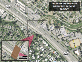 In June 2015, it was reported that work had begun on the San Francisquito Creek replacement
project. The project will remove and replace the US 101 bridge over the
San Francisquito Creek, at the border of San Mateo County and Santa Clara
County. The project will also remove and replace the West Bayshore Road
and East Bayshore Road bridges over the creek. The bridge over San
Franciquito Creek was originally constructed in 1931 and widened in 1957
to include the frontage roads on either side of the freeway. Over the
years, the bridge has deteriorated due to wear and tidal action. Based on
structural inspections, a recommendation to replace the bridge was made in
2001 and reconfirmed in subsequent inspections. The new bridges will
provide increased hydraulic capacity to be consistent with the
improvements proposed by the San Francisquito Creek Joint Powers
Authority. The new bridges will have less maintenance cost and provide
protection from flooding. The project was be advertised in early 2015. It
is expected that a contractor would begin construction in April 2015.
Construction is expected to occur over three seasons with most of the work
taking place from June to October due to restricted work windows in the
creek. Work in 2015 focused on demolition of existing bridges and
soundwalls. The project was expected to be completed in 2018.
In June 2015, it was reported that work had begun on the San Francisquito Creek replacement
project. The project will remove and replace the US 101 bridge over the
San Francisquito Creek, at the border of San Mateo County and Santa Clara
County. The project will also remove and replace the West Bayshore Road
and East Bayshore Road bridges over the creek. The bridge over San
Franciquito Creek was originally constructed in 1931 and widened in 1957
to include the frontage roads on either side of the freeway. Over the
years, the bridge has deteriorated due to wear and tidal action. Based on
structural inspections, a recommendation to replace the bridge was made in
2001 and reconfirmed in subsequent inspections. The new bridges will
provide increased hydraulic capacity to be consistent with the
improvements proposed by the San Francisquito Creek Joint Powers
Authority. The new bridges will have less maintenance cost and provide
protection from flooding. The project was be advertised in early 2015. It
is expected that a contractor would begin construction in April 2015.
Construction is expected to occur over three seasons with most of the work
taking place from June to October due to restricted work windows in the
creek. Work in 2015 focused on demolition of existing bridges and
soundwalls. The project was expected to be completed in 2018.
San Mateo/San Francisco Counties
Newell Avenue (E. Palo Alto) Pedestrian Overcrossing (~ SM 0.467)
In October 2016, the CTC approved for future consideration of funding a project that will construct a Class I Pedestrian/Bicycle Overcrossing Structure over US 101 to provide a direct connection between the south side and north side of US 101 in East Palo Alto. Improvements will also include a sidewalk, bicycle signage, striping along West Bayshore Road and a new pedestrian crossing will be added at Newell Avenue. The Project is estimated to cost $9,800,000 and is fully funded through construction with Local Funds ($1,200,000) and Active Transportation Program Funds ($8,600,000). Construction is estimated to begin in Fiscal Year 2016/17.
In May 2019, it was reported that the new overpass,
connecting at Newell Road and Clarke Avenue, had opened. It was designed
to unite East Palo Alto neighborhoods and improve access for residents to
schools, shops and parks, city officials said. Construction of the
$14-million project took 18 months from start to completion. The city
received $8.6 million from California’s Active Transportation
Program and the remaining balance came from a combination of local funds.
The bridge’s pedestrian enhancements include LED lighting and a
12-foot-wide walkway. It cuts the crossing distance over US 101 by
one-third of the distance from 1.5 miles to a half-mile, city officials
said.
(Source: Palo Alto Online, 5/19/2019)
University Avenue-US 101 Interchange Improvements Project (04-SM-101 0.8/1.1)
 In December 2021, it was reported that the San Mateo
County Transportation Authority Board of Directions allocated $8 M towards
the City of East Palo Alto’s latest pedestrian/bicycle overcrossing
along the north side of the US 101/University Avenue overcrossing. The
estimated total project cost is $15 M. The project will relieve an
interchange bottleneck at University Avenue and US 101. The project will
also reduce intersection delay along University Avenue at both Donohoe
Street and Woodland Avenue. The southbound ramp improvements will reduce
queue lengths in both the AM and PM peak periods. Bicycle and pedestrian
safety will be improved with a dedicated overcrossing that will eliminate
bicycle and vehicle weaving conflicts on University Avenue. Combined,
these improvements will create separated, comfortable facilities for
people walking and biking to access nearby schools, business centers,
retail areas, and transit stops.
In December 2021, it was reported that the San Mateo
County Transportation Authority Board of Directions allocated $8 M towards
the City of East Palo Alto’s latest pedestrian/bicycle overcrossing
along the north side of the US 101/University Avenue overcrossing. The
estimated total project cost is $15 M. The project will relieve an
interchange bottleneck at University Avenue and US 101. The project will
also reduce intersection delay along University Avenue at both Donohoe
Street and Woodland Avenue. The southbound ramp improvements will reduce
queue lengths in both the AM and PM peak periods. Bicycle and pedestrian
safety will be improved with a dedicated overcrossing that will eliminate
bicycle and vehicle weaving conflicts on University Avenue. Combined,
these improvements will create separated, comfortable facilities for
people walking and biking to access nearby schools, business centers,
retail areas, and transit stops.
(Source: E Palo Alto Sun, 12/21/2021; Image source: City of E Palo Alto Plans)
According to E Palo Alto: The US 101 / University
Avenue Interchange Project (04-SM-101 0.8/1.1, ProjID 04000007591)
Pedestrian Overcrossing will improve the connectivity for pedestrians and
bicyclists between the east side and west side of East Palo Alto. The
project will construct a Class I shared pedestrian and bicycle path from
Donohoe Street on the east side of East Palo Alto to Woodland Avenue on
the west side of East Palo Alto. The path includes a new.
4-span, pedestrian overcrossing bridge just north of the existing
University Avenue Bridge over US 101. Improvements to US 101 will be
included in the project. The northbound US 101 off-ramp to
University Avenue will be re-aligned. The southbound US 101 off-ramp
will be widened at University Avenue to create two dedicated right turn
lanes and two dedicated left turn lanes. The total budget for the
project, including design and construction management is $14 million
project. The project funding is provideed by the San Mateo County
Transportation Authority Measure A and Measure W, a Stanford Recreation
Mitigation Grant, State SB1 / LLP funds, and Federal HPP funds.
Construction should start Feb/Mar 2023.
(Source: City of E Palo Alto, 11/2022)
In August 2022, the CTC amended the Local Partnership
Formulaic Program to add the University Avenue-US 101 Interchange
Improvements Project in San Mateo County and program $2,302,000 of their
2020 Formulaic Program funding to the Construction phase in Fiscal Year
2022-23. In the City of East Palo Alto this project will construct a
twelve-foot-wide Class I pedestrian and bicycle facility, including a new
overcrossing, safety enhancements, and intersection improvements. The
anticipated benefits of this project include improving public safety,
providing access to key destinations, traffic calming, and increasing
walking and bicycling in the project area.
(Source: October 2022 CTC Agenda, Agenda Item 4.27)
In December 2022, it was reported that the
pedestrian-bicycle overcrossing over US 101 at University Avenue in East
Palo Alto broke ground in early December 2022. The University Avenue/101
Pedestrian Overcrossing Project, which will parallel but be separate from
the existing bridge, will create safe access to the east and west sides of
East Palo Alto and neighboring Palo Alto after decades of separation by
the busy freeway. The $14.6 million project, which is the second of two
pedestrian overpasses to join the city — the first is the Clarke
Avenue bridge near the Ravenswood 101 Shopping Center — has been
more than a decade in the works. It will span 12 feet wide connecting the
east side along East Bayshore Road to a route in the University Circle
business development near the Four Seasons Hotel Silicon Valley. The
project has been granted $4.8 million from Measure A funds through the San
Mateo County Transportation Authority, $771,000 in federal earmark funds
and $1 million from the Stanford Recreation Mitigation Grant, which was
approved by the Santa Clara County Board of Supervisors. The city was
recently awarded $5.7 million through Measure W and $2.3 million through
the State Local Partnership Program to fill the construction funding gap.
The project is scheduled to begin construction this spring and be
completed by winter 2024. The existing overpass, perhaps the oldest
crossing over US 101 in the county, will eventually be replaced. The
upgrade could take 15 or 20 more years and would likely cost upward of $83
million — the cost the California Department of Transportation
(Caltrans) paid to replace the overpass at Willow Road in Menlo Park.
Instead, city, county, state and federal officials came up with a
replacement that would be separate from the existing bridge so that it
could eventually be torn down without impacting pedestrian and bike
access. The new bridge would also open access to mothers with baby
strollers and people with assisted devices such as wheelchairs as well as
foot and bike traffic.
(Source: Palo Alto Weekly, 12/12/2022)
In December 2022, the CTC approved a request of
$2,302,000 for the locally-administered LPP (Formulaic) University
Avenue/US 101 Interchange Improvements Project, on the State Highway
System, in San Mateo County. (04-SM-101 R098/R1.1, PPNO 0090L, ProjID
0400000759, EA 4CONL). University Avenue/Highway 101
Interchange Improvements Project. In the city of City of East
Palo Alto on University Avenue from Donohue St to Woodland Avenue. The
project will construct a 12-foot-wide Class I pedestrian and bicycle
facility that includes a new pedestrian/bicycle overcrossing along the
north side of the US 101/University Avenue overcrossing. The northbound US 101 to southbound University Avenue loop off-ramp will be realigned to
square up with University Avenue with a tighter radius-curve for
pedestrian and bicyclist safety enhancement. Additionally, the project
includes improvements to the southbound US 101 off-ramp to improve traffic
flow and reduce traffic conflicts.
(Source: December 2022 CTC Agenda, Agenda Item
2.5s.(2))
US 101 / Willow Road Interchange (Menlo Park) (~ SM 1.885)
In March 2013, it was reported that Caltrans, in
partnership with San Mateo County, East Palo Alto and Menlo Park, plans to
reconstruct the current full cloverleaf interchange of US 101 and Willow
Road to "address deficiencies impacting motorists, bicyclists, and
pedestrians by eliminating traffic weaves and providing adequate space for
vehicles to stack on freeway off-ramps," according to the agency. The six
designs under consideration—four using variations of a partial
cloverleaf, and two using a diamond configuration—range in cost from
$38.2 million to $54.9 million for construction costs and right-of-way
acquisitions. A half cloverleaf design, labeled "1B" in the staff report
with an estimated price tag of $42.5 million, appears to be the leading
contender after consultants reviewed the designs. The city of East Palo
Alto has also expressed its support for that configuration. One key
request from Menlo Park was to evaluate the feasibility of adding a median
bike lane along Willow Road, through the interchange. The staff report
states that a median lane presents some safety issues, as drivers aren't
used to it and it exposes bicyclists to traffic on both sides at
intersections. The design team concluded that the option wasn't viable.
(Source: The Almanac, 3/2620/13)
In June 2015, it was reported that the City of Menlo
Park has signed on as an official sponsor of the interchange project at US 101 and Willow Road. The city hopes to find and secure the $65 million
needed to construct a new interchange at Willow Road. The project has been
in the works for more than two decades. In 2009, county residents passed
the Measure A sales tax measure, which funds countywide transportation
improvements and will allow Caltrans and the San Mateo County
Transportation Authority to design and construct the interchange. The new
design features seismic updates and widening of the bridge to accommodate
pedestrian and bicycle facilities that don't now exist. Construction is
slated to begin next spring and will last roughly 2½ years. Though
traffic will be affected during construction, motorists still will be able
to travel in both directions along Willow Road. As project sponsor, Menlo
Park will be responsible for doing community outreach, rallying political
support, ensuring there's enough funds to cover the construction phase and
helping coordinate efforts. Caltrans and the Transportation Authority
would be in charge of construction because the interchange is owned and
controlled by Caltrans.
(Source: SJ Mercury News, 6/10/2015)
In October 2015, it was reported that the San Mateo
County Transportation Authority allocated $56.4 million toward Menlo
Park’s US 101/Willow Interchange Project (for the 3 year Measure A
cycle). That will convert the existing full cloverleaf into a partial
cloverleaf interchange, replace the existing overcrossing with additional
lanes as well as sidewalks and enhanced bike paths, according to a TA
staff report.
(Source: San Mateo Daily Journal, 10/2/2015)
In February 2017, it was reported that a member of
Atherton’s Transportation Commission has prompted Menlo Park to take
another look at a $70 million project to rebuild the Willow Road/US 101
interchange. The Caltrans-led project, which is being paid for through
county Measure A funds, will replace the existing interchange with a new,
wider bridge, and the current “full cloverleaf” will be
replaced by a “partial cloverleaf.” Sidewalks and bicycle
lanes separated from vehicular traffic will be added to both sides of
Willow. The project is already under way, with utility work causing
periodic roadway closures, and is expected to last two years. Actual
construction of a new bridge isn’t expected to begin until the
summer. Atherton's complaint is that the project won’t make the
roadway any safer, as Caltrans has stated, but will worsen congestion.
They propose instead that Measure A funds should be diverted to fixing the
Willow Road and University Avenue intersections with Bayfront Expressway,
where the congestion primarily originates. The Atherton commission member
believes the change to a partial cloverleaf will lead to longer queues and
could lead to more collisions, saying that has been the case at the US 101
interchanges at Marsh Road and Hillsdale Boulevard after they were rebuilt
with partial cloverleafs. This member also doubts the need to rebuild the
overpass to make it seismically sound or to make the Willow section safer
for bicyclists and pedestrians, two aspects the city has cited for backing
the project. He suggests that a bike bridge be built along US 101
somewhere between Willow and University, and Willow be left alone.
(Source: Mercury News, 2/2/2017)
The 2018 STIP, approved at the CTC March 2018 meeting, appears to show the Willow Road project, PPNO 0690A, in the 2016 STIP. No funds appear to be allocated for FY18-19 or after.
In December 2020, the CTC approved $4,000,000 AB 3090
Reimbursement for the US 101/Willow Road Interchange Reconstruction
project, as AB 3090 approved under STIP Amendment 14S-35, August 2016.
(Source: December 2020 CTC Agenda, Agenda Item
2.5c.(4))
The SAFETEA-LU act, enacted in August 2005 as the reauthorization of TEA-21, authorized $400,000 for High Priority Project #3062: Conduct environmental review of proposed improvements related to the connection of Dumbarton Bridge to US 101 (~ SM 3.584).
US 101 / Route 84 Project: Woodside Road Interchange (04-SM-101 4.6/6.5, 04-SM-84 25.3/25.721)
 In October 2015, it was reported that the San Mateo
County Transportation Authority allocated $2.65 million to help add
vehicle lanes, sidewalks and bikeways to the Woodside Road/US 101
interchange (~ SM 5.264), as well as to expand and signalize the ramp
intersection, according to the report.
In October 2015, it was reported that the San Mateo
County Transportation Authority allocated $2.65 million to help add
vehicle lanes, sidewalks and bikeways to the Woodside Road/US 101
interchange (~ SM 5.264), as well as to expand and signalize the ramp
intersection, according to the report.
(Source: San Mateo Daily Journal, 10/2/2015)
In July 2017, it was reported that a plan to ease
congestion at a Redwood City highway interchange moved into the design
phase this week. The City Council on Monday authorized staff to pay AECOM
Technical Services up to $7.9 million to design improvements for the US 101/Route 84 (Woodside Road) interchange, which involves widening Woodside
Road to add new lanes, building new ramps to and from US 101 and adding
sidewalks and bicycle lanes. The council also authorized paying Krupa
Consulting up to an additional $335,000 to continue managing the project.
The purpose of the project is to alleviate peak-hour congestion at the
interchange and reduce traffic at local street intersections of Woodside
Road with Veterans Boulevard, Broadway, Bay Road, Seaport Boulevard,
Blomquist Street and East Bayshore Road. The city, as sponsor of the
interchange project, is responsible for completing the first phase of
design, set to begin next month and continue through Aug. 31, 2019. AECOM
will design widening Woodside Road from four to six lanes, plus turn
pockets; lowering Woodside an additional 6 inches to boost vertical
clearance at the US 101 undercrossing to 15 feet; reconstructing ramp
connections between Woodside and US 101, replacing a northbound US 101
ramp to connect with Seaport at a new signalized intersection and
constructing flyover ramps between Veterans and US 101; eliminating the
five-legged intersection at Woodside and Broadway; adding a series of new
sidewalks and bike lanes throughout the project area; and adding
high-occupancy vehicle lanes to US 101 ramps. The project doesn’t
require the city to spend any funds out of its operating budget on the
design phase. The work is funded through the San Mateo County
Transportation Authority Highway Program Grant, which had a balance of
$8,044,880 as of May 31, and more than $1.5 million in traffic mitigation
fees collected from two commercial developments recently approved in the
Woodside corridor.
(Source: Mercury News, 7/26/2017)
The 2018 STIP, approved at the CTC March 2018 meeting, appears to allocate $8M in FY21-22 for R/W acquisition for PPNO 0692K, Rt 101/Woodside Rd Interchange improvements.
The 2020 STIP, approved at the CTC March 2020 meeting,
makes no changes to the programmed allocations for PPNO 0692K, Rt
101/Woodside Rd Interchange improvements.
(Source: March 2020 CTC Agenda, Item 4.7, 2020 STIP
Adopted 3/25/2020)
In May 2022, the CTC approved the following project for
future consideration of funding: 04-SM-101 4.6/6.5, 04-SM-84 25.3/25.721.
US 101 / Route 84 Project. Widen the interchange and other
improvements (ND) (PPNO 0692K) (STIP). The project is located on a
1.9-mile segment of US 101 and a 0.4-mile segment on Route 84 (Woodside
Road), and includes connection modifications to Veterans Boulevard,
Broadway Street, Bay Road, Seaport Boulevard, East Bayshore Road, and
Blomquist Road in Redwood City, San Mateo County. The project will
construct ramp connections to US 101, including direct-connect flyover
ramps between US 101 and Veterans Boulevard, install pedestrian and
bicycle facilities, improve the intersection at Woodside Road, and perform
connection modifications to adjoining streets. The Project is fully funded
through right of way acquisition with State Transportation Improvement
Program Funds ($8,000,000) and Local Funds ($65,450,000). Construction is
estimated to begin in Fiscal Year 2025-26.
(Source: May 2022 CTC Agenda, Agenda Item 2.2c.(5))
In May 2022, the CTC approved the following R/W STIP
allocation: $8,000,000. 04-SM-101 4.4/6.5. PPNO 04-0692K; ProjID
0414000032; EA 23536. US 101/Woodside Road Interchange Improvement
Project. US 101 In the city of Redwood City. Widen Woodside Road to
six lanes, construct turn pockets, and reconstruct all ramp connections
between Woodside Road and US 101 including construction of a flyover
ramp from northbound US 101 to Veterans Boulevard. Allocation: R/W
$8,000,000.
(Source: May 2022 CTC Agenda, Agenda Item 2.5c.(2)
#2)
Cordilleras Creek Bridge № 35-0019 (04-San Mateo-101 6.7/7.6)
The following project was included in the final adopted 2018 SHOPP in March 2018: PPNO 1483C. 04-San Mateo-101 7.1. US 101 In Redwood City, at Cordilleras Creek Bridge № 35-0019. Replace bridge to restore structural integrity. Begin Con: 1/11/2023. Total Project Cost: $48,480K.
The 2020 SHOPP, approved in May 2020, included the
following Bridge Restoration item of interest (carried over from the 2018
SHOPP): 04-San Mateo-101 PM 7.1 PPNO 1483C Proj ID 0415000004 EA 2J730. US 101 in Redwood City, at Cordilleras Creek Bridge № 35-0019. Replace
bridge to restore structural integrity. Programmed in FY21-22, with
construction scheduled to start in September 2021. Note: Construction
capital and construction support phases are not authorized. Total
project cost is $48,480K, with $30,855K being capital (const and right of
way) and $17,625K being support (engineering, environmental, etc.).
(Source: 2020 Approved SHOPP a/o May 2020)
More detail was in a withdrawn item in the June 2021
minutes: 04-SM-101, PM 7.13. US 101 Cordilleras Creek Bridge
Replacement Project. Reconstruct Cordilleras Creek Bridge on U.S.
101 in San Mateo County. (MND) (PPNO 1483C). This project is located on US 101 at post mile 7.13 in Redwood City in San Mateo County. The
Department proposes to replace the existing Cordilleras Creek
Bridge. This project is currently programmed in the 2020 SHOPP for a
total of $48,480,000, of which, $34,070,000 is currently through G-13
Contingency. Construction is estimated to begin in 2022-23. The scope, as
described for the preferred alternative, is consistent with the project
scope programmed by the Commission in the 2020 SHOPP.
(Source: June 2021 CTC Agenda, Agenda Item
2.2c.(1))
In June 2021, the CTC amended this item in the 2020
SHOPP: (1d) #23 04-SM-101 7.1 6.7/7.6 PPNO
04-1483C ProjID 0415000004 EA 2J730. US 101 In Redwood City, at
from 0.4 mile south to 0.5 mile north of Cordilleras Creek
Bridge № 35-0019. Replace bridge to restore structural integrity.
(Additional $1,300,000 contribution for Const Cap from Local Measure A
funds.) Note: Update postmiles to accommodate traffic lane-shifting during
construction staging. To shift traffic back and forth across the existing
median, concrete median barrier will need to be replaced and profile in
both directions will need to be matched. Environmental costs have also
increased due to work in the creek, thus increasing construction capital.
Increase in R/W capital is due to additional temporary easements and
acquisitions. R/W Cap $4,285K $5,114K; *Const
Cap $26,570K $31,297K; Total $48,480K
$54,036K.
*: Phase not programmed.
(Source: June 2021 CTC Agenda, Agenda Item
2.1a.(1d) #23)
In October 2022, the CTC amended the SHOPP as follows:
04-SM-101 6.7/7.6. PPNO 04-1483C; ProjID 0415000004; EA 2J730. US 101 In
Redwood City, from 0.4 mile south to 0.5 mile north of Cordilleras Creek
Bridge № 35-0019. Replace bridge to restore structural
integrity. (Additional $1,300,000 contribution for Const Cap from
Local Measure A funds.) Allocation Changes ($ × 1,000): Con
Sup $0 ⇨ $6,650; Const Cap: $0 ⇨ $31,297; Total $15,239
⇨ $53,186. Note: Split mitigation project EA 2J73A/PPNO 04-2916W
from parent project EA 2J730/PPNO 04-1483C. Fully program previously
unfunded phases of this G13 Contingency project. Additional funds from an
express lane project to construct a barrier are not needed as the stage
construction no longer requires shifting traffic across median. The
concrete barrier will now be constructed under the original express lane
project.
(Source: October 2022 CTC Agenda, Agenda Item
2.1a.(1d) #16)
In October 2022, the CTC approved the following
construction phase allocation: $37,849,000. 04-SM-101 6.7/7.6. PPNO
04-1483C; ProjID 0415000004; EA 2J730. US 101 In Redwood City, from 0.4
mile south to 0.5 mile north of Cordilleras Creek Bridge №
35-0019. Outcome/Output: Replace bridge to restore
structural integrity and replace existing drainage. Programmed allocation:
CON ENG $6,650,000; CONST $31,297,000. CEQA - MND, 5/6/2021;
Re-validation 8/19/2022. NEPA - FONSI, 5/6/2021; Re-validation 8/19/2022.
Future consideration of funding approved under Resolution E-21-52; June
2021. Six month time extension for CONST and CON ENG approved under Waiver
22-73; June 2022. Concurrent Amendment under SHOPP Amendment 22H-004;
October 2022. SB 1 Baseline Agreement approval under Resolution
SHOPP-P-2021-07B; June 2021.
(Source: October 2022 CTC Agenda, Agenda Item
2.5b.(1) #6)
In September 2023, it was reported that US 101 would
have intermittent closures related to the replacement of the Cordilleras
Creek Bridge.
(Source: Local News Matters, 9/22/2023)
San Carlos / Holly St. Interchange (101 SM 8.406)
In October 2015, it was reported that the San Mateo
County Transportation Authority allocated $10.7 million for San
Carlos’ US 101/Holly Street Interchange Project (101 SM 8.406),
which will convert the existing full cloverleaf to a partial cloverleaf
interchange while adding new and widened bike lanes. The city’s
request for another $3 million to construct a separate pedestrian/bicycle
bridge was denied, as it wasn’t eligible under the conditions of the
TA’s highway program, according to the report.
(Source: San Mateo Daily Journal, 10/2/2015)
In December 2017, it was reported that an effort to
reduce congestion and improve safety on the Holly Street and US 101
interchange in San Carlos took a leap forward recently when the San Mateo
County Transportation Authority approved funds needed to make up a gap in
the project’s funding pegged earlier this year. Plans to update the
existing interchange with a new design and add a pedestrian and bicycle
bridge just south of it had been on hold for months before the agency
supplemented a previous grant with another $3.8 million commitment to the
project, said Vice Mayor Cameron Johnson. Also on the board of the
Transportation Authority, Johnson said the interchange’s current
design, which forces cars coming onto and off freeway ramps to weave
together, has created slowdowns and raised safety concerns for those
traveling through the city. Redesigning the interchange’s cloverleaf
entrances and exits and creating a new connection for pedestrians and
bicyclists is expected to cost a total of $35 million, adding that efforts
to design and review the environmental effects of the project also
factored into the cost. $24 million has been committed from outside grant
funds and that the city is expected to commit $11 million to the project
when the council discusses the project in February 2018. Should the
council agree on the final amount coming from the city coffers at that
meeting, the project could break ground as early as June or July 2018.
Replacing two of the four cloverleaf entrances with additional lanes and
traffic signals at Holly Street are among the changes aimed at improving
the safety of drivers, bicyclists and pedestrians traveling on a major
city thoroughfare to get to US 101 and office buildings east of it.
Creating a separate bridge for bicyclists and pedestrians might encourage
workers and residents with concerns about using Holly Street for their
commutes to look at other options. Together with a separate project to
install a new traffic signal at East San Carlos Avenue and Industrial
Road, the interchange improvements would chart a path for bicyclists from
the San Carlos Caltrain station to the office buildings on the east side
of US 101, as well as to the 204-room Landmark hotel being constructed
near the new signal. The project should take an estimated 18 months once
ground is broken, and because the construction will mostly be taking place
above or near the highway, some night work will be necessary. There may be
congestion near on- and off-ramps during construction but expected regular
traffic patterns on Holly Street to continue.
(Source: San Mateo Daily Journal, 12/18/2017)
In February 2018, it was reported that, although San
Carlos officials weighed concerns about how the Holly Street and US 101
interchange project might affect local streets, they opted not to delay it
any further when they approved another $7 million toward the major
infrastructure overhaul. The council voted 4-1 to approve the additional
funds, which are part of the city’s match to the nearly $21 million
committed by several other agencies, including the state, the Metropolitan
Transportation Commission and the City/County Association of Governments.
Expected to cost more than $30 million, plans to update the existing
interchange with a new design and to add a pedestrian and bicycle bridge
just south of it had been on hold until the San Mateo County
Transportation Authority supplemented a previous grant with close to $4
million in December.
(Source: San Mateo Daily Journal, 2/28/2018)
A new pedestrian/bike bridge is coming on US 101 at Hillsdale Boulevard
(~ SM 11.135). Local officials envision this $35 million project as a key
link to encourage users to get out of their cars and not contend with
traffic. It will allow a much safer way for pedestrians and bicyclists to
get from the Hillsdale Boulevard interchange while connecting the bike
lanes from the Hillsdale Caltrain station to Foster City and neighborhoods
east of US 101. This bridge is the last significant segment of a 1.2-mile
bike lane between the Hillsdale station and the Los Prados and Lakeshore
neighborhoods east of US 101. The existing overcrossing is the only one in
the area with the nearest crossing approximately 2 miles to the north at
19th Avenue and the Belmont overcrossing more than 2.5 miles to
the south.
(Source: Mercury News: "Mr. Roadshow" 11/2/2017)
US 101/Route 92 Interchange Improvements (~ SM 11.885)
In June 2010, it was reported that studies are
beginning to improve the US 101/Route 92 interchange. Officials from three
local transit agencies are splitting a $450,000 study that by the end of
Summer 2011 should map out why cars move so slowly through the area, and
what can be done about it. The purpose of the study is to figure out if
there are any quick and easy fixes for operational problems in the
interchange. C/CAG, MTC and the county Transportation Authority will each
pay $150,000 to fund the study.
(Source: Oakland Tribune, 6/9/2010)
In March 2016, it was reported that state funding for
improvements to the US 101/Route 92 interchange that backs up traffic in
San Mateo has been eliminated. Members of the Metropolitan Transportation
Commission expressed frustration but approved a list of cuts, including
the one above. Funding may not be available until 2021.
(Source: SM Daily Journal, 3/28/2016)
In January 2018, it was reported that short- and
long-term ideas for the US 101 / Route 92 interchange are taking shape as
an early round of funding to consider options is coming together. The San
Mateo County Transportation Authority, or TA, is leading the project that
involves working with Caltrans, the City/County Association of
Governments, and the cities of Foster City and San Mateo. The project may
also align with fast-moving plans to create managed lanes across a San
Mateo County stretch of the congested US 101. Essentially, one of the
longer-term proposals is to construct new overpasses that would give
carpoolers and toll payers on Route 92 direct access to the managed lanes
in the center of US 101. Shorter-term ideas include widening certain
intersection ramps, reconfiguring lanes and eliminating the problematic
weave between commuters heading toward the San Mateo-Hayward Bridge. While
still early, nearly $3 million is being sought to prepare two documents
that will outline the scope of the longer-term “Direct Connector
Project” and the shorter-term “Interchange Area Improvements
Project.” That expense doesn’t include the environmental,
design or construction phases that cumulatively could cost more than $150
million. Suggested short-term improvements could happen in the next three
to five years. Alternatives include increasing capacity by adding a
carpool lane on the ramp from westbound Route 92 to southbound US 101.
Another option is to modify the Hillsdale Boulevard exit from northbound
US 101 to increase capacity and avoid spillover onto the freeway,
according to documents submitted to the TA. One proposal that includes
short- and long-term improvements is to add another lane on eastbound
Route 92 between US 101 to Mariners Island Boulevard. The goal is to
eliminate the short weaving distance between drivers from both directions
on US 101 trying to merge with others headed toward the bridge. The other
long-term suggestion is to create a quicker route for carpoolers by
creating new “connectors” or overpasses, from westbound Route 92 to both directions on US 101. That improvement would feed into the US 101 Managed Lanes Project, which suggests squeezing in a new lane in each
direction on the freeway. Located in the center, the express lanes would
be free for carpoolers with three people, and open to others willing to
pay a toll. That $593 million project is in the environmental review phase
with construction aiming to begin May 2019, according to Caltrans.
(Source: SM Daily Journal, 1/30/2018)
The 2018 STIP, approved at the CTC March 2018 meeting, appears to show that the 2016 STIP included funding for PPNO 0668D, Route 92/US 101 Interchange Improvements - Phase 2. In San Mateo. Reconstruct/Reconfigure Route 101/Route 92 Interchange. The purpose statement notes that the current level of service (LOS) on SR 92 at US 101 is F. The purpose of this project is to develop alternatives that address the current congestion and improve traffic safety at this location. The project has a total of $5.628M in the STIP: $2.411M in FY19-20 for Environmental and Planning, and $3.217M in FY 20-21 for PS&E.
The 2020 STIP, approved at the CTC March 2020 meeting,
shifted the programmed funding for PPNO 0668D "Rt 101 interchange
improvements" from FY20-21 to FY21-22.
(Source: March 2020 CTC Agenda, Item 4.7, 2020 STIP
Adopted 3/25/2020)
In May 2021, it was reported that local transit
agencies have begun public outreach for the US 101/Route 92 Short
Term Area Improvement Project, which will provide ramp and merger
improvements to four highway areas in San Mateo and Foster City. The
project would provide immediate low-cost construction options to improve
local ramp access from US 101, reduce weaving cars and improve overall
safety. Four improvement areas are being considered for construction
fixes. Area improvement one focuses on the westbound Route 92 to
southbound US 101 loop connector and would widen the loop connector ramp
and add a lane to increase capacity. Improvement two is for eastbound
Route 92, which seeks to improve heavy traffic and increase merging time.
It would eliminate the inside merge between eastbound Route 92 and
southbound US 101 and shift the existing merge points, although it would
not add a lane. Improvement three is to the southbound US 101 to westbound
Route 92 ramp. It would realign the Fashion Island Boulevard off-ramp and
segregate the eastbound and westbound Route 92 ramps to prevent illegal
motorist crossings. Improvement four addresses the northbound US 101 to
Hillsdale Boulevard exit ramp. It would widen and restripe the northbound
US 101 off-ramp, extend the eastbound through lanes through the northbound
US 101 and Hillsdale Boulevard intersection and realign the northbound US 101 loop on-ramp. Construction is estimated to start in April 2023, with
completion to be determined. The project total is estimated to be $28.6
million. If funding is not available for all four improvement areas,
Caltrans staff said each part could be constructed individually and would
be dependent on funding available.
(Source: San Mateo Daily Journal, 5/10/2021)
In July 2023, it was reported that MTC’s
Programming and Allocations Committee recommended allocations of Regional
Measure 3 toll dollars for this project. The committee's recommendation
will be considered by the full Commission at its July 26 2023 meeting. The
specific allocation was: San Mateo County Transportation Authority: $2
million for the environmental phase of the U.S. 101/State Route 92
Interchange Direct Connector Project in San Mateo.
(Source: MTG/ABAG Bay Link Blog, 7/12/2023)
The SAFETEA-LU act, enacted in August 2005 as the reauthorization of TEA-21, authorized $3,000,000 for High Priority Project #525: Construct US 101 Auxiliary Lanes from 3rd Ave in the City of San Mateo (~ SM 13.456) to Millbrae Ave in Millbrae (~ SM 17.93).
San Mateo / Poplar Ave Interchange (~ SM 14.323)
With respect to the Route 92/US 101 interchange, there is more information in the draft EIR from 1979. Back in 1979, the section of Route 92 had an 0.7mi freeway gap, with an at-grade signalized intersection. The EIR concerned connecting freeway-to-freeway connectors (each replacing an existing ramp loop); reconstructing portions of the existing interchange; and building two new bridges across the Marina Lagoon. There were two alternatives under consideration. Alternate A is completion of the Route 92 freeway and reconstructing the interchange by replacing the loopramps in the southwest and northeast quadrants with direct freeway-to-freeway connections The loop ramps in the southeast and northwest quadrants would be structurally upgraded along with other parts of the interchange which are now temporary construction The nonfreeway section of Route 92 within the project limits would be reconstructed to freeway standards. This construction will include building two new bridges over Marina Lagoon. Alternate B is completion of the Route 92 freeway and reconstruction of the interchange by replacing all four loop ramps with direct freeway-to-freeway connections The gap in the freeway section of Route 92 will be completed in the same way as in Alternate A. The EIR notes that the Route 92/US 101 interchange was originally planned as a direct without loop ramps freeway-to-freeway interchange. This is the design of the interchange that is in the freeway agreement executed in 1967 between the City of San Mateo and the State of California. It was planned to construct the Route 92 freeway in this area and the interchange with Route 101 in a series of projects. This was necessary because of financing considerations and because this type of staged construction provided a good way to handle the detours and rerouted traffic. As part of this construction portions of the interchange and the segment of Route 92 connecting the interchange to Mariners Island were built on a temporary alignment. This portion of the staged project was constructed between 1967 and 1971. The temporary section of Route 92 includes the bridge over Marina Lagoon, a second temporary bridge spanning an adjacent lagoon, and an undivided section of highway that has a sharply curving alignment. Three structures of the interchange were built on temporary wood testle supported construction; these are the loop ramp in the southwest quadrant, the loop ramp in the southeast quadrant, and the connection between the permanent elevated section of westbound Route 92 and the temporary section of roadway leading to the top of the existing overcrossing. Alternative A was chosen to provide a lower cost alternative. Under Alternate A the interchange would be completed and the gap in the freeway portion of Route 92 would be closed as follows:
The EIR notes that Route 92 will be completed as a
four lane throughout the project. However because it necessary to provide
for the many merging and movements, there are locations where the ramps
freeway sections have increased roadway widths, and most of the freeway
within the project limits is wider than a standard section of four lane
freeway. The completed interchange will have three levels. The levels are
the two direct connections between Route 101 and Route 92. These
connections cross the interchange structures at a maximum height of 55'
above the ground.
(Source: Draft EIR Route 92 Gap Completion, 2/12/1979)
In February 2010, it was reported that the City of San
Mateo has started work to improve the US 101 intersection at Poplar
Avenue. The four-way intersection at Amphlett Boulevard features stop
signs in three directions, while motorists coming off the freeway travel
without stopping. In some cases, drivers are forced to make left turns or
enter US 101 while cars speed off the freeway in their path or turn in
front of them. The interchange has a much higher rate of
accidents—in fact, 37% more! City officials are working on options,
and hope to narrow down potential fixes through the public works
commission. The city has a $150,000 fund to complete the planning.
Currently, the only ideas on the table came from a November 2004 study,
and include included adding a median in Poplar to restrict turning access,
eliminating the interchange altogether or moving it north to the Peninsula
interchange, which provides access only to northbound US 101. However, the
option to move the onramp to the Peninsula interchange will be unlikely,
as Burlingame officials would have to add a lane to the street and have
indicated they would not be willing to do so. Further, if the Poplar
interchange were to be eliminated, the bulk of the traffic for drivers
trying to enter or exit southbound US 101 would move to the Third and
Fourth avenue junction, which would result in unacceptable levels of
traffic.
(Source: "San Mateo to fix dangerous Highway 101 intersection", Oakland Tribute, 2/14/2010)
In June 2015, it was reported that after ditching
previous efforts due to the high cost of securing properties through
eminent domain, San Mateo and Caltrans officials are forging ahead with
multi-million dollar projects aimed at improving safety and traffic flow
at the city’s key intersections to US 101 at Poplar and Peninsula
avenues. The city has released a Project Study Report that outlines two
conceptual designs for creating a southbound on- and off-ramp at Peninsula
Avenue. Now, city officials will seek $2.5 million to conduct an
environmental review of the potential changes before any construction will
begin. The proposal, which stems from high accident rates at the Poplar
Avenue intersection, has also raised concerns among Burlingame residents
who fear their neighborhood bordering the project site would be impacted
by increased traffic. San Mateo is south of Peninsula Avenue and
Burlingame is to the north. In the short term, the city has already
planned improvements along Poplar Avenue such as installing a median to
deter cross-traffic from Amphlett Boulevard and Idaho Street. But
ultimately, Caltrans and San Mateo officials are considering closing the
intersection and creating a full access interchange to US 101 at Peninsula
Avenue to the west and Airport Boulevard to the east. After more than a
decade of planning, the city anticipates starting construction early next
year by installing a median along Poplar Avenue that would span from US 101 through Idaho Street. The improvements would ease cross traffic by
only allowing right turns to be made from drivers heading either direction
toward Poplar Avenue from Amphlett Boulevard and Idaho Street. The
Peninsula Avenue interchange project is in a much earlier stage.
Currently, there are no southbound on- or off-ramp from Peninsula Avenue;
instead, drivers seeking to merge onto US 101 are directed down Amphlett
Boulevard to enter from Poplar Avenue. The proposed project would keep the
northbound on- and off-ramps from Airport Boulevard to the east of the
freeway. The proposed alternatives would both require the city to secure
some right-of-way from several neighboring apartment and commercial
buildings along Amphlett Boulevard, according to the study. The second
alternative — a partially spread diamond interchange that has a less
pronounced curve as compared to the tight diamond interchange —
would require the complete removal of several existing properties.
Preliminary cost estimates predict the first alternative could cost about
$56 million while the more invasive alternative two could run up to $71
million, according to the study. The environmental review period will take
about a year and a half before a preferred alternative is chosen. If
everything goes smoothly, construction could begin in late 2021 and finish
in 2023.
(Source: San Mateo Daily Journal, 6/24/2015)
In January 2021, it was reported that San Mateo city
officials have provided updated information about the US 101/Peninsula
Avenue Interchange Project. The project would address long-term safety and
traffic operations and reduce travel times within the Peninsula Avenue
interchange area for San Mateo and Burlingame residents. It would include
improved bicycle and pedestrian travel options on Peninsula Avenue from
just west of North Humboldt Street to North Bayshore Boulevard. It would
relocate the existing US 101 southbound on- and off-ramps from East Poplar
Avenue to Peninsula Avenue, creating a single, full-access interchange at
Peninsula Avenue and Airport Boulevard. Poplar Avenue’s ramps would
close, as they do not meet current standards and causes traffic
congestion. The city is moving the southbound ramps to Peninsula Avenue
because it has two lanes in each direction, no parking or driveways and
has shoulders and bike lanes, all advantages over East Poplar Avenue. San
Mateo has two options for the design, a spread diamond interchange or a
tight diamond interchange alternative. The tight diamond interchange would
have closer spaced ramp intersections and was proposed to minimize
right-of-way impacts, or the need to acquire private property. Both
alternatives would also involve local road improvements and parking
changes in some surrounding areas, like North Amphlett Boulevard and
Peninsula Avenue. The city has been interested in improving safety at the
East Poplar Avenue off-ramps for several years and began a traffic study
and stakeholder engagement in 2017. The project is currently in the
environmental studies and preliminary engineering phase, expected to be
finished by May 2022. It focuses on traffic analysis, getting public
input, drafting an environmental document through a public process and
getting the final environmental document and overall project approval by
Caltrans. The city will be starting the California Environmental Quality
Act review process in a couple of months, with a CEQA scoping meeting
expected to be held in April. An environmental document would be available
for public review and comment in late 2021. The three primary partners are
San Mateo, the project sponsor, the San Mateo County Transportation
Authority, the funding partner, and Caltrans, responsible for reviewing
the environmental process and approving the project. San Mateo is
responsible for moving the project forward and obtaining funding for the
project, said Matthew Zucca, deputy director of Public Works. San Mateo
will work with Caltrans to select a preferred design and produce a final
environmental document. The city currently does not have funding for
subsequent project phases, which could cause some delay from the May 2022
phase completion date into the project design phase. The two final phases
are the project design and right-of-way acquisition phase and the
construction phase. The city will likely have a property acquisition
process if the project is approved. Both proposed alternatives could
affect some commercial property structures along North Amphlett Boulevard.
The spread diamond right-of-way alternative could affect the structure of
the Bayview Apartments parcel on North Amphlett Boulevard. The city said
it would focus on negotiating with properties to avoid eminent domain. The
soonest the property acquisition phase could start is May 2022, following
project approval.
(Source: San Mateo Daily Journal, 2/10/2021)
In October 2013, the CTC relinquished right of way in the city of San Mateo along Route 101 on Airport Boulevard (04-SM-101-PM 14.8), consisting of a reconstructed city street.
In October 2022, the CTC authorized relinquishment of right of way,
consisting of collateral facilities, in the city of Burlingame along US 101 on Broadway, Old Bayshore Highway, and Rollins Road (04-SM-101-PM
16.4/16.7), under the terms and conditions as stated in the freeway
agreement dated February 19, 1985. The City, by Resolution 007-2021
dated February 1, 2021 and letter signed May 19, 2022, agreed to waive the
90-day notice requirement and accept title upon relinquishment by the
State.
(Source: October 2022 CTC Agenda, Agenda Item 2.3c)
US 101 / Broadway Interchange - Burlington (~ SM 16.612)
In August 2010, it was reported that detailed plans
have been released to replace the interchange at Broadway in Burlingame,
which is used by about 33,000 drivers daily. The $73 million project
includes a new seven-lane overpass across the freeway north of the
existing four-lane crossing. Unlike the current bridge, which connects
both sides of the freeway with a winding road requiring turns, the new
overpass will be a straight shot connecting Rollins Road to the west with
Bayshore Highway to the east. Airport Boulevard would move 100 feet to the
north to connect to the overcrossing, requiring the demolition of the 76
Phillips Conoco gas station at 1200 Bayshore Highway and its adjacent
parking lot. As many as three additional businesses near the freeway also
could lose their properties. The current mazelike setup, which includes 19
approaches and connections to the freeway, will be made simpler, and all
the onramps and offramps will be replaced. With the release of the state
environmental report from Caltrans—which is partnering with the city
of Burlingame and the San Mateo County Transportation Authority on the
project—the biggest remaining obstacle is funding. The city expects
about half the money to come from the county's half-cent transportation
sales tax. City officials also have secured a $4 million grant from the
Metropolitan Transportation Commission and plan to set aside $8 million in
proceeds from Burlingame's recent 2 percent hotel tax hike, although the
city has only earmarked $500,000 toward the project so far. Burlingame
Public Works Director Syed Murtuza said the city has been asking the
federal government to make up the difference. With environmental
clearance, it should be easier to convince politicians the plan is ready
for construction.
(Source: San Jose Mercury News)
In May 2011, the CTC approved for future consideration of funding a project that will construct roadway improvements including the replacement of the Broadway overcrossing. The project is not fully funded. The project is currently programmed in the 2010 State Transportation Improvement Program for project development in the amount of $8,218,000. Total estimated project cost is $74,500,000 for capital and support. Depending on the availability of funds, construction is estimated to begin in Fiscal Year 2014-15.
In October 2011, the CTC approved for future consideration of funding the above project: Reconfigure the existing US 101/Broadway interchange in the city of Burlingame. (PPNO 0702A) This project in San Mateo County will reconstruct the US 101/Broadway Interchange in the city of Burlingame. The project is not fully funded. The project is programmed in the 2010 State Transportation Improvement Program for Project Development only. Total estimated project cost is $74,500,000. Construction is estimated to begin in Fiscal Year 2013-14. The scope as described for the preferred alternative is consistent with the project scope programmed by the Commission in the 2010 State Transportation Improvement Program. A copy of the MND has been provided to Commission staff. The project will mitigate potential impacts to wetlands and waters of the U.S to a less than significant level. Potential impacts to wetlands in the project area will be mitigated by purchase of mitigation bank credits and other methods determined through consultation with the U.S. Army Corps of Engineers. As a result, an MND was completed for this project.
The SAFETEA-LU act, enacted in August 2005 as the reauthorization of TEA-21, authorized $1,000,000 for High Priority Project #2701: Construct US 101 bicycle/pedestrian overpass at Millbrae Ave (~ SM 17.93) for the San Francisco Bay Trail.
In March 2001, the CTC had on its agenda relinquishment of a segment of the original routing from SM PM 22.1 and SM PM 23.9 in the City of South San Francisco.
US 101/Produce Avenue Interchange Project (04-SM-101, PM 21.3/21.7)
 The 2018 STIP, approved at the CTC March 2018 meeting, appears to allocate $5M for PS&E in FY20-21 for PPNO 702D, Rt 101/Produce Ave Interchange
reconstruction. (~ PM SM 21.545)
The 2018 STIP, approved at the CTC March 2018 meeting, appears to allocate $5M for PS&E in FY20-21 for PPNO 702D, Rt 101/Produce Ave Interchange
reconstruction. (~ PM SM 21.545)
The 2020 STIP, approved at the CTC March 2020 meeting,
continues the programmed allocation for PPNO 0702D Rt 101/Produce Ave
Interchange reconstruction
(Source: March 2020 CTC Agenda, Item 4.7, 2020 STIP
Adopted 3/25/2020)
In August 2022, it was reported that plans for a new US 101 overcrossing for cars, bikes and pedestrians near the Produce Avenue
exit in South San Francisco cleared a major hurdle in July 2022 with the
release of the project’s draft environmental impact report. The $111
million project, first proposed in 2012, aims to improve access to the
industrial area east of US 101, which continues to see new developments.
It would be the city’s fourth east-west crossing of the highway, and
the only with dedicated bicycle lanes. If all goes to plan, construction
will begin in 2025 and wrap up in 2027. The bridge would extend from the
intersection of South Airport Boulevard and Utah Avenue over the highway
to reach San Mateo Avenue, creating a new three-way intersection.
Additionally, the intersection of San Mateo Avenue, Produce Avenue and
Airport Boulevard including the southbound foot ramp would be upgraded to
improve safety for pedestrians and cyclists. San Mateo Boulevard’s
northbound lanes from the Utah Avenue to the above intersection would be
restriped to create two lanes where there is currently just one. The area
east of the highway that the project would serve is among the Bay
Area’s fastest growing employment districts, with more than 13
million square feet of office and research space slated to be added in the
next 20 years, expected to double employment in the area to roughly
55,000, according to the environmental report. The area on the west side
of the highway also has seen considerable residential growth recently and
more is on the way. The project will require the removal of an IHOP
Restaurant and a commercial warehouse, which houses Bay Badminton Center,
SF Elite Volleyball Club and Golden Gate Moving Company. The overpass
would primarily pass over a private parking lot serving the airport, which
would remain. So far, the project has received $5 million in part from the
county’s measure A sales tax to cover planning. Construction is
expected to be funded by local, state and federal grants, which the city
is currently working on obtaining. The project is a collaboration between
the city and the San Mateo County Transportation Authority.
(Source: San Mateo Daily Journal, 8/12/2022)
In March 2023, the CTC approved for future
consideration of funding the following project for which a Final
Environmental Impact Report (FEIR) has been completed: US 101/Produce
Avenue Interchange Project. US 101 in San Mateo County (04-SM-101,
PM 21.3/21.7). Construct a new overcrossing extending from the Utah
Avenue/South Airport Boulevard intersection to San Mateo Avenue. (PPNO
0702D). The project is located on US 101 from postmile 21.3 to 21.7, in
San Mateo County. The Department proposes to construct a new overcrossing
extending from the Utah Avenue/South Airport Boulevard intersection to San
Mateo Avenue. The intersections at South Airport Boulevard/Utah Avenue and
San Mateo Avenue/Utah Avenue will be reconstructed to include turn lanes
and connect to the new overcrossing. The Airport Boulevard/Produce
Avenue/San Mateo Avenue intersection will be modified or reconstructed.
The project is currently programmed in the 2022 State Transportation
Improvement Program (STIP) for a total of $15,750,000, which includes
Plans, Specifications, and Estimates. Construction is estimated to begin
2024-25. The scope, as described for the preferred alternative, is
consistent with the project scope as programmed by the Commission in the
2022 STIP.
(Source: March 2023 CTC Agenda, Agenda Item 2.2c.(8))
In March 2023, the CTC approved the following
allocation for a locally-administered STIP project: $5,000,000. 04-SM-101
20.7/21.7 21.3/21.7. PPNO 04-0702D; ProjID
0413000212; EA 4H360. US 101 / Produce Avenue Interchange. In
the City of South San Francisco. Reconstruct and reconfigure
existing interchange including adding an overcrossing as
follows: 1) Extend Utah Avenue to the west over US 101 to connect with San
Mateo Avenue and provide access to southbound US 101 on-/off-ramps at
Produce Avenue; 2) Construct new sidewalks and Class 2 bike lanes on both
sides of the east- west local street connection, and 3) Modify ramp
configurations at Produce Avenue. CEQA - EIR, 02/08/2023 NEPA - FONSI,
02/08/2023. Concurrent Future Consideration of Funding approved under
Resolution E-23-38, March 2023. Contribution from other sources:
$7,600,000. Time extension for FY 20-21 PS&E expires on 02/28/2023.
During the Project Report process, the project improvements were refined
further, and the post miles were revised as shown. The project description
was modified at the request of FHWA personnel reviewing the project's Air
Quality Conformity analysis. Allocation: PS&E $5,000,000.
(Source: March 2023 CTC Agenda, Agenda Item 2.5c.(2) #4)
San Francisco HOT/HOV Lanes
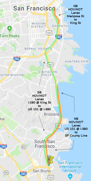 In January 2017, it was reported that exploration has begun on creating HOV lanes between the San
Francisco City/County line (~ SF 0.0) and I-280 (~ SF R4.337L), and
possibly making those lanes HOT ("Express") lanes. The notion of charging
drivers to use an express lane met heat from supervisors, who earlier this
month voted against funding $4 million to study express lanes in the next
phase of the study. The supervisors voted 5-4 in favor of funding the
study, but with the absence of two supervisors were unable to garner the
necessary six-vote majority.
In January 2017, it was reported that exploration has begun on creating HOV lanes between the San
Francisco City/County line (~ SF 0.0) and I-280 (~ SF R4.337L), and
possibly making those lanes HOT ("Express") lanes. The notion of charging
drivers to use an express lane met heat from supervisors, who earlier this
month voted against funding $4 million to study express lanes in the next
phase of the study. The supervisors voted 5-4 in favor of funding the
study, but with the absence of two supervisors were unable to garner the
necessary six-vote majority.
(Source: SF Examiner, 12/27/2018)
In July 2018, it was reported that transit officials
are looking into carving out carpool lanes along both US 101 and I-280
that could double as toll lanes to allow drivers willing to pay a bit
extra for a faster commute in and out of the city. The southbound commute
lane would extend along I-280 from King Street, near AT&T Park, down
to where US 101 meets I-380 near San Francisco International Airport. The
northbound lane would run along US 101 — from I-380 up to the San
Francisco County line — then pick up again on I-280 from Mariposa to
King streets. The San Francisco lanes could eventually hook up with other
express lanes being planned in San Mateo — and those that are
already in operation in Santa Clara County. In time, they could stretch
all the way to Morgan Hill. In some sections, the new lanes would take the
place of the highway’s existing shoulder. In other sections, adding
a carpool lane would mean taking out a lane of traffic. The estimated cost
would be $60 million to $100 million. An estimated 300,000 people a day
travel the heavily congested Peninsula corridor, including drivers and
passengers in single cars, passengers on Muni and SamTrans buses, and
techies on the fleets of private commuter shuttles that serve Silicon
Valley campuses. There are also an increasing number of ride-hailing
services such as Lyft and Uber, ferrying people to and from the airport.
It’s estimated the carpool lanes could shave five to nine minutes
off the trip. At the same time, losing regular lanes to express lanes
could add up to five minutes for people not in a carpool. As this is San
Francisco, there are questions: (1) Who benefits the most from the lanes?
Those who live in San Francisco, or those who live elsewhere and commute?
(2) Should the carpool lanes should be open for a minimum of two people in
a car — or three? (3) Whether drivers who are willing to pay should
be allowed onto the lanes, as they are in other parts of the Bay Area?
After all, this is San Francisco, and letting the affluent buy their way
out of traffic is not necessarily the ideal way to promote use of public
transit. The price paid depends on the time of day and length of the trip.
(Source: SF Gate, 7/9/2018)
In March 2020, the CTC authorized reqlinquishment of right of way, consisting of collateral facilities, in the city and county of San Francisco (City) along US 101 at 3rd Street, just N of Meade Ave (04-SF-101-PM 0.7).
101 Deck Replacement project at Alemany Circle (~ SF 2.109)
In October 2019, warnings started to surface about an
upcoming "carmaggedon" in San Francisco in July 2020. This is when
Caltrans will replace 800-feet of bridge deck on US 101 just north of the
Alemany Boulevard exit in San Francisco. During the project the bridge
deck of the freeway will be demolished and rebuilt, which will require
detouring freeway traffic on and off the freeway to provide room for
construction. The project will begin in July 2020 and be finished within
three weeks. This portion of the US 101, sometimes referred to as the
Bayshore Freeway, was built in the early 1950s. Over the past 70 years,
weather and heavy traffic have deteriorated the bridge deck to the point
where replacement is the most feasible option. A bridge deck is a large,
concrete and steel box which sits on top girders spanning the space
between bridge columns. Workers build wooden forms to hold wet concrete,
which they lay atop steel girders. A steel lattice is built on top the
forms over which they pour concrete. The concrete hardens into a sturdy
bridge deck. The process used when this bridge was built is not very
different from the process used today. To provide room to build the
project, Caltrans will build a detour that will take northbound US 101
traffic off the freeway at the Alemany Boulevard exit. Traffic will travel
about 600 feet and re-enter the freeway at the Northbound US 101 on-ramp.
(Source: Caltrans Alemany Project Page)
In April 2020, it was reported that the traffic
reductions during the Spring 2020 Coronavirus Pandemic have permitted
Caltrans to move up the schedule for the US 1010 Alemany Project. The
project was expected to highly-impact San Francisco’s commute. The
project was originally scheduled for July, at a time when traffic is
lighter than normal anyways as people go on vacation, but traffic during
the "safer at home" orders is even lighters. "This area normally has about
240,000 vehicles that go over it every day," according to Caltrans.
"We’re seeing reductions in the region of about 40-60%, which makes
it a great time to do this." The project was originally designed to take
about 18 days, but Caltrans is expecting to improve the amount of time
that it takes to do the work. Work starts April 25, and they expect to be
done by early May.
(Source: KCBS Radio, 4/10/2020)
In May 2020, it was reported that contractor C.C.
Myers, now doing business as Myers & Sons, was the prime contractor on
the just-completed $37 million rebuild of the Alemany Boulevard overpass
on US 101 in San Francisco. The rebuild was originally scheduled to begin
in July 2020, but was moved up to April to take advantage of the drop in
traffic brought on by the pandemic. Caltrans offered a bonus of $1 million
for every day Myers finished the job ahead of the original 18-day
schedule. The flip side of the deal was that Myers would have to pay back
$1 million for every day the job went beyond 18 days. Myers got the work
done in nine days. Their quick work scored an $8 million bonus (which was
the maximum bonus). This is common for the firm. After the 1994 Northridge
earthquake in Southern California, Myers fixed four damaged bridges on the
Santa Monica Freeway (I-10) in Los Angeles in 66 days, a full 74 days
ahead of schedule, and earned a $14.8 million bonus. When an overturned
gasoline tanker explosion destroyed a three-lane overpass section of the
MacArthur Maze (I-580/I-80 jct.) in Emeryville in 2007, the Myers firm got
a $5 million bonus for finishing ahead of schedule.
(Source: $ SF Chronicle 5/10/2020)
Central Freeway Removal (~ SF M5.447, SF R4.359R to SF T4.942)
Note: With the closure and removal of a portion of the Central Freeway in San Francisco between Fell Street to Turk in 1996 as part of the 1989 earthquake damage, Route 101 is now signed on Van Ness Ave. from the Central Freeway. In early 1997, the Central Freeway was reopened in the northbound direction, but is not presently signed as Route 101.
The portion of this route defined as "the approach to the Golden Gate Bridge" in the legislative definition depends on Section 72.1 of the State and Highways Code. This section (defined by Senate Bill 798, Chapter 559, 9/29/99) defines the Central Freeway Replacement Project. This involves demolition of the existing Central Freeway, construction of a new freeway between Mission Street and Market Street, construction of appropriate ramps to the new freeway, and an improvement of Octavia Street from Market Street north. According to Robert Cruckishank, as of Summer 2004, the new Central Freeway in San Francisco is taking shape, with piers constructed and steel beams being lowered into place for what will be the viaduct itself. The freeway will end at Market Street and what had been a freeway north of Market will become Octavia Boulevard, a "Parisian-style" landscaped road.
(By the way, Octavia Street is named after Miss Octavia Gough, the sister of Charles Gough, who was on the commission to lay out the streets west of Larkin Street known as the Western Addition. This comes from an obituary of Gough, published in the San Francisco Call, dated July 27, 1895. It eliminated the former supposition that Octavia meant the eighth street back from Divisadero. It documents the relationship of Charles Gough to Octavia Street and; almost surely, to Steiner Street, named for Gough's good friend. Steiner was delivering water in the pioneer days when Gough was delivering milk.)
According to reports, demolition of the existing
freeway west of Mission Street (the remains of the double-deck section
built in 1957-9) began in January, 2003 and continued for 180 days, with
penalties of $9600/day for each day it runs over (a closure
party—the end of the freeway revolt—was held in March 2003).
Construction of the new Octavia Blvd on the land previously occupied by
the freeway from Market Street to Fell Street east of Octavia Street began
in October, 2003 and was originally scheduled to be completed in
September, 2004. During demolition, Mission, Market, and Oak Streets under
the freeway will be closed on some weekends. Other streets are apparently
subject to longer closures. A new section of elevated freeway, with two
lanes in each direction (plus a right-turn lane at the very end) will be
built from Mission Street to Market Street, replacing the current
northbound-only structure. Construction began in February 2004 and is to
be completed in February, 2006. Because the new structure will meet Market
Street at grade, McCoppin Street between Market Street and Valencia Street
will be closed. Caltrans is not allowing anything to be built under the
freeway structure because they may need access to it from underneath, so
some of the space underneath may continue to be used for parking lots.
(Thanks to a posting by Eric Fisher on m.t.r for
this information.)
In early September 2005 (about a year late), the long-awaited replacement for San Francisco's Central Freeway was opened. Where the freeway structure was, drivers heading north or west descend from the freeway at Market Street and are greeted by a boulevard with poplar trees in the middle and Chinese elms on each side of the four-lane thoroughfare between faux historic lampposts. The central roadway with its lines of trees is framed by a one-way path on each side reserved for local traffic—the east side is for drivers heading north and west side is for those heading south. Even with parking lanes and a sidewalk, the result is a passage that measures just 133 feet from side to side. There are a number of awkard features to the design, but most reports seem to feel it is an improvement.
Routing in San Francisco
There's lots of confusion about the current routing of US 101, because of problems with signage in the city of San Francisco. After the 1989 Loma Prieta earthquake, US 101 N was rerouted to exit the Central Skyway at Mission St., then NE to Van Ness Ave. US 101 S was rerouted along Van Ness Ave and South Van Ness Ave to the Central Skyway on-ramp. However, there are signs labeled "To US 101" on Central Freeway N at 7th Street, making people believe that US 101 exits there. Similarly, the "To US 101" signs southbound make people think US 101 exits at 5th Street. This is wrong. According to Caltrans, US 101 officially is routed on the Central Freeway. It is neither 7th or 5th St. Hence, to follow US 101, take the Central Freeway. Note that the signs at 5th St. and 7th St. were specifically requested by the City of San Francisco; subsequent surface street signing to direct people to US 101 is the city's responsibility. The city has placed such signs; according to a missing piece of the Photolog uncovered by Joe Rouse, the path is 7th to McAllister to Leavenworth to Turk to Van Ness, with the route to US 101 being signed at each junction (in addition to several reassurance trailblazers on 7th Street).
According to Joe Rouse, the Central Freeway is officially still part of US 101, even after the post-Loma Prieta modifications. Prior to the quake, the Central Freeway ended at Golden Gate and Turk; Turk and Golden Gate were part of US 101 between the Central Freeway and Van Ness Avenue. After the Central Freeway was lopped off at Fell Street, Golden Gate and Turk were decommissioned as state highways and a break in the official routing was created on US 101 at Fell Street, with the route resuming at Van Ness and Golden Gate. Van Ness Avenue south of Golden Gate Avenue (and Mission Street for that matter) have never been officially adopted as state highway.
After the Central Freeway was lopped off at Fell Street, signage for US 101 was extended on Van Ness south of Golden Gate and on Mission Street, but this is signage only—not route adoption. While the Central Freeway's future was being debated, the City of San Francisco requested that Caltrans direct traffic bound for NB 101 so that those coming from the Bay Bridge were directed to exit at 5th Street (and then continue down Harrison to 7th), and NB 101 traffic was directed to continue to 7th Street via I-80. From there, to get to US 101 motorists were directed to use 7th to McAllister to Leavenworth to Turk to Van Ness. But this is signage only—these streets were never adopted as part of US 101. The purpose was to get motorists to bypass the confusing mess at the Market/Van Ness/Mission intersections. The state did leave a sign for 101 North at the turnoff to the Central Freeway from WB I-80, again most likely for motorists's benefit, since there are two onramps to WB I-80 downstream of the 5th Street exit. It was also useful if you were coming from the Bay Bridge and you somehow missed the exit to 5th Street, as you could still get to US 101 North via the Central Freeway.
Although the signage for the Central Freeway from the south indicated that it was for Mission and Fell Streets, signage for US 101 North was also left on that connector to the Central Freeway (where the offramp for 9th Street splits off). Once on the Central Freeway itself, 101 North traffic was directed to exit at Mission. So if you were coming from the south and didn't see the signs directing you to 7th Street, you were okay too.
With the completion of Octavia Blvd, it appears that traffic from the south and from the east are once again directed to use the Central Freeway to continue on NB US 101, rather than use the 7th or 5th Street exits. The exit number listing for WB I-80 will have to be corrected to show that Exit 1B is now for US-101 North. It currently does not show this. So what is the planned alignment for US 101 in this area? It appears that the plan was to continue to sign the Mission Street exit as the exit to continue north on US 101, with the mainline touchdown to Octavia Street being treated as an exit. This makes it look like US 101 is exiting itself. But nothing is finalized. Although the signage may show route continuity via Mission and Van Ness, officially, there is a gap in Route 101 from where the freeway ended at Fell Street to the intersection of Van Ness and Golden Gate Avenues. The southern end of this gap might be moved to the new end of the freeway at Market Street.
In January 2017, the CTC authorized relinquishment of right of way in the city and county of San Francisco along Route 101 (Van Ness Avenue) between Plum Street and Lombard Street (04-SF-101 PM T4.6/6.7), consisting of nonmotorized transportation facilities, namely sidewalks. The City and County, by relinquishment agreement dated December 16, 2016, agreed to waive the 90-day notice requirement and accept title upon relinquishment by the State.
In December 2000, the CTC had on its agenda adoption of a traversable highway a segment of Route 101 in San Francisco from PM SF R5.0 (PK SF R8.0) at Erie Street to PM 5.3 (PK 8.5) at Golden Gave Avenue.
There appear to be some plans to make a portion of this route in San Francisco into an underground tollway. The San Francisco Chronicle published an article on 2/18/2001 where it indicated that transportation planners "said the city should look into building ``supercorridor'' roads under Van Ness Avenue, 19th Avenue, and Fell and Oak streets." The suggested 19th Avenue tunnel would run five miles, from Junipero Serra Boulevard through Golden Gate Park and up to Lake Street, with exits at Brotherhood Way, Ocean Avenue, Quintara Street, Lincoln Way and Geary Boulevard. The Van Ness tunnel would run almost two miles, from about Fell to Lombard Street, with exits at Broadway and Geary Boulevard. Along Oak and Fell, the planners suggest an underground road running more than half a mile from Laguna to Divisadero streets. However, the roads would would violate the long-standing general plan for San Francisco, which calls for no new highway capacity.
Lombard Street Improvements (~ SF 6.701 to SF 7.798)
In March 2016, it was reported that the San Francisco
Municipal Transportation Agency’s Board of Directors was considering
a $12 million safety overhaul for the street. In this overhaul, Lombard
Street could be redesigned to feature numerous curb extensions called
“bulbouts,” which help pedestrians become more visible behind
parked cars, and also reduces the distance from curb to curb when crossing
the street. SFMTA would also paint “zebra” style
high-visibility crosswalks all across Lombard, which the agency says
reduces crashes with pedestrians by 37%. Leading Pedestrian Intervals,
which let walkers cross briefly before cars allowed to move, would also be
installed. Advanced limit lines would also be painted at intersections.
These are lines restricting cars to stopping ten feet before crosswalks.
These changes won’t take place on Lombard’s famous crooked
portion – rather, they will happen between Francisco and Franklin
streets, leading to the entrance of Golden Gate Bridge near the Presidio.
This portion of Lombard is a leg of US 101, under the purview of Caltrans.
Caltrans plans to repave Lombard in 2018, giving SFMTA a chance to revamp
the street for safety. City officials identified Lombard as one of its
most dangerous streets in a study for its Vision Zero policy, in which The
City pledged to end all traffic deaths by 2024. On Lombard between 2008
and 2013, there were over 150 collisions resulting in injuries, two of
which were fatal and 20 severe, according to the SFMTA.
(Source: Andy3175 @ AAroads, March 2016; SFExaminer,
3/14/2016)
There have been some small relinquishments, either of current routings or past routings. CTC June 2000 Agenda Item 2.3c included relinquishment resolutions for San Francisco PM G4.7-5.3 in San Francisco.
In April 2021, it was reported that the San Francisco Municipal
Transportation Agency’s Board of Directors approved adding temporary
HOV lines to segments of Route 1 and US 101 cutting through the Richmond
District and Cow Hollow. The temporary lanes are the latest in a nearly
yearlong effort by the city’s largest transit agency to increase
reliability as the pandemic reduced public transit services and turned
more San Franciscans to getting around by car. The plan reserves the lanes
closest to the curb for high-occupancy vehicles on stretches of these
three-lane corridors. The HOV lanes would be implemented on Route 1 from
the beginning of Crossover Drive and Lincoln Way through Golden Gate Park
and on Park Presidio Boulevard past Lake Street. The remaining lanes would
be unaffected. For US 101, a temporary HOV lane would be installed on
Lombard Street and Richardson Avenue, running from Lyon Street to Van Ness
Avenue.
(Source: $
SF Chronicle, 4/20/2021)
Doyle Drive/Presidio Parkway (~ SF 7.798 to SF 9.472).
![[Doyle Drive]](maps/001-doyle.jpg) There are also plans to reconstruct the Doyle Drive
portion from Lombard St/Richardson Ave to the Route 1 Interchange in San
Francisco. Existing Doyle Drive was built in 1937 and is substantially
unchanged from then. Elevated sections consist of complex steel truss
girders on foundations of doubtful strength. It is located in a
'liquefaction zone' making it especially liable to earthquake damage. The
road was built with 2×3 10ft (3m) travel lanes, no median, and no
real shoulders.
There are also plans to reconstruct the Doyle Drive
portion from Lombard St/Richardson Ave to the Route 1 Interchange in San
Francisco. Existing Doyle Drive was built in 1937 and is substantially
unchanged from then. Elevated sections consist of complex steel truss
girders on foundations of doubtful strength. It is located in a
'liquefaction zone' making it especially liable to earthquake damage. The
road was built with 2×3 10ft (3m) travel lanes, no median, and no
real shoulders.
The permitted design of the Parkway has 3 lanes
northbound to the bridge and 4 lanes southbound off the bridge, the extra
lane so there can be a clean 2+ 2 lane split leading away from the bridge
into a pair of surface arterials Marina Blvd and US 101 (Richardson,
Lombard). They will be modern 3.6m (12ft) wide lanes and there will be
shoulders both sides and a grassed median. Close to half the length will
be underground (in two pairs of cut and cover tunnels of 260m and 310m) or
elevated. At each end the Parkway will transition to signalized arterial
standard roadways, not expressway.
(Source: Tollroadnews, 1/26/2010)
The SAFETEA-LU act, enacted in August 2005 as the reauthorization of TEA-21, authorized $8,000,000 for High Priority Project #2606: Replace South Access to the Golden Gate Bridge-Doyle Drive. The act also authorized $6,000,000 for High Priority Project #3808: Replace South Access to the Golden Gate Bridge—Doyle Drive.
The environmental studies for this project are part of TCRP Project #22, requested by the San Francisco County Transportation Authority. More information can be found at http://www.doyledrive.org/. It appears that there may be an extra toll on the Golden Gate Bridge to help pay for repair of the dangerous Doyle Drive approach, which handles 91,000 vehicles a day. The toll, which has not yet been set, probably would fluctuate, rising during times of heavy traffic to a high of around $2. Doyle Drive is particularly dangerous because lanes are too narrow by 2 to 3 feet, there's no barrier separating opposing traffic, there are no shoulders and the structure is seismically fragile. According to San Francisco transit officials, Doyle Drive has almost three times the typical number of accidents for a facility of its type. Toll revenues would be used to help pay for the $810 million project to replace the 70-year-old Doyle Drive with a wider, safer, sturdier roadway. The federal government would pay an additional $35 million. San Francisco officials have collected the bulk of the money from state and local sources and hope to begin construction by 2009. Construction cost (not project cost) of the 2.6km (1.6 miles) of seven lane (4 lanes SB, 3 lanes NB) expressway is estimated at $1,045m or $387m/km, ($653m/mile), and $57m/lane-km ($93m/lane mile.)
In 2007, the CTC considered a number of requests for funding from the Corridor Mobility Improvement Account (CMIA). One request were funded: construction of aux lanes from Embarcadero to Marsh Rd in San Mateo County ($60M). The Doyle Drive replacement in San Francisco County was not recommended for funding. However, in August 2007 the CTC amended the project (TCRP #22), which is an environmental study for reconstruction of Doyle Drive, from Lombard St./Richardson Avenue to Route 1 Interchange in City and County of San Francisco to update the project schedule and funding plan. TCRP Project #22 is to replace Doyle Drive (US 101) in order to improve the seismic, structural, and traffic safety of the roadway. The redesign of Doyle Drive will have qualities that keep within the setting of the Presidio of San Francisco as a National Park, will incorporate increased intermodal access to the Presidio, and will improve access from local roadways. The project has attracted intense scrutiny from the National Park Service, the Presidio Trust, and the public, as it affects an area of the Presidio where the Presidio Trust is planning the restoration of a river habitat along Tennessee Hollow, as well as the planned expansion of Crissy Marsh. The project is now scheduled to start Phase 1 in FY07/08, with completion estimated for FY12/13. Note that this is just for the environmental study!
Part of the problem with the Doyle Drive reconstruction
is a provision included in the $58 million federal offer: the new Doyle
Drive must become a toll road that would help pay back the construction
costs. This has resulted in a lot of opposition from the North Bay that
would pour south - particularly from Marin County. This opposition may
endanger the effort to replace the road, threatening to entangle it in the
same kind of political morass that stalled construction of the new eastern
span of the Bay Bridge and caused its cost to soar. Marin officials have
called the proposal to charge a $1 to $2 toll on the road unfair to North
Bay commuters, who account for 75 percent of the morning southbound
traffic on Doyle Drive, and labeled the proposal "a Marin commuter tax."
Regional transportation officials, on the other hand, believe the federal
money may be the only chance to fix the dangerous structure. The issue
needed to be resolved quickly: to qualify for the federal money, San
Francisco needs the legal authority to charge tolls on Doyle Drive by
March 31, 2008. San Francisco needed the state Legislature to pass a law
allowing the city to collect tolls, yet the political dispute seems to
have cowed Bay Area legislators who planned to introduce that legislation.
Election year politics are part of the argument; the other part is that
since Doyle Drive is a state highway, Caltrans should pay to replace the
narrow, seismically fragile viaduct. But Caltrans didn't build the road
originally: The Golden Gate Bridge district built the road with no
shoulders, no median and narrow lanes in 1933 as part of the bridge
project. In 1945, it was turned over to the state Division of Highways,
predecessor to Caltrans, according to a history compiled by the San
Francisco County Transportation Authority. But the bridge district didn't
give up its interest in Doyle Drive. In 1955, it asked the state to
rebuild Doyle Drive and make it wider. When the state came up with a plan
for an eight-lane highway with a median, San Franciscans objected, and the
state Legislature passed a bill requiring San Francisco's approval to
widen the highway. Numerous attempts to come up with a plan - and money -
to replace Doyle Drive without adding more lanes of traffic have fallen
victim to community opposition and a lack of funding. The current plan,
with an estimated cost of $1.1 billion, is the result of about 15 years of
planning, studies and negotiations. The so-called "Presidio Parkway"
design was selected in 2006 after planners, engineers and community groups
winnowed down 16 options to one that features a combination of a high
viaduct, two short tunnels, and an open sunken roadway, all with a
landscaped median. The existing Doyle Drive, which carries 120,000
vehicles a day, is near the top of the state's list for bridges in need of
replacement. Its six lanes are narrow, its road has no shoulders and
opposing lanes of traffic are separated only by a line of plastic stakes.
According to Caltrans, Doyle Drive is rated a 2 out of 100 on the Federal
Highway Administration's structural safety index. The current funding plan
for replacement, according to the Metropolitan Transportation Commission
and the San Francisco County Transportation Authority, has the state
contributing about $475 million from a variety of accounts, San Francisco
chipping in $68 million from sales tax revenues, and the federal
government adding $58 million from the Urban Partnership program. That
federal program requires congestion tolling - tolls that rise and fall
with congestion in an effort to dissuade drivers from traveling when
traffic is heaviest. There's still a gap of about $460 million.
(Source: San Francisco Chronicle, February 19, 2008)
In May 2008, the Golden Gate district considered a
congestion toll plan. The district already plans to increase by a dollar
its current toll of $5 for those who pay with cash and $4 for those who
use FasTrak. The congestion-based toll would add a dollar more during the
periods of 7 to 9 a.m. and 4 to 6 p.m. on weekdays and 3 to 7 p.m. on
weekends and holidays. This would be part of a federal program that would
bring $158 million in federal funds to the Bay Area for transportation
projects, including Doyle Drive. North Bay drivers and politicians -
particularly those from Marin County - objected to the Doyle Drive toll
idea, and bridge directors from the north side of the span pledged to
fight what they called "a Marin commuter tax." As part of a regional
compromise, the bridge board agreed to collect a congestion-based toll on
the bridge but only if it could use the revenue to fund improvements to
Golden Gate buses and ferries. The board also voted to ban use of any of
the money to pay for Doyle Drive improvements.
(Source: San Francisco Chronicle, May 9, 2008)
In Mid-December 2008, the San Francisco Board of
Supervisors, acting as the San Francisco Transportation Authority board,
certified the environmental impact report for the Doyle Drive replacement
project and officially selected the $1 billion Presidio Parkway design for
construction. This clears the way for the federal government to approve
the project, which is expected by the end of 2008. The authority hopes to
complete engineering and design, and begin construction, by 2010. The new
Doyle Drive is expected to open in 2014. The design chosen includes
stretches of elevated and at-grade roadway and two tunnels, with six lanes
of traffic, three in each direction, shoulders, and a median. The parkway
design was favored by community committees in 2006. Some relatively minor
changes have been made the past two years to satisfy officials at the
Presidio National Park and neighbors concerned about pedestrian safety.
(Source: San Francisco Chronicle, December 17, 2008)
In March 2009, it was reported that Doyle Drive was among 57 transportation projects in California chosen to receive the first wave of 2009 federal stimulus funds. The Doyle Drive replacement is expected to create about 500 jobs. The commission plans to disburse the money in April 2009 for the 1.2-mile Doyle Drive project, pending a commission environmental approval. The rebuilding of Doyle Drive will cost about $1 billion. Before the commission's decision Wednesday, sources for all but about $100 million of the funding had been identified. Both U.S. Sen. Dianne Feinstein and House Speaker Nancy Pelosi, Democrats from San Francisco, have said that securing full funding to replace Doyle Drive is a top priority. They're looking to the economic stimulus windfall from Washington to cover the remaining tab. If the money comes through, construction could begin by the end summer 2009, instead of in 2010, with completion anticipated in 2014, state and regional transportation officials said. The roadway is used by more than 100,000 vehicles a day.
In April 2009, the CTC accepted the EIR on the Doyle Drive project. The purpose of the project is to improve the seismic, structural, and traffic safety of the roadway that is approaching the end of its useful life. Doyle Drive, the southern approach of US 101 to the Golden Gate Bridge, is 1.5 miles long with six traffic lanes. The proposed project will replace the existing facility with a new six lane facility and southbound auxiliary lane, between the Park Presidio Interchange and the new Presidio access at Girard Road. In April the CTC also allocated $50,000,000 in funding from the Federal American Recovery and Reinvestment Act of 2009 (ARRA).
In January 2010, construction started with the closure of a sharp hook-shaped curve that veered off of Doyle Drive before the toll plaza and passeed beneath the highway to Park Presidio. The southbound Doyle Drive off-ramp to southbound Route 1 will be periodically closed, and starting in February 2010, the northbound Route 1 to southbound Doyle Drive connection will be closed for a year and a half for construction. The official detour uses Lombard Street, Van Ness Avenue and Geary Boulevard. Drivers approaching Doyle Drive will be warned of the closures with electronic signs. Those missing the warnings will be able to use a "last chance" detour at Lincoln Boulevard or Merchant Road via the visitors parking area at the south end of the bridge.
In February 2010, the CTC approved amending Traffic Congestion Relief Program (TCRP) Project 22 and re-allocate previously allocated funds for the Route 101; environmental study for reconstruction of Doyle Drive, from Lombard Street/Richardson Avenue to Route 1 Interchange in the city and county of San Francisco. Specifically, this reprogrammed $1,300,000 TCRP from Plans, Specifications & Estimate (PS&E) to Construction Support, and reallocated previously allocated funds from PS&E to Construction Support. This change related to an Emergency Limited Bid (ELB) contract that is being used to relocate some of the utilities. Although the use of such approach will help advance the delivery of that contract by about 20 months, the Federal Highway Administration does not recognize the ELB as an approved method of delivery, prohibiting federal funds use on this contract (and the original plan was to use Federal demonstration funding). Note that most of the Doyle Drive/Presedio Parkway project is being done through a public-private partnership (called P3 funding); in particular, P3 is being used for Phase II construction.
Work began on the first tunnel in July 2010. The $116 million Battery Tunnel, funded by federal stimulus dollars and $33 million in local funds, is under construction in the Presidio along with an elevated 1,340-foot long viaduct just south of Doyle Drive that would take drivers into city. When the 1,036-foot long tunnel initially opens around Labor Day 2011, the five lanes inside will handle both northbound and southbound traffic until a second northbound tunnel is built where the existing Doyle Drive now stands. Traffic in the tunnel will be separated by a moveable Renderings show the two Battery Tunnels, with the southbound tunnel at right.
In February 2012, it was reported there there may be
some funding kerfluffles for the Doyle Drive project. Specifically, the
San Francisco County Transportation Authority needs to come up with $60
million so that Golden Link Partners, a private consortium that has
entered into an unusual public-private partnership, can begin construction
of the second phase of the project. The authority needs to have firm
funding sources within months so that the consortium can secure private
financing by the end of June and proceed with the second half of the work.
The shortfall was caused by two problems. First, $34 million in state
transportation funds that have been pledged to the project will note
arrive quickly enough. The Metropolitan Transportation Commission, the Bay
Area's transportation planning and financing agency, has proposed
advancing the money to San Francisco and getting paid back over the next
several years. But the California Transportation Commission, which has had
objections to the public-private approach on Doyle Drive, must approve
that proposal. Secondly, there is a $26 million gap that resulted when the
idea of redirecting federal money earmarked for two other Bay Area
transportation projects didn't get congressional support. Construction
crews have been building the first part of the 1.6-mile Presidio Parkway -
the new name for the connection to the Golden Gate Bridge - since the end
of 2009. The work includes a new US 101/Route 1 interchange, a southbound
high viaduct and the southbound Battery Tunnel. By Spring 2012, the first
phase will be completed, and a temporary bypass paved. Traffic will be
moved off the old Doyle Drive and will share the newly built structures
until the rest of the Presidio Parkway is completed in early 2015.
Demolition crews will tear down the old concrete viaducts and roadways.
The existing narrow approach to the Golden Gate Bridge was built in 1937
as part of the bridge project. It's now considered unsafe because it lacks
a median and shoulders, is seismically fragile and sits atop unstable
soils.
(Source: SF Chronicle, 2/6/2012)
In May 2013, it was reported that work has started to
remove the remainder of Doyle Drive. The roadbed, steel trusses, columns
and finally the foundation of the structure will be peeled away. Work on
the new viaduct, which will take drivers north into Marin, is expected to
begin in summer 2013. Three tunnels, a low viaduct and a new interchange
to the Marina and the Presidio will be part of the second phase of work as
well. The new design will open up views of San Francisco Bay, create new
direct access to the Presidio from the new parkway and improve pedestrian
and cyclist connections within the Presidio. The major portion of
construction is scheduled to be complete by late 2015 with landscaping
work to follow through mid-2016.
(Source: Marin Independent Journal, 5/8/13)
In August 2014, the CTC authorized reprogramming of funds from the design phase to construction capital. The funds are being used for wetlands mitigation in the area that surrounds the batch plant, located near the entrance to the northbound Battery Tunnel.
In May 2015, it was reported that all of the roadways
connecting Park Presidio-19th Avenue to the Marina, and the
Marina to the Golden Gate Bridge were anticipated to open in June 2015.
Reconstruction of Doyle Drive occurred in two phases starting in 2008. The
new road is now also known as the Presidio Parkway. The new tunnels,
dubbed the Main Post and Battery tunnels, have been alternatingly open to
traffic during construction. Some construction will continue through 2016.
The green tunnels will be the icing on the cake. Though bare now, by
project’s end, they will be covered in grass, trees, benches, and
trails open to the public.
(Source: SF Examiner, 5/12/2015)
In July 2015, it was reported that over the July 4
weekend, the original Doyle Drive was closed and replaced with the
brand-new Presidio Parkway, a sleeker, safer, better-looking version of
Doyle Drive. Motorists heading toward the bridge from San Francisco will
transition to Presidio Parkway as they do now, but then almost immediately
they will cross a small bridge over what will become an extension of the
Crissy Field Marsh — it will feel a bit like a bump. Drivers will
then speed into the first of two new tunnels, emerge where the temporary
bypass once was and make a straight shot uphill, to the second tunnel.
Nothing like twisting through the narrow lanes of the old road that often
felt dangerously like bumper cars. When they come out of the second
tunnel, they’ll be on the new, high viaduct that soars above the
Presidio on the way to the Golden Gate Bridge toll plaza and the bridge
itself. If they decide they don't want to cross, they can use the
“hook ramp” that veers off to the right, then curves beneath
US 101 and disgorges vehicles onto SB Route 1. Also reopening is the NB
Route 1 to SB US 101 ramp. Both have been closed since 2010. Drivers
heading into San Francisco from the Golden Gate Bridge will head through
the toll plaza, south past Route 1 and into the tunnel that was share with
NB traffic on the temporary alignment. Instead of following the temporary
alignment, which weaves toward Crissy Field in a gentle S-curve, a new
roadway will carry them straight to a second tunnel at the Main Post. When
they emerge, they’ll have the choice of staying on the main road to
Richardson Avenue or taking a new off-ramp on the right side that will
give drivers a choice of heading toward the Marina District or into the
Presidio.
(Source: SF Gate, 7/9/2015)
In April/May 2016, the Atlantic had a long discussion
about how the Presidio Parkway project stiched the two halfs of the
Presedio back together. The Doyle Drive replacement, completed in 2015, is
tucked inside concrete tunnels, the roofs of which will serve as green
bridges linking the two sections of the Presidio that were separated in
the 1930s. (An existing surface street, Old Mason Street, still runs
parallel to the shoreline, but is easily traversable by pedestrians and
bicyclists.) The top of the now-covered road and the surrounding area will
be landscaped by James Corner Field Operations, the landscape-architecture
and urban-design firm behind New York City’s High Line. In the end,
the Presidio will gain 14 acres of newly developed park space.
Corner’s design features a terraced landscape that climbs from
marshlands along the shore up to gently crowned tunnel tops, where a
series of lawns, meadows, and sweeping pathways are interspersed with
small gardens and nooks that block the breezes off the water. The new
ground over the tunnels will be about 30 feet higher than most of its
surroundings, offering heretofore unavailable views. The plantings
selected by Corner aim to call back to the natural conditions that existed
on the site before the road cut through. More than 50 native species of
plants collected throughout the Presidio are now being cultivated in its
nursery for the park’s landscaping, which is expected to start next
year and be completed in late 2018. Various grasses and succulents will
blanket the tunnels, and the bluff leading down toward the water will be
covered in native shrubs and grasses like those seen atop other
escarpments along the edge of the bay. The hope is that these groups of
plants will create habitats for the diverse bird, butterfly, and insect
populations of the Presidio, as well as a natural refuge for the
city’s residents and visitors.
(Source: Atlantic Monthly, May 2016)
In April 2019, it was reported that the Presidio
Parkway is more than two years late and $208 million over budget. When the
commission approved another $34 million in delay-related spending in March
2019, two commissioners who originally opposed the project lamented their
predictions had come true. “This has been a fiasco from the
beginning,” Commissioner Bob Alvarado said at the March 14 meeting.
Before Schwarzenegger got involved, the project had an estimated cost of
$473 million to $499 million. It would replace a 1.6-mile section of US 101 south of the Golden Gate Bridge that had deteriorated since it was
built in 1936 and no longer met earthquake standards. Schwarzenegger
wanted to try something different, calling for a public-private
partnership. Unlike other state highway projects, which Caltrans would
design, put out for bid and then pay a contractor to build, the
partnership approach would select a contractor at a lower upfront cost to
design, build and maintain the project for more than 30 years. Proponents
of Schwarzenegger’s approach, including Caltrans leaders, said it
would give the project a better chance of being completed on time and on
budget than the state’s traditional approach while shifting risks of
delays and future problems to a contractor. Caltrans selected San
Francisco-based contractor Golden Link Concessionaire to do the project
for $1.1 billion, and then asked the Transportation Commission and the
Legislature to approve the agreement. The commission’s staff, the
Legislative Analyst’s Office and Professional Engineers in
California Government all warned that the details of the contract
didn’t match the rhetoric surrounding the project, while warning of
its risks. Both bodies approved the project anyway, authorizing the state
to pay the contractor about $173 million once construction was done and
then $35 million to $40 million per year for 33 years. The project became
the first public-private partnership following 2009 legislation that
authorized the partnerships. The best fits for the partnerships, analysts
said, were projects that included upfront contributions from contractors
and continuous revenue streams, such as tolls. The Presidio Parkway is
near the Golden Gate Bridge toll, but the parkway is not funded by ongoing
fees. The state is paying for the Parkway through 2043 from its general
highway account. Commissioners approved seven supplemental fund requests
for the project from 2013 through 2018. They made an eighth at the March
meeting, bringing total over-budget spending to $208 million, after being
told that each of the two prior allocations would settle all outstanding
claims and disputes. The project was supposed to be finished in December
2016. Commission staffers and Caltrans said the Presidio Trust, the
national park that owns the land, required 46 additional permits since
then, which each took an average of five months to obtain.
(Source: Sacramento Bee, 4/10/2019)
Golden Gate Bridge (SF 9.899 to MRN L0.261)
![]() Note that the Golden Gate Bridge is not part of US 101. The Golden Gate is maintained by the
Golden Gate Bridge, Highway, and Transportation District. However, the Golden Gate Bridge is part of a Safety Enforcement-Double Fine Zone, per Senate Bill 155, Chapter 169,
on July 23, 1999 and a Safety Awareness Zone per SB 988, Chapter 593,
September 29, 2006. The Golden Gate Bridge will also be undergoing a
seismic retrofit under TCRP Project #143. The Golden Gate Bridge opened in
1937.
Note that the Golden Gate Bridge is not part of US 101. The Golden Gate is maintained by the
Golden Gate Bridge, Highway, and Transportation District. However, the Golden Gate Bridge is part of a Safety Enforcement-Double Fine Zone, per Senate Bill 155, Chapter 169,
on July 23, 1999 and a Safety Awareness Zone per SB 988, Chapter 593,
September 29, 2006. The Golden Gate Bridge will also be undergoing a
seismic retrofit under TCRP Project #143. The Golden Gate Bridge opened in
1937.
In January 2010, it was reported that the Golden Gate Bridge District was working on plans to raise money for the bridge. Ideas include elevator rides to the very top of the Golden Gate Bridge's international orange towers, or a chance to tour the famed structure's catwalks beneath the busy roadway. Some of the ideas are in this article from the LA Times.
In March 2011, it was reported that the main cables of the Golden Gate Bridge would be renovated for the first time since the span opened in 1937. This isn't a replacement (the cables cannot be replaced); it involves chipping the old paint off, vacuuming the chips and repainting the cables. Exterior paint is what protects the 80,000 miles of wire inside the cables from corroding.
In November 2016, it was reported that maintenance of the Golden Gate
Bridge was lacking. While the main portion of the bridge is regularly
repainted, the Golden Gate Bridge’s main cable has not been painted
in its entirety since the mid-1930s, only spot painted. When viewed from
the air by helicopter or from the ground, virtually the entire length of
the cable housing appears to show wear and tear. Golden Gate Bridge
Manager Denis Mulligan explained that the Bridge District has different
time frames to do work on different components of the bridge, and says
that the District has based those time frames on what kinds of repairs and
upkeep might be needed. While the outside cable casing may look bad, the
27,000 individual steel strands inside the cable casing have remained
pristine. Back in 1969, the District hired an outside consultant
engineering firm to walk the bridge. The firm issued a report that
recommended the main cable be painted in its entirety as soon as possible.
Despite the recommendation, it never happened. The District started the
project about five years ago, but then stopped the painting. Engineers
announced that the hand rails along the main cable needed to be replaced,
for the safety of the bridge painting crews. Even Golden Gate Bridge Board
of Directors member Dietrich Stroeh has had some concerns about the cable,
and the south tower. Stroeh has talked to staff about getting the project
going again. But Stroeh said that another section of the bridge needed to
be treated for rust. “We found in exposing some of the sub
structures that the bracing underneath which is like crisscrossed, behind
the riveted piece on there,” explained Stroeh. “It was all
rusty.” Then there’s the money for the painting of the cable
in its entirety. The Bridge District had set aside tens of millions of
dollars to paint the bridge back in 2011. But Stroeh said it was spent on
other projects.
(Source: KPIX CBS 5, 11/22/2016)
Information on how to pay the tolls on the Golden Gate Bridge in advance may be found here. This is especially significant if you are in a rental car, for there can be significant surcharges. Those who do not use the bridge frequently can use a one-time payment plan that allows them to use a credit card online or by phone or pay cash in person. Note that drivers do not have the option of paying cash on a Golden Gate Bridge crossing.
Golden Gate Suicide Barrier
In July 2010, a Metropolitan Transportation Commission committee approved $5 million in funding for the design of a suicide barrier on the Golden Gate Bridge. The barrier will cost $45 million and the bridge district said it will not spend money on the project - meaning federal, state or private funding must be found. If it is, the system would take about 18 months to install. The barrier plan calls for a net extending 20 feet below and 20 feet from the side of the span. The net would be made from stainless steel cable and would collapse slightly if someone jumped in, making it difficult to get out, bridge officials said. The district would buy a "snooper" truck with an elongated arm to get people out, although such rescues might be rare because the net is expected to act as a deterrent. Roughly two dozen people jump from the span each year, and more than 1,300 people have jumped from the span since it opened in 1937.
In October 2015, it was reported that Golden Gate
Bridge officials began the process of finding a construction firm to build
the landmark $76 million suicide barrier. This only occurred because the
bridge board approved a deal with the National Park Service to allow
builders to store material and equipment on park lands during
construction. This is because the Bridge District does not own any land;
when the span was built it received a permit from what was then known as
the U.S. Department of War. The park service is now the federal agency
that controls the land. Bids for the barrier work will be opened in
January 2016, with another six weeks needed to go through the submissions
made by bidders. Once a construction firm is selected, which could be as
soon as March 2016, preliminary work could start within weeks, although
parts for the actual net device would take some time to manufacture. Once
work begins, the project would take roughly 3.5 years to complete,
although financial incentives will be offered to the contractor to
complete the work as soon as possible. The bridge district’s barrier
plan calls for a net extending 20 feet below and 20 feet from both sides
of the span, although it will have to be modified in certain areas because
of surrounding terrain. The net would be made of stainless steel cable and
would collapse slightly if someone jumped in, making it difficult to get
out. While people could still jump into the net, such occurrences might be
rare because the net would act as a deterrent. Caltrans will contribute
$22 million to the overall project, the state $7 million from Mental
Health Services Act funds and the Golden Gate Bridge district $20 million
in addition to $27 million from the Metropolitan Transportation
Commission.
(Source: Marin Independent Journal, 10/9/2015)
In April 2016, it was reported that work on the suicide
barrier for the Golden Gate Bridge will be delayed yet again. In February
2016, bridge officials reported there would be a two-month delay, in part
because the original steel selected for the project could not be
manufactured in large enough quantities in the United States. Rather than
have it made overseas, a different type of steel will have to be used for
the project. Because of the steel, other revisions and the volume of
questions, the bid opening date had been moved from March 8 to May 3,
2016. But potential bidders continue to have multiple questions on the
project that can’t be easily answered. Now the bid opening has been
pushed to July 12, 2016. Even with the delay the barrier work will be
completed by 2020 as initially anticipated and there will be incentives
for contractors to finish work sooner than later. The steel net and its
supports will be manufactured off site. The contractor will install the
net first along the east side of the bridge and then the west side. The
suicide deterrent project will be the first large-scale horizontal net
installation on a major bridge in the United States. At 385,000 square
feet, it will be almost the size of seven football fields, suspended 220
feet above the water. The bridge district’s barrier plan calls for a
net extending 20 feet below and 20 feet from the side of the span,
although it will have to be modified in certain areas because of
surrounding terrain. The net will be made of stainless steel, marine-grade
cable to stand up to the elements, bridge officials said. The net will be
gray instead of red to better blend with the water. Caltrans will
contribute $22 million to the overall project, the state $7 million from
Mental Health Services Act funds and the Golden Gate Bridge district $20
million in addition to $27 million from the Metropolitan Transportation
Commission.
(Source: Marin IJ, 4/22/2016)
In July 2016, it was reported that a potential major
stumbling block has developed for the Golden Gate Bridge suicide barrier
project: the low bid for the work has come in almost double the
construction cost estimate. The bridge district opened two bids for the
work, and the low bid came in at $142 million from the Oakland-based
Shimmick/Danny's Joint Venture. The Pennsylvania-based American Bridge Co.
submitted its bid at $174 million. The bridge has a $76 million financing
plan in place approved by the board that was based on consultant
estimates. The bridge district's barrier plan calls for a net extending 20
feet below and 20 feet from the side of the span, although it will have to
be modified in certain areas because of surrounding terrain. The net will
be made of stainless steel, marine-grade cable to stand up to the
elements. The net will be gray instead of red to better blend with the
water.
(Source: East Bay Times, 7/15/2016)
In September 2016, it was reported that the cost of the
barrier could escalate to as much as $198 million. The Golden Gate Bridge
Board voted in late September 2016 to formally delay the project until
Jan. 9 so a funding plan can be revised. Bridge officials were stunned in
July when bids came in almost double the $76 million estimate. Now span
officials are noting the project could be as much as $198 million, but
caution that that figure is likely high. It was included as a safeguard in
a budget planning document to acknowledge the high-end cost of the
project.
(Source: Marin IJ, 9/23/2016)
In November 2016, it was reported that Golden Gate
Bridge officials are close to finalizing a new funding plan to build a
suicide barrier on the span, a project that now has a price tag of $204
million. By December 16, the Golden Gate Bridge district board is expected
to vote on another $40 million for the project. Additionally, a committee
of the Metropolitan Transportation Commission will consider shifting $40
million in federal funds to the barrier project. The agency has already
provided $27 million. Additionally, Caltrans is expected to provide $40
million, with approval coming in early December. Caltrans has already
contributed $22 million. This brings the total additional funding to $120
million for the project. A $39 million construction contingency is worked
into the new $204 million cost and any unspent dollars would be shared
proportionately among the MTC, Caltrans and the bridge district. Officials
were hoping that if work could start this year, the project could be
finished by 2020.
(Source: East Bay Times, 11/4/2016)
In December 2016, it was reported that the Golden Gate
Bridge district board’s Building and Operating Committee voted to
recommend the work go to Oakland-based Shimmick/Danny’s Joint
Venture, which bid $142 million for the barrier work in July. It was the
lower of two bids. The original budget for the work was $84 million, which
included contingency work. Pending approval, the project is estimated to
begin in 2017 and be completed in 2021. The approval of Shimmick was a
close call. A rival contractor, Coraopolis, Pa.-based American Bridge
Company, filed a protest alleging Shimmick’s proposal failed to meet
many standards of the project, though Shimmick denied those allegations.
If the committee found the allegations had merit, both contracts would
have been rejected, because the Golden Gate District deemed the bridge
company’s $174 million proposal too expensive and the bid process
would have reset, possibly delaying the project by at least a year.
(Source: Marin I-J, 12/15/2016; SFExaminer,
12/16/2016)
In January 2017, it was reported that construction on
the Golden Gate Bridge’s long-delayed suicide prevention net is
expected to take four years and could disrupt traffic at times. A
committee of the Golden Gate Bridge Highway and Transportation District,
the iconic structure’s governing body, recommended an allocation of
$2 million to the California Highway Patrol to facilitate traffic flow
while workers install the net. This funding would pay the CHP for opening
and closing designated lanes at night, when the bulk of the work is
expected to occur. The construction is scheduled for nighttime because
less cars are on the road. If funded, the CHP officers will also enforce
reduced speed limits while contractors work on the nets, at times using
lanes to stage workers and equipment. The exact hours of the night work
have not been disclosed. The project is expected to start in 2017 and
finish in 2021.
(Source: SF Chronicle, 1/26/2017)
In March 2017, a completion date for the barrier was
announced: Jan. 12, 2021. Work has already begun. “It may not be
visible on the bridge, but there is already activity going on in the
contractor’s office and in our engineering office,” said Ewa
Bauer, bridge engineer, adding that meetings are occurring about twice a
week on logistics. The first evidence the public will see of the project
is construction of a fence on the span designed to protect workers below,
Bauer said. The project involves installing the equivalent of seven
football fields of netting along the 1.7-mile bridge. The net will be made
of stainless steel, marine-grade cable to stand up to the elements, bridge
officials said. The bridge district’s barrier plan calls for a net
extending 20 feet below and 20 feet from the side of the span, although it
will have to be modified in certain areas because of surrounding terrain.
The net will be gray instead of red to better blend with the water. The
net will not be visible to motorists driving on the bridge, and is
designed to be sensitive to views of and from the span.
(Source: Marin I-J, 3/1/2017)
In November 2017, it was reported that engineers will
have to do more wind testing on a model of the Golden Gate Bridge before
the span is modified for a seismic upgrade project and a suicide barrier,
officials said. Testing done last month in a Canadian lab (see below)
showed the bridge model performed well under a horizontal wind flow of
more than 100 mph. But the bridge became unstable when the wind flow was
changed by 1 degree, the Marin Independent Journal reported Friday.
(Source: LA Times, 11/24/2017)
In April 2020, it was reported that the Coronovirus
shutdowns of Spring 2020 were not stopping work on the barrier, as
construction of the Golden Gate Bridge suicide barrier is being deemed
essential under the state and local “shelter in place” orders
and will continue during the pandemic, according to the bridge district.
“The net will save about 30 lives a year, so it qualifies as an
exempt project under the orders,” said Paolo Cosulich-Schwartz,
public affairs manager for the Golden Gate Bridge, Highway and
Transportation District. The $211 million project began in August 2018 and
involves 3.5 miles of netting placed 20 feet below the bridge railing and
extending 20 feet out on both sides of the bridge. The net consists of a
mesh of stainless steel and is meant to act as both a life-saving barrier
as well as a visual deterrent. The project is slated for completion in
2023. Advocates of the barrier project have torn views on the
district’s decision to continue construction amid the coronavirus
pandemic: “You want to be careful and you want to protect people in
the pandemic, but you also want to protect people who are suicidal”.
(Source: Marin I-J, 4/8/2020)
In January 2022, it was reported that there were
further delays to the suicide barrier. The suicide barrier project was
originally planned to be completed in January 2021, but was then delayed
to January 2023. Now the district anticipates the barrier won’t be
completed until the end of 2023. District officials say both delays are
the result of the construction contractor, Shimmick Construction Co, who
isn’t working as quickly as the district would like to do the job.
In response, the head of the company, said contractors are “in
discussions with the district about a number of issues that have resulted
in delays.” The delay is expected to add millions of dollars to the
project cost. When the bridge district first put the project out to bid,
officials were shocked when responses were more than double the original
estimate of $76 million. The cost was later revised to $198 million and
then increased to $211 million after the project was delayed until 2023.
Now the district anticipates the cost will be closer to $215 million as a
result of the most recent delays. Construction crews have installed about
240 of the 369 metal support arms that will hold the mesh metal net. The
net is expected to be installed beginning next year.
(Source: Marin I-J, 12/31/2021)
In November 2022, it was reported that the suicide
prevention net will cost about $400 million, more than double its original
price, because of problems sparked by the government agency that manages
the span, the lead contractors allege. The allegations filed Monday in
state court by Shimmick Construction Co. and Danny’s Construction
Co. say that changes to and flaws in the government’s net design and
the lack of transparency about the deterioration of the bridge’s
maintenance platforms have raised the construction price from $142 million
to at least $398 million. The project aims to add 20-foot-wide
(6-meter-wide) stainless steel mesh nets on both sides of the 1.7-mile
(2.7-kilometer) bridge and replace maintenance platforms used by bridge
workers that were built in the 1950s. Work on the net began in 2018 and
was set to be completed by January 2021 but has been repeatedly delayed.
Shimmick Construction Co. and Danny’s Construction Co., which formed
a joint venture to handle the project, were sued last year by
subcontractor Vigor Works, LLC, which claims it’s owed millions of
dollars. The joint venture countersued earlier this year. In the motion
filed this week, they asked a judge to allow them to also sue the Golden
Gate Bridge, Highway and Transportation District, which manages the span.
The contractors contend in the latest court documents that the district
delayed the completion of the project and damaged their reputations by
concealing “significant information ... including extensive
deterioration in certain areas of the bridge.” According to the
joint venture, the deterioration is mainly in the maintenance platforms
— U-shaped structures known as travelers that are powered by diesel
engines and hug the bridge on both sides and bottom to give workers access
to the bridge’s underside and hard-to-reach areas. The joint venture
has completed about 47% of the net and expects to finish it by December
2023, nearly four years behind schedule. Adding the net requires the
maintenance platforms to be reconfigured. The upgraded platforms are not
expected to be completed until January 2026. The contractors claim bridge
officials also changed the design of the net when the project was already
underway and imposed unnecessary requirements on the contractors that
drove costs higher and caused delays. They cited a scaffolding standard
not required by the California Occupational Safety and Health Standards
Board, and said the district failed to obtain a waiver until this February
for the federal requirement to buy the steel needed in the U.S.
(Source: AP News, 11/30/2022)
In August 2023, it was reported that the new suicide
prevention barrier on the Golden Gate Bridge is having a significant
effect — even though it’s not completed yet. According to
statistics released in July from the Bridge Rail Foundation, a nonprofit
advocacy group that has campaigned for a barrier on the Golden Gate Bridge
since 2006, there have been five confirmed suicide jumps from the bridge
in 2023 through June, compared with 22 from all of 2022. Between 2000 and
2019, the bridge averaged between 30 and 40 suicides per year.
Construction on the suicide prevention barrier — a horizontal net of
steel cables that runs 20 feet below the walkways on both sides of the
bridge — began in 2017 and is expected to be finished by the end of
2023. The net is now over 75 percent complete, and the project cost as of
August 2023 is about $217 million (the cost originally was projected to be
around $76 million), according to the Golden Gate Bridge, Highway and
Transportation District. Two-thirds of the money for the project are
federal funds administered by Caltrans and the Metropolitan Transportation
Commission, and one-third a combination of bridge toll money and funds
from the Mental Health Services Act (California’s Proposition 63,
passed by voters in 2004). The net, made of stainless steel, is
designed not for a cushy landing but rather to inflict a painful, though
non-lethal, injury on a jumper. While one function of the net is hindering
anyone who does land on it from taking further action, the overriding aim
is to deter people from jumping in the first place. Why the barrier seems
to be deterring some people despite being unfinished — there are
wide sections of the railing with a direct line to the ocean —
isn’t entirely clear. Some speculate that areas of the bridge
without a net may be easier for police and the district bridge patrol to
keep an eye on, and that some would-be jumpers who see the net may assume
it goes completely across.
(Source: Local News Matters, 8/4/2023)
In November 2023, it was reported that workers are
nearly finished installing 3½ miles of stainless steel nets —
creating what officials call a “suicide deterrent system”
— strung on both sides of the bridge, end to end. Construction cost
$217 million and the system has taken longer to build than the bridge
itself did. The nets are nearly invisible from a distance, blending into
the steelwork. They cannot be seen from the 40 million vehicles that cross
the bridge each year. But they are visible to anyone standing at the rail.
They hang about 20 feet down and stretch about 20 feet out. They are
stitched between 369 new struts, 50 feet apart, painted International
Orange like the rest of the bridge. These are not the soft, springy nets
of a circus act. They are taut, marine-grade stainless steel nets meant to
withstand the Golden Gate’s combination of rain, wind, salt and fog.
They are designed to send the message that it’s going to hurt if you
jump, and also jumping off the bridge is illegal. The nets have already
shown themselves to be a deterrent, but not a perfect solution. Several
people have jumped into them. Some have been rescued from there, but
“a handful” had “jumped into the net and then jumped to
their death. One factor facilitating suicides is the short barrier: The
railing is just four feet high. Bridge lore has it that the original
design called for the railing to be 5 ½ feet tall, but it was lowered
either by the chief engineer, Joseph Strauss or the architect Irving
Morrow, whose credited contributions include many of the bridge’s
hallmarks, such as its paint color and Art Deco flourishes. The California
Highway Patrol first asked for a higher railing in 1939 to deter jumpers.
(Source: New York Times, 11/5/2023)
The suicide net was completed in December 2023. The
nets—placed 20 feet (6 meters) down from the bridge’s
deck—are not visible from cars crossing the bridge. But pedestrians
standing by the rails can see them. They were built with marine-grade
stainless steel that can withstand the harsh environment that includes
salt water, fog and strong winds that often envelop the striking orange
structure at the mouth of San Francisco Bay. There is now a continuous
physical suicide barrier installed the full length of the 1.7-mile bridge
on the east and the west side. The nets are meant to deter a person from
jumping and curb the death rate of those who still do, though they will
likely be badly injured. It's stainless-steel wire rope netting, so
it’s like jumping into a cheese grater. It’s not soft.
It’s not rubber. It doesn’t stretch.
(Source: SF Standard, 1/3/2024)
Electronic Tolltaking / Tolls
★★★ ⇒ Information on how to pay the tolls on the Golden Gate Bridge in advance may be found here. This is especially significant if you are in a rental car, for there can be significant surcharges. Those who do not use the bridge frequently can use a one-time payment plan that allows them to use a credit card online or by phone or pay cash in person. Note that drivers do not have the option of paying cash on a Golden Gate Bridge crossing.
In January 2011, it was reported that the Golden Gate
Bridge District was planning to eliminate human tolltakers, replacing them
with electronic toll collection stations. The plan would save $19.2
million over eight years by replacing all 32 toll takers with FasTrak
receivers and video cameras. The cameras would record the license plate of
every driver without a FasTrak transponder and send a bill to the car's
registered owner at the end of the month. Under the plan, the $3.2 million
system would be installed late this year and undergo testing before going
live in December 2012. The electronic toll collection system, when fully
operational, is projected to cost roughly $7.8 million each year, compared
with a cost of more than $10 million each year for the current system.
(Source: San Francisco Chronicle, 1/11/2011)
In March 2013, it was reported that the Golden Gate
Bridge had gone to all-electronic tolling, eliminating the toll-takers.
FasTrak holders, who represent a majority of bridge users, will continue
to have the appropriate toll amounts deducted from their pre-paid
accounts. Motorists who have pay-as-you-go accounts will see that the
amounts are deducted from the credit cards they used to set up the
account. Such accounts can be set up at the bridge district's website, http://www.goldengate.org/tolls/. Drivers who don't have one of those accounts or FasTrak will receive an
invoice in the mail. FasTrak users will continue to pay a discounted toll
of $5. Carpools of three or more people will pay $3, while most everyone
else will continue to pay $6. Payments also can be made at kiosks or with
store clerks at the bridge, gas stations, grocery stores and at other
locations along thoroughfares leading to and from the bridge, at first
including several locations in Santa Rosa and Petaluma. One-time payments,
which also can be made at the district's website, can be made up to 30
days prior to crossing the Golden Gate or 48 hours after doings so. After
that window, an invoice is sent to the vehicle's registered owner.
Motorists have 21 days to pay the toll without penalty. A $25 fine is
tacked on if it is not paid 30 days. The matter is then referred to the
DMV, which can place a hold on the vehicle's registration until the fine
is taken care of.
(Source: Press-Democrat, 3/26/13)
In June 2015, it was reported that tolls for the Golden
Gate Bridge have increased. For motorists with FasTrack electronic toll
collection devices on the windshield, the Golden Gate Bridge roundtrip
toll rose to $6.25 from $6.00. Many rental cars and ride share vehicles
have FasTrack systems installed. For pay-by-plate motorists, the extra
quarter meant an increase to $7.25. Carpool of three or more get a deal
from 5 a.m. to 9 a.m. and from 4 p.m. to 6 p.m., with a new fare of $4.25.
Additionally, a five-year plan has been announced, calling for an
additional quarter each July in 2016, 2017 and 2018. According to the
Marin Independent Journal, the haul will amount to an extra $138 million
over five years.
(Source: SF Examiner, 6/29/2015)
In October 2015, Governor Brown signed a bill that that
will prevent tolls from being charged to pedestrians and bicyclists on the
Golden Gate Bridge and other state bridges for the next five years. Marin
Assemblyman Marc Levine, D-San Rafael, and Assemblyman Phil Ting, D-San
Francisco, introduced AB 40 earlier this year, which in part, will
“prohibit the district from fixing or collecting any tolls or access
fees for pedestrian and bicyclist use of the Golden Gate Bridge
sidewalks.” Golden Gate Bridge officials initially opposed it, but
lobbied to broaden the language of the bill to make it applicable to all
state bridges even though tolls were not being considered for other spans.
The lawmakers agreed to expand it, and the bridge district then took a
neutral stance on the bill. Golden Gate Bridge officials said they pushed
for the inclusive language out of fairness: If the law applies to one
bridge in the state it should apply to all. The bill was modified again to
cap it at five years, meaning a toll plan could come back after that time.
It then was approved by the Legislature. About a decade ago the bridge
board considered charging tolls to bicyclists and pedestrians, but it
backed away from the plan after protests from bike groups. At that time it
was estimated such a toll could raise $500,000 to $1.5 million annually.
(Source: Marin Independent Journal, 10/7/2015)
In August 2016, it was reported that Golden Gate Bridge
officials may be removing the toll plaza that has been part of the bridge
since it opened in 1937. The plaza would be replaced with a large
gantry-type structure. In 2000, a much ballyhooed $7 million FasTrak
electronic toll system came online at the bridge's toll plaza. At the time
toll takers still worked at the span and drivers had the option of paying
with cash or electronically. Because there were two functions, the FasTrak
equipment was hard-wired into the toll booth structure. In 2013, toll
takers were eliminated in a cost-cutting measure and in the passing years
the FasTrak equipment has become outdated. Additionally, the cameras,
lights and other FasTrak equipment has become the unintended target of
vehicles crashing into the apparatus in the plaza's narrow lanes. The
state is also developing new rules for electronic toll systems that the
span's current equipment doesn't meet. Rather than put new equipment in
the old toll plaza, bridge officials are looking to erect a gantry a few
hundred feet south of the toll plaza to be placed over southbound lanes by
December 2018. The new technology is the toll gantry, on which lasers,
lights and cameras are hung to assess tolls. While sophisticated, the new
equipment would not be able to count passengers, keeping the three-person
carpool regulations somewhat on the honor system, although enforced by the
California Highway Patrol. Officials looked around the toll plaza for the
optimal gantry site and settled on an area just south of the toll plaza
across from the bridge district administration building parking lot. Color
of the gantry and design still need to be determined. There are no plans
currently to demolish the toll plaza, meaning the art deco clock at the
span will keep its home for the time being.
(Source: East Bay Times, 8/28/2016)
In August 2017, it was reported that a large
gantry-type structure project is moving forward as Golden Gate Bridge
officials look to upgrade toll collection machinery. The bridge district
has hired Oakland-based consultant AECOM for roughly $1 million to design
the gantry, which will be built south of the existing toll plaza. The
entire project will cost about $7 million. The technology at the toll
plaza was put in two years before the first iPhone was put out, and is
quite dated. In 2000 the FasTrak electronic toll system came online at the
bridge’s toll plaza. At the time toll takers still worked at the
span and drivers had the option of paying with cash or electronically.
Because there were two functions, the FasTrak equipment was hard-wired
into the toll booth structure. But in 2013, toll takers were eliminated in
a cost-cutting measure and in the passing years the FasTrak equipment has
become outdated. Additionally, the cameras, lights and other FasTrak
equipment has become the unintended target of vehicles crashing into the
apparatus in the plaza’s narrow lanes. The state is also developing
new rules for electronic toll systems that the span’s current
equipment doesn’t meet. Rather than put new equipment in the old
toll plaza, bridge officials are looking to erect a gantry by Jan. 1,
2019. The gantry will have motion sensors, antennas, lights and cameras to
assess tolls. That puts most equipment above the roadway, allowing
maintenance to occur without lane closures. "The limited vertical
clearance and configuration of the existing toll booths structure cannot
support the new technology, so a new support structure is required,”
reads a report on the gantry. The new support structure will be a single
steel gantry supported by concrete foundations, located approximately 200
feet south of the toll booths and spanning over all southbound lanes.
About 20 million cars pass southbound over the span each year. AECOM was
hired last month to design the structure. While sophisticated, the new
equipment would not be able to count passengers, keeping the three-person
carpool regulations somewhat on the honor system, although enforced by the
California Highway Patrol. There are no plans for the existing toll plaza.
That will part of a separate project that has not entirely come into
focus. For now, that means the art deco clock at the span will keep its
home. Officials have indicated that, at some point, they may look to
reconfigure the toll plaza; however, the clock would remain at the span if
that occurred.
(Source: Marin I-J, 8/15/2017)
In December 2017, it was reported that a new way for
Golden Gate Bridge officials to collect tolls will be in place by 2020. A
large gantry-type structure project is moving forward as Golden Gate
Bridge officials look to upgrade toll collection machinery. Earlier this
year, the bridge district hired Oakland-based consultant AECOM for roughly
$1 million to design the 20-foot-high gantry, which will be built 140 feet
south of the existing toll plaza. The entire project will cost about $7
million. Input will be sought from community groups for the final design.
In 2000 the FasTrak electronic toll system came online at the
bridge’s toll plaza. At the time toll takers still worked at the
span and drivers had the option of paying with cash or electronically.
Because there were two functions, the FasTrak equipment was hard-wired
into the toll booth structure. But in 2013, toll takers were eliminated in
a cost-cutting measure and in the passing years the FasTrak equipment has
become outdated. Additionally, the cameras, lights and other FasTrak
equipment have become the unintended target of vehicles crashing into the
apparatus in the plaza’s narrow lanes. The state is also developing
new rules for electronic toll systems that the span’s current
equipment doesn’t meet. Rather than put new equipment in the old
toll plaza, bridge officials are looking to erect the gantry. The gantry
will have motion sensors, antennas, lights and cameras to assess tolls.
That puts most equipment above the roadway, allowing maintenance to occur
without lane closures. The new support structure will be a single steel
gantry supported by concrete foundations. About 20 million cars pass
southbound over the span each year. While sophisticated, the new equipment
would not be able to count passengers, keeping the three-person carpool
regulations somewhat on the honor system, although enforced by the
California Highway Patrol. There are current plans to remove the existing
toll plaza. That will be part of a separate project that has not entirely
come into focus. For now, that means the art deco clock at the span will
keep its home.
(Source: Mercury News, 12/15/2017)
In April 2018, it was reported that Golden Gate Bridge
directors have decided to replicate the slender, curved Art Deco look of
the span’s light poles on a new overhead toll gantry that will be
built over the southbound lanes of traffic near the administration
building to electronically collect tolls. The vote for the design, one of
three being considered, was unanimous. The others mimicked the
bridge’s main cable and the rounded shape of the landmark’s
former tollbooth, which has been taken out of service. A toll gantry,
typically an industrial-looking gray steel structure, holds the technology
and gadgetry used to collect tolls electronically. But Golden Gate
officials didn’t want to mar or distract from the landmark span.
They had architects design structures that sported the bridge’s
international orange hue, were as light and unobtrusive as possible, and
reflected, in some way, the bridge’s look and feel. Construction
will take place in 2019, and the gantry will start collecting tolls in
2020.
(Source: SF Gate, 4/29/2018)
Golden Gate Seismic Retrofitting
The Golden Gate Bridge seismic project began in 1998. Initially the work was to have cost roughly $300 million but has since increased to more than $900 million as prices have gone up over time and bridge officials were forced to further gird the bridge after the 9/11 attacks.
The SAFETEA-LU act, enacted in August 2005 as the reauthorization of TEA-21, authorized $8,800,000 for High Priority Project #429: Seismic retrofit of the Golden Gate Bridge. Note that the Golden Gate Bridge is not part of US 101. This appears to be supplemental funding for TCRP Project #143, and might even be a kickstart for that project, as it hasn't been discussed at the CTC level. The funding is likely insufficient, being cut down from the requested $11M.
In September 2011, it was noted that in 2013, the GG Bridge District will face a $75 million payout to help with construction of the new Doyle Drive and $100 million in seismic strengthening costs for its span. Between 2001 and 2011, the district has whittled its deficit from $454 million, then to $132 million and as of 2011 to $87 million by raising bridge tolls, issuing layoffs and cutting bus service, among other steps. However, inflation, capital projects and other factors will require the district to continue to take steps to reduce costs over the next several years. That includes a plan to eliminate all toll-takers on the span late next year, as the bridge goes to all-electronic tolling.
In May 2012, it was reported that the retrofitting
includes replacing the roadway on top of the anchorage house. The work is
being accomplished by workers cutting out 25-by-10-foot segments and
replacing them with 78, new 38,000-pound prefabricated segments over the
course of 300 feet. It is the first time the road over the anchorage house
has been replaced since the bridge opened 75 years ago. Most of the span's
roadway was replaced in 1986, but at that time the technology was not
available to easily pull the road up and off of the anchorage house.
That's because the roadway also serves as the roof and ceiling of the
anchorage house, the box-like structure the length of a football field at
the north end of the bridge, which holds all the cables coming off the
span that tie down the structure. Once it is in, the new roadway will be
sealed, so water does not get into the anchorage house, as well as paved
for a smooth finish. Work on the latest phase of seismic work in the
anchorage house also included utility relocation, strengthening existing
and building new concrete walls, as well as putting in a stronger
foundation with micro piles. They are also replacing the support towers.
Work on the first phase of the seismic project, strengthening the north
approach, was finished in spring 2002. Work on the second phase, along the
south approach, was finished in 2007. Work for the final "Phase 3B"
— addressing the anchorage house and the center suspension portion
of the span — will cost $200 million and bridge officials are
seeking funding for that work in Washington D.C. All work could be
finished by 2018.
(Source: Marin Independent Journal, 4/29/2012)
Seismic work on the northern approach, southern
approach and the north anchorage house — the box-like structure that
holds all the cables coming off the span that tie down the bridge —
has been completed. As of October 2017, the bridge is considered safe,
with officials saying the north and south ends could sustain an 8.3-scale
quake. The center suspension segment was saved for last because it is
least susceptible to collapse in a major quake, bridge officials said. The
final phase of the seismic effort is pegged between $450 million and $500
million. The suspension section could withstand a large earthquake, bigger
than a 7.0, but there would be extensive damage and the bridge would
likely have to be closed for a long period. Currently, bridge officials
are working to seismically strengthen the center portion of the span and
wind testing is a key element of the work. Engineers are always concerned
that any modification to a bridge, however slight, could affect how it
performs in high winds. Seismic work on the center suspension portion of
the span will involve platforms and the replacement of a top lateral
bracing system. That will require installation of temporary bracing
supports to maintain structural integrity and load carrying capacity of
the span. Bridge engineers want to conduct wind tests to make sure the
temporary pieces and platforms can survive the sometimes howling winds
that can slam into the bridge deck that sits 220 feet above the water.
About 110,000 people use the span daily.
(Source: Marin I-J, 10/24/2017)
In September 2023, it was reported that Golden Gate
Bridge officials were preparing to launch the final and largest phase of a
decadeslong project to make the 85-year-old structure withstand stronger
earthquakes. The Golden Gate Bridge, Highway and Transportation District
plans to select a construction contractor later in 2023 to begin
preliminary work on the estimated $880 million final phase. The project
will upgrade the main span and the towers and allow the bridge to
withstand a magnitude 8.3 quake, which would be comparable to the
destructive 1906 San Francisco earthquake. The seismic retrofit project,
which was launched in 1997, was prompted by the Loma Prieta earthquake in
1989. The 15-second, 6.9-magnitude quake caused major damage to bridges
and highways, including the collapse of the top deck of the Bay Bridge and
the Cypress Street viaduct in Oakland. The Golden Gate Bridge had no
observable damage but was located about 60 miles north of the
quake’s epicenter. A vulnerability study conducted by the bridge
district after the Loma Prieta earthquake found that a magnitude 7.0 quake
with an epicenter near the bridge could cause major damage to the span. A
magnitude 8.0 temblor would create a substantial risk of collapse at the
two viaducts on the San Francisco and Marin entry points as well as at the
Fort Point Arch. About $260 million in seismic upgrades were completed at
these vulnerable sections of the bridge from 2001 to 2014. District staff
said the bridge no longer faces the risk of collapse at these sections,
but the main suspension bridge still faces the risk of significant damage.
The final phase will install 38 devices to absorb quake energy that would
otherwise flow into the bridge. Special joints will be added to the sides
of each tower and near the pylons at each edge of the main span that allow
for three-dimensional movement. Construction crews will also strengthen
structures themselves, including the road deck and the bases of the tower,
to minimize the input of seismic energy and thereby reduce damage. Three
contractors have submitted applications for the project in response to a
request sent out in May. The district’s board is expected to select
a contractor and begin a yearlong process to work through each step of the
construction to set prices, timelines and other details. The final
retrofit project still has a substantial funding gap that must be closed
before its planned 2025 construction start. About $451 million of the $880
million has been raised, with the majority of that funding coming from the
$1.1 trillion federal infrastructure legislation of 2021. The price is
about $1.4 million higher than originally estimated and could increase
further in 2024. The district aims to close the funding gap through state
funds.
(Source: Marin I-J, 9/5/2023)
In January 2024, it was reported that the next phase of
the seismic retrofit would begin in 2024. The previous phases were
completed in 2014, and included retrofitting the North and South
anchorages and viaducts that were found to be the most vulnerable. It also
involved replacing the steel supports and new foundation that is 10 times
stronger. The 2014 project also put seismic isolation bearings on top, so
when the ground starts to shake, that tower doesn't have to drag the whole
weight of the bridge. The retrofit also funded dozens of energy
dissipation devices that will be installed to reduce the amount of energy
transferred on the bridge in the event of a big earthquake. The latest
phase focuses on retrofitting the suspension bridge portion. This involves
the replacement of hundreds of floor beams with new bracing. The process
isn't expected to be complete until 2029.
(Source: ABC 7 News, 1/22/2024)
Median Barrier / Zipper Barrier / Lane Configurations
In September 2013, is was reported that after 15 years
of planning and searching for funding, the bridge district's Board of
Directors approved the purchase of the $26.5 million barrier - designed to
prevent head-on collisions. The barrier would be installed in late October
or early November of 2014 during a 52-hour weekend closure. Lindsay
Transportation Systems would build the barrier at 12 inches wide, 32
inches tall and 11,538 feet long. It would consist of steel walls filled
with compressed concrete in attached segments that would be moved with a
pair of "zipper trucks" to adjust lane configurations on the six-lane
span.
(Source: SFGate, 9/19/13)
In January 2016, it was reported that the lane
configuration on the bridge would be changing. The 2015 configuration of
four northbound lanes and two southbound lanes will be altered beginning
Jan. 4, 2016. On Monday, Tuesday and Wednesday afternoons, there will be
three southbound and three northbound lanes on the span — a move the
Golden Gate Bridge, Highway & Transportation District made after
analyzing traffic data. The change comes after the bridge district decided
in September to consistently go with four northbound lanes as part of a
pilot project. The 2015 configuration will remain on Thursday and Friday
afternoons — from 4:30 p.m. to 5:30 p.m., a bit shorter than
before.The district said it will analyze the lane change and its impact on
traffic in April.
(Source: SF Gate, 12/30/2015)
In March 2020, it was reported that the Median Barrier
has stopped what was once an alarming trend of head-on collisions. There
have been no head-on crashes on the span since the bridge district
installed the barrier in 2015. That’s down from an average of about
2.8 per year. Between 1970 and 2015, there were 128 head-on collisions on
the bridge. Those resulted in 16 deaths and dozens of serious injuries.
Before the barrier, north and southbound traffic was separated by flimsy,
yellow tubes that were a few inches taller than a bowling pin. Workers
hanging off a truck placed the rubber tubes by hand along the roadway
every 25 feet. The $30 million median barrier, made of concrete and steel,
is 32 inches high and a foot wide. It’s moved three times each day
by workers driving yellow “zipper” trucks in accordance with
commute patterns. The barrier rests on the bridge with gravity holding it
in place, but is strong enough to absorb major impacts without moving
because of an internal spring system. On several occasions, cars have hit
the barrier. Officials noted that it’s likely those accidents could
have been disastrous if the separator wasn’t in place. The downside
to the barrier is that it has emboldened some drivers who apparently feel
more comfortable driving in excess of the bridge’s 45 mph speed
limit. Though there haven’t been any head-on collisions, there has
been a “slight uptick” in the number of traffic accidents
overall since the barrier was installed. Most of them, he noted, have been
“minor and without injury.”
(Source: Marin I-J, 2/29/2020)
The Bridge Sings
In June 2020, it was reported that a recent bicycle
path and railing retrofit has resulted in the Golden Gate Bridge sounding
"like an orange wheezing kazoo". Paolo Cosulich-Schwartz, a Golden Gate
Bridge, Highway & Transportation District spokesperson, said the
sounds stemmed from long-planned wind retrofitting. “The new musical
tones coming from the bridge are a known and inevitable phenomenon that
stem from our wind retrofit project during very high winds. The wind
retrofit project is designed to make the Bridge more aerodynamic under
high wind conditions and is necessary to ensure the safety and structural
integrity of the Bridge for generations to come. We knew going into the
handrail replacement that the bridge would sing during exceptionally high
winds from the west, as we saw yesterday. We are pleased to see the new
railing is allowing wind to flow more smoothly across the bridge,”
Cosulich-Schwartz said. Specifically, the sound is the result of fast
northwesterly winds passing through new railings and wind fairings on the
western side between the two towers as part of on ongoing wind retrofit
project. It has been described by the district as “singing,”
but some local residents had other choice words, calling it screeching
that sounded like torture and saying it caused such physiological distress
that it was impossible to ignore. After the noise became noticeable at the
beginning of June, the district put out a statement on June 6 stating that
the “new musical tones coming from the bridge are a known and
inevitable phenomenon that stems from our wind retrofit project during
very high winds.” Later, the district walked back those comments.
(Source: The Guardian, 6/6/2020; Mercury News, 7/1/2020)
District staff spoke with a consultant to discuss plans
to study the cause of the noise and develop changes to potentially muffle
it. In the meantime, they plan to record the sound and compare it to their
weather station data to create a baseline record of when and under what
conditions the noise occurs. The wind retrofit is being performed to
ensure the bridge can withstand winds of up to 100 miles per hour. It is
also required as part of the installation of the bridge’s suicide
barrier that is under construction. About 75% of the new railings have
been installed and about 10% of the wind fairings. The project’s
final environmental impact report, published in 2010, found that the new
railings and fairings would not result in any substantial increase in
ambient noise compared to before its installation. The EIR results were
based on expert analysts who conducted multiple tests on a 1:20 scale
model of the bridge. The model bridge was constructed of aluminum and
plastic, however, not of steel as it is on the actual bridge.
(Source: Mercury News, 7/1/2020)
In January 2022, it was reported that engineers have
developed a $450,000 plan to muffle the loud humming noise that has been
emanating from the Golden Gate Bridge on windy days. The sound was an
unintended result of wind upgrades on the bridge railing in 2020.
Residents living in nearby communities such as Sausalito and San
Francisco’s Presidio area were most affected, but the strange
humming could be heard from several miles away. The noise is generated by
fast northwesterly winds passing through the new railings and wind
fairings that were installed on the western side between the two towers.
After studying the sound for the last year, the bridge’s governing
agency recently approved a plan that its chief engineer, Ewa
Bauer-Furbush, said will “significantly reduce and in very many
instances will eliminate the noise.” The plan calls for installing
thin U-shaped aluminum clips with rubber inserts on the railing pickets
along the entire span of the bridge. The bridge district hopes to have the
clips installed by the end of 2022, but much of that will depend on how
quickly the materials can be fabricated. Surveys of the bridge found that
the noise could reach as high as 100 decibels, which is similar to the
sound of a jackhammer or garbage truck. Wind tunnel tests conducted by the
district have shown that the clips reduce most of the wind noise by 10 to
40 decibels. A 10-decibel reduction results in the sound being half as
loud to the human ear. After the noise became noticeable in June 2020, the
district issued a statement saying the “new musical tones coming
from the bridge are a known and inevitable phenomenon that stems from our
wind retrofit project during very high winds.” The wind upgrades
were installed as part of the ongoing suicide barrier project on the
bridge. The barrier will be located on both sides of the bridge and will
include a mesh metal net that officials say will serve as a deterrent. The
wind retrofit was required to allow the bridge the millions of pounds of
extra weight from the steel barrier.
(Source: Marin I-J, 12/31/2021)
The following portions of this are currently constructed to freeway standards: (1) from Route 5 to 4 miles west of Ventura, ending at Sea Cliff (approx 80 miles); (2) from Punta to the western city limits of Goleta (approx 17 miles); (3) near Rufgio St Beach (approx 5 miles); (4) from Gaviota to Solvang (approx 20 miles); (5) from Route 176 to Nipomo (approx 19 miles); (6) from Arroyo Grande to 1 mile north of San Luis Obispo (approx 17 miles); (7) from Santa Margita to Paso Robles (approx 19 miles); (8) from San Miguel to 2 miles north of King City (approx 22 miles); (9) through Salinas (10 miles); (10) from Gilroy to San Jose (33 miles); (11) the Bayshore Freeway in San Jose to San Francisco.
 Commuter Lanes
In San Mateo County, a HOV lane runs (in both directions) from Whipple Avenue to the Santa Clara county line, for a length of 6.6 mi. This was opened in July 1991. It requires two or more occupants, and operates on weekdays during the following hours: 5:00-9:00AM, 3:00-7:00PM.
In Santa Clara County, a HOV lane runs (both directions) from the San Mateo county line to the vicinity of Bernal Road, for a length of approximately 25 miles. The portion between the San Mateo County Line and Guadalupe Parkway was opened in November 1986 and extended twice in 1988; the portion between Guadalupe Parkway and Route 280 was opened in April 1993; and the portion between Route 280 and Bernal Road was opened in June 1990. All require two or more occupants, and operate on weekdays during the following hours: 5:00-9:00AM, 3:00-7:00PM.
With respect to usage: A 2001 Caltrans survey showed that use of the HOV lane in the San Francisco Bay Area fell from 14,110 vehicles in 1996 to 9,093 in 2001. During the busiest hour of the morning, more than 1,500 cars used the HOV lane, which is about the same number of cars as in each non-carpool lane. Note that the 2001 survey showed that US 101 has the distinction of the slowest speed for carpoolers at 28 mph during the afternoon.
There are plans to add a reversible HOV lane through San Rafael from Sir Francis Drake Blvd to N San Pedro Road in Marin County. This is TCRP Project #17, requested by the Marin Congestion Management Agency together with Caltrans. In August 2005, this was amended to be two HOV lanes, instead of a single reversable lane.
There also appear to be plans to address the HOV gap between south of the Coleman School Pedestrian Overcrossing to North San Pedro Road Undercrossing.
 Double Fine Zones
Between the intersection with Boronda Road and the intersection with the San Benito-Monterey County line. Authorized by Senate Bill 155, Chapter 169, on July 23, 1999.
The Golden Gate Bridge, per Senate Bill 988, Chapter 593, September 29, 2006.
Route 101 between Golden Gate Avenue and Lyon Street in the City and County of San Francisco, per Senate Bill 1491, Chapter 121, July 10, 2008.
 Historical Route
Historically, this route is close to the original "El Camino Real" (The Kings Road). This route (from Route 5 to Route 82) has officially been designated as "El Camino Real by Assembly Bill 1769, Chapter 1569, in 1959. Note that there are other roads that are likely the original El Camino Real, in particular, portions of Monterey Road from S of Gilroy to downtown San Jose.
The segment of US 101 from Route 110 to Route 2 is part of "Historic Highway Route 66", designated by Assembly Concurrent Resolution 6, Chapter 52, in 1991.
 Naming
 The I-5/I-10/Route 60/US 101 interchange, commonly referred to
as the East Los Angeles Interchange (~ 101 LA S0.117), is named the
“Medal of Honor Recipient , Eugene A. Obregon, USMC, Memorial
Interchange” (it was originally named the “Marine
Private First Class Eugene A. Obregon Interchange”). This
interchange was named in memory of Medal of Honor Recipient Eugene A.
Obregon, USMC. While serving as an ammunition carrier with Golf Company,
Third Battalion, Fifth Marine Regiment, First Marine Division
(Reinforced), during the Korean War, PFC Obregon was killed in action on
September 26, 1950. The machine-gun squad of Private Obregon was
temporarily pinned down by hostile fire; and during this time, he observed
a fellow marine fall wounded in the line of fire. Armed only with a
pistol, Private Obregon unhesitantly dashed from his cover position to the
side of the fallen marine. Firing his pistol with one hand as he ran,
Private Obregon grasped his comrade by the arm, and despite the great
peril to himself, dragged the marine to the side of the road. Still under
enemy fire, Private Obregon was bandaging the marine's wounds when hostile
troops began approaching their position. Quickly seizing the wounded
marine's rifle, Private Obregon placed his own body as a shield in front
of the wounded marine and lay there firing accurately and effectively into
the approaching enemy troops until he, himself, was fatally wounded by
enemy machine-gun fire. By his courageous fighting spirit, and loyal
devotion to duty, Private Obregon enabled his fellow marines to rescue the
wounded marine. By fate and courage, Private Obregon is one of the valiant
Mexican Americans to receive the Congressional Medal of Honor, the
nation's highest military honor for bravery. Named by Senate Concurrent
Resolution (SCR) 109, Resolution Chapter 66, on 6/26/2008.
The I-5/I-10/Route 60/US 101 interchange, commonly referred to
as the East Los Angeles Interchange (~ 101 LA S0.117), is named the
“Medal of Honor Recipient , Eugene A. Obregon, USMC, Memorial
Interchange” (it was originally named the “Marine
Private First Class Eugene A. Obregon Interchange”). This
interchange was named in memory of Medal of Honor Recipient Eugene A.
Obregon, USMC. While serving as an ammunition carrier with Golf Company,
Third Battalion, Fifth Marine Regiment, First Marine Division
(Reinforced), during the Korean War, PFC Obregon was killed in action on
September 26, 1950. The machine-gun squad of Private Obregon was
temporarily pinned down by hostile fire; and during this time, he observed
a fellow marine fall wounded in the line of fire. Armed only with a
pistol, Private Obregon unhesitantly dashed from his cover position to the
side of the fallen marine. Firing his pistol with one hand as he ran,
Private Obregon grasped his comrade by the arm, and despite the great
peril to himself, dragged the marine to the side of the road. Still under
enemy fire, Private Obregon was bandaging the marine's wounds when hostile
troops began approaching their position. Quickly seizing the wounded
marine's rifle, Private Obregon placed his own body as a shield in front
of the wounded marine and lay there firing accurately and effectively into
the approaching enemy troops until he, himself, was fatally wounded by
enemy machine-gun fire. By his courageous fighting spirit, and loyal
devotion to duty, Private Obregon enabled his fellow marines to rescue the
wounded marine. By fate and courage, Private Obregon is one of the valiant
Mexican Americans to receive the Congressional Medal of Honor, the
nation's highest military honor for bravery. Named by Senate Concurrent
Resolution (SCR) 109, Resolution Chapter 66, on 6/26/2008.
(Image sources: Flickr - Raymond Yue; Alchetron)
 The segment of US 101 from the Route 5/Rout 10/Route 60/US 101 (101 LA 0.0) to the "four-level" interchange (i.e., the
Route 110/US 101 interchange, 101 LA 1.569) is named the "Santa Ana
Freeway". It was named by its location. A good article on the
history of the "four-level" interchange may be found on the KCET website.
The segment of US 101 from the Route 5/Rout 10/Route 60/US 101 (101 LA 0.0) to the "four-level" interchange (i.e., the
Route 110/US 101 interchange, 101 LA 1.569) is named the "Santa Ana
Freeway". It was named by its location. A good article on the
history of the "four-level" interchange may be found on the KCET website.
(Image source: US Ends, Freeways of Los Angeles on Twitter)
 The portion of US 101 from
North Alameda Street (~ LA 0.758) to North Mission Road (~ LA S1.314),
including the on ramp and off ramp of North Vignes Street, in Los Angeles
County is named the "Los Angeles County Deputy Sheriff Juan Abel
Escalante Memorial Highway". This segment was named in memory of
Juan Abel Escalante, who faithfully served the Los Angeles County
Sheriff's Department and the residents of Los Angeles County as a deputy
assigned to the Custody Division. Deputy Escalante was a United States
Army Reservist awarded the Armed Forces Reserve Medal, Army Service
Ribbon, National Defense Service Medal, Global War on Terrorism Service
Medal, and the Army Achievement Medal. He is remembered as a passionate,
loving husband to his wife, Celeste, a loving son to his parents, Anna and
Cesar Powell, a caring father to his children Alexander, Julian and
Marisa, and a thoughtful sibling to his brothers, Edgar and Cesar. Deputy
Escalante was killed in the line of duty outside his home in the City of
Los Angeles on August 2, 2008. Named by Assembly Concurrant Resolution
(ACR) 103, 9/7/2010, Resolution Chapter 117.
The portion of US 101 from
North Alameda Street (~ LA 0.758) to North Mission Road (~ LA S1.314),
including the on ramp and off ramp of North Vignes Street, in Los Angeles
County is named the "Los Angeles County Deputy Sheriff Juan Abel
Escalante Memorial Highway". This segment was named in memory of
Juan Abel Escalante, who faithfully served the Los Angeles County
Sheriff's Department and the residents of Los Angeles County as a deputy
assigned to the Custody Division. Deputy Escalante was a United States
Army Reservist awarded the Armed Forces Reserve Medal, Army Service
Ribbon, National Defense Service Medal, Global War on Terrorism Service
Medal, and the Army Achievement Medal. He is remembered as a passionate,
loving husband to his wife, Celeste, a loving son to his parents, Anna and
Cesar Powell, a caring father to his children Alexander, Julian and
Marisa, and a thoughtful sibling to his brothers, Edgar and Cesar. Deputy
Escalante was killed in the line of duty outside his home in the City of
Los Angeles on August 2, 2008. Named by Assembly Concurrant Resolution
(ACR) 103, 9/7/2010, Resolution Chapter 117.
(Image source: Findagrave)
 The portion of southbound US 101, from the Broadway St. ramp (~ LA 0.941) to
the Temple St. ramp (~ LA 1.448), adjacent to the Cathedral of Our Lady of
the Angels, is officially named the “Los Angeles Firefighter
Kelly Wong Memorial Highway”, but is signed as the “LA
City Firefighter Kelly Ka Li Wong Memorial Highway”. It was
named in memory of Los Angeles Fire Department Firefighter Kelly Wong, who
passed away in the line of duty on June 5, 2017, at the age of 29. Wong
moved to California in 1997 when he was eight years old with his mother,
Anne; first attended college at Mt. San Antonio College, where he received
his associate degree in fire technology, graduated with academic honors,
and was recognized for his stewardship in the local community; and went on
to receive his Bachelor of Science from Columbia Southern University, with
a concentration in fire systems. Wong continued on to graduate and become
a firefighter with the Los Angeles Fire Department on August 20, 2015,
Drill Tower 40, Class 14-2, earning distinction in the firefighting
academy and being named the Top Academic Recruit of his graduating class.
In his free time, Kelly Wong enjoyed the outdoors, traveling, as well as
learning new subjects and problem solving, and he was an avid aviation
enthusiast who was in the process of obtaining his fixed wing private
pilot rating from Universal Air Academy at Brackett Field Airport. Kelly
Wong was just starting his career as a two-year veteran of the Los Angeles
Fire Department, assigned to Fire Station 92 in Rancho Park and about to
be transferred to Fire Station 9, the Downtown and Skid Row station when,
on June 3, 2017, while participating in a training exercise in downtown
Los Angeles, he unfortunately fell from an aerial ladder and suffered
critical injuries. On June 5, 2017, Kelly Wong succumbed to those
injuries. Named by Senate Resolution SCR 78, Res. Chapter 105, 08/01/22. However, the sign was put up in June 2021, over a year before the naming resolution was signed.
The portion of southbound US 101, from the Broadway St. ramp (~ LA 0.941) to
the Temple St. ramp (~ LA 1.448), adjacent to the Cathedral of Our Lady of
the Angels, is officially named the “Los Angeles Firefighter
Kelly Wong Memorial Highway”, but is signed as the “LA
City Firefighter Kelly Ka Li Wong Memorial Highway”. It was
named in memory of Los Angeles Fire Department Firefighter Kelly Wong, who
passed away in the line of duty on June 5, 2017, at the age of 29. Wong
moved to California in 1997 when he was eight years old with his mother,
Anne; first attended college at Mt. San Antonio College, where he received
his associate degree in fire technology, graduated with academic honors,
and was recognized for his stewardship in the local community; and went on
to receive his Bachelor of Science from Columbia Southern University, with
a concentration in fire systems. Wong continued on to graduate and become
a firefighter with the Los Angeles Fire Department on August 20, 2015,
Drill Tower 40, Class 14-2, earning distinction in the firefighting
academy and being named the Top Academic Recruit of his graduating class.
In his free time, Kelly Wong enjoyed the outdoors, traveling, as well as
learning new subjects and problem solving, and he was an avid aviation
enthusiast who was in the process of obtaining his fixed wing private
pilot rating from Universal Air Academy at Brackett Field Airport. Kelly
Wong was just starting his career as a two-year veteran of the Los Angeles
Fire Department, assigned to Fire Station 92 in Rancho Park and about to
be transferred to Fire Station 9, the Downtown and Skid Row station when,
on June 3, 2017, while participating in a training exercise in downtown
Los Angeles, he unfortunately fell from an aerial ladder and suffered
critical injuries. On June 5, 2017, Kelly Wong succumbed to those
injuries. Named by Senate Resolution SCR 78, Res. Chapter 105, 08/01/22. However, the sign was put up in June 2021, over a year before the naming resolution was signed.
(Naming Location Source: UFLA FB Post; Biographical information: Find a Grave; Image sources: Facebook, Facebook)
 Officially, the segment of US-101 from Rout 110 (~ 101 LA 1.569) to Route 134 (~101 LA 11.733R) is named the "Hollywood
Freeway". The first segment of the Hollywood Freeway opened in 1940
(as the Hollywood Expressway); the last segment opened in 1948. As for the
origin of the name Hollywood, many different stories can be found. A
popular explanation is that it was the name given by the wife of founder
Horace H. Wilcox who named it after the "Mass of the Holy Wood of the
Cross" said by Father Junipero Serra near the site. It may have also been
a name borrowed from one of the Hollywoods of the east.
Officially, the segment of US-101 from Rout 110 (~ 101 LA 1.569) to Route 134 (~101 LA 11.733R) is named the "Hollywood
Freeway". The first segment of the Hollywood Freeway opened in 1940
(as the Hollywood Expressway); the last segment opened in 1948. As for the
origin of the name Hollywood, many different stories can be found. A
popular explanation is that it was the name given by the wife of founder
Horace H. Wilcox who named it after the "Mass of the Holy Wood of the
Cross" said by Father Junipero Serra near the site. It may have also been
a name borrowed from one of the Hollywoods of the east.
(Image source: Pinterest)
 The portion of US 101 between Hollywood Boulevard (101 LA 6.520)
and Cahuenga Boulevard (101 LA 7.459), in the County of Los Angeles, is
named the "Los Angeles Police Officer Ian J. Campbell Memorial Highway"
(signed as "LAPD Police Officer..."). It was named in memory of
Los Angeles Police Officer Ian J. Campbell, who was born in Valley City,
North Dakota. His father was a doctor who served honorably in World War I.
Officer Campbell's parents were of Scottish descent. At 13 years of age,
after his father died of cancer, Campbell and his mother moved to Los
Angeles. Officer Campbell attended and graduated from Fairfax High School,
and then attended Los Angeles City College. At approximately 12 years of
age, Officer Campbell started playing the bagpipes, taking lessons from
renowned Pipe Major David Aitken, winning best bagpiper in the novice
category at the Scottish Highland Games held in Santa Monica. At 19 years
of age, Officer Campbell enlisted in the United States Marine Corps, where
he was trained as a radio operator, served two combat tours during the
Korean War, and was honorably discharged from the Marine Corps as a Staff
Sergeant, having been awarded the Marine Corps Good Conduct Medal,
National Defense Service Medal, Korean Service Medal with four bronze
stars, and the United Nations Korean Service Medal. Upon his discharge
from the Marine Corps, Officer Campbell returned to Los Angeles and
attended undergraduate school at the University of California at Los
Angeles. Officer Campbell entered the Los Angeles Police Academy and, on
May 5, 1958, he graduated from the academy, successfully completing his
probationary period as a Los Angeles police officer while assigned to the
West Los Angeles Police Station, thereafter being transferred to the
Hollywood Division of the Los Angeles Police Department (LAPD). On March
9, 1963, Officer Campbell was conducting a stop of a suspicious vehicle at
Gower Street and Carlos Avenue in Hollywood when he was kidnapped at
gunpoint, forcibly taken to a deserted onion field south of Bakersfield,
and executed. Officer Campbell was 31 years of age at the time of his
death and had served the LAPD for five years. On March 13, 1963, bagpipes
were played for the first time for an officer of the LAPD at the funeral
of Officer Campbell, a tradition that continues to this day following the
line-of-duty death of every LAPD officer. On June 26, 1965, as a memorial
to Officer Campbell, the Ian Campbell Memorial Trophy was awarded to the
best aggregate bagpiper in the novice category at the Scottish Highland
Games, a tradition that continues to this day. Named by Assembly
Concurrent Resolution 100, Resolution Chapter 109, on September 4, 2012.
In March 2013, signs honoring Officer Campbell, whose slaying by
kidnappers was chronicled in the book and movie "The Onion Field," were
placed alongside the Hollywood Freeway to mark the 50th
anniversary of the famous case.
The portion of US 101 between Hollywood Boulevard (101 LA 6.520)
and Cahuenga Boulevard (101 LA 7.459), in the County of Los Angeles, is
named the "Los Angeles Police Officer Ian J. Campbell Memorial Highway"
(signed as "LAPD Police Officer..."). It was named in memory of
Los Angeles Police Officer Ian J. Campbell, who was born in Valley City,
North Dakota. His father was a doctor who served honorably in World War I.
Officer Campbell's parents were of Scottish descent. At 13 years of age,
after his father died of cancer, Campbell and his mother moved to Los
Angeles. Officer Campbell attended and graduated from Fairfax High School,
and then attended Los Angeles City College. At approximately 12 years of
age, Officer Campbell started playing the bagpipes, taking lessons from
renowned Pipe Major David Aitken, winning best bagpiper in the novice
category at the Scottish Highland Games held in Santa Monica. At 19 years
of age, Officer Campbell enlisted in the United States Marine Corps, where
he was trained as a radio operator, served two combat tours during the
Korean War, and was honorably discharged from the Marine Corps as a Staff
Sergeant, having been awarded the Marine Corps Good Conduct Medal,
National Defense Service Medal, Korean Service Medal with four bronze
stars, and the United Nations Korean Service Medal. Upon his discharge
from the Marine Corps, Officer Campbell returned to Los Angeles and
attended undergraduate school at the University of California at Los
Angeles. Officer Campbell entered the Los Angeles Police Academy and, on
May 5, 1958, he graduated from the academy, successfully completing his
probationary period as a Los Angeles police officer while assigned to the
West Los Angeles Police Station, thereafter being transferred to the
Hollywood Division of the Los Angeles Police Department (LAPD). On March
9, 1963, Officer Campbell was conducting a stop of a suspicious vehicle at
Gower Street and Carlos Avenue in Hollywood when he was kidnapped at
gunpoint, forcibly taken to a deserted onion field south of Bakersfield,
and executed. Officer Campbell was 31 years of age at the time of his
death and had served the LAPD for five years. On March 13, 1963, bagpipes
were played for the first time for an officer of the LAPD at the funeral
of Officer Campbell, a tradition that continues to this day following the
line-of-duty death of every LAPD officer. On June 26, 1965, as a memorial
to Officer Campbell, the Ian Campbell Memorial Trophy was awarded to the
best aggregate bagpiper in the novice category at the Scottish Highland
Games, a tradition that continues to this day. Named by Assembly
Concurrent Resolution 100, Resolution Chapter 109, on September 4, 2012.
In March 2013, signs honoring Officer Campbell, whose slaying by
kidnappers was chronicled in the book and movie "The Onion Field," were
placed alongside the Hollywood Freeway to mark the 50th
anniversary of the famous case.
(Image source: Flikr, Pinterest)
 The interchange of the U 101, Route 134, and Route 170 freeways (~101 LA 11.733R) is named the "Bruce
T. Hinman Memorial Interchange." Officer Bruce T. Hinman was on
routine motorcycle patrol on Route 170 at US 101 when he stopped to assist
a disabled motorist. A drunk driver traveling at 60 m.p.h. along US 101
attempted to change routes by driving over a raised berm, then across the
freeway and onto the dirt shoulder where he crashed into the disabled
vehicle. The impact spun the disabled vehicle around, striking the
motorist, who was using the freeway call box, and knocking Officer Hinman
to the ground. The car came to rest with its rear wheels on top of the
officer's chest, suffocating him. Officer Hinman, 34, was placed on life
support but died a week later. He was a nine-year member of the CHP and
was assigned to the West Valley Area office directly after graduating from
the Academy. CHP Officer Bruce Hinman, an eight-year CHP veteran, was said
to be the first officer in the 26-year history of the patrol's West Valley
station to die in the line of duty.
The interchange of the U 101, Route 134, and Route 170 freeways (~101 LA 11.733R) is named the "Bruce
T. Hinman Memorial Interchange." Officer Bruce T. Hinman was on
routine motorcycle patrol on Route 170 at US 101 when he stopped to assist
a disabled motorist. A drunk driver traveling at 60 m.p.h. along US 101
attempted to change routes by driving over a raised berm, then across the
freeway and onto the dirt shoulder where he crashed into the disabled
vehicle. The impact spun the disabled vehicle around, striking the
motorist, who was using the freeway call box, and knocking Officer Hinman
to the ground. The car came to rest with its rear wheels on top of the
officer's chest, suffocating him. Officer Hinman, 34, was placed on life
support but died a week later. He was a nine-year member of the CHP and
was assigned to the West Valley Area office directly after graduating from
the Academy. CHP Officer Bruce Hinman, an eight-year CHP veteran, was said
to be the first officer in the 26-year history of the patrol's West Valley
station to die in the line of duty.
(Image source: Flikr, Officer Down Memorial Page)
 The portion of US 101 between the Laurel Canyon Boulevard
exit on US 101 and the interchange with Route 134 (~ LA 11.866R to LA
12.88) and portion of Route 134 from the interchange with US 101 to the
North Pass Avenue exit on Route 134 (~ LA 0.000 to LA 1.798) in the County
of Los Angeles is named the “Amelia Earhart Memorial Highway”.
It was named in memory of Amelia Earhart, who was born on July 24, 1897,
in Atchison, Kansas. After graduating from Hyde Park High School in 1915,
Earhart attended Ogontz, a girl’s finishing school in the suburbs of
Philadelphia. Earhart left Ogantz in the middle of her second year to work
as a nurse’s aide in a military hospital in Canada during World War
I, attended college, and later became a social worker at Denison House, a
settlement house in Boston. Earhart took her first flying lesson on
January 3, 1921, and, in six months, managed to save enough money to buy
her first plane, a second-hand Kinner Airster two-seater biplane painted
bright yellow, which she named “The Canary,” and used to set
her first women’s record by rising to an altitude of 14,000 feet. In
1928, Earhart was asked to join pilot Wilmer “Bill” Stultz and
copilot and mechanic Louis E. “Slim” Gordon as part of a
project to be the first woman to fly across the Atlantic Ocean. On June
17, 1928, the team left Trepassey Harbor, Newfoundland, in a Fokker F7
named Friendship, and arrived at Burry Port, Wales approximately 21 hours
later. Their landmark flight made headlines worldwide because three pilots
had died within the year trying to be the first woman to fly across the
Atlantic. When the crew returned to the United States, they were greeted
with a ticker-tape parade in New York and a reception held by President
Calvin Coolidge at the White House. Earhart and George Putnam, a book
publisher and publicist, developed a friendship during preparation for the
Atlantic crossing and were married on February 7, 1931. Intent on
retaining her independence, she referred to the marriage as a
“partnership” with “dual control”. Together,
Earhart and Putnam worked on secret plans for Earhart to become the first
woman and the second person to fly solo across the Atlantic and on May 20,
1932, five years to the day after the Lindbergh flight across the
Atlantic, she took off from Harbor Grace, Newfoundland, to Paris; alas
strong north winds, icy conditions, and mechanical problems plagued the
flight and forced her to land in a pasture near Londonderry, Ireland. As
word of her flight spread, the media surrounded her, both overseas and in
the United States. President Herbert Hoover presented Earhart with a gold
medal from the National Geographic Society and Congress awarded her the
Distinguished Flying Cross-the first ever given to a woman. At the
ceremony, Vice President Charles Curtis praised her courage, saying she
displayed “heroic courage and skill as a navigator at the risk of
her life”. Earhart felt the flight proved that men and women were
equal in “jobs requiring intelligence, coordination, speed,
coolness, and willpower”. In the years that followed, Earhart
continued to reach new heights, setting an altitude record for autogyros
of 18,415 feet that stood for years and on January 11, 1935, she became
the first person to fly solo across the Pacific Ocean from Honolulu to
Oakland, California. In 1937, as Earhart neared her 40th
birthday, she was ready for a monumental, and final, challenge: she wanted
to be the first woman to fly around the world. On June 1, 1937, Earhart
and her navigator, Fred Noonan, departed from Miami and began the
29,000-mile journey around the world and by June 29, when they landed in
Lae, New Guinea, all but 7,000 miles had been completed. On July 2, 1937,
the pair embarked on a 2,556 mile flight from Lae, New Guinea to Howland
Island. During this flight they encountered difficult conditions for
navigation and Earhart lost radio contact the following morning with a
nearby United States Coast Guard ship. Earhart’s plane disappeared
and nothing further was heard from her. The world will always remember
Amelia Earhart for her courage, vision, and groundbreaking achievements,
both in aviation and for women. In a letter to her husband, written in
case a dangerous flight proved to be her last, her brave spirit was clear.
“Please know I am quite aware of the hazards,” she said.
“I want to do it because I want to do it. Women must try to do
things as men have tried. When they fail, their failure must be but a
challenge to others”. Named by Assembly Resolution ACR 79, Res. Chapter 121, 08/19/22.
The portion of US 101 between the Laurel Canyon Boulevard
exit on US 101 and the interchange with Route 134 (~ LA 11.866R to LA
12.88) and portion of Route 134 from the interchange with US 101 to the
North Pass Avenue exit on Route 134 (~ LA 0.000 to LA 1.798) in the County
of Los Angeles is named the “Amelia Earhart Memorial Highway”.
It was named in memory of Amelia Earhart, who was born on July 24, 1897,
in Atchison, Kansas. After graduating from Hyde Park High School in 1915,
Earhart attended Ogontz, a girl’s finishing school in the suburbs of
Philadelphia. Earhart left Ogantz in the middle of her second year to work
as a nurse’s aide in a military hospital in Canada during World War
I, attended college, and later became a social worker at Denison House, a
settlement house in Boston. Earhart took her first flying lesson on
January 3, 1921, and, in six months, managed to save enough money to buy
her first plane, a second-hand Kinner Airster two-seater biplane painted
bright yellow, which she named “The Canary,” and used to set
her first women’s record by rising to an altitude of 14,000 feet. In
1928, Earhart was asked to join pilot Wilmer “Bill” Stultz and
copilot and mechanic Louis E. “Slim” Gordon as part of a
project to be the first woman to fly across the Atlantic Ocean. On June
17, 1928, the team left Trepassey Harbor, Newfoundland, in a Fokker F7
named Friendship, and arrived at Burry Port, Wales approximately 21 hours
later. Their landmark flight made headlines worldwide because three pilots
had died within the year trying to be the first woman to fly across the
Atlantic. When the crew returned to the United States, they were greeted
with a ticker-tape parade in New York and a reception held by President
Calvin Coolidge at the White House. Earhart and George Putnam, a book
publisher and publicist, developed a friendship during preparation for the
Atlantic crossing and were married on February 7, 1931. Intent on
retaining her independence, she referred to the marriage as a
“partnership” with “dual control”. Together,
Earhart and Putnam worked on secret plans for Earhart to become the first
woman and the second person to fly solo across the Atlantic and on May 20,
1932, five years to the day after the Lindbergh flight across the
Atlantic, she took off from Harbor Grace, Newfoundland, to Paris; alas
strong north winds, icy conditions, and mechanical problems plagued the
flight and forced her to land in a pasture near Londonderry, Ireland. As
word of her flight spread, the media surrounded her, both overseas and in
the United States. President Herbert Hoover presented Earhart with a gold
medal from the National Geographic Society and Congress awarded her the
Distinguished Flying Cross-the first ever given to a woman. At the
ceremony, Vice President Charles Curtis praised her courage, saying she
displayed “heroic courage and skill as a navigator at the risk of
her life”. Earhart felt the flight proved that men and women were
equal in “jobs requiring intelligence, coordination, speed,
coolness, and willpower”. In the years that followed, Earhart
continued to reach new heights, setting an altitude record for autogyros
of 18,415 feet that stood for years and on January 11, 1935, she became
the first person to fly solo across the Pacific Ocean from Honolulu to
Oakland, California. In 1937, as Earhart neared her 40th
birthday, she was ready for a monumental, and final, challenge: she wanted
to be the first woman to fly around the world. On June 1, 1937, Earhart
and her navigator, Fred Noonan, departed from Miami and began the
29,000-mile journey around the world and by June 29, when they landed in
Lae, New Guinea, all but 7,000 miles had been completed. On July 2, 1937,
the pair embarked on a 2,556 mile flight from Lae, New Guinea to Howland
Island. During this flight they encountered difficult conditions for
navigation and Earhart lost radio contact the following morning with a
nearby United States Coast Guard ship. Earhart’s plane disappeared
and nothing further was heard from her. The world will always remember
Amelia Earhart for her courage, vision, and groundbreaking achievements,
both in aviation and for women. In a letter to her husband, written in
case a dangerous flight proved to be her last, her brave spirit was clear.
“Please know I am quite aware of the hazards,” she said.
“I want to do it because I want to do it. Women must try to do
things as men have tried. When they fail, their failure must be but a
challenge to others”. Named by Assembly Resolution ACR 79, Res. Chapter 121, 08/19/22.
(Image source: Wikipedia)
 The segment of US 101 from Route 134 (~101 LA 11.733R) to the
northern end of the Ventura County line (~ 101 VEN 43.622) is named the "Ventura
Freeway". The section from Los Angeles to Ventura was originally
named by historical usage. The segment from the Junction with Route 1 to
the Ventura County Line was named by Senate Concurrent Resolution (SCR) 4,
Chapter 62, 1973. The first segment of the Ventura Freeway opened in 1955;
the last segment in 1974.
The segment of US 101 from Route 134 (~101 LA 11.733R) to the
northern end of the Ventura County line (~ 101 VEN 43.622) is named the "Ventura
Freeway". The section from Los Angeles to Ventura was originally
named by historical usage. The segment from the Junction with Route 1 to
the Ventura County Line was named by Senate Concurrent Resolution (SCR) 4,
Chapter 62, 1973. The first segment of the Ventura Freeway opened in 1955;
the last segment in 1974.
(Image source: The Acorn)
 The portion of US 101 between the junction with I-405, at LA 17.165 and Balboa Boulevard, at
LA 19.217, is named the “Dr. Sally Ride Memorial Highway”.
Sally Ride was born in the City of Los Angeles, California, and raised in
the City of Encino, California. As a child, Sally was a gifted tennis
player who dreamed of playing professionally, and eventually earned a
scholarship to Westlake School for Girls in the City of Los Angeles, where
she graduated in 1968. Upon graduating from high school, Sally attended
Swarthmore College for a year and one-half, and then transferred to
Stanford University, where she received a Bachelor of Science degree in
physics and a Bachelor of Arts degree in English in 1973. She continued at
Stanford University, earning her Master of Science and doctorate degrees
in physics in 1975 and 1978. In 1977, Sally answered a Stanford University
student newspaper article placed by the National Aeronautics and Space
Administration (NASA) announcing that, for the first time, women could
apply to the astronaut corps. One year later, Sally was selected as one of
only six women for NASA’s astronaut class of 1978. After completing
her training, Sally started her aeronautics career on the ground, serving
as a capsule communicator as part of the ground-support crew for the
second and third space shuttle flights. In June 1983, Sally was one of
five crewmembers aboard the space shuttle Challenger, where she became the
first American woman to fly in space, and the youngest American in space,
and she flew on Challenger again in 1984. After her career as an astronaut
ended, Sally became a professor of physics and served as the Director of
the California Space Institute at the University of California, San Diego;
as a member of the President’s Committee of Advisors on Science and
Technology and on the Advisory Board of the National Women’s History
Museum. Sally passed away on July 23, 2012, after a 17-month battle with
pancreatic cancer. Named by Assembly Resolution ACR 51, Res. Chapter 114, Statutes of 2021, 09/07/21.
The portion of US 101 between the junction with I-405, at LA 17.165 and Balboa Boulevard, at
LA 19.217, is named the “Dr. Sally Ride Memorial Highway”.
Sally Ride was born in the City of Los Angeles, California, and raised in
the City of Encino, California. As a child, Sally was a gifted tennis
player who dreamed of playing professionally, and eventually earned a
scholarship to Westlake School for Girls in the City of Los Angeles, where
she graduated in 1968. Upon graduating from high school, Sally attended
Swarthmore College for a year and one-half, and then transferred to
Stanford University, where she received a Bachelor of Science degree in
physics and a Bachelor of Arts degree in English in 1973. She continued at
Stanford University, earning her Master of Science and doctorate degrees
in physics in 1975 and 1978. In 1977, Sally answered a Stanford University
student newspaper article placed by the National Aeronautics and Space
Administration (NASA) announcing that, for the first time, women could
apply to the astronaut corps. One year later, Sally was selected as one of
only six women for NASA’s astronaut class of 1978. After completing
her training, Sally started her aeronautics career on the ground, serving
as a capsule communicator as part of the ground-support crew for the
second and third space shuttle flights. In June 1983, Sally was one of
five crewmembers aboard the space shuttle Challenger, where she became the
first American woman to fly in space, and the youngest American in space,
and she flew on Challenger again in 1984. After her career as an astronaut
ended, Sally became a professor of physics and served as the Director of
the California Space Institute at the University of California, San Diego;
as a member of the President’s Committee of Advisors on Science and
Technology and on the Advisory Board of the National Women’s History
Museum. Sally passed away on July 23, 2012, after a 17-month battle with
pancreatic cancer. Named by Assembly Resolution ACR 51, Res. Chapter 114, Statutes of 2021, 09/07/21.
(Image source: Brad Sherman on FB: Wikipedia)
 The portion of US 101 in the County of Ventura is named the "Screaming
Eagles Highway". Named in honor of the 101st Airborne
Division ("Screaming Eagles"). The 101st Airborne Division
traces its lineage to World War I with the formation of the 101st
Division on July 23, 1918, and subsequently has been involved in every
major war that the United States has participated in since then. It was
instrumental in the success of the D-Day Invasion, in the Operation Market
Garden in Holland, in Bastogne for the Battle of the Bulge, in Vietnam for
Operation Nevada Eagle, and in many other courageous missions worldwide.
Named by Assembly Concurrent Resolution 54, Chaptered 7/2/2003, Chapter
85.
The portion of US 101 in the County of Ventura is named the "Screaming
Eagles Highway". Named in honor of the 101st Airborne
Division ("Screaming Eagles"). The 101st Airborne Division
traces its lineage to World War I with the formation of the 101st
Division on July 23, 1918, and subsequently has been involved in every
major war that the United States has participated in since then. It was
instrumental in the success of the D-Day Invasion, in the Operation Market
Garden in Holland, in Bastogne for the Battle of the Bulge, in Vietnam for
Operation Nevada Eagle, and in many other courageous missions worldwide.
Named by Assembly Concurrent Resolution 54, Chaptered 7/2/2003, Chapter
85.
(Image source: Conejo Valley Guide)
 The portion of U 101 between Hampshire Road (VEN 1.622) and Lynn Road (VEN 5.046) in the
County of Ventura is named the Sergeant Ronald “Ron” Lee
Helus Memorial Highway. Sergeant Ronald “Ron” Lee Helus
of the Ventura County Sheriff’s Department was born in Canoga Park,
California in July 1964. He was raised in Canoga Park, California, and he
attended Canoga Park High School from 1979 through 1982. He later studied
at Union Institute & University, where he met his wife in anatomy
class and graduated with a bachelor of science degree in Criminal Justice
Management. Ron began his career with the County of Ventura upon entering
the sheriff’s academy in 1989; in September 1989, Ron was hired as a
deputy sheriff trainee and began the rigorous five-month training program
at the Sheriff’s Regional Training Center; after fracturing his
tibia, Ron recovered from his injury and matriculated with the next
academy class. Ron was a member of the Class of 1990, that began with 24
sheriff’s recruits and graduated 10. Ron was sworn in as a deputy
sheriff in October 1990, and worked as a custody deputy at both the
pretrial detention facility and the East Valley Jail; after working in the
Detention Services Division until October 1993, he was transferred to
patrol duty at the East Valley Station and worked as a property crimes
detective at the Moorpark Police Station as a deputy. In July 1997, Ron
was promoted to senior deputy and worked as a senior deputy at a local
correctional facility before serving as a patrol senior deputy at the East
Valley Station, where Ron was selected and assigned to the narcotics unit
for seven years beginning in December 2000. In August 2007, Ron was
promoted to sergeant and began working as a custody sergeant at the
pretrial detention facility; in April 2010 he began working as a patrol
sergeant at the East Valley Station and proudly served the residents of
the area. Ron remained at the East Valley Station until the time of his
death where he mentored, coached, and had a huge influence on hundreds of
patrol deputies. Ron graduated from the Sherman Block Supervisory
Leadership Institute in September 2015, while also attending the
University of Oklahoma where he earned a master’s degree in
administrative leadership in 2016. Ron was a member of Ventura
County’s prestigious SWAT team for eight years; additionally, he was
a member of the Firearms Cadre and a Range Master for 12 years and he also
worked as a concealed carry weapons (CCW) training instructor and
self-defense instructor at Black Hawk Karate. On November 7, 2018,
Sergeant Ron Helus was shot after responding to an active shooter at the
Borderline Bar and Grill in Thousand Oaks and passed away on November 8;
Ron was approximately one year from retiring from the Ventura County
Sheriff’s Department. The incident occurred whenSergeant Helus heard
gunfire coming from inside the bar, which was occupied by nearly 200
college students, and he and a California Highway Patrol officer made the
courageous decision to enter the bar and immediately confront the shooter
to protect as many civilians as possible. Named by Assembly Concurrent
Resolution 17, Resolution Chapter 120, 7/23/2019.
The portion of U 101 between Hampshire Road (VEN 1.622) and Lynn Road (VEN 5.046) in the
County of Ventura is named the Sergeant Ronald “Ron” Lee
Helus Memorial Highway. Sergeant Ronald “Ron” Lee Helus
of the Ventura County Sheriff’s Department was born in Canoga Park,
California in July 1964. He was raised in Canoga Park, California, and he
attended Canoga Park High School from 1979 through 1982. He later studied
at Union Institute & University, where he met his wife in anatomy
class and graduated with a bachelor of science degree in Criminal Justice
Management. Ron began his career with the County of Ventura upon entering
the sheriff’s academy in 1989; in September 1989, Ron was hired as a
deputy sheriff trainee and began the rigorous five-month training program
at the Sheriff’s Regional Training Center; after fracturing his
tibia, Ron recovered from his injury and matriculated with the next
academy class. Ron was a member of the Class of 1990, that began with 24
sheriff’s recruits and graduated 10. Ron was sworn in as a deputy
sheriff in October 1990, and worked as a custody deputy at both the
pretrial detention facility and the East Valley Jail; after working in the
Detention Services Division until October 1993, he was transferred to
patrol duty at the East Valley Station and worked as a property crimes
detective at the Moorpark Police Station as a deputy. In July 1997, Ron
was promoted to senior deputy and worked as a senior deputy at a local
correctional facility before serving as a patrol senior deputy at the East
Valley Station, where Ron was selected and assigned to the narcotics unit
for seven years beginning in December 2000. In August 2007, Ron was
promoted to sergeant and began working as a custody sergeant at the
pretrial detention facility; in April 2010 he began working as a patrol
sergeant at the East Valley Station and proudly served the residents of
the area. Ron remained at the East Valley Station until the time of his
death where he mentored, coached, and had a huge influence on hundreds of
patrol deputies. Ron graduated from the Sherman Block Supervisory
Leadership Institute in September 2015, while also attending the
University of Oklahoma where he earned a master’s degree in
administrative leadership in 2016. Ron was a member of Ventura
County’s prestigious SWAT team for eight years; additionally, he was
a member of the Firearms Cadre and a Range Master for 12 years and he also
worked as a concealed carry weapons (CCW) training instructor and
self-defense instructor at Black Hawk Karate. On November 7, 2018,
Sergeant Ron Helus was shot after responding to an active shooter at the
Borderline Bar and Grill in Thousand Oaks and passed away on November 8;
Ron was approximately one year from retiring from the Ventura County
Sheriff’s Department. The incident occurred whenSergeant Helus heard
gunfire coming from inside the bar, which was occupied by nearly 200
college students, and he and a California Highway Patrol officer made the
courageous decision to enter the bar and immediately confront the shooter
to protect as many civilians as possible. Named by Assembly Concurrent
Resolution 17, Resolution Chapter 120, 7/23/2019.
Background: The effort to name this segment started in
2018. It was reported in November 2018 that there was work afoot to name
some portion of US 101 in Camarillo or Thousand Oaks (~ VEN 4.079) after
Ventura County sheriff’s Sgt. Ron Helus, one of 12 people killed by
a gunman in the Borderline Bar & Grill mass shooting Nov. 7., 2018.
The city has been in talks with Irwin, D-Thousand Oaks, to introduce a
resolution asking the Legislature to approve naming a portion of the 101
at Moorpark Road near the Borderline in Helus’ honor. The 29-year
veteran of the Ventura County Sheriff’s Office was killed after he
heard gunfire inside the bar the night of Nov. 7 and entered the
establishment to confront the gunman. Irwin, a former Thousand Oaks City
Council member, said Wednesday she expects to introduce her resolution in
January and anticipates it being approved without issue. She said she
hopes to get the signs up honoring Helus in a year. The Thousand Oaks City
Council voted unanimously to support dedicating that portion of US 101 in
Helus’ honor.
(Source: VC Star, 11/28/2018)
 The portion of Route 101 from the top of the
Conejo Grade (~ 101 VEN 5.934) to Lewis Road (~ VEN 13.803) in the City of
Camarillo is named the "Adolfo Camarillo Memorial Highway." Named
in honor of Adolfo Camarillo, born in 1864 in what would become Ventura
County. In 1880, at 16 years of age, took over operations of the 10,000
acre Rancho Calleguas upon the death of his father Juan. Adolfo Camarillo
married Isabella Menchaca in 1888 and they moved into an adobe on the
ranch and subsequently raised five children. In 1890, Adolfo Camarillo
planted two rows of eucalyptus trees, with the help of two Chumash
Indians, which arched over what became Route 101 for many years. These
trees were designated as Ventura County Historical Landmark Number 3 on
August 5, 1968, and were identified as the Adolfo Camarillo Heritage Grove
in the Negative Declaration for the widening of Route 101 through
Camarillo in 1980. In 1892, Adolfo Camarillo constructed the Queen Anne
Victorian Camarillo Ranch House, which is visible to the north from Route 101 and was recommended for designation as a California Point of
Historical Interest by the State Office of Historical Preservation on
August 5, 2005, and was approved for that designation by the State
Director of Parks and Recreation on September 29, 2005. Adolfo Camarillo
graduated from the International Business College in Los Angeles in 1895
and was a pioneer in raising lima beans, which became the major crop in
Ventura County during that time. He served as a member of the Board of
Supervisors of Ventura County from 1907 to 1915. He was a member of the
Pleasant Valley School District Board of Trustees for 56 years, serving as
presiding officer for a total of 23 years. Adolfo Camarillo donated
property for the Southern Pacific Railroad to be constructed through
Camarillo in 1898 and this resulted in a station being built that became
known as "Camarillo," and the town site for Camarillo was laid out that
same year. He gave to the community by donating 50 acres of land for the
first high school in Camarillo, which is named for him, and granted land
for the new Conejo Grade Route 101 project in 1937, enabling the highway
to be constructed across the entire width of the original Rancho Calleguas
from the Conejo Grade to the Union Pacific Railroad, formerly the Southern
Pacific Railroad, tracks adjacent to downtown Camarillo, He was a leader
in a number of organizations in Camarillo and California, including the
Ventura County Fair Board, the Camarillo Chamber of Commerce, Los
Rancheros Visitadores, and the California Lima Bean Growers Association.
He was a director of the California State Fair Board and of the Bank of A.
Levy. He also bred and raised a stable of Morgan-Arabian horses, now
famously known as the "Camarillo White Horses," which represented the
community at many events, including the Pasadena Rose Parades and the
opening of the Oakland Bay Bridge in 1936, and were ridden by him at many
Los Rancheros Visitadores trail rides. Adolfo Camarillo was known
affectionately as "The Last Spanish Don" because he cherished and
preserved the Spanish traditions of early California. Named by Assembly
Concurrent Resolution (ACR) 116, Resolution Chapter 74, on 7/3/2008.
The portion of Route 101 from the top of the
Conejo Grade (~ 101 VEN 5.934) to Lewis Road (~ VEN 13.803) in the City of
Camarillo is named the "Adolfo Camarillo Memorial Highway." Named
in honor of Adolfo Camarillo, born in 1864 in what would become Ventura
County. In 1880, at 16 years of age, took over operations of the 10,000
acre Rancho Calleguas upon the death of his father Juan. Adolfo Camarillo
married Isabella Menchaca in 1888 and they moved into an adobe on the
ranch and subsequently raised five children. In 1890, Adolfo Camarillo
planted two rows of eucalyptus trees, with the help of two Chumash
Indians, which arched over what became Route 101 for many years. These
trees were designated as Ventura County Historical Landmark Number 3 on
August 5, 1968, and were identified as the Adolfo Camarillo Heritage Grove
in the Negative Declaration for the widening of Route 101 through
Camarillo in 1980. In 1892, Adolfo Camarillo constructed the Queen Anne
Victorian Camarillo Ranch House, which is visible to the north from Route 101 and was recommended for designation as a California Point of
Historical Interest by the State Office of Historical Preservation on
August 5, 2005, and was approved for that designation by the State
Director of Parks and Recreation on September 29, 2005. Adolfo Camarillo
graduated from the International Business College in Los Angeles in 1895
and was a pioneer in raising lima beans, which became the major crop in
Ventura County during that time. He served as a member of the Board of
Supervisors of Ventura County from 1907 to 1915. He was a member of the
Pleasant Valley School District Board of Trustees for 56 years, serving as
presiding officer for a total of 23 years. Adolfo Camarillo donated
property for the Southern Pacific Railroad to be constructed through
Camarillo in 1898 and this resulted in a station being built that became
known as "Camarillo," and the town site for Camarillo was laid out that
same year. He gave to the community by donating 50 acres of land for the
first high school in Camarillo, which is named for him, and granted land
for the new Conejo Grade Route 101 project in 1937, enabling the highway
to be constructed across the entire width of the original Rancho Calleguas
from the Conejo Grade to the Union Pacific Railroad, formerly the Southern
Pacific Railroad, tracks adjacent to downtown Camarillo, He was a leader
in a number of organizations in Camarillo and California, including the
Ventura County Fair Board, the Camarillo Chamber of Commerce, Los
Rancheros Visitadores, and the California Lima Bean Growers Association.
He was a director of the California State Fair Board and of the Bank of A.
Levy. He also bred and raised a stable of Morgan-Arabian horses, now
famously known as the "Camarillo White Horses," which represented the
community at many events, including the Pasadena Rose Parades and the
opening of the Oakland Bay Bridge in 1936, and were ridden by him at many
Los Rancheros Visitadores trail rides. Adolfo Camarillo was known
affectionately as "The Last Spanish Don" because he cherished and
preserved the Spanish traditions of early California. Named by Assembly
Concurrent Resolution (ACR) 116, Resolution Chapter 74, on 7/3/2008.
(Image source: Camarillo Ranch Foundation)
 Kostiuchenko Memorial Highway") The 2.040-mile portion of US 101 between
Lewis Road/Junction Route 34 at 101 VEN 13.848 and Las Posas Road at 101
VEN 15.888 in the County of Ventura is named the "Deputy Sheriff
Yevhen “Eugene” Kostiuchenko Memorial Highway". It was
named in memory of Ventura County Deputy Sheriff Yevhen
“Eugene” Kostiuchenko,born in Kiev, Ukraine, in January 1973.
One of two children, Kostiuchenko was raised in Kiev, Ukraine, where he
attended secondary school from 1980 through 1990. Later, he attended the
Military University of Defense of Russian Federation in Moscow where he
received a master’s degree in linguistics; Kostiuchenko was fluent
in four languages: Ukrainian, Russian, English, and Farsi and could also
communicate in German. Kostiuchenko achieved the rank of captain in the
Ukrainian armed forces where he served from 1995 to 1999, and was a
military intelligence officer who served as a liaison with the Federal
Bureau of Investigation, the Drug Enforcement Administration, and the
Central Intelligence Agency. Kostiuchenko held the very prestigious
position of serving as the adjutant to the general of the Ukrainian army.
Kostiuchenko began his career with the County of Ventura in April 2003. He
initially worked as a program administrator with the Sheriff’s
Office of Emergency Services where he assisted with training and response
plans for the county’s Terrorism Working Group. On July 5, 2007,
Kostiuchenko was hired as a deputy sheriff trainee and began the rigorous
five-month training program at the Sheriff’s Regional Training
Center. Kostiuchenko was a member of Class 2007-2 that began with 25
sheriff’s recruits and graduated 20. Through Kostiuchenko’s
discipline, dedication, and work ethic, he was one of the successful 3%
who made it all the way from the initial application process to
graduation. Kostiuchenko was sworn in as a deputy sheriff on November 29,
2007, and worked in the Detention Services Division until October 2013.
After working in two custody facilities, he was transferred to patrol in
the City of Camarillo where he began patrol training. Kostiuchenko
completed patrol training in April 2014, and worked as a patrol deputy in
Camarillo, proudly serving the residents of that city. Kostiuchenko was an
avid runner who could often be seen running through the streets of
Camarillo as he trained for the Baker to Vegas Challenge Cup Relay. This
event, often referred to as the ultimate foot pursuit, is a difficult
relay race consisting of 120 miles and 20 stages that starts in Baker,
California, and ends in Las Vegas, Nevada. Eugene was a member of the
Sheriff’s Office elite competitive team and would often run the
hardest and longest legs of the race. On October 28, 2014, Kostiuchenko
had completed an early morning traffic stop and was walking back to his
patrol vehicle when he was struck and killed by an intoxicated driver.
Named by Assembly Concurrent Resolution (ACR) 14, July 21, 2015, Res.
Chapter 114, Statutes of 2015.
The 2.040-mile portion of US 101 between
Lewis Road/Junction Route 34 at 101 VEN 13.848 and Las Posas Road at 101
VEN 15.888 in the County of Ventura is named the "Deputy Sheriff
Yevhen “Eugene” Kostiuchenko Memorial Highway". It was
named in memory of Ventura County Deputy Sheriff Yevhen
“Eugene” Kostiuchenko,born in Kiev, Ukraine, in January 1973.
One of two children, Kostiuchenko was raised in Kiev, Ukraine, where he
attended secondary school from 1980 through 1990. Later, he attended the
Military University of Defense of Russian Federation in Moscow where he
received a master’s degree in linguistics; Kostiuchenko was fluent
in four languages: Ukrainian, Russian, English, and Farsi and could also
communicate in German. Kostiuchenko achieved the rank of captain in the
Ukrainian armed forces where he served from 1995 to 1999, and was a
military intelligence officer who served as a liaison with the Federal
Bureau of Investigation, the Drug Enforcement Administration, and the
Central Intelligence Agency. Kostiuchenko held the very prestigious
position of serving as the adjutant to the general of the Ukrainian army.
Kostiuchenko began his career with the County of Ventura in April 2003. He
initially worked as a program administrator with the Sheriff’s
Office of Emergency Services where he assisted with training and response
plans for the county’s Terrorism Working Group. On July 5, 2007,
Kostiuchenko was hired as a deputy sheriff trainee and began the rigorous
five-month training program at the Sheriff’s Regional Training
Center. Kostiuchenko was a member of Class 2007-2 that began with 25
sheriff’s recruits and graduated 20. Through Kostiuchenko’s
discipline, dedication, and work ethic, he was one of the successful 3%
who made it all the way from the initial application process to
graduation. Kostiuchenko was sworn in as a deputy sheriff on November 29,
2007, and worked in the Detention Services Division until October 2013.
After working in two custody facilities, he was transferred to patrol in
the City of Camarillo where he began patrol training. Kostiuchenko
completed patrol training in April 2014, and worked as a patrol deputy in
Camarillo, proudly serving the residents of that city. Kostiuchenko was an
avid runner who could often be seen running through the streets of
Camarillo as he trained for the Baker to Vegas Challenge Cup Relay. This
event, often referred to as the ultimate foot pursuit, is a difficult
relay race consisting of 120 miles and 20 stages that starts in Baker,
California, and ends in Las Vegas, Nevada. Eugene was a member of the
Sheriff’s Office elite competitive team and would often run the
hardest and longest legs of the race. On October 28, 2014, Kostiuchenko
had completed an early morning traffic stop and was walking back to his
patrol vehicle when he was struck and killed by an intoxicated driver.
Named by Assembly Concurrent Resolution (ACR) 14, July 21, 2015, Res.
Chapter 114, Statutes of 2015.
(Image Source: SoCal C.O.P.S.; Officer Down Memorial Page)
 The segment of US 101 from South
Seaward Avenue (VEN 28.452) to Vista Del Mar Drive (VEN 29.457) in the
County of Ventura is named the "Ventura County Fire Engineer Ryan
Osler Memorial Highway" (signed as "Ventura County Fire Department Engineer Ryan S.
Osler Memorial Highway". It was named in memory of Fire Engineer
Ryan S. Osler of Santa Clarita, a member of the Ventura County Fire
Department, who lost his life on September 21, 2016, when the water tender
he was riding in rolled over at a roundabout while he was coming into the
City of Lompoc on Route 246. Ryan Osler, who was 38 years of age, was
responding to the Canyon Fire on Vandenberg Air Force Base when, for
unknown reasons, the vehicle hit a curb at the roundabout on Purisima
Road. The driver of the truck suffered minor injuries and was released
from the hospital later that same day. Osler was an 18-year veteran of the
Ventura County Fire Department, who left a wife and two children. His
father had served for 22 years in the same department. Osler was a loving
husband, father, son, and brother to his two sisters. As a young man, a
fast-moving storm caught him and his two sisters off guard as they played
in a cove off Lake Powell. The storm swept away their houseboat and as the
sand swirled furiously, Ryan Osler grabbed a nearby beach bag and wrapped
it around his two little sisters. Osler always put others first and loved
the various aspects of his job. He once helped deliver a baby and on
another occasion told an elderly woman that she would be okay and that
they were there to help. Osler believed that a job wasn’t worth
doing unless you were doing it the right way and at 150 percent. He was
always there to reassure those he served. Osler was the first member of
the Ventura County Fire Department to die in the line of duty in 25 years.
Named by Assembly Concurrent Resolution (ACR) 135, Res. Chapter 142,
8/17/2018.
The segment of US 101 from South
Seaward Avenue (VEN 28.452) to Vista Del Mar Drive (VEN 29.457) in the
County of Ventura is named the "Ventura County Fire Engineer Ryan
Osler Memorial Highway" (signed as "Ventura County Fire Department Engineer Ryan S.
Osler Memorial Highway". It was named in memory of Fire Engineer
Ryan S. Osler of Santa Clarita, a member of the Ventura County Fire
Department, who lost his life on September 21, 2016, when the water tender
he was riding in rolled over at a roundabout while he was coming into the
City of Lompoc on Route 246. Ryan Osler, who was 38 years of age, was
responding to the Canyon Fire on Vandenberg Air Force Base when, for
unknown reasons, the vehicle hit a curb at the roundabout on Purisima
Road. The driver of the truck suffered minor injuries and was released
from the hospital later that same day. Osler was an 18-year veteran of the
Ventura County Fire Department, who left a wife and two children. His
father had served for 22 years in the same department. Osler was a loving
husband, father, son, and brother to his two sisters. As a young man, a
fast-moving storm caught him and his two sisters off guard as they played
in a cove off Lake Powell. The storm swept away their houseboat and as the
sand swirled furiously, Ryan Osler grabbed a nearby beach bag and wrapped
it around his two little sisters. Osler always put others first and loved
the various aspects of his job. He once helped deliver a baby and on
another occasion told an elderly woman that she would be okay and that
they were there to help. Osler believed that a job wasn’t worth
doing unless you were doing it the right way and at 150 percent. He was
always there to reassure those he served. Osler was the first member of
the Ventura County Fire Department to die in the line of duty in 25 years.
Named by Assembly Concurrent Resolution (ACR) 135, Res. Chapter 142,
8/17/2018.
(Image source: Facebook, Daily News)
 The bicycle-pedestrian path (Class 1 Bicycle path) constructed as part of the project to widen US 101 (US 101
Carpool Lane Improvement Project), from Mobil Pier Road (~ VEN 28.465) to
Bates Road (~ VEN R43.601) in the County of Ventura, is named the "Ralph
Fertig Memorial Bicycle-Pedestrian Path". It was named in memory of
Ralph Fertig, a longtime bicycle advocate in Santa Barbara of such
consistency, durability, and selflessness that his presence achieved an
almost geologic aspect, who passed away on July 18, 2014. Fertig, a
lynch-pin of bicycle activism in the Santa Barbara area and statewide,
raised the profile of bicycling in Santa Barbara and was responsible for
bringing the 1998 ProBike conference to Santa Barbara. Fertig also served
as the Regional Director of the California Association of Bicycling
Organization (CABO) for the Central Coast for many years. Quiet,
unassuming, and absolutely dogged, Fertig made it his mission for more
than 20 years to attend every transportation planning meeting to bear
witness to the need for more space on the roads for bicycles. To an
uncommon extent, Fertig understood the complicated anatomy of
transportation funding; he knew where the money was hidden, what it had
been set aside for, and far better than most, he understood the rules and
regulations guiding the expenditure of those funds. Fertig was respectful,
positive, and persistent and was the first local bicycle advocate to
consistently assess and provide public comment on the needs of the
bicycling community. Named by Assembly Concurrent Resolution (ACR) 58,
Res. Chapter 153, Statutes of 2015, on September 3, 2015.
The bicycle-pedestrian path (Class 1 Bicycle path) constructed as part of the project to widen US 101 (US 101
Carpool Lane Improvement Project), from Mobil Pier Road (~ VEN 28.465) to
Bates Road (~ VEN R43.601) in the County of Ventura, is named the "Ralph
Fertig Memorial Bicycle-Pedestrian Path". It was named in memory of
Ralph Fertig, a longtime bicycle advocate in Santa Barbara of such
consistency, durability, and selflessness that his presence achieved an
almost geologic aspect, who passed away on July 18, 2014. Fertig, a
lynch-pin of bicycle activism in the Santa Barbara area and statewide,
raised the profile of bicycling in Santa Barbara and was responsible for
bringing the 1998 ProBike conference to Santa Barbara. Fertig also served
as the Regional Director of the California Association of Bicycling
Organization (CABO) for the Central Coast for many years. Quiet,
unassuming, and absolutely dogged, Fertig made it his mission for more
than 20 years to attend every transportation planning meeting to bear
witness to the need for more space on the roads for bicycles. To an
uncommon extent, Fertig understood the complicated anatomy of
transportation funding; he knew where the money was hidden, what it had
been set aside for, and far better than most, he understood the rules and
regulations guiding the expenditure of those funds. Fertig was respectful,
positive, and persistent and was the first local bicycle advocate to
consistently assess and provide public comment on the needs of the
bicycling community. Named by Assembly Concurrent Resolution (ACR) 58,
Res. Chapter 153, Statutes of 2015, on September 3, 2015.
(Image source: SB Bike)
 The pedestrian undercrossing of US 101 in the
community of La Conchita in the County of Ventura (~ VEN 41.628) is named
the "Peter Douglas Coastal Access Way". It was named in memory of
Peter Douglas, the former Executive Director of the California Coastal
Commission, who passed away during the night on Sunday, April 1, 2012, at
his sister’s home in La Quinta, California at 69 years of age after
a long battle with cancer. Douglas was the CCC’s longest-serving
executive director, a position he held from 1985 to 2011, inclusive. Prior
to working for the commission, he served in the Legislature as an aide to
then-Assembly Member Alan Siertoy (D-Beverly Hills), and as a committee
consultant. During that time he was responsible for the drafting and
passage of Proposition 20 (the Coastal Initiative) in 1972, as well as the
California Coastal Act of 1976 which created the California Coastal
Commission. Over the decades, Douglas’ name has become synonymous
with coastal protection. His accomplishments are too numerous to list, but
he played a part in creating, acquiring, or preserving many coastal parks
and state beaches, campgrounds, trails, and overnight hostels, including
Crystal Cove, Garrapata, Tollowa Dunes, Steep Ravine and Sea West State
Parks, San Onofre and Doheney Beach State Campgrounds, the Monterey Bay
Recreational Trail, the Avila Lighthouse Trail, the Point Buchon Trail,
and many others. Douglas also worked to protect California’s ocean
waters from offshore oil development and other industrial practices.
During his 34-year tenure at the commission, Peter Douglas earned the
love, respect, and loyalty of his staff, and inspired environmental
advocates and stewards statewide and beyond. He will be forever remembered
for his kind heart and unpredictable sense of humor. Douglas was the first
recipient of the national Julius A. Stratton “Champion of the
Coast” award for leadership in coastal management at Coastal Zone
‘95, an international, biennial symposium on coastal zone
management. He provided technical assistance on coastal management issues
to other countries and served on the China-United States panel on
integrated coastal management and was a member of the first National
Oceanic Atmospheric Administration (NOAA) Science Advisory Board and
served on the National Academy of Sciences Committee on Science and Policy
for the Coastal Ocean. In 2008, the Department of Transportation
approached the California Coastal Commission with a plan to improve US 101
in the Counties of Ventura and Santa Barbara. This ambitious proposal
involved adding a carpool lane, bicycle lane, and a pedestrian
undercrossing, and other safety and access improvements. Douglas suggested
changes to the project that involved a major redesign and, when all was
said and done, the department proceeded with his suggestions. Named by
Assembly Concurrent Resolution (ACR) 58, Res. Chapter 153, Statutes of
2015, on September 3, 2015.
The pedestrian undercrossing of US 101 in the
community of La Conchita in the County of Ventura (~ VEN 41.628) is named
the "Peter Douglas Coastal Access Way". It was named in memory of
Peter Douglas, the former Executive Director of the California Coastal
Commission, who passed away during the night on Sunday, April 1, 2012, at
his sister’s home in La Quinta, California at 69 years of age after
a long battle with cancer. Douglas was the CCC’s longest-serving
executive director, a position he held from 1985 to 2011, inclusive. Prior
to working for the commission, he served in the Legislature as an aide to
then-Assembly Member Alan Siertoy (D-Beverly Hills), and as a committee
consultant. During that time he was responsible for the drafting and
passage of Proposition 20 (the Coastal Initiative) in 1972, as well as the
California Coastal Act of 1976 which created the California Coastal
Commission. Over the decades, Douglas’ name has become synonymous
with coastal protection. His accomplishments are too numerous to list, but
he played a part in creating, acquiring, or preserving many coastal parks
and state beaches, campgrounds, trails, and overnight hostels, including
Crystal Cove, Garrapata, Tollowa Dunes, Steep Ravine and Sea West State
Parks, San Onofre and Doheney Beach State Campgrounds, the Monterey Bay
Recreational Trail, the Avila Lighthouse Trail, the Point Buchon Trail,
and many others. Douglas also worked to protect California’s ocean
waters from offshore oil development and other industrial practices.
During his 34-year tenure at the commission, Peter Douglas earned the
love, respect, and loyalty of his staff, and inspired environmental
advocates and stewards statewide and beyond. He will be forever remembered
for his kind heart and unpredictable sense of humor. Douglas was the first
recipient of the national Julius A. Stratton “Champion of the
Coast” award for leadership in coastal management at Coastal Zone
‘95, an international, biennial symposium on coastal zone
management. He provided technical assistance on coastal management issues
to other countries and served on the China-United States panel on
integrated coastal management and was a member of the first National
Oceanic Atmospheric Administration (NOAA) Science Advisory Board and
served on the National Academy of Sciences Committee on Science and Policy
for the Coastal Ocean. In 2008, the Department of Transportation
approached the California Coastal Commission with a plan to improve US 101
in the Counties of Ventura and Santa Barbara. This ambitious proposal
involved adding a carpool lane, bicycle lane, and a pedestrian
undercrossing, and other safety and access improvements. Douglas suggested
changes to the project that involved a major redesign and, when all was
said and done, the department proceeded with his suggestions. Named by
Assembly Concurrent Resolution (ACR) 58, Res. Chapter 153, Statutes of
2015, on September 3, 2015.
(Image source: The Coast)
 Throughout Santa Barbara County, this freeway is called the "El Camino Real 101 Freeway".
Between Santa Barbara County and the San Jose area, it is simply named "El Camino Real".
(Image source: Waymarking)
 The interchange of Route 154 and US 101 (~ SB 18.347), in the County of Santa
Barbara is named the "CHP Officer James C. O’Connor Memorial
Interchange". It was named in memory of Officer James Christopher
O’Connor, who was born on July 9, 1956. On December 23, 1982,
Officer James Christopher O’Connor, graduated from the California
Highway Patrol Academy and was assigned to the West Valley area. He
completed motorcycle training on February 28, 1985, and was transferred to
the Ventura area, where he spent the remainder of his career. Officer
O’Connor was killed in the line of duty on November 15, 1990, at
approximately 1524 hours. He and three fellow motor officers were
traveling home from a divisionwide motorcycle training day in Santa Maria.
A 1986 Ford Thunderbird, driven by a 78-year-old driver, failed to turn
her vehicle at a curve and crossed over the center line into the group of
officers. Officer O’Connor was struck head-on and thrown
approximately 60 feet. During the impact, he was knocked out of his helmet
and boots. Officer O’Connor’s fellow officers called for help
and immediately began cardiopulmonary resuscitation (CPR). He was
transported to a nearby hospital, but succumbed to his injuries. Officer
O’Connor was a good man and a good officer. He was known for his
skill in riding motorcycles and his ability to get into accidents when
driving an automobile. One day, while on patrol, Officer O’Connor
managed to crash his patrol car into the center divider at approximately
75 mph while trying to split traffic. It was named in recognition of
Officer James Christopher O’Connor’s contributions and
sacrifice in serving the Department of the California Highway Patrol and
the citizens of California.Named by Assembly Concurrent Resolution 100,
Resolution Chapter 109, on September 4, 2012.
The interchange of Route 154 and US 101 (~ SB 18.347), in the County of Santa
Barbara is named the "CHP Officer James C. O’Connor Memorial
Interchange". It was named in memory of Officer James Christopher
O’Connor, who was born on July 9, 1956. On December 23, 1982,
Officer James Christopher O’Connor, graduated from the California
Highway Patrol Academy and was assigned to the West Valley area. He
completed motorcycle training on February 28, 1985, and was transferred to
the Ventura area, where he spent the remainder of his career. Officer
O’Connor was killed in the line of duty on November 15, 1990, at
approximately 1524 hours. He and three fellow motor officers were
traveling home from a divisionwide motorcycle training day in Santa Maria.
A 1986 Ford Thunderbird, driven by a 78-year-old driver, failed to turn
her vehicle at a curve and crossed over the center line into the group of
officers. Officer O’Connor was struck head-on and thrown
approximately 60 feet. During the impact, he was knocked out of his helmet
and boots. Officer O’Connor’s fellow officers called for help
and immediately began cardiopulmonary resuscitation (CPR). He was
transported to a nearby hospital, but succumbed to his injuries. Officer
O’Connor was a good man and a good officer. He was known for his
skill in riding motorcycles and his ability to get into accidents when
driving an automobile. One day, while on patrol, Officer O’Connor
managed to crash his patrol car into the center divider at approximately
75 mph while trying to split traffic. It was named in recognition of
Officer James Christopher O’Connor’s contributions and
sacrifice in serving the Department of the California Highway Patrol and
the citizens of California.Named by Assembly Concurrent Resolution 100,
Resolution Chapter 109, on September 4, 2012.
(Image Source: Frank B. Baiamonte/California Road Trip - January 2015 - Part 4; Calif. Assn of Highway Patrolmen)
 US 101 from SB 36.16 in Santa Barbara
to MON 9.67 in Monterey County has been formally submitted for inclusion
in the “National Purple Heart Trail”. The National
Purple Heart Trail was established in 1992 for the purpose of
commemorating and honoring men and women who have been wounded or killed
in combat while serving in the United States Armed Forces. It courses its
way across the vast majority of the United States. In 2001, pursuant to
SCR 14, the Legislature designated portions of I-5 and I-80 as
California's selections for inclusion in the National Purple Heart Trail.
In 2009, the state legislature found it was appropriate to designate
additional portions of the state highway system for inclusion in the
National Purple Heart Trail in order to honor the men and women who have
been wounded or killed in combat while serving in the United States Armed
Forces. Named by Assembly Concurrent Resolution (ACR) 12, Resolution
Chapter 84, on 8/24/2009. Additionally, in 2013, the portion of US 101 in
the County of Santa Barbara from mile marker 36.16 to the Santa Barbara
and Ventura County line, and the entire portion of US 101 in the County of
Ventura was also designated for inclusion in the National Purple
Heart Trail. The latter portions were designated by Senate
Concurrent Resolution 27, August 29, 2013. Resolution Chapter 88.
US 101 from SB 36.16 in Santa Barbara
to MON 9.67 in Monterey County has been formally submitted for inclusion
in the “National Purple Heart Trail”. The National
Purple Heart Trail was established in 1992 for the purpose of
commemorating and honoring men and women who have been wounded or killed
in combat while serving in the United States Armed Forces. It courses its
way across the vast majority of the United States. In 2001, pursuant to
SCR 14, the Legislature designated portions of I-5 and I-80 as
California's selections for inclusion in the National Purple Heart Trail.
In 2009, the state legislature found it was appropriate to designate
additional portions of the state highway system for inclusion in the
National Purple Heart Trail in order to honor the men and women who have
been wounded or killed in combat while serving in the United States Armed
Forces. Named by Assembly Concurrent Resolution (ACR) 12, Resolution
Chapter 84, on 8/24/2009. Additionally, in 2013, the portion of US 101 in
the County of Santa Barbara from mile marker 36.16 to the Santa Barbara
and Ventura County line, and the entire portion of US 101 in the County of
Ventura was also designated for inclusion in the National Purple
Heart Trail. The latter portions were designated by Senate
Concurrent Resolution 27, August 29, 2013. Resolution Chapter 88.
(Image source: Purple Heart Trail in California)
 The portion of U 101 from Santa Maria Way in Santa Barbara County (~ SB 84.338) to the south edge of the Santa Maria River Bridge (~ SLO 0.141) is designated the
“Officer Loren D. Scruggs Memorial Highway.” This
segment was named in memory of CHP Officer Loren D. Scruggs. Officer
Scruggs attended high school and college in Santa Maria in Santa Barbara
County, and, after joining the CHP, served his entire career in that
community. On April 23, 1971, Officer Scruggs, at the age of 35 years, was
killed in the line of duty near the Betteravia Avenue offramp on US 101.
He had stopped a vehicle for a registration violation, but was approached
by another driver who asked for directions, and who subsequently pulled
out a gun and shot Officer Scruggs, and the killer fled but his body was
later found with self-inflicted wounds. Named by Senate Concurrent
Resolution (SCR) 57, Resolution Chapter 38, on May 14, 2008.
The portion of U 101 from Santa Maria Way in Santa Barbara County (~ SB 84.338) to the south edge of the Santa Maria River Bridge (~ SLO 0.141) is designated the
“Officer Loren D. Scruggs Memorial Highway.” This
segment was named in memory of CHP Officer Loren D. Scruggs. Officer
Scruggs attended high school and college in Santa Maria in Santa Barbara
County, and, after joining the CHP, served his entire career in that
community. On April 23, 1971, Officer Scruggs, at the age of 35 years, was
killed in the line of duty near the Betteravia Avenue offramp on US 101.
He had stopped a vehicle for a registration violation, but was approached
by another driver who asked for directions, and who subsequently pulled
out a gun and shot Officer Scruggs, and the killer fled but his body was
later found with self-inflicted wounds. Named by Senate Concurrent
Resolution (SCR) 57, Resolution Chapter 38, on May 14, 2008.
(Image source: Santa Maria Times; Calif. Assn of Highway Patrolmen)
 The portion of US 101 in the
County of San Luis Obispo, from postmile SLO 13.173 to postmile SLO
17.767, is named the “Katcho Achadjian Memorial Highway”;
additionally, the portion of US 101 in the County of San Luis Obispo, from
PM SLO 15.579 to SLO 19.812, is named the “Katcho Achadjian
Memorial Highway”. It was named in memory of Katcho
Achadjian, who was born to Armenian parents in Jalala, Lebanon in 1951,
and immigrated to the United States in 1971 to continue his education.
After settling in California’s central coast, Achadjian attended
Cuesta Community College before transferring to California Polytechnic
State University, San Luis Obispo, where he received his degree in
business administration and later shared his experience and expertise
teaching political science classes. Katcho Achadjian opened his first
business, a Shell Gas Station on Grand Avenue in Pismo Beach, in 1978 and
went on to operate three gas stations. Achadjian obtained his United
States citizenship on December 17, 1982. In 1998, Achadjian was elected to
the County of San Luis Obispo’s Board of Supervisors, where he
served as chair of the board in 2001 and 2006 and contributed to the
passage of the county’s budget, balanced and on time for 12
consecutive years, during his three terms on the board. In 2010, Katcho
Achadjian made the jump to state government when he was elected to
represent the 33rd Assembly District, later redrawn as the 35th
Assembly District, in the California State Legislature. While
holding state office, Katcho Achadjian served on the Committee on Military
and Veterans Affairs, the Committee on Banking and Finance, and the
Committee on Jobs, Economic Development, and the Economy in the Assembly.
During his tenure, Katcho Achadjian authored several bills, including
Assembly Bill 65 in 2013 (Chapter 259 of the Statutes of 2013), which
closed a loophole in the state’s definition of rape. A true public
servant renowned for his superb ability to broker compromises with diverse
groups of people in order to forge solutions to the challenges that faced
the community, Katcho Achadjian was a long-time supporter of civic,
service, and nonprofit organizations, coastal ranching and farming, and
protecting the California coastline. Achadjian was a charter member of the
San Luis Obispo Law Enforcement Assistance Foundation’s Board of
Directors, served on the County of San Luis Obispo’s Sheriff’s
Advisory Council, served on the Board of Directors of the Arroyo Grande
Community Hospital, and provided leadership as chair of the County of San
Luis Obispo’s First 5 Commission and the French Hospital Medical
Center. On March 5, 2020, Achadjian passed away. The portion between SLO
15.579 and SLO 19.812 was named by Assembly Resolution ACR 126, Res. Chapter 158, 08/30/22; the portion between SLO 13.173 and SLO 17.767 was named by Senate Concurrent Resolution (SCR) 31, Res.
Chapter 137, Statutes of 2023, 08/23/23.
The portion of US 101 in the
County of San Luis Obispo, from postmile SLO 13.173 to postmile SLO
17.767, is named the “Katcho Achadjian Memorial Highway”;
additionally, the portion of US 101 in the County of San Luis Obispo, from
PM SLO 15.579 to SLO 19.812, is named the “Katcho Achadjian
Memorial Highway”. It was named in memory of Katcho
Achadjian, who was born to Armenian parents in Jalala, Lebanon in 1951,
and immigrated to the United States in 1971 to continue his education.
After settling in California’s central coast, Achadjian attended
Cuesta Community College before transferring to California Polytechnic
State University, San Luis Obispo, where he received his degree in
business administration and later shared his experience and expertise
teaching political science classes. Katcho Achadjian opened his first
business, a Shell Gas Station on Grand Avenue in Pismo Beach, in 1978 and
went on to operate three gas stations. Achadjian obtained his United
States citizenship on December 17, 1982. In 1998, Achadjian was elected to
the County of San Luis Obispo’s Board of Supervisors, where he
served as chair of the board in 2001 and 2006 and contributed to the
passage of the county’s budget, balanced and on time for 12
consecutive years, during his three terms on the board. In 2010, Katcho
Achadjian made the jump to state government when he was elected to
represent the 33rd Assembly District, later redrawn as the 35th
Assembly District, in the California State Legislature. While
holding state office, Katcho Achadjian served on the Committee on Military
and Veterans Affairs, the Committee on Banking and Finance, and the
Committee on Jobs, Economic Development, and the Economy in the Assembly.
During his tenure, Katcho Achadjian authored several bills, including
Assembly Bill 65 in 2013 (Chapter 259 of the Statutes of 2013), which
closed a loophole in the state’s definition of rape. A true public
servant renowned for his superb ability to broker compromises with diverse
groups of people in order to forge solutions to the challenges that faced
the community, Katcho Achadjian was a long-time supporter of civic,
service, and nonprofit organizations, coastal ranching and farming, and
protecting the California coastline. Achadjian was a charter member of the
San Luis Obispo Law Enforcement Assistance Foundation’s Board of
Directors, served on the County of San Luis Obispo’s Sheriff’s
Advisory Council, served on the Board of Directors of the Arroyo Grande
Community Hospital, and provided leadership as chair of the County of San
Luis Obispo’s First 5 Commission and the French Hospital Medical
Center. On March 5, 2020, Achadjian passed away. The portion between SLO
15.579 and SLO 19.812 was named by Assembly Resolution ACR 126, Res. Chapter 158, 08/30/22; the portion between SLO 13.173 and SLO 17.767 was named by Senate Concurrent Resolution (SCR) 31, Res.
Chapter 137, Statutes of 2023, 08/23/23.
(Image source: Paso Robles Daily News)
 Frank Memorial Highway") The portion of US 101 between Spyglass Drive (SLO
R19.826) and Avila Beach Drive (~ SLO R21.113) in the County of San Luis
Obispo is named the "Matthew “SLOStringer” Frank Memorial
Highway". It was named in memory of Matthew Frank, who wasborn in
March 1987 in San Luis Obispo, where he would come to be known as
“SLOStringer”. Matthew Frank was inspired from a young age by
his father Steven, a traffic engineer and member of the San Luis Obispo
Sheriff’s Aero Squadron, to take an interest in public safety and
the work of first responders. Matthew Frank had a passion for breaking
news that grew with his interest in public safety that eventually
developed into his work as “SLOStringer”. Frank, who reported
using the pseudonym “SLOStringer” on social media, became
known through his diligence and accuracy as a premier source of public
safety news and reported up and down the central coast. Frank bravely
travelled to breaking stories to bring the public information, including
to the Chimney Fire at Lake Nacimiento in August of 2016. Frank was widely
appreciated by the first responders he covered as a voice for public
safety and those who protect it. Unfortunately, freelance journalist and
photographer Matthew Frank, at 30 years of age, was killed on Tuesday,
March 21, 2017, near the Cuesta Grade while traveling north on US 101
around 3 a.m., when his SUV left the road, rolled, and crashed into a
tree. Named by Assembly Concurrent Resolution (ACR) 103, Res. Chapter 169,
8/28/2018.
The portion of US 101 between Spyglass Drive (SLO
R19.826) and Avila Beach Drive (~ SLO R21.113) in the County of San Luis
Obispo is named the "Matthew “SLOStringer” Frank Memorial
Highway". It was named in memory of Matthew Frank, who wasborn in
March 1987 in San Luis Obispo, where he would come to be known as
“SLOStringer”. Matthew Frank was inspired from a young age by
his father Steven, a traffic engineer and member of the San Luis Obispo
Sheriff’s Aero Squadron, to take an interest in public safety and
the work of first responders. Matthew Frank had a passion for breaking
news that grew with his interest in public safety that eventually
developed into his work as “SLOStringer”. Frank, who reported
using the pseudonym “SLOStringer” on social media, became
known through his diligence and accuracy as a premier source of public
safety news and reported up and down the central coast. Frank bravely
travelled to breaking stories to bring the public information, including
to the Chimney Fire at Lake Nacimiento in August of 2016. Frank was widely
appreciated by the first responders he covered as a voice for public
safety and those who protect it. Unfortunately, freelance journalist and
photographer Matthew Frank, at 30 years of age, was killed on Tuesday,
March 21, 2017, near the Cuesta Grade while traveling north on US 101
around 3 a.m., when his SUV left the road, rolled, and crashed into a
tree. Named by Assembly Concurrent Resolution (ACR) 103, Res. Chapter 169,
8/28/2018.
(Image source: Paso Robles Press; The Tribune)
 The portion of US 101
between San Luis Bay Drive (Exit 196) (~ SLO R22.29) and Madonna Road
(Exit 201) (~ SLO 27.483) in the County of San Luis Obispo, is named the "Christopher
Meadows Memorial Highway". It was named in memory of Christopher
Meadows, a Bay Area native who made San Luis Obispo his home after he
began his studies at Cal Poly in 2003. Mr. Meadows graduated from the
Orfalea College of Business in 2007 and was active in the leadership of
his business fraternity, Delta Sigma Pi. Mr. Meadows chose a career to
help others, obtained an Emergency Medical Technician certificate from
Cuesta Community College in San Luis Obispo, and began working at the San
Luis Ambulance Service. Mr. Meadows began his service with the San Luis
Obispo County Sheriff’s Search and Rescue (SAR) unit in February of
2008. Mr. Meadows’ energy, personality, and strong desire to help
others drove him to strive for a high level of success in all his
endeavors. Mr. Meadows had completed his probationary period with the SAR
unit, received the award of 2009 Probationary Member of the Year in the
unit, and, as a full member of the unit, was soon to be promoted to
Medical Team Leader. Mr. Meadows was working with the SAR unit at the
Oceano Dunes on May 24, 2009. He was responding to a medical emergency
when a tragic accident claimed his life, a risk he took willingly to help
others. Mr. Meadows is the first member of the SAR unit to be lost in the
line of duty. According to longstanding tradition, the Board of
Supervisors and the Sheriff’s Office of San Luis Obispo County
joined in a resolution to christen a Patrol and Rescue Boat in Christopher
Meadows’ honor. Mr. Meadows’ spirit also lives on in the form
of the Christopher Meadows Memorial Paramedic Education Fund, which has
awarded paramedic scholarships to four students since 2010. CAL-FIRE, Cal
Poly College of Business, Cuesta College, Dignity Health Central Coast,
the French Hospital Medical Center, the Morro Bay Fire Department, the
Morro Bay Fire Fighters’ Association, the Oceano Dunes District of
the Department of Parks and Recreation, San Luis Ambulance, the San Luis
Obispo County Board of Supervisors, the San Luis Obispo County Deputy
Sheriff’s Association, the San Luis Obispo County Sheriff’s
Advisory Council, the City of San Luis Obispo Fire Department, the San
Luis Obispo County Sheriff’s Search and Rescue, the Sierra Vista
Regional Medical Center, and the State Park Peace Officers of Oceano Dunes
District all support this resolution as a fitting tribute to Mr.
Meadows’ service and sacrifice.Named by Assembly Concurrent
Resolution 100, Resolution Chapter 109, on September 4, 2012.
The portion of US 101
between San Luis Bay Drive (Exit 196) (~ SLO R22.29) and Madonna Road
(Exit 201) (~ SLO 27.483) in the County of San Luis Obispo, is named the "Christopher
Meadows Memorial Highway". It was named in memory of Christopher
Meadows, a Bay Area native who made San Luis Obispo his home after he
began his studies at Cal Poly in 2003. Mr. Meadows graduated from the
Orfalea College of Business in 2007 and was active in the leadership of
his business fraternity, Delta Sigma Pi. Mr. Meadows chose a career to
help others, obtained an Emergency Medical Technician certificate from
Cuesta Community College in San Luis Obispo, and began working at the San
Luis Ambulance Service. Mr. Meadows began his service with the San Luis
Obispo County Sheriff’s Search and Rescue (SAR) unit in February of
2008. Mr. Meadows’ energy, personality, and strong desire to help
others drove him to strive for a high level of success in all his
endeavors. Mr. Meadows had completed his probationary period with the SAR
unit, received the award of 2009 Probationary Member of the Year in the
unit, and, as a full member of the unit, was soon to be promoted to
Medical Team Leader. Mr. Meadows was working with the SAR unit at the
Oceano Dunes on May 24, 2009. He was responding to a medical emergency
when a tragic accident claimed his life, a risk he took willingly to help
others. Mr. Meadows is the first member of the SAR unit to be lost in the
line of duty. According to longstanding tradition, the Board of
Supervisors and the Sheriff’s Office of San Luis Obispo County
joined in a resolution to christen a Patrol and Rescue Boat in Christopher
Meadows’ honor. Mr. Meadows’ spirit also lives on in the form
of the Christopher Meadows Memorial Paramedic Education Fund, which has
awarded paramedic scholarships to four students since 2010. CAL-FIRE, Cal
Poly College of Business, Cuesta College, Dignity Health Central Coast,
the French Hospital Medical Center, the Morro Bay Fire Department, the
Morro Bay Fire Fighters’ Association, the Oceano Dunes District of
the Department of Parks and Recreation, San Luis Ambulance, the San Luis
Obispo County Board of Supervisors, the San Luis Obispo County Deputy
Sheriff’s Association, the San Luis Obispo County Sheriff’s
Advisory Council, the City of San Luis Obispo Fire Department, the San
Luis Obispo County Sheriff’s Search and Rescue, the Sierra Vista
Regional Medical Center, and the State Park Peace Officers of Oceano Dunes
District all support this resolution as a fitting tribute to Mr.
Meadows’ service and sacrifice.Named by Assembly Concurrent
Resolution 100, Resolution Chapter 109, on September 4, 2012.
(Image source: 5th Annual Christopher Meadows Memorial Wine Tasting & Silent Auction;Mercury News)
 The portion of US 101 from the
Madonna Road exit in San Luis Obispo (~ SLO 27.483) to the Santa Barbara
Road exit in South Atascadero (~ SLO 42.267) is named the "Alex Madonna
Memorial Highway". This segment was named in honor of Alex Madonna.
Alex Madonna was a San Luis Obispo native, born in 1918 in a house that
was on property that is now a part of Camp San Luis Obispo. He lived with
his mother and older sister near the Mission San Luis Obispo, and
graduated from San Luis Obispo High School in 1937. While still in high
school, Madonna started a construction company with a Model T Ford truck
and a pick and shovel. This construction company built the San Luis County
Regional Airport; completed work on many projects involving the
construction of US 101 within the County of San Luis Obispo (included
grading and plant mixed surfacing of Route 101 from one mile south of
Templeton to Paso Robles, construction of five bridges and pedestrian
undercrossings on Route 101 from 1.5 miles west of Santa Margarita to
Atascadero, resurfacing and installing pavement markers on Route 101 from
the Vineyard Drive Overcrossing to the South Paso Robles Overhead, and
ramp repair on Route 101 at Atascadero Creek); building a good portion of
Route 101 from Salinas to Buellton; repaving portions of Route 1, Route 41, and Route 46; consutruction of the final stretch of I-5; and
construciton of a bridge on Route 58 and Route 166. Alex Madonna also was
responsible for opening the world famous Madonna Inn in San Luis Obispo in
1958. Named by Assembly Concurrent Resolution (ACR) 97, Resolution Chapter
83, on 07/11/2006.
The portion of US 101 from the
Madonna Road exit in San Luis Obispo (~ SLO 27.483) to the Santa Barbara
Road exit in South Atascadero (~ SLO 42.267) is named the "Alex Madonna
Memorial Highway". This segment was named in honor of Alex Madonna.
Alex Madonna was a San Luis Obispo native, born in 1918 in a house that
was on property that is now a part of Camp San Luis Obispo. He lived with
his mother and older sister near the Mission San Luis Obispo, and
graduated from San Luis Obispo High School in 1937. While still in high
school, Madonna started a construction company with a Model T Ford truck
and a pick and shovel. This construction company built the San Luis County
Regional Airport; completed work on many projects involving the
construction of US 101 within the County of San Luis Obispo (included
grading and plant mixed surfacing of Route 101 from one mile south of
Templeton to Paso Robles, construction of five bridges and pedestrian
undercrossings on Route 101 from 1.5 miles west of Santa Margarita to
Atascadero, resurfacing and installing pavement markers on Route 101 from
the Vineyard Drive Overcrossing to the South Paso Robles Overhead, and
ramp repair on Route 101 at Atascadero Creek); building a good portion of
Route 101 from Salinas to Buellton; repaving portions of Route 1, Route 41, and Route 46; consutruction of the final stretch of I-5; and
construciton of a bridge on Route 58 and Route 166. Alex Madonna also was
responsible for opening the world famous Madonna Inn in San Luis Obispo in
1958. Named by Assembly Concurrent Resolution (ACR) 97, Resolution Chapter
83, on 07/11/2006.
(Image sources: Dave's Travel Corner; Best Vacations Journal)
 The portion of US 101
between Santa Barbara Road in Atascadero (~ SLO 42.267) and Spring Street
in Paso Robles (~ SLO 55.731) in San Luis Obispo County is named the "Vernon
L. Sturgeon Memorial Highway" (signed as "Senator Vernon L.
Sturgeon Memorial Highway") It was named in honor of Vernon L.
Sturgeon. Although born in Chandler, Arizona, he attended schools in Paso
Robles and followed in his father's footsteps as a milk distributor in San
Luis Obispo County for 20 years. Sturgeon served on the Paso Robles City
Council for eight years and as the Mayor of the City of Paso Robles for
three years. He was elected to the State Senate for Senate District 29 in
1961, and served in the Legislature until 1966, when that district was
reapportioned. At that time, he became a key advisor to Governor Ronald
Reagan, serving as the Governor's Legislative Liaison Officer, starting in
1967, and also serving as Chief Deputy Director of the Department of
Public Works. He was appointed by Governor Reagan to the Public Utilities
Commission in 1969, and was later reappointed by Governor Jerry Brown,
making him one of the few people to be appointed to the same position by
both governors. He served on the commission until 1979, which included a
three year term as president of the commission. In has various capacities,
he played a significant role in securing the temporary site for the
original Cuesta College, and was instrumental in securing funds for a
number of projects and California Polytechnic University, San Luis Obispo.
Also, through his efforts, the library at Hearst Castle was made available
to University of California students for research. He also carried the
appropriations bill in the Senate for funding the construction of Route 46
from Paso Robles to the coast in San Luis Obispo County. Named by Senate
Concurrent Resolution (SCR) 72, Resolution Chapter 96, on 8/15/2006.
The portion of US 101
between Santa Barbara Road in Atascadero (~ SLO 42.267) and Spring Street
in Paso Robles (~ SLO 55.731) in San Luis Obispo County is named the "Vernon
L. Sturgeon Memorial Highway" (signed as "Senator Vernon L.
Sturgeon Memorial Highway") It was named in honor of Vernon L.
Sturgeon. Although born in Chandler, Arizona, he attended schools in Paso
Robles and followed in his father's footsteps as a milk distributor in San
Luis Obispo County for 20 years. Sturgeon served on the Paso Robles City
Council for eight years and as the Mayor of the City of Paso Robles for
three years. He was elected to the State Senate for Senate District 29 in
1961, and served in the Legislature until 1966, when that district was
reapportioned. At that time, he became a key advisor to Governor Ronald
Reagan, serving as the Governor's Legislative Liaison Officer, starting in
1967, and also serving as Chief Deputy Director of the Department of
Public Works. He was appointed by Governor Reagan to the Public Utilities
Commission in 1969, and was later reappointed by Governor Jerry Brown,
making him one of the few people to be appointed to the same position by
both governors. He served on the commission until 1979, which included a
three year term as president of the commission. In has various capacities,
he played a significant role in securing the temporary site for the
original Cuesta College, and was instrumental in securing funds for a
number of projects and California Polytechnic University, San Luis Obispo.
Also, through his efforts, the library at Hearst Castle was made available
to University of California students for research. He also carried the
appropriations bill in the Senate for funding the construction of Route 46
from Paso Robles to the coast in San Luis Obispo County. Named by Senate
Concurrent Resolution (SCR) 72, Resolution Chapter 96, on 8/15/2006.
(Image source: Paso Robles USA; Photos from the Vault)
 The interchange at Route 101 and Route 46 East (~ SLO 57.776),
and any subsequent interchange constructed to replace that interchange, in
the City of Paso Robles is named the "California Highway Patrol
Officer Brett J. Oswald Memorial Interchange". It was named in
memory of Officer Brett James Oswald, who was born in 1962, to his parents
Richard and Linda Oswald, in San Rafael, California. Officer Oswald
graduated from Sam Barlow High School in Gresham, Oregon in 1980, received
his associates degree from Central Texas College in Killeen, Texas in
1991, and furthered his education by completing courses at Rio Hondo
Community College in Whittier, California, and Cuesta College, San Luis
Obispo, California. Prior to joining the California Highway Patrol,
Officer Oswald held several jobs, including film development, fabricating
counter tops, custodial work for a local junior high school, military, and
even assisting with his family's business. Officer Oswald, badge number
13164, graduated from the California Highway Patrol Academy in 1990 as a
flight officer, and was assigned to the Santa Fe Springs Area Office.
Officer Oswald subsequently served as a traffic officer in the King City
Area Office, a flight officer in the Paso Robles Coastal Division Air
Operations Office, and a traffic officer in the Templeton Area Office.
Officer Oswald proudly served a total of 20 years and one month as a
California Highway Patrol Officer. Officer Oswald was killed in the line
of duty on June 27, 2010, in Paso Robles, California, when he was struck
by a vehicle while waiting for a tow truck on the side of the road. He
responded to a report that a vehicle had hit a tree on South River Road in
Paso Robles. After investigating, Officer Oswald determined that no
accident had occurred and that the vehicle was abandoned. He called for a
tow truck and was waiting next to his patrol car, when a passing vehicle
crossed the double yellow lines and struck the patrol car. The force of
the impact pushed the patrol car into him. Officer Oswald was transported
to a local hospital where he later died from his injuries. In his spare
time, Officer Oswald enjoyed reading, photography, making people laugh,
working on his property, and a good cigar from time to time. Above all
else, Officer Oswald enjoyed spending time with his family. Named by
Assembly Concurrent Resolution 117, Resolution Chapter 63, June 29, 2012.
The interchange at Route 101 and Route 46 East (~ SLO 57.776),
and any subsequent interchange constructed to replace that interchange, in
the City of Paso Robles is named the "California Highway Patrol
Officer Brett J. Oswald Memorial Interchange". It was named in
memory of Officer Brett James Oswald, who was born in 1962, to his parents
Richard and Linda Oswald, in San Rafael, California. Officer Oswald
graduated from Sam Barlow High School in Gresham, Oregon in 1980, received
his associates degree from Central Texas College in Killeen, Texas in
1991, and furthered his education by completing courses at Rio Hondo
Community College in Whittier, California, and Cuesta College, San Luis
Obispo, California. Prior to joining the California Highway Patrol,
Officer Oswald held several jobs, including film development, fabricating
counter tops, custodial work for a local junior high school, military, and
even assisting with his family's business. Officer Oswald, badge number
13164, graduated from the California Highway Patrol Academy in 1990 as a
flight officer, and was assigned to the Santa Fe Springs Area Office.
Officer Oswald subsequently served as a traffic officer in the King City
Area Office, a flight officer in the Paso Robles Coastal Division Air
Operations Office, and a traffic officer in the Templeton Area Office.
Officer Oswald proudly served a total of 20 years and one month as a
California Highway Patrol Officer. Officer Oswald was killed in the line
of duty on June 27, 2010, in Paso Robles, California, when he was struck
by a vehicle while waiting for a tow truck on the side of the road. He
responded to a report that a vehicle had hit a tree on South River Road in
Paso Robles. After investigating, Officer Oswald determined that no
accident had occurred and that the vehicle was abandoned. He called for a
tow truck and was waiting next to his patrol car, when a passing vehicle
crossed the double yellow lines and struck the patrol car. The force of
the impact pushed the patrol car into him. Officer Oswald was transported
to a local hospital where he later died from his injuries. In his spare
time, Officer Oswald enjoyed reading, photography, making people laugh,
working on his property, and a good cigar from time to time. Above all
else, Officer Oswald enjoyed spending time with his family. Named by
Assembly Concurrent Resolution 117, Resolution Chapter 63, June 29, 2012.
(Image source: CHP 11-99 Foundation)
 The portion of US 101 in the County of Monterey between Kenny Road (MON 50.285) and
Underwood Road (MON 51.060) is named the “Army Specialist
Eduardo Silva Memorial Highway”. It was named in memory of
Army Specialist Eduardo Silva, who grew up in Greenfield, California.
After graduating from Greenfield High School in 2002, Silva enlisted in
the Army in August of 2006. Upon graduating from basic combat training at
Fort Jackson, Columbia, South Carolina, Silva arrived at Fort Campbell in
July of 2008, where he served as a Food Service Specialist. Silva served
with the 563rd Aviation Support Battalion, 159th
Combat Aviation Brigade, and the 101st Airborne Division. Silva
was first deployed to Afghanistan in November of 2008; and during his
third deployment, Silva sustained a fatal injury on June 9, 2009, in a
noncombat-related incident in Bagram, Afghanistan. During his career of
service, Silva earned numerous awards and decorations that include the
Army Commendation Medal, National Defense Service Medal, Afghanistan
Campaign Medal, Iraqi Campaign Medal, Korean Defense Medal, Army Service
Ribbon, and Weapons Qualification: M4-rifle, expert. Named by Assembly
Resolution ACR 201, Res. Chapter 165, 08/30/22.
The portion of US 101 in the County of Monterey between Kenny Road (MON 50.285) and
Underwood Road (MON 51.060) is named the “Army Specialist
Eduardo Silva Memorial Highway”. It was named in memory of
Army Specialist Eduardo Silva, who grew up in Greenfield, California.
After graduating from Greenfield High School in 2002, Silva enlisted in
the Army in August of 2006. Upon graduating from basic combat training at
Fort Jackson, Columbia, South Carolina, Silva arrived at Fort Campbell in
July of 2008, where he served as a Food Service Specialist. Silva served
with the 563rd Aviation Support Battalion, 159th
Combat Aviation Brigade, and the 101st Airborne Division. Silva
was first deployed to Afghanistan in November of 2008; and during his
third deployment, Silva sustained a fatal injury on June 9, 2009, in a
noncombat-related incident in Bagram, Afghanistan. During his career of
service, Silva earned numerous awards and decorations that include the
Army Commendation Medal, National Defense Service Medal, Afghanistan
Campaign Medal, Iraqi Campaign Medal, Korean Defense Medal, Army Service
Ribbon, and Weapons Qualification: M4-rifle, expert. Named by Assembly
Resolution ACR 201, Res. Chapter 165, 08/30/22.
(Image source: Linkedin)
 The portion of US 101 from Espinosa Road near the City of Greenfield (approx. 101 MON
52.193) to Hudson Road near the City of Soledad (approx. 101 MON 55.935)
in the County of Monterey is named the "United States Army Sgt. Javier
Sanchez Memorial Highway". It was named in memory of United States
Army Sgt. Javier Sanchez, 28 years of age, from Greenfield, California,
and a Ventana Continuation High School graduate, who was killed in action
in Sar Rowzah, Afghanistan, on June 23, 2013, and received the Afghanistan
and Iraq Campaign Medals. Named by Senate Concurrent Resolution (SCR) 57,
Res. Chapter 21, 3/9/2018.
The portion of US 101 from Espinosa Road near the City of Greenfield (approx. 101 MON
52.193) to Hudson Road near the City of Soledad (approx. 101 MON 55.935)
in the County of Monterey is named the "United States Army Sgt. Javier
Sanchez Memorial Highway". It was named in memory of United States
Army Sgt. Javier Sanchez, 28 years of age, from Greenfield, California,
and a Ventana Continuation High School graduate, who was killed in action
in Sar Rowzah, Afghanistan, on June 23, 2013, and received the Afghanistan
and Iraq Campaign Medals. Named by Senate Concurrent Resolution (SCR) 57,
Res. Chapter 21, 3/9/2018.
(Image source: The Californian)
 The portion of US 101 from Exit 301 at Arroyo Seco Road (approx MON 60.489) to Exit 305
at Camphora Gloria Road (approx MON 64.383) in the County of Monterey is
named the "Gateway to the Pinnacles Highway". It was named
because this segment is near the City of Soledad, and the City of Soledad
is the “Gateway to the Pinnacles,” located only five miles
from Pinnacles National Park, which became the nation’s 59th
National Park on January 10, 2013, by an act of Congress signed into law
by President Barack Obama. The City of Soledad is also located near the
Spanish Mission Nuestra Señora de la Soledad (the Mission of Our Lady
of Solitude), founded on October 9, 1791, as the 13th of 21 missions in
California. Lastly, the City of Soledad is a great destination for
tourists, located in one of the primary wine grape growing regions of
California, with over 20 vineyards and wineries within a 30-mile radius.
[Translation: This naming was done to attract people to the City of
Soledad.] Named by Assembly Concurrent Resolution 67, Resolution Chapter
141, on September 2, 2014.
The portion of US 101 from Exit 301 at Arroyo Seco Road (approx MON 60.489) to Exit 305
at Camphora Gloria Road (approx MON 64.383) in the County of Monterey is
named the "Gateway to the Pinnacles Highway". It was named
because this segment is near the City of Soledad, and the City of Soledad
is the “Gateway to the Pinnacles,” located only five miles
from Pinnacles National Park, which became the nation’s 59th
National Park on January 10, 2013, by an act of Congress signed into law
by President Barack Obama. The City of Soledad is also located near the
Spanish Mission Nuestra Señora de la Soledad (the Mission of Our Lady
of Solitude), founded on October 9, 1791, as the 13th of 21 missions in
California. Lastly, the City of Soledad is a great destination for
tourists, located in one of the primary wine grape growing regions of
California, with over 20 vineyards and wineries within a 30-mile radius.
[Translation: This naming was done to attract people to the City of
Soledad.] Named by Assembly Concurrent Resolution 67, Resolution Chapter
141, on September 2, 2014.
(Image source: Monterey County Weekly)
 The section of US 101 between Exit 305 at 101 MON 64.63 and Exit
310 at 101 MON 69.37 in the County of Monterey is officially named the Soledad
State Prison Correctional Officers Memorial Highway honoring John
V. Mills, William C. Shull, Robert J. McCarthy, and Kenneth E. Conant. It
was named in memory of corrections personnel that had been killed in the
line of duty. Specifically, between January 1970 and May 1971, three
correctional officers and a correctional employee were attacked and killed
in the line of duty at the California Department of Corrections and
Rehabilitation Correctional Training Facility, formerly known as the
Soledad State Prison, in a string of violent inmate uprisings. John V.
Mills, born in July 1944 in Riverside, California, grew up in Fresno,
attended Long Beach State College, served two years in the Army, and had
just been assigned to the medium security Y-Wing in relief of another
officer who was on vacation. On January 16, 1970, Officer Mills was locked
in the cell block with 95 inmates, and was attacked and beaten to death at
approximately 6:30 p.m. by inmates in retaliation for the shooting deaths
of three other inmates at the prison. Officer Mills was a 14-month veteran
correctional officer of the prison and resident of Monterey, who left a
widow and a son. William C. Shull, born in June 1930 in Gettysburg,
Pennsylvania, attended Gettysburg High School, served 22 years in the
Army, retiring with the rank of Master Sergeant, and was awarded the
Bronze Star and Army Commendation Medal. On July 23, 1970, Officer Shull
was assigned to the recreational building 1-Yard exercise area in relief
of another officer who was unable to work that day, and was found lifeless
at 9:30 a.m. by an inmate, having been beaten and stabbed to death by
inmates in retaliation for the shooting deaths of three other inmates at
the prison. Officer Shull was a one-year veteran correctional officer of
the prison and resident of Seaside, who left a widow and four girls.
Robert J. McCarthy, born in August 1927 in Oklahoma, served 21 years in
the Army, retiring with the rank of Sergeant. On March 4, 1971, Officer
McCarthy was conducting a count of the inmates in X-Wing, at 11:15 p.m.,
when an inmate, claiming he needed to mail a letter, lured Officer
McCarthy to his cell door and stabbed him. Valiant efforts by hospital
staff and an inmate in the infirmary stabilized Officer McCarthy’s
condition, but he died after he was transferred to the military hospital
at Fort Ord. Officer McCarthy was a veteran correctional officer of the
prison since 1966 and a resident of the City of Marina, who left a widow
and two children. Kenneth E. Conant, born in December 1921 in Denver,
Colorado, attended the University of Denver and the University of Southern
California. On May 19, 1971, Mr. Conant, a correctional employee, was
sitting at his desk preparing to conduct a disciplinary committee hearing
with two prison officials when they were attacked by two inmates who
entered the office with handmade knives, and Mr. Conant was fatally
stabbed while the prison officials received minor injuries. Mr. Conant was
a 20-year veteran of corrections work and a resident of Salinas, who left
a widow and a son. It was named on 09/06/13 by SCR 23, Res. Chapter 95,
Statutes of 2013.
The section of US 101 between Exit 305 at 101 MON 64.63 and Exit
310 at 101 MON 69.37 in the County of Monterey is officially named the Soledad
State Prison Correctional Officers Memorial Highway honoring John
V. Mills, William C. Shull, Robert J. McCarthy, and Kenneth E. Conant. It
was named in memory of corrections personnel that had been killed in the
line of duty. Specifically, between January 1970 and May 1971, three
correctional officers and a correctional employee were attacked and killed
in the line of duty at the California Department of Corrections and
Rehabilitation Correctional Training Facility, formerly known as the
Soledad State Prison, in a string of violent inmate uprisings. John V.
Mills, born in July 1944 in Riverside, California, grew up in Fresno,
attended Long Beach State College, served two years in the Army, and had
just been assigned to the medium security Y-Wing in relief of another
officer who was on vacation. On January 16, 1970, Officer Mills was locked
in the cell block with 95 inmates, and was attacked and beaten to death at
approximately 6:30 p.m. by inmates in retaliation for the shooting deaths
of three other inmates at the prison. Officer Mills was a 14-month veteran
correctional officer of the prison and resident of Monterey, who left a
widow and a son. William C. Shull, born in June 1930 in Gettysburg,
Pennsylvania, attended Gettysburg High School, served 22 years in the
Army, retiring with the rank of Master Sergeant, and was awarded the
Bronze Star and Army Commendation Medal. On July 23, 1970, Officer Shull
was assigned to the recreational building 1-Yard exercise area in relief
of another officer who was unable to work that day, and was found lifeless
at 9:30 a.m. by an inmate, having been beaten and stabbed to death by
inmates in retaliation for the shooting deaths of three other inmates at
the prison. Officer Shull was a one-year veteran correctional officer of
the prison and resident of Seaside, who left a widow and four girls.
Robert J. McCarthy, born in August 1927 in Oklahoma, served 21 years in
the Army, retiring with the rank of Sergeant. On March 4, 1971, Officer
McCarthy was conducting a count of the inmates in X-Wing, at 11:15 p.m.,
when an inmate, claiming he needed to mail a letter, lured Officer
McCarthy to his cell door and stabbed him. Valiant efforts by hospital
staff and an inmate in the infirmary stabilized Officer McCarthy’s
condition, but he died after he was transferred to the military hospital
at Fort Ord. Officer McCarthy was a veteran correctional officer of the
prison since 1966 and a resident of the City of Marina, who left a widow
and two children. Kenneth E. Conant, born in December 1921 in Denver,
Colorado, attended the University of Denver and the University of Southern
California. On May 19, 1971, Mr. Conant, a correctional employee, was
sitting at his desk preparing to conduct a disciplinary committee hearing
with two prison officials when they were attacked by two inmates who
entered the office with handmade knives, and Mr. Conant was fatally
stabbed while the prison officials received minor injuries. Mr. Conant was
a 20-year veteran of corrections work and a resident of Salinas, who left
a widow and a son. It was named on 09/06/13 by SCR 23, Res. Chapter 95,
Statutes of 2013.
(Image source: Officer Down Memorial Page (Mills); Officer Down Memorial Page (Shull); Officer Down Memorial Page (McCarthy); Officer Down Memorial Page (Conant))
 The portion of US 101 from milepost 312
(approx MON 72.411) to exit 317 (approx MON 77.01), south of Chualar, in
Monterey County, is named the "Bracero Memorial Highway". This
segment was named in honor of the Mexican nationals, known as Braceros,
who were legally contracted to work mostly in the agricultural and
railroad industries in the Salinas Valley, and elsewhere, to alleviate a
labor shortage during World War II. Two tragic, preventable incidents
illustrate their unsafe working conditions. On June 17, 1958,
approximately 50 Mexican Braceros were being transported from a Soledad
labor camp to perform field work in the Salinas Valley. The truck
transporting them was a flat bed truck converted to have a covered metal
top, wooden benches, and only narrow exits at the end of the vehicle.
Purportedly, two gasoline cans were in the truck for two days prior to the
incident, which the driver claimed were emptied the day before the
accident. The driver did not inform the passengers that they should not
smoke because there were gasoline cans in the truck. One of the men lit a
match igniting a flash fire in the passenger compartment of the vehicle.
Twelve men died immediately of asphyxia and second, third, and
fourth-degree burns as they were trapped in the vehicle, two more men
later died, and an additional 17 Mexican Braceros were hospitalized. At
that time, there was no state law prohibiting carrying gasoline cans in
vehicles, and no criminal charges were brought. The National Safety
Council considered the fire the worst noncollision vehicle tragedy in the
nation since 1944. The second incident occured on September 17, 1963, on a
lonely stretch of railroad track paralleling US 101 at Thomas Ranch Road
in the City of Chualar, near Salinas, California, 32 Bracero farmworkers
lost their lives and another 24 were injured in the biggest single fatal
vehicle accident in California history and the worst of its type in United
States' history. The Braceros who were injured and killed were being
transported in a truck converted into a bus without the approval of, or
inspection by, any government agency, on the way to harvest celery for one
dollar ($1) per hour, when struck by an oncoming train. Legal immigrant
farmworkers continue to cross the border to work in many parts of
California without being provided safe working conditions or being treated
with dignity and respect, and so in recognition of the Braceros'
contributions and sacrifice in the Salinas Valley and elsewhere in
California, this segment was dedicated. Named by Assembly Concurrant
Resolution (ACR) 113, 08/17/2010, Resolution Chapter 86. Image of the
Salinas Californian, Sept. 18, 1963.
The portion of US 101 from milepost 312
(approx MON 72.411) to exit 317 (approx MON 77.01), south of Chualar, in
Monterey County, is named the "Bracero Memorial Highway". This
segment was named in honor of the Mexican nationals, known as Braceros,
who were legally contracted to work mostly in the agricultural and
railroad industries in the Salinas Valley, and elsewhere, to alleviate a
labor shortage during World War II. Two tragic, preventable incidents
illustrate their unsafe working conditions. On June 17, 1958,
approximately 50 Mexican Braceros were being transported from a Soledad
labor camp to perform field work in the Salinas Valley. The truck
transporting them was a flat bed truck converted to have a covered metal
top, wooden benches, and only narrow exits at the end of the vehicle.
Purportedly, two gasoline cans were in the truck for two days prior to the
incident, which the driver claimed were emptied the day before the
accident. The driver did not inform the passengers that they should not
smoke because there were gasoline cans in the truck. One of the men lit a
match igniting a flash fire in the passenger compartment of the vehicle.
Twelve men died immediately of asphyxia and second, third, and
fourth-degree burns as they were trapped in the vehicle, two more men
later died, and an additional 17 Mexican Braceros were hospitalized. At
that time, there was no state law prohibiting carrying gasoline cans in
vehicles, and no criminal charges were brought. The National Safety
Council considered the fire the worst noncollision vehicle tragedy in the
nation since 1944. The second incident occured on September 17, 1963, on a
lonely stretch of railroad track paralleling US 101 at Thomas Ranch Road
in the City of Chualar, near Salinas, California, 32 Bracero farmworkers
lost their lives and another 24 were injured in the biggest single fatal
vehicle accident in California history and the worst of its type in United
States' history. The Braceros who were injured and killed were being
transported in a truck converted into a bus without the approval of, or
inspection by, any government agency, on the way to harvest celery for one
dollar ($1) per hour, when struck by an oncoming train. Legal immigrant
farmworkers continue to cross the border to work in many parts of
California without being provided safe working conditions or being treated
with dignity and respect, and so in recognition of the Braceros'
contributions and sacrifice in the Salinas Valley and elsewhere in
California, this segment was dedicated. Named by Assembly Concurrant
Resolution (ACR) 113, 08/17/2010, Resolution Chapter 86. Image of the
Salinas Californian, Sept. 18, 1963.
(Image source: Twitter; Mercury News)
 Feliciano Memorial Highway") The portion of Route 101 north of Chualar between Payson Street (approx MON
77.188) and Esperanza Road (approx MON 78.693) in Monterey County is named
the Caltrans Highway Maintenance Lead Worker Michael (Flea) Feliciano
Memorial Highway. This segment was named in memory of Michael (Flea)
Feliciano, who was born on January 25, 1949, in Monterey, California. He
graduated from Pacific Grove High School and Monterey Peninsula College
where he majored in Police Science. He played varsity baseball all four
years in high school, was the first athlete at Pacific Grove High School
to receive All Mission Trail Athletic League three years in a row as a
varsity pitcher, and played as a semi-pro baseball pitcher from 1967 to
1976. He worked for 14 years for the City of Seaside Parks Department and
was responsible for all irrigation of parks, islands, and medians; and
also worked for the Fort Ord Golf Course and the Garnerville Ranchos
District. In 2004, Michael (Flea) Feliciano was the District 5 Maintenance
Lead Worker of, and an eleven year employee with, the Department of
Transportation (Caltrans). He was a state-certified water auditor, a
member of the Northern California Turf Council, and a member of the
National Crisis Prevention Institute. On February 25, 2004, Michael (Flea)
Feliciano's crew was returning to the maintenance yard in Salinas after
closing a lane due to storm flooding on Route 101 when an errant driver
crossed the highway median and slammed into the truck Michael (Flea)
Feliciano was driving, killing Michael (Flea) Feliciano. Michael (Flea)
Feliciano was the 159th Caltrans worker to be killed in the
line of duty since 1924. Named by Senate Concurrent Resolution (SCR) 120,
Resolution Chapter 141, on 9/8/2006.
The portion of Route 101 north of Chualar between Payson Street (approx MON
77.188) and Esperanza Road (approx MON 78.693) in Monterey County is named
the Caltrans Highway Maintenance Lead Worker Michael (Flea) Feliciano
Memorial Highway. This segment was named in memory of Michael (Flea)
Feliciano, who was born on January 25, 1949, in Monterey, California. He
graduated from Pacific Grove High School and Monterey Peninsula College
where he majored in Police Science. He played varsity baseball all four
years in high school, was the first athlete at Pacific Grove High School
to receive All Mission Trail Athletic League three years in a row as a
varsity pitcher, and played as a semi-pro baseball pitcher from 1967 to
1976. He worked for 14 years for the City of Seaside Parks Department and
was responsible for all irrigation of parks, islands, and medians; and
also worked for the Fort Ord Golf Course and the Garnerville Ranchos
District. In 2004, Michael (Flea) Feliciano was the District 5 Maintenance
Lead Worker of, and an eleven year employee with, the Department of
Transportation (Caltrans). He was a state-certified water auditor, a
member of the Northern California Turf Council, and a member of the
National Crisis Prevention Institute. On February 25, 2004, Michael (Flea)
Feliciano's crew was returning to the maintenance yard in Salinas after
closing a lane due to storm flooding on Route 101 when an errant driver
crossed the highway median and slammed into the truck Michael (Flea)
Feliciano was driving, killing Michael (Flea) Feliciano. Michael (Flea)
Feliciano was the 159th Caltrans worker to be killed in the
line of duty since 1924. Named by Senate Concurrent Resolution (SCR) 120,
Resolution Chapter 141, on 9/8/2006.
(Image source: Flikr, Caltrans HQ on Facebook)
 The portion of US 101 from Esperanza Road (approx 101 MON 78.682)
to Gould Road (approx 101 MON 82.564) in the County of Monterey is named
the "United States Army Specialist Ricardo Cerros, Jr. Memorial
Highway". It was named in memory of United States Army Ranger
Specialist Ricardo Cerros, Jr., 24 years of age, from Salinas, California,
and an Everett Alvarez High School graduate, who was killed in action in
Logar Province, Afghanistan, on October 8, 2011, and received the Purple
Heart. Named by Senate Concurrent Resolution (SCR) 57, Res. Chapter 21,
3/9/2018.
The portion of US 101 from Esperanza Road (approx 101 MON 78.682)
to Gould Road (approx 101 MON 82.564) in the County of Monterey is named
the "United States Army Specialist Ricardo Cerros, Jr. Memorial
Highway". It was named in memory of United States Army Ranger
Specialist Ricardo Cerros, Jr., 24 years of age, from Salinas, California,
and an Everett Alvarez High School graduate, who was killed in action in
Logar Province, Afghanistan, on October 8, 2011, and received the Purple
Heart. Named by Senate Concurrent Resolution (SCR) 57, Res. Chapter 21,
3/9/2018.
(Image source: The Californian)
The section of US 101 in Salinas (approx MON 84.17 to MON R91.887) is the "Veterans Memorial Highway". Named by Assembly Concurrent Resolution № 133, Chapter 103, in 1994.
 The portion of US 101 from John Street in the
City of Salinas (approx MON 86.799) to the Espinosa Road/Russell Road
undercrossing (approx MON R91.887) is named the "John Steinbeck
Highway". It was named in honor of John Ernst Steinbeck, Jr., who
was born on February 27, 1902, in Salinas, California, and is one of the
most influential and memorable American authors of the 20th
century. John Steinbeck’s work has attracted people from around the
world to visit the central coast of California, the Monterey Bay, and the
Salinas Valley in which many of his works are set. John Steinbeck has
brought fame and honor to the United States as a distinguished writer
whose fiction is representative of the vitality and unique qualities of
the American people. John Steinbeck’s writing is known for its keen
perception of the times, which has helped shed light on some of the
economic and social problems of migrant workers in rural America. John
Steinbeck was awarded the Pulitzer Prize in 1940, the Nobel Prize for
Literature in 1962, and the United States Medal of Freedom in 1964 for his
cultural contributions as a novelist, journalist, historian, and social
commentator. John Steinbeck’s widely celebrated literary works
include 16 novels, a collection of short stories, four screenplays,
various journalistic essays, three travel narratives, a translation, and
two published journals. Named by Assembly Concurrent Resolution 67,
Resolution Chapter 141, on September 2, 2014.
The portion of US 101 from John Street in the
City of Salinas (approx MON 86.799) to the Espinosa Road/Russell Road
undercrossing (approx MON R91.887) is named the "John Steinbeck
Highway". It was named in honor of John Ernst Steinbeck, Jr., who
was born on February 27, 1902, in Salinas, California, and is one of the
most influential and memorable American authors of the 20th
century. John Steinbeck’s work has attracted people from around the
world to visit the central coast of California, the Monterey Bay, and the
Salinas Valley in which many of his works are set. John Steinbeck has
brought fame and honor to the United States as a distinguished writer
whose fiction is representative of the vitality and unique qualities of
the American people. John Steinbeck’s writing is known for its keen
perception of the times, which has helped shed light on some of the
economic and social problems of migrant workers in rural America. John
Steinbeck was awarded the Pulitzer Prize in 1940, the Nobel Prize for
Literature in 1962, and the United States Medal of Freedom in 1964 for his
cultural contributions as a novelist, journalist, historian, and social
commentator. John Steinbeck’s widely celebrated literary works
include 16 novels, a collection of short stories, four screenplays,
various journalistic essays, three travel narratives, a translation, and
two published journals. Named by Assembly Concurrent Resolution 67,
Resolution Chapter 141, on September 2, 2014.
(Image sources: The Salinas Californian; LA Times)
 The portion of US 101 in the County of Monterey from the
Sala Road Overcrossing (MON 92.190) to the Prunedale South Road
Overcrossing (MON 94.071) is named the “PFC George Howell
Memorial Highway”. It was named in memory of Private
First Class George Howell, who enlisted in the United States Army at 24
years of age. Howell left Prunedale, California, for boot camp in Georgia
in search of economic security for his wife and two small children, and
training that might transfer to the civilian job market once his active
duty enlistment was finished. The Army seemed a natural fit for Howell, as
his father, who died in 2001, served in the Army during the Vietnam War
and other family members had also been in the military. Howell signed up
for a three-year term on active duty, followed by reserve duty. After
completing basic training, Howell's assigned unit, the 1st
Battalion, 87th Infantry Regiment, 1st Brigade
Combat Team of the 10th Mountain Division, was deployed from
Fort Drum, New York, to Iraq. While in Iraq, Howell was assigned as a
driver in the motor pool, where his division had responsibility to provide
security in the volatile Kirkuk region and assist in training Iraqi
security forces. On December 21, 2007, Howell was killed when his vehicle
struck a roadside bomb outside Riyadh, north of Baghdad, in a blast that
injured four other soldiers, two critically. Howell was awarded a Purple
Heart and the Army Service Ribbon for his commitment and sacrifice for his
country. Named by Assembly Resolution ACR 202, Res. Chapter 170, 09/06/22.
The portion of US 101 in the County of Monterey from the
Sala Road Overcrossing (MON 92.190) to the Prunedale South Road
Overcrossing (MON 94.071) is named the “PFC George Howell
Memorial Highway”. It was named in memory of Private
First Class George Howell, who enlisted in the United States Army at 24
years of age. Howell left Prunedale, California, for boot camp in Georgia
in search of economic security for his wife and two small children, and
training that might transfer to the civilian job market once his active
duty enlistment was finished. The Army seemed a natural fit for Howell, as
his father, who died in 2001, served in the Army during the Vietnam War
and other family members had also been in the military. Howell signed up
for a three-year term on active duty, followed by reserve duty. After
completing basic training, Howell's assigned unit, the 1st
Battalion, 87th Infantry Regiment, 1st Brigade
Combat Team of the 10th Mountain Division, was deployed from
Fort Drum, New York, to Iraq. While in Iraq, Howell was assigned as a
driver in the motor pool, where his division had responsibility to provide
security in the volatile Kirkuk region and assist in training Iraqi
security forces. On December 21, 2007, Howell was killed when his vehicle
struck a roadside bomb outside Riyadh, north of Baghdad, in a blast that
injured four other soldiers, two critically. Howell was awarded a Purple
Heart and the Army Service Ribbon for his commitment and sacrifice for his
country. Named by Assembly Resolution ACR 202, Res. Chapter 170, 09/06/22.
(Image source: LA Times)
 Route 101 through Morgan Hill (~ SCL R14.45 to SCL
R18.424) is also named the "Sig Sanchez Highway" (signed as "Sig
Sanchez Freeway"). Sig Sanchez was a San Jose Councilman. During
his tenure as mayor and as a county supervisor, the passion and
perseverance of Sig Sanchez overcame several obstacles so as to allow the
building of the Morgan Hill Bypass on Route 101 in the County of Santa
Clara. Named by Senate Concurrent Resolution 46, Chapt. 1994 in 1994.
Route 101 through Morgan Hill (~ SCL R14.45 to SCL
R18.424) is also named the "Sig Sanchez Highway" (signed as "Sig
Sanchez Freeway"). Sig Sanchez was a San Jose Councilman. During
his tenure as mayor and as a county supervisor, the passion and
perseverance of Sig Sanchez overcame several obstacles so as to allow the
building of the Morgan Hill Bypass on Route 101 in the County of Santa
Clara. Named by Senate Concurrent Resolution 46, Chapt. 1994 in 1994.
(Image source: Metroactive Features; Mercury News)
The section from Route 82 in San Jose (perhaps SCL R27.024) to I-80 in San Francisco is named the "Bayshore Freeway". It was named by its location. One map shows it as the "South Valley Freeway" in Santa Clara County (between Route 82 and Monterey Street), but that seems not to be a name recognized by Caltrans.
 The portion of U 101 from Route 87 (101 SCL 39.92) to Fair Oaks Avenue (101 SCL 44.83) in
the County of Santa Clara is named the "CHP Officer Charles Lilly
Memorial Highway". It was named in memory of Officer Charles Richard
Lilly, who was born on June 24, 1937, to Charles and Margaret, in Portola,
California. In 1964, Officer Lilly, badge number 4029, graduated from the
CHP Academy with the Cadet Training Class III-65 and was assigned to the
San Jose area. Officer Lilly was a genuine person, a dedicated officer,
and family man. He was known for his charisma and his ability to get along
well with others. In his spare time, Officer Lilly enjoyed listening to
music and attending church. He also had a keen interest in law and
attended a semester at Lincoln Law University in San Jose, California. On
October 29, 1967, Officer Lilly was killed in the line of duty during a
routine traffic stop. As the officer was exiting the patrol car, his
partner drove on to pursue another vehicle. A third vehicle, the driver of
which was later known to be intoxicated, veered off the road and fatally
struck Officer Lilly. Named by Assembly Concurrent Resolution 100,
Resolution Chapter 109, on September 4, 2012.
The portion of U 101 from Route 87 (101 SCL 39.92) to Fair Oaks Avenue (101 SCL 44.83) in
the County of Santa Clara is named the "CHP Officer Charles Lilly
Memorial Highway". It was named in memory of Officer Charles Richard
Lilly, who was born on June 24, 1937, to Charles and Margaret, in Portola,
California. In 1964, Officer Lilly, badge number 4029, graduated from the
CHP Academy with the Cadet Training Class III-65 and was assigned to the
San Jose area. Officer Lilly was a genuine person, a dedicated officer,
and family man. He was known for his charisma and his ability to get along
well with others. In his spare time, Officer Lilly enjoyed listening to
music and attending church. He also had a keen interest in law and
attended a semester at Lincoln Law University in San Jose, California. On
October 29, 1967, Officer Lilly was killed in the line of duty during a
routine traffic stop. As the officer was exiting the patrol car, his
partner drove on to pursue another vehicle. A third vehicle, the driver of
which was later known to be intoxicated, veered off the road and fatally
struck Officer Lilly. Named by Assembly Concurrent Resolution 100,
Resolution Chapter 109, on September 4, 2012.
(Image source: CHP Castro Valley Tweet; Calif. Assn. of Highway Patrolmen)
 The portion of Route 101 from 101
SCL 48.596, at Shoreline Boulevard, to 101 SCL 52.550, at the San Mateo
County line, in the County of Santa Clara, is named the "Frederick E.
Terman Memorial Highway". Named in memory of Frederick E. Terman,
who was one of the most successful American administrators of science,
engineering, and higher education in the 20th century. Terman
was born in June 1900, in English, Indiana. Terman attended Stanford
University, where he completed his undergraduate degree in chemistry and
his master’s degree in electrical engineering. Terman returned to
Stanford University in 1925 as a member of the engineering faculty and for
his first 12 years he was the only faculty member teaching electronics (or
radio engineering, as it was called at the time). In 1932, Terman wrote
and published a textbook on Radio Engineering, which was one of the most
important books on electrical and radio engineering and remains a good
reference on these subjects. Terman worked hard to bolster electrical
engineering and technology in California at a time when most engineering
job opportunities were on the East Coast. Terman was elected president of
the Institute of Radio Engineers in 1940, the first person ever, west of
Pittsburgh, to be elected. During World War II, Terman directed a staff of
more than 850 at the Radio Research Laboratory at Harvard University, an
organization that was the source of various technologies used to counter
enemy radar during the war. These countermeasures significantly reduced
the effectiveness of radar-directed anti-aircraft fire. After the war,
Terman returned to Stanford University and was appointed Dean of the
School of Engineering. Terman made the Stanford School of Engineering one
of the best in the country. By 1950, Stanford University awarded as many
electrical engineering Ph.D. degrees as the Massachusetts Institute of
Technology, with a much smaller faculty. Terman laid the foundations that
would make Stanford University one of the world’s preeminent
research universities from which many major Silicon Valley corporations
have been formed, including Hewlett-Packard, Cisco, Yahoo!, Rambus,
Google, and VMWare. Terman single-handedly created the university,
government, and private industry partnership model that still
characterizes Silicon Valley in the 21st century by creating
the Stanford Industrial Park, a revolutionary idea at the time, to
associate industry more closely with the university. Companies such as
Varian Associates, Hewlett-Packard, Eastman Kodak, General Electric, and
Lockheed Corporation moved into Stanford Industrial Park and turned the
mid-Peninsula area into a hotbed of innovation, which eventually became
known as Silicon Valley. Terman encouraged the licensing of Stanford
University inventions and the establishing of faculty-consulting relations
as a means of getting Stanford University ideas into the core of industry.
Bill Hewlett and Dave Packard were two of Terman’s favorite
engineering students, and certainly his most successful
protégés. Following his encouragement, they formed
Hewlett-Packard. Years later, they left behind a Fortune Global 500
company that sells products around the world and multiple multibillion
dollar charitable foundations. Frederick E. Terman passed away on December
19, 1982, in Palo Alto, California, at 82 years of age. In his declining
years, Terman reflected, “When we set out to create a community of
technical scholars in Silicon Valley, there wasn’t much here and the
rest of the world looked awfully big. Now a lot of the rest of the world
is here”. Named by Senate Concurrent Resolution (SCR) 30, Res.
Chapter 110, Statutes of 201, on July 16, 2015.
The portion of Route 101 from 101
SCL 48.596, at Shoreline Boulevard, to 101 SCL 52.550, at the San Mateo
County line, in the County of Santa Clara, is named the "Frederick E.
Terman Memorial Highway". Named in memory of Frederick E. Terman,
who was one of the most successful American administrators of science,
engineering, and higher education in the 20th century. Terman
was born in June 1900, in English, Indiana. Terman attended Stanford
University, where he completed his undergraduate degree in chemistry and
his master’s degree in electrical engineering. Terman returned to
Stanford University in 1925 as a member of the engineering faculty and for
his first 12 years he was the only faculty member teaching electronics (or
radio engineering, as it was called at the time). In 1932, Terman wrote
and published a textbook on Radio Engineering, which was one of the most
important books on electrical and radio engineering and remains a good
reference on these subjects. Terman worked hard to bolster electrical
engineering and technology in California at a time when most engineering
job opportunities were on the East Coast. Terman was elected president of
the Institute of Radio Engineers in 1940, the first person ever, west of
Pittsburgh, to be elected. During World War II, Terman directed a staff of
more than 850 at the Radio Research Laboratory at Harvard University, an
organization that was the source of various technologies used to counter
enemy radar during the war. These countermeasures significantly reduced
the effectiveness of radar-directed anti-aircraft fire. After the war,
Terman returned to Stanford University and was appointed Dean of the
School of Engineering. Terman made the Stanford School of Engineering one
of the best in the country. By 1950, Stanford University awarded as many
electrical engineering Ph.D. degrees as the Massachusetts Institute of
Technology, with a much smaller faculty. Terman laid the foundations that
would make Stanford University one of the world’s preeminent
research universities from which many major Silicon Valley corporations
have been formed, including Hewlett-Packard, Cisco, Yahoo!, Rambus,
Google, and VMWare. Terman single-handedly created the university,
government, and private industry partnership model that still
characterizes Silicon Valley in the 21st century by creating
the Stanford Industrial Park, a revolutionary idea at the time, to
associate industry more closely with the university. Companies such as
Varian Associates, Hewlett-Packard, Eastman Kodak, General Electric, and
Lockheed Corporation moved into Stanford Industrial Park and turned the
mid-Peninsula area into a hotbed of innovation, which eventually became
known as Silicon Valley. Terman encouraged the licensing of Stanford
University inventions and the establishing of faculty-consulting relations
as a means of getting Stanford University ideas into the core of industry.
Bill Hewlett and Dave Packard were two of Terman’s favorite
engineering students, and certainly his most successful
protégés. Following his encouragement, they formed
Hewlett-Packard. Years later, they left behind a Fortune Global 500
company that sells products around the world and multiple multibillion
dollar charitable foundations. Frederick E. Terman passed away on December
19, 1982, in Palo Alto, California, at 82 years of age. In his declining
years, Terman reflected, “When we set out to create a community of
technical scholars in Silicon Valley, there wasn’t much here and the
rest of the world looked awfully big. Now a lot of the rest of the world
is here”. Named by Senate Concurrent Resolution (SCR) 30, Res.
Chapter 110, Statutes of 201, on July 16, 2015.
(Image source: Wikipedia)
Route 101 in San Mateo County between the Santa Clara County line (SM 0.0) and the Ralston Avenue exit (~ SM 9.539) is named the Military Servicewomen's Memorial Highway. It was named in recognition of the contribution made by our country's women in the defense of the United States. Named by Assembly Concurrent Resolution 171, Chapt. 154, September 1, 1998.
Route 101 between Ralston Avenue in Belmont (~ SM 9.539) and Route 92 (~ SM 11.785) is named the "Civilian Women Volunteers All Wars Memorial Freeway". It was named in honor of the civilian women volunteers that have run recreation centers and libraries on military institutions, taught in hospitals and schools, provided health care, and run orphanages. in a large number of wars. Named by Assembly Concurrent Resolution № 83, Chapter 36, approved March 15, 2000.
 Route 101 between the
Broadway-Burlingame Exit (~ SM 16.606) and the San Franciso International
Airport (~ SM 18.509) is named the "Officer Dave Chetcuti Memorial
Highway". Millbrae Police Officer Dave Chetcuti, 43, became the
first officer from that city's police department to be killed in the line
of duty, April 25, 1998. Officer Chetcuti was shot and killed after
responding to backup another officer from a neighboring agency who was
being shot at. A San Bruno police officer had stopped the suspect for not
having current registration. As the officer approached the suspect's car,
the suspect produced a high powered rifle and opened fire.The officer was
able to escape injury by diving into a drainage ditch for cover and
calling for help. Chetcuti, a motorcycle officer, was the first responding
officer on scene. As he pulled up the suspect opened fire on him, striking
him several times in the head and chest. The suspect then stole his weapon
and fled the scene. A short chase ended until the suspect stopped and
exited the vehicle with hands in the air. Patrolman Chetcuti had served
with the Millbrae Police Department for 11 years. It was named by Senate
Concurrent Resolution 97, Chapter 158 in 1998.
Route 101 between the
Broadway-Burlingame Exit (~ SM 16.606) and the San Franciso International
Airport (~ SM 18.509) is named the "Officer Dave Chetcuti Memorial
Highway". Millbrae Police Officer Dave Chetcuti, 43, became the
first officer from that city's police department to be killed in the line
of duty, April 25, 1998. Officer Chetcuti was shot and killed after
responding to backup another officer from a neighboring agency who was
being shot at. A San Bruno police officer had stopped the suspect for not
having current registration. As the officer approached the suspect's car,
the suspect produced a high powered rifle and opened fire.The officer was
able to escape injury by diving into a drainage ditch for cover and
calling for help. Chetcuti, a motorcycle officer, was the first responding
officer on scene. As he pulled up the suspect opened fire on him, striking
him several times in the head and chest. The suspect then stole his weapon
and fled the scene. A short chase ended until the suspect stopped and
exited the vehicle with hands in the air. Patrolman Chetcuti had served
with the Millbrae Police Department for 11 years. It was named by Senate
Concurrent Resolution 97, Chapter 158 in 1998.
(Addl info: Officer Down Memorial Page; Image sources: 404'd page on Flikr; San Mateo County Sheriff on Facebook)
The section between US 101 near Brisbane (~ SM 23.89) and US 101 in San Francisco (~ SF 0.0) was at one time called the "Hunters Point Freeway". This route was adopted in late 1963. It was named by location.
 Route 101 in San Francisco from the San Mateo County line
(~ SF 0.0) and the junction of I-80 (~SF R4.307R) is named the "James
Lick Freeway". It was named by Assembly Concurrent Resolution 37,
Chapter 122 in 1951. James Lick (1796-1876) worked in his youth as an
expert organ and piano maker, following this trade some twenty years in
Argentina, Chile and Peru. He arrived in San Francisco just before the
gold rush with about $30,000 and made investments in what was then
outlying real estate. He built the famous hotel known as the Lick House
and continued to purchase real estate which kept being absorbed by the
city as it grew. He also built a large flour mill in San Jose. As a result
of investments he was very wealthy at the time of his death and left
several million dollars for scientific, charitable and educational
purposes. He financed the observatory atop Mt. Hamilton.
Route 101 in San Francisco from the San Mateo County line
(~ SF 0.0) and the junction of I-80 (~SF R4.307R) is named the "James
Lick Freeway". It was named by Assembly Concurrent Resolution 37,
Chapter 122 in 1951. James Lick (1796-1876) worked in his youth as an
expert organ and piano maker, following this trade some twenty years in
Argentina, Chile and Peru. He arrived in San Francisco just before the
gold rush with about $30,000 and made investments in what was then
outlying real estate. He built the famous hotel known as the Lick House
and continued to purchase real estate which kept being absorbed by the
city as it grew. He also built a large flour mill in San Jose. As a result
of investments he was very wealthy at the time of his death and left
several million dollars for scientific, charitable and educational
purposes. He financed the observatory atop Mt. Hamilton.
(Image source: Found SF)
The curve on Route 101 in San Francisco just north of Army Street (now Cesar Chavez, 101 SF 3.005) to just south of Vermont Street (~ SF 4.06) is called "Hospital Curve", because the highway runs behind San Francisco General Hospital.
From Route 80 in San Francisco (~SF R4.307R) until the freeway portion ends (~ SF M5.442), it is named the "Central Skyway" or "Central Freeway".
Historically, this entire route was called the "Coast Highway".
 Named Structures
Colloquially, the intersection of US 101 and Route 110 is called the "Four Level Interchange" (~ LA 1.558). Plans for it were unveiled in 1947 and it was constructed and open to traffic by 1949 or 1953-54, depending on who you believe. (SCAQMD and Library of Congress say 1949; Caltrans' own website says 1953; a historian at USC has material on the Web that says 1954). According to the Automobile Club, by the early 1950s the uppermost roadway was open for traffic on the Hollywood Freeway. The connections to the Harbor/Pasadena Freeway were completed a year later. This was the world's first four-level interchange. The Four Level itself has been recognized as a historic resource in its own right for some time. This has resulted in ill-advised cosmetic modifications, such as a cast-concrete bridge rail installed because it was considered to look "historic" (in fact the Four Level opened with very modern-looking steel bridge rails), as shown in the famous 1954 photo Caltrans Public Affairs has put online.
 The Four Level Interchange (~ LA 23.6 to LA 23.982) is officially named the Bill Keene Interchange. It was
named in honor of Bill Keene, a traffic and weather reporter for KNX Radio
in Los Angeles from 1957 until his retirement in 1993. Mr. Keene served in
a similar capacity on KNXT/Channel 2 and was part of the highly successful
"The Big News" with Jerry Dunphy and sports announcer Gil Stratton. Mr.
Keene was born on July 1, 1927, and started his professional career in
Scottsbluff, Nebraska, winning an audition at his high school, and served
in the United States Air Force in World War II as a pilot. Mr. Keene
became interested in weather reporting as a career after an unruly winter
interrupted his private flying lessons. Mr. Keene worked at KBOL-Boulder
and later hosted the Bill Keene Show" in Los Angeles, which was a local
variety show, where he met his future wife Louise Vienna. In his traffic
and weather-reporting days, Mr. Keene made traffic reports more
interesting by referring to accidents with words like "cattywampus,"
"chrome cruncher," and "paint peeler". Named by Senate Concurrent
Resolution 78, Chapter 165, August 30, 2004.
The Four Level Interchange (~ LA 23.6 to LA 23.982) is officially named the Bill Keene Interchange. It was
named in honor of Bill Keene, a traffic and weather reporter for KNX Radio
in Los Angeles from 1957 until his retirement in 1993. Mr. Keene served in
a similar capacity on KNXT/Channel 2 and was part of the highly successful
"The Big News" with Jerry Dunphy and sports announcer Gil Stratton. Mr.
Keene was born on July 1, 1927, and started his professional career in
Scottsbluff, Nebraska, winning an audition at his high school, and served
in the United States Air Force in World War II as a pilot. Mr. Keene
became interested in weather reporting as a career after an unruly winter
interrupted his private flying lessons. Mr. Keene worked at KBOL-Boulder
and later hosted the Bill Keene Show" in Los Angeles, which was a local
variety show, where he met his future wife Louise Vienna. In his traffic
and weather-reporting days, Mr. Keene made traffic reports more
interesting by referring to accidents with words like "cattywampus,"
"chrome cruncher," and "paint peeler". Named by Senate Concurrent
Resolution 78, Chapter 165, August 30, 2004.
(Image source: Franklin Ave Blog; Wikipedia; The Southern Californian)
At the South Ventu Park Road exit (~ VEN 6.177) in Newbury Park is the "Stagecoach Inn Historial Plaque". This marks the original location of the historic Stagecoach Inn.
 Bridge № 52-241 (VEN 30.94) over the Ventura River in Ventura county is named the "Senator
James J. McBride Memorial Bridge". It was built in 1962, and named
by Senate Concurrent Resolution 9, Chapter 18, in the same year. State
Senator James F. McBride served the people of Ventura County in the
California Assembly and Senate from 1933 to 1961. He was born in August
1888 in Ireland, and died (in office) on June 12, 1961 in Sacramento, CA.
He was also a member of the Ventura Board of Education and the Ventura
Recreation Commission. He was the author of the legislation that created
the Camarillo State Hospital, and was the first legislator to tour the
Annex to the State Capitol in 1951.
Bridge № 52-241 (VEN 30.94) over the Ventura River in Ventura county is named the "Senator
James J. McBride Memorial Bridge". It was built in 1962, and named
by Senate Concurrent Resolution 9, Chapter 18, in the same year. State
Senator James F. McBride served the people of Ventura County in the
California Assembly and Senate from 1933 to 1961. He was born in August
1888 in Ireland, and died (in office) on June 12, 1961 in Sacramento, CA.
He was also a member of the Ventura Board of Education and the Ventura
Recreation Commission. He was the author of the legislation that created
the Camarillo State Hospital, and was the first legislator to tour the
Annex to the State Capitol in 1951.
(Image source: Join California)
 Tunnel № 51-172R (SB 47.19) in Santa Barbara county
is named the "Gaviota Gorge Tunnel". It was built in 1953. It was
named after the Gaviota Pass. According to the history of the Goleta area,
the first Spanish expedition to come up the California coast by land was
led by Gaspar de Portola in 1769. One night they camped at a Chumash
village on the beach called Onomyo. This village was near a small gap
through the mountains that the natives used as a pass. Portola chose to
continue north on the beach, as the Chumash passage through the mountains
was deemed too narrow and dangerous. His journey up the beach from there
was recorded as the worst part of the expedition so far, allowing for very
difficult travel and only at low tide. Father Juan Crespi kept a journal
of the expedition and he named this camping spot, San Luis Rey de Francia,
but he noted “the soldiers know it as La Gaviota, because they
killed a seagull there”. The soldier’s nickname stuck. In
1861, dynamite was used to widen the pass and the first county road was
finished with a wooden bridge over the Gaviota Creek. Despite the
improvements, heavy winter weather could still shut the new road
down. The Gaviota Pass became heavily used by the Overland
stagecoaches and relay stations began to pop up along the route. In 1915
the State Division of Highways took control of the road, graveling,
straightening and widening it. The wooden bridge was replaced by a steel
suspension bridge. After World War II attention was turned to improving
the Coast Highway. This was a very important part of that highway, as it
was the only pass on the coast from south to north. Rather than further
widening the pass by removing massive amounts of rock from the
mountainside, a tunnel was “holed through” on the east side of
the gap, starting in 1952. The tunnel could only be bored out from the
south side because there was no safe way to remove the dirt and rock
from the north end. The tunnel is 435 feet long, 35 feet wide and 18 feet
high. The walls contain 18 inches of cement.
Tunnel № 51-172R (SB 47.19) in Santa Barbara county
is named the "Gaviota Gorge Tunnel". It was built in 1953. It was
named after the Gaviota Pass. According to the history of the Goleta area,
the first Spanish expedition to come up the California coast by land was
led by Gaspar de Portola in 1769. One night they camped at a Chumash
village on the beach called Onomyo. This village was near a small gap
through the mountains that the natives used as a pass. Portola chose to
continue north on the beach, as the Chumash passage through the mountains
was deemed too narrow and dangerous. His journey up the beach from there
was recorded as the worst part of the expedition so far, allowing for very
difficult travel and only at low tide. Father Juan Crespi kept a journal
of the expedition and he named this camping spot, San Luis Rey de Francia,
but he noted “the soldiers know it as La Gaviota, because they
killed a seagull there”. The soldier’s nickname stuck. In
1861, dynamite was used to widen the pass and the first county road was
finished with a wooden bridge over the Gaviota Creek. Despite the
improvements, heavy winter weather could still shut the new road
down. The Gaviota Pass became heavily used by the Overland
stagecoaches and relay stations began to pop up along the route. In 1915
the State Division of Highways took control of the road, graveling,
straightening and widening it. The wooden bridge was replaced by a steel
suspension bridge. After World War II attention was turned to improving
the Coast Highway. This was a very important part of that highway, as it
was the only pass on the coast from south to north. Rather than further
widening the pass by removing massive amounts of rock from the
mountainside, a tunnel was “holed through” on the east side of
the gap, starting in 1952. The tunnel could only be bored out from the
south side because there was no safe way to remove the dirt and rock
from the north end. The tunnel is 435 feet long, 35 feet wide and 18 feet
high. The walls contain 18 inches of cement.
(Information and Image source: Goleta History, Wikipedia)
 The Buena Vista Avenue overpass at PM SLO 29.985 on Route 101 in the County of San Luis Obispo is
named the “Detective Luca Benedetti Memorial Overpass”.
It was named in memory of Luca Benedetti, who was born in San Francisco,
California, in 1984 to Italian immigrant parents. Benedetti attended
California Polytechnic State University, San Luis Obispo, where he studied
engineering. Though he studied Computer Engineering, Benedetti discovered
his true passion was law enforcement. Benedetti graduated from the Allan
Hancock Police Academy and began his career with the Atascadero Police
Department in 2008, moving to the San Luis Obispo Police Department
(SLOPD) in 2012, where he became a member of the San Luis Obispo Regional
SWAT Team. During his time with the SLOPD, Benedetti served in additional
special assignments, including Traffic Accident Reconstruction,
Information Technology, and Field Training Officer. Benedetti received the
Mothers Against Drunk Driving award in four consecutive years for leading
the department in successful DUI arrests, and even had the privilege of
delivering a baby in the department parking lot. Detective Luca Benedetti
was tragically killed in the line of duty on May 10, 2021, while serving a
search warrant as a member of the SWAT Team. Named by Assembly Resolution
ACR 183, Res. Chapter 162, 08/30/22.
The Buena Vista Avenue overpass at PM SLO 29.985 on Route 101 in the County of San Luis Obispo is
named the “Detective Luca Benedetti Memorial Overpass”.
It was named in memory of Luca Benedetti, who was born in San Francisco,
California, in 1984 to Italian immigrant parents. Benedetti attended
California Polytechnic State University, San Luis Obispo, where he studied
engineering. Though he studied Computer Engineering, Benedetti discovered
his true passion was law enforcement. Benedetti graduated from the Allan
Hancock Police Academy and began his career with the Atascadero Police
Department in 2008, moving to the San Luis Obispo Police Department
(SLOPD) in 2012, where he became a member of the San Luis Obispo Regional
SWAT Team. During his time with the SLOPD, Benedetti served in additional
special assignments, including Traffic Accident Reconstruction,
Information Technology, and Field Training Officer. Benedetti received the
Mothers Against Drunk Driving award in four consecutive years for leading
the department in successful DUI arrests, and even had the privilege of
delivering a baby in the department parking lot. Detective Luca Benedetti
was tragically killed in the line of duty on May 10, 2021, while serving a
search warrant as a member of the SWAT Team. Named by Assembly Resolution
ACR 183, Res. Chapter 162, 08/30/22.
(Image source: KSBY)
 Serrano, United States Marine Corp LCpl Walter Francis Skinner") Bridge 44-177 (MON 30.80), over the Salinas River in Monterey county, is named
the "Skinner-Serrano Memorial Bridge". It was built in 1971, and
named by Assembly Concurrent Resolution 105, Chapter 37, in 1992. United
States Army Cpl. Rodolfo Carrillo "Rudy" Serrano, 21, was killed in action
in Dinh Tuong Province, South Vietnam, on April 1, 1968. United States
Marine Corp LCpl Walter Francis Skinner, 19, was killed in action in Quang
Tri Province, South Vietnam, on February 25, 1968.
Bridge 44-177 (MON 30.80), over the Salinas River in Monterey county, is named
the "Skinner-Serrano Memorial Bridge". It was built in 1971, and
named by Assembly Concurrent Resolution 105, Chapter 37, in 1992. United
States Army Cpl. Rodolfo Carrillo "Rudy" Serrano, 21, was killed in action
in Dinh Tuong Province, South Vietnam, on April 1, 1968. United States
Marine Corp LCpl Walter Francis Skinner, 19, was killed in action in Quang
Tri Province, South Vietnam, on February 25, 1968.
(Image source: Wall of Faces (Serrano); Wall of Faces (Skinner))
The intersection of Route 85 and US 101 in San Jose (SCL 26.78) is named the Michael Evanhoe Interchange. It was named in honor of Michael Evanhoe, who served between 1995 and 2004 as the chief development officer responsible for the planning, programming, project development, marketing, and congestion management functions for the Santa Clara Valley Transportation Authority (VTA) in the County of Santa Clara. In that position, Mr. Evanhoe managed the $700 million VTA highway program, and was responsible for long-range transportation planning and programming for VTA, working to address and set the VTA's priorities for discretionary state and federal transportation funds. Mr. Evanhoe worked in the field of transportation since 1965, initially with the Caltrans in its Sacramento, Marysville, and San Francisco offices from 1965 to 1974, and later serving as Assistant Secretary for Transportation in the Business, Transportation and Housing Agency from 1975 to 1978 and Executive Director of the California Transportation Commission from 1978 to 1984. He joined the Sunset Development Company in San Ramon in 1984 and served as Vice President of Operations until 1988, was later appointed as Executive Director of the Golden Triangle Task Force in Santa Clara County from 1988 to 1990, and was subsequently appointed as the Executive Director of the Congestion Management Agency of Santa Clara County in 1990, serving in the latter position until the agency merged with the Santa Clara County Transit District in 1994 to form the VTA. Over the years, Mr. Evanhoe has gained the respect and admiration of elected officials, staff, and business leaders by getting the job done, maintaining a positive work environment, taking on new challenges, and working collaboratively with others. He had substantial responsibilities for construction of the Route 85/US 101 interchange and the widening of US 101. Named by Assembly Concurrent Resolution 152, chaptered September 1, 2004. Resolution Chapter 175.
 The interchange of I-680, I-280, and US 101 (SCL
34.87) in the City of San Jose is named the "Joe Colla Interchange."
This interchange was named in memory of Joseph Anthony Colla, who actively
served the San Jose community during the 1970s as a pharmacist, bike
racer, bike race promoter, and San Jose City Council Member. Councilman
Joe Colla worked in the 1970s alongside future mayors Norman Mineta and
Janet Gray Hayes to help the City of San Jose develop economically and
culturally and become described as "San Jose, a City with a Future". Colla
is best known for a stunt involving the US 101/I-680/I-280 interchange.
Construction started on that interchange, and then stopped as then-Gov.
Jerry Brown suspended most highway building in the state in a cost-cutting
measure. Road crews disappeared and what remained was a 200-foot ramp
suspended in the air with rebar sticking out of both ends. The ramp was
dubbed San Jose's "Monument to Nowhere." In the pre-dawn hours of a sunny
but chilly January day, Colla got a crane operator to lift a Chevy on top
of the unfinished ramp. Then the feisty councilman and drugstore owner
jumped in a helicopter, which dropped him off next to the car. A
photograph was snapped of Colla with arms outstretched and the caption:
"Where Do We Go From Here?"As a direct result of Councilman Joe Colla's
exploits, including posing the question, "Where do I drive from here?"
from atop the unfinished interchange, and identifying the monolith as "A
Monument to Nowhere." This made Colla a true urban legend. After the car
stunt, he organized a 300-car caravan to Sacramento to push for the
interchange's completion. Eventually the City of San Jose received the
necessary funding and the interchange project was completed. Named by
Assembly Concurrant Resolution (ACR) 102, August 30, 2010, Resolution
Chapter 107.
The interchange of I-680, I-280, and US 101 (SCL
34.87) in the City of San Jose is named the "Joe Colla Interchange."
This interchange was named in memory of Joseph Anthony Colla, who actively
served the San Jose community during the 1970s as a pharmacist, bike
racer, bike race promoter, and San Jose City Council Member. Councilman
Joe Colla worked in the 1970s alongside future mayors Norman Mineta and
Janet Gray Hayes to help the City of San Jose develop economically and
culturally and become described as "San Jose, a City with a Future". Colla
is best known for a stunt involving the US 101/I-680/I-280 interchange.
Construction started on that interchange, and then stopped as then-Gov.
Jerry Brown suspended most highway building in the state in a cost-cutting
measure. Road crews disappeared and what remained was a 200-foot ramp
suspended in the air with rebar sticking out of both ends. The ramp was
dubbed San Jose's "Monument to Nowhere." In the pre-dawn hours of a sunny
but chilly January day, Colla got a crane operator to lift a Chevy on top
of the unfinished ramp. Then the feisty councilman and drugstore owner
jumped in a helicopter, which dropped him off next to the car. A
photograph was snapped of Colla with arms outstretched and the caption:
"Where Do We Go From Here?"As a direct result of Councilman Joe Colla's
exploits, including posing the question, "Where do I drive from here?"
from atop the unfinished interchange, and identifying the monolith as "A
Monument to Nowhere." This made Colla a true urban legend. After the car
stunt, he organized a 300-car caravan to Sacramento to push for the
interchange's completion. Eventually the City of San Jose received the
necessary funding and the interchange project was completed. Named by
Assembly Concurrant Resolution (ACR) 102, August 30, 2010, Resolution
Chapter 107.
(Image source: Mercury News; Calisphere; Mercury News)
 Johnson") Bridge 35-252 on U 101, the Route 92/Route 101 Interchange in San Mateo (SM 11.78), is named
the "Harold "Bizz" Johnson" Interchange. Congressman Harold T.
"Bizz" Johnson, state Senator from 1949 to 1958, who served in the House
of Representatives from 1958-1980, was instrumental in helping establish
the Rails-to-Trails program. He also promoted water development projects
and sided with consumer-owned electric utilities against the economic and
political clout of big investor-owned systems like Pacific Gas and
Electric Co. He also successfully broadened language in the Surface
Transportation Assistance Act to allow bridges over highways, railroads
and other physical features to qualify for funding under the Act's bridge
replacement provisions. It was built in 1971, and was named by Senate
Concurrent Resolution 42, Chapt. 155 in 1985.
Bridge 35-252 on U 101, the Route 92/Route 101 Interchange in San Mateo (SM 11.78), is named
the "Harold "Bizz" Johnson" Interchange. Congressman Harold T.
"Bizz" Johnson, state Senator from 1949 to 1958, who served in the House
of Representatives from 1958-1980, was instrumental in helping establish
the Rails-to-Trails program. He also promoted water development projects
and sided with consumer-owned electric utilities against the economic and
political clout of big investor-owned systems like Pacific Gas and
Electric Co. He also successfully broadened language in the Surface
Transportation Assistance Act to allow bridges over highways, railroads
and other physical features to qualify for funding under the Act's bridge
replacement provisions. It was built in 1971, and was named by Senate
Concurrent Resolution 42, Chapt. 155 in 1985.
(Image sources:Wikipedia)
This route also has the following Safety Roadside Rest Areas:
 National Trails
 This route is part of the De Anza National Historic Trail.
 This portion of this route from Route 110/Figueroa Blvd to Route 2 (Santa Monica Blvd) was part of the "Arrowhead
Trail
(Ocean to Ocean Trail)". It was named by Resolution Chapter 369 in
1925.
This portion of this route from Route 110/Figueroa Blvd to Route 2 (Santa Monica Blvd) was part of the "Arrowhead
Trail
(Ocean to Ocean Trail)". It was named by Resolution Chapter 369 in
1925.
 This portion of this route from Route 110/Figueroa Blvd to Route 2 (Santa Monica Blvd) was part of the "National
Old
Trails Road".
This portion of this route from Route 110/Figueroa Blvd to Route 2 (Santa Monica Blvd) was part of the "National
Old
Trails Road".
 This portion of this route from Route 110/Figueroa Blvd to Route 2 (Santa Monica Blvd) was part of the "New
Santa Fe Trail".
This portion of this route from Route 110/Figueroa Blvd to Route 2 (Santa Monica Blvd) was part of the "New
Santa Fe Trail".

 This portion of this route from Route 110/Figueroa Blvd to Route 2 (Santa Monica Blvd) appears to have been part
of the "National Park to Park Highway", and the "Pikes Peak
Ocean to Ocean Highway".
This portion of this route from Route 110/Figueroa Blvd to Route 2 (Santa Monica Blvd) appears to have been part
of the "National Park to Park Highway", and the "Pikes Peak
Ocean to Ocean Highway".

 This route appears to have been part of the "Pacific Highway". It also appears parts of the original route were part of
the "Lone Star Trail".
This route appears to have been part of the "Pacific Highway". It also appears parts of the original route were part of
the "Lone Star Trail".
 Business Routes
 Memorials
Christopher G. Williams, Southbound US 101 @ Blackie Road in Prunedale, CA
(~ MON 94.263). The accident was 6/10/98 and the sign actually went up the
first year the assembly bill was adopted (2001). Chris was killed on his
Harley Davidson motorcycle by a hit and run drunk driver on the evening of
Salinas' Big Hat Barbeque (kickoff to the California Rodeo in Salinas, CA)
and the driver was later apprehended in Santa Cruz County. The driver was
eventually sentenced to 11 years, 8 months in prison and has since been
released after serving 5 years. Chris was the father of 3 children. Chris
was a generous, fun, caring, loving father, brother and friend. He was 36
years old and worked for Pacific Bell in San Jose and commuted to and from
Salinas daily and would not hesitate to stop and help a driver on the side
of the road. He worked hard for his family and loved life. His three young
children were the most important things in his life and after the accident
the kids were split up and their lives have been a challenge without their
father.
(Information provided by Laurie R. Moreno, Chris's
sister)
 Scenic Route
[SHC 263.6] From Route 27 (Topanga Canyon Boulevard) to Route 46 near Paso Robles; and from Route 156 near Prunedale northeasterly to Route 156.
In June 2017, it was reported that US 101 along the Gaviota Coast has
been designated a scenic highway ("Gaviota Coast State Scenic Highway").
The
21-mile stretch of US 101 meanders west from the City of Goleta’s
western boundary to the interchange with Route 1 at Las Cruces north of
the Gaviota Tunnel. In October, the Santa Barbara County Board of
Supervisors supported the scenic designation nomination. It has been the
intent of the county to seek the designation since the adoption of the
county’s Coastal Land Use Plan policies and standards regarding the
Gaviota Coast in 1982. The official designation as a State Scenic Highway
was approved in December 2016 (no change to the SHC was required; the
designation in the code already encompassed that segment of US 101). The
designation was made possible by Caltrans District 5, California State
Park’s natural preservation mandates and the county’s coastal
visual policies.
(Source: Noozhawk, 6/19/2017)
 Classified Landcaped Freeway
The following segments are designated as Classified Landscaped Freeway:
| County | Route | Starting PM | Ending PM |
| Los Angeles | 101 | S0.00 | S1.32 |
| Los Angeles | 101 | 0.00 | 0.11 |
| Los Angeles | 101 | 1.00 | 6.72 |
| Los Angeles | 101 | 6.83 | 7.06 |
| Los Angeles | 101 | 7.19 | 8.36 |
| Los Angeles | 101 | 8.40 | 9.08 |
| Los Angeles | 101 | 9.29 | 27.59 |
| Los Angeles | 101 | 33.59 | 33.83 |
| Los Angeles | 101 | 34.83 | 35.16 |
| Los Angeles | 101 | 35.19 | 36.84 |
| Los Angeles | 101 | 37.37 | 37.69 |
| Ventura | 101 | 0.58 | 1.37 |
| Ventura | 101 | 1.54 | 1.73 |
| Ventura | 101 | 3.86 | 4.58 |
| Ventura | 101 | 4.85 | 7.35 |
| Ventura | 101 | 7.48 | 8.36 |
| Ventura | 101 | 8.50 | 8.76 |
| Ventura | 101 | 13.49 | 16.19 |
| Ventura | 101 | 21.60 | 22.50 |
| Ventura | 101 | 22.50 | 23.12 |
| Ventura | 101 | 23.46 | 23.98 |
| Ventura | 101 | 25.60 | 30.94 |
| Santa Barbara | 101 | 0.54 | 1.24 |
| Santa Barbara | 101 | 1.24 | 22.44 |
| Santa Barbara | 101 | 23.53 | 23.87 |
| Santa Barbara | 101 | 24.29 | 24.91 |
| Santa Barbara | 101 | R56.84 | 58.00 |
| Santa Barbara | 101 | 87.40 | 90.27 |
| San Luis Obispo | 101 | 12.12 | R19.60 |
| San Luis Obispo | 101 | 27.29 | 27.61 |
| San Luis Obispo | 101 | 27.96 | 30.36 |
| San Luis Obispo | 101 | 43.35 | 43.80 |
| San Luis Obispo | 101 | 43.88 | 44.14 |
| San Luis Obispo | 101 | 44.37 | 44.59 |
| San Luis Obispo | 101 | 45.45 | 46.20 |
| San Luis Obispo | 101 | 46.60 | 47.04 |
| San Luis Obispo | 101 | 56.40 | 57.28 |
| San Luis Obispo | 101 | 57.81 | 58.54 |
| Monterey | 101 | 85.01 | R89.50 |
| Monterey | 101 | R90.73 | R91.00 |
| Santa Clara | 101 | R17.38 | R17.98 |
| Santa Clara | 101 | R23.58 | R23.81 |
| Santa Clara | 101 | R24.36 | R24.59 |
| Santa Clara | 101 | R26.71 | 31.24 |
| Santa Clara | 101 | 31.40 | 40.59 |
| Santa Clara | 101 | 40.86 | 41.19 |
| Santa Clara | 101 | 41.88 | 42.13 |
| Santa Clara | 101 | 42.50 | 44.99 |
| Santa Clara | 101 | 45.57 | 47.14 |
| Santa Clara | 101 | 47.76 | 50.47 |
| Santa Clara | 101 | 51.84 | 52.45 |
| San Mateo | 101 | 0.01 | 0.72 |
| San Mateo | 101 | 0.86 | 5.52 |
| San Mateo | 101 | 5.58 | 6.16 |
| San Mateo | 101 | 6.23 | 6.95 |
| San Mateo | 101 | 7.66 | 13.12 |
| San Mateo | 101 | 13.34 | 13.58 |
| San Mateo | 101 | 14.68 | 14.91 |
| San Mateo | 101 | 16.36 | 17.59 |
| San Mateo | 101 | 17.80 | 26.11 |
| San Francisco | 101 | 0.00 | 4.13 |
 Freeway
[SHC 253.5] From Route 5 near Seventh Street in Los Angeles to near Fell Street in San Francisco; signed as US Highway. Added to the Freeway and Expressway system in 1959.
 Interstate Submissions
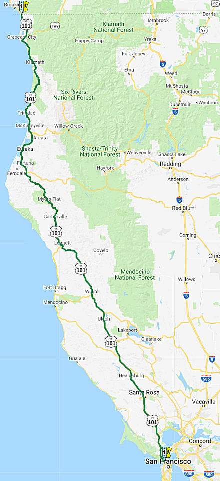 From a point in Marin County opposite San Francisco to the Oregon state line
via Crescent City.
From a point in Marin County opposite San Francisco to the Oregon state line
via Crescent City.
Post 1964 Signage HistoryThe definition of this segment remains unchanged from 1963, other than it changing from (c) to (b).
Portions of this route are now Route 254, as surface routings have been replaced by freeway. Another "old US 101" segment is present-day Route 271. It also appears that State Street in the Ukiah, Calpella, and Redwood Valley areas is a former segment of US 101, in particular, the segment from Route 253 to downtown Calpella.
Note: Licensed carriers of livestock are exempted from certain limitations of access when those carriers are directly en route to or from a point of loading or unloading of livestock on specified portions of Route 101 located in the Counties of Del Norte, Humboldt, and Mendocino from its junction with Route 1 near Leggett north to the Oregon border, if the travel is necessary, incidental to the shipment of the livestock, and certain conditions are met. This examption expires on January 1, 2015. However, if the director of the Department of Transporation determines that certain safety improvements to a portion of Route 101 have resulted in the reclassification of the entire segment as a terminal access route pursuant to specified provisions of the Vehicle Code, the exemption may be repealed. (ACR 349, Statute Chapter 172, 8/4/11)
Before the current freeway US 101 was aligned through Ukiah on State
Street. In 1959, plans were made to widen State Street as an interim
measure to flow traffic on US 101 through downtown Ukiah more efficiently
until the highway could be moved to a freeway bypass. By 1963, 5.2
miles of US 101/Route 20 in north Ukiah were upgraded to a four lane
freeway. The article notes that the construction contract for
building US 101 to a freeway in Ukiah was awarded in September 1963. By
1965, US 101 had been realigned onto the freeway bypass.
(Source: Gribblenation Blog (Tom Fearer), “Former US Route 101 on State Street in Ukiah and the Highway Corridors of Ukiah”, March 2021)
Willits Bypass (101 MEN 43.743 to MEN 48.69)
Note: For more information on the Willits Bypass, see the discussion of the bypass in the STATUS section below.
 In 196x, the State Highway Engineer recommended a freeway routing for 12.2 mi of US 101
between 0.5 mi N of he Northwestern Pacific railroad underpass S of
Willits and 0.4 mi N of Reeves Creek in Mendocino County. The route
runs about a mile E of Willits on a more direct line than the current
highway. The recommended route was Alternative C, which came in at $4.8
mil lower in cost than Alternative B, the Westerly Bypass. It was also
less disruptive to the community, affecting 53 parcels vs. 143 parcels. By
1963, the March/April 1963 California Highways & Public Works was
referencing this routing as having been adopted.. The adopted
freeway alignment is cited to have a planned beginning at the Northwestern
Pacific railroad underpass south of downtown Willits with a northern
termination point at Reeves Creek. The southern segment of the
Willits Freeway was constructed to Haehl Creek by 1969, bypassing bypassed
the Northwestern Pacific Railroad underpass that is now part of Walker
Road. The late 1980s/early 1990s saw a series of environmental impact and
engineering studies take place to determine the viability of a freeway
bypass of Willits. Ultimately this resulted in a February 2008 route
adoption of the Willits Bypass. The Willits Bypass alignment carried
substantial differences compared to the 1963 Willits Freeway (the blog
entry that was the source of much of this paragraph has a good map).
The Willits Bypass was conceived as a four lane freeway alignment but the
project was met with heavy resistance. Ultimately the Willits Bypass
was constructed as a Super Two Freeway and was dedicated on November 3rd,
2016.
In 196x, the State Highway Engineer recommended a freeway routing for 12.2 mi of US 101
between 0.5 mi N of he Northwestern Pacific railroad underpass S of
Willits and 0.4 mi N of Reeves Creek in Mendocino County. The route
runs about a mile E of Willits on a more direct line than the current
highway. The recommended route was Alternative C, which came in at $4.8
mil lower in cost than Alternative B, the Westerly Bypass. It was also
less disruptive to the community, affecting 53 parcels vs. 143 parcels. By
1963, the March/April 1963 California Highways & Public Works was
referencing this routing as having been adopted.. The adopted
freeway alignment is cited to have a planned beginning at the Northwestern
Pacific railroad underpass south of downtown Willits with a northern
termination point at Reeves Creek. The southern segment of the
Willits Freeway was constructed to Haehl Creek by 1969, bypassing bypassed
the Northwestern Pacific Railroad underpass that is now part of Walker
Road. The late 1980s/early 1990s saw a series of environmental impact and
engineering studies take place to determine the viability of a freeway
bypass of Willits. Ultimately this resulted in a February 2008 route
adoption of the Willits Bypass. The Willits Bypass alignment carried
substantial differences compared to the 1963 Willits Freeway (the blog
entry that was the source of much of this paragraph has a good map).
The Willits Bypass was conceived as a four lane freeway alignment but the
project was met with heavy resistance. Ultimately the Willits Bypass
was constructed as a Super Two Freeway and was dedicated on November 3rd,
2016.
(Source: Gribblenation Blog (Tom Fearer), “US Route 101 and California State Route 20 in Willits”, March 2021; Image source: Press Democrat, 1/27/1963 via Joel Windmiller
2/1/2023)
Note: With the completion of the Willits Bypass in
November 2016, the old alignment of US 101 through Willits will become
part of Route 20 south of the point where it comes in from Fort Bragg, and
the portion north of Route 20 is supposed to be relinquished to the city.
Main Street north of Flower Street/CA 20 in Willits wasn't relinquished
until it was fully repaved by Caltrans in late 2018. However, as of May
2021, the postmile tool was still showing US 101 on Main Street (the
original routing), and was not giving postmiles for the new bypass, nor
was it giving Route 20 postmiles for the segment along Main Street.
(Source: Joe Rouse @ AARoads, 11/23/2016; Gribblenation Blog (Tom Fearer), “US Route 101 and California State Route 20 in Willits”, March 2021; Daniel Faigin, May 2021)
Originally, there were plans to bypass US 101 from Cummings to Cooks
Valley, near Richardson Grove State Park. The Richardson Grove bypass,
supposedly under construction in 1970 according to maps, ultimately it
never would be completed. This was part of a larger bypass planned as part
of Route 271. Only the southern part from Cummings (~ MEN R84.643) to
Leggett (~ MEN T91.297) and the northern part from S of Piercy (~ MEN
R101.819) to Cooks Valley (~ HUM T0.129). The uncompleted portion of the
bypass included Confusion Hill (~ MEN R99.456). In 2009, the original
alignment of US 101 in Confusion Hill was bypassed. This was because US 101 immediately north of Confusion Hill was infamously prone to
slides. The realignment of US 101 onto a bypass of Confusion Hill
required construction of two new bridges over the South Fork Eel
River. The decade long project to replace US 101 north of Confusion
Hill was realized in October of 2009 when the Confusion Hill Bridges were
fully opened to traffic. Upon the opening the Confusion Hill Bridges
the original alignment of US 101 was removed per FHWA guidelines.
The Confusion Hill Northern Bypass Bridge is a 531 foot long box girder
design. The Confusion Hill Southern Bypass Bridge is a 1,395 foot
long box girder design. Confusion Hill still shows up in the Caltrans
Postmile Tool as Route 101U (Unrelinquished) MEN 99.493. Route 101U near
Confusion Hill shows with a Postmile range of MEN 99.431 to MEN 100.457;
the alignment is likely retained because other jurisdictions didn't want
it due to the cost of slide mitigation. It incorporates Rosewarne Road
near Red Mountain Creek.
(Source: Gribblenation Blog (Tom Fearer), “Former US Route 101 at Confusion Hill”, March 2021)
The Newton B. Drury Scenic Parkway is a 10 mile segment of former US 101. Newton B. Drury Scenic Parkway begins at US 101/Redwood Highway Exit 753 in Redwood National Park within Humboldt County. Newton B. Drury Scenic Parkway follows the course of Prairie Creek through the namesake Prairie Creek Redwoods State Park back to US 101/Redwood Highway Exit 765 just north of the Del Norte County Line. The parkway was created as a result of a realignment of US 101 in 1993, after completion of a realignment effort started in the early 1980s. .
In Eureka CA, there are some survey markers on Ninth Street between A and
L streets. These are circular metal discs anchored into the south sidewalk
bearing the words "CALIFORNIA DIVISION OF HIGHWAYS," "HUM-101" and the
date 1971. The discs are centerline markers of what would have been the
realignment of US 101, taking off from what is now Bayshore Mall, staying
south of Fourth and Fifth streets, and rejoining the present-day highway
west of the Eureka Slough bridge. Had the plan gone ahead, there would
have been a high-speed bypass through Eureka in the same way there is a
bypass of downtown Arcata.
(Source: North Coast Journal, 9/12/2019)
Pre 1964 Signage HistoryN of San Francisco, US 101 (which was signed since the mid-1930s) was LRN 1, defined in 1909, N to 5 mi NE of Crescent City. It was LRN 71, defined in 1919, from this point (the junction with US 199) to the Oregon border.
Marin County
According to Barry Spitz’s Marin, a History,
and A History of Corte Madera, edited by Jana Haehl, the
original “State Highway,” as it was designated in Marin in
1909, was a collection of Miwok trails and county roads that started at
the ferry terminal in Sausalito and traveled a westerly course around
Richardson Bay. After passing just-completed Tamalpais Union High School,
it bypassed downtown Mill Valley and followed today’s Camino Alto
over the hill into Corte Madera. From there, it went through Larkspur,
Ross, and San Anselmo, before turning east onto what’s now San
Rafael’s Miracle Mile. The original “State Highway” then
traveled down Fourth Street and turned north at today’s Lincoln
Avenue before going through what would become Novato (today’s
Redwood Highway), into the California redwoods and eventually on to
Oregon. That circuitous route through Marin was four miles longer than
what the current six- and eight-lane US 101 travels between Sausalito and
San Rafael. Thus, in 1925 the U.S. government authorized construction of
US 101, the nation’s westernmost federally owned highway. By 1929,
work on a direct passage through Marin had begun. They constructed the
Redwood Highway right across the marshland. After it was finished, tidal
waters sometimes rose on both sides of the highway, giving motorists a
sense of trepidation as they drove atop the dike that formed the roadbed.
Today, that roadway is eight-lanes wide, and Town Center and the Village
at Corte Madera shopping centers occupy those marshlands. According to
Caltrans historian Alicia Whitten, the conversion to a direct route
through Marin culminated with the November 1931 completion of the Redwood
Bridge, a redwood-timbered quarter-mile span over Richardson Bay. In 1956,
it was replaced with a much wider steel and concrete structure. In
1935—even before the Golden Gate Bridge opened—Marin County
moved to ban billboards along its stretch of US 101. The Waldo Tunnel also
opened in 1937. The original 1,000-foot bore was four lanes wide, handled
two-way traffic and cost $630,346. In the mid-’50s, a second tunnel
opened to handle southbound traffic (northbound uses the original tunnel).
It cost $1.75 million. In 1942, the elevated roadbed through San Rafael
was completed and 10 years later came the first versions of
“cloverleaf” turnouts at Sir Francis Drake Boulevard and North
San Pedro Road.
(Source: Marin Magazine, May 2009)
 In 1955, a freeway routing was adopted for Cotati (~ SON 12.564), with underpasses as Roblar
Ave and Gravenstein Hwy. There would be no overpass at School St. because
of the short distances between the full underpasses. There would be a
half-diamond interchange at Roblar, and a full diamond interchange at
Gravenstein and Redwood Highway. There would also be a frontage road
between Roblar and School St.
In 1955, a freeway routing was adopted for Cotati (~ SON 12.564), with underpasses as Roblar
Ave and Gravenstein Hwy. There would be no overpass at School St. because
of the short distances between the full underpasses. There would be a
half-diamond interchange at Roblar, and a full diamond interchange at
Gravenstein and Redwood Highway. There would also be a frontage road
between Roblar and School St.
(Source: Santa Rosa Press Democrat, 2/16/1955, via Joel Windmiller,
2/17/2023)
Santa Rosa
Railroad Square in Santa Rosa refers to a neighborhood
bounded by; Third Street, Davis Street, Sixth Street and Santa Rosa Creek.
The creation of Railroad Square can be directly attributed to LRN 1
(signed as US 101 after 1926) being moved to a limited access roadway.
With the passage of the 1909 First State Highway Bond Act, LRN was plotted
from the Oregon State Line to San Francisco Bay. LRN 1 headed northbound
traversed Santa Rosa using the following alignment: (1) Santa Rosa Avenue
to Old Courthouse Square; (2) Old Courthouse Square to Mendocino Avenue;
(3) Mendocino Avenue north out of Santa Rosa. During the 1919 Third State
Highway Bond Act, LRN 51 (signed as Route 12 after 1934) was added to the
Highway System. LRN 51 as originally defined was aligned between Santa
Rosa east to Shellville. The original alignment of LRN 51 east of LRN 1
branched away via 4th Street from Mendocino Avenue. In 1933,
LRN 51 was extended west through Santa Rosa to Sebastopol. LRN 51
multiplexed US 101/LRN 2 along Mendocino Avenue, Old Courthouse Square,
and Santa Rosa Avenue before splitting west along Sebastopol Road. The
opening of the 4.3 mi "Santa Rosa Freeway" (in today's parlance, an
expressway) route of US 101/LRN 1 on May 20th, 1949 altered the
routes of US 101 and Route 12. US 101/LRN 1 moved to the Santa Rosa
Freeway routing, and the route of Route 12 westbound was altered north of
downtown, moving off of 4th Street approaching downtown to meet
US 101/LRN 1 via College Avenue. US 101/Route 12 multiplexed on the Santa
Rosa Freeway south to Sebastopol Road where Route 12 split west. For a
time the former surface route of US 101/LRN 1 in Santa Rosa was signed as
US 101A. An unintended consequence of the Santa Rosa Freeway was that it
divided what is now Railroad Square from the rest of downtown Santa Rosa.
See the linked Gribblenation blog for more details, including links to
maps and pictures.
(Source: Gribblenation Blog "Railroad Square Historic District, US Route 101, California State Route 12; Santa Rosa, California")
In July 2021, it was noted that some of the early plans
for Santa Rosa proposed having US 101 routed around the town instead of
through it and proposed routes further east or west, possibly along Fulton
and Wright roads, to ease truck traffic in the city. But some businessmen
worried about potential customers being rerouted too far from shops
lobbied to have it close to downtown, and ultimately the city council
agreed. State highway engineers in the 1940s recommended a highway
overpass, which was protested by Santa Rosans and was referred to in media
reports as a “highway on stilts.” “How would traffic,
once hoisted into the air, ever find its way back into our business
districts?” asked a 1941 Press Democrat editorial. Public opinion
trumped engineers’ opinions and on May 20, 1949, the ground-level
Santa Rosa “freeway” opened to the public. It cost $2.85
million to build the divided, four-lane highway about 4.3 miles long, and
around the Davis Street neighborhood, 92 houses were moved and 22 were
wrecked to make room for it, according to the state highway commission.
The ground-level freeway intersected with several city streets, including
some without stop lights, resulting in a series of accidents and
pedestrians fatally struck while crossing. Finally, in 1968, US 101
through Santa Rosa was elevated after 2½ years of construction work
and another $3.8 million spent.
(Source: Press Democrat, 7/15/2021)
Between Cloverdale (~ SON R51.909) and Hopland (~ MEN 11.011), the
original alignment of US 101 and the Redwood Highway can be found west of
the modern highway via Mountain House Road, Route 128 and Cloverdale
Boulevard. By 1917, CSAA maps were showing LRN 1 aligned on what is now
Mountain House Road and Route 128 from Cloverdale to Hopland. This routing
continued with the signage of US 101 in 1926. In 1928, it was reported
that the Redwood Empire Association requested comment from the California
Highway Commission regarding a potential realignment of US 101/LRN 1 from
Cloverdate to Hopland east of the Russian River. The California
Highway Commission responded by advising the Redwood Empire Association
that a survey for the realignment of US 101/LRN had already been
conducted. By 1929, the realignment was planned and approved,
although there was no funding. The realignment would track largely east of
the Russian River and shorten the highway by approximately three
miles. By 1934 funding had been found, and the alignment was nearly
completed along the Russian River. The original alignment of US 101/LRN between Hopland-Cloverdale (referred to the as the Hopland Grade)
was "tortuous" and ridge lined with two summits peaking over 1,200 feet
above sea level. The realignment of US 101 started
construction in February 1923 and cost approximately $1,225,000 dollars.
The original alignment was partially retained as a state highway west of
Cloverdale Boulevard to Mountain House Road as part of then Route 28
(renumbered as Route 128 in 1953)/LRN 48. This captured the movement of
LRN 1 to the new alignment, and thus extended LRN 48 from its old terminus
at the old alignment of LRN 1 in McDonald to the new alignment of LRN 1 at
Cloverdale. The freeway bypass of Cloverdalle opened in 1994. See the
linked Gribblenation blog for more details, including links to maps and
pictures.
(Source: Gribblenation Blog, “Former US Route 101 between Hopland and Cloverdale”, March 2021)
In Willits, US 101 was originally routed along Main Street as early as
1917, when the route was simply (unsigned) LRN 1. Around 1937, US 101/Redwood Highway was greatly improved on the outskirts of Willits
An article in CHPW from that time references two ongoing projects
anticipated to be completed during summer of 1937 that would eliminate 47
curves from US 101/Redwood north and south of Willits. In
1953, LRN 15 was extended from Ukiah to Fort Bragg via Willits. This would
eventually become Route 20. By 1958, Route 20 was extended through Willits
via Fort Bragg-Willits Road to Route 1. This extension of Route 20
included a multiplex of US 101 north of Ukiah into downtown Willits,
incorporating existing Flower Road and Fort Bragg-Willits Road as part of
Route 20/LRN 15. See the linked Gribblenation blog for more details,
including links to maps and pictures.
(Source: Gribblenation Blog (Tom Fearer), “US Route 101 and California State Route 20 in Willits”, March 2021)
North of Willits (General)
Chris Sampang observes that there are quite a few surface streets that are likely old US 101 routings, having been bypassed when the freeway N of Willits was completed. He identifies these as:
Note also that in Cloverdale, part of Cloverdale Blvd was likely part of US 101, and was cosigned with Route 128.
Benbow, Garberville and Redway (~ HUM R8.356 to HUM R14.538)
The former surface alignment of US 101 (LRN 1) in
Garberville and Redway once crossed the Garberville Bluffs along what is
now Redwood Drive via a corridor constructed as part of the Redwood
Highway during the 1910s. US 101 through Benbow, Garberville and
Redway was modernized by 1935. US 101 would eventually be upgraded
to freeway standards in Benbow, Garberville and Redway by extension of the
Redwood Freeway during 1966-68.
(Source: Gribblenation Blog (Tom Fearer), "US Route 101 in Benbow, Garberville and Redway", 3/2023)
Prior to the construction of LRN 1, wagon borne traffic
heading north from Cummings to Humboldt County had to ascend the
treacherous Rattlesnake Grade (also known as the Bell Springs
Grade). The Rattlesnake Grade is described in the July 1916
California Highway Bulletin as being only passable during the summer
months. The initial north climb on the Rattlesnake Grade ascended
grades as high as 20% the from Cummings to the 4,100-foot-high Bell
Springs Mountain. The descent from Bell Mountain to Dyerville (now
on Route 254/Avenue of the Giants) is described as having grades as steep
as 30% amid an elevation drop of just over 3,900 feet. The
construction of LRN 1 (then known as the Mendocino State Highway) sought
to follow the Eel River watershed to bypass the Rattlesnake Grade. Much of
the Rattlesnake Grade still exists as modern Bell Springs Road.
(Source: Gribblenation Blog (Tom Fearer), "US Route 101 in Benbow, Garberville and Redway", 3/2023)
During November 1926, US 101 was created. US 101 from
San Francisco north to Crescent City was aligned over the Redwood
Highway. Within Redway and Garberville US Route 101 was aligned on
Redwood Drive. In 1934, a realignment/straightening of US 101/LRN 1
through Benbow, Garberville and Redway was in progress. The
realignment would reduce the number of curves in the
Benbow/Garberville/Redway corridor from 130 to 34 over a 0.46-mile shorter
routing.
(Source: Gribblenation Blog (Tom Fearer), "US Route 101 in Benbow, Garberville and Redway", 3/2023)
In 1956, a 50-mile-long corridor study was completed
regarding upgrading US 101/LRN 1 in southern Humboldt County to freeway
standards. The location of the new Redwood Freeway corridor of US 101 was approved by the State Highway Engineer on January 25, 1956.
A public hearing on the new US 101 Redwood Freeway corridor was held in
Garberville on February 8, 1956. The new US 101 freeway bypassing
Redway, Garberville opened during Fall 1967. It was extended S of
Benbow by 1969.
(Source: Gribblenation Blog (Tom Fearer), "US Route 101 in Benbow, Garberville and Redway", 3/2023)
Eureka (~ HUM 74.616 to HUM 81.508)
Around 1918, in the Eureka area, growing population led
the Division of Highways to complete a new road between Eureka and Arcata.
The division built the section of highway connecting Eureka and Arcata in
1918 as a more direct route between the two towns. It replaced the
original Arcata Road, known after 1959 as Old Arcata Road north of Bayside
and Myrtle Avenue south of Bayside, which ran further east of Humboldt
Bay’s shoreline and tidal flats through the towns of Sunny Brae,
Bayside, and Indianola as the main artery between the two towns. Although
it was graded in 1918, the new road was not gravel surfaced until 1921,
and was finally paved in 1925. The road skirted Humboldt Bay parallel to
the Northwestern Pacific Railroad tracks, traveling through the locality
of Brainard (now Bracut), a rail stop most likely named for the family who
had owned the land in the nineteenth century. For most of its eight mile
length, the road cut through the tidal flats of the bay. The only
exception is the foothill area near what is now called Bracut, and was
formerly known as Brainard Cut.
(Source: Route 101 Eureka-Arcata Corridor Highway Improvement Project Historic Resources Evaluation Report, 7/16/2004)
 Following World War II, the Eureka-Arcata metropolitan area experienced rapid growth
with the expansion of the area’s lumber industry. In 1944, the
Division of Highways began to plan for highway development and expansion
in the area, but the project was limited by a lack of funds. Constructed
in two stages, the expanded highway consisted of two new northbound lanes
parallel to the old highway, which was rebuilt for use as two southbound
lanes. The Division of Highways opened the three-mile first section of the
new highway, from Gannon Slough, south of Arcata, to just north of that
town’s limits, in July 1954. The freeway followed the old road along
the eastern stretches of the bay, but north of Bracut it continued north
into Arcata instead of following the old road west along the bay’s
north shore. Work began on the southerly five miles of the highway, from
Gannon Slough south to the Eureka city limits, in May 1954 and was
completed in the summer of 1955. Improvements to US 101 were completed in
the summer of 1955, relieving traffic congestion between the two cities.
The highway also provided improved access for two county roads
serving the Humboldt County Airport and the small developing
industrial area in the East Highway subdivision. Also at this time, a new
freeway routing was built between Eureka and Arcata. Just south of Arcata,
the old road had skirted Humboldt Bay, traveling west until turning north
into town. After 1954, the Arcata Bypass skirted the east shore of
Humboldt Bay, then continued directly north into Arcata instead of
following the old road west along the northern reaches of the Bay.
Following World War II, the Eureka-Arcata metropolitan area experienced rapid growth
with the expansion of the area’s lumber industry. In 1944, the
Division of Highways began to plan for highway development and expansion
in the area, but the project was limited by a lack of funds. Constructed
in two stages, the expanded highway consisted of two new northbound lanes
parallel to the old highway, which was rebuilt for use as two southbound
lanes. The Division of Highways opened the three-mile first section of the
new highway, from Gannon Slough, south of Arcata, to just north of that
town’s limits, in July 1954. The freeway followed the old road along
the eastern stretches of the bay, but north of Bracut it continued north
into Arcata instead of following the old road west along the bay’s
north shore. Work began on the southerly five miles of the highway, from
Gannon Slough south to the Eureka city limits, in May 1954 and was
completed in the summer of 1955. Improvements to US 101 were completed in
the summer of 1955, relieving traffic congestion between the two cities.
The highway also provided improved access for two county roads
serving the Humboldt County Airport and the small developing
industrial area in the East Highway subdivision. Also at this time, a new
freeway routing was built between Eureka and Arcata. Just south of Arcata,
the old road had skirted Humboldt Bay, traveling west until turning north
into town. After 1954, the Arcata Bypass skirted the east shore of
Humboldt Bay, then continued directly north into Arcata instead of
following the old road west along the northern reaches of the Bay.
(Source: Route 101 Eureka-Arcata Corridor Highway Improvement Project Historic Resources Evaluation Report, 7/16/2004)
In 1968, proposals were floated for a US 101 "bypass"
freeway through Eureka. These proposals died at some point, as the 2023
routing appears to be unchanged from the routing at the time of the
proposals. They show a primary routing ("blue"), also known as the
Waterfront routing, that is near the current route, with a few variations
in the central city area ("red"). There is an "orange" routing that goes
more through the center of the city, and a "green" routing that avoids the
major portion of the city to the E.
(Source: Eureka Times Standard 9/11/1968 via Joel Windmiller,
1/27/2023)
About the same time as the Arcata expressway expansion
discussions in 1964-1968, a controversial debate was transpiring about the
Eureka bypass. The Eureka bypass had four routes that were discussed
for years by the local government and the voters. Downtown business owners
and community members all had objections to one or more of the four
routes. The Eureka City Council finally adopted a route and signed a
contract with Caltrans, only to have then Governor Edmund G. Brown, Jr.
cancel the freeway budget funds.
(Source: The Arcata Freeway: How it Split the Community More Than Just Geographically, Barbara Lani Stites, 3/1/1991)
Arcata (~ HUM 84.928 to HUM 89.128)
The original highway through Arcata and Eureka was
first graded in 1918 and surfaced in gravel in 1921. By 1925 concrete
pavement was installed. As early as 1944 the state was contemplating
highway improvements from the south city limits of Eureka, through Arcata,
to the Route 299 interchange. This program was listed as a high priority
project dependent upon the availability of funds from the state budget.
These funds were made available in the 1947 Collier-Burns Highway Act. In
1950, the Arcata City Council approved the location of the corridor
by-passing downtown Arcata.
(Source: The Arcata Freeway: How it Split the Community More Than Just Geographically, Barbara Lani Stites, 3/1/1991)
 Between 1964 and 1968, there was little opposition expressed against the
conversion of the US 101 expressway into a freeway. During these years the
Division of Highways held dozens of meetings with the Arcata City Council
and Humboldt State College to discuss the project's design. The proposal
called for reconstruction of a 1.7 mile segment of the existing four-lane
divided expressway to an initial six-lane divided freeway with provisions
for two additional lanes in the median. A four-lane frontage road was
planned in front of the college on the east side of the freeway, as well
as, two interchanges and on-off ramps at 14th Street. The
conversion would extend from 7th Street in the south to the
Arlington Way Overhead just north of the city limits, with an estimated
cost of $11,600,000. Both the council and the college incorporated this
freeway design into their general and master plans as a result of the
joint meetings with the state. The City Council executed a freeway
agreement with the state in March 1968.
Between 1964 and 1968, there was little opposition expressed against the
conversion of the US 101 expressway into a freeway. During these years the
Division of Highways held dozens of meetings with the Arcata City Council
and Humboldt State College to discuss the project's design. The proposal
called for reconstruction of a 1.7 mile segment of the existing four-lane
divided expressway to an initial six-lane divided freeway with provisions
for two additional lanes in the median. A four-lane frontage road was
planned in front of the college on the east side of the freeway, as well
as, two interchanges and on-off ramps at 14th Street. The
conversion would extend from 7th Street in the south to the
Arlington Way Overhead just north of the city limits, with an estimated
cost of $11,600,000. Both the council and the college incorporated this
freeway design into their general and master plans as a result of the
joint meetings with the state. The City Council executed a freeway
agreement with the state in March 1968.
(Source: The Arcata Freeway: How it Split the Community More Than Just Geographically, Barbara Lani Stites, 3/1/1991)
Several opposition groups organized sporadically
throughout the two decades of the freeway controversy. In June 1970, the
first group organized was the Citizens Committee for a New Hearing on the
Arcata Freeway. They were the first of many groups to suggest that the
freeway be reduced from six lanes to four lanes. In 1972, the opposition
groups confronted state and local officials and political lines were
drawn. Opposition to the six lanes began in earnest when the Stop-at-Four
Committee was formed. In 1972, a Caltrans policy change reduced the
freeway to 4 lanes. However, in 1973 the controversy continued among
various segments of the community. The renewed debate was over the state's
Environmental Impact Statement (EIS) which was required by the newly
enacted California Environmental Quality Act. The City Council passed
Resolution No. 723-70 on May 2, 1973. This resolution specified nine
points, which, in effect, placed the city's government in opposition
to the freeway proposal. It called for four lanes and no structural
changes to the existing roadway. Before the end of 1973, the California
Highway Commission made the final approval of funds for the conversion of
the expressway to a freeway, as well as, approving the EIS. Caltrans
planned to have advertisements for bids out by spring 1974. In 1974, the
new Arcata council repeated a request to the California Highway Commission
to reduce the size of the freeway. The response was an offer by Caltrans
to eliminate two ramps. In the meantime, the Commission approved a 25%
increase to the project's budget so that the freeway bids could proceed.
After 26½ months, the freeway was finally completed on October 2,
1976.
(Source: The Arcata Freeway: How it Split the Community More Than Just Geographically, Barbara Lani Stites, 3/1/1991)
The Gribblnation Blog "Douglas Memorial Bridge; the ruins of US Route 101 and the Redwood Highway over the Klamath River" provides a detailed history of the Douglas Memorial Bridge in Klamath.
Last Chance Grade: Klamath River (~ DN R4.158) to Crescent City (~ DN 25.164)
The history of US 101 in the area of the Last Chance
Grade (the segment from the Klamath River (~ DN R4.158) to Crescent City
(~ DN 25.164)) starts with Crescent City-Requa Road, which was authorized
for construction by the Del Norte County Board of Supervisors in 1888.
Prior to that, the only connection had been by boats along the coast or by
foot. This road was placed under construction in 1889 and was known as the
Crescent City-Requa Road. The Crescent City-Requa Road would be
completed by 1895 and ascended the notable slope of the Last Chance
Slide. Journeys on the Crescent City-Requa Road were made via four
horse or six horse teams which took ten to sixteen hours to complete
depending on the weather conditions. By 1917, state maintenance had
seemingly been assumed, as state maps were showing LRN 1 aligned
over the Last Chance Grade via the Crescent City-Requa Road. The existing
Crescent City-Requa Road was upgraded and modernized to State standards by
1920. Much of the previous Redwood puncheon roadway (plank road)
from Crescent City south to Wilson's Creek was abandoned as it was not
suited to automotive traffic. This 1920 alignment of LRN 1/Redwood
Highway now exists as Enderts Beach Road and the California Coastal Trail
in Del Norte Coast Redwoods State Park. In 1934, work was completed on a
new alignment that eliminate 205 curves south of Crescent City to the Last
Chance Slide, leaving only 34 curves and shortning the distance between
Crescent City and the Last Chance Slide from 10.31 miles to 9.52 miles.
The route has changed little since then. See the linked Gribblenation
blog for more details, including links to maps and pictures.
(Source: Gribblenation Blog (Tom Fearer), “US Route 101 and the Last Chance Grade”, February 2021)
Note: Significant rerouting in the area of the Last Chance Slide is planned post 2021; see the discussion in the STATUS section below.
Crescent City (~ DN 23.173 to DN R27.929)
 In November 1956, a proposal was presented by the Division of Highways for a
rerouting of US 101 in Crescent City. This rerouting would move US 101 off
Front, H, and 3rd Streets and on to one-way couplets of L and M
street, together with an extension of L Street paralleling Front Street.
In November 1956, a proposal was presented by the Division of Highways for a
rerouting of US 101 in Crescent City. This rerouting would move US 101 off
Front, H, and 3rd Streets and on to one-way couplets of L and M
street, together with an extension of L Street paralleling Front Street.
(Source: Humboldt Standard, 11/27/1956 via Joel Windmiller,
1/29/2023)
StatusGolden Gate Bridge to Route 37 near Novato
In August 2011, the CTC approved $24,413,000 in SHOPP funding for repairs in and near Sausalito, Corte Madera and Larkspur from the Golden Gate Bridge (~ MRN L0.0) to Corte Madera Creek (~ MRN 8.556) that will rehabilitate 45.0 lane miles of roadway to improve the ride quality, prevent further deterioration of the traveling surface, minimize costly roadway repairs and extend the pavement service life. They also approved finding to repave an 8.5-mile stretch of US 101 in Marin from Vista Point at the Golden Gate Bridge (~ MRN 0.026) to Lucky Drive in Larkspur (~MRN 8.371). The work will begin in Fall 2011. Additionally, Caltrans is repaving US 101 between Terra Linda (~ MRN 13.725) and Route 37 in southern Novato (~ MRN 18.969), and another segment of the route will be repaved as part of a widening project on US 101 north of Route 37 (~ MRN 18.969) to just north of Atherton Avenue (~ MRN R22.044).
Marin County Carpool Lane Hours
In June 2017, it was reported that the Metropolitan
Transportation Commission — the Bay Area’s transportation
planning agency — is seeking extension of carpool lane hours on
southbound US 101, from 6:30 to 10 a.m., as a pilot project. Hours are now
6:30 to 8:30 a.m. Two people in a vehicle constitute a carpool. The agency
said the change would offer better traffic flow for commuters sharing
rides and for Golden Gate Transit buses. Marin transportation officials
and the California Highway Patrol are opposing the plan, worried it would
make traffic worse rather than better. The MTC had hoped to start the
program in June 2017. The Transportation Authority of Marin would like the
plan to move at a slower pace, and be put on hold until other freeway
operations can altered, such as the implementation of ramp metering. The
expanded hours could create more carpools, supporters have noted. Golden
Gate Bridge officials support the expansion of carpool hours, which could
allow Golden Gate Transit buses to make better time. But there are
opponents. The Marin office of the California Highway Patrol sees
unintended consequences of changing the hours, including more traffic and
collisions. After the initial pilot this summer, the commission would like
to see a northbound US 101 pilot expansion of carpool lane hours from
February through July of 2018. The northbound carpool lane hours are now
from 4:30 to 7 p.m., but would expand to 3 to 7 p.m. during the test
period. Carpool lanes began in Marin in 1974 for buses only. In 1976 they
were opened up to carpools of three people and in 1988 the standard was
reduced to two people. The hours were expanded in July 1998, but after
complaints they reverted to the current hours that December.
(Source: Marin I-J, 6/9/2017)
Corte Madera Area / Marin Overpass Safety Improvements (~ MRN 1.519)
In October 2016, it was reported that work crews are
improving a decades-old overpass above US 101 on the Waldo Grade in
Sausalito as part of a larger effort countywide to replace safety railings
and prevent vehicles from crashing on roadways below. The Spencer Avenue
overpass that leads to Wolfback Ridge was built in 1954, before SUVs and
larger vehicles were commonplace. The higher profile, and sometimes
heavier vehicles of today require stronger bridge railings. Concrete
baluster rails will be replaced with stronger concrete barriers. The
Spencer overpass is one of several bridges in the county scheduled for the
work along the highway corridor. Work on the on- and off-ramps and US 101
over Corte Madera Creek in Larkspur — built between 1957 and 1961
— is ongoing. The Monte Mar Drive undercrossing in Sausalito, built
in 1954, and the Gallinas Creek bridge, built in 1951, are part of the
work. San Rafael-based Ghilotti Bros. Inc./RM Harris is doing the work for
Caltrans at a cost of roughly $8 million.
(Source: Marin I-J, 10/6/2016)
In November 2017, it was reported that crews continue
to work on improving safety railings on decades-old overpasses and ramps
as part of a larger effort statewide. This includes work on the onramps
and offramps and US 101 over Corte Madera Creek in Larkspur — built
between 1957 and 1961. Work is also occurring on the Waldo Grade in
Sausalito. The Spencer Avenue overpass that leads to Wolfback Ridge was
built in 1954, before SUVs and larger vehicles were common. The sometimes
heavier vehicles of today require stronger bridge railings, Caltrans
officials have noted. “Updated bridge rails will be concrete
barriers ... which provide enhanced ability to prevent an errant vehicle
from leaving the structure and reduce the severity (of) potential
crashes,” a Caltrans report says. Concrete baluster rails will be
replaced with stronger concrete barriers. The Monte Mar Drive
undercrossing in Sausalito, built in 1954, and the Gallinas Creek bridge,
built in 1951, are also part of the project, which costs about $9 million.
Under a separate $1.8 million contract, work was completed on Freitas
Parkway in Terra Linda, and on the highway overpasses at North San Pedro
Road and Lucas Valley Road. The work is part of a plan over a decade
across the state to reduce “non-crash worthy” bridges.
(Source: Marin I-J, 11/5/2017)
Marin County Metering Lights (~ MRN 1.534 to MRN 8.561)
In September 2016, it was reported that Transportation
Authority of Marin (TAM), Caltrans and the Metropolitan Transportation
Commission (MTC) united to endorse metering lights along US 101 in Marin
County. Those agencies, along with local municipalities, formed the Ramp
Metering Technical Advisory Committee (RMTAC), which has concluded that
— given the limited funding available — the first phase of
metering should occur on the northbound ramps from Spencer Avenue near
Sausalito (~ MRN 1.534) to Sir Francis Drake Boulevard (~ MRN 8.561). A
long list of highway onramps will follow suit with metering lights.
According to TAM, "By metering an on ramp you break up the ‘platoon
effect’ vehicles have as they enter the highway. This allows the
cars to seamlessly enter the lane like a ‘zipper effect.’ By
allowing the cars to merge evenly with the traffic on the highway, the
traffic on the highway does not need to hit the brakes, which often causes
a series of cars to slow down. A major element of metering ramps is that
they allow traffic to flow at a consistent rate. This allows for a faster
rate of travel and reduced travel times in a corridor. The significance of
this is that it provides users with a more reliable pattern they can count
on when planning their trips.” Most onramps in Marin — about
39 of them — will be fitted with metering lights.
(Source: Marin News Pointer, 9/1/2016)
In May 2017, it was reported that Marin needs roughly
$6 million to make metering lights operational, but funding for the
program has gone dry. For the past five years the Metropolitan
Transportation Commission, Caltrans and the Transportation Authority of
Marin have been discussing ramp metering as a way to unclog increasingly
sluggish freeway traffic. At one point the Metropolitan Transportation
Commission — the Bay Area’s transportation planning agency
— gave Caltrans money to begin bringing metering lights online
around the Bay Area, but those funds didn’t reach Marin. An initial
Marin phase would involve about 10 northbound US 101 ramps from Sausalito
to Sir Francis Drake Boulevard, a section of the freeway that gets tied up
in traffic during the evening commute. “We need about $5 million or
$6 million for a first phase,” said Dianne Steinhauser, executive
director of the Transportation Authority of Marin. A second phase could
have the metering lights turned on in Novato. US 101 in Marin has 30 ramps
in the northbound direction and 29 in the southbound direction. Of those,
43 could have metering lights. Several onramps in Marin, such as the one
to northbound US 101 near the ferry terminal in Larkspur, have metering
lights installed, but they are not functional. Those were put in as part
of a state requirement that lights be installed once an interchange is
rebuilt.
(Source: Marin I-J, 5/1/2017)
In April 2019, it was reported that the first of a
two-phase traffic meter installation project had been started by Caltrans.
This project will see meters installed at four northbound and one
southbound onramp in central and southern Marin. Over 2019, the state
agency will monitor traffic flow at the new locations using sensors to
determine the best timing for the traffic meters. The lights are expected
to come online in spring 2020. The first phase of the project is estimated
to cost $6.9 million and will install meters between the Route 131/Tiburon
Boulevard onramp and the Sir Francis Drake Boulevard onramp, according to
Caltrans spokesman Marcus Wagner. The second phase, which is slated to
begin in 2026-27, would install traffic meters at all remaining northbound
onramps in Marin, though the project could begin sooner, according to
local transportation officials.
(Source: Marin I-J, 4/27/2019)
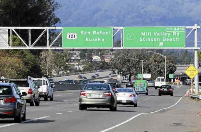 In December 2016, it was noted that (as part of a sign
replacement project) a “Mill Valley Road” sign was erected
along northbound US 101 at the Route 1 exit (~ MRN 3.907). The sign has
drivers scratching their heads. There is no such road in Marin. Caltrans
spokesman Steve Williams acknowledged the goof, but he was not sure how it
occurred. The agency promises a fix in the coming days. Caltrans is in the
process of changing out signs throughout the county to ones made with a
better reflector material.
In December 2016, it was noted that (as part of a sign
replacement project) a “Mill Valley Road” sign was erected
along northbound US 101 at the Route 1 exit (~ MRN 3.907). The sign has
drivers scratching their heads. There is no such road in Marin. Caltrans
spokesman Steve Williams acknowledged the goof, but he was not sure how it
occurred. The agency promises a fix in the coming days. Caltrans is in the
process of changing out signs throughout the county to ones made with a
better reflector material.
(Source: Marin I-J, 12/12/2016)
Marin City Climate Change Adaptations (~ 04-Mrn-101 3.151/3.393)
In April 2022, it was reported that a proposed project
along US 101 would elevate a portion of the southbound lane and offramp at
the Marin City exit (~ MRN 3.151); construct a 700-foot floodwall between
the highway and a stormwater pond; and install pumping mechanisms to
increase flow from the pond into the Richardson Bay. The goal is to ease
flooding in Southern Marin. The project also includes an effort to raise
Route 1 north of the Manzanita commuter lot, which is closed routinely
because of flooding. An automatic tide gate would be installed at the lot
and drainage would be reconstructed. The Mill-Valley-Sausalito multiuse
path also would be raised by about 3 feet. The projects have a rough
estimate of $75 million to $100 million. They are in a draft phase and
will likely require an environmental engineering review, which is expected
to take one to two years.
(Source: East Bay Times, 4/10/2022)
In July 2022, it was reported that the state
Legislature and Gov. Gavin Newsom have allocated $30 million in the state
budget to begin planning for defenses against climate change for the area.
The budget adopted provides $20 million to begin designing flood
protections on Route 37 (04-Mrn-37 PM R11.2/14.6. PPNO 04-5200; ProjID
0419000376; EA 4Q320) and the Novato Creek Bridge (04-Mrn-37 0.0). Another
$10 million is for planning defenses for recurring flooding on US 101 that
blocks the only road in and out of Marin City (~ 04-Mrn-101 3.393). Route 37, the 21-mile link between I-80 and US 101 near Novato, is used daily by
nearly 50,000 commuters, many of them making their way to jobs in the
North Bay. The low-lying highway along the bay has regularly experienced
prolonged closures because of flooding. By 2040, sea-level rise threatens
to regularly inundate the corridor, making it virtually unusable,
according to Caltrans. Caltrans is studying several projects to overhaul
the road, including a complete rebuild or rerouting of the highway. One
nearer-term project is the rebuilding of the Novato Creek Bridge. The
bridge placement project is being studied as part of an environmental
review of a problematic 4-mile section of highway between Novato and the
Black Point Bridge. This section has flooded twice since 2017, including
in the winter of 2019, causing the highway to close for days or weeks at a
time. The study, which will include various design options, is set for
completion next year. Regardless of the option that is studied, the Novato
Creek Bridge will need to be replaced, and funding can be utilized for the
design costs of the Novato Creek Bridge, interim fixes and raising the
highway corridor in some of the most vulnerable sections. With respect to
the US 101 funding, Marin City has long dealt with US 101 flooding that
blocks the only access point in and out of the community during heavy
rains and high tides. The $10 million state allocation allows Caltrans,
the Transportation Authority of Marin and other project partners to begin
design work or environmental reviews for flood control projects. One
proposed project would elevate a section of a southbound US 101 lane and
the offramp at the Marin City exit. The project would also build a
700-foot floodwall between the highway and a stormwater pond near the
Gateway Shopping Center, as well as facilities to pump water from the pond
into Richardson Bay.
(Source: Marin I-J, 7/3/2022)
Tiberon Blvd Interchange / Mill Valley (~ MRN 5.657)
In December 2017, it was reported that Caltrans was
taking the lead on an estimated $2 million project aimed at unclogging a
busy freeway interchange linking Tiburon and Mill Valley, transportation
officials said. The project would add a lane on Tiburon Boulevard from
North Knoll Road westward and create a two-lane northbound onramp to US 101. The plan is now slated to be part of a larger $9.2 million project by
Caltrans, which includes adding onramp metering lights along US 101 from
the Golden Gate Bridge to Sir Francis Drake Boulevard, said Steve
Williams, a Caltrans spokesman. The Tiberon Blvd/US 101 interchange
carries 80,000 vehicles a day and has seen increased traffic since 1990,
according to a Mill Valley staff report. The Redwood Highway Frontage
Road, which runs parallel to the freeway from Strawberry, feeds onto
Tiburon Boulevard and the northbound freeway onramp and is also due for
improvements. The plan is to widen the frontage road too, allowing more
vehicles to move through the intersection in a shorter amount time. As of
September, Mill Valley, Tiburon, Belvedere and the county agreed to split
the cost of a $350,000 project study. Now that Caltrans has adopted the
project, it has accelerated the process and reduced the potential cost to
cities and the county. Whitney said Caltrans is now working on the design
of the project. Williams confirmed that about 60 percent of the design is
complete. Cost estimates could change as the design is finalized, he said.
Caltrans expects the project to break ground in early 2019.
(Source: Marin I-J, 12/11/2017)
In May 2019, it was reported that Caltrans crews began
construction on the interchange that connects Tiburon and Mill Valley as
part of a project aimed at reducing congestion in the area. Using
bulldozers, workers leveled a swath of open space next to the northbound
US 101 onramp from Tiburon Boulevard. Plans call for adding a second lane
there and installing metering lights to improve the efficiency of cars
merging onto the highway. The project will widen Tiburon Boulevard at
North Knoll Road, extending westward to the onramp. A third lane will be
added there and will be designated only for right turns toward the
highway. Caltrans is also planning to add a second lane and metering
lights to the loop onramp that leads from East Blithedale Avenue to
northbound US 101, on the opposite side of the interchange. The
construction is part of a larger $6.9 million ramp metering project on
northbound US 101 in central and southern Marin. There is a push to
eventually widen the freeway overpass there, but widening the onramps is a
more financially feasible solution in the meantime. The project is being
funded by state transportation money and funds collected through Senate
Bill 1, commonly known as the gas tax, which was signed into law in 2017.
(Source: Marin I-J, 5/10/2019)
In December 2011, it was reported that the overpass that connects Paradise and Tamalpais drives in Corte Madera (~MRN 7.008) will get $1.2 million to address problems that were causing it to sink into bay mud beneath the structure, causing pavement to dip. The CTC approved funding to repair the trouble spot; existing fill will be replaced with lightweight concrete material to stop the pavement from sinking and dipping. A contract for the work is expected to go out to bid next month with work starting in July 2012.
Tamalpais Drive Overcrossing № 27-0072 Reconstruction (04-Mrn-101 7.4)
In August 2023, it was reported that the CTC approved
$40 million for overhauling the Tamalpais Drive crossing over US 101 in
Corte Madera. The many upgrades proposed by Caltrans include seismic
retrofits to address earthquake safety concerns; disability access
upgrades; traffic flow improvements at intersections; new lighting and
landscaping; and a separate, multi-use path for pedestrians and cyclists.
The project will include the removal of two spiral walkway ramps on the
south side of the bridge. Built before the passage of the Americans with
Disabilities Act, the ramps are not compliant with the law and will be
replaced by ramps that meet the standards. Caltrans’ initial
proposal did not include the separated path, but the design was modified
after comments from Corte Madera residents, the Town Council and other
stakeholders. Currently, pedestrians must walk on a narrow sidewalk and
cyclists must ride alongside traffic on a painted bike lane. Local funding
is also being provided through a $3 million investment from Corte Madera
and $1.1 million from the county’s congestion management agency, the
Transportation Authority of Marin.
(Source: Marin I-J, 8/20/2023)
In August 2023, the CTC approved for future
consideration of funding 04-Mrn-101, PM 7.37: US 101 in Marin County.
Upgrade the structure over US 101 at Tamalpais Drive overcrossing by
replacing the existing nonstandard pedestrian facilities with Americans
with Disabilities Act compliant features. The project also includes
seismic structural improvements, intersection modifications,
reconfiguration of the on/off ramps, and repairs and maintenance of the
existing structure, in Marin County. (PPNO 1493E). The project also
includes seismic structural improvements, intersection modifications,
reconfiguration of the on/off ramps, and repairs and maintenance of the
existing structure. The project is currently programmed in the 2022
SHOPP for a total of $38,666,000, which includes Right of Way (Support and
Capital) and Construction (Support and Capital). Construction is estimated
to begin 2025-26. The scope, as described for the preferred alternative,
is consistent with the project scope as programmed by the Commission in
the 2022 SHOPP. A copy of the ND has been provided to Commission staff.
The project will result in less than significant impacts to the
environment. As a result, a ND was completed for this project.
(Source: August 2023 CTC Agenda, Agenda Item 2.2c.(1) Item 4)
In August 2023, the CTC approved the following
pre-construction allocation: $4,181,000. 04-Mrn-101 7.4. PPNO 04-1493E;
ProjNo 0416000042; EA 4J860. US 101 In Corte Madera, at Tamalpais Drive
Overcrossing № 27-0072 (PM 7.37). Bridge seismic restoration and
upgrade facilities to Americans with Disabilities Act (ADA) standards.
Additional $5,298,000 contribution for R/W Cap, R/W Sup, and Const Cap
from the Town of Corte Madera and Transportation Authority of Marin.
Concurrent consideration of funding under Resolution E-23-108; August
2023. Four month allocation time extension for PS&E and R/W Sup
approved under Waiver 23-72; June 2023. Allocation (Programmed / Allocated):
PS&E PS&E $3,462,000 / $3,982,000; R/W Sup
$169,000 / $199,000.
(Source: August 2023 CTC Agenda, Agenda Item 2.5b.(2b) #10)
Corte Madera Overpass/Greenbrae Interchange (~ MRN 8.03 - 8.582)
In September 2012, it was reported that Caltrans was working on plans for construction of the Greenbrae Interchange project on US 101. The purpose of the project is to reduce traffic congestion within the Greenbrae/Twin Cities Corridor by alleviating the short merging, diverging, and weaving areas along US 101. The plans for SB US 101 from Sir Francis Drake Boulevard include an auxiliary lane with an exit onto Fifer and an extended merge onto US 101. An overpass, meanwhile, carries southbound US 101 traffic to an exit onto Wornum Drive.
In January 2013, it was reported there was opposition
to the Corte Madera overpass project. This is proposed $143 million
construction project that would create elevated freeway segments and
demolish a pedestrian overcrossing along the Larkspur and Corte Madera
stretch of US 101. Caltrans and Transportation Authority of Marin
officials say the project — which has racked up $7 million in
expenses — is needed to improve safety, reduce congestion and
enhance multi-modal access in the area. Critics say the outdated,
monstrous Los Angeles-style proposal should be scrapped. Under the
project, a 44' flyover would be built to take drivers from southbound US 101 into Corte Madera, ending at Wornum Drive (~ MRN 8.03). Drivers coming
off Sir Francis Drake heading south (~ MRN 8.582) would use a newly built
road next to the freeway to make a more smooth and safe transition onto
the freeway. A barrier would also be put in place to make sure traffic
headed north through the interchange from Lucky Drive continues through to
East Sir Francis Drake Boulevard, stops at a light and then continues
north to get to US 101. The community believes the project is not designed
to increase capacity on the freeway, does not address flooding issues that
occur with every winter storm, doesn't adequately address the traffic
problem on Sir Francis Drake Boulevard and will degrade the bicycle and
pedestrian connection across US 101. In February 2013, it was reported
that Caltrans offered to create a 7-member committee to explore
alternatives. It was also reported that Corte Madera officials have
formally opposed the closure of Nellen Avenue (~ MRN 8.18)— a
potential roadblock for the planned southbound improvements — and
have demanded a full environmental impact report if the project moves
forward. The Town Council and members of the public are especially opposed
to the construction of a 33-foot tall flyover to take drivers from
southbound US 101 and Sir Francis Drake Boulevard into Corte Madera,
ending at Wornum Drive.
(Source: Marin Independent-Journal, 1/27/13, 2/7/2013, 2/12/2013)
In February 2013, it was reported that Larkspur has
joined Corte Madera in demanding the creation of a full environmental
impact report for the controversial project to rearrange the
Larkspur-Corte Madera stretch of US 101. Larkspur cites a lack of project
alternatives, inadequate public circulation of the draft state study,
significant visual and aesthetic impacts, understated impacts to local
traffic and a lack of detailed flooding mitigations as some of the
proposed project's problems. The letter states removal of trees from
around the highway, the construction of a large flyover and tall concrete
walls will block views of Mount Tamalpais, decreasing visual enjoyment of
the area and segregating the Redwood Highway area from greater Corte
Madera and Larkspur. Larkspur emergency personnel are also concerned the
project design will reduce local response times to the highway stretch
from the south end of the Greenbrae interchange to the Wornum Drive
overpass.
(Source: Marin Independent-Journal, 2/22/2013)
In July 2013, it was reports that a concensus is
starting to be reached regarding the southbound lanes near the Greenbrae
interchange. The planning group wants to study having two lanes exit onto
Sir Francis Drake Boulevard from southbound US 101, having three lanes
over the Corte Madera Creek from Sir Francis Drake Boulevard, keeping the
Greenbrae pedestrian overcrossing intact, adding auxiliary lanes from Sir
Francis Drake Boulevard to Tamalpais Drive and allowing a right turn from
Fifer Avenue onto Nellen Avenue. As far as northbound traffic lanes are
concerned, the group was unable to reach complete consensus. Most of the
group, except San Rafael Mayor Gary Phillips and Marin County Supervisor
Katie Rice, supported the creation of an auxiliary lane from Tamalpais
Drive, studying an interchange from the San Rafael-Richmond Bridge to US 101, widening east Sir Francis Drake Boulevard to two lanes and exploring
options to allow better merging from the highway to the San
Rafael-Richmond Bridge. A proposal to study a right-turn lane from
eastbound Fifer Avenue to southbound Nellen Drive was unanimously
supported.
(Source: Marin Independent-Journal, 7/23/13, 8/26/13)
In September 2013, the county finally settled on a plan
for the Greenbrae interchange. Board members ultimately voted in favor of,
with amendments, one of the authority staff plans that would spend $39.6
million on mostly bicycle and pedestrian improvements, a majority of which
were proposed by the working group. The board voted to spend $500,000 on a
feasibility study to connect US 101 to the San Rafael-Richmond Bridge,
$4.5 million for new regional and local bus stops, $250,000 for a
feasibility study for undercrossings on Wornum Drive, $9 million to widen
the bicycle pathway over Corte Madera Creek, $500,000 to extend a bicycle
path from Fifer Avenue to Wornum Drive, $2 million for sidewalk and
pedestrian improvements for Redwood Highway, $500,000 for colored asphalt
treatments, $500,000 for widening eastbound Sir Francis Drake Boulevard
onto the southbound collector lanes, $4 million to extend the eastbound
auxiliary lane from Sir Francis Drake Boulevard to just before the San
Rafael-Richmond Bridge, $2 million for a feasibility study to widen east
Sir Francis Drake from one to two lanes, $11.4 million to help the
Sonoma-Marin Area Rail Transit train extend from San Rafael to Larkspur
— with up to $3 million dedicated to the Andersen Drive crossing in
San Rafael — and $4.5 million to study completing the North-South
Greenway — a mostly auto-free alternative to US 101 — and
studying building Wornum Drive undercrossings.
(Source: Marin Independent Journal, 9/27/13)
US 101 / I-580 Interchange (~ MRN 9.896)
In September 2015, an editorial in the Marin
Indepedendent Journal called for more attention to be paid to one of
Marin’s worst traffic problems, solving the nightly jam of US 101
traffic getting onto I-580. It was noted that fixing the was part of local
discussions in 2013, when transportation leaders were working on
improvements for the US 101-Sir Francis Drake Boulevard interchange.
However, that plan imploded politically and money earmarked for freeway
improvements was diverted to the new bike bridge over Drake and to the
Sonoma-Marin Area Rail Transit train and path to Larkspur. The 2013 plan
ran into trouble because it sought to improve traffic problems in both
directions on US 101. The proposed southbound improvements called for
significant construction that went beyond what the leadership could
support. The editorial noted that the prevalent public complaint has been
about the northbound direction, which should have been the priority.
However, a new northbound 101-580 connector will also require extensive
construction.
(Source: Marin Independent Journal, 9/26/15)
In June 2016, it was reported that dreams of easing
traffic with a concrete connector from northbound US 101 to eastbound
I-580 and the Richmond-San Rafael Bridge won’t be realized anytime
soon, transit officials say. Drivers heading north on US 101 who want to
get on the bridge to get to the East Bay have two options: use East Sir
Francis Drake Boulevard in Larkspur or take the Bellam Boulevard off-ramp
in San Rafael. Both involve exiting the freeway and passing through city
streets before getting onto I-580. The lack of a direct freeway-to-freeway
connector from northbound US 101 to eastbound I-580 helps vex an already
troublesome northbound traffic pattern in Marin during the evening
commute. In 1988 and 2004, Bay Area voters approved Regional Measures 1
and 2, which increased tolls on state bridges for transportation projects.
The next iteration would likely be dubbed Regional Measure 3, but
wouldn’t probably wouldn’t be on a ballot until 2018 at the
earliest. The Marin connector project — which doesn’t have a
price tag — would also likely require some local, state and federal
funding. In the short-term, Assemblyman Marc Levine, D-San Rafael, and the
commission are working on a plan to reopen a third eastbound lane on the
Richmond-San Rafael Bridge. Under the plan, the traffic lane would be
opened late next year. While opening the lane may sound simple, under
state and federal rules environmental analysis is required. In addition,
new signs will have to go on the span and a retaining wall on the Contra
Costa County side must be set back to create added space for cars heading
off the span. The third lane on the bridge would be open to motorists
during the weekday evening commute. Project elements include reconfiguring
the Main Street on-ramp from the San Quentin Village area with a retaining
wall to improve the traffic merge with the new lane, and replacing
pavement on the bridge approaches to accommodate heavier traffic loads,
according to the commission.
(Source: Marin Independent Journal, 6/20/2016)
In February 2017, it was reported that discussions on building a connector in San Rafael from northbound US 101 to eastbound I-580 are underway and could get funding from a toll hike being considered by regional transportation officials. Currently, drivers heading north on US 101 who want to get on Richmond-San Rafael Bridge have two options — use East Sir Francis Drake Boulevard in Larkspur or the Bellam Boulevard offramp in San Rafael. Both involve exiting the freeway and passing through city streets before getting on I-580. The lack of a direct freeway-to-freeway connector from northbound US 101 to eastbound I-580 exacerbates the troublesome northbound traffic in Marin during the evening commute. In late February 2017, the Transportation Authority of Marin began to discuss three different connector options, with cost estimates ranging from $135 million to $255 million. Three preliminary options have been developed:
All options would have three lanes onto I-580. All are
proposed for San Rafael, with other areas deemed too expensive. The
Metropolitan Transportation Commission — the Bay Area’s
transportation planning agency — is considering a ballot measure to
raise tolls to pay for projects, and Marin officials are lining up plans
to submit if called upon. The connector is one being looked at. The
regional toll measure is being considered for the 2018 ballot. If
approved, a $1 toll increase would raise $127 million annually for
transportation projects in Marin, Alameda, Contra Costa, Napa, San Mateo,
Santa Clara, Sonoma, Solano and San Francisco counties. A $2 increase
would generate $254 million a year, and a $3 hike $381 million annually.
(Source: Marin Independent Journal, 2/26/2017)
In July 2019, it was reported that oreliminary
engineering and environmental studies for the proposed direct connector
from northbound US 101 to eastbound I-580 was set in motion after the
Marin Transporation Agency Board approved more than $6 million in contract
agreements. The direct connector would remove commuters from surface
streets like Sir Francis Drake Boulevard and Bellam Boulevard and provide
them direct access to the Richmond-San Rafael Bridge from northbound US 101. The board voted unanimously to enter into a five-year, $5.9 million
contract with North Carolina-based Kimley Horn and Associates Inc. to
perform the studies. Measure AA funds will pay for the contract. The board
also voted to spend up to $400,000 in Measure AA dollars to hire Connie
Fremier of San Anselmo-based Fremier Enterprises Inc. to manage the
project. The TAM staff says an outside project manager is needed because
they are “extremely busy” with other ongoing projects such as
the Marin-Sonoma Narrows project and ramp metering on US 37 and US 101.
Fremier has a record with TAM, having managed one of its past projects.
Dan Cherrier, TAM deputy executive director, described Fremier as an
“excellent choice to lead this.” Seven alternative designs of
the connector are estimated to cost between $135 million and $265 million.
About $135 million in Regional Measure 3 bridge toll revenues are slated
for the connector, but the funds are being held in escrow because of
ongoing legal challenges. Construction is not expected to occur until
2025.
(Source: Marin Independent Journal, 7/8/2019)
In December 2020, it was reported that transportation
officials in Marin are preparing to begin the environmental review process
for a project that aims to ease commute traffic with a connector ramp
between US 101 and eastbound I-580. The project, which the Transportation
Authority of Marin authorized last year, calls for building a partially
raised ramp to relieve the congestion that backs up as drivers traverse
city streets to access I-580. Currently, to reach the interstate, drivers
going north on US 101 must exit the freeway at East Sir Francis Drake
Boulevard in Larkspur or the Bellam Boulevard offramp in San Rafael. TAM
has allocated about $150 million for the project, including roughly $135
million from Regional Measure 3 bridge tolls and $16.5 million from
Measure AA, Marin’s transportation sales tax. Transportation
officials aim to begin an environmental review for the project in 2021 and
complete it by 2024. The project’s final design would then be
completed by 2026 and construction would start that same year, wrapping up
in early 2029. There are outlined several project design options that the
San Rafael City Council are considering. The costs range from $104 million
to $446 million. Additional funding would need to be allocated for the
project before construction begins. Two of the preliminary designs show a
connector veering off US 101 just past the Sir Francis Drake offramp and
traveling east around Marin Sanitary Service. One would veer around the
south side of Central Marin Sanitation Agency and the other around the
north side. Cars would travel at about 50 mph on those connectors, which
would reach about 60 feet in height and cost between $323 million and $447
million. In the other designs, cars exit US 101 farther north, near the
Bellam Boulevard offramp, and travel parallel to Francisco Boulevard West.
In three of the designs, which would cost between $104 million and $214
million, cars would travel at 35 mph. They would vary in height, with the
tallest reaching 100 feet. In a fourth design, at an estimated $179
million, cars would travel at 45 mph.
(Source: Marin IJ, 12/13/2020)
In February 2021, it was reported that the
Transportation Authority of Marin (TAM) had started the planning and
environmental phase of a proposed project to construct a direct highway
connection from northbound US 101 to eastbound I-580 in Marin County. The
proposed project will allow vehicles to continue along US 101 northbound
onto a new highway connector in San Rafael and merge directly onto I-580
eastbound toward the Richmond-San Rafael Bridge. TAM will complete the
environmental analysis to evaluate options and work with the community and
stakeholders to select a preferred alternative. This project is a
collaborative effort between TAM, Caltrans and the cities of San Rafael
and Larkspur. Regional Measure 3, approved by Bay Area voters in 2018, is
a key source of funding for the proposed project. The California Supreme
Court last year agreed to hear an appeal of a 2019 ruling by the Superior
Court for the City and County of San Francisco that upheld Regional
Measure 3.
(Source: The Bay Link, 2/16/2021)
In July 2021, it was reported that San Rafael officials
are expressing reservations about emerging plans to build a connector
between US 101 and I-580. City Council members, who received an update on
the effort, said they are worried that the Transportation Authority Marin
project could impact the city’s traffic flow. Currently, northbound
US 101 drivers must use local streets in San Rafael or Sir Francis Drake
Boulevard in Larkspur to get to the Richmond-San Rafael Bridge by I-580.
The connector plan, still in the early stages of development, would link
the two freeways for direct access to the bridge. Nine potential project
routes are on the table, several of which could impact the city. Anne
Richman, the executive director of TAM, said the project does not propose
closing the busy Sir Francis Drake Boulevard corridor, although some
proposed route alternatives could impact the onramp or require
reconstruction. However, the city emphasized that future changes to the
corridor and different traffic alignments could have a big effect on the
city. Guerin and city consultant Barry Miller reviewed objectives for the
city, including net benefit to neighborhoods, mobility, economic
investment, improved safety for travelers, aesthetics, design for the
future and efficiency, feeling that there was a broader range of options
that could be thought about.
(Source: $ Marin I-J, 7/11/2021)
 In November 2021, it was reported that narrowing of the
set of potential options for the connector was continuing. Members of the
San Rafael City Council generally supported continuing to study four out
of nine alternatives based on community concerns about cost and impacts on
the city. The Transportation Authority of Marin is leading the effort. The
preferred proposals included alternatives 2 and 6, which would exit US 101
midway down the bridge structure at the top of Cal Park Hill; and
alternatives 3 and 3b modified, which would exit closer to Bellam
Boulevard near Marin Square Shopping Center. Currently, northbound US 101
drivers must use local streets in San Rafael or Sir Francis Drake
Boulevard in Larkspur to get to the Richmond-San Rafael Bridge by I-580.
The connector plan, still in the early stages of development, would link
the two freeways for direct access to the bridge. If there is no project,
traffic patterns on northbound US 101 are expected to get worse,
increasing the travel time between the Tamalpais Drive interchange and the
Bellam exit from 13 minutes to 25 minutes by 2040. Traffic on Sir Francis
Drake and Bellam boulevards is expected to be even further taxed by the
high volume. Based on preliminary estimates, the project could range from
$114 million to $379 million. There is approximately $135 million
earmarked for the project from Regional Measure 3 funds. Another $16.5
million is set aside from TAM’s Measure AA half-cent sales tax. Part
of the plan does include replacing the eastbound I-580 overcrossing over
Bellam Boulevard and adding bicycle and pedestrian improvements on the
boulevard. Nearly all alternatives would also require land acquisition to
construct the connector on or through private land. The projected timeline
allows through 2025 to complete environmental review. The project design
is expected to start in 2026, with any land acquisitions to occur
beginning in 2028. Construction would likely happen in 2030.
In November 2021, it was reported that narrowing of the
set of potential options for the connector was continuing. Members of the
San Rafael City Council generally supported continuing to study four out
of nine alternatives based on community concerns about cost and impacts on
the city. The Transportation Authority of Marin is leading the effort. The
preferred proposals included alternatives 2 and 6, which would exit US 101
midway down the bridge structure at the top of Cal Park Hill; and
alternatives 3 and 3b modified, which would exit closer to Bellam
Boulevard near Marin Square Shopping Center. Currently, northbound US 101
drivers must use local streets in San Rafael or Sir Francis Drake
Boulevard in Larkspur to get to the Richmond-San Rafael Bridge by I-580.
The connector plan, still in the early stages of development, would link
the two freeways for direct access to the bridge. If there is no project,
traffic patterns on northbound US 101 are expected to get worse,
increasing the travel time between the Tamalpais Drive interchange and the
Bellam exit from 13 minutes to 25 minutes by 2040. Traffic on Sir Francis
Drake and Bellam boulevards is expected to be even further taxed by the
high volume. Based on preliminary estimates, the project could range from
$114 million to $379 million. There is approximately $135 million
earmarked for the project from Regional Measure 3 funds. Another $16.5
million is set aside from TAM’s Measure AA half-cent sales tax. Part
of the plan does include replacing the eastbound I-580 overcrossing over
Bellam Boulevard and adding bicycle and pedestrian improvements on the
boulevard. Nearly all alternatives would also require land acquisition to
construct the connector on or through private land. The projected timeline
allows through 2025 to complete environmental review. The project design
is expected to start in 2026, with any land acquisitions to occur
beginning in 2028. Construction would likely happen in 2030.
(Source: Marin I-J, 11/17/2021; TAMP Project Page; Image source: Alternatives Presentation)
In October 2023, it was reported
that Marin transportation officials were gearing up to launch a two-year
environmental review of the proposed connector between US 101 and I-580 in
San Rafael. The Transportation Authority of Marin board passed a
resolution in September 2023 authorizing a cooperative agreement with
Caltrans to begin the process. The Transportation Authority of Marin is
leading the project, while Caltrans is serving as the reviewing agency.
The project, which has an estimated cost of $192 million to $315 million,
would create a new freeway connector allowing northbound US 101 drivers to
merge directly onto eastbound I-580. The proposed alternatives would
position the new connector south of Bellam Boulevard in east San Rafael.
As it stands, northbound US 101 drivers must use Bellam Boulevard and
local streets in San Rafael or Sir Francis Drake Boulevard in Larkspur to
get to I-580 and onto the Richmond-San Rafael Bridge. The proposed
connector would be two lanes, with the possible addition of a third lane
for a high-occupancy vehicle bypass. The project would also create an
auxiliary lane on I-580. Four project alternatives are being considered.
Alternative 2 proposes a flyover between Cal Park Hill and the Bellam
Boulevard exit that crosses Andersen Drive and follows Simms Street to
merge onto I-580. That option costs $241 million. Alternative 3A is the
least expensive option at $192 million. It proposes a connector near
Bellam Boulevard that crosses over the existing northbound US 101 and
eastbound I-580 offramp. Alternative “3B modified” would cost
$200 million. It would create a new exit lane from US 101 in a similar
location as 3A that connects directly with I-580. A new eastbound I-580
offramp would need to be constructed. Alternative 6 proposes a flyover
that begins in the same area as Alternative 2 but farther south, crossing
Jacoby Street, Andersen Drive and the Golden Gate Transit bus yard before
merging onto I-580. That option is $315 million. Transportation officials
are also proposing a host of road improvements on and around Bellam
Boulevard. Proposals include replacing the eastbound I-580 bridge over
Bellam Boulevard. There are discussions of making improvements to
sidewalks and crosswalks and creating buffered bicycle lanes on Bellam
Boulevard between Anderson Drive and Kerner Boulevard. The streets
improvements will add about $20,000 to $30,000 to whichever connector
project is selected. Officials have secured $135 million in Regional
Measure 3 funding and $16.5 million in Measure AA funding for the project.
Work remains to close the funding gap.
(Source: Marin I-J, 10/20/2023)
In March 2015, the CTC authorized relinquishment of right of way in the city of San Rafael on Francisco Boulevard East, Francisco Boulevard West, Grand Avenue and Rice Drive (04-Mrn-101-PM 10.3/10.7), consisting of reconstructed city streets. They also relinquished right of way in the city of San Rafael on Francisco Boulevard West (04-Mrn-101-PM 10.0/10.6), consisting of a reconstructed city street.
San Rafael Harbor Bridge № 27-0033 (04-Marin-101 10.6/10.9)
In June 2019, the CTC approved a request for an additional $4,346,000 for the SHOPP Bridge Rehabilitation project (PPNO 0350H) on US 101, in Marin County, to re-advertise and award the construction contract. This project replaces the 77-year old bridge with a new bridge with a service life of 75 years. The new bridge will replace 7,093 square feet of “poor” condition bridge deck and add an additional 2,442 square feet of new bridge deck, for a total of 9,535 square feet of good quality bridge deck. In addition, the existing non-standard bridge rails will be replaced by Type 80 barriers. The project will also construct horizontal alignment corrections which will improve safety and traffic flow, construct standard shoulder widths, and add pedestrian curb ramps and crosswalks. This project will also provide a longer left-turn only lane at the offramp intersection. This longer turn lane, will reduce mainline backup traffic during peak hours.
The project’s voted amount is $9,785,000 for construction capital and $2,700,000 for construction support. Contract advertisement was on October 15, 2018 and bid opening was on February 13, 2019. The low bidder was found nonresponsive and the allocated funding, including G-12 capacity is still insufficient to award to the qualified low bidder. Thus, supplemental funds are needed to award the contract at the updated construction capital cost estimate of $14,131,000.
This is an Accelerated Bridge Construction (ABC) project. The cost of materials and labor are higher in the current construction market, especially for precast concrete, structural concrete, and bridge foundation work. This project also requires a temporary bridge and foundation during construction. The Engineer’s Estimate has been revised to reflect current market conditions and updated to the 2018 standard specifications
The project is in congested areas near downtown San
Rafael with a nearby residential community. A survey showed that the
community was concerned about noise due to 42 days of nighttime pile
driving and instead would prefer three weekends of round-the-clock pile
driving. Thus, the pile driving will only be on weekends, with a full ramp
closure that requires multiple rigs, crews, and other equipment.
(Source: June 2019 CTC Minutes, Agenda Item
2.5e.(2); Marin I-J, 6/30/2019)
In March 2020, the CTC approved the following amendment
to the 2018 SHOPP: 04-Mrn-101 10.6/10.8 PPNO 0350H ProjID 0413000049 EA
4G820. US 101 in San Rafael, at US 101 NB offramp to 2nd Street
at San Rafael Harbor Bridge № 27-0033S. Replace bridge. Total cost:
$17,681. BC 7/2/2020. The CTC also approved the following financial
allocation: 04-Mrn-101 PM 10.6/10.8. PPNO 0350H. ProjID 0413000049. EA
4G820. US 101 in San Rafael, at Route 101 northbound offramp to 2nd
Street at San Rafael Harbor Bridge № 27-0033S. Replace bridge.
(Concurrent Amendment under SHOPP Amendment 18H-015; March 2020.)
(Concurrent CONST and CON ENG allocation under Resolution FP-19-72; March
2020.) Financial allocation: PS&E $250,000. Lastly, the CTC also
approved a financial allocation of $17,431,000 for CONST and CON ENG,
noting that the purpose of the project is to address the seismic needs,
replace existing bridge on a new alignment and widen the ramp.
(Source: March 2020 CTC Agenda, Agenda Item
2.1a.(1b) Item 1, 2.5b.(2b) #7, 2.5b.(4))
In May 2022, the CTC approved a request for an
additional $1,160,000 in Construction Support for the SHOPP Bridge
Rehabilitation project on US 101 (04-Mrn-101 10.6/10.8 PPNO 0350H ProjID
0413000049 EA 4G820), in Marin County, to complete the construction
contract. This project is located on US 101, in the City of San Rafael
(City), from the northbound US 101 off-ramp to Second Street, at the San
Rafael Harbor Bridge (№ 27-0033S), in Marin County. The project will
replace the existing bridge using an accelerated bridge construction
method and has three construction stages. The project was programmed in
the SHOPP in 2014 with delivery in Fiscal Year 2017-18. In August
2018, the project was allocated $2,700,000 in Construction Support. When
the project was advertised in 2018, the bids were much higher than the
available funds, so the Department decided to reject all bids, amend, and
re-advertise the project. In March 2020, the project was
re-programmed and re-allocated for the amount that was initially
allocated. The project was awarded in May 2020 and construction
began in February 2021 with 240 working days. In February 2022, the
project received G-12 funds in the amount of $340,000. The remaining
Construction Support is currently at $290,000 and the project is 75
percent complete with 32 working days remaining. The planned
Construction Contract Acceptance date of April 2022 will be adjusted to
December 2022. The project realized cost increases due to the following
factors. There was a traffic alignment conflict at the beginning of
stage two. A delay occurred in stage two during the bridge removal.
Critical work in stage three was delayed due to lane closure
restrictions. Additionally, improvements were made to the
intersection through a contract change order. When the temporary traffic
was switched from stage one configuration to stage two configuration
(three lanes), the off-ramp lane alignments were not accommodating larger
transit buses safely. To accommodate the larger busses, the traffic
handling plan was redesigned and coordinated with the City to change the
off-ramp from three lanes to two lanes. A traffic management plan
was developed that included additional measures such as; portable
changeable message signs, overhead changeable message signs, and an end of
queue detection system. These measures were implemented and
maintained for three weeks to manage this unexpected lane reduction at
this busy off-ramp. Regular traffic advisories were issued to the
public and daily reporting were provided to the Department’s
management. The estimated support required for these changes is
$260,000. Demolition of the existing bridge took five weeks longer than
anticipated due to varying bridge deck thickness. As-built plans show
varying bridge deck thickness from 12 inches to 21 inches. The
contractor’s approved baseline schedule planned for two weeks for
bridge removal, but the contractor was not prepared to handle the varying
bridge deck thickness to finish this operation as scheduled. Due to this
unplanned situation, it took an additional five weeks to complete the
stage two bridge removal. The estimated support due to this additional
work is $280,000. Due to a grade difference between the roadway and the
new approach slab, one extra weekend of paving with extended full ramp
closure was needed before the stage three traffic switch. The
estimated support due to this additional work is $90,000. The stage
three traffic switch was scheduled by the contractor in October
2021. Preparatory work for this switch was scheduled to take place
during a 55-hour weekend full ramp closure. When this schedule was
discussed with the City, they requested not to close the ramp due to high
traffic volumes expected by visitors travelling to the music festival that
weekend. To accommodate this request, the stage three traffic switch
was pushed out by one week and was further delayed by one more week due to
a rainstorm. This delay also contributed to the overall delay in
completing the in-water work for the structure and pushed out the
construction to a second season. Construction activities in the creek are
allowed by the environmental permits from the middle of June to the end of
November. Various delays as described above contributed to the delay
of in-water work completion and extended the construction work to the next
season. Time extensions were requested to allow in-water work to be
completed, however due to the winter storms, the permitting agencies were
only able to authorize an extension to the middle of December (13-day
extension) to remove non-permitted cofferdams and sheet piles from the
waterway. Continuous coordination and communication with the various
resource agencies was required during this time to extend the permit
window. Additional environmental monitoring and reporting to the
agencies was implemented during the 13 days, to meet the conditions of the
permit extension. Remaining in-water work had to be deferred to a
second season. Support expenditures for two construction seasons was
not planned for in the schedule or support cost estimates. The
estimated support for this work, including installing stormwater items and
maintaining the site through the winter, is $550,000.In order to reduce
the traffic back-up along the northbound US 101 off-ramp with Second
Street, the intersection was widened by the addition of another right turn
lane and relocation of a signal pole through a contract change
order. These upgrades improved pedestrian safety and provided
congestion relief during the interim configuration as well. The
estimated support due to this work is $60,000.
(Source: May 2022 CTC Agenda, Agenda Item
2.5e.(5))
In January 2014, the CTC authorized relinquishment of right of way in the city of San Rafael along Route 101 on Myrtle Avenue, Grand Avenue, and Linden Lane (04-Mrn-101-PM 11.6/11.9), consisting of collateral facilities. The City, by letter dated December 3, 2013, waived the 90-day notice requirement and agreed to accept title upon relinquishment by the State.
San Rafael to Novato SB Bus Lane (~MRN 11.114 to ~MRN R21.991)
In November 2020, it was reported that Marin planners
are preparing to study whether to use the southbound US 101 shoulder
between Novato and San Rafael for buses when traffic slows to a crawl. The
$350,000 study led by the Transportation Authority of Marin, or TAM, will
look at the costs, benefits and hurdles of creating the potentially
exclusive 12-mile long bus lane along one of the county’s more
traffic-prone stretches of highway. The study will consider allowing
Golden Gate Transit and Marin Transit buses to use the southbound highway
shoulder only between Atherton Avenue in Novato and Mission Avenue in San
Rafael when traffic slows below 35 mph. The buses would only be allowed to
travel at 35 mph. The study is expected to be completed in summer 2021,
with a vote by the TAM board soon after. The idea for the bus lane, known
as a bus bypass lane, dates back to 2010 as a potential feature for the US 101 project to widen the Marin-Sonoma Narrows. The idea resurfaced again
when the Federal Highway Administration released guidance in 2017 on using
highway shoulders as temporary lanes for buses. Caltrans identified the US 101 corridor in Marin as a potential candidate to test the idea. Most of
the funding for the study will come from a $308,000 Caltrans grant from
state gas tax funding. The grant requires TAM to provide matching funds,
which will bring the study’s cost up to about $350,000, McGill said.
When the project was being considered in the past, officials from the
California Highway Patrol and the Golden Gate Bridge, Highway and
Transportation District raised concerns about the proposal, including the
shoulder narrowing to 10 feet in some areas and the potential for buses to
damage drainage structures. Other concerns included vehicles weaving on
and off the highway at ramps and disabled vehicles parked on shoulders.
The study will incorporate input from a committee of officials from the
Golden Gate Bridge district, Marin Transit, Caltrans, Novato, San Rafael,
Sonoma-Marin Area Rail Transit and the CHP.
(Source: $$ Marin I-J, 11/16/2020)
There have been some small relinquishments, either of current routings or past routings. CTC June 2000 Agenda Item 2.3c included relinquishment resolutions for Marin County PM 16.3-18.3 in the City of Novato.
Route 37 near Novato to Santa Rosa (Primarily Sonoma Narrows)
In March 2017, it was reported that Marin transportation officials want
to be part of a pilot program that would allow buses to use freeway
shoulders to speed travel times, an alignment that has been used
successfully in other parts of the country. During commute hours, buses
can become tangled in traffic as they cross lanes to get to bus stops on
the right side of US 101, then cross back over to get back to a carpool
lane on the far left of the freeway. By having buses travel on the
shoulders, they could more easily pick up and drop off passengers at bus
stops, which are in many cases adjacent to those shoulders. The buses
could then continue on the shoulder to the next stop without mixing with
other traffic. Caltrans announced in December it would seek to launch a
pilot program in the Bay Area to test the idea. In January the
transportation authority submitted a letter to the agency, asking that
Marin be part of the pilot program. There would be some limitations to the
program. In Marin, shoulders only exist north of North San Pedro Road near
the Civic Center. Work completed in 2011 that created a continuous carpool
lane from San Rafael into Southern Marin utilized the shoulders for the
widening, so they do not exist. That project took eight years and cost
$261 million. For safety reasons, bus speed would be limited, possibly to
35 mph and no faster than 15 mph more than adjacent traffic. Other traffic
would not be allowed into the shoulder. To fully employ the program in
Marin, metering lights may be necessary. The meters are essentially
traffic lights at the end of a freeway onramp. They go from red to green
at intervals of five to 10 seconds and help slow the number of cars that
enter the freeway. That would help create breaks for buses to travel along
shoulders.
(Source: Marin I-J, 3/2/2017)
Marin-Sonoma Narrows Project (~ MRN 18.372 to ~ SON 7.644)
This project proposes freeway, High Occupancy Vehicle (HOV) improvements, and pedestrian/bicycle improvements to the US 101 corridor. Running 17-miles in length, it begins south of the Route 37 interchange in the City of Novato (Marin County) (~ MRN 18.372), continues through the narrower non-freeway portion of US 101 between Novato and Petaluma known locally as the "Novato Narrows", and ends south of the Old Redwood Highway in the City of Petaluma (Sonoma County) (~ SON 7.644). For more information, see https://dot.ca.gov/caltrans-near-me/district-4.
The SAFETEA-LU act, enacted in August 2005 as the reauthorization of TEA-21, authorized $12,000,000 for High Priority Project #2444: Widen US 101 in Marin and Sonoma Counties from Route 37 in Novato to Old Redwood Highway in Petaluma. It also authorized $15,000,000 as part of High Priority Project #3762, which was the same thing.
![[Map]](maps/101-tcrp-18.jpg) In April 2006, the CTC considered approval of
the a TCRP project application amendment for $15,400,000 in new TCRP
funding for Project #18 – Route 101, which will widen eight miles of
freeway to six lanes from Novato to Petaluma (Novato Narrows) in Marin and
Sonoma Counties. The goal of the application was to program $600,000 in
TCRP funds for Plans, Specifications, and Estimates (PS&E); program
$1,000,000 in TCRP funds for Right of Way (R/W); program $13,800,000 in
TCRP funds for Construction; and update the project schedule and funding
plan. The overall project is to construct an HOV lane in both the
northbound and southbound directions of Route 101 from Route 37 in Novato
to the Old Redwood Highway in Petaluma. The project will convert the
section from north of Atherton Avenue to Route 116 from a fourlane
expressway to a six-lane freeway. In addition, the project includes
provisions for interchanges, extension of frontage roads, and bicycle and
pedestrian facilities. East Washington Street Interchange improvements on
Route 101 are part of the overall project. The existing northbound
off-ramp does not have enough storage capacity to handle the traffic.
Therefore, traffic is stored on the mainline causing congestion in the
northbound direction. The existing southbound on-ramp does not have
standard geometrics and enough tapering to allow for traffic to merge into
the mainline, creating congestion in the southbound direction. The goal is
to have the improvements to the off- and on-ramps be compatible with the
future HOV lane project. However, as of 2007, environmental studies and
preliminary engineering have been delayed due to the inability to hire
consultants to complete the technical studies. Complicating this is the
requirement of the United States Fish and Wildlife Services (USFWS) for
additional surveys to determine the impacts on the Red Legged Frog within
the project limits. As of April 2007, the estimated completion dates are:
Phase 1: FY 2008/2009; Phase 2: FY 2007/2008; Phase 3: FY 2007/2008.
In April 2006, the CTC considered approval of
the a TCRP project application amendment for $15,400,000 in new TCRP
funding for Project #18 – Route 101, which will widen eight miles of
freeway to six lanes from Novato to Petaluma (Novato Narrows) in Marin and
Sonoma Counties. The goal of the application was to program $600,000 in
TCRP funds for Plans, Specifications, and Estimates (PS&E); program
$1,000,000 in TCRP funds for Right of Way (R/W); program $13,800,000 in
TCRP funds for Construction; and update the project schedule and funding
plan. The overall project is to construct an HOV lane in both the
northbound and southbound directions of Route 101 from Route 37 in Novato
to the Old Redwood Highway in Petaluma. The project will convert the
section from north of Atherton Avenue to Route 116 from a fourlane
expressway to a six-lane freeway. In addition, the project includes
provisions for interchanges, extension of frontage roads, and bicycle and
pedestrian facilities. East Washington Street Interchange improvements on
Route 101 are part of the overall project. The existing northbound
off-ramp does not have enough storage capacity to handle the traffic.
Therefore, traffic is stored on the mainline causing congestion in the
northbound direction. The existing southbound on-ramp does not have
standard geometrics and enough tapering to allow for traffic to merge into
the mainline, creating congestion in the southbound direction. The goal is
to have the improvements to the off- and on-ramps be compatible with the
future HOV lane project. However, as of 2007, environmental studies and
preliminary engineering have been delayed due to the inability to hire
consultants to complete the technical studies. Complicating this is the
requirement of the United States Fish and Wildlife Services (USFWS) for
additional surveys to determine the impacts on the Red Legged Frog within
the project limits. As of April 2007, the estimated completion dates are:
Phase 1: FY 2008/2009; Phase 2: FY 2007/2008; Phase 3: FY 2007/2008.
For Marin/Sonoma Counties, in 2007, the CTC considered a number of requests for funding from the Corridor Mobility Improvement Account (CMIA). Two requests were funded: Marin-Sonoma Narrows Seg. A (Novato) ($82.4M), and construction of aux. lane from WB I-580 to NB US 101 ($20M) in Marin County. Requests to add HOV lanes from Wilfred Av to Santa Rosa Av in Sonoma County, adding HOV lanes from Railroad Av to Rohnert Park Expwy in Sonoma County, adding HOV lanes from Steele to Windsor River (North Ph A) in Sonoma County, the Marin-Sonoma Narrows Seg. B (Novato-Petaluma) in Marin/Sonoma County, and adding HOV lanes near Airport and operational improvements (North Ph B) in Sonoma County were not recommended for funding. The funding plan was updated in December 2007. The funding plan was modified again in February 2009. In August 2010, the CTC amended the CMIA baseline agreement for the US 101 HOV Lanes - Wilfred project (PPNO 0781E) to update the project delivery schedule, specifically moving the end of construction to December 2013 with close-out ending in January 2015.
This was updated in September 2007, with a approved resolution to redistribute $10,900,000 from Construction to PS&E, and designate two sub-projects: TCRP Project #18.1 – Route 101, East Washington Interchange and receive transfer $1,600,000 in TCRP funds from Project #18; and TCRP Project #18.2 – Route 101, San Antonio Curve Correction and to receive transfer of $2,900,000 in TCRP funds from TCRP Project #18.
In January 2008, this project was updated to be consistent with CMIA funding.
In May 2008, increased construction costs led to reduction in scope and division of the project. The CMIA element (PPNO A0360F) constitutes only a portion of the overall Marin-Sonoma Narrows (“Narrows”) project. The scope of the overall Narrows project (mostly unfunded) extends 16 miles from Route 37 in Marin County to north of the Corona Overcrossing in Petaluma (Sonoma County). It includes the addition of HOV lanes, and the construction of interchanges, frontage roads and other pedestrian facilities. It also includes the installation of traffic operation system (TOS) elements such as monitoring stations and ramp metering on the mainline and ramps. The May 2008 reduced the HOV lane limits in the southbound direction by one mile in order to fully fund the construction of the San Antonio Road Interchange. Constructing the San Antonio Interchange now will significantly reduce the number of left and right turn access points in the corridor, allowing effective management of the freeway traffic. This will provide significant benefits in the form of reduced recurrent and non-recurrent congestion. In addition, the construction of this new interchange positions the corridor for the future addition of an HOV lane in each direction. The amendment also divides the project into three portions:
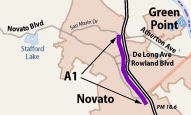 This contract constructs a NB HOV lane from Route 37 (~ MRN 18.372) to Atherton Avenue
(~ MRN R21.968) and a SB HOV lane from Route 37 to Rowland Boulevard (~
MRN R20.185). Completion of this project would extend the existing HOV
lane system north of Route 37. The other project improvements include
constructing soundwalls and installing TOS elements, such as monitoring
stations and ramp metering on mainline and ramps.
This contract constructs a NB HOV lane from Route 37 (~ MRN 18.372) to Atherton Avenue
(~ MRN R21.968) and a SB HOV lane from Route 37 to Rowland Boulevard (~
MRN R20.185). Completion of this project would extend the existing HOV
lane system north of Route 37. The other project improvements include
constructing soundwalls and installing TOS elements, such as monitoring
stations and ramp metering on mainline and ramps. 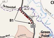 This contract constructs a new interchange and frontage roads to serve the San Antonio
Road (~ MRN 27.421 to ~ MRN 24.505). These improvements implement access
control and will become the first step in converting the facility from
expressway to freeway. New frontage roads will eliminate existing direct
driveways access to and from US 101, eliminate a left turn movement
across travel lanes on US 101 and provide new pedestrian and bicycle
facilities. The right of way acquisitions will accommodate some future
phases of the overall “Narrows” project. The intent is to
affect each property owner only once and also to acquire as much
right-of-way for the overall MSN project as the current funding and
favorable real estate market conditions will allow for.
This contract constructs a new interchange and frontage roads to serve the San Antonio
Road (~ MRN 27.421 to ~ MRN 24.505). These improvements implement access
control and will become the first step in converting the facility from
expressway to freeway. New frontage roads will eliminate existing direct
driveways access to and from US 101, eliminate a left turn movement
across travel lanes on US 101 and provide new pedestrian and bicycle
facilities. The right of way acquisitions will accommodate some future
phases of the overall “Narrows” project. The intent is to
affect each property owner only once and also to acquire as much
right-of-way for the overall MSN project as the current funding and
favorable real estate market conditions will allow for. 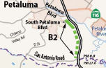 This contract constructs a new interchange, frontage roads, and equipment for ramp
metering (~ MRN 27.421 to ~ SON 3.286). These improvements implement
access control and will become the first step in converting the facility
from expressway to freeway. New frontage roads will eliminate existing
direct driveways access to and from US 101, eliminate a left turn
movement across travel lanes on US 101 and provide new pedestrian and
bicycle facilities. The right-of-way acquisitions will accommodate some
future phases of the overall “Narrows” project. The intent
is to affect each property owner only once and also to acquire as much
right-of-way for the overall MSN project as the current funding and
favorable real estate market conditions will allow for.
This contract constructs a new interchange, frontage roads, and equipment for ramp
metering (~ MRN 27.421 to ~ SON 3.286). These improvements implement
access control and will become the first step in converting the facility
from expressway to freeway. New frontage roads will eliminate existing
direct driveways access to and from US 101, eliminate a left turn
movement across travel lanes on US 101 and provide new pedestrian and
bicycle facilities. The right-of-way acquisitions will accommodate some
future phases of the overall “Narrows” project. The intent
is to affect each property owner only once and also to acquire as much
right-of-way for the overall MSN project as the current funding and
favorable real estate market conditions will allow for. In August 2009, the CTC adjusted funding and schedule for the Sonoma Narrows project.
Marin-Sonoma Narrows - Southern Section - Freeway Section Widening (~ MRN 18.372 to ~ MRN R20.185)
In September 2009, the CTC approved for future consideration of funding a project in Marin and Sonoma Counties that will construct a northbound high occupancy vehicle lane from Route 37 to Atherton Avenue and a southbound HOV lane from Route 37 to Rowland Boulevard; construct a southerly interchange at San Antonio Road and Route 101, including frontage roads with pedestrian/bicycle facility; replace the bridge over San Antonio Creek and realign the roadway curve; construct an interchange at Petaluma Boulevard including frontage roads with pedestrian/bicycle facility; and construct roadway improvements in the cities of Novato and Petaluma. The project is fully funded using Corridor Mobility Improvement Account, Traffic Congestion Relief Program, State Transportation Improvement Program, federal and local funds for $274,000,000, capital and support. The scope as described for the preferred alternative is consistent with the project scope set forth in the approved project baseline agreement. Construction is estimated to begin in Fiscal Year 2010-11. Of course, there are always delays to projects such as this. For example, in May 2011, the CTC received notice of increased costs and delays. The reason? For the southerly interchange, (1) two additional easements were needed for placing the bike-path and a portion of the southbound on-ramp at the Southerly Interchange inside the Olompali State Park limits—as a result, additional cultural and biological studies were required and may there may need to be an amendment to the biological opinion; (2) placing the bike-path and a portion of the southbound on-ramp at the Southerly Interchange on the Olompali State Park property saves a significant number of existing trees along southbound Route 101 and also improves access to the Olompali State Park. External stakeholders including State Parks, County of Marin, and the Marin Bicycle Coalition support the revised design. This revised layout will also eliminate a future realignment of Route 101 when the currently unfunded Phase 2 of the overall Marin-Sonoma Narrows Corridor is built. (3) An additional 9,000 feet of a North Marin Water District (NMWD) waterline needed to be relocated as a result of the above described design changes. (4) The newly proposed frontage road south of the Olompali Park will extend over a hillside area with a potentially active landslide. A more detailed geotechnical investigation and monitoring is needed to conclusively determine if the hillside is stable. In other cases, challenges for right of way acquisition slowed work.
In February 2010, the CTC amended this project (TCRP Project 18.1 – Route 101; widen eight miles of freeway to six lanes, Novato to Petaluma (Marin-Sonoma Narrows) in Marin and Sonoma Counties – East Washington Interchange) to reprogram $1,000,000 in funds from Right of Way (R/W) to Plans, Specifications & Estimate (PS&E), and reallocate previously allocated funds from R/W to PS&E. They also changed the implementing agency for PS&E and R/W from Caltrans to the City of Petaluma, and split the project into a roadway contract and a follow-up landscape contract.
One interesting note is that this project was affected by use of metric units. Caltrans had completed 65 percent PS&E using metric units when the design work had to be stopped because the final funding plan with the local partners was not finalized. The funding finally became available in June 2009. However, Caltrans's Metric Exception policy was set to expire in June 2010. Therefore, the PS&E and R/W had to be completed by this deadline if the already completed design work was to be salvaged, as the change in units would have required significant rework. Caltrans could not commit to deliver PS&E and R/W within this time constraint, and the City of Petaluma wanted to deliver PS&E and R/W by the Metric Exception deadline and salvage the completed PS&E work. Caltrans agreed to grant the Metric Exception and make the City of Petaluma the implementation agency for PS&E and R/W.
In Marin County, transportation planners in June 2010 indicated they are thinking about opening up the carpool lane on portions of US 101 to solo drivers — as long as they pay a fee.
In July 2012, it was reported that the HOV lane had opened southbound between Novato Creek and Route 37 as part of the first phase of the massive Marin Sonoma Narrows Project. The northbound lane was scheduled to open in early August.
In September 2014, it was reported that Caltrans opened a 1.6-mile carpool lane from just north of Atherton Avenue to just south of Olompali State Park. The $14 million project includes a widened bridge over Rush Landing Road, where traffic will now merge into three lanes through the 1.6-mile stretch.
Marin Narrows Segment B7 (04-Mrn-101 20.8/27.1)
This segment is described as follows: On Route 101, in Marin County, in and near city of Novato, from just south of the Franklin Avenue Overhead to 0.3 miles south of the Marin/Sonoma County line. The Project will widen Route 101 to construct a southbound HOV lane from 0.3 miles south of the Marin/Sonoma County line to just south of the Franklin Avenue Overhead (6.0 miles), and a northbound HOV lane from 1.7 miles north of the Atherton Avenue Overcrossing to 0.3 miles south of the Marin/Sonoma County line (3.5 miles). The Project includes roadway and bridge widening for HOV lanes and standard shoulders. The Project will also upgrade the horizontal and vertical roadway alignment (for a 70 mph design speed), modify the Redwood Landfill Interchange ramps to conform with the new alignment, and restripe a frontage road (Redwood Boulevard) for Class II bike lanes in Novato.
In June 2021, the CTC approved amending the STIP to
use the funding available through the 2021 Mid-Cycle STIP and share
distribution of the federal Coronavirus Response and Relief Supplemental
Appropriations Act of 2021 funds (COVID Relief Funds) to add a new project
to the STIP: Route 101 Marin-Sonoma Narrows, Segment B7 (PPNO 04-0361M;
ProjID 0419000068; EA 26472); program $1,122 to the CON capital phase in
FY 2021-22. The project will widen US 101 within project limits and
correct the vertical alignment of a portion of the mainline.
(Source: June 2021 CTC Agenda, Agenda Item
2.1a.(19))
In August 2021, the CTC approved an allocation of
$41,240,000 for the State-Administered Multi-Funded SB 1 SCCP/STIP Marin
Sonoma Narrows (MSN) Contract B7 project (PPNO 0361M), on the State
Highway System, in Marin County, consisting of $26,390,000 for
construction and $14,850,000 for construction engineering. 04-Mrn-101
20.8/27.3 27.1. On Route 101, in Marin County, in
and near city of Novato, from just south of the Franklin Avenue Overhead
to 0.3 miles south of the Marin/Sonoma County line. The Project will
widen Route 101 to construct a southbound HOV lane from 0.3 miles south of
the Marin/Sonoma County line to just south of the Franklin Avenue Overhead
(6.0 miles), and a northbound HOV lane from 1.7 miles north of the
Atherton Avenue Overcrossing to 0.3 miles south of the Marin/Sonoma County
line (3.5 miles). The Project includes roadway and bridge widening for HOV
lanes and standard shoulders. The Project will also upgrade the horizontal
and vertical roadway alignment (for a 70 mph design speed), modify the
Redwood Landfill Interchange ramps to conform with the new alignment, and
restripe a frontage road (Redwood Boulevard) for Class II bike lanes in
Novato. (Future consideration of funding approved under Resolution E
-09-70; September 2009.) (Contribution from other sources: $2,500,000 (CON
ENG) and $77,256,000 (CONST) in Federal Discretionary and local funds.)
(The post-mile (ahead) has been revised from 27.3 to 27.1 to reflect
better conforms.)
(Source: August 2021 CTC Agenda, Agenda Item
2.5s.(6) / 2.5v.(4))
In June 2022, the CTC approved an allocation
of $3,500,000 for the State-Administered SB1 Local Partnership
Program (LPP) (Formulaic) Marin Sonoma Narrows (MSN) Contract B7 project
(PPNO 0361M). 04-Mrn-101 20.8/27.3. PPNO 04-0361M; ProjID 0419000068; EA
26472. Marin Sonoma Narrows (MSN) Contract B7. On Route 101, in
Marin County, in and near city of Novato, from just south of the Franklin
Avenue Overhead to 0.3 miles south of the Marin/Sonoma County line.
The Project will widen Route 101 to construct a southbound HOV lane from
0.3 miles south of the Marin/Sonoma County line to just south of the
Franklin Avenue Overhead (6.0 miles), and a northbound HOV lane from 1.7
miles north of the Atherton Avenue Overcrossing to 0.3 miles south of the
Marin/Sonoma County line (3.5 miles). The Project includes roadway and
bridge widening for HOV lanes and standard shoulders. The Project will
also upgrade the horizontal and vertical roadway alignment (for a 70 mph
design speed), modify the Redwood Landfill Interchange ramps to conform
with the new alignment, and restripe a frontage road (Redwood Boulevard)
for Class II bike lanes in Novato. Future consideration of funding
approved under Resolution E-09-70; September 2009. Contribution from other
sources: $3,795,000. Time extension for FY 20-21 R/W expires June 30,
2022. Allocation: R/W $3,500,000.
(Source: June 2022 CTC Agenda, Agenda Item
2.5s.(1))
In July 2022, it was reported that work on the final
segment of the project between Novato and the Sonoma/Marin county line has
begun. In May 2021, the Metropolitan Transportation Commission provided
$76 million in STP/CMAQ funding to help the overall $135 million project
move forward. Upon completion, all of the US 101 widening will be
finished. This final phase of the project is part of the larger
Marin-Sonoma Narrows effort to construct 17 miles of carpool lanes in each
direction through Marin and Sonoma Counties, completing a total 50 miles
of continuous carpool lanes in each direction, between Windsor and
Richardson Bay. The project will also restripe the Redwood Boulevard
frontage road for Class II bike lanes in Novato, creating a continuous
bikeway between Novato and Petaluma. MTC has long identified improvements
to the US 101 corridor in the North Bay as an important regional priority,
including the Marin-Sonoma Narrows, where lanes narrowed from three to two
creating bottlenecks. The work expands lanes from four to six, adding a
carpool lane in each direction. MTC has also contributed $15 Million in
re-purposed federal earmarks, another $15.4 Million in STP funds and $23
Million in RTIP funds, and monies from the Prop 1B Corridor Improvement
program, among other dollars to the overall widening project. Caltrans,
the Transportation Authority of Marin and the Sonoma County Transportation
Authority are partners on the project.
(Source: Bay Link Blog, 7/21/2022)
In June 2023, it was reported that Caltrans was
diverting southbound traffic onto new elevated lanes spanning from San
Antonio Creek to just north of Atherton Avenue in Novato. The new lanes
were constructed as part of the final phase of a decade-long widening
project in Marin and Sonoma counties meant to relieve longstanding traffic
congestion on the corridor. The estimated $762 million project will add a
carpool lane in each direction along 17 miles of US 101 between Novato and
Petaluma. The section received its “Narrows” nickname because
the road contracts from three lanes to two lanes in each direction. Once
completed, the Marin-Sonoma Narrows project will provide drivers with
continuous access to carpool lanes from north of the Golden Gate Bridge to
Santa Rosa. Caltrans has completed all but the 6-mile span from the county
line into Novato. The final phase is estimated to cost $135 million.
People who regularly commute into Marin or San Francisco have already seen
the new southbound lanes under construction for months within the highway
median. The new lanes are 10 feet higher than the existing highway
alignment, which will result in an improved line of sight for drivers and
better drainage. After the switch, construction crews plan to begin
excavating and rebuilding the old southbound lanes at the higher
elevation, which will likely take about a year to complete. Once those
upgrades are finished, southbound traffic will be moved back onto those
lanes. Caltrans will then divert the northbound traffic onto the elevated
section in the median in order to begin widening the northbound corridor.
When the northbound section is completed, Caltrans will execute the final
touches and restripe the highway. The northbound construction will take
less time to complete because only 3.5 miles of carpool lanes need to be
added, compared to 6 miles in the southbound direction. In addition to
widening the highway, the project will also create a continuous bikeway
between Novato and Petaluma; build new frontage roads to remove unsafe
local roads that turned out directly onto the highway; raise sections of
the highway out of the floodplain; and add new interchanges.
(Source: Marin I-J, 6/7/2023)
In July 2023, it was reported that in June 2023 MTC
last month formally approved the first allocations of Regional Measure 3
dollars, releasing over $270 million for nine projects for which the
sponsors already were moving ahead under Letters of No Prejudice. These
initial allocations included: Transportation Authority of Marin: $88
million for the final phase of the US 101 Marin-Sonoma Narrows project
north of Novato.
(Source: MTG/ABAG Bay Link Blog, 7/12/2023)
Bicycle/Pedestrian Project: Atherton to Petaluma River Bridge
The SAFETEA-LU act, enacted in August 2005 as the reauthorization of TEA-21, authorized $400,000 for High Priority Project #1767: Construct US 101 bicycle-pedestrian project in Marin and Sonoma Counties from north of Athenton Ave (~ MRN R21.972) to south of Petaluma River bridge (~ SON 3.329).
In March 2018, the CTC authorized relinquishment of
right of way in the city of Novato along Route 101 on Redwood Boulevard,
consisting of collateral facilities. The City, by freeway agreement dated
January 27, 1998, and Resolution № 16-12 dated February 14, 2012,
agreed to accept title upon relinquishment by the State. The City, by
Resolution № 2018-005 dated January 9, 2018, agreed to waive the
90-day notice requirement and accept title upon relinquishment by the
State.
(Source: CTC Agenda, March 2018 Agenda Item 2.3c)
Redwood Landfill Interchange (~ MRN 25.0)
In January 2011, the CTC approved the public road connection for the proposed Redwood Landfill Interchange on US 101 in Marin County, which is part of the Marin Sonoma Narrows High Occupancy Vehicle (HOV) project. The Marin Sonoma Narrows project proposes improvements to US 101 by adding HOV facilities from the junction of Route 37 in the City of Novato to just north of the Corona Road Overcrossing in the City of Petaluma, a distance of approximately 16 miles. The Marin Sonoma Narrows project proposes HOV operational improvements and proposes upgrading the existing expressway portion of US 101 to a controlledaccess freeway. The existing facility at the proposed Redwood Landfill interchange location is a four-lane expressway with two 12-foot lanes in each direction. A significant portion of the existing facility in this segment does not meet current design standards for horizontal alignment and vertical profile. The shoulders are variable width with the outside shoulders varying from 5 feet to 8 feet and the inside shoulders varying from 2 feet to 4 feet. The non-paved median varies in width from 11 feet to 51 feet and contains a double thrie-beam barrier. Local traffic accesses the expressway using various driveways and at-grade intersections. The proposed Redwood Landfill Interchange will close all direct access to US 101 and will construct a new diamond-type interchange at the existing Redwood Landfill Overcrossing. The existing fourlane expressway will be reconstructed to provide a six-lane freeway with two mixed flow lanes and one HOV lane in each direction. The new interchange will construct new on and off-ramps at the Redwood Landfill Overcrossing. Frontage roads will be constructed to provide access to the freeway for local traffic. The expressway to freeway conversion will improve traffic flow and safety by providing a new interchange, frontage roads and bike paths. The Redwood Landfill Interchange will improve the movement and circulation of heavy trucks using with the nearby landfill facility.
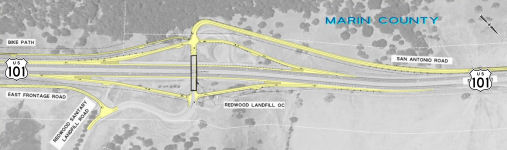 In August 2011, it was reported that the CTC approved
$1.492 million to complete design work for a redesigned interchange at the
Redwood Landfill just north of Novato and $400,000 to finish designing a
realignment a curve along US 101 near San Antonio Creek. The project will
also include frontage roads with bike lanes on both side of US 101, with
the one on the westside stretching from San Antonio Road south to Olompali
State Historic Park. The frontage roads will allow Caltrans to eliminate
Olompali and San Antonio Road's intersections with US 101 as well as those
of private driveways, permitting the route to become truly limited access.
Eventually, US 101 from Novato to Petaluma will be widened to three lanes
in each direction as part of Caltrans' Novato Narrows project. The
frontage roads and revised landfill interchange is estimated to cost $74
million. The San Antonio curve realignment, designed to improve safety and
reduce flooding at the creek, is estimated at $71 million with a
construction start tentatively set for late 2014.
In August 2011, it was reported that the CTC approved
$1.492 million to complete design work for a redesigned interchange at the
Redwood Landfill just north of Novato and $400,000 to finish designing a
realignment a curve along US 101 near San Antonio Creek. The project will
also include frontage roads with bike lanes on both side of US 101, with
the one on the westside stretching from San Antonio Road south to Olompali
State Historic Park. The frontage roads will allow Caltrans to eliminate
Olompali and San Antonio Road's intersections with US 101 as well as those
of private driveways, permitting the route to become truly limited access.
Eventually, US 101 from Novato to Petaluma will be widened to three lanes
in each direction as part of Caltrans' Novato Narrows project. The
frontage roads and revised landfill interchange is estimated to cost $74
million. The San Antonio curve realignment, designed to improve safety and
reduce flooding at the creek, is estimated at $71 million with a
construction start tentatively set for late 2014.
(Source: Road Warrior Blog)
In May 2012, the CTC approved $29.7 million for remodeling of the interchange at the Redwood Landfill and construction of frontage roads that will eliminate intersections with San Antonio Road, Olomapli State Historic Park and a few private driveways. The project is estimated to cost a total of $76 million, including design, relocation of utilities and environmental mitigation. Completion is scheduled for 2015.
In November 2015, it was reported that an eminent
domain lawsuit reagarding the Redwood Landfill interchange was just
resolved. This involved Caltrans’ acquisition of 34 acres for a
$29.7 million interchange project at the Redwood Sanitary Landfill, which
would widen the overpass over US 101 and install new frontage roads on
both sides of the highway to create safer conditions for traffic going in
and out of the landfill. After a 20-day trial, the litigation has finally
ended with a jury verdict that appears to be close to a split between the
property owner’s appraisal and Caltrans’ appraisal. The Marin
jury awarded rancher $3.2 million for land seized in Novato,
Caltrans’ appraisal was $575,000, and the owner’s appraisal
was $6 million. The jury returned a verdict at $3.2 million, which equaled
about $1.7 million for the part-taken, and $1.5 million in severance
damages to the remaining property as a result of the project. In arguing
for severance damages, the property owner claimed that the project would
disrupt roads, cattle crossings, pipelines and a quarry operation, and
would impact the property’s potential use as a lucrative winery.
Prior to trial, Caltrans apparently offered $1.8 million as a “final
offer”. Because the jury verdict was significantly above
Caltrans’ final offer, the owner may be entitled to litigation
expenses, including reimbursement of attorneys’ fees and expert
fees, if the owner’s final demand was reasonable. The owner is
filing a motion to recover such fees.
(Source: JDSupra Business Advisor, 11/4/2015)
In mid-July 2013, it was reported that piles were
being driven near the Novato Creek Bridge as part of the work to widen the
Marin-Sonoma Highway 101 Narrows, which aims to relieve the bottleneck
that frustrates drivers on a daily basis. Three separate projects in Marin
and one in Sonoma County are part of a new round of work on the project.
In Marin, two will lengthen the US 101 carpool lane in Novato, while the
other will see improvements to the Redwood Landfill interchange. The
contractor is working to expand the carpool lane southbound from north of
Novato Creek to Rowland Boulevard, a little more than half a mile. That
work — which includes widening the Novato Creek Bridge at a cost of
about $4 million — involves driving the piles. Crews are also
extending the carpool lane northbound from Atherton Avenue to south of the
Redwood Landfill, about 1.5 miles in total. That work will cost about $15
million. Work on the carpool lanes should be done by the end of 2013. In
addition, work on the Redwood Landfill interchange work is continuing. It
includes widening the overpass on US 101 and construction of frontage
roads in the area. That work will cost $28 million and will be completed
in 2014. In Petaluma, work is under way on the north end of the Narrows
project. A $120 million project there will reconstruct the Petaluma
Boulevard South interchange, replace the Petaluma River Bridge, widen
nearly three miles of frontage roads, provide new pedestrian and bicycle
improvements and replace the northbound Route 116 bridge and widen the
southbound Route 116 bridge to accommodate future carpool lanes on US 101.
This work will not complete the project. The Narrows — so named
because the number of lanes on US 101 narrow to two in each direction
— still has a large portion in the middle that needs to be
addressed. The latest projects represent only the initial phases of a $700
million plan to widen US 101. About half of that money has been acquired
so far. The entire Narrows project calls for widening the 16-mile stretch
of US 101 between Route 37 and the Old Redwood Highway interchange in
north Petaluma.
(Source: Marin Independent-Journal, 7/18/13)
In November 2013, it was reported that Caltrans opened 2,640 new feet — a half-mile — of southbound carpool lane between just north of Novato Creek and Rowland Boulevard in Novato. Ghilotti Bros. Inc. crews are also extending the carpool lane northbound from Atherton Avenue to south of the Redwood Landfill, about 1.5 miles in total. That work will cost about $15 million. The work is expected to completed by the end of 2014.
San Antonio Road Bridge (~ MRN 27.568)
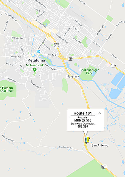 In August 2015, it was reported that there are plans to replace the San Antonio Road
Bridge near the Marin-Sonoma border. The bridge, built in 1917, will
remain standing for pedestrian and bicycle use as a new $5.5 million span
is constructed. The project, financed by federal grants, is part of the
Marin-Sonoma Narrows freeway widening program. It involves realignment of
San Antonio Road between Novato and Petaluma, including the span over San
Antonio Creek. Engineering and preliminary environmental studies are
underway, with final design work due next year. Construction could begin
in 2017 and take 18 months.
In August 2015, it was reported that there are plans to replace the San Antonio Road
Bridge near the Marin-Sonoma border. The bridge, built in 1917, will
remain standing for pedestrian and bicycle use as a new $5.5 million span
is constructed. The project, financed by federal grants, is part of the
Marin-Sonoma Narrows freeway widening program. It involves realignment of
San Antonio Road between Novato and Petaluma, including the span over San
Antonio Creek. Engineering and preliminary environmental studies are
underway, with final design work due next year. Construction could begin
in 2017 and take 18 months.
(Source: Marin Independent-Journal, 8/11/2015)
In April 2016, it was reported that construction had
commenced on the project to replace the San Antonio Road Bridge. The first
sign of this construction is the permanent closure of the driveway where
Kastania Road dumps directly onto US 101. This is part of Caltrans’s
latest round of freeway improvements, a $91.8 million project that will
also improve flood protection and sight lines for the roadway as it curves
over San Antonio Creek between Sonoma and Marin counties. In addition to
the Kastania driveway, a direct connector to San Antonio Road and, later,
a connector at the smaller Gunn Drive will close. Drivers on those roads
will no longer be able to attempt to cross as many as four lanes of
traffic across US 101, and will be instead forced to meander along new
parallel routes toward improved interchanges at Kastania and San Antonio.
Work to close off northbound-side connections along the stretch is
anticipated to go forward later in the project, fully shutting down all
driveways in the area, according to information from Caltrans. First built
in the 1950s, the two-lane stretch south of Petaluma remains a relic of
the region’s more rural past, a time when driving directly across US 101 was perhaps a more reasonable — and safe — thing to do.
This is final segment to be updated as part of converting US 101 from an
expressway to a freeway between Marin and Sonoma counties. The roadway
will be realigned at the county line to improve the curve and create space
on the east side of the freeway for a frontage road. The existing
northbound lanes will become this frontage road. The intersections at
Kastania Road and San Antonio Road will be closed permanently on April 4
and April 11, respectively. Access will then be rerouted to the frontage
roads.
(Source: Argus Courier, 4/7/2016; Jeffe @ AAroads, 4/5/2016)
In July 2016, it was reported that officials with
Caltrans, the Sonoma County Transportation Authority and the
Transportation Authority of Marin held a dual event to celebrate the
completion of parts of the Marin-Sonoma Narrows project and the start of
another phase. Officials held a groundbreaking ceremony for the start of
construction for the realignment and widening of US 101 at San Antonio
Creek at the Marin-Sonoma county line. A ribbon-cutting ceremony for the
completion of the Petaluma River Bridge and the Route 116/Lakeville
Highway Interchange was also held.
(Source: Novato Patch, 7/6/2016)
In December 2017, it was reported that construction
on a large section of the Marin-Sonoma Narrows near the county line was
winding down and could be ready for drivers to use as soon as January
2018. Dubbed the San Antonio Curve Correction project, the $73 million in
work over roughly 2.5 miles has realigned US 101 at San Antonio Road and
created space to eventually add a carpool lane, according to the
Transportation Authority of Marin, which is overseeing the work with
Caltrans. The work also replaces the freeway’s San Antonio Creek
Bridge, an area that has flooded in the past. This latest segment moves US 101 to the west, eliminates driveways and crossings, improves sight lines
and builds a bicycle pathway along San Antonio Creek to connect San
Antonio Road with the Petaluma Boulevard South frontage road. Work began
in 2016. About 500,000 cubic yards of soil was excavated, then placed and
compacted in the valley adjacent to San Antonio Creek to
“flatten” the roadway bed. The dirt had to be covered with
plastic sheeting to keep it contained. The new San Antonio Creek Bridge is
510 feet long and 122 feet wide, with an area of 62,475 square feet over
1.4 acres. It has been designed to withstand an earthquake in excess of
7.0 magnitude and sits high above potential flooding. The new roadway and
bridge have been constructed to accommodate future carpool lanes, but will
be striped as a four-lane highway initially because HOV lanes have not
been completed on either side of the new work.
(Source: Marin I-J, 12/11/2017)
In April 2018, it was reported that a $73 million,
2.5-mile realigned segment of US 101 at the county line, which includes a
new flood-proof bridge over San Antonio Creek, was set to open sometime in
April 2018. The section initially will be opened as two lanes southbound.
By the end of this year, two lanes will be added northbound. Eventually
the segment will be widened to three lanes in each direction — along
with the rest of the Narrows — by 2022, if funding comes through. A
three-mile segment from Atherton Avenue north is in the planning stages,
and a sister project in Sonoma is waiting for money to start. Those two
would complete the widening of the 17-mile corridor between Route 37 in
Novato and the Old Redwood Highway interchange in north Petaluma. This
latest segment moves US 101 to the west, eliminates driveways and
crossings and builds a bicycle pathway along San Antonio Creek to connect
San Antonio Road with the Petaluma Boulevard South frontage road. Work
began in 2016.
(Source: Marin I-J, 4/4/2018)
In September 2018, it was reported a new bridge at
the county line over San Antonio Creek is nearly complete. Southbound
drivers are already using the new bridge, which is wider, straighter and
higher above the creek than the flood-prone twin spans being replaced. In
November 2018, northbound traffic is expected to shift onto the new
bridge, marking a key moment in the construction project. The move will
mean that, for the first time since the highway was built in the 1950s,
adjoining properties will no longer have direct access to US 101. Several
driveways still feed into the northbound lanes near the county line, and
it is not uncommon to see mail trucks idling on the shoulder, delivering
to mailboxes that front the highway. After the upcoming traffic shift, the
old northbound lanes will become a new frontage road, an extension of
Petaluma Boulevard South, that will serve the properties in the Narrows.
This road, and a parallel road on the west side of the freeway, will
dead-end at the county line. Officials intentionally designed these
frontage roads to serve local traffic and not provide an alternative to US 101. A new bike path along the frontage road slated to open next year will
connect to San Antonio Road and a bike path along Olompali State Park,
making it possible to cycle through the Narrows from Petaluma to Novato, a
long-sought goal of local cyclists. Once the shift onto the new San
Antonio Creek bridge is complete, there will still only be four total
lanes of traffic in the area. Complete striping of the carpool lanes from
the Petaluma River to the county line is contingent on a separate widening
project just to the north at Kastania Road, which started later. That
drop, from a total of six lanes to four, is just north of the Petaluma
River bridge, the beginning of the final segment of the US 101 widening
project in Sonoma County that, until May, was unfunded. This past spring,
state officials awarded Sonoma County $85 million to widen US 101 through
Petaluma from the river to Corona Road. The funding came from SB 1. The
plan is to award a contract in spring 2019 and start construction in
August 2019. The project through Petaluma, which is scheduled to wrap up
at the end of 2022, would complete the carpool lanes on a 30-mile corridor
from Windsor to the Sonoma-Marin county line. It will also provide access
for a new road across Petaluma at Rainier Avenue, a long-sought city
transportation need. One final segment of US 101 widening work still
remains in limbo, from the county line south to Novato. Marin County
officials are counting on construction funding from Regional Measure 3, a
state bridge toll increase voters approved in June. But that money is
currently tied up in a court challenge filed by the Howard Jarvis
Taxpayers Association, which argues that the toll increase is really a tax
and needed a two-thirds vote to pass.
(Source: Petaluma Argus-Courier, via Press Democrat, 9/4/2018)
In October 2018, it was reported that as
construction workers continue to complete new sections of US101 along the
Novato Narrows, Caltrans was preparing to shift northbound lanes of
traffic to a new alignment. The new alignment will take place from the San
Antonio Road/Landfill exit in the south to Kastania/Petaluma Boulevard
exit in the north.
(Source: Press Democrat, 10/20/2018)
In October 2018, the CTC approved a request for an
additional $14,659,000 in Construction Capital for the State
Transportation Improvement Program (STIP) HOV Lane project (PPNO 0360G) on
US 101, in Marin and Sonoma Counties (MSN Contract B3), to complete
construction. This project is one of multiple contracts of the
Marin-Sonoma Narrows (MSN) Corridor Project. The project is loated on US 101, from 0.8 miles south to 2.0 miles north of the San Antonio Creek /
Marin-Sonoma County line in Marin and Sonoma Counties, and will realign US 101 to the west, to improve horizontal and vertical roadway alignments and
construct a new San Antonio Creek Bridge to elevate US 101 above the flood
plain. This improvement will establish full access control by closing five
direct access points to US 101 and extending the existing frontage road
constructed earlier under MSN Contract B2. A bicycle facility will be
provided near San Antonio Creek, by connecting frontage roads, to the
south and north, respectively constructed earlier under MSN Contracts B1
and B2. The new freeway will have 3-lanes in each direction including the
HOV lane and will be open to traffic when the ongoing, adjacent MSN
Contract B2-Phase 2 (to the north) is completed in 2019.
(Source: October 2018 CTC Agenda Item 2.5e.(12))
The 2020 STIP, approved at the March 2020 CTC
meeting, included PPNO 0360G San Antonio Road curve correction
(IIP)(supplemental), in the Interregional portion of the STIP with no
change in programming: 9,336K in prior year funding.
(Source: March 2020 CTC Agenda, Item 4.7, 2020 STIP
Adopted 3/25/2020)
In December 2021, it was reported that Caltrans
completed the northbound widening on the Washington Creek Bridge between
Lakeville Highway (Route 116) and the Lynch Creek Trail bridge just north
of the E. Washington Street interchange. The newly widened
Washington Creek Bridge was the last piece needed to complete an
uninterrupted three-lane freeway on northbound US 101 between the Marin
County Line and Windsor. This permitted connection of a 30-mile stretch of
carpool lane has been connected on northbound US 101 in the North Bay from
the Marin border to Windsor, which will improve traffic along a
notoriously slow stretch of freeway known as the Marin Sonoma Narrows.
Only two roadway projects remain on the Marin Sonoma Narrows, including
the Petaluma widening project, which is underway. The final project will
begin in spring 2022, which will add carpool lanes between Novato and the
Marin/Sonoma county border.
(Source: Bay Link Blog, 12/3/2021)
In December 2017, the CTC approved the following financial allocation: Sonoma 04-Son-101 0.0/4.5: US 101 Marin Sonoma Narrows B2 Phase 2 Sonoma Median Widening HOV Lanes. Near Marin/Sonoma County Line: Construct median and widen shoulder for HOV lanes between Kastania Road (~ SON 2.715) and just south of the county line (~ SON 0.0 / MRN 27.615) (TCIF #124). $18,000,000. Federal Discretionary funding for $15 million is from repurposed Federal Earmarks. ALLOCATION IS CONTINGENT UPON APPROVAL OF A BUDGET REVISION BY THE DEPARTMENT OF FINANCE.
Marin-Sonoma Narrows - Petaluma South Interchange Project (~ MRN 27.421 to ~ SON 3.286)
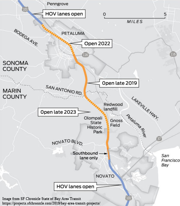 In August 2010, the CTC approved amending the 2010 State Transportation
Improvement Program (STIP) and the Corridor Mobility Improvement Account
(CMIA) baseline agreements for the Route 101 Marin-Sonoma Narrows - HOV
Lane (PPNO 0360F), Route 101 Marin-Sonoma Narrows - Southerly Interchange
(PPNO 0360J), and Route 101 Marin-Sonoma Narrows - Petaluma Boulevard
South Interchange (PPNO 0360H) projects to update the funding plan for
each project, update the project scope and the schedule for the Southerly
Interchange project, update the schedule of the Petaluma Boulevard
Southerly Interchange project, and to split-off a landscaping and
soundwall mitigation project (PPNO 0360L).
In August 2010, the CTC approved amending the 2010 State Transportation
Improvement Program (STIP) and the Corridor Mobility Improvement Account
(CMIA) baseline agreements for the Route 101 Marin-Sonoma Narrows - HOV
Lane (PPNO 0360F), Route 101 Marin-Sonoma Narrows - Southerly Interchange
(PPNO 0360J), and Route 101 Marin-Sonoma Narrows - Petaluma Boulevard
South Interchange (PPNO 0360H) projects to update the funding plan for
each project, update the project scope and the schedule for the Southerly
Interchange project, update the schedule of the Petaluma Boulevard
Southerly Interchange project, and to split-off a landscaping and
soundwall mitigation project (PPNO 0360L).
In June 2011, the CTC approved $45 million for rebuilding the US 101 bridges over the Petaluma River. The money will be used to replace two of the four separate bridges at the south edge of Petaluma. Two of the bridges are north and southbound structures that cross the river and two cross Route 116.
In June 2012, the CTC amended the CMIA baseline agreement for the MSN Corridor project to increase the project scope and update the project funding plan. Specifically, the project scope was amended to add Contracts A2, A3 and C3 to the Marin-Sonoma Narrows Corridor scope of work:
In April 2013, it was reported that work on the
center section of the 17-mile Marin-Sonoma Narrows project began. This
two-projects-in-one segment includes a $77 million contract for a new
Petaluma Boulevard South interchange, new frontage roads and replacement
of the dual Petaluma River bridges with one, six-lane bridge to
accommodate future carpool lanes. The nine-mile section between Novato and
Petaluma, commonly referred to as the narrows, will be converted from
expressway to freeway status by closing uncontrolled access. Wider
frontage roads will feature bicycle access. A $28 million contract will
provide for the replacement of the northbound US 101 overpass of Lakeville
Highway/Route 116 and widening the southbound span. The construction
contracts do not include the previous land acquisition, design and
engineering costs. Construction of the Route 116 sections is expected to
finish in the winter of 2014, with the Petaluma Boulevard South work to be
done in the winter of 2015. Ghilloti Brothers and Myers JV won the bids
for the projects.
(Source: Press-Democrat, 4/1/13)
In July 2013, it was reported that Petaluma’s
welcome sign ("the flyswatter"), may soon have to come down. As Caltrans
reconfigures the Petaluma Boulevard South interchange with US 101, the
sign welcoming northbound motorists to the Egg Basket of the World is in
the way. But any changes won’t be permanent, said Onita Pellegrini,
chief executive of the Petaluma Chamber of Commerce. When the sign comes
down — whenever construction needs the space — it could stay
down for two years during the highway work. It could go back up sooner if
city-owned or even private land can be found for it. The northern sign is
on city land. The simple, orange-painted metal sign has a horizontal oval
top with “Petaluma” in the center with the outline of hills
behind it. The year the city was incorporated, 1858, is bracketed by
“Sonoma County” on the underside curve. Underneath, between
the steel support posts, are signs of the city’s service clubs
including Lions, Kiwanis, Elks and Rotary. The sign is on Caltrans
property, so replacing a service group sign or even accessing it is
complicated. The city has to make sure anything put on the sign
doesn’t distort a driver’s view, isn’t flashing or
reflective.
(Press Democrat, 7/22/13)
In March 2014, it was reported that the Sonoma County Transportation Authority approved $4.5 million to buy land to widen US 101 to six lanes through Petaluma, but it will be at least three years, and perhaps longer, before there is a remedy to the bottleneck that has plagued commuters for years. One of the two remaining four-lane sections of US 101 in Sonoma County from Windsor south to the Marin County line now is nearly ready for construction, though transportation officials have not secured the $90 million needed to widen the highway from just north of Corona Road to the Petaluma River.
In April 2014, it was reported that some Petaluma city officials are hoping new revenue generated from an anticipated county sales tax measure could lead to the completion of highway widening from Petaluma to the county line. If Sonoma County officials choose to put a sales tax measure on the November ballot, Petaluma City Councilmember Mike Healy said prioritizing funding for Route 101 would be critical to the completion of the project. County officials are considering several options to raise funds to repair the county's 1,400 miles of roads, which have been rated some of the worst in the Bay Area. A proposal for a new sales tax or the extension of the county's existing Measure M transportation sales tax, passed in 2004 to widen Route 101, are just two avenues being discussed for the November ballot.
In September 2014, it was reported that the northbound off-ramp at the new Petaluma Boulevard South/Kastania Road interchange has opened. The interchange is now three-fourths open, with only the northbound on-ramp left to be completed. Crews continue to work on the new frontage road, extending Petaluma Boulevard South along the east side of the freeway. Farther south in Marin county, the new interchange at the Redwood Landfill is nearly complete with only the southbound off-ramp left to open. That project, including a new bike path through the Narrows, is expected to be completed in October 2014.
In January 2015, the CTC approved $5,526,000 in supplemental STIP funds for construction engineering for the Route 101 Marin Sonoma Narrows – Petaluma Boulevard South Interchange and Petaluma River Bridge project (PPNO 0360H), in Sonoma County. The current construction engineering budget is $12,190,000. This request for $5,526,000 results in an increase of 45.3 percent over the current budget for construction engineering. The cost increase was the result of various issues relating to the exclusionary netting that was used to deter bird nesting on the existing bridge structures over Petaluma River Bridge. To deter migratory birds from nesting during construction, the contractor was required to install exclusionary netting per the project specifications. As the nesting season began, Caltrans biologists and construction staff noticed hundreds of birds landing on the netting. A closer examination revealed that several birds were able to breach the exclusionary netting and that ten birds had died after being trapped inside the netting. Immediately, Caltrans biologists, engineers, and contractor personnel met on-site to discuss plans to modify the netting installation to prevent further bird entrapment and mortality. The contractor was directed to implement modifications to the netting installation. The US Fish and Wildlife Service was also notified about the bird mortalities .The following day the contractor started work to modify netting installation. The repair work was time consuming and challenging due to limited access to the underside of the bridge. These modifications were completed two weeks later. During the interim, while repairs were being undertaken, another 53 birds became trapped and died. Four additional bird deaths occurred later for a total of 67 mortalities. A special investigation conducted by the Fish and Wildlife concluded that bird entrapment and mortalities at the Petaluma River Bridges were unintentional and acknowledged that considerable efforts were made by Caltrans and the contractor to immediately correct the situation. These unintended bird mortalities also triggered a strong reaction from the local environmental community. As part of a supplemental report of the 2013-14 State budget, the California State Senate passed a resolution requiring the Department to take necessary corrective actions. The Native Songbird Care and Conservation organization and others filed a complaint against the Department seeking a judgment that the Department ceases all the operations and the activities that might harm and/or interfere with the nesting activities of cliff swallows. The lawsuit was eventually settled on the condition that, among other things, the Department will not demolish the existing bridge structures during the bird nesting seasons. This restriction coupled with other restrictions on in-water activities (specified in the 1602 permit) has lengthened the time needed to complete construction. The increase is due to additional biological monitoring, staff time to revise the bird exclusionary measures, cost to defend lawsuits, additional design support, and the cost due to delays.
In October 2015, it was reported that consideration
was ongoing regarding HOT lanes through the Marin-Sonoma Narrows. The plan
is backed by the Metropolitan Transportation Commission — the Bay
Area’s transportation planning agency — for parts of the
region, but has received a lukewarm reception from Marin officials. Marin
was eliminated from an original toll lane plan, with the commission
focusing on more congested highway segments in the South and East bays.
Marin reappeared as a possibility earlier in 2015 as the MTC prepared its
regional transportation plan for the next two decades. In 2011, the Marin
agency conducted a traffic and revenue study for the 101 corridor between
Richardson Bay and the Sonoma County line. Results concluded that
sufficient demand existed to generate enough revenue to complete the full
Novato Narrows project, install and maintain tolling equipment, and fully
recover costs in 17 years. However, that would require raising a carpool
occupancy from two people to at least three people and having the toll
lane operate on the weekend.
(Source: Marin Independent Journal, 9/30/2015)
In December 2015, it was reported that Sonoma County
transportation officials believe they have identified a funding source to
complete a widening project at the northern entrance to the Novato
Narrows, a notorious section of US 101 south of Petaluma that enrages many
motorists. Carpool lanes would be opened on a 5-mile stretch of US 101
from the Petaluma River Bridge to just south of the Sonoma-Marin county
line as part of the project. However, traffic congestion in the area will
remain a problem for the foreseeable future due to stretches of the
roadway remaining at four lanes from the county line to Novato. There was
no timetable for when those sections might be widened. However, the
completed widening project would at least offer motorists some relief. The
project hinges on money to widen a 1.5-mile stretch of the highway south
of the Petaluma River Bridge, between two widening projects that already
are in the works. If the MTC board approves $20 million for the latest
widening project, these funds, when added to local transportation money,
would cover the $37 million price tag to complete the work. State
transportation officials would still need to sign off on the deal. The
funding would complete widening of the highway between the new $130
million Petaluma River Bridge, set to debut in the spring, and a project
that will raise and straighten the highway at the county line, near the
crossing with San Antonio Creek, which often floods during heavy storms,
sending water onto the highway. Widening work along the entire 5-mile
stretch could be completed by 2018. However, the goal of adding carpool
lanes along the length of Highway 101 through Sonoma and Marin counties
remains a distant dream due to funding shortfalls. In Sonoma County, plans
to widen the highway from Corona Road to the Petaluma River Bridge, a
stretch of roughly 3.5 miles, are on hold as officials seek to identify
$85 million needed to complete the project. In Marin County, projects to
widen about 6 miles of the highway heading south, and 3 miles going north,
through the Narrows also are nowhere near completion. Those projects carry
price tags of $120 million.
(Source: Press-Democrat, 12/9/2015)
In February 2016, it was reported that a once
promising $20 million funding package for US 101 widening south of
Petaluma now appears to be in jeopardy. The regional Metropolitan
Transportation Commission in December voted to support the highway
widening project between the Petaluma River Bridge and the Marin County
line. Completing that project would allow officials to open almost five
miles of carpool lanes south of Petaluma. But recent Caltrans estimates of
the amount of gas tax revenue, which pays for highway projects, were $800
million lower than expected. Instead of appropriating $46 million in new
projects, the California Transportation Commission now must cut some $754
million in existing projects. The MTC is still backing the project, but
with deep cuts likely coming to the statewide highway improvement program,
Sonoma County’s $20 million request looks doubtful. The $20 million
in state funding was to be added to $14 million that the SCTA recently
made by refinancing its bonds. Transportation officials hope to identify
funding for the project in order to continue the incremental progress made
on widening US 101 from Novato to Windsor. A project to widen the Petaluma
River Bridge is on track to wrap up this spring, about the same time that
ground breaks on a new highway bridge over San Antonio Creek at the county
line. The piece in between the two projects remains unfunded, as does the
stretch of highway through Petaluma from Corona Road to the Petaluma
River. Funding for the highway through Petaluma, including a crossing for
the future Rainier Avenue extension, won’t likely materialize until
at least 2018, when voters could be asked to extend a county sales tax
used for highway projects. South of the county line, the stretch of US 101
to the north end of Novato — the so-called Sonoma-Marin Narrows
— also remains unfunded.
(Source: Argus Courier, 2/19/2016)
In May 2016, it was reported that a request to use
part of an $18.2 million pot of federal funding toward the San Rafael
Transit Center to accommodate commuter rail is ruffling feathers in Sonoma
County, where leaders would rather use the money to widen the Novato
Narrows on US 101. The money comes from a congressional earmark granted in
2005 for ferry service to Port Sonoma, a silted boat harbor on the
Petaluma River, across from Black Point near Novato. The project has since
been abandoned and its funding is up for grabs after the federal
Department of Transportation released the money in March, according to
regional transportation officials. The joint letter, signed by
SMART’s boss, Farhad Mansourian, and bridge district chief Denis
Mulligan, said the remaining dollars should go to the Sonoma County
Transportation Authority for the Marin-Sonoma Narrows US 101 widening. The
letter was sent after talks about a three-way split of the money among the
agencies broke down, with Sonoma interested in a bigger share. The San
Rafael transit center — formally known as the C. Paul Bettini
Transit Center, named after a former mayor — opened in 1991 and is
used by 9,000 people daily. A basic rehabilitation of the San Rafael
Transit Center to allow trains to pass through was roughed out at $3.5
million in March, but costs could climb, officials said.
(Source: Marin Independent Journal, 5/5/2016)
In July 2016, it was reported that three
transportation agencies broke ground on the next phase of the Novato
Narrows widening — a 3-mile widening and realigning of US 101 south
of Petaluma — and celebrated the completion of a new, wider highway
bridge over the Petaluma River and three new interchanges south of
Petaluma. Several days earlier, Sonoma County officials agreed on a plan
to divvy up $18 million in federal money — originally set aside to
build a ferry terminal in Port Sonoma, a project since discarded —
with $15 million going to the Narrows project. That’s enough to pay
for the next phase, enabling Caltrans to widen 5 more miles of highway in
both directions. The Narrows project illustrates the difficulty of getting
major transportation projects constructed in California, especially in
smaller counties. State and federal money for transportation projects has
been drying up, leaving counties like Marin and Sonoma to scrounge for
funding where they can. Often that means passing county transportation
sales taxes or raising bridge tolls. Soon after Caltrans, working with
Marin and Sonoma counties, completed planning for the project billions in
state money became available for highway projects, which enabled work to
get started in Marin County. Segments have been completed in both counties
and more than half of the job is done. After the next two segments are
completed, transportation planners will need to find the $250 million to
finish the job.
(Source: SFGate, 7/9/2016)
In February 2017, it was reported that the Sonoma
County Transportation Authority (SCTA) took the final step needed to fully
fund the next phase of US 101 in the Marin Sonoma Narrows. The project
will open five miles of new lanes in each direction south of the Petaluma
River Bridge. The $35M project will leverage $15.2 M in local Measure M
sales tax funding with a repurposed federal earmark ($15M), an existing
federal earmark ($0.8M), Trade Corridor Improvement Funds ($3M) and MTC
federal funding ($1M). Current construction in the area plus this new
phase of work is expected to continue through 2019.
(Source: Sonoma County Gazette, 2/8/2017)
In February 2018, it was reported that Marin
business leaders were agitating for completion of the Narrows widening,
noting that the project "is crucial for the economy of the North Bay".
Sources of cash from a state gas tax increase and possible bridge toll
increase make getting $250 million to finish the work a possibility. In
support, Marin transportation officials are speeding up the design of
Novato Narrows widening to make sure they are ready to go to construction
if money becomes available. The Transportation Authority of Marin has
approved up to $700,000 for design and associated for the widening work.
While various segments of the Narrows — so named because lanes
narrow from three to two, causing a bottleneck — have been widened
piecemeal in Marin and Sonoma counties over the past several years, more
funding is needed to finish work in the 17-mile corridor between Route 37
in Novato and the Old Redwood Highway interchange in north Petaluma.In the
end, the commission did not approve recommending gas tax money for the
Marin segment of the Narrows project, but it could be funded by a planned
bridge toll hike measure known as Regional Measure 3 — which will be
on the ballot in June. A $3 toll increase over six years would raise $381
million annually for transportation projects in Marin, Alameda, Contra
Costa, Napa, San Mateo, Santa Clara, Sonoma, Solano and San Francisco
counties. The overall project has a price tag of $743 million and would
increase lanes from four to six by adding carpool lanes in each direction.
In addition to the carpool lanes, new interchanges and frontage roads are
being built to remove unsafe access from private properties and local
roads. The project also includes continuous bike routes between Novato and
Petaluma. If funding can be located, work to complete the Marin segments
could begin by 2020. Sonoma is also working at its end to complete its
Narrows segment. Planning does involve some difficulties. Exemptions from
Caltrans would be needed to build into the existing median, which would
help reduce the cost by cutting the need for private property to widen the
highway.
(Source: Marin I-J, 2/4/2018)
In May 2018, it was reported that The California
Transportation Commission approved nearly $85 million to widen US 101
through Petaluma, an allocation that completes the funding package for a
$121 million project to add a third highway lane from the Petaluma River
to Corona Road. The funding comes from SB1, the state gas tax increase.
The money will be appropriated for the 2018-19 fiscal year and Sonoma
County officials hope to finish construction on the Petaluma project by
the end of 2021, completing a more than $1 billion effort to widen US 101
from the Marin County line to Windsor that began in 2001. South of the
county line, Marin officials plan to use new bridge toll money, if a
ballot initiative passes in June, to widen US 101 to Novato. The highway
project, through the heart of Petaluma, will facilitate the city’s
long planned Rainier crosstown connector. Rainier Avenue would extend from
the Deer Creek shopping center, under a newly raised freeway, and over the
Petaluma River and SMART train tracks to end at Petaluma Boulevard.
(Source: Petaluma Argus Courier, 5/16/2018)
In the SB1 Project List, as of June 2018, under the Solutions for Congested Corridors Program program, the following appears: Marin-Sonoma Narrows (MSN) Segment C2 High Occupancy Vehicle (HOV) Lanes Gap Closure Project: In Sonoma, Route 101/Route 116 connection to 0.3 miles north of Corona Road; Construct HOV lanes and sound walls. $84,791,000.
In June 2018, it was reported that officials
celebrated the passage of the bridge toll measure for transportation
projects at the ballot. In unofficial results, Regional Measure 3 passed
in the nine Bay Area counties with 54 percent of the vote. The measure
will raise tolls on all Bay Area bridges except the Golden Gate by $1 in
2019, and another $1 in both 2022 and 2025. Money from the $4.5 billion
measure is earmarked for Bay Area transportation projects including $120
million to widen US 101 from the Sonoma-Marin county line to Novato. MTC
can borrow against future bridge toll revenues, so much of the money could
be available up front. All of the projects listed on the measure’s
funding plan will receive money, but grants will be issued based on
project needs and construction readiness.
(Source: Petaluma Argus Courier, 6/17/2018)
In March 2019, it was reported that the end of the
Marin-Sonoma Narrows project may be in sight. Construction is nearing
completion on a stretch from the county line to Route 116/Lakeville
Highway, which is expected to open by the end of 2019. Voters approved a
toll-bridge increase in Regional Measure 3, which steers $120 million to
the project. That should be enough, officials say, for the two counties to
combine those funds with other money to finish the two final stretches by
2023. The two-county project is complex in both design and dollars, and it
has been built in stages as money became available. For drivers,
it’s been a long slog — not just enduring the usual congested
traffic, but also navigating the detours and construction slowdowns.
Additionally, in March, the California Transportation Commission formally
allocated the money to the two-county road project, which will complete a
third lane from Windsor to the Marin County line. The funding was
threatened last year by the potential repeal of a tax hike created by
Senate Bill 1, but California voters defeated the measure in November with
57 percent opposition. Another $120 million is still needed to complete
the project’s remaining Marin County section, from the county line
to north of Novato. Those dollars have been identified through the toll
hike on the region’s seven state-owned bridges approved by voters in
the Bay Area’s nine counties in June. The first of three $1 toll
increases over seven years took effect in January on all but the Golden
Gate Bridge, but Regional Measure 3 has been challenged in San Francisco
Superior Court and the money sits idle with a date for the lawsuit’s
initial hearing yet to be set.
(Source: SF Chronicle, 3/14/2019; PressDemocrat,
3/16/2019)
In March 2019, the CTC approved an allocation of
$85,370,000 for the multi-funded State-Administered Senate Bill 1 (SB 1)
Solutions for Congested Corridors Program (SCCP)/Local Partnership Program
(LPP) US 101 Marin Sonoma Narrows Segment C2 – HOV Lanes Gap Closure
project (PPNO 0360Q), on the State Highway System, in Sonoma County.
Project details: Sonoma 04-SON-101 4.0/7.3. PPNO 04-0360Q. Proj ID
0400020132. Marin Sonoma Narrows Segment C2 - HOV Lanes Gap
Closure. In Sonoma, US 101 and Route 116 connection to 0.3
miles north of Corona Road; Construct HOV lanes and sound walls. Future
Consideration of Funding approved under Resolution E-09-70; September
2009. ALLOCATION IS CONTINGENT UPON APPROVAL OF A BUDGET REVISION BY THE
DEPARTMENT OF FINANCE.
(Source: March 2019 CTC Minutes Agenda Item 2.5s.(5))
In April 2019, it was reported that completion of
the US 101 widening project through the Marin-Sonoma Narrows was closer to
reality after two funding roadblocks were cleared, but there was still one
hurdle left. A lawsuit filed by Randall Whitney, a resident of Lafayette
and Oakland, against the Metropolitan Transportation Commission in August
2018 challenging Regional Measure 3, the six-year toll increase for the
seven state-owned bridges in the Bay Area that was approved by voters last
year, continues to block key funding. The revenue was set to provide $120
million to the Narrows project, which seeks to widen the highway from four
to six lanes between Petaluma and Novato. Whitney’s lawsuit and a
similar lawsuit filed a month earlier by the Howard Jarvis Taxpayers
Association blocked MTC from allocating $4.5 billion in Regional Measure 3
funds, including funding for the Narrows. Both lawsuits contend that the
toll increases are actually a special tax and therefore required a
two-thirds majority vote to pass, and so Regional Measure 3’s
approval by a simple majority last year violates the state constitution.
In early April 2019, San Francisco Superior Court Judge Ethan Schulman
ruled in the Howard Jarvis case that the toll hike was not a tax and the
case was dismissed. A few weeks before the judge’s decision, the
California Transportation Commission voted to allocate $85.3 million in
state gas tax revenue to complete the addition of a third lane through
Petaluma. That portion is expected to be finished by the end of 2022. Work
is still being performed on the Novato portion of the project. Passage of
the half-cent sales tax via Measure AA in Marin last year has allowed the
Transportation Authority of Marin to move ahead with funding the design,
permitting and advertisement of the project so that it will be
shovel-ready by spring 2020. Should the Regional Measure 3 dollars become
available, there is still a $32 million gap for that portion of the
project. The Transportation Authority of Marin is seeking state funding to
cover that gap in the meantime. The Marin section of the project is
estimated to cost about $135 million total, and is expected to be
completed by 2023.
(Source: Marin Independent-Journal, 4/18/2019)
In June 2019, it was reported that Marin
transportation officials were cautiously optimistic after a recent court
ruling upheld a major funding source for several local highway projects,
but the funding could be in limbo because of appeals. Regional Measure 3,
the June 2018 ballot measure that increases tolls for seven Bay Area
bridges to raise $4.5 billion for local transportation projects, has now
been upheld twice this year following two separate challenges filed by the
Howard Jarvis Taxpayers Association and Oakland resident Randall Whitney.
The two lawsuits claimed the toll hikes were a special tax and therefore
required a two-thirds majority vote for approval under California law. In
both cases, the San Francisco Superior Court sided with the Metropolitan
Transportation Commission and the associated Bay Area Toll Authority,
which manage the tolls and revenues. MTC spokesman John Goodwin said the
most recent ruling was not a surprise as MTC worked with the Legislature
and legal staff to ensure that the ballot measure was legal. In his ruling
against Whitney’s lawsuit last week, San Francisco Superior Court
Judge Ethan Schulman said the two-thirds majority vote requirement for
special taxes only applies to local governments. Because the state
Legislature ordered through a 2017 bill for a special election to be held
on Regional Measure 3, the two-thirds majority vote requirement does not
apply because the Legislature is not a local government as defined under
the state constitution, according to Schulman’s ruling. David
Schonbrunn, an MTC critic and president of the San Rafael-based
Transportation Solutions Defense and Education Fund organization, was
critical of the ruling. The judge, Schonbrunn said, admitted that Regional
Measure 3 was a tax, but “maneuvered his way out of having to rule
against the powerful.”
(Source: Marin I-J, 6/17/2019)
In October 2019, it was reported that Sonoma County
transportation officials have broken ground on a 3.3-mile US 101 widening
project through the heart of Petaluma. Through 2022, construction will be
taking place from Lakeville Highway (~ SON 3.746) to Corona Road (~ SON
6.795), a stretch that sees 150,000 vehicle trips per day. Caltrans
contractor Ghilotti Construction Company of Santa Rosa is building the
$121 million project that includes $85 million from the state gas tax
increase, $28 million from Sonoma County’s Measure M sales tax, and
$7 million from Petaluma. The first order of business is constructing
sound walls to shield residential properties that front the freeway. Three
sound wall segments will be built along the northbound lanes — from
Caulfield Lane to East Washington Street, along the Vintage Chateau
Apartments, and in front of two mobile home parks at Corona Road —
and one sound wall will be built on the southbound side along the Payran
neighborhood at East Washington Street. While the sound wall work
progresses, crews will use packed dirt to construct an incline that will
eventually lead to a new highway bridge over the SMART tracks and over the
location of the future Rainier Avenue extension. Work over the SMART
tracks will take place at night in order to not disrupt the train
schedule. The contractor is still coordinating with SMART about potential
closures of a bike path that the rail agency is constructing along the
tracks. Actual highway lane widening will begin in the median, which
will take most of 2020. The second year will be spent widening the outside
of the northbound lane, and work will shift to the southbound side in
2022. The East Washington Street interchange, which completed major
improvements in 2013, will get a slight modification in the current
project. The northbound offramp will terminate farther west, giving more
space for cars turning east onto East Washington Street and improving the
intersection with McDowell Boulevard. Also included in the project are
ramp meters, electronic signs and traffic-monitoring
equipment. Another widening project from the county line south to
Novato is being designed but won’t break ground for at least a year,
officials said. It is funded through a bridge toll measure, which is being
challenged in court.
(Source: Petaluma 360, 10/2/2019)
In December 2019, it was reported that new carpool
lanes were opening in both directions on US 101 between the Marin-Sonoma
County line and Lakeville Highway in Petaluma. The lanes are part of the
ongoing Marin-Sonoma “Narrows” project launched in 2011 to
widen 17 miles of US 101 between Novato and Petaluma from four to six
lanes by adding a carpool lane in each direction. The entire project is
expected to cost about $762 million. The northbound, four-mile carpool
lane between San Antonio Road and the Petaluma River Bridge opened in late
November 2019. The southbound lane opened in early December 2019. In
addition, a bicycle path was opened at the San Antonio Creek bridge. A
separate construction contract between the two bridges was deemed far
enough along for officials to open the carpool lanes through the key
bottleneck, although work around the Kastania Road interchange and a final
round of paving is expected to continue into 2020. A major portion of
funding for the Marin section of the project, which is estimated to cost
about $135 million, is being held up due to legal challenges against the
Regional Measure 3 bridge toll hikes. About $120 million for the project
is being held in escrow as the state appellate court reviews the
challenges filed by the Howard Jarvis Taxpayers Association and Oakland
resident Randall Whitney this year. The Transportation Authority of Marin
still needs another $32 million to cover the entirety of the project,
which it is seeking from other sources.
(Source: Marin IJ, 12/1/2019; Petaluma360,
12/17/2019)
In July 2020, it was reported that a state appeals
court has upheld a lower court’s ruling allowing a 2018
voter-approved toll hike on state-owned bridges in the Bay Area to stand,
a move that could finally unleash up to $4.5 billion to pay for regional
road and transit upgrades, including projects tied to US 101, SMART and
Route 37 in the North Bay. A three-judge panel of the First District Court
of Appeal in San Francisco issued its decision on Monday, siding with the
Bay Area Toll Authority following oral arguments in late May. A planned
appeal to the state Supreme Court, however, could further stall the
funding and delay dozens of projects that depend on it. The ruling goes
against the Howard Jarvis Taxpayers Association and a Contra Costa
resident, who together sued over Regional Measure 3, arguing it was a tax
that needed a two-thirds majority and not a simple majority when 55% of
voters approved it two years ago. But the appellate court upheld the
ruling of a San Francisco Superior Court judge, who in April last year
found the toll increases represented a user fee, not a tax. Tim Bittle,
director of legal affairs for the taxpayers association, said the group
intends to appeal. It is not yet clear, Goodwin said, whether the
collected revenues from the three scheduled $1 toll hikes, which started
in January 2019, could be disbursed before the state’s high court
takes up the case, if it does. The three Sonoma County projects guaranteed
funding under Regional Measure 3 include: $120 million toward completing
the US 101 Sonoma-Marin Narrows lane-widening; $100 million for Route 37
improvements; and $40 million for SMART’s Windsor extension, which
is slated to be finished by the end of 2021. Without those funds, however,
none of the projects — nor the dozens of others in the Bay Area
— can proceed.
(Source: Press Democrat, 6/30/2020)
In November 2020, it was reported that the CTC would
be voting at the December meeting on appropriating $40.1 million to the
Marin-Sonoma Narrows project. The state-led project aims to ease the heavy
traffic congestion and long delays along 17 miles of US 101 between Novato
and Petaluma where the highway narrows from three to two lanes. Before the
2020 pandemic, about 146,000 cars and about 6,900 trucks traveled that
stretch of highway daily. The estimated $762 million Marin-Sonoma Narrows
project will add a carpool lane to each direction of the highway, which
would result in a continuous carpool lane from the north of the Golden
Gate Bridge to Santa Rosa. The $40.1 million in state gas tax revenue
would go toward completing the final 6-mile section of the years-long
project between Novato and the Marin-Sonoma County line. The last section
of the project is estimated to cost about $135 million. If the $40 million
is approved, the project would be fully funded, at least on paper. But
there is a catch. About $120 million set aside for the project is being
held in limbo by an ongoing legal challenge that has made its way to the
state Supreme Court. The funding is derived from bridge toll revenues
collected through the voter-approved Regional Measure 3. The measure,
approved in 2018, raises tolls on the seven state-owned bridges —
not including the Golden Gate Bridge — by $3 between 2019 and 2025
to raise $4.5 billion for various transportation projects in the
nine-county Bay Area. The Howard Jarvis Taxpayers Association and Oakland
resident Randall Whitney filed litigation against the bridge toll
management agency, the Bay Area Toll Authority, in 2018. They allege the
toll hike required a two-thirds majority approval by voters in the
nine-county Bay Area, rather than a simple majority. The measure passed
with 55% approval. As a result, the nearly $200 million in tolls collected
so far are being held in escrow until a decision is rendered, which could
delay any project funding for at least a year if not indefinitely. Project
proponents are relying on a favorable vote by the state Supreme Court to
complete the Narrows project.
(Source: $$ Marin IJ, 11/20/2020)
In December 2020, it was reported that the CTC has
approved $40 million in a unanimous vote for the Marin-Sonoma
“narrows” project on US 101 between Novato and Petaluma where
traffic clogs as the highway narrows from three to two lanes. The project
will add a carpool lane in each direction along the 17-mile stretch of
highway. An estimated 146,000 cars and 6,900 trucks used the section of
highway daily prior to the pandemic. The $40.1 million in competitive
state gas tax dollars will go toward completing the final 6 miles of the
project between Novato and the Marin-Sonoma County border. Once completed,
the $762 million Marin-Sonoma Narrows project will result in commuters
having a continuous carpool lane from Santa Rosa to just north of the
Golden Gate Bridge. In addition to carpool lanes, the project also will
add bike lanes, new frontage roads, remove unsafe highway access points
and add new interchanges. While the $40.1 million will fully fund the last
section of the Narrows project on paper, an ongoing years-long lawsuit
that has made its way to the state Supreme Court may change the situation
entirely. About $90 million in bridge toll revenue was set aside for the
project in 2018. The bridge tolls, passed by Bay Area voters through
Regional Measure 3 in June 2018, have been challenged in court by the
Howard Jarvis Taxpayers Association and Oakland resident Randall Whitney
and is now before the state Supreme Court. The two litigants argue the
bridge tolls are a special tax and therefore required two-thirds majority
approval among voters as opposed to the simple majority it received in
2018. Regional Measure 3 raises tolls on the seven state-owned bridges
— not including the Golden Gate Bridge — by $3 between 2019
and 2025 to raise $4.5 billion for various transportation projects in the
nine-county Bay Area. About 55% of voters in the nine-county Bay Area
approved the measure. The Metropolitan Transportation Commission is
holding the $200 million in toll funds collected so far in escrow until
the court issues a decision.
(Source: $$ Marin IJ, 12/2/2020; The Bay Link, 12/3/2020)
In February 2021, it was reported that construction
on the final phase of the US 101 Sonoma Narrows project—the portion
in Petaluma—has begun. Since 2001, work on the narrows project has
proceeded in stages as money became available. The $121 million price tag
for this final Sonoma County stretch — adding carpool lanes in both
directions between the Petaluma River and Corona Road, and replacing an
elevated section of the freeway — was defrayed by $85 million from a
state gas tax increase, $28 million from Sonoma County’s Measure M
sales tax. The city of Petaluma kicked in an additional $7 million to
elongate an elevated section of highway that goes over the site of the
proposed Rainier crosstown connector project. Although the project is
still in the design phase, the plan is to eventually extend Rainier Avenue
from McDowell Boulevard west to Petaluma Boulevard North, providing
Petalumans another option for getting across town. Starting in February
2021, traffic on US 101 just north of the East Washington Avenue on-ramp
has been diverted onto what was formerly the highway’s median.
Caltrans then commenced tearing down those vacated northbound lanes, and
will replace them with new ones. That elevated section of the freeway,
called the Petaluma Overhead, passes over the SMART tracks and multiuse
path. Northbound work is expected to be finished by the end of 2021, with
this phase of the project completed sometime in 2022. Once the Petaluma
part is wrapped up, the sole remaining unfinished part of the narrows
project will be a 6-mile Marin County segment, from Atherton Avenue in
Novato to San Antonio Road, just south of the Marin-Sonoma County line.
That widening work, to be paid for with $40 million in gas tax revenues,
begins this spring and should be finished in late 2023 or early 2024
— a quarter century after a consulting team headed by urban planner
Peter Calthorpe submitted its final recommendations to Marin and Sonoma
County officials.
(Source: Press Democrat, 2/2/2021)
In May 2021, it was reported that the final leg of a
$1.2 billion Marin Couty Narrows widening project received a boost as the
Metropolitan Transportation Commission approved a contingency funding plan
for the Marin County Narrows portion of the work. The commission’s
decision to use federal regional discretionary funds to funnel up to $76
million to the Transportation Authority of Marin for widening work north
of Novato comes six months after the project secured a $40 million state
grant, and officials say it ensures the timely completion of the largest
road project in the North Bay in a generation. Work is expected to begin
later in 2021, and transportation officials have circled late 2023 or
early 2024 for completion of the Marin Narrows, the final stage of a
massive highway widening project that will ensure six lanes of US 101 from
Windsor to Sausalito. In the Narrows alone, which includes ongoing work on
a $121 million, 3-mile segment from Corona Road to the Petaluma River, the
project is expected to cost $754 million. The unfinished section of the
Narrows in Marin County includes a 6-mile segment along southbound US 101
and a 3½-mile northbound segment south of the county line. The total
cost is nearly $136 million, with additional funding coming from a variety
of local sources, including earmarked sales tax. The Metropolitan
Transportation Commission’s accounting maneuver replaces money
collected from voter-approved toll increases that remain at the center of
a lawsuit filed by the Howard Jarvis Taxpayers Association. That lawsuit
is now awaiting a hearing before the California Supreme Court, and if the
state’s highest court sides with lower courts in rejecting the
challenge, it would free up $90 million initially set aside for the Marin
Narrows work. In a potentially risky decision, which officials say is
backed by confidence in the regional transit agency’s case, the
Transportation Authority of Marin has agreed to pay back the MTC only if
the court rules against the taxpayer group. The lawsuit is centered on a
voter-approved ballot measure that hiked by $1 tolls on seven state-owned
bridges, not including the Golden Gate Bridge. The increase began in 2019,
and is set to expire in 2025, collecting $4.5 billion for road and transit
upgrades throughout the region. A win for the Metropolitan Transportation
Commission would bolster a host of local projects, including freeing up
$100 million for Route 37 improvements and $40 million for the
Sonoma-Marin Area Rail Transit system’s 3-mile extension to Windsor.
(Source: $Argus Courier, 5/26/2021)
In October 2021, it was reported that the US 101
widening project in Petaluma was entering another phase that recently
elevated southbound drivers, who spent months traveling in lanes several
feet below motorists heading in the opposite direction. In October,
construction crews began demolishing the southbound lanes between East
Washington Street and Corona Road. Because of this, southbound travelers
were shifted into temporary lanes in the center median. Crews are removing
a stretch of road that passes over Sonoma-Marin Rail Transit tracks, but
is still at a lower elevation than the northbound lanes built earlier in
2021. Southbound traffic will be using the center median until summer and
conditions should be similar to what drivers in the opposite direction
experienced in early 2021 when the old northbound lanes were removed.
Carpool lanes are being added to both directions of US 101. Once the
southbound bridge is removed, crews will begin building a new three-lane
bridge. The entire width of the freeway will increase from about 48 feet
to 120 feet and there will be shoulders and full lanes in the new
configuration. This is only a portion of a larger effort to expand US 101
from two lanes to three lanes along a 16-miles stretch of US 101 from
Route 37 in Marin County to Corona Road in Petaluma. The existing phase
should wrap up by late 2022. Once the Petaluma portion is done, all that
is left is a 6-mile Marin County segment from Atherton Avenue in Novato to
San Antonio Road, south of the Marin-Sonoma County line. That widening
work begins in Spring 2022 and should be finished in late 2023 or early
2024.
(Source: Press Democrat, 10/10/2021)
In July 2022, it was reported that Caltrans and the
SCTA announced the opening of another portion of the widening: the
southbound carpool lane on US 101 in Petaluma. It is the final milestone
on the Petaluma Widening Project that adds north and southbound carpool
lanes between Corona Road and Lakeville Highway (Route 116). That
three-year, $122 million project included $85 million in funding from
Senate Bill 1, the Road Repair and Accountability Act of 2017, and $37
million in funding from Sonoma County’s Measure M. The Petaluma
Widening Project added north and southbound carpool lanes between Corona
Road and Lakeville Highway, which fill a gap between existing carpool
lanes that extend north to downtown Windsor and south to the Marin-Sonoma
border. The newly added portion lengthens the carpooling lanes to 60 miles
between Petaluma and Windsor. The Petaluma Widening Project included
raising and widening the North Petaluma Overhead; building a bridge over
the Sonoma-Marin Area Rail Transit tracks and a new bridge over Rainier
Avenue; adding a new northbound auxiliary lane between Lakeville Highway
and East Washington Street; and installing four new sound walls. The
northbound carpool lane opened in November 2021.
(Source: Bay Link Blog, 7/21/2022; $Argus Courier, 7/21/2022)
In February 2009, the CTC approved a project on US 101 involving the construction roadway improvements including reconstructing and widening the East Washington Street/US 101 interchange (~ SON 4.682) in Petaluma.
Central HOV Lane Project (~ SON 7.654 to ~ SON 13.868)
![[Rohnert Park]](maps/101-rohnertpk.jpg) In June 2008, the CTC approved amending the scope of the
Sonoma 101 Central – Phase A CMIA project by adding an additional
1.3 miles of High Occupancy Vehicle (HOV) lanes using $8,000,000 in local
funds. The proposed amended project would be a combination of the CMIA
approved Central - Phase A project with the Central - Cotati Grade project
(a portion of the original Central – Phase B project). The proposed
amended project would complete 5.0 miles (of 6.4 miles planned) of the
Central HOV project from Pepper Road in Petaluma to Rohnert Park
Expressway in Rohnert Park. The remainder of the Central- Phase B project
would be constructed at a future date when funding becomes available. The
full Central HOV lane project proposes widening Route 101 from four to six
lanes in Sonoma County. The project is 6.4 miles long extending from Old
Redwood Highway in Petaluma to Rohnert Park Expressway in Rohnert Park.
The new lanes are part of the Highway 101 Corridor Management Plan that
will provide for continuous HOV lanes from just north of the Golden Gate
Bridge in Marin County to Windsor River Road north of the city of Windsor
in Sonoma County. The Central HOV project also upgrades the highway to
current standards, adds auxiliary lanes, and provides Intelligent
Transportation System elements, such as changeable message signs, vehicle
detection systems, ramp metering systems and stations, advisory variable
speed signs, and communication network links. To reflect funding
constraints and potential delivery challenges associated with a slide area
on southern end of the Cotati Grade, the Central HOV project was segmented
into Phase A and Phase B prior to the time of CMIA program adoption.
Central – Phase A was included in the adopted CMIA program, Central
- Phase B was not. The Central – Phase A project proposes to
complete the northern 3.7 miles of the full Central HOV project from
Railroad Avenue in Cotati to Rohnert Park Expressway in Rohnert Park and
is fully funded and on schedule to begin construction in July 2009. The
median section of the Cotati Grade is wide enough to provide for the two
additional lanes, standard outside shoulders, and six foot inside
shoulders. In September 2012, the CTC approved an additional $4,610,000
for this project.
In June 2008, the CTC approved amending the scope of the
Sonoma 101 Central – Phase A CMIA project by adding an additional
1.3 miles of High Occupancy Vehicle (HOV) lanes using $8,000,000 in local
funds. The proposed amended project would be a combination of the CMIA
approved Central - Phase A project with the Central - Cotati Grade project
(a portion of the original Central – Phase B project). The proposed
amended project would complete 5.0 miles (of 6.4 miles planned) of the
Central HOV project from Pepper Road in Petaluma to Rohnert Park
Expressway in Rohnert Park. The remainder of the Central- Phase B project
would be constructed at a future date when funding becomes available. The
full Central HOV lane project proposes widening Route 101 from four to six
lanes in Sonoma County. The project is 6.4 miles long extending from Old
Redwood Highway in Petaluma to Rohnert Park Expressway in Rohnert Park.
The new lanes are part of the Highway 101 Corridor Management Plan that
will provide for continuous HOV lanes from just north of the Golden Gate
Bridge in Marin County to Windsor River Road north of the city of Windsor
in Sonoma County. The Central HOV project also upgrades the highway to
current standards, adds auxiliary lanes, and provides Intelligent
Transportation System elements, such as changeable message signs, vehicle
detection systems, ramp metering systems and stations, advisory variable
speed signs, and communication network links. To reflect funding
constraints and potential delivery challenges associated with a slide area
on southern end of the Cotati Grade, the Central HOV project was segmented
into Phase A and Phase B prior to the time of CMIA program adoption.
Central – Phase A was included in the adopted CMIA program, Central
- Phase B was not. The Central – Phase A project proposes to
complete the northern 3.7 miles of the full Central HOV project from
Railroad Avenue in Cotati to Rohnert Park Expressway in Rohnert Park and
is fully funded and on schedule to begin construction in July 2009. The
median section of the Cotati Grade is wide enough to provide for the two
additional lanes, standard outside shoulders, and six foot inside
shoulders. In September 2012, the CTC approved an additional $4,610,000
for this project.
In January 2009, the CTC approved for future consideration of funding roadway improvements that include the construction of an additional high occupancy vehicle (HOV) lane in each direction between Old Redwood Highway and the Rohnert Park Expressway in the cities of Petaluma, Cotati and Rohnert Park. The project will construct roadway improvements to a 6.4 mile long section of Route 101 in Sonoma County. The improvements will include the construction of an additional HOV lane in each direction. The additional lanes will be constructed in the existing median. The project is programmed with corridor mobility improvement account funds, state transportation improvement program funds, and local funds. The total estimated project cost, capital and support, is $118,250,000. Construction is estimated to begin in Fiscal Year 2009-10. The scope, as described for the preferred alternative, is consistent with the project scope set forth in the approved project baseline agreement.
In March 2009, the CTC again amended the STIP regarding the widening of Route 101 from a four to a six-lane highway with the addition of High Occupancy Vehicle (HOV) lanes between north of Pepper Road to the Rohnert Park Expressway. Caltarns and the SCTA proposed to transfer $2,947,000 in RIP shares from R/W capital to construction ($1,747,000) and construction support ($1,200,000). A corresponding amount of local Measure M funds will be transferred from construction and construction support to R/W capital. The amount of $3,000 RIP will remain in R/W capital to cover previous expenditures. There is no change to the total project cost and the project scope remains consistent with the amended baseline approved in June 2008. The purpose of this amendment was to consolidate R/W capital to one funding source. Existing R/W capital has both STIP and Measure M, and this amendment will result in R/W capital being fully funded by Measure M (with the exception of $3,000 in prior expenditures). Given the State's fiscal environment, this amendment will provide fund flexibility and will simplify the accounting of only one funding source for R/W capital.
In August 2010, there was a report on the construction in Rohnert Park. By the end of 2010, a new southbound offramp to Wilfred Avenue will open, taking drivers onto a new bridge over Commerce Boulevard. At the same time, the Santa Rosa Avenue overpass will reopen, but it no longer will connect to US 101. Instead, it'll meet up with the Wilfred offramp. As a result, drivers on Santa Rosa Avenue wanting to get onto US 101 will have to go down to Wilfred and then take the US 101 onramp there. The $40 million widening of US 101 from Santa Rosa Avenue to Rohnert Park Expressway is on track to finish on schedule in 2012. Once complete, the entire project will have used 60,000 metric tons of asphalt, 182,000 cubic meters of fill, 11,000 cubic meters of concrete and 3 million kilograms (6.6 million pounds) of steel. Crews are making steady progress on the new northbound overpass at Commerce Boulevard, with concrete and steel columns sunk 100 feet deep. Once that overpass is complete, traffic both ways will be rerouted to it while the old southbound overpass is knocked down and a new one built.
At the end of November 2011, Caltrans opened the extra lanes between Rohnert Park Expressway south to Petaluma Boulevard North.
In June 2012, Caltrans provided an update on various
projects in Rohnert Park and Petaluma. In early June 2012 through July
2012, construction crews completed repaving of US 101 from Rohnert Park
Expressway to Petaluma Boulevard North. The paving eliminated the uneven
pavement through Rohnert Park and over the Cotati Grade. In mid-June,
Caltrans opened up the new Golf Course Drive segment under US 101 that
will connect to Wilfred Avenue, giving drivers another way to get from one
side of Rohnert Park to the other. In late August or early September 2012,
the new Wilfred Avenue/Commerce Boulevard overpasses on US 101 were
scheduled to open, providing drivers three lanes in both directions. The
third lane will be the carpool lane during commute hours, allowing
carpoolers to speed by other drivers from about Petaluma Boulevard North
to downtown Windsor. With respect to the remodeling of the East Washington
Street interchange in Petaluma, it was ahead of schedule, with the next
step occuring in July 2012 when four girders weighing 76.5 tons each are
expected to be erected over Washington Creek as a bridge for a new
northbound onramp that will run behind the Raley’s shopping center.
The onramp will gradually drop to the highway’s level to allow
traffic to merge onto US 101 south of Lynch Creek. Once the remodeling is
completed, westbound traffic on East Washington will have to use the new
onramp to go north on US 101. The existing left turn onto the current
northbound onramp will be eliminated. Eastbound traffic will continue to
be able to use the current onramp.
(Roadwarrior Blog, 6/3/2012)
In July 2012, it was reported that the new
interchange at Old Redwood Highway was in doubt. The issue was whether the
city can pay its share with former redevelopment dollars. The $42.5
million budgeted for the Old Redwood Highway interchange includes about
$15 million from Petaluma redevelopment funds - and 80% of it has been
disqualified by the state Department of Finance. Petaluma is appealing,
but had not received a response from the state as of July 2012. When the
Legislature abolished redevelopment agencies throughout the state last
year, it required agencies to submit lists of contracted projects,
creating so-called “enforceable obligations.” Those projects
would be allowed to keep redevelopment money already committed while other
funds would be redistributed to help balance the state budget and to other
taxing entities in the county. In Petaluma, the Old Redwood Highway
redesign was identified as a redevelopment priority in 2003. The city and
the Sonoma County Transportation Authority, which administers local
transportation tax money, signed cooperative agreements in May 2010 to
fund environmental review, design and construction. In addition to
Petaluma's portion, other funding includes $21.4 million in Measure M
county sales tax proceeds and $4.6 million in state funds. The project is
set to go to bid in September or October 2012.
(Source: Press-Democrat, 7/9/12)
In August 2011, the CTC approved $472,000 in SHOPP funding for repair work on US 101 near Cotati, at Sierra Avenue (~ SON 11.987) to remove slide material, stabilize failed slope, reconstruct embankment and place erosion control and Rock Slope Protection at one location damaged by heavy rainfall. They also approved $1,854,000 in SHOPP funding for repairs near Cloverdale, at East 1st Street to remove slide material, construct tieback wall, install drainage system, and reconstruct the highway at one location damaged by severe storm.
In December 2022, the CTC authorized relinquishment of right of way,
consisting of collateral facilities, in the city of Cotati along US 101 on
Saint Joseph Way (04-Son-101-PM 12.6). The City, by letter signed October
4, 2022, agreed
to waive the 90-day notice requirement and accept title upon
relinquishment by the State.
(Source: December 2022 CTC Agenda, Agenda Item
2.3c)
In February 2023, it was reported that the Sonoma County Transportation
Authority has announced it will distribute about $67 million to 29
projects in various stages of execution. They range from sidewalk and
crosswalk improvements to trail and bus programs. Of this allocation, $3.4
million is going toward a Rohnert Park bicycle and pedestrian crossing
across US 101 near Copeland Creek (~ SON 13.095). According to city staff,
the crossing would link Copeland Creek Trail, west of the highway, to an
area to the east just north of Avram Avenue and Commerce Boulevard. The
project is still going through early stages of approval and construction
is several years away.
(Source: Press Democrat, 2/26/2023)
In March 2007, the CTC considered relinquishment of right of way on US 101 in the city of Rohnert Park, at Rohnert Park Expressway (4-Son-101-PM 13.8), consisting of reconstructed city street. The City of Rohnert Park, by cooperative agreement dated March 9, 1999, waived the 90-day notice requirement and agreed to accept title upon relinquishment by the State.
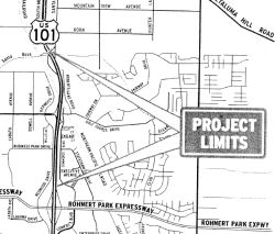 In June 2007, the CTC considered a resolution to
authorized roadway improvements in Rohnert Park (~ SON 14.067 to SON
15.563). This project is fully funded in the 2006 State Transportation
Improvement Program and Corridor Mobility Improvement Account Program. The
total estimated project cost is $86,300,000. Construction is estimated to
begin in FY 2007-08. The project will involve construction activities in
the environmentally sensitive habitat of the California tiger salamander.
In addition, the project will also remove 150 mature redwood trees.
In June 2007, the CTC considered a resolution to
authorized roadway improvements in Rohnert Park (~ SON 14.067 to SON
15.563). This project is fully funded in the 2006 State Transportation
Improvement Program and Corridor Mobility Improvement Account Program. The
total estimated project cost is $86,300,000. Construction is estimated to
begin in FY 2007-08. The project will involve construction activities in
the environmentally sensitive habitat of the California tiger salamander.
In addition, the project will also remove 150 mature redwood trees.
In October 2012, the CTC relinquished right of way in the city of Rohnert Park along Route 101 on Golf Course and Redwood Drives (04-Son-101-PM 14.2/14.9), consisting of collateral facilities.
In January 2018, the CTC relinquished right of way in the city of Rohnert
Park along Route 101 on Redwood Drive (04-Son-101-PM 15.1), consisting of
collateral facilities.
(Source: CTC Agenda, January 2018, Agenda Item 2.3c)
In April 2006, the CTC considered relinquishment of US 101 near Sonoma: 04-Son-101-PM 15.4 in the County of Sonoma. This is right of way in the County of Sonoma, at Santa Rosa Avenue and Roberts Lake Road, consisting of superseded highway right of way.
Santa Rosa to Cloverdale (Route 128)
US 101 Hearn Avenue Regional Multimodal Interchange project (04-Son-101 18.5, PPNO 0785C)
 In June 2019, it was reported that Santa Rosa City Council voted to ask county transportation
officials to reroute $9.5 million in regional sales tax revenue toward
rebuilding the Hearn Avenue (~ SON 18.474) crossing over US 101 in south
Santa Rosa, a $28 million project that would double the number of lanes on
the bridge and include new turn lanes, bike lanes and sidewalks. The
money, which comes from a 20-year county sales tax voters approved in
2004, is currently set aside for converting the intersection of Route 12
and Fulton Road into a full highway interchange — a $45 million
project that has yet to begin. The decision to move the money will be up
to the Sonoma County Transportation Authority, which is likely to consider
the matter in September. There is no guarantee SCTA would assent to Santa
Rosa’s request — the money will return to a general funding
pool and wouldn’t be a direct transfer — but Hearn is clearly
a priority for the city of Santa Rosa, and SCTA is eager to deliver
critical Measure M projects. Santa Rosa has been unable to secure full
funding for each of its three Measure M projects: the Hearn Avenue bridge,
the Fulton Road interchange, and the $47.5 million dollar extension of
Farmers Lane between Bennett Valley Road and Petaluma Hill Road along the
city’s southeastern edge. Moving the Fulton money toward Hearn
— except for $500,000 that will be used for study — reflects
the city’s desire to prioritize a bigger Hearn highway crossing
without totally abandoning the west side project. The move also preserves
several million dollars in Measure M funding for the Farmers Lane
extension. Previous efforts to secure grants for Hearn Avenue were
unsuccessful, in part because Santa Rosa didn’t put up enough local
dollars to draw down matching funds. Bolstering the city’s plans
with extra cash could improve its chances. A city spokeswoman said the
two-year construction process for Hearn Avenue could begin in January 2021
if Santa Rosa is able to secure full funding by the middle of 2020.
In June 2019, it was reported that Santa Rosa City Council voted to ask county transportation
officials to reroute $9.5 million in regional sales tax revenue toward
rebuilding the Hearn Avenue (~ SON 18.474) crossing over US 101 in south
Santa Rosa, a $28 million project that would double the number of lanes on
the bridge and include new turn lanes, bike lanes and sidewalks. The
money, which comes from a 20-year county sales tax voters approved in
2004, is currently set aside for converting the intersection of Route 12
and Fulton Road into a full highway interchange — a $45 million
project that has yet to begin. The decision to move the money will be up
to the Sonoma County Transportation Authority, which is likely to consider
the matter in September. There is no guarantee SCTA would assent to Santa
Rosa’s request — the money will return to a general funding
pool and wouldn’t be a direct transfer — but Hearn is clearly
a priority for the city of Santa Rosa, and SCTA is eager to deliver
critical Measure M projects. Santa Rosa has been unable to secure full
funding for each of its three Measure M projects: the Hearn Avenue bridge,
the Fulton Road interchange, and the $47.5 million dollar extension of
Farmers Lane between Bennett Valley Road and Petaluma Hill Road along the
city’s southeastern edge. Moving the Fulton money toward Hearn
— except for $500,000 that will be used for study — reflects
the city’s desire to prioritize a bigger Hearn highway crossing
without totally abandoning the west side project. The move also preserves
several million dollars in Measure M funding for the Farmers Lane
extension. Previous efforts to secure grants for Hearn Avenue were
unsuccessful, in part because Santa Rosa didn’t put up enough local
dollars to draw down matching funds. Bolstering the city’s plans
with extra cash could improve its chances. A city spokeswoman said the
two-year construction process for Hearn Avenue could begin in January 2021
if Santa Rosa is able to secure full funding by the middle of 2020.
(Source: Press Democrat, 6/12/2019)
In February 2023, it was reported that the Sonoma
County Transportation Authority has announced it will distribute about $67
million to 29 projects in various stages of execution. They range from
sidewalk and crosswalk improvements to trail and bus programs. The single
largest contribution, about $5 million, is going to Santa Rosa for its US 101 corridor interchange at Hearn Avenue. The city describes this project
as a reconstruction and widening of the Hearn interchange to improve
safety and bicycle and pedestrian crossing. It includes four traffic
lanes, left-turn lanes and routes for bicyclists and pedestrians.
Construction may begin as early as October 2023.
(Source: Press Democrat, 2/26/2023)
In May 2023, the CTC received notice of a
proposed STIP amendment to delete the Construction capital (CON)
phase programmed with STIP funds of $3,400,000 in Fiscal Year 2023-24 for
the Santa Rosa US 101 Bicycle and Pedestrian Overcrossing project (PPNO
2354) and program a new project, the US 101 Hearn Avenue Regional
Multimodal Interchange project (PPNO 0785C) for $3,400,000 ($2,365,000 in
Construction Support (CON Supp) and $1,035,000 in CON funds) in Fiscal
Year 2023-24, in Sonoma County, per STIP Guidelines. The Santa Rosa US Highway 101 Bicycle and Pedestrian Overcrossing project (PPNO 2354) was
programmed to construct a Class I Americans with Disabilities Act (ADA)
accessible and mode-separated bicycle and pedestrian overcrossing over US Highway 101, including new crosswalk, curb ramps and pedestrian lighting
and ADA compliant ramps and touchdown landings on Elliott Avenue and
Edwards Avenue. This project has recently seen an increase in project
costs due to complex bridge construction and is not yet ready for
allocation. The US 101 Hearn Avenue Regional Multimodal Interchange
project (PPNO 0785C) proposes to demolish and reconstruct/replace the US 101/Hearn Avenue overcrossing to increase the vertical clearance over US 101 and provide two vehicle lanes in each direction, a median, sidewalks,
and Class II and Class IV bikeways that will extend to Corby Avenue and
Santa Rosa Avenue. The project will also widen the southbound US 101
off-ramp with turning lanes at its intersection with Corby Avenue, add
lanes at the intersections of Hearn Avenue/Corby Avenue and Hearn
Avenue/Santa Rosa Avenue, and add ADA elements and protected intersection
facilities for bike crossings and detection to reduce potential conflicts
between bikes and vehicles. At the June 2023 CTC Meeting, the CTC approved
this amendment.
(Source: May 2023 CTC Agenda, Agenda Item 2.1b.(11); June 2023 CTC
Agenda, Agenda Item 2.1a.(13))
In August 2023, the CTC approved for future
consideration of funding 04-Son-101, PM 17.9/19.0. US 101/Hearn
Avenue Interchange Project. Replace the existing Hearn Avenue
overcrossing with a new overcrossing that would have four traffic lanes
with bike lanes and sidewalks on both sides of the roadway, in Sonoma
County. (ND Addendum) (PPNO 0785C) (LPP) (STIP). The project is located on
US 101, from PM 17.9 to PM 19.0, in Sonoma County. The Department proposes
to replace the existing Hearn Avenue overcrossing and widen the SB
off-ramp at the approach lane bridge in a similar location to the existing
overcrossing and widen the SB off-ramp at the approach to the intersection
with Corby Avenue. The project is currently programmed in the 2022 State
Transportation Improvement Program (STIP)/Senate Bill 1 (SB 1) Local
Partnership Programs (Formulaic and Competitive) for a total of
$43,675,000, which includes Construction (Support and Capital).
Construction began in 2023-24. The scope, as described for the preferred
alternative, is consistent with the project scope as programmed by the
Commission in the 2022 STIP/SB 1 Local Partnership Programs (Formulaic and
Competitive). A copy of the ND has been provided to Commission
staff. The Commission approved the project for future consideration of
funding on May 17, 2017, under Resolution E-17-23. Since the approval of
the ND, there have been changes to the project and an Addendum was
prepared pursuant to CEQA. These changes include revisions to the proposed
sidewalk and bicycle lane configuration, minor adjustments to the size of
partial property acquisitions and easements, minor adjustments to the
postmiles, updates to the quantities of affected trees and wetlands/waters
of the United States, and corresponding tree replacement and
wetlands/waters mitigation. These changes do not result in new significant
environmental effects or a substantial increase in the severity of effects
reported in the ND. No substantial changes have occurred with respect to
the project circumstances or effects, severity of effects, alternatives,
or mitigation measures. The project changes do not meet the criteria
outlined in CEQA Guidelines Section 15162 to prepare a Subsequent ND. The
Department subsequently completed an Addendum to the ND pursuant to CEQA.
The Department has approved this project for construction. This approval
and the Addendum will satisfy the environmental requirements for this
stage of the planning process.
(Source: August 2023 CTC Agenda, Agenda Item 2.2c.(2) Item 3)
In October 2023, it was reported that work on
the long-awaited project intended to improve traffic flow in south Santa
Rosa while also enhancing bike and pedestrian facilities so residents can
more easily cross over US 101 would soon get underway. The Hearn Avenue
interchange project calls for replacing the existing overpass at Hearn and
US 101 with a wider bridge to accommodate more traffic. New bike lanes and
improvements to the highway ramps also are planned. The project is
expected to ease congestion in the growing region. The area includes some
of the city’s busiest retail centers, with hundreds of new housing
units planned and under construction. Construction is anticipated to start
in spring 2024 and the total cost is about $43.7 million, which is being
paid for through a mix of local and state funds. Plans to address the
bridge and intersection have been in the works for decades and it’s
part of a larger project to expand other local roadways to improve traffic
flow and safety in south Santa Rosa but the city struggled to get
financing for this last piece. The current bridge features one lane in
each direction and a narrow sidewalk on the south side. The expanded
bridge will have four traffic lanes that will help improve traffic flow
and provide more room for emergency vehicles to efficiently cross the
bridge. The current configuration doesn’t provide enough space for
cars to pull over if an ambulance or fire truck needs to get through,
particularly when cars are backed up during rush hour. A new protected
cycle path separated from vehicle traffic by a barrier is planned on the
south side of the bridge. A striped bike lane and new sidewalk are planned
on the north and officials with the city and transportation authority are
studying whether it’s feasible to make it a protected bike lane. The
bridge will be built to comply with new Caltrans design standards that
require higher vertical clearance and other improvements and will feature
updated railings. Plans call for widening the southbound highway off-ramp
at Hearn to add additional turn lanes at Corby Avenue. The intersection at
Hearn and Corby also will be reconfigured to include additional turn
lanes. New curb ramps and crosswalks also are planned at Hearn and Corby.
(Source: Press Democrat, 10/13/2023)
In May 2012, it was reported that construction crews will start a $1.1 million project to connect the two stretches of Sixth Street in Santa Rosa (~ SON 20.279) that end at the highway, with completion due in October. In 2005, Caltrans built the Route 101 overpass at Sixth Street in Santa Rosa but never built the street under it. The work includes the new stretch of road, new sidewalks, landscaping and a stoplight at Davis and Sixth. The stoplight will be at about the end of the downtown southbound offramp from US 101; to avoid traffic backing up the offramp, part of the offramp will be re-striped to two lanes from the current one. Caltrans originally planned to connect the two parts of Sixth Street as part of its US 101 widening project but dropped the Sixth Street work to shave costs. Before US 101 was elevated, Sixth Street did connect. Part of the construction project involves digging up the old road now buried.
In October 2021, the CTC authorized relinquishment of right of way,
consisting of collateral facilities (2 segments), in the city of Santa
Rosa along Route 101 on 3rd Street and James Street
(04-Son-101-PM 20.1), under the terms and conditions as stated in the
Freeway Agreement dated July 3, 1979. The City, by Resolution
№ RES-2021-017 dated January 12, 2021, agreed to waive the 90-day
notice requirement and accept title upon relinquishment by the State.
(Source: October 2021 CTC Agenda, Agenda Item 2.3c)
In October 2021, the CTC authorized relinquishment of right of way,
consisting of collateral facilities (4 segments), in the city of Santa
Rosa along Route 101 on College Avenue (04-Son-101-PM 20.7), under the
terms and conditions as stated in the Freeway Agreement dated July 3,
1979. The City, by Resolution № RES-2021-017 dated January 12,
2021, agreed to waive the 90-day notice requirement and accept title upon
relinquishment by the State.
(Source: October 2021 CTC Agenda, Agenda Item 2.3c)
Santa Rosa US Highway 101 Bicycle and Pedestrian Overcrossing (04-Son-101 21.500, PPNO 2354)
In April 2019, it was reported that the City of
Santa Rosa is conducting design and location studies for
a long-planned bridge for cyclists and pedestrians to cross US 101. The
bridge is touted by the city and its supporters as a necessary connector
that will facilitate safer nonautomotive access over the freeway near its
high-traffic interchanges at College Avenue and Steele Lane. They serve
Coddingtown Mall, the nearby Sonoma Marin Area Rail Transit station, Santa
Rosa Junior College, Santa Rosa High School and nearby neighborhoods.
Although designing of the bridge is underway, the city still must
determine how to drum up the estimated $11 million to $13 million needed
to build the crossing, In terms of design, Santa Rosa will need to
determine whether they want a light, airy design that preserves views for
highway motorists — or a more imposing and unique bridge that
becomes a new city landmark. The city’s bridge team has studied
numerous designs, focusing on see-through spans with cables connecting the
bridge deck to supporting arches or columns, both of which would preserve
a northbound view of the hilly Shiloh Ranch Regional Park in Windsor.
Construction impacts to highway traffic would be temporary but
significant, officials said. An open-arch bridge would require US 101 to
be totally closed for several hours, while a column-supported span could
be built with only incremental partial closures. On top of the need for
funding and design agreement, the city’s bridge team has to balance
numerous restrictions on the span’s dimensions and anchor points.
For instance, the bridge deck has to be kept relatively shallow —
meaning the city can’t pursue a cheaper concrete design that
inherently requires a deeper base. Caltrans has expressed its preference
that the bridge doesn’t include a center column between the
northbound and southbound lanes. The bridge has been in the works for more
than a decade, and city documents show work slated to begin in January
2021 and finish in July 2022. The city has been able to find money to
study potential bridge designs, but doesn't have funding secured for
construction. The city is optimistic about its ability to secure grant
funding for up to 80 percent of the construction cost and will start
applying for funding in Summer 2019. The remainder of the construction
cost would come from traditional road-building funds such as gas tax
revenue. The city’s bridge team is focused on two possible sites:
Stretching over the highway between Elliott and Edwards avenues, or
between Bear Cub Way and Range Avenue further south. Most members of the
public who weighed in on the project Thursday favored the northern
alignment, which is closer to the mall and the junior college.
(Source: Press-Democrat, 4/19/2019)
In August 2021, it was reported that people on
foot and on bikes will be able to cross US 101 in Santa Rosa by 2026,
thanks to $12 million in federal grants awarded by the Metropolitan
Transportation Commission to build an overcrossing. The amount is more
than half of the project’s estimated $21 million in construction
costs, city officials said in an announcement of the federal grants. The
city needs to secure an additional $6 million for the project, which could
begin as early as October 2023 with a completion date of December 2025.The
project is a 17-foot-wide bicycle and pedestrian shared-use overcrossing
spanning Highway 101 at the Elliot-Edwards alignment approved by Caltrans.
City officials said the overcrossing will serve as a connector providing a
safer and more comfortable alternative for bicyclists and pedestrians over
the freeway, between two high-traffic interchanges at College Avenue and
Steele Lane. The project is also a critical link in the east-west bicycle
and pedestrian network identified in the city’s Bicycle and
Pedestrian Master Plan Update 2018. Opportunities for community input on
the project are planned for this fall. The first, planned for October
2021, will present the overcrossing’s preliminary design to the
city’s Design Review Board.
(Source: Local News Matters, 8/22/2021)
In May 2023, the CTC received notice of a
proposed STIP amendment to delete the Construction capital (CON)
phase programmed with STIP funds of $3,400,000 in Fiscal Year 2023-24 for
the Santa Rosa US 101 Bicycle and Pedestrian Overcrossing project (PPNO
2354) and program a new project, the US 101 Hearn Avenue Regional
Multimodal Interchange project (PPNO 0785C) for $3,400,000 ($2,365,000 in
Construction Support (CON Supp) and $1,035,000 in CON funds) in Fiscal
Year 2023-24, in Sonoma County, per STIP Guidelines. The Santa Rosa US Highway 101 Bicycle and Pedestrian Overcrossing project (PPNO 2354) was
programmed to construct a Class I Americans with Disabilities Act (ADA)
accessible and mode-separated bicycle and pedestrian overcrossing over US Highway 101, including new crosswalk, curb ramps and pedestrian lighting
and ADA compliant ramps and touchdown landings on Elliott Avenue and
Edwards Avenue. This project has recently seen an increase in project
costs due to complex bridge construction and is not yet ready for
allocation. The US 101 Hearn Avenue Regional Multimodal Interchange
project (PPNO 0785C) proposes to demolish and reconstruct/replace the US 101/Hearn Avenue overcrossing to increase the vertical clearance over US 101 and provide two vehicle lanes in each direction, a median, sidewalks,
and Class II and Class IV bikeways that will extend to Corby Avenue and
Santa Rosa Avenue. The project will also widen the southbound US 101
off-ramp with turning lanes at its intersection with Corby Avenue, add
lanes at the intersections of Hearn Avenue/Corby Avenue and Hearn
Avenue/Santa Rosa Avenue, and add ADA elements and protected intersection
facilities for bike crossings and detection to reduce potential conflicts
between bikes and vehicles. In June 2023, the CTC approved this amendment.
(Source: May 2023 CTC Agenda, Agenda Item 2.1b.(11); June 2023 CTC
Agenda, Agenda Item 2.1a.(13))
US 101 Widening - Steele Lane, Santa Rosa (~ SON 21.746) to Windsor (~ SON 29.402)
The SAFETEA-LU act, enacted in August 2005 as the reauthorization of TEA-21, authorized $5,600,000 for High Priority Project #278: Widening US 101 and reconstructing the off ramps on between Steele Lane and Windsor, CA to reduce traffic and promote carpools. This ties in with a number of already existing projects for US 101 under the TCRP, including TCRP #159 to repair the Steele Lane interchange, and some HOV projects.
In his 2006 Strategic Growth Plan, Governor Schwartzenegger proposed constructing HOV lanes between Santa Rosa and Windsor. This construction was completed in November 2010. He also proposed completing the Willits and Hopeland Byasses.
TCRP Project #159 will redesign and reconstruct the Steele Lane Interchange.
![[Santa Rosa]](maps/101-santarosa.jpg) In December 2008, the CTC approved for future
consideration of funding a project in Sonoma County that would widen the
existing four-lane route to six lanes between the Steele Lane interchange
and the Windsor River Road interchange in the unincorporated community of
Windsor. The project is fully funded in the 2008 State Transportation
Improvement Program (STIP). The project is programmed with Corridor
Mobility Improvement Account, local, and federal funds. The cost of the
project is $120,260,000. The scope, as described for the preferred
alternative, is consistent with the project scope set forth in the
approved project baseline agreement. Construction of the project impacts
aquatic habitat of steelhead, coho, and shinook salmon, which are
federally-listed species; and western pond turtle, northwestern pond
turtle, northern red-legged frog, and foothill yellow-legged frog, which
are state species of concern. Additionally loss of mature vegetation and
redwood trees, permanent impacts to waters of the U.S., and the public
controversy regarding the project resulted in an environmental impact
report being completed for this project. Due to mitigation such as
revegetation, tree replacement, aesthetic design treatments, riparian and
aquatic habitat restoration, and relocation of identified turtle and frog
species encountered during surveys, impacts were determined to be less
than significant.
In December 2008, the CTC approved for future
consideration of funding a project in Sonoma County that would widen the
existing four-lane route to six lanes between the Steele Lane interchange
and the Windsor River Road interchange in the unincorporated community of
Windsor. The project is fully funded in the 2008 State Transportation
Improvement Program (STIP). The project is programmed with Corridor
Mobility Improvement Account, local, and federal funds. The cost of the
project is $120,260,000. The scope, as described for the preferred
alternative, is consistent with the project scope set forth in the
approved project baseline agreement. Construction of the project impacts
aquatic habitat of steelhead, coho, and shinook salmon, which are
federally-listed species; and western pond turtle, northwestern pond
turtle, northern red-legged frog, and foothill yellow-legged frog, which
are state species of concern. Additionally loss of mature vegetation and
redwood trees, permanent impacts to waters of the U.S., and the public
controversy regarding the project resulted in an environmental impact
report being completed for this project. Due to mitigation such as
revegetation, tree replacement, aesthetic design treatments, riparian and
aquatic habitat restoration, and relocation of identified turtle and frog
species encountered during surveys, impacts were determined to be less
than significant.
Sonoma Highway 101 Airport Interchange (~ SON 26.005)
In April 2012, the CTC authorized $24,108,000 for North B - Sonoma Highway 101 Airport Interchange. The project is located in the town of Windsor in Sonoma County. The project will reconfigure two existing partial interchanges at Fulton Road and Airport Boulevard into a single complete interchange by replacing the existing Airport Boulevard Overcrossing at Route 101. The project will also construct soundwalls at selected locations within the project limits. At its April 2012 meeting, the Commission allocated $17,742,000 of CMIA funds and $1,866,000 of State-Local Partnership Program (SLPP) funds. The project funding plan also included $10,392,000 of local funds. The project was advertised in June 2012. When bids were opened on August 8, 2012, the lowest bid came in 12 percent over the Engineer’s Estimate. The two lowest bidders were found to be non-responsive. Eventually, all of the bids were rejected. The project was re-advertised on September 24, 2012. When bids were opened on October 17, 2012, the lowest bid came in 7.9 percent over the Engineer’s Estimate. The Sonoma County Transportation Authority (SCTA) is proposing to cover the funding shortfall of $3,813,000 with a combination of SLPP funds ($1,827,000) and local funds ($1,986,000). The Commission programmed and allocated these additional SLPP funds at its September 2012 meeting. In December 2012, the funding plan was updated.
In January 2013, it was reported that work has begun on
the Airport Interchange. The interchange is one of the most heavily used
in Sonoma County, serving the Charles M. Schulz-Sonoma County Airport and
6,000 workers in adjacent business parks. The new interchange, costing
$34.5 million, is scheduled to be completed in late 2014. Ghilotti
Construction of Santa Rosa was the low bidder on the construction project
at $28.7 million. Work is expected to begin in June 2013. The new
diamond-shaped interchange will feature longer and wider on- and off-ramps
that, along with new stoplights and improvements to Airport Boulevard. The
new interchange also will require the closure of the onramps and offramps
to Fulton Road, although the overpass itself will remain.
(Source: Press-Democrat, 1/8/2013)
In August 2011, the CTC approved $1,350,000 in SHOPP funding for repairs near Santa Rosa, at River Road intersection; also at Shiloh Road intersection (SON PM 28.0), that will reconstruct two intersections and install signals to bring pedestrian facilities to ADA standards and improve safety at the intersections.
In November 2018, there were updates about former US 101 in Healdsberg (~
SON 34.905), where Healdsberg Ave (former US 101) meets Mill St. and Vine
St. in a roundabout: After two years, the new roundabout was just about
finished. Billed as the solution to a clunky five-way intersection, the
highly touted project fast became a multimillion-dollar headache, and in
turn the butt of jokes, on social media and in the region’s
infrastructure circles. The roundabout will be delivered on budget, which
includes $2.7 million paid to Santa Rosa-based engineering firm GHD for
the city’s project management and design needs. All told, the
project cost a total of about $14 million.
(Source: Press-Democrat, 11/25/2018)
Cloverdale to Calpella (Route 20)
A bypass was opened in Feb 1994 months around Cloverdale on Route 101 (~ SON R50.179 to SON R53.527). This connects to the former end of Route 101 2 mi south of Cloverdale to an approx. 3 mile stretch of freeway about 1 mile north of Cloverdale.
In April 2006, the CTC considered relinquishment 04-Son-101-PM 53.9/56.2 in the County of Sonoma. This is right of way in the County of Sonoma, between the Preston Overhead and the Mendocino County Line, consisting of superseded highway right of way.
In January 2007, the CTC considered relinquishment of right of way on US 101 near Sonoma between the Preston Overhead and the Mendocino County line ( 4-Son-101-PM 53.9/56.2), consisting of superseded highway right of way.
In April 2010, the CTC approved relinquishment of right of way in the county of Mendocino along Route 101U (Geyser Road) from the Sonoma County line to Route 101 (1-Men-101U-PM 0.0/0.6), consisting of superseded highway right of way (~ 101 MEN R0.698).
In October 2006, the CTC considered relinquishment of right of way in the county of Mendocino, about 300 feet northerly of the Pieta Creek Bridge (1-Men-101-PM 6.0/6.2), consisting of superseded highway right of way.
In May 2015, the CTC approved for future consideration of funding a project in Mendocino County near the town of Hopland (~ MEN 11.011) that will stabilize two active landslide areas and restore the roadway at the slide areas on US 101. The project is programmed in the 2014 State Highway Operation and Protection Program. The estimated cost is $18,305,000 for capital and support. Construction is estimated to begin in Fiscal Year 2015-16. The scope, as described for the preferred alternative, is consistent with the project scope programmed by the Commission in the 2014 State Highway Operation and Protection Program.
In October 2011, the CTC approved relinquishment of right of way in the city of Ukiah along Route 101 on East Perkins Street (~ MEN R24.514), consisting of collateral facilities.
Calpella (~ MEN 30.868) to Leggett (Route 1) (~ MEN T91.258)
Calpella to Laughlin Median Barrier (01-Men-101 30.8/R33.8)
 In March 2021, the CTC amended the following project into the 2020 SHOPP: (1a) #13.
01-Men-101 30.8/R33.8 PPNO 4751 ProjID 0120000062 EA 0K310. US 101 Near
Ukiah, from Route 20 to 0.1 mile south of Uva Drive/North State Street.
Construct median barrier. PA&ED $682K; PS&E $941K; R/W Sup $66K;
Con Sup $1,028K; R/W Cap $28K; Const Cap $6,312K TOTAL $9,057K. Begin
const. 7/5/2023.
In March 2021, the CTC amended the following project into the 2020 SHOPP: (1a) #13.
01-Men-101 30.8/R33.8 PPNO 4751 ProjID 0120000062 EA 0K310. US 101 Near
Ukiah, from Route 20 to 0.1 mile south of Uva Drive/North State Street.
Construct median barrier. PA&ED $682K; PS&E $941K; R/W Sup $66K;
Con Sup $1,028K; R/W Cap $28K; Const Cap $6,312K TOTAL $9,057K. Begin
const. 7/5/2023.
(Source: March 2021 CTC Agenda, Agenda Item
2.1a.(1a) #13)
In March 2021, the CTC approved the following
pre-construction support phase allocation(s): (2a) #4. $682,000
(PA&ED). 01-Men-101 30.8/R33.8. PPNO 01-4751; ProjID 0120000062; EA
0K310. US 101 Near Ukiah, from Route 20 to 0.1 mile south of Uva
Drive/North State Street. Construct median barrier. (Concurrent Amendment
under SHOPP Amendment 20H-006; March 2021.) Prog. year 22-23.
(Source: March 2021 CTC Agenda, Agenda Item
2.5b.(2a) #4)
Roadway Realignment: S of Black Bart Road (01-Men-101 39.8/40.4)
In August 2022, the CTC approved the following SHOPP
amendment: 01-Men-101 39.8/40.4. PPNO 01-4772; ProjID 0121000105; EA
0L380. US 101 Near Willits, from 1.1 miles south to 0.5 mile south of
Black Bart Road. Widen shoulders, realign roadway, place High
Friction Surface Treatment (HFST), construct Maintenance Vehicle Pullouts
(MVPs), replace median barrier, and install rumble strips. Allocation ($
× 1,000): PA&ED $1,839; PS&E $1,639; R/W Sup $272; Con Sup
$3,592; R/W Cap $1,011; Const Cap: $15,615; Total $23,968. Begin Const:
12/17/2025. Concurrent COS allocation under Resolution FP-22-11; August
2022.
(Source: August 2022 CTC Agenda, Agenda Item
2.1a.(1a) #16)
Black Bart Road to Waterplant/Grider Road Median Barrier (01-Men-101 41.2/R42.8)
 In May 2021, the CTC amended the following project into the 2020 SHOPP:
(1a) #21. 01-Men-101 41.2/R42.8 PPNO 4752 ProjID 0120000081 EA 0K410. US 101 Near Willits, from north of Black Bart Road to north of
Waterplant/Grider Road. Construct concrete median barrier and
retaining wall, upgrade guardrail, and make intersection improvements.
(Concurrent COS allocation under Resolution FP-20-70; May 2021.)
PA&ED $1,719K; PS&E $2,489K; R/W Sup $194K; Con Sup $1,789K; R/W
Cap $61K; Const Cap $10,658K TOTAL $16,910K. Begin const. 7/2/2024.
In May 2021, the CTC amended the following project into the 2020 SHOPP:
(1a) #21. 01-Men-101 41.2/R42.8 PPNO 4752 ProjID 0120000081 EA 0K410. US 101 Near Willits, from north of Black Bart Road to north of
Waterplant/Grider Road. Construct concrete median barrier and
retaining wall, upgrade guardrail, and make intersection improvements.
(Concurrent COS allocation under Resolution FP-20-70; May 2021.)
PA&ED $1,719K; PS&E $2,489K; R/W Sup $194K; Con Sup $1,789K; R/W
Cap $61K; Const Cap $10,658K TOTAL $16,910K. Begin const. 7/2/2024.
(Source: May 2021 CTC Agenda, Agenda Item 2.1a.(1a)
#21)
In May 2021, the CTC approved the following
pre-construction support phase allocation(s): (2a) #2. $1,719,000
(PA&ED). 01-Men-101 41.2/R42.8. PPNO 01-4752; ProjID 0120000081; EA
0K410. US 101 Near Willits, from north of Black Bart Road to north of
Waterplant/Grider Road. Construct concrete median barrier and retaining
wall, upgrade guardrail, and make intersection improvements. (Concurrent
Amendment under SHOPP Amendment 20H-007; May 2021.) Prog. year
23-24.
(Source: May 2021 CTC Agenda, Agenda Item 2.5b.(2a)
#2)
In June 2020, the CTC approved relinquishment of right of way on the
superseded portion of Route 101 (Main Street), from Route 20 to the north
City limits, to the City of Willits (01-Men-101-PM 46.36/47.53) under the
terms and conditions as stated in the relinquishment agreement dated
January 25, 2012.
(Source: June 2020 CTC Minutes, Agenda Item 2.3c)
Willits Bypass (US 101/Route 20) (~ MEN T43.716 to MEN 48.372)
![[Willits Map]](maps/willits2.jpg) There are several alternatives under consideration here,
most of them bypassing the city on the east, one on the west. This would
be a new four-lane freeway on a new alignment near Willits; the EIR is
currently in circulation. [July 2002 CTC Agenda; 2.2b.(1)]. Additional
details on this bypass can be found on the Caltrans Willits Bypass Page . The recommended route is LT, which will leave current US 101 at the Upper Haehl Creek interchange, and rejoin current US 101 at the Quail Meadows Interchange.
There are several alternatives under consideration here,
most of them bypassing the city on the east, one on the west. This would
be a new four-lane freeway on a new alignment near Willits; the EIR is
currently in circulation. [July 2002 CTC Agenda; 2.2b.(1)]. Additional
details on this bypass can be found on the Caltrans Willits Bypass Page . The recommended route is LT, which will leave current US 101 at the Upper Haehl Creek interchange, and rejoin current US 101 at the Quail Meadows Interchange.
As part of the Corridor Mobility Improvement Account (CMIA) program, the Willits Bypass was submitted for $177M in funding, but this funding request was not funded.
The SAFETEA-LU act, enacted in August 2005 as the reauthorization of TEA-21, authorized $5,600,000 for High Priority Project #2749: Construct bypass along US 101 around Willits, CA to reduce congestion, improve air quality and enhance the economic lifeline of North Coast.
A negative environmental impact declaration was received in July 2007
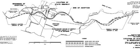 In February 2008, a route was adopted for the Willits Bypass. As part of this, a portion of former Route 101 will be designated as Route 20 (and may require legislation to make
the route contiguous). As shown in the map to the right, the open dashed
line is the freeway alignment adopted in 1968 that is being rescinded. The
solid heavy line is the new alignment. The heavy solid dashed line is the
1968 freeway alignment being retained. The project proposes to construct a
four-lane freeway bypass with full access control, two interchanges, and
three grade separations east of Willits. The freeway will depart from
existing Route 101 approximately 0.3 miles south of the Haehl Overhead and
will end approximately 1.8 miles south of Reynolds Highway along the
existing Route 101 alignment just south of the at-grade rail crossing of
the Northwestern Pacific Railway. The bypass will provide access to
Willits and Fort Bragg at interchanges toward the north and south ends of
the project. Frontage roads and driveways to local roads will be
constructed as needed to provide access to landlocked parcels. A portion
of the January 11, 1963 freeway route adoption will be rescinded as part
of this proposed freeway route adoption as shown on the route location
map. The proposed freeway route adoption will link the portions of the
January 11, 1963 route adoption remaining in effect. The Department
recommended redesignating a portion of existing Route 101 to Route 20 from
0.3 miles south of Haehl Overhead to existing Route 101/ Route 20
junction, in town as Route 20 in order to provide a link from Route 20 to
Route 101 on its new alignment. Relinquishment of the existing Route 101
from Route 20, in town, to near the north end of the bypass would occur
after project construction. Relinquishment would transfer the State's
right of way, title, and interest of a section of Route 101 to the City of
Willits and to Mendocino County.
In February 2008, a route was adopted for the Willits Bypass. As part of this, a portion of former Route 101 will be designated as Route 20 (and may require legislation to make
the route contiguous). As shown in the map to the right, the open dashed
line is the freeway alignment adopted in 1968 that is being rescinded. The
solid heavy line is the new alignment. The heavy solid dashed line is the
1968 freeway alignment being retained. The project proposes to construct a
four-lane freeway bypass with full access control, two interchanges, and
three grade separations east of Willits. The freeway will depart from
existing Route 101 approximately 0.3 miles south of the Haehl Overhead and
will end approximately 1.8 miles south of Reynolds Highway along the
existing Route 101 alignment just south of the at-grade rail crossing of
the Northwestern Pacific Railway. The bypass will provide access to
Willits and Fort Bragg at interchanges toward the north and south ends of
the project. Frontage roads and driveways to local roads will be
constructed as needed to provide access to landlocked parcels. A portion
of the January 11, 1963 freeway route adoption will be rescinded as part
of this proposed freeway route adoption as shown on the route location
map. The proposed freeway route adoption will link the portions of the
January 11, 1963 route adoption remaining in effect. The Department
recommended redesignating a portion of existing Route 101 to Route 20 from
0.3 miles south of Haehl Overhead to existing Route 101/ Route 20
junction, in town as Route 20 in order to provide a link from Route 20 to
Route 101 on its new alignment. Relinquishment of the existing Route 101
from Route 20, in town, to near the north end of the bypass would occur
after project construction. Relinquishment would transfer the State's
right of way, title, and interest of a section of Route 101 to the City of
Willits and to Mendocino County.
The Willits Bypass dates back to 1962. A project report recommending construction of a four-lane freeway facility on Route 101, to bypass the City of Willits, was approved in 1962. As a result of this Report, a bypass route was adopted by the California Highway Commission on January 11, 1963. In 1969, improvements to Route 101 were made. A segment of freeway south of Willits was constructed and right of way was acquired. Due to funding shortfalls and a shift in transportation philosophies, further development of the bypass project stopped. In 1987, the Commission directed the Department to re-evaluate the adopted route and to consider other alternatives to satisfy the “new” required environmental process. In 1988, a Project Study Report (PSR) investigating the feasibility of constructing a four-lane freeway bypass around Willits was approved. This approved PSR authorized environmental studies to be completed. During the course of the studies, the Department investigated a wide range of alternatives. In the 1992 State Transportation Improvement Program (STIP), the Commission partially funded the Willits Bypass project, programming $60.5 million for construction and $9 million for right of way. Engineering and environmental studies continued on the many alternatives under consideration through 1994, but due to funding shortages and resource redirection, by 1995, progress halted. With a new route adoption, construction should proceed. It is interesting to note that there are five signalized intersections on the existing alignment within the project limits, the only signalized intersections on Route 101 between San Francisco and Eureka.
In July 2010, the CTC approved the Willits Bypass for future consideration of funding. The project is programmed in the 2010 State Transportation Improvement Program and includes federal demonstration funds. Total estimated project cost is $232,394,000 for capital and support.
In September 2010, after meeting with US Army Corps of Engineers regulators, it was announced that Caltrans has determined that 20 months is not sufficient time to complete the full wetland assessment and mitigation documentation required to obtain a "404 permit" for the project to bypass US 101 around Willits, and has withdrawn the project.
In August 2011, there was a report on the agreement between Caltrans and the City of Willits regarding how Main Street will be returned to city control after the bypass is completed. Assuming the city signed the agreement timely, CalTrans has yielded on several main sticking points: it has agreed to address the Sherwood Road interchange, limit bypass construction traffic on city roads, fix the drainage and access problems in front of Willits High School and provide $4.48 million to upgrade all sidewalks on US 101 from the Route 20 interchange north to the city limits to meet current American's with Disabilities Act requirements. By relinquishment law, CalTrans must certify to the California Transportation Commission and to the California Legislature any roadway being relinquished is in a "state of good repair." The actual definition of "state of good repair" has been the meat of much of the relinquishment discussion. The vague standard, codified by the Legislature in the relinquishment statute, has been interpreted differently by city residents and CalTrans officials. Precedent suggests the intent of the "state of good repair" standard means the highway should not to require significant maintenance for a period of 20 years. The Willits city engineer is also concerned about the poor documentation of the CalTrans right of way, unclear documentation about bridge conditions, and a series of issues with the surface and subsurface drainage along the right of way. The bridges in question are nearly 100 years old.
In March 2012, the CTC approved $135.5 million to construct the Willits bypass. Opponents vowed to continue fighting the project, which runs through wetlands east of the city. The 5.9 mile bypass is expected to be completed in 2016. Caltrans will begin seeking bids May 1, 2012. Land clearing could begin by winter. The cost of the project, including impact reports, permits, land purchases and mitigations for the loss of wetlands is expected to be about $210 million.
In September 2012, the CTC approved $107 million in construction contracts for the first phase of the US 101 Willits bypass. Caltrans hopes to begin construction by late fall 2012, but environmentalists said they would be seeking a court order to block the planned work.
Even as late as February 2013 there was opposition to the bypass. According to one editorial, the proposed routing will not help the traffic in Willits. Instead, the Caltrans plan is believed to result in lasting harm to Little Lake Valley. According to this editorial, 75% of traffic that clogs the intersection at US 101 and Route 20 is local traffic that will still clog this intersection until it is redesigned. The Caltrans bypass would actually add to the backup problem with another stop sign at the southern interchange. Two-thirds of the big trucks will still be in town on business or using Route 20. The community had developed a bypass project, but the community proposal was rejected by Caltrans. The community-supported bypass would improve the distribution of local traffic and help relieve the existing congestion on Main Street, especially at the junction of US 101 and Route 20. It would also provide a creekside trail for pedestrian and bicycle use.
In August 2013, it was reported that Caltrans may face fines or even be forced to stop work on the Willits Bypass project, as it is out of compliance with environmental regulations. The freeway goes right through a sensitive wetlands area, so Caltrans is required to do $50 million in environmental improvements to compensate. However, the US Army Corps of Engineers says Caltrans failed to get a qualified contractor and meet required deadlines for the environmental work. The Corps calls the violations "very serious."
The LA Times reported on the dispute over the bypass in
August 2013. Opponents have decried the environmental destruction,
contending that a two-lane bypass would have been far less damaging and
should have been considered. They have conducted studies that indicate the
project's traffic-carrying capabilities far exceed expected volumes, and
last year filed a federal suit citing violations of the Clean Water Act
and National Environmental Policy Act — laws not even conceived of
in the 1950s. Plenty of residents are fed up with the protests, saying the
project at last will relieve Main Street's traffic jams while modernizing
infrastructure for countless Californians who don't wish to stop in town
at all. Caltrans district spokesman Phil Frisbie said the agency followed
regulations in winning approval for the project, agreeing to a massive
mitigation plan to enhance nearly 2,000 acres of the watershed in exchange
for compacting 60 acres. So far, only the southbound lanes have been
funded. They will be striped for two-way traffic while Caltrans seeks more
financing.
(Source: Los Angeles Times, 8/24/13)
In September 2013, Caltrans resumed hauling dirt to the project, but can only haul it at night through the town of Willits. During this time, two demonstrators chained themselves to a truck for more than eight hours, backing up a string of trucks and stopping work on the project.
In June 2014, the U.S. Army Corps of Engineers
suspended the permit for the Willits Bypass project which has been plagued
by environmental and financial issues. Construction on the freeway in
early 2013, but Caltrans is way behind schedule on required protections
and improvements for the environment. There have also been major erosion
problems at the construction site with pollution running off into streams
that provide habitat for threatened Coho salmon and steelhead trout.
Caltrans was notified of repeated violations of the U.S. Clean Water Act.
The Corps says no additional construction work is allowed in the wetlands
area until Caltrans complies with its permit conditions. The Corps letter
says Caltrans may continue to work on required environmental improvements
as long they are "approved by the Corps in writing." CalTrans halted all
work on the US 101 bypass around Willits on July 8, 2014. Between June 20
and July 7, CalTrans racked up a bill for $800,000 in standby charges and
other delay costs. As of early July, DeSilva Gates Construction had
already reassigned nearly all of its personnel to other projects and the
structural contractor, Flatiron West, had only two crews remaining on the
jobsite. Despite these cutbacks, Caltrans said the delay costs were
beginning to reach $100,000 per day.This is the first project suspension
of this type issued by the San Francisco Corps District in at least 10
years, according to the Army Corps. The project construction was so far
out of balance with the wetlands mitigation. CalTrans has proposed another
mitigation schedule which will not complete the mitigation in areas
outside of the bypass footprint until post-bypass in 2018. The Corps has
taken no action on this proposal, but would rather see CalTrans do as the
permit required. The regulators are urging CalTrans to give strong
consideration to reducing the project size and/or a detailed project list
of mitigation actions to be done this year which would balance out the
mitigation work with project impacts.
(Source: ABC 7 News, 6/20/14; MendocinoBeacon,
7/10/14)
In November 2014, it was reported that Sherwood Valley
and other Pomo tribal officials say they have witnessed and documented
CalTrans blatantly violating National Historic Preservation Act
regulations meant to protect tribal heritage and resources. They say
CalTrans has failed to consult, failed to provide completely transparent
information about their archaeological surveys, ignored tribal input and
ethnography about the location of historical sites and recklessly
disrupted areas where they should have known there were important Pomo
village areas. Tension between CalTrans and tribal officials crescendoed
in September 2013, when they learned construction workers had previously
installed 85-foot wick drain pipes underground through a site that was
believed to contain a hearth, fossilized seeds and other cultural items of
great interest to the tribe. As concern grew, representatives from the
Coyote Valley and Round Valley, which also have members descended from
Little Lake Valley, joined Sherwood Valley in monitoring and consulting on
the project. CalTrans had been aware of the site through ethnographic
information, but because officials never created a map and only relied on
written descriptions, they impaled the site with the wick drains anyway,
which, in a letter to Fitzgerral, State Historic Preservation Officer
Carol Roland-Nawi said severely damaged the site and indicated CalTrans
had been non-compliant with the law. Tribal monitors will continue to do
their best to stop construction when a new site is uncovered, they said,
but there is only enough funding for a handful of them to cover an entire
six miles. The tribes are also trying to work on a final agreement with
CalTrans on the handling of cultural resources, but the meetings have been
scheduled several weeks apart and the process is slow.
(Source: New American Media, November 2014)
In December 2014, it was reported that Caltrans is
seeking an additional $64 million (this amount was approved by the CTC in
December 2014) to complete construction on a highway bypass around
Willits. Caltrans officials have in the past said that the delays,
including for running afoul of environmental permits needed to build in
sensitive wetland areas, would lead to cost overruns. Work on the 5.9-mile
US 101 bypass that will direct traffic around the town of Willits is 55%
complete. It is expected to open in the summer of 2017, two years behind
schedule. The Willits bypass has become one of the most contentious land
use battles on the North Coast, pitting environmentalists, whose protests
at the construction site have sometimes led to arrests, against
transportation planners and business interests, who say the bypass will
save drivers as much as 30 minutes and cut down on shipping costs. Some of
the more moderate critics think a bypass is needed, but have called for
Caltrans to scale down its plan. The agency’s current blueprints
call for a 4-lane freeway bypass with diamond interchanges at the north
and south ends. A funding shortfall has forced Caltrans to build a 2-lane
first phase of the project while additional money is identified. Opponents
think the agency should stop at two lanes and scale back the northern
interchange into a smaller roundabout. The agency says that redesigning
the project now would require additional environmental review and could
add another two years to the already overdue project.
(Source: Press Democrat, 12/1/2014)
In July 2015, it was reported that a state
investigation determined the falsework that collapsed on the Willits
bypass on January 22, 2015, “was not properly designed, was not
erected as per the design plans, was missing components, [and]
deficiencies were not identified when inspected and signed off by the
project engineer for the company erecting it.” The California
Occupational Safety and Health Administration cited all three employers at
the worksite – Caltrans, Flatiron West, Inc., and “DeSilva
Gates-Flatiron West: A Joint Venture” – for four
“serious” violations. Those July 16, 2015, citations were for:
failure to properly inspect the falsework; failure to make a thorough
survey of the conditions of the site to determine “predictable
hazards” to employees; failure to ensure vertical supports were
erected on a “properly compacted and reasonably level” base;
and failure to ensure the falsework was designed and erected to
“assure its ability to withstand all intended loads. CalOSHA
concluded that “Multiple problems with missing and improperly
installed components and the loss of support at a double-sill arrangement
that did not have a double-cap restraint system installed was the root
cause of the collapse. Unstable ground is still being investigated. The
potential initiators of the double-sill failure were identified as
improper cable tensions due to settlements and excessive joint take-up and
an eccentric load induced into the falsework.” Caltrans has been
fined $5,400 for each violation, a total of $21,600. De Silva
Gates-Flatiron West: A Joint Venture has been fined a total of $49,500.
Flatiron West, Inc. has been fined a total of $93,900.
(Source: Lost Coast Outpost, 7/23/2015)
In November 2015, it was reported that two Northern
California Indian Tribes have filed suit in federal court, alleging that
Caltrans has destroyed important archaeological areas and failed to
properly protect historical sites during construction of a stretch of road
in Mendocino County. The suit, which was filed by the Coyote Valley Band
of Pomo Indians and the Round Valley Indian Tribes, alleges violations of
the National Environmental Policy Act and the National Historic
Preservation Act. As examples, the suit alleges that Caltrans is
bulldozing over important wetlands, unearthing historical obsidian pieces
without properly storing them, and blocking historic salmon passages. .
(Source: NBC Bay Area, November 2015)
In March 2016, it was reported that the Willits City
Council was informed that Caltrans was planning to open the Willits Bypass
for through traffic on Sept. 16. This remains a planning date barring
unforeseen circumstances. While the roadway construction is expected to
complete by that time, the Ryan Creek fish passage was expected to
complete later. Other “child” projects associated with the
bypass such as the revamp of the Sherwood Road intersection with North
Main Street, the addition of sidewalks and drainage in front of Willits
High School and the repaving and Americans with Disabilities Act
compliance from Route 20 to the northern Willits city limits are expected
to complete in 2017. The bypass mitigation projects, currently underway,
in areas away from the freeway footprint have their own schedule and will
continue for years after the roadway is placed into service. The roadway
construction is considered to be 87% complete, according to the February
update provided by Caltrans to the Willits City Council. Most of the work
has been suspended until the end of the rainy season.
(Source: Ukiah Daily Journal via Andy3175 @ AAroads, 3/3/2016)
In August 2016, it was reported that the completion
ceremony for the Willits Bypass has been scheduled for Thursday, November
3 at 11:00 a.m. The ceremony, which will include dedicating the 1.1 mile
long viaduct bridge to fallen U. S. Navy Seal Jesse Pittman, will take
place on the new highway, at the north end of the viaduct, near the north
interchange. Views from the two-lane bypass, which is raised in sections,
offer sweeping views of Little Lake Valley, taking in pastures, wetlands
and mountains. The bucolic scenery belies the debate, protests, lawsuits,
construction snafus and budget issues that contributed to decades of delay
for the highway project. It remains a divisive topic for many Willits
residents, and Caltrans’ proposal to one day expand the bypass by
two lanes could revive the protests and court challenges that stalled work
three years ago. Opponents focused on its size, route and encroachment
into wetlands and proximity to Native American cultural sites. Caltrans is
spending $80 million to offset the loss of wetlands, with plans to create
new habitat and rehabilitate streams, transportation officials said. As
the bypass neared completion, the main concern voiced by residents here is
about the potential loss of business when traffic is shunted around the
economically stressed city. Its economy used to be dependent on logging
and farming. Its largest employers now include the hospital, school
district and manufacturing businesses. Retail and service-based business,
much of it dependent on tourism, also are important and are the most
likely to be affected by the bypass. Willits is one in a long line of
California cities to be bypassed by US 101. They included Ukiah in the
1960s and Cloverdale in the early 1990s. While US 101 will continue to
narrow and slow traffic through other small towns, like Hopland and
Laytonville, the Willits bypass will eliminate the last stop light on the
highway between San Francisco and Eureka, a 270-mile stretch. City and
business groups said they are doing what they can to ease the transition.
They are working on plans to ensure tourists know about the town and see
its main drag as an inviting stopover. Caltrans funded a redesign study
for Main Street and is spending about $16 million for basic roadway,
interchange and sidewalk improvements. The city is negotiating for help
making the route more attractive to pedestrians as well. Proposed
improvements include bicycle lanes and street designs that slow traffic.
Once the city owns Main Street and takes over its management, it will also
be able to partially or completely shut down the road for special events,
including farmers markets.
(Source: Caltrans, 8/4/2016; PressDemocrat,
10/6/2016)
In December 2017, the CTC authorized the following financial allocation: (1) 01-Men-101 45.3/47.9: Willits Bypass - Relinquishment of Bypassed Route 101 (Existing Route 101 Through Willits). In the city of Willits from PM 46.63 to PM 47.52. Rehabilitate and relinquishment of facilities. $3,992,000; (2) 01-Men-101 47.1/47.3: Willits Bypass - Sherwood Road Geometric Upgrades / US 101. In the city of Willits from 0.1 mile north of Sherwood Road. Update the roadway curve, slope and add shoulders. $4,165,000.
In September 2018, it was reported that the
relinquishment of the Bypassed Route 101 had entered its final phases.
Beginning Monday Oct. 1, CalTrans would be repaving Main St. during the
days, for several days, with work starting at about 9 a.m. This work will
mean one way traffic control, with a pilot car, on Main St. The paving
work is expected to be completed Oct. 15, with the next phase being
"striping" which is expected to be done by Nov. 1. Work will also be
continuing on the new junction between Sherwood Rd. and Main St. All this
work is being done as part of the project to bring Willits Main St., which
was formally part of U.S. Route 101, up to snuff, and ready to be returned
to the ownership, control and responsibility of the City of Willits. The
street has been controlled by the various incarnations of the California
Department of Transportation since the early part of last century. At the
end of all this work Willits will have a gleaming, brand new, freshly
painted Main Street, with upgraded sidewalks.
(Source: Mendocino Voice, 9/28/2018)
In December 2009, the CTC approved for future funding a project that will repair, upgrade, or replace 36 existing drainage facilities on Route 101 from 0.4 miles north of Baechtel Creek Bridge in Willits (01-MEN-101-46.29) to 0.2 miles south of Cummings Road Undercrossing near Leggett (01-MEN-101-R084.48). The project is fully funded in the State Highway Operation and Protection Program. Total estimated project cost is $5,979,000, capital and support. It is estimated to begin construction in Fiscal Year 2011-12.
In June 2021, the CTC authorized relinquishment of right-of-way,
consisting of 3 segments of collateral facilities in the county of
Mendocino along Route 101 on North Main Street (1-Men-101-PM 47.53/48.73),
under the terms and conditions as stated in the freeway agreement dated
September 23, 2008 and the relinquishment agreement dated November 1,
2011. The City, by letter dated April 28, 2021, agreed to waive the
90-day notice requirement and acknowledged receipt of the Historical
Resources Compliance Report for the area.
(Source: June 2021 CTC Agenda, Agenda Item 2.3c)
Outlet Creek Bridge Median Addition (01-Men-101 50.7/52.2)
In March 2022, the CTC adopted the 2022 SHOPP, which
included the following as a new capital amendment: 01-Men-101 50.7/52.2.
PPNO 01-4748; ProjID 0121000023; EA 0K890. US 101 Near Willits, from
Outlet Creek Bridge to 1.5 miles north of Outlet Creek Bridge. Widen
roadway to add median, construct concrete median barrier, place High
Friction Surface Treatment (HFST), upgrade and extend guardrail, replace
sign panels, overlay pavement, improve drainage, and place rumble strips.
Programmed funding (× $1000): PA&ED $1,476; PS&E $1,246; R/W
Sup $94; Con Sup $2,780; R/W Cap $22; Const Cap $13,691; Total
$19,309. Begin Const 4/29/2025.
(Source: March 2022 CTC Agenda, Agenda Item 4.25
(SHOPP Adoption), Attch. C (New 2022 SHOPP Capital Project Amendments),
Item #5)
In January 2024, the CTC approved the following
pre-construction-phase SHOPP allocation: $1,535,000. 01-Men-101 50.7/52.2.
PPNO 01-4748; ProjID 0121000023; EA 0K890. US 101 Near Willits, from
Outlet Creek Bridge to 1.5 miles north of Outlet Creek Bridge. Widen
roadway to add median, construct concrete median barrier, place High
Friction Surface Treatment (HFST), upgrade and extend guardrail, replace
sign panels, overlay pavement, improve drainage, and place rumble strips.
(Categorically Exempt). Programmed (Allocation, if different):
PS&E $1,246,000 ($1,441,000); R/W Sup $94,000 ($94,000).
(Source: January 2024 CTC Agenda, Agenda Item 2.5b.(2a) #4)
In October 2016, the CTC authorized that $2,084,000 be allocated from the Budget Act of 2015, Budget Act Items 2660-301-0890, to provide funds to award a project is located in Mendocino County on the US 101, just north of the City of Willits from 0.1 mile north of Ryan Creek Road (MEN 51.841) to 1.3 miles north of Reynolds Highway (~ MEN 52.104) . This project is one of four child projects tied to the Willits Bypass project (EA 01-26200). This project satisfies the environmental permit conditions contained in the California Department of Fish andWildlife (CDFW) Incidental Take Permit 2081 and 1602 Streambed Alteration Agreement for the Willits Bypass project. This project will construct two 10-foot diameter (168.1 feet long) steel pipes on the south fork of Ryan Creek to serve as Fish Passage Improvements that will be pipe rammed under the US 101. Pipe ramming installation of this diameter is neat the upper end of the technology’s capabilities (12 feet) and it requires an experienced contractor. The Department has only one experience in this type of operation with an exception of a recent project in District 4 that used a smaller diameter pipe than this project is using. There are very few contractors in the country capable of performing this type of jacking operation. During the Plans, Specification and Estimate phase the Department hired an Architectural and Engineering consultant specializing in this type of culvert installation to assist with the design, specification, and estimate of the two 10-foot diameter metal pipes. The consultant found out that depending on the level of difficulty and restrictions, this type of installation can vary from $1,200/foot to $11,000/foot. The Engineer’s estimate for the pipe ramming installation of the two 10-foot diameter metal pipes was $3,743/foot, and the lowest bidder’s price came in significantly higher at $7,143/foot.
Leggett to Alton (Route 36), including Humboldt State Park
Realignment Near Red Mountain (~ MEN T91.263 to MEN 93.71)
According to Compass's Redwood Coast map, a freeway alignment is planned for US 101 between Leggett (where Route 271's south segment and Route 1 have their terminus) and the Red Mountain Creek (where another freeway segment begins) north of Riverdale; this explains why Route 271 is defined as a single-segment route (as presumably it will be extended to the existing non-freeway US 101 through Standish-Hickey State Recreation Area). There are plans to realign the highway near Leggett to avoid a rockslide. In addition to a no-build alternative, there are three build alternatives on slightly different alignments. All three of the build alternatives would realign the highway to the west and construct two bridges to span the South Fork of the Eel River. In February 2006, the FEIR was transmitted to California Transportation Commission staff; it was prepared due to the potentially unmitigable visual impacts associated with the placement of new bridges over a designated Wild and Scenic River. Based on this, in February 2006, the CTC considered a route adoption of a bypass around Confusion Hill as a traversable highway from 1.1 kilometer (0.7 mile) south of Red Mountain Creek to 0.5 kilometer (0.3 mile) south of Red Mountain Creek, in the county of Mendocino. The current adopted alignment from 0.4 kilometer (0.6 mile) north of Tan Oak Park to 1.1 kilometer (0.7 mile) south of Red Mountain Creek will not be altered from the north side of the South Fork Eel River, based on the approved 2002 Route Concept Report (RCR).
As background, this segment is functionally classified as a rural principal arterial, is part of the California Freeway and Expressway System and is included in the National Highway System (NHS). It is also designated as part of the “SHELL” system (Sub-system of Highway for the movement of Extra-Legal permit Loads). The route is also a high emphasis and focus route on the Interregional Road System (IRRS). Hence, the maintenance of US 101 between the San Francisco Bay Area and Oregon is critical to the economic well being of this area, as it carries high volumes of commercial trucking year round and recreational traffic during the summer months. Developing improvements to assure all weather dependability is essential to this route. A portion of US 101, from 0.6 mile north of Tan Oak Park to the Humboldt County line was adopted as a freeway in 1967 along an alignment on the north side of the Eel River. The existing alignment was later denominated to a controlled access highway. A Project Study Report (PSR) was initiated in spring of 1999 to propose a solution to the unreliability of Route 101 through the Confusion Hill slide area. Frequent road closures due to debris fall and slope movement have been a continual maintenance problem for this portion of Route 101. In 2001, the cost to stabilize the roadway was $3.2 million, and estimated costs of vehicle delays were $665,000. Costs to keep the route open continue to increase, and in 2002/2003, construction costs exceeded $9 million and vehicle delay costs were estimated near $2 million. The PSR approved June 25, 2001 recommended proceeding with project approval and development of an environmental document for realignment of the roadway outside the slide area at Confusion Hill. The project was determined to be consistent with State and Regional transportation planning and would facilitate goods movement. In August of 2003, the Department acquired $72 million in emergency relief funds for emergency repairs and the permanent relocation and restoration of slide-damaged Route 101 at Confusion Hill in Mendocino County. The Federal Highway Administration (FHWA) allocated $65 million for the permanent relocation of the highway and another $7 million for the emergency re-opening work that has occurred since Winter 2002. FHWA placed several conditions upon funding the project. One condition was that emergency funding be contingent upon construction completion by 2008. Another condition placed upon funding was that the Department must further investigate an alternative for maintaining the existing alignment while investigating relocation alternatives that meet the purpose and need of the project. In 2004, it was discovered that construction of two bridges required an increase in project construction duration from two years to three and an increase in capital cost from $65 million to an estimated $68 to $71 million. The current construction completion date is in 2009.
According to Caltrans, there were plenty of challenges in building the two bridges that now cross the Eel River in two places, to bypass the slide-prone Confusion Hill area of US 101. Construction crews had to mine 60-foot shafts into the hillside to support the legs of the massive new south span of the bridge, haul more than 400,000 yards of excavated rock and dirt from the construction site and erect a cast-in-place segment bridge, the likes of which are few and far between. The quarter-mile south span of the bypass consists of 68 segments, each of which had to be cast and poured in place, some 255 feet above the river bed. The two bridges were named after and dedicated in memory of a pair of local pioneers, Elizabeth Jane Rosewarne and Mignon “Minnie” Stoddard Lilley. The bypass is scheduled to be opened to southbound traffic in early July 2009, and to northbound traffic by October 2009.
In June 2011, the CTC approved $3 million to decommission an old stretch of US 101 in the Confusion Hill area near Leggett in Mendocino County, ripping out steel mesh, lights and the pavement to keep them from falling into the South Fork Eel River because of continuing landslide there. The landslide forced Caltrans to realign US 101 there.
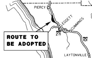 In 1962, the California Highway Commission adopted 20 miles of US 101 in Mendocino County as a freeway
from 0.6 mile north of Tan Oak Park to the Humboldt County line. In 1967,
a portion of this adopted route, from 0.9 mile south of Red Mountain Creek
to 0.8 mile north of Red Mountain Creek (about 7 miles south of Humboldt
County line), was realigned and adopted as a freeway by the California
Highway Commission. On February 2, 2006, the Commission approved a
resolution adopting as a State highway a 0.4 mile segment of US 101
connecting the existing US 101 and the adopted 1967 freeway alignment
across the South Fork Eel River in the Confusion Hill area. This route
adoption was necessary to provide connectivity on the State Highway System
and bypass an existing ancient landslide. At the time, the plan for the
bypassed portion of the existing highway was to be relinquished to the
County of Mendocino. Since then, new negotiations between the Department
and the County have modified the areas to be relinquished, obliterated and
retained by the Department as shown in the route adoption map. The area
retained by the Department will become a much needed debris material
storage area and will provide public access to Red Mountain Road. This
proposed route adoption replaces the route adopted as a State highway in
2006 and realigns a portion of the freeway route adopted in 1967. The
proposed route adoption and subsequent freeway construction on a new
alignment will improve the reliability, safety and operations of the
highway at this location. The relocated route will also bypass the only
Surface Transportation Assistance Act truck restriction location on US 101
in Mendocino County.
In 1962, the California Highway Commission adopted 20 miles of US 101 in Mendocino County as a freeway
from 0.6 mile north of Tan Oak Park to the Humboldt County line. In 1967,
a portion of this adopted route, from 0.9 mile south of Red Mountain Creek
to 0.8 mile north of Red Mountain Creek (about 7 miles south of Humboldt
County line), was realigned and adopted as a freeway by the California
Highway Commission. On February 2, 2006, the Commission approved a
resolution adopting as a State highway a 0.4 mile segment of US 101
connecting the existing US 101 and the adopted 1967 freeway alignment
across the South Fork Eel River in the Confusion Hill area. This route
adoption was necessary to provide connectivity on the State Highway System
and bypass an existing ancient landslide. At the time, the plan for the
bypassed portion of the existing highway was to be relinquished to the
County of Mendocino. Since then, new negotiations between the Department
and the County have modified the areas to be relinquished, obliterated and
retained by the Department as shown in the route adoption map. The area
retained by the Department will become a much needed debris material
storage area and will provide public access to Red Mountain Road. This
proposed route adoption replaces the route adopted as a State highway in
2006 and realigns a portion of the freeway route adopted in 1967. The
proposed route adoption and subsequent freeway construction on a new
alignment will improve the reliability, safety and operations of the
highway at this location. The relocated route will also bypass the only
Surface Transportation Assistance Act truck restriction location on US 101
in Mendocino County.
In June 2013, the CTC authorized relinquishment of right of way in the county of Mendocino on Route 101U in the Confusion Hill area (01-Men-101U-PM 99.49/99.79), consisting of superseded highway right of way (~ MEN R99.428).
In March 2017, the CTC allocated $1,650,000 in emergency SHOPP funding for storm repairs from the Winter 2017 storm, near Piercy, from 0.9 mile north of Route 101/Route 271 Separation (Piercy) to 1.3 miles south of South Fork Eel River Bridge 01-Men-101 R104.7/R105.3). On December 10, 2016, a period of heavy rainfall caused a mud slide onto the traveled way, covering 3 of 4 lanes, and resulting in complete closure of the roadway. Further geotechnical investigations determined the slide area to be much larger than initially identified. Large rocks and trees have the risk of sliding on to the travel way. This project will remove landslide debris, place a debris flow barrier, provide traffic control, remove unstable material from the slope, stabilize and reconfigure slope, repair drainage, repair roadway, and provide erosion control. The work will allow for further evaluation of site conditions and determine a final repair strategy. This work is necessary to prevent further damage and ultimately safely reopen the highway to the public.South Fork Eel River Bridge (Bridge 10-0218, MEN R106.57)
In October 2020, it was reported that the CTC approved
approximately $1.3M in support costs for bridge work at South Fork Eel
River Bridge № 10-0218 (MEN R106.57) on U.S. Highway 101 in
Mendocino County near Piercy. Work includes a seismic retrofit, bridge
rail upgrades, restriping for wider shoulders and bicycle access, and
upgraded deck drainage.
(Source: Redheaded Blackbelt, 10/22/2020)
Richardson Grove Operational Improvement Project (01-Hum-101 1.1/2.2)
 Tom Fearer's Gribblenation Blog "US Route 101 through Richardson Grove State Park" provides a detailed history of the attempts to reroute US 101 through Richardson
Grove. He notes the following:
Tom Fearer's Gribblenation Blog "US Route 101 through Richardson Grove State Park" provides a detailed history of the attempts to reroute US 101 through Richardson
Grove. He notes the following:
The 1969 Division of Highways State Map shows a proposed realignment of US 101 around Richardson Grove. US 101 is shown to have a proposed alignment tracking east of Richardson Grove and the South Fork Eel River over the Mendocino County Line. The 1970 Division of Highways State Map shows the Richardson Grove bypass under construction. US 101 through Richardson Grove appears to have been planned to be recycled into Route 271. However, the 1977 Caltrans State Map no longer shows the planned US 101 bypass of Richardson Grove suggesting it was cancelled.
In March 2009, the CTC received for review a draft EIR concerning a project in Humboldt County to widen, realign and construct roadway improvements on Route 101 from just north of the Mendocino/Humboldt County line to just south of Garberville. The project is not programmed. The project is included in the 2008 State Highway Operation and Protection Program (SHOPP) Long Lead Projects list consistent with Commission Resolution G-13. This resolution requires the Department to notify the Commission when project development work is begun on SHOPP projects that are not currently programmed. The total cost of the project is estimated to be $5,500,000. Construction is estimated to begin in Fiscal Year 2013-14.
In July 2010, the CTC approved for future consideration of funding a project that will construct roadway improvements including realigning a portion of Route 101 near the town of Garberville (HUM PM 1.1 to HUM PM 2.2). The project is fully funded in the 2010 State Highway Operation and Protection Program. Construction is estimated to begin in Fiscal Year 2010-11. Total estimated project cost is $10,053,000 for capital and support. Construction activities will remove mature redwood and Douglas fir trees. In addition, construction activities will occur in the structural root zone of old growth redwoods abutting the existing roadway. The project will also impact the visual setting of the area.
In April 2012, it was reported that a U.S. District Court judge on Wednesday ordered Caltrans to revise its redwood tree mapping for the Richardson Grove realignment project based on discrepancies found in the agency's data and those provided by the case's plaintiffs. This was done after after another judge carried out a site visit to the grove earlier this month and found that Caltrans incorrectly documented the diameter of one tree and omitted a second tree in its maps. The proposed Caltrans project would realign portions of US 101 in Richardson Grove State Park to allow larger cargo trucks to pass through narrow sections of the route. Caltrans has slated 54 trees for removal. According to the agency, these trees include six small redwoods but no old growth redwoods. A coalition of environmental groups and local citizens argued that the construction could damage the old growth root system even if the trees aren't cut down.
In June 2017, it was reported that an ongoing legal
battle between Caltrans and the Environmental Protection Information
Center (EPIC) has delayed adjustments to the stretch of US 101 that goes
through Richardson Grove State Park. Another lawsuit was filed in the
Humboldt County Superior Court on June 23, 2017. CalTrans representative
Eli Rohl said that the discussion has been an ongoing issue for nearly a
decade. The concern is truck size. Back in 2007, Caltrans proposed a
project that would allow industry standard trucks to pass through
Richardson Grove. Currently, US 101 has some curves where STAA length
trucks can't properly make the turns on the highway (STAA trucks are
slightly longer than standard semi-trucks, making it difficult for them to
drive on winding roads). This results in off-tracking due to the geometry
of the roadway, which off-tracking is a fancy way of saying some part of
the truck at one point or another crosses into oncoming traffic. The legal
battle has cost CalTrans $30 million for what was supposed to be a $3
million project. But for EPIC,the fight is worth it to prevent harm to the
trees that line the road through Richardson Grove. Caltrans said the
agency has spent time and money conducting environmental impact studies to
combat EPIC's lawsuit. Then in 2012, they said an appellate court told
them the studies they had already conducted were not sufficient: they
can't support Caltrans' finding of no significant impact without further
environmental studies. Caltrans then went back and did another three years
of environmental studies. Caltrans argues that adjusting the road will be
economically beneficial to the businesses in Humboldt because shipping
would be more convenient. EPIC counters that I-5 is the optimal route for
shipping, and that the benefits do not compare to the risks that
construction poses to old growth redwood trees. Caltrans then says the
project will only remove non-old growth trees and will impact the land as
minimally as possible. Yet EPIC still sees the project as a threat to the
trees.
(Source: KRCTV, 6/27/2017; Postfrom
Andy Field on AARoads)
In March 2018, it was reported that attorneys for
Caltrans and environmental organizations made their case before a Humboldt
County judge and a packed courtroom as to whether Caltrans has an adequate
environmental review for its controversial US 101 widening project through
Richardson Grove State Park. Caltrans’ 1.1-mile highway widening
project through the old-growth redwood park began in 2007, but has been
repeatedly challenged in state and federal courts by environmental groups
like the Arcata-based Environmental Protection Information Center and
local residents Bess Bair, Trisha Lee Lotus, Jeffrey Hedin and David
Spreen. Caltrans is seeking to expand the highway to allow industry
standard-sized trucks to be able to pass through, but challengers claim
the project does not address potential impacts to redwood trees and their
root systems. Caltrans has repeatedly found in its environmental reviews
that the project would have no significant environmental impacts under
both the California Environmental Quality Act and the National
Environmental Policy Act. A state appellate court panel found in 2014 that
Caltrans did not provide information on the impacts to old-growth redwoods
and how they planned to reduce those effects. Caltrans was then ordered by
the Humboldt County Superior Court to revise its state environmental
document. Caltrans released an addendum to its state environmental review
in May 2017, including a revised project plan that would reduce the number
of trees that would be removed — no old-growth redwoods would be
removed — reduce the amount of pavement that would be added, and
reduce the amount of material that will be moved and used as fill.
(Source: Redwood Times, 3/12/2018)
 In May 2019, it was reported that a longtime state
proposal to widen a 1-mile stretch of US 101 in Richardson Grove State
Park in Humboldt County to make room for bigger trucks has hit a roadblock
in federal court, where a judge says Caltrans lacks adequate plans to
protect ancient redwoods that soar 300 feet above the highway. For the
third time since the project was proposed in 2007, the state Department of
Transportation assessed it in 2017 and concluded it would cause “no
significant impact” to the environment. But U.S. District Judge
William Alsup of San Francisco said Caltrans had brushed aside evidence
that the road-widening could suffocate some redwoods, cause root disease
in others and worsen damage to trees hit by trucks that skidded off the
highway. The department’s studies have failed to rule out
“significant risks to the lives of these giants,” some of
which are 3,000 years old, Alsup said in a ruling Friday that rejected the
2017 assessment. He said Caltrans had also given short shrift to the noise
generated by heavier trucks and its effect on park visitors. Without an
analysis of that noise, Alsup said, “the future could bring about
the forever destruction of enjoyment of Richardson Grove State
Park.” Environmental organizations including the Center for
Biological Diversity and a group of North Coast residents have been
challenging the project since 2010. They won an injunction from Alsup in
2011 that blocked construction contracts and required the state to revise
its plans — unsuccessfully, so far. Matt Brady, director of the
Caltrans district that includes the project, said the department was
considering its options, which include an appeal. Richardson Grove is at
the southern edge of Humboldt County, 200 miles north of San Francisco. As
US 101 enters the park, the four-lane highway narrows to a winding
two-lane road, 22 feet wide, bordered closely by redwoods.
In May 2019, it was reported that a longtime state
proposal to widen a 1-mile stretch of US 101 in Richardson Grove State
Park in Humboldt County to make room for bigger trucks has hit a roadblock
in federal court, where a judge says Caltrans lacks adequate plans to
protect ancient redwoods that soar 300 feet above the highway. For the
third time since the project was proposed in 2007, the state Department of
Transportation assessed it in 2017 and concluded it would cause “no
significant impact” to the environment. But U.S. District Judge
William Alsup of San Francisco said Caltrans had brushed aside evidence
that the road-widening could suffocate some redwoods, cause root disease
in others and worsen damage to trees hit by trucks that skidded off the
highway. The department’s studies have failed to rule out
“significant risks to the lives of these giants,” some of
which are 3,000 years old, Alsup said in a ruling Friday that rejected the
2017 assessment. He said Caltrans had also given short shrift to the noise
generated by heavier trucks and its effect on park visitors. Without an
analysis of that noise, Alsup said, “the future could bring about
the forever destruction of enjoyment of Richardson Grove State
Park.” Environmental organizations including the Center for
Biological Diversity and a group of North Coast residents have been
challenging the project since 2010. They won an injunction from Alsup in
2011 that blocked construction contracts and required the state to revise
its plans — unsuccessfully, so far. Matt Brady, director of the
Caltrans district that includes the project, said the department was
considering its options, which include an appeal. Richardson Grove is at
the southern edge of Humboldt County, 200 miles north of San Francisco. As
US 101 enters the park, the four-lane highway narrows to a winding
two-lane road, 22 feet wide, bordered closely by redwoods.
(Source: SF Chronicle, 5/6/2019)
In June 2019, Humboldt County Superior Court Judge
Kelly Neel blocked Caltrans from “any and all” activities that
could “physically alter” the Richardson Grove area, finding
the state agency’s decisions prevented the public from providing
input on the project’s impacts. “The public must have a
say,” Humboldt County Superior Court Judge Kelly Neel wrote in her
decision. “Here, the state proceeded in such a way as to deprive the
public and other agencies of the opportunity to provide comment on the
impacts analysis … (the Court does not believe this was done in bad
faith).” Neel found that when Caltrans added an arborist’s
assessment of the project to its draft environmental impact report, it did
so in a way that didn’t allow the public or other agencies to
critique the merits of the arborist’s rating system. She writes the
agency didn’t formally adhere to the California Environmental
Quality Act, allowing the project to “evade judicial review”
of any legal concerns that may arise from the plan. “Moreover, the
rating system devised by the arborist may or may not rest on sound
scientific footing,” Neel writes. “Without review and critique
by others with expertise in the relevant fields, this footing remains
untested. Peer review is essential to sound science.” This latest
ruling marks the fourth time that a judge has taken some kind of action on
the project since its inception. Tom Wheeler, EPIC’s executive
director, noted that Caltrans’ original intent with the highway has
been made obsolete by Route 299, which provides an alternate pathway
between the East Bay Area and Humboldt County.
(Source: Times-Standard, 6/11/2019)
In December 2020, it was reported that the Ninth
Circuit gave California a green light to move forward with the
construction of US 101 realignment through a majestic grove of ancient
redwood trees, reversing a lower court ruling that halted construction
pending further environmental review. Caltrans has been trying for more
than a decade to alter a 1.1-mile strip of US 101 through Richardson Grove
State Park in Humboldt County, about a 3 ½-hour drive north from San
Francisco. Established in 1922, the park is home to redwood trees as old
as 3,000 years old and soaring up to 300 feet and with diameters as wide
as 18 feet. The goal of the project is to let larger trucks traverse the
narrow strip of highway, which threads very close to old-growth trees,
without a police escort. This would allow those trucks to avoid a 227-mile
detour, which took almost twice as long before another highway between
Redding and Eureka was opened to larger trucks in 2017. Lead plaintiff
Bess Bair has sued to block the project three times over the last 10
years, most recently in 2017, each time challenging the state’s
findings of no significant impact on old-growth redwoods. Previous
litigation required Caltrans to conduct further studies. Last year, U.S.
District Judge William Alsup again sided with environmentalists opposing
the construction. He found Caltrans failed to fully consider the impact of
paving and construction on trees’ root zones, potential tree damage
from truck accidents and the effect of traffic noise on park enjoyment. In
a 22-page opinion issued Wednesday, a unanimous three-judge Ninth Circuit
panel reversed that ruling.
(Source: Courthouse News Service, 12/2/2020)
In August 2021 (before the final court ruling), the
CTC amended the following project into the SHOPP: 01-Hum-101 1.1/2.2. PPNO
01-2251 ProjID 0100000266 EA 46480. US 101 Near Garberville, from 0.5 mile
south to 0.5 mile north of Richardson Grove Undercrossing. Realign
roadway. (Concurrent COS allocation under Resolution FP-21-05; August
2021.) Financials ($ × 1,000; * indicates non-programmed
phases): PA&ED $568; *PS&E $674; *R/W Sup
$77; *Con Sup $2,713; *R/W Cap $72; *Const
Cap $9,460; Total $13,564. Begin Const: 10/1/2023. The CTC also approved
the following pre-construction allocation: 01-Hum-101 1.1/2.2. PPNO
01-2251; ProjID 0100000266; EA 46480. US 101 Near Garberville, from 0.5
mile south to 0.5 mile north of Richardson Grove Undercrossing. Realign
roadway. Allocation: PA&ED $568,000 (22-23) (PA&ED only)
(Concurrent Amendment under SHOPP Amendment 20H-010; August 2021.)
(Source: August 2021 CTC Agenda, Agenda Item 2.1a.(1a) #17; August 2021
CTC Agenda, Agenda Item 2.5b.(2a) #1)
In August 2021, it was reported that the 11-year legal
saga over Richardson Grove was finally over, when a federal judge on
Monday gave California a green light to move forward with the highway
project. Caltrans has been trying since 2006 to widen a 1.1-mile strip of
US 101 through Richardson Grove State Park. Established in 1922, the park
is home to redwood trees up to 3,000 years old, soaring up to 300 feet
high and with diameters as wide as 18 feet. The goal of the $21 million
project is to let larger trucks traverse the narrow strip of highway,
which threads perilously close to old-growth trees, without a police
escort. This would allow those trucks to avoid a 93-mile detour via Route 299 from Redding to Eureka. U.S. District Judge William Alsup has halted
the project three times over the last decade, most recently in 2019 when
he found that Caltrans failed to fully consider the impact of paving and
construction on tree root zones, potential tree damage from truck
accidents and the effect of traffic noise on park enjoyment. But the Ninth
Circuit overturned his decision this past December, finding Alsup’s
rationale for requiring further studies was based on “erroneous
conclusions about the project’s effects on redwood tree health and
possible increases in truck traffic and noise.” In a 15-page ruling
issued 8/30/2021, Alsup assessed the final set of unresolved claims in the
long-running legal dispute and concluded Caltrans has fulfilled all of its
legal obligations. The judge found the agency adequately considered
project alternatives and mitigation measures, obtained proper approval
from the state parks department and corrected prior shortcomings with
subsequent project revisions. The judge also found he could not consider
any claims related to the National Environmental Policy Act (NEPA),
including an assertion that the state failed to consider the influence of
climate change on trees affected by the project, because the Ninth Circuit
foreclosed that avenue in its decision last year. In the final words of
his ruling, Alsup reaffirmed his belief that Caltrans should be required
to conduct further reviews on traffic noise, truck accidents and the
impact of construction on root zones, but he acknowledged that a higher
court overruled his judgment on those issues. According to Caltrans’
website, a construction start date for the project has not yet been
scheduled. The latest version of the project requires the removal of 38
trees, none of which are old-growth. Construction is expected to affect
the root zones of 78 old-growth redwoods.
(Source: Courthouse News, 8/30/2021)
In October 2021, Caltrans posted a note about a
reopening of the review period on the 2017 addendum to the Richardson
Grove FEIR. They noted that in 2017, the California Department of
Transportation (Caltrans) completed an Addendum to the Final Environmental Impact Report (Addendum) for the project. This document, along with the 2010 Final Environmental
Impact Report (EIR), studies, and other background material, is available
at http://dot.ca.gov/.../d1-richardson-grove-improvement. Between 2010 and 2017, Caltrans reduced the project footprint slightly and
refined the design. They noted that the 2017 Addendum is being circulated
for public review and comment through late November 2021. The project fact sheet notes that:
(Source: Caltrans District 1 on FB, 10/4/2021)
In June 2022, the CTC amended this project in the
SHOPP as follows: 01-Hum-101 1.2/2.2 1.1/2.2. PPNO
01-2251; ProjID 0100000266; EA 46480. US 101 Near Garberville, from 0.5
mile south to 0.5 0.6 mile north of Richardson
Grove Undercrossing. Realign roadway. Note: Fully program
previously unfunded phases. Correct the postmiles which were
previously recorded in error. Allocation ($ × 1,000): PA&ED $568;
PS&E $692; R/W Sup $80; Con Sup $2,815; R/W Cap $72; Const Cap
$9,460; TOTAL $568 $13,687.
(Source: June 2022 CTC Agenda, Agenda Item 2.1a.(1d) #2)
In December 2023, the CTC approved for future
consideration of funding the following project for which a Final
Environmental Impact Report (FEIR) and Addendum has been completed: Richardson
Grove Operational Improvement Project. US 101 in Humboldt County.
Modify the roadway alignment to accommodate Surface Transportation
Assistance Act (STAA) truck travel on US 101. The project involves minor
realignments, minor widening, culvert improvements, construction of a
retaining wall, and repaving the roadway, in Humboldt County. (01-Hum-101,
PM 1.1/2.2; PPNO 01-2251). The project is located on US 101 from postmile
(PM) 1.1 to PM 2.2, in Humboldt County. The Department proposes to modify
the roadway alignment to accommodate STAA truck travel on US 101. The
project involves minor realignments, minor widening, culvert improvements,
construction of a retaining wall, and repaving the roadway. The project is
currently programmed in the 2022 State Highway Operation and Protection
Program (SHOPP). The total programmed amount which includes Right of Way
(Support and Capital), and Construction (Support and Capital) is
$13,678,000. Construction is estimated to begin 2024-25. The scope, as
described for the preferred alternative, is consistent with the project
scope as programmed by the Commission in the 2022 SHOPP. A copy of
the FEIR has been provided to Commission staff. Resources in the project
area that may be impacted by the project include old growth redwood trees,
marbled murrelet, aesthetics, cultural resources, and impacts to the
community and Richardson Grove State Park. Avoidance, and
minimization, and mitigation measures will reduce any
potential effects on the environment. These measures include, but are not
limited to, restorative planting of 0.56 acre of the former US 101
roadbed, implementation of an invasive plant removal contract with the
California Conservation Corps, a two-year survey by a qualified biologist
to document the presence of marbled murrelet in the project vicinity,
providing corvid-proof waste receptacles, dumpsters, recycling bins, food
lockers, and drain grates to replace the existing equipment at Richardson
Grove State Park, and other construction Best Management Practices as
described in Appendix D of the Environmental Document.
(Source: December 2023 CTC Agenda, Agenda Item 2.2c.(7))
Since the completion of the FEIR, there have been
changes to the scope and an Addendum was prepared pursuant to the
California Environmental Quality Act (CEQA). These changes include
reducing the overall project footprint and culvert work by steepening
cut-slopes and reducing shoulder widening, replacing the metal beam
guardrail with a shorter transition barrier and crash cushion to meet
current safety standards, and extending the barrier at the northern end of
the proposed retaining wall by ten-feet, angle it away from traffic, and
place a crash cushion at the southern end of the retaining wall.
Additionally, the Department requested technical assistance from the
National Marine Fisheries Service (NMFS) to update the evaluation of the
potential impacts of the culvert work, roadway work, and proposed barrier
rail modifications on listed fish species. Consequently, the Department
conducted further analysis and initiated informal consultation with NMFS.
A Letter of Concurrence was received from NMFS on January 23, 2017.
Lastly, the Department conducted a revised impact analysis for old growth
redwoods and concluded that the significance determinations from the FEIR
have not changed. The summary of these analyses is described in the
Addendum. The project would not involve substantial changes in regulatory
circumstances, did not identify new alternatives, and proposed similar
avoidance, and minimization, and mitigation
measures when compared to the FEIR. The project changes do not meet the
criteria outlined in CEQA Guidelines Sections 15162 and 15163 to prepare a
Subsequent or Supplemental FEIR. As a result, a FEIR and Addendum were
prepared for the project.
(Source: December 2023 CTC Agenda, Agenda Item 2.2c.(7))
In December 2023, the CTC approved the following SHOPP
preconstruction-phase allocation:. $772,000. 01-Hum-101 1.1/2.2. PPNO
01-2251; ProjID 0100000266; EA 46480. US 101 Near Garberville, from 0.5
mile south to 0.6 mile north of Richardson Grove Undercrossing.
Realign roadway. Concurrent consideration of funding under Resolution
E-23-153; December 2023. Six month allocation time extension for PS&E
and R/W Sup approved under Waiver 23-72; June 2023. Programmed (Allocation,
if different): PS&E $692,000; R/W Sup $80,000.
(Source: December 2023 CTC Agenda, Agenda Item 2.5b.(2) #2)
In May 2017, the CTC authorized $5.75M in emergency SHOPP funding for a project on US 101 near Redcrest, from 0.8 mile north of Sorenson Road to 2.3 miles north of Sorenson Road (01-Hum-101 R40.5/R42.0). A series of storms starting January 7, 2017 lead to slope failures affecting northbound and southbound lanes. A geotechnical review identified the saturated slope caused fallen trees, significant asphalt shoulder cracks, and culvert failures. This project will provide traffic control, repair failed culverts, stabilize slope, remove slide debris and trees, repair roadway, and construct soldier pile retaining walls. The work is necessary to protect the roadway from further damage and prevent complete road closure. An ongoing geotechnical investigation will determine additional repair strategies.
In December 2011, the CTC approved $930,00 for a safety project on that will repave 1.7 miles of US 101 near Pepperwood in Humboldt County (~ HUM R44.026).
Eel River Bridge Seismic Retrofit Project (01-Hum-101, R53.7/M54.2)
 In October 2019, the CTC approved the following long-lead
amendment to the 2018 SHOPP: 01-Hum-101 M53.9. PPNO 2301B. Proj ID
0116000148. EA 0A111. Route 101 In Rio Dell, at Eel River Bridge №
04-0016R. Seismic retrofit. Delayed to FY24-25. Note: More recent studies
identified a substantial cost increase for this project. Additional time
is needed to refine the design concept and cost estimate. In order to
accommodate the large cost increase, the project is being delayed into a
year with available fiscal capacity.
In October 2019, the CTC approved the following long-lead
amendment to the 2018 SHOPP: 01-Hum-101 M53.9. PPNO 2301B. Proj ID
0116000148. EA 0A111. Route 101 In Rio Dell, at Eel River Bridge №
04-0016R. Seismic retrofit. Delayed to FY24-25. Note: More recent studies
identified a substantial cost increase for this project. Additional time
is needed to refine the design concept and cost estimate. In order to
accommodate the large cost increase, the project is being delayed into a
year with available fiscal capacity.
(Source: October 2019 CTC Agenda, Agenda Item
2.1a.(1) Long Lead Item 1)
In June 2023, the CTC approved for future consideration
of funding 01-Hum-101, R53.7/M54.2. Eel River Bridge Seismic Retrofit
Project. Partially replace and seismically retrofit the Eel River
Bridge (№ 04-0016R) on US 101, in Humboldt County. (MND) (PPNO
2301B). The project is located on US 101 from postmile R53.7 to postmile
M54.2, in Humboldt County. The Department proposes to replace spans 1-4 of
the northbound Eel River Bridge with a cast-in-place prestressed box
girder bridge, the remaining spans 5-8 will be seismically retrofitted.
Additional work includes constructing a retaining wall to realign the
northbound bridge approach. The project is currently programmed in the
2022 SHOPP for a total of $42,251,000, which includes Right of Way
(Support and Capital) and Construction (Support and Capital). Construction
is estimated to begin 2025-26. The scope, as described for the preferred
alternative, is consistent with the project scope as programmed by the
Commission in the 2022 SHOPP. A copy of the MND has been provided to
Commission staff. The project will result in less than significant impacts
to the environment after mitigation. The following resource areas may be
impacted by the project: wetlands and jurisdictional waters. Avoidance,
minimization, and mitigation measures will reduce any potential effects on
the environment. These measures include, but are not limited to, on-site
restoration and mitigation credits. As a result, a MND was completed for
this project.
(Source: June 2023 CTC Agenda, Agenda Item 2.2c.(1) Item 3)
In August 2023, the CTC approved the following SHOPP
SB1 Primary Class Project Pre-Construction Phase (environmental support,
design, and R/W support) allocation: $5,635,000. 01-Hum-101 M53.9. PPNO
01-2301B; ProjID 0116000148; EA 0A111. US 101 In Rio Dell, at Eel River
Bridge № 04-0016R. Seismic retrofit. Future consideration of funding
approved under Resolution E-23-82; June 2023. Two month allocation time
extension for PS&E and R/W Sup approved under Waiver 23-72; June 2023.
Allocation (Programmed / Allocated): PS&E $5,113,000
/ $5,404,000; R/W Sup $216,000 / $231,000.
(Source: August 2023 CTC Agenda, Agenda Item 2.5b.(2b) #1)
In October 2023, the CTC revised the following project
in the 2022 SHOPP: 01-Hum-101 M53.9 R53.7/M54.2.
PPNO 01-2301B; ProjID 0116000148; EA 0A111. US 101 In Rio Dell, at
from 0.2 mile south of Eel River Bridge № 04-0016R to
0.4 mile south of Metropolitan Heights Road. Seismic
retrofit and partial bridge replacement. Note: Update
postmiles, description, R/W capital, construction capital, and
construction support to make scope changes to the project. To
improve safety for northbound vehicles entering the bridge, the southerly
approach of the bridge will be realigned by partially replacing the
bridge. This additional need will be funded through Infrastructure
Investment and Jobs Act (IIJA) funds. Allocation ($ × 1,000):
PA&ED $5,433; PS&E $5,113; R/W Sup $216; Con Sup $4,632
$6,004; R/W Cap $44 $2,390; Const Cap $26,813
$69,728; TOTAL $42,251 $88,884.
(Source: October 2023 CTC Agenda, Agenda Item 2.1a.(1d) #1)
![[Rtes 101/36 near Alton]](maps/101-alton.jpg) In August 2008, Caltrans released for bid a project to
construct and interchange and frontage road in Humboldt County near Alton
on Route 101 from Van Duzen River Overflow Bridge (~ HUM 56.878) to 0.6 Km
North of Drake Hill Road (~ HUM 58.707) and on Route 36 from 0.5 Km West
of Main Street to Main Street. Known as the Alton Interchange, this will
upgrade a section of US 101 to full freeway, at the Route 36 Junction.
In August 2008, Caltrans released for bid a project to
construct and interchange and frontage road in Humboldt County near Alton
on Route 101 from Van Duzen River Overflow Bridge (~ HUM 56.878) to 0.6 Km
North of Drake Hill Road (~ HUM 58.707) and on Route 36 from 0.5 Km West
of Main Street to Main Street. Known as the Alton Interchange, this will
upgrade a section of US 101 to full freeway, at the Route 36 Junction.
Kenmar Road Roundabouts - 01-HUM-101 59.2/59.7
The 2018 STIP, approved at the CTC March 2018 meeting, appears to allocate funding for PPNO 2512 in Fortuna, "Rt 101/Kenmar Rd IC improvements (APDE)". This impacts the interchange with Kenmar Road. The intent is to install two "dog-bone" roundabouts on either side of US 101. The Westerly roundabout accomodates traffic to and from the US 101 southbound offramp, Kenmar Road, and the US 101 southbound onramp; and the Easterly roundabout manages traffic from Kenmar Road, the southerly reach of Eel River Drive, and NB US 101 on and off ramps.
In August 2019, the CTC approved the following
allocation: 01-HUM-101 59.2/59.7. PPNO 2512 Proj ID 0119000036 EA 4PAED.
US 101 Kenmar Road Interchange Improvements. Interchange between Kenmar
Road and Highway 101. Install "dog bone" roundabouts on each side of US 101. The westerly roundabout accommodates traffic to and from the US 101
southbound offramp, Kenmar Road, and the southbound US 101 onramp. The
easterly roundabout manages traffic from Kenmar Road, the southerly reach
of Eel River Drive, and northbound US 101 on and offramps. The northern
portion of Eel River Drive is realigned to cross the railroad and connect
directly into the new roundabout located east of US 101. This project
includes a separated bike and walking path with connections to potential
trails, as well as pedestrian facilities throughout the system.
(Environmental phase) (APDE) PA&ED $550,000
(Source: August 2019 CTC Agenda, Agenda Item
2.5c.(2) #1)
Fortuna - 12th Street US 101 Interchange Modernization Project (01-Hum-101 60.2/60.6)
In August 2022, the CTC approved the following
pre-construction allocation: $950,000. 01-Hum-101 60.2/60.6. PPNO 01-2574;
ProjID 0122000143; EA 0M340. 12th Street US 101
Interchange Modernization Project. The project is located at the 12th
Street and US 101 interchange in Fortuna (north interchange), and includes
work on or adjacent to the existing US 101 overpass structure, and
potential realignments or connections to Newburg Road and Pond Street in
Fortuna. The project includes upgrading this interchange to a more modern
roundabout or other intersection, and making non-motorized user
improvements to allow for safe access across the freeway. Allocation:
RIP/22-23 PA&ED $281,000; COVID-RIP/22-23 PA&ED $669,000.
(Source: August 2022 CTC Agenda, Agenda Item
2.5c.(6) #1)
Alton to Arcata (Route 299)
In March 2019, the CTC approved for future consideration of funding a
project on US 101 in the city of Eureka in Humboldt County (01-Hum-101, PM
75.3/77.6). The project proposes to construct Americans with Disabilities
Act (ADA) improvements. The proposed project includes replacing or
installing curb ramps, sidewalks, driveways, splitter islands and
accessible pedestrian signals at existing signalized intersections. The
project also proposes to include drainage improvements and addresses the
need for ADA upgrades at this location of high traffic and pedestrian
volume. This project is fully funded and programmed in the 2018 SHOPP for
approximately $8.97 million, construction is estimated to begin in Fiscal
Year 2019-20. The scope, as described for the preferred alternative, is
consistent with the project scope programmed by the Commission in the 2018
SHOPP. They also approved the following support allocation: 01-Hum-101
75.3/77.6 PPNO 2346 Proj ID 0112000156. US 101 In Eureka, from north of
Herrick Avenue Overcrossing to south of the Eureka Slough Bridge. Upgrade
curb ramps, sidewalks, and signal push-buttons to Americans with
Disabilities Act (ADA) Standards. (Concurrent consideration of funding
under Resolution E-19-16; March 2019.) Allocation: PS&E $921,000 R/W
Sup $730,000.
(Source: March 2019 CTC Minutes, Agenda Item
2.2c.(1); March 2019 CTC Minutes, Agenda Item 2.5b.(2a) Item 1)
In December 2019, it was reported that by the end of 2019, Caltrans plans
to turn part of Henderson Street into a one-way route to alleviate traffic
delays in the area. Specifically, the area of Henderson Street between US 101 (HUM 76.63) and Fairfield will be turned into three lanes, all going
toward the highway. Drivers who typically use Henderson Street to exit the
highway can use Harris, Hawthorn or another alternate route. Those leaving
Henderson toward US 101 will then have two left turn lanes as well as the
right lane to either turn right or go straight.
(Source: KRCR News, 12/3/2019)
US 101 through Eureka (~ HUM 77.3 to HUM 78.1)
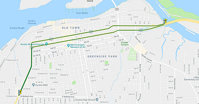 In February 2019, it was reported that public officials in Eureka were trying to figure out
how to make the main route through town more — well —
drivable. The chief players in the traffic game are Caltrans, the city of
Eureka and the Humboldt County Association of Governments (HCAOG).
Caltrans legally owns and manages US 101, which includes all of Fourth
Street, Fifth Street and Broadway. The city is responsible for managing
everything alongside the roadway and HCAOG holds the purse strings for the
state and federal transportation funds that can be used in Eureka.
Collectively, the entities are considering some big changes. Fourth
Street, north of R Street, carries two lanes of traffic, and Caltrans
argues that simply isn't enough room to carry all the vehicles coming in
from the freeway. Once you pass R Street going south on Fourth Street, the
roadway opens up to three lanes and the traffic eases noticeably. Caltrans
intends to add a third lane to the northern section of Fourth Street. It
won't physically expand the roadway but, instead, will eliminate parking
on both sides of the street, re-stripe the pavement to three lanes and,
somehow, end up with enough room for a 5-foot bicycle lane on one side of
the street and a 3-foot shoulder on the other. Once the traffic has enough
room to proceed freely, the cars will naturally group themselves into
"platoons" as they pass through green lights and stop at red lights,
leaving gaps in the flow of vehicles, according to Caltrans. But not
everybody is happy with this plan. At the Nov. 18 2018 Eureka city council
meeting, City Councilmember Natalie Arroyo wondered how crossing an
additional lane of live traffic could possibly be safer for pedestrians
and Colin Fiske of the Coalition for Responsible Transportation Priorities
disliked adding traffic lanes on principle. But Caltrans Project Manager
Jeff Pimentel argued that, when traffic isn't congested, there are a lot
more gaps between vehicles and the safest time to cross the street is when
there are no cars coming. Moreover, if there is no parking, it's a lot
easier to see what's coming down the road. The Caltrans representative
also pointed out that Fifth Street, which has three lanes of traffic and
less congestion, has only half the collision rate of Fourth Street, with
its jammed-up two lane roadway. Caltrans also plans to re-surface Fourth
Street and replace the storm drains near the curbs, aiming to eliminate
the giant puddles of rainwater that accumulate near the sidewalks. In
addition, Caltrans intends to place bulb-outs, those little
traffic-calming curb extensions that city planners love and some drivers
hate, along the shoulders of US 101 throughout the length of the highway
in Eureka. That, Pimentel argues, would reduce the amount of traffic space
that pedestrians have to cross by 10 feet. Caltrans also has other
projects on its plate to subdue the Eureka traffic. Motorists who use
Fairfield Street as a shortcut between the old Eureka Mall and Wabash
Avenue will soon find that option gone. Traffic planners are trying to
tame the nightmare intersection at Wabash and Broadway by blocking off
Fairfield Street, turning a five-legged monster into a more manageable
four-legged beast. That means that most drivers will have to spend less
time sitting at the very long red lights on Broadway or Wabash Avenue.
Curb ramps will be made ADA-compliant, making it possible for folks in
wheelchairs or electric carts to cross the street wherever they want to.
High-visibility crosswalks will be placed at unsignalized intersections
and splitter islands will be placed in the middle of Broadway to make
crossing easier for pedestrians. New traffic signals will be constructed
at L Street, on both Fourth and Fifth streets. Additional projects include
possibly extending Fourth Street into the Balloon Tract to connect with
Koster Street, though the reasoning for this change was not immediately
made clear. A new stoplight is slated to be constructed at Broadway and
Hawthorne. A new bus shelter is planned for Fourth Street just outside the
Red Lion Inn. The twin bridges over the Eureka Slough will be retrofitted.
Engineers will also try to improve the synchronization of the many traffic
lights on US 101 through town.
In February 2019, it was reported that public officials in Eureka were trying to figure out
how to make the main route through town more — well —
drivable. The chief players in the traffic game are Caltrans, the city of
Eureka and the Humboldt County Association of Governments (HCAOG).
Caltrans legally owns and manages US 101, which includes all of Fourth
Street, Fifth Street and Broadway. The city is responsible for managing
everything alongside the roadway and HCAOG holds the purse strings for the
state and federal transportation funds that can be used in Eureka.
Collectively, the entities are considering some big changes. Fourth
Street, north of R Street, carries two lanes of traffic, and Caltrans
argues that simply isn't enough room to carry all the vehicles coming in
from the freeway. Once you pass R Street going south on Fourth Street, the
roadway opens up to three lanes and the traffic eases noticeably. Caltrans
intends to add a third lane to the northern section of Fourth Street. It
won't physically expand the roadway but, instead, will eliminate parking
on both sides of the street, re-stripe the pavement to three lanes and,
somehow, end up with enough room for a 5-foot bicycle lane on one side of
the street and a 3-foot shoulder on the other. Once the traffic has enough
room to proceed freely, the cars will naturally group themselves into
"platoons" as they pass through green lights and stop at red lights,
leaving gaps in the flow of vehicles, according to Caltrans. But not
everybody is happy with this plan. At the Nov. 18 2018 Eureka city council
meeting, City Councilmember Natalie Arroyo wondered how crossing an
additional lane of live traffic could possibly be safer for pedestrians
and Colin Fiske of the Coalition for Responsible Transportation Priorities
disliked adding traffic lanes on principle. But Caltrans Project Manager
Jeff Pimentel argued that, when traffic isn't congested, there are a lot
more gaps between vehicles and the safest time to cross the street is when
there are no cars coming. Moreover, if there is no parking, it's a lot
easier to see what's coming down the road. The Caltrans representative
also pointed out that Fifth Street, which has three lanes of traffic and
less congestion, has only half the collision rate of Fourth Street, with
its jammed-up two lane roadway. Caltrans also plans to re-surface Fourth
Street and replace the storm drains near the curbs, aiming to eliminate
the giant puddles of rainwater that accumulate near the sidewalks. In
addition, Caltrans intends to place bulb-outs, those little
traffic-calming curb extensions that city planners love and some drivers
hate, along the shoulders of US 101 throughout the length of the highway
in Eureka. That, Pimentel argues, would reduce the amount of traffic space
that pedestrians have to cross by 10 feet. Caltrans also has other
projects on its plate to subdue the Eureka traffic. Motorists who use
Fairfield Street as a shortcut between the old Eureka Mall and Wabash
Avenue will soon find that option gone. Traffic planners are trying to
tame the nightmare intersection at Wabash and Broadway by blocking off
Fairfield Street, turning a five-legged monster into a more manageable
four-legged beast. That means that most drivers will have to spend less
time sitting at the very long red lights on Broadway or Wabash Avenue.
Curb ramps will be made ADA-compliant, making it possible for folks in
wheelchairs or electric carts to cross the street wherever they want to.
High-visibility crosswalks will be placed at unsignalized intersections
and splitter islands will be placed in the middle of Broadway to make
crossing easier for pedestrians. New traffic signals will be constructed
at L Street, on both Fourth and Fifth streets. Additional projects include
possibly extending Fourth Street into the Balloon Tract to connect with
Koster Street, though the reasoning for this change was not immediately
made clear. A new stoplight is slated to be constructed at Broadway and
Hawthorne. A new bus shelter is planned for Fourth Street just outside the
Red Lion Inn. The twin bridges over the Eureka Slough will be retrofitted.
Engineers will also try to improve the synchronization of the many traffic
lights on US 101 through town.
(Source: North Coast Journal, 2/24/2019)
The 2020 SHOPP, approved in May 2020, included the
following ADA item of interest (carried over from the 2018 SHOPP):
01-Humboldt-101 PM 77.3/78.1 PPNO 2456 Proj ID 0116000186 EA 0G420. US 101
in Eureka, from Wabash Avenue to Commercial Street. Upgrade curb ramps,
driveways, and sidewalk, and add Accessible Pedestrian Signals (APS)
upgrades to make compliant with Americans with Disabilities Act
(ADA) standards; also install fiber optic communications connection from
traffic signals to the Caltrans district office. Programmed in FY21-22,
with construction scheduled to start in June 2022. Total project cost is
$8,797K, with $4,685K being capital (const and right of way) and $4,112K
being support (engineering, environmental, etc.),
(Source: 2020 Approved SHOPP a/o May 2020)
In December 2020, it was reported Caltrans has been
studying possible improvements to Broadway for decades, starting with a
proposed bypass in the 1960s. That plan was abandoned, as were several
others. The most recent attempt at solving this problem, called the Eureka
Broadway Multimodal Corridor Plan, was begun in 2019, using funding
allocated by the Humboldt County Association of Governments (HCAOG), in
conjunction with Caltrans, and the city of Eureka. The plan was discussed
in depth at the Dec. 2020 board meeting of HCAOG. The final cost of the
project is estimated to be $155 million, although proponents claim social
benefits resulting from the project will eventually bring in three times
that amount. The underlying problem, according to Caltrans, is that the
roadway simply is not wide enough to handle all its demands. Modern
transportation planning requires that roadways encourage
“multi-modal” use, which means bicycles, buses and sidewalks.
Encouraging people to leave their cars at home means less air pollution
and greenhouse gas. But to achieve this, people have to feel secure
outside of their cars. They need sidewalks to walk on, bicycle lanes that
are separated from the flow of traffic, sheltered places to wait for a bus
and well-marked, frequent locations to safely cross the street. Ideally,
Broadway would have two traffic lanes in each direction and a center turn
lane, as well as separate bus lanes, bike lanes and sidewalks on each side
of the road. But large stretches of the existing road are too narrow to
accommodate all these needs. Short of seizing the property of businesses
that line the roadway — a move that would probably be political
suicide for public officials and add dramatically to the cost of the
project — project planners had to think quite literally outside of
the box and divert some of the traffic to new roadways. After considering
(and dropping) a number of alternatives, the plan is to make sections of
Broadway one-way. Northbound traffic would continue on the existing route:
southbound traffic would be diverted off the road in two distinct
locations onto what are called “one-way couplets.” Instead of
turning directly onto Broadway from Fourth St., motorists would be
diverted onto a future roadway that would cross the Balloon Tract and
connect with Koster Street. Koster Street, which runs behind the general
area of Costco and Eureka Natural Foods, would become one-way and rejoin
Broadway at Del Norte Street, for another two-way stretch. Broadway would
split again near the Bayshore Mall, diverting southbound traffic to an
as-yet undetermined location that would possibly cross coastal wetlands.
This second “Southern Couplet” would rejoin Broadway at
Truesdale Street. Broadway would continue as a two-way road the rest of
the way to Herrick Avenue and the freeway. In addition to these changes,
public safety would be enhanced with the addition of numerous pedestrian
crosswalks marked by flashing beacons, continuous sidewalks and bicycle
lanes separated from traffic by planters or landscaping. The plan
would eliminate most left turns onto Broadway by installing a raised
meridian in the middle of the road, which could only be crossed at
specific signalized intersections.
(Source: North Coast Journal, 12/28/2020)
In December 2023, the California Coastal Commission had
an application before it related to this project: "Construct 1.4 miles of
new Class IV separated bikeways; widen existing sidewalk and install
minimal new sidewalk; install a new traffic signal and pedestrian
crossing; construct two new transit stops; install new pedestrian and
bicyclist lighting; remove existing striping; restripe; decrease lane
widths in select locations; close five existing driveways; plant
trees; and install additional complete street measures." The location was
stated as "An approximately 1.4-mile segment of US 101 (Broadway Street)
from the south Bayshore Mall
entrance to the Herrick Avenue Overpass in Eureka, Humboldt County." The
specifics noted in the report were as follows: For bike lanes, Caltrans
proposes a 5-footwide path with a 3-footwide striped buffer with
flexible bollard post vertical elements to separate the cycling lane from
traffic. For traffic calming, Caltrans proposes to reduce much of the US 101 lanes to 11-feet in width, add some decorative median treatments, and
plant some trees, all with the intent to create a distinction between
rural US 101 and urban US 101 in the Eureka corridor. The project also
proposes to create two new bus stop locations at Tetrault Tire Center
(PM 75.55) and Pierson Building Center (PM 75.52) and proposes to
restripe the existing bus stop location at McCullen Avenue to allow busses
to stop entirely outside of the traffic lane. A new pedestrian crossing
and associated traffic light are proposed to be installed at Hilfiker Lane
(PM 75.70), and the existing pedestrian crossing at the entrance of Papa
and Barkley (PM 75.30) will be modified to include a separated bicycle
crossing providing access to the future connection to the Hikshari Trail.
Finally, five existing driveways are proposed to be closed to improve
safety and reduce the frequency and severity of collisions and the
redundancy of driveways, and one driveway is proposed to be paved and made
ADA compliant. This was approved with some special mitigation conditions.
(Source: December 2023 California Coastal Commission Minutes, Agenda
Item 12b)
In December 2021, the CTC authorized relinquishment of 01-Hum-101-PM
79.16 (3 segments): right of way, consisting of superseded State highway
and collateral facilities in the city of Eureka along Route 101 on 5th
Street and R Street, under the terms and conditions as stated in City
Resolution 2019-51 dated October 1, 2019. Then, in August 2022, the
CTC amended Relinquishment Resolution R-4079, adopted by the Commission on
December 9, 2021 and recorded at the Humboldt County Recorder as Document
2022-002502 on February 7, 2022, which contained an incorrect reference
within the legal description. Relinquishment R-4079 relinquishes right of
way in the city of Eureka along US 101 on 5th Street and R
Street, under terms and conditions as stated in City Resolution 2019-51
dated October 1, 2019. The City, by letter dated August 19, 2021,
agreed to waive the 90-day notice requirement and accept title upon
relinquishment by the State.
(Source: December 2021 CTC Agenda, Agenda Item
2.3c; August 2022 CTC Agenda, Agenda Item 2.3c)
Eureka Slough Bridge Retrofit (01-Hum-101 PM 79.5/80.2)
In May 2019, the CTC changed the Eureka Slough project
(01-Hum-101 PM 79.5/80.2, PPNO 2417, Proj ID 0115000088) to a long-lead
project, programming completion and construction in FY26-27. This permits
the seismic retrofit to be combined with potential replacement of the
Eureka Slough Bridge № 04-0022L.
(Source: May 2019 CTC Agenda, Agenda Item 2.1c.(1)
Item Long Lead #1)
In March 2023, the CTC approved the following 2022
SHOPP amendment: 01-Hum-101 79.5/80.2. PPNO 01-2417; ProjID
0115000088; EA 0F200. US 101 In Eureka, at the Eureka Slough Bridge
№ 04-0022L. Seismic retrofit. Note: Delete project.
Additional studies concluded that both northbound and southbound
structures need seismic retrofit and given the age of the bridges, bridge
replacement strategy will be pursued. The new scope will be programmed
into a new project EA 0M760/PPNO 01-2600.
(Source: March 2023 CTC Agenda, Agenda Item 2.1a.(1f) #1)
In March 2023, the CTC approved amending the SHOPP with
the following long-lead item: 01-Hum-101 79.5/80.2. PPNO 01-2600;
ProjID 0123000066; EA 0M760. US 101 In Eureka, at the Eureka Slough
Bridge №s 04-0022L/R. Replace bridges. Long Lead Project.
Concurrent COS allocation under Resolution FP-22-57; March 2023. Note: Due
to project’s location, extensive environmental impacts,
environmental mitigation and permitting, and a higher level of
environmental document are anticipated. Allocation ($ × 1,000):
PA&ED $9,950; ⊘PS&E
$6,500; ⊘R/W Sup $535; ⊘Con Sup $15,400; ⊘R/W
Cap $9,055; ⊘Const Cap
$130,000; TOTAL $171,440. Begin Const: 1/30/2029. “⊘”
indicates phase not programmed.
(Source: March 2023 CTC Agenda, Agenda Item 2.1a.(1c) #3)
In March 2023, the CTC approved the following
pre-construction project support phase SHOPP (2a) or SB1 (2b) allocation:
$9,950,000. 01-Hum-101 79.5/80.2. PPNO 01-2600; ProjID 0123000066; EA
0M760. US 101 In Eureka, at the Eureka Slough Bridge № 04-0022L/R.
Replace bridges. Long Lead Project. Concurrent Amendment under SHOPP
Amendment 22H-007; March 2023. PA&ED $9,950,000.
(Source: March 2023 CTC Agenda, Agenda Item 2.5b.(2a) #3)
In July 2023, the California Coastal Commission
received an application from Caltrans to conduct a geotechnical
investigation that includes geophysical surveys and geotechnical drilling
of up to 22 subsurface borings to a maximum depth of approximately 200
ft., up to 10 of which would be located within Eureka Slough, to inform
project design and feasible alternatives for the Eureka Slough Bridges
Replacement Project located along US 101 at Eureka Slough, approximately
post mile 79.9, Eureka, Humboldt County. This was approved with some
special mitigation conditions.
(Source: July 2023 California Coastal Commission Minutes, Agenda
Item 6.a)
Eureka to Arcata Improvements (01-Hum-101 79.8/85.8, PPNOs 01-0072, 01-2389)
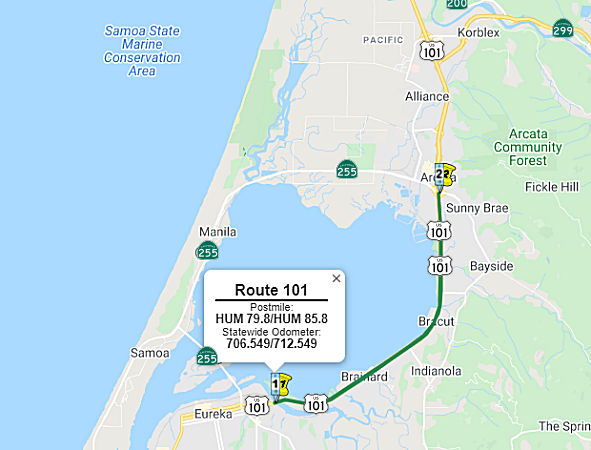 In July 2006, the CTC received a notice of preparation for an EIR for a corridor project consisting of a
2006 State Highway Operation and Protection Program (SHOPP) project and a
2006 State Transportation Improvement Program (STIP) project. The roadway
rehabilitation work programmed in the SHOPP is fully funded. Construction
is estimated to begin in Fiscal Year 2009-2010. The STIP project to
upgrade Route 101 to a four-lane facility is not fully funded. The project
is currently programmed for $5,719,000 in Regional Improvement Program
funds and Federal Demonstration Funds. Total estimated project cost is
$42,090,000, capital and support. This project is estimated to begin
construction in Fiscal Year 2011-2012. There are a number of alternatives
being considered.
In July 2006, the CTC received a notice of preparation for an EIR for a corridor project consisting of a
2006 State Highway Operation and Protection Program (SHOPP) project and a
2006 State Transportation Improvement Program (STIP) project. The roadway
rehabilitation work programmed in the SHOPP is fully funded. Construction
is estimated to begin in Fiscal Year 2009-2010. The STIP project to
upgrade Route 101 to a four-lane facility is not fully funded. The project
is currently programmed for $5,719,000 in Regional Improvement Program
funds and Federal Demonstration Funds. Total estimated project cost is
$42,090,000, capital and support. This project is estimated to begin
construction in Fiscal Year 2011-2012. There are a number of alternatives
being considered.
In November 2007, the CTC reviewed a draft EIR that proposed constructing roadway improvements that included closing median crossings along a portion of Route 101 near Arcata. Total estimated project cost is $38,985,000. Construction is estimated to begin in Fiscal Year (FY) 2009-10. The STIP project involves upgrading Route 101 to a four-lane facility and is not fully funded. The project may also include construction of a diamond interchange at Indianola Cutoff (~ HUM 82.704) and/or signalization of the Airport Road/Route 101 intersection (~ HUM R93.868). The project is currently programmed for $5,719,000 in the STIP (RIP) and Federal Demonstration funds. Total estimated project cost is $42,090,000, capital and support. This project should be ready for construction in FY 2009-10, depending on the availability of funds.
In November 2011, the CTC withdrew roughly $15 million
in transportation funds that had been slated for safety and maintenance
work along the US 101 corridor between Eureka and Arcata. This money had
been set aside back around 2000 through the State Highway Operation and
Protection Program (SHOPP). It was supposed to finance safety improvements
between Eureka and Arcata, including repaving, bridge replacements,
tide-gate replacements, new lighting and more. Eleven years later, that
work hadn't started, and with so many other transportation projects
shovel-ready around the state, officials at Caltrans headquarters in
Sacramento took the money back. Part of the problem was that the projects
were connected to the Eureka-Arcata Route 101 Corridor Improvement project, which aims to install a traffic signal at Jacobs Ave. and an overpass at the Indianola cutoff, among other
modifications to the six highway intersections between the two cities.
Caltrans and HCAOG opted to combine the two projects in hopes of
streamlining the permitting process, but that backfired.
(Source: North Coast Journal, 11/8/11)
In May 2017, the CTC approved for future consideration of funding a project—not very detailed—that addresses traffic safety concerns on US 101, located in Humboldt County between the Eureka Slough Bridge in Eureka and the 11th Street overcrossing in Arcata. The project will be funded from multiple sources including State Transportation Improvement Program (STIP) and State Highway Operation and Protection Program (SHOPP) funds. This project is programmed in the 2016 STIP and 2016 SHOPP for an estimated $57.0 million Construction (capital and support) and Right of Way (capital and support). Construction is tentatively scheduled to begin in 2019. The scope, as described for the preferred alternative, is consistent with the project scope programmed by the Commission in the 2016 STIP and 2016 SHOPP.
The 2018 STIP, approved at the CTC March 2018 meeting, appears to adjust and increase the funding for PPNO 0072, 01-Hum-101 79.8/85.8, Eureka/Arcata Corridor Improvement. In Eureka and Arcata, from Eureka Slough Bridge to Route 101/Route 255 separation. Upgrade 4 lane facility (Alternative Y 4). The description says this US 101 corridor improvement project proposes long term safety improvements to seven at-grade intersections and will reduce operational conflicts and delays at these intersections. Improvements are necessary to decrease collisions, to minimize confusion related to merge and turn movements and to reduce wait times for turn movements. The proposed interchange at Indianola Cutoff will facilitate closing median crossings to provide a safe, reliable and modern transportation facility, consistent with State and Regional Transportation Planning. These improvements will result in a safer highway facility and will reduce operational conflicts. The 2018 appears to take the total funding from $20,468K to $22,371K, with the bulk of the work occuring in FY20-21.
In October 2018, the CTC approved the following
allocation: $2,000,000. 01-Hum-101 79.8/85.8. US 101 Eureka/Arcata
Corridor Improvement. In Eureka and Arcata, from Eureka Slough Bridge to
Route 101/Route 255 separation. Upgrade 4 lane facility (Alternative Y 4).
Future consideration of funding approved under Resolution E-17-19; May
2017.
(Source: October 2018 CTC Agenda Item 2.5c.(2))
In May 2019, it was reported that the California
Coastal Commission requested that its staff shelve plans to hold a June
hearing on Caltrans’ proposed plans to overhaul the Safety Corridor
on US 101 between Eureka and Arcata and, instead, to agendize the hearing
for the commission’s August meeting in Eureka. The
commissions’ vote to recommend staff postpone the hearing came after
it received a number of letters from North Coast individuals and
organizations requesting the move. Surfrider Foundation California Policy
Manager Jennifer Savage also addressed the commission during its public
comment period. Savage said the project — which seeks to spend
roughly $35 million to build a new interchange at Indianola Road, replace
the Jacoby Creek Bridge, add a stoplight at Airport Road and close all
other medians on the roughly 7-mile stretch of highway — is complex
and decades in the making. “Our community really deserves a chance
to weigh in,” Savage said, before charging that Caltrans’
plans have so far failed to analyze the impacts construction will cause to
alternate routes, like Old Arcata Road and Route 255 through the Samoa
Peninsula. Savage also criticized the project’s review for not
addressing projected sea level rise, and charged that Caltrans’
public engagement efforts have been inadequate. The commission’s
decision to punt the hearing from its June agenda could result in the
California Transportation Commission pulling funding for the project
during the Caltrans’ next fiscal year, said Jeff Pimentel, the
project manager. “There’s always the risk,” Pimentel
said. “Being that we will now have a delay in terms of getting the
project ready for advertisement and bid-by-contractor, the project could
lose its funding.”
(Source: North Coast Journal, 5/9/2019; TimeStandard
5/23/2019)
In August 2019, it was reported that the Eureka-Arcata
US 101 Corridor Improvement Project was approved by the California Coastal
Commission. The vote was 10-1 for improvements on the 6-mile long segment
of US 101, along east side of Humboldt Bay between the slough bridge in
Eureka. After several hours, staff members approved Caltrans application
with conditions. The meeting addressed many concerns from the public about
the Indianola cutoff, one person calling it a "death trap." This project
includes: Installation of median crossing closures, construction of new
interchange at Indianola cutoff; extensions of highway acceleration and
deceleration lanes; replacement of southbound Jacoby Creek Bridge and
Gannon Slough Bridge; replacement of tide gates; a half-signal at Airport
Road; and bridge and rail replacements. The conditions include: Sea Level
Rise and Flooding Impact Monitoring and Reporting; Long-term Sea Level
Rise Phased Adaption Plan and Required CDPA; Visual Impacts Mitigation;
Coastal Trail Planning; Spartina Removal Plan as Additional Offsite
Mitigation for Permanent Wetland Impact; Jacoby Creek Bridge Tidewater
Goby Monitoring Survey; Jacoby Creek Demolition Plan; Tide Gate
Replacement and Monitoring; Pile Driving Protections; Hydroacoustic
Monitoring Plan, On-Site Mitigation and Monitoring Plan; Construction
Responsibilities; Erosion and Sediment Control and Pollution Prevention
Plan; Herbicide Management Plan; Final Lighting Plan; Debris Removal Plan;
Protection of Archaeological Resources; Final Construction Plans; Public
Access During Construction; Final Tree Planting Plan; Seasonal Limitations
for Authorized Development; State Lands Commission Approval; Assumption of
Risk, Waiver of Liability, and Indemnity Agreement; Encroachment Permit;
Evidence of Legal Ability of Applicant to Undertake Development on
Property Owned by Others and Comply with Conditions of Approval; Liability
of Costs and Attorneys' Fees.
(Source: Caltrans Distirct 1 on Facebook, 8/9/2019; KRCRABC
7, 8/9/2019)
In March 2020, the CTC approved the 2020 STIP, which
appeared to continue the programmed funding for PPNO 0072 "Eureka-Arcata
corridor improvement (RIP)" and PPNO 2389 "Eureka-Arcata
corridor-Mitigation (split from 72)(RIP)". The bulk of this funding is
prior year, but some extends into FY20-21. It also included PPNO 0072
Eureka-Arcata corridor improvement (IIP), in the Interregional portion of
the STIP with one change in programming: $2,141K in prior year funding,
and 24,341K in FY20-21 changed to 45,057K; as well as PPNO 2389,
Eureka-Arcata corridor-Mitigation (split from 72)(IIP), with 11,160K in
prior year funding.
(Source: March 2020 CTC Agenda, Item 4.7, 2020 STIP
Adopted 3/25/2020)
In May 2021, the CTC approved the following allocation:
$58,721,000 for the State-Administered STIP Eureka/Arcata Corridor
Improvement project (PPNO 0072), on the State Highway System, in Humboldt
County. The breakdown was $49,469,000 from the Budget Act of 2020, Budget
Act Items 2660-301-0042 and 2660-301-0890 for construction and $9,252,000
for construction engineering. Details: 01-Hum-101 79.8/85.8. PPNO 01-0072;
ProjID 0100000127; EA 36600. Eureka/Arcata Corridor Improvement.
US 101 in Eureka and Arcata, from Eureka Slough Bridge to Route 101/Route 255 separation. Upgrade 4 lane facility (Alternative Y 4). (CONST savings
of $54,000 to be returned to Humboldt County regional shares.) (CONST
savings of $107,000 to be returned to interregional share balance.)
(Future consideration of funding approved under Resolution E -17-19; May
2017.)
(Source: May 2021 CTC Agenda, Agenda Item 2.5c.(1))
In March 2022, it was reported that the final designs
for proposed safety improvements at the Indianola Cutoff are expected in
May 2022: these plans will address constructing an undercrossing at the
exit off US 101. Caltrans expects to have a contractor hired by the end of
the year if everything goes smoothly. Part of the plan is to construct an
undercrossing at the Indianola Cutoff intersection, which includes a
component that will allow pedestrians and cyclists to access the Humboldt
Bay Trail. Right now, They are still working on determining exactly how
long the concrete columns need to be and what kind of spacing is needed
between them under the embankment portions of the undercrossing. The
agency may need to go to the California Transportation Commission and seek
more funding in the future since cost estimates come in higher than
expected, especially with the prices for fuel and steel going up.
(Source: Eureka Times Standard, 3/21/2022)
In July 2022, it was reported that Caltrans is
continuing to evaluate its options for mitigating the effects of sea level
rise on the Arcata-Eureka corridor on the way to developing an overall
adaptation plan. The agency’s representatives say it’s likely
to take a hybrid approach, combining four sea level rise adaptation
measures — protect, accommodate, retreat or take a hybrid approach
— available for the 6-mile stretch of US 101 between Eureka and
Arcata. The most likely strategy to be utilized is thought to be a hybrid
strategy in which the corridor will be assessed through multiple segments,
with some segments leaning on one sea-level rise strategy while other
segments tap into a different strategy. The hybrid approach could include
segments with living shorelines and structural causeways that are
intentionally placed and developed to support both restoring habitat and
marshland retreat for the living shorelines. If the alignment of US 101
remained the same, it would affect about 25 to 100 parcels. The cost is
unknown since all the things a hybrid approach would encompass are still
unclear. Realigning the highway so its further inland would affect more
parcels — more than 600 — and cost about $1 to $3 billion.
Caltrans briefly considered using Old Arcata Road for that option.
The accommodation strategy would require constructing an elevated
structural causeway between Eureka Slough Bridge, US 101 and the Route 255
interchange, with an anticipated cost of $2.5 and $10 billion. That would
impact about 25 to 75 parcels. In terms of the strategy for protecting the
highway, Caltrans is considering “the gradual progression of an
earthen berm highway,” or building up the highway, which would have
a construction cost of $100 million with $20 million expected to be needed
for the highway every 10 years. Caltrans received a coastal development
permit in 2019 and the sea level rise adaptation plan for the
Eureka-Arcata corridor is part of the requirements for that permit. The
plan is expected to be completed by December 2025.
(Source: Eureka Times Standard, 7/15/2022)
In June 2023, it was reported that Caltrans has broken
ground on the Indianola Undercrossing. This is part of a long-anticipated
project that aims to make the Indianola Cutoff crossing safer for drivers.
The crossing has been the site of countless traffic collisions, many of
them fatal, due to the current inadequate layout. The project will be a
three-year construction project that will construct a structure and
undercrossing at the Indianola Cutoff intersection with US 101, removing
the current grade crossing. The project should be complete by the end of
2025.
(Source: District 1/Twitter, 6/15/2023; KRCR, 6/15/2023)
Eureka-Arcata Route 101 Corridor Improvement Project: Jacoby Creek Bridge (01-Hum-101, PM 79.9/86.3)
Note: This may be the same project as PPNO 2376 below.
 In June 2023, the CTC approved for future consideration
of funding 01-Hum-101, PM 79.9/86.3. Eureka-Arcata Route 101 Corridor
Improvement Project. Improve safety and reduce operational
conflicts and traffic delays on US 101 intersections between Eureka and
Arcata, in Humboldt County. (FEIR Addendum) (PPNO 2375M) (SHOPP). The
project is located on US 101 from postmile 79.9 to postmile 86.3, in
Humboldt County. The Department proposes to improve safety and reduce
operational conflicts and traffic delays by eliminating uncontrolled left
turn movements, extending or constructing acceleration and deceleration
lanes, replacing the Jacoby Creek Bridge, and upgrade Metal Beam
Guardrail (MBG). The project is currently programmed in the 2018 State
Highway Operation and Protection Program (SHOPP) for a total of
$7,138,000, which includes Right of Way (Support and Capital) and
Construction (Support and Capital). Construction is estimated to begin
2019-20. The scope, as described for the preferred alternative, is
consistent with the project scope as programmed by the Commission in the
2018 SHOPP. A copy of the FEIR has been provided to Commission staff. The
Commission approved the project for future consideration of funding on May
17, 2017, under Resolution E-17-19. Since the approval of the FEIR there
have been changes to the listed species lists pursuant to the Federal
Endangered Species Act (FESA) and California Endangered Species Act
(CESA). Newly listed species are Bombus crotchii (Crotch bumble
bee), Lampetra richardsoni (western brook lamprey), Carex
leptalea (bristle-stalked sedge), Carex lyngbyei (Lyngbye’s
sedge), and Scaphinotus behrensi (Behrens’ snail-eating
beetle). Two species, Bryoria spiralifera (twisted horsehair
lichen) and Phalacrocorax auratus (double-crested cormorant),
have been removed from the species list. Listed species that have had a
change in status include: Oncorhynchus mykiss (summer-run
steelhead trout) status has been added as Candidate Endangered, Pacific
Marten (Humboldt) Coastal DPS has been added as Threatened, Pkania
pennanti (Fisher, west coast DPS) has been removed from
Threatened, and Rana boylii (foothill yellow-legged frog) has
changed from Threatened to Endangered. Given the scope of work and habitat
for the project no impact is anticipated for any species listed above. The
Department subsequently completed an Addendum to the FEIR pursuant to the
California Environmental Quality Act (CEQA). The Department has approved
this project for construction. This approval and the Addendum will satisfy
the environmental requirements for this stage of the planning process.
In June 2023, the CTC approved for future consideration
of funding 01-Hum-101, PM 79.9/86.3. Eureka-Arcata Route 101 Corridor
Improvement Project. Improve safety and reduce operational
conflicts and traffic delays on US 101 intersections between Eureka and
Arcata, in Humboldt County. (FEIR Addendum) (PPNO 2375M) (SHOPP). The
project is located on US 101 from postmile 79.9 to postmile 86.3, in
Humboldt County. The Department proposes to improve safety and reduce
operational conflicts and traffic delays by eliminating uncontrolled left
turn movements, extending or constructing acceleration and deceleration
lanes, replacing the Jacoby Creek Bridge, and upgrade Metal Beam
Guardrail (MBG). The project is currently programmed in the 2018 State
Highway Operation and Protection Program (SHOPP) for a total of
$7,138,000, which includes Right of Way (Support and Capital) and
Construction (Support and Capital). Construction is estimated to begin
2019-20. The scope, as described for the preferred alternative, is
consistent with the project scope as programmed by the Commission in the
2018 SHOPP. A copy of the FEIR has been provided to Commission staff. The
Commission approved the project for future consideration of funding on May
17, 2017, under Resolution E-17-19. Since the approval of the FEIR there
have been changes to the listed species lists pursuant to the Federal
Endangered Species Act (FESA) and California Endangered Species Act
(CESA). Newly listed species are Bombus crotchii (Crotch bumble
bee), Lampetra richardsoni (western brook lamprey), Carex
leptalea (bristle-stalked sedge), Carex lyngbyei (Lyngbye’s
sedge), and Scaphinotus behrensi (Behrens’ snail-eating
beetle). Two species, Bryoria spiralifera (twisted horsehair
lichen) and Phalacrocorax auratus (double-crested cormorant),
have been removed from the species list. Listed species that have had a
change in status include: Oncorhynchus mykiss (summer-run
steelhead trout) status has been added as Candidate Endangered, Pacific
Marten (Humboldt) Coastal DPS has been added as Threatened, Pkania
pennanti (Fisher, west coast DPS) has been removed from
Threatened, and Rana boylii (foothill yellow-legged frog) has
changed from Threatened to Endangered. Given the scope of work and habitat
for the project no impact is anticipated for any species listed above. The
Department subsequently completed an Addendum to the FEIR pursuant to the
California Environmental Quality Act (CEQA). The Department has approved
this project for construction. This approval and the Addendum will satisfy
the environmental requirements for this stage of the planning process.
(Source: June 2023 CTC Agenda, Agenda Item 2.2c.(2) Item 1)
Jacoby Creek Bridge № 04-0023 / Gannon Slough Bridge № 04-0024 (01-Hum-101 84.4/84.8)
In October 2019, the CTC amended this item in the
SHOPP: 01-Hum-101 79.8/84.7 84.4/84.8 PPNO 2376
Proj ID 0113000091 EA 0E000. US 101 Near Eureka, at various
locations from 0.2 miles south of Eureka Slough Bridge to 0.2 miles
north of Gannon Slough Bridge from 0.1 mile south of Jacoby
Creek Bridge № 04-0023 to 0.1 mile north of Gannon Slough Bridge
№ 04-0024. Upgrade bridge rails and replace bridge. Total
Const: $13,655K 12,678K. Note: Split environmental
mitigation work from this project into EA 0E001/PPNO 01-2376M to mitigate
wetland impacts. Revise postmiles to correctly reflect the project limits.
(Source: October 2019 CTC Agenda, Agenda Item
2.1a.(1) Amendment Item 1)
Arcata: Improvements to Sunset Ave./L K Wood Blvd. and Sunset Ave./US 101 Northbound Ramps Intersections (01-Hum-101 86.3/86.5)
In August 2022, the CTC approved the following
pre-construction allocation: $500,000. 01-Hum-101 86.3/86.5. PPNO 01-2579;
ProjID 0122000144; EA 0L650. Improvements to Sunset Ave./L K Wood
Blvd. and Sunset Ave./US 101 Northbound Ramps Intersections. In the
City of Arcata, within Arcata's and Caltrans Right of Way, on the Sunset
Avenue Overpass, from the LK Wood Boulevard intersection to the US 101
northbound ramps. Install a roundabout at the intersection and close the G
Street connection. Allocation: PA&ED $500,000.
(Source: August 2022 CTC Agenda, Agenda Item
2.5c.(6) #2)
In November 2002, the CTC considered vacation of the portion of the original routing in the city of Arcata, from PM 86.63 to PM 87.18 in Humboldt County.
In May 2019, the CTC approved the following SHOPP Support Phase
allocation: 01-Hum-101 87.8/R91.5 Route 1 In and near Arcata, between West
End Road and School Road at four locations. Construct shoulder rumble
strip, upgrade guardrail, construct guardrail slope retaining wall, and
place High Friction Surface Treatment (HFST). PPNO 7024 ProjID 0117000013
PS&E $582,000 R/W Sup $90,000
(Source: May 2019 CTC Minutes, Agenda Item
2.5b.(2a) Item 1)
In February 2019, it was reported that the CTC allocated $171,000 in
right-of-way support costs for bridge projects on Route 96 and US 101 in
Humboldt County. The projects will revamp three bridges at the following
locations in Humboldt County: The Willow Creek Bridge on Route 96, the
Camp Creek Bridge on Route 96 in Orleans, and the G Street Overcrossing
(HUM 086.77, Bridge 04-0243) along US 101 in Arcata.
(Source: Lake County Record Bee, 2/6/2019)
Route 101/Route 299 Junction (HUM 88.2/88.3)
The following project was included in the final adopted 2018 SHOPP in March 2018: PPNO 2397. 01-Humboldt-101 88.2/88.3. On US 101 In Arcata, at Route 299. Realign ramp curve. Begin Con: 5/1/2020. Total Project Cost: $6,160K.
In June 2019, the CTC approved the following SHOPP
scope amendment: 01-Hum-101 88.2/88.3 88.3 PPNO
2397 ProjID 0114000117. US 101 In Arcata, at Route 299/US 101
Separation. Realign ramp curve. Increase in construction capital
due to larger excavation quantity needs recently identified with the
discovery of unsuitable construction site materials. Performance measures
have been updated based on the most recent calculation guidelines. Project
description and post miles are revised to reflect a spot location. Updated
cost: $7,117K
(Source: June 2019 CTC Minutes, Agenda Item
2.1a.(1) Scope Item 4)
At the May 2020 CTC meeting, the CTC approved the
following allocation: $5,058,000. 01-Hum-101 PM 88.3. PPNO 01-2397 ProjID
0114000117 EA 0E650. US 101 in Arcata, at Route 299/US 101 Separation.
Outcome/Output: Reduce the number and severity of collisions by realigning
the connector ramp, and upgrade lighting, signs, and drainage. CON ENG:
$803,000; CONST $3,908,000
(Source: May 2020 CTC Agenda, Agenda Item 2.5b.(1)
#2)
Arcata 101 Merge Improvement Project (HUM 88.3/88.6)
") The following project was included in the final adopted 2018 SHOPP in March 2018: PPNO 2424. 01-Humboldt-101 88.3/88.6. On US 101 In Arcata, from north of Route 299/Route 101 Connector to 0.2 mile
south of Guintoli Lane Overcrossing. Construct auxiliary lane to improve
merging movements. Begin Con: 5/1/2022. Total Project Cost: $8,086K.
The following project was included in the final adopted 2018 SHOPP in March 2018: PPNO 2424. 01-Humboldt-101 88.3/88.6. On US 101 In Arcata, from north of Route 299/Route 101 Connector to 0.2 mile
south of Guintoli Lane Overcrossing. Construct auxiliary lane to improve
merging movements. Begin Con: 5/1/2022. Total Project Cost: $8,086K.
In October 2019, the CTC amended the SHOPP on this
project: 01-Hum-101 88.3/88.6. PPNO 2424. Proj ID 0115000043. EA 0E890.
Route 101 In Arcata, from north of Route 299/Route 101 Connector to 0.2
mile south of Guintoli Lane Overcrossing. Construct auxiliary lane to
improve merging movements. Adjust total cost due to R/W capital change
from $15K to $532K.
(Source: October 2019 CTC Agenda, Agenda Item
2.1a.(1) Amendment Item 7)
The 2020 SHOPP, approved in May 2020, included the
following Mobility item of interest (carried over from the 2018 SHOPP):
01-Humboldt-101 PM 88.3/88.6 PPNO 2424 Proj ID 0115000043 EA 0E890. US 101
in Arcata, from north of Route 299/Route 101 Connector to 0.2 mile south
of Giuntoli Lane Overcrossing. Construct auxiliary lane to improve merging
movements. Programmed in FY21-22, with construction scheduled to start in
May 2022. Total project cost is $8,603K, with $4,630K being capital (const
and right of way) and $3,973K being support (engineering, environmental,
etc.),
(Source: 2020 Approved SHOPP a/o May 2020)
In January 2021, the CTC approved for future
consideration of funding the following project: 01-Hum-101, PM 88.3
01-Hum-299, PM 0.0 Arcata 101 Merge Improvement Project. Extend the Route 299 entrance ramp onto northbound US 101 to the Giuntoli Lane exit ramp in
Humboldt County. (ND) (PPNO 2424) (SHOPP). The project is located on US 101 in Arcata in Humboldt County. The Department is proposing to improve
merging movements by extending the Route 299 entrance ramp onto northbound
US 101 to the Giuntoli Lane exit ramp at the Route 299/US 101
Separation. This project is fully funded and is currently programmed
in the 2020 SHOPP for a total of
$8,603,000 which includes Construction (capital and support) and Right of
Way (capital and support). Construction is estimated to begin in 2022-23.
The scope, as described for the preferred alternative, is consistent with
the project scope programmed by the Commission in the 2020 SHOPP. A
Negative Declaration (ND) has been completed. The project will result in
less than significant impacts to the environment.
(Source: January 2021 CTC Agenda, Agenda Item
2.2c.(1))
In January 2021, the CTC approved the following
pre-construction support phase allocation(s): (2a) #3. $1,329,000
(PS&E); $105,000 (R/W Sup, $90,000 Programmed) 01-Hum-101 88.3/88.6.
PPNO 01-2424; ProjID 0115000043; EA 0E890.US 101 In Arcata, from north of
Route 299/Route 101 Connector to 0.2 mile south of Giuntoli Lane
Overcrossing. Construct auxiliary lane to improve merging movements.
Construct auxiliary lane to improve merging movements. (Concurrent
consideration of funding under Resolution E-21-02; January 2021.) (Twenty
month time extension for PS&E approved under Waiver 19-29; June
2019.) Prog Year 21-22.
(Source: January 2021 CTC Agenda, Agenda Item
2.5b.(2a) #3)
In March 2021, the CTC amended this project in the
SHOPP: (1d) #2. 01-Hum-101 88.3/88.6 PPNO 2424 ProjID 0115000043 EA
0E890. US 101 In Arcata, from north of Route 299/Route 101 Connector to
0.2 mile south of Giuntoli Lane Overcrossing. Construct auxiliary lane to
improve merging movements. Amended to increase construction capital, R/W
capital, and to delay completion. Increase in construction capital from
$4,098K to $5,042K is due to the addition of maintenance vehicle pullouts,
security fencing, rock slope protection, enhanced structural section, and
aerially deposited lead material removal. Increase in R/W capital from
$523K to $709K is due to the temporary construction easements required in
order to remove old fencing and constructing new fence. Revised total:
9,724K Delay of project by one year to FY22-23 will avoid traffic handling
conflicts with an adjacent project.
(Source: March 2021 CTC Agenda, Agenda Item
2.1a.(1d) #2)
In January 2023, it was reported that the CTC approved
approximately $7.2 million toward the construction of an auxiliary lane on
US 101 from Route 299 to south of Giuntoli Lane in Arcata, Humboldt
County.
(Source: Ukiah Daily Journal, 1/31/2023)
In January 2023, the CTC approved for future
consideration of funding the following project for which a Negative
Declaration (ND) and an Addendum have been completed: Arcata 101
Merge Improvement Project. US 101 and Route 299, in Humboldt County
(01-Hum-101, PM 88.3; 01-Hum-299, PM 0.0). Extend the Route 299
entrance ramp onto northbound US 101 to the Giuntoli Lane exit ramp, in
Humboldt County. (PPNO 2424). This project is located on US 101 at
postmile 88.3 and SR 299 at postmile 0.0, in Humboldt County. The
Department is proposing to improve merging movements by extending the
Route 299 entrance ramp onto northbound US 101 to the Giuntoli Lane exit
ramp at the Route 299/US 101 Separation. This project is currently
programmed in the 2022 State Highway Operations Program (SHOPP) for a
total of $9,724,000 which includes Construction (capital and support) and
Right of Way (capital and support). Construction is estimated to begin in
2022-23. The scope, as described for the preferred alternative, is
consistent with the project scope programmed by the Commission in the 2022
SHOPP. A copy of the ND has been provided to Commission staff. The
Commission approved the project for future consideration of funding on
January 28, 2021, under Resolution E-21-02. Construction associated with
the proposed maintenance pullout on Route 299 has been removed from the
scope of work and the overlay of westbound Route 299 to northbound US 101
interchange has been added. An outdated service pedestal, concrete pad,
and conduit on Giuntoli Lane would be removed and replaced along a similar
alignment. The Department subsequently completed an Addendum to the ND
pursuant to the California Environmental Quality Act. The Department has
approved this project for construction. This approval and the Addendum
will satisfy the environmental requirements for this stage of the planning
process.
(Source: January 2023 CTC Agenda, Agenda Item 2.2c.(5))
In January 2023, the CTC approved a construction /
construction support phase allocation of $720,000. 01-Hum-101 88.3/88.6.
PPNO 01-2424; ProjID 0115000043; EA 0E890. US 101 In Arcata, from Route 299/Route 101 Connector to 0.2 mile south of Giuntoli Lane Overcrossing.
Outcome/Output: Construct auxiliary lane to improve merging movements by
extending westbound Route 299 onramp to the Giuntoli Lane offramp.
Allocation: CON ENG $1,546,000; CONST $5,042,000. CEQA - ND, 10/1/2020;
Re-validation 11/28/2022. NEPA - CE, 10/1/2020; Re-validation 11/28/2022.
Future consideration of funding approved under Resolution E-21-02; January
2021. The CTC approved an addendum for the previously approved Future
Consideration of Funding under Resolution E-23-09; January 2023.
(Source: January 2023 CTC Agenda, Agenda Item 2.5b.(1) #1)
Arcata to the Oregon State Line
Trinidad Rancheria Access Improvements (~ HUM 99.99 to HUM 100.149)
In August 2023, it was reported that the Cher-Ae
Heights Indian Community of the Trinidad Rancheria (Trinidad Rancheria)
was hosting a Community Information Workshop for the US 101 / Trinidad
Area Access Improvements Project. The project proposes improvements to US 101 and local roads to provide safe and sustainable access to Tribal lands
and the surrounding communities along Scenic Drive; to relieve projected
traffic congestion associated with planned future developments in the
Trinidad Area; and to reconnect tribal lands on the east and west sides of
US 101. The project is being led by the Trinidad Rancheria, in partnership
with the California Department of Transportation (Caltrans). The proposed
improvements include reconstruction of Scenic Drive to accommodate
standard lane and shoulder widths and a pedestrian/bicycle path, improved
connectivity to US 101 through reconstruction of the existing
Trinidad-Main Street interchange or construction of a new interchange
adjacent to the Rancheria, and construction of a pedestrian and bicycle
path between Tribal lands on the east and west side of US 101. A Project
Study Report-Project Development Support (PSR-PDS) was approved by
Caltrans and the Trinidad Rancheria in December 2017. This project
initiation document evaluated 12 alternatives that addressed safety,
accessibility, mobility, and operational issues, as well as reconnection
of tribal lands. A Project Report is being developed that will evaluate
those alternatives that meet the purpose and need of the project.
Environmental site surveys are being conducted and environmental studies
are expected to continue through the end of 2023. Once these studies are
complete, a draft environmental document will be prepared, which will be
circulated for public review in 2024.
(Source: Lost Coast Outpost, 8/11/2023)
In January 2015, the CTC approved for future consideration of funding a project in Humboldt County that will repair three slope failures on US 101 near the town of Orick (~ HUM 120.995). The project is programmed in the 2014 State Highway Operation and Protection Program. The total estimated cost is $8,364,000 for capital and support. Construction is estimated to begin in Fiscal Year 2015-16. The scope, as described for the preferred alternative, is consistent with the project scope programmed by the Commission in the 2014 State Highway Operation and Protection Program.
In August 2019, the CTC authorized an allocation of $6,921,000 for
01-Hum-101 124.5. US 101 Near Orick, at 0.2 mile south of Lost Man Creek
Bridge. Outcome/Output: Remove fish passage barrier by replacing the
existing double box culvert with a new single span bridge. This project
will also restore the stream channel and banks on both sides of the new
bridge, and improve the curve radius of the roadway.
(Source: August 2019 CTC Agenda, Agenda Item
2.5b.(1) #4)
Orick to S Prarie Creek Park Curve and Roadway Improvements (01-Hum-101 125.2/125.6)
 In March 2021, the CTC amended the following project into
the 2020 SHOPP: (1a) #11. 01-Hum-101 125.2/125.6 PPNO 2536 ProjID
0120000035 EA 0K150. US 101 Near Orick, from 0.9 mile south to 0.5 mile
south of South Prairie Creek Park Undercrossing. Improve curves and
roadway cross slope, widen shoulders,and improve drainage. PA&ED
$1,777K; PS&E $1,928K; R/W Sup $224K; Con Sup $2,826K; R/W Cap
$1,035K; Const Cap $5,663K TOTAL $13,453K. Begin const. 8/27/2024.
In March 2021, the CTC amended the following project into
the 2020 SHOPP: (1a) #11. 01-Hum-101 125.2/125.6 PPNO 2536 ProjID
0120000035 EA 0K150. US 101 Near Orick, from 0.9 mile south to 0.5 mile
south of South Prairie Creek Park Undercrossing. Improve curves and
roadway cross slope, widen shoulders,and improve drainage. PA&ED
$1,777K; PS&E $1,928K; R/W Sup $224K; Con Sup $2,826K; R/W Cap
$1,035K; Const Cap $5,663K TOTAL $13,453K. Begin const. 8/27/2024.
(Source: March 2021 CTC Agenda, Agenda Item
2.1a.(1a) #11)
In March 2021, the CTC approved the following
pre-construction support phase allocation(s): (2a) #1. $1,777,000
(PA&ED). 01-Hum-101 125.2/125.6. PPNO 01-2536; ProjID 0120000035; EA
0K150. US 101 Near Orick, from 0.9 mile south to 0.5 mile south of South
Prairie Creek Park Undercrossing. Improve curves and roadway cross slope,
widen shoulders, and improve drainage. (Concurrent Amendment under SHOPP
Amendment 20H-006; March 2021.) Prog Year 23-24.
(Source: March 2021 CTC Agenda, Agenda Item
2.5b.(2a) #1)
In June 2022, the CTC amended this project in the SHOPP
as follows: 01-Hum-101 125.2/125.6. PPNO 01-2536; ProjID 0120000035; EA
0K150. US 101 Near Orick, from 0.9 mile south to 0.5 mile south of South
Prairie Creek Park Undercrossing. Improve curves and roadway cross slope,
widen shoulders, and improve drainage. Note: The environmental and
R/W risks that were identified during project initiation have been
realized. The impacts to large diameter redwood trees have elevated
the environmental document, which has delayed the completion of
PA&ED. The project also requires a permit and an acquisition
from the National Park Service which has a processing time of about 24
months after completion of PA&ED. The project is delayed by two
years due to these reasons. Amendment: FY 23-24 25-26.
(Source: June 2022 CTC Agenda, Agenda Item
2.1a.(1d) #3)
In January 2024, the CTC approved the following
pre-construction-phase SHOPP allocation: $2,152,000. 01-Hum-101
125.2/125.6. PPNO 01-2536; ProjID 0120000035; EA 0K150. US 101 Near Orick,
from 0.9 mile south to 0.5 mile south of South Prairie Creek Park
Undercrossing. Improve curves and roadway cross slope, widen
shoulders, and improve drainage. (Categorically Exempt). Programmed (Allocation,
if different): PS&E $1,928,000; R/W Sup $224,000.
(Source: January 2024 CTC Agenda, Agenda Item 2.5b.(2a) #2)
In March 2012, the CTC authorized $257,000 for a State Administered STIP Transportation Enhancement Project on US 101 in Del Norte County, 01N-DN-101 2.7/8.8 In and near Klamath. Construct Native American art designs, install native plantings, and replace existing fencing with decorative fencing that matches local aesthetic theme.
In September 2011, the CTC approved for future consideration of funding a project in Del Norte County that will rehabilitate the Route 101 Klamath River Bridge (DN R004.04). The project is programmed in the 2010 State Highway Operation and Protection Program. The total estimated project cost is $9,543,000 for capital and support. Construction is estimated to begin in Fiscal Year 2011-12. The scope as described for the preferred alternative will be consistent with the project scope programmed by the Commission in the 2010 State Highway Operation and Protection Program (ND). Due to potential impacts to biological resources, visual resources, hydrology and water quality, cultural resources, and the local economy, an Initial Study was completed for the project. Based upon environmental studies and proposed environmental commitments, including minimization and avoidance measures, incorporation of BMPs, limited hours of construction, and the presence of an on-site Native American monitor, the project will not have a significant effect on the environment.
Hunter Creek Bridge (№ 01-0003) / Panther Creek Bridge (№ 01-0025) Bridge Replacement (01-DN-101, PM 8.2/8.7)
In August 2018, the CTC approved for future
consideration of funding the following project for which a Mitigate
Negative Declaration (MND) has been completed: US 101 in Del Norte County
(01-DN-101, PM 8.2/8.7). Replace two existing bridges on US 101 in Del
Norte County (PPNO 1072). This project is located at the Hunter Creek
Bridge (№ 01-0003) and the Panther Creek Bridge (№ 01-0025) in
Del Norte County. The project proposes to replace these existing bridges.
The proposed project will ensure US 101 will remain passable in the event
of a seismic event with seismically sound structures that meet current
design standards. It is proposed that the Hunter Creek Bridge be replaced
with a two-span structure with a multicolumned pier and the Panther Creek
Bridge replaced with a single-span steel tied-arch structure without
piers. The proposed project is estimated to cost $20.7 million for capital
construction. This project is fully funded and is currently programmed in
the 2018 State Highway Operations and Protection Program (SHOPP) for
approximately $33.4 million which includes Construction (capital and
support) and Right-of-Way (capital and support). Construction is estimated
to begin in 2020. The scope, as described for the preferred alternative,
is consistent with the project scope programmed by the Commission in the
2018 SHOPP.
(Source: August 2018 CTC Agenda Item 2.2c(1))
In December 2019, the CTC had on its agenda (and
approved) the following allocation for a project with costs that exceed
the programmed amount by more than 20%: $25,760,000 in Capital and Support
cost for the Bridge Preservation, Bridge Seismic Restoration project on US 101, in Del Norte County (01-DN-101 8.2/8.7 PPNO 1072 Proj ID 0100020444
EA 0B090). This project is located on US 101 near the Town of Klamath in
Del Norte County. The project will concurrently replace two existing
bridges. Panther Creek Bridge, a complex, single-span, steel-tied arch
bridge located in an environmentally sensitive area, and Hunter Creek
Bridge; a two-span, cast-in-place, reinforced concrete bridge. The project
requires permits from multiple resource agencies, including the U.S. Army
Corps of Engineers, the U.S. Fish and Wildlife Service, the National
Marine Fisheries Service, the U.S. Environmental Protection Agency, and
the California Department of Fish and Wildlife. All environmental permits
and agreements have been acquired, and the project is planned to be
completed within 332 working days, during two construction seasons. The
project is currently programmed in the 2018 SHOPP for $17,690,000 in
construction capital and $3,842,000 in construction support for a total of
$21,532,000 and for delivery in Fiscal Year 2018-19. In June 2019, the
Commission approved a 6-month time extension to allow the Department to
secure all the environmental permits before requesting the allocation of
funds to construct the project. The Plans, Specifications, and Estimates
(PS&E) phase has been completed, and the project was Ready to List
(RTL) as of October 2019. However, based on the most recent
Engineer’s Estimate (EE) and the updated estimates to deliver this
project, the Department is requesting an allocation that exceeds the
programmed funds by more than 20 percent. This allocation request is for
$25,760,000, of which $21,918,000 is for construction capital and
$3,842,000 for construction support. The increases in capital costs for
this project are primarily due to complexity of the Panther Creek Bridge
and design modifications that were necessary to secure all required
permits to deliver the project.
(Source: December 2019 CTC Agenda, Agenda Item
2.5d.(1))
In December 2021, the CTC authorized relinquishment of 01-DN-101-PM 8.1.
Right of way, consisting of collateral facilities in the county of Del
Norte along Route 101 on Requa Road, under the terms and conditions as
stated in the freeway agreement dated June 7, 1971.
(Source: December 2021 CTC Agenda, Agenda Item
2.3c)
Last Chance Grade (DN 12.0/15.5)
 In January 2015, it was reported that Caltrans was requesting input on a feasibility study
that Caltrans is conducting in an attempt to find a long-term solution for
the Last Chance Grade — a stretch of US 101 about 12 miles south of
Crescent City that has been continually shifting throughout the years,
causing catastrophically dangerous and expensive landslides. Caltrans has
about a dozen different options for ways to address the issue, including
several different potential bypass routes. According to studies by
Caltrans, there have been more than 200 slides on the section of highway,
and between July 2012 and February 2013 sections of the road dropped by 13
inches horizontally and 10 inches vertically. Since then the road has
continued to shift. The Del Norte County Citizens Advisory Committee for
Last Chance Grade is striving to gather letters supporting a bypass from
the supervisors of North Coast counties from Sonoma to Southern Oregon.
In January 2015, it was reported that Caltrans was requesting input on a feasibility study
that Caltrans is conducting in an attempt to find a long-term solution for
the Last Chance Grade — a stretch of US 101 about 12 miles south of
Crescent City that has been continually shifting throughout the years,
causing catastrophically dangerous and expensive landslides. Caltrans has
about a dozen different options for ways to address the issue, including
several different potential bypass routes. According to studies by
Caltrans, there have been more than 200 slides on the section of highway,
and between July 2012 and February 2013 sections of the road dropped by 13
inches horizontally and 10 inches vertically. Since then the road has
continued to shift. The Del Norte County Citizens Advisory Committee for
Last Chance Grade is striving to gather letters supporting a bypass from
the supervisors of North Coast counties from Sonoma to Southern Oregon.
(Source: Eureka Times-Standard, 1/26/2015)
In March 2017, after the heavy Winter 2017 rains, a
10-foot section of US 101 just south of Crescent City known as Last Chance
Grade collapsed because of the area’s notorious landslide activity.
Specifically, around 10 feet of the western side of the highway about 10
miles south of Crescent City crumbled away after a retaining wall failed.
The section of the road was already closed due to ongoing construction and
that crews were already aware the section of road was beginning to crumble
away. Crews will be installing micropiles — metal rods filled with
concrete — to secure the roadway. The 4-mile Last Chance Grade has
experienced hundreds of landslides since it was constructed in 1894,
making it a costly and continuous effort by Caltrans crews to ensure the
road remains intact. Caltrans has spent nearly $40 million since 1981 to
maintain the section of highway. More information on Last Chance Grade and
bypass project can be found on the Caltrans website www.lastchancegrade.com/. In May 2017, the California Transportation Commission has allocated $5
million to fund the environmental and geotechnical studies needed to build
an alternative route around Last Chance Grade, the long-failing portion of
US 101 just south of Crescent City. There are currently six proposed
alternative routes for the vital link between Crescent City and points
south, with price tags ranging from $300 million to $1 billion. Each one
comes with its own set of major obstacles, including old growth redwoods,
challenging terrain and sites of cultural significance to local tribes.
(Source: Eureka Times-Standard, 3/8/2017; NorthCoast
Journal, 5/17/2017)
In January 2018, the CTC had an informational report on
the following allocations: 01-DN-101 14.8/15.1: $9,200,000 (allocated
11/20/2017) for US 101: Near Crescent City, from 1.0 mile to 1.3 miles
norh of Rudsill Road. Ongoing slide activity since March 7, 2016 has
continued to cause damage within the Last Chance Grade slide complex. This
project will stabilize the roadway from continuous and increased
landslides. Work includes a minor adjustment to the roadway alignment to
allow for both lanes to be opened to traffic, construct two retaining
walls, replace a failed cross-culvert and down drain, and install a
subsurface dewatering system. Also: 01-DN-101 15.1/15.5: $12,800,000
(allocated 11/20/2017): Near Klamath, from Wilson Creek Road to 1.7 miles
north of Rudisill Road. This project is needed to stabilize the roadway
due to continuous and increased landslides within the limits of the Last
Chance Grade slide complex. Due to continuous slope movement, the project
will repair four damaged retaining walls, construct one new retaining
wall, install removable barrier rail, replace a failed culvert, and
construct mechanically stabilized fill.
(Source: CTC Agenda, 2018-01-31, Agenda Item 5.f(1))
In March 2018, it was reported that California
Transportation Commission has earmarked an additional $5 million to help
pave the way for an alternative to Last Chance Grade. The new funds will
be combined with a previous $5 million allocated by the agency last May to
pay for the environmental studies needed to move forward with a workaround
to the challenged section of US 101 south of Crescent City, which has been
failing for decades. The $10 million total includes geotechnical studies,
which will be completed by this fall and seismic studies, which will be
completed by the fall of 2019. There are currently six alternative routes
being analyzed, each with their own unique and challenging set of
obstacles, ranging from old growth redwoods to complex terrain to sites of
cultural significance to local tribes. The project to move the highway
inland comes with an estimated $300 million to $1 billion price tag.
(Source: North Coast Journal, 3/19/2018)
The following project was included in the final adopted 2018 SHOPP as a "Long Lead Project" in March 2018: PPNO 1112. 01-Del Norte-101 12.0/15.5. Route 101 Near Crescent City, at Last Chance Grade, from Wilson Creek Bridge to 3.8 miles north of Wilson Creek Bridge. Permanent roadway restoration and realignment. PA&ED and R/W funds are requested for geotechnical evaluation ($5 million) of the current seven alternatives and for the environmental clearance ($5 million) needed to perform geotechnical work. Note: Due to the complexity of the project, $10.0 million is assigned to gather data (geotechnical and preliminary environmental work) that will identify risk and assist in project development. * R/W, * PA&ED phase(s) is authorized. Approximate project estimates: PA&ED $52,600,000, R/W $89,600,000, Con $1,610,000,000. Begin Con: 10/14/2031. Total Project Cost: $10,075K (PA&ED and R/W Only).
The following project was included in the final adopted 2018 SHOPP in March 2018: PPNO 1122. 01-Del Norte-101 21.2. On US 101 Near Crescent City, at 0.2 mile north of Cushing Creek Viaduct. Restore roadway to pre-slide condition. Begin Con: 11/15/2020. Total Project Cost: $18,020K.
At the end of June 2018, the Last Chance Grade - Expert Based Risk Assessment (EBRA) (Final) was released. The executive summary noted that US 101 crosses landslides along Last
Chance Grade that have been actively moving and impacting the highway for
decades. More recently (i.e., 2015-2018), the highway has generally been a
site of one-way controlled traffic and ongoing structural repairs. The
annual maintenance and preservation cost of $2 to $5 million is
increasing. Nearly continuous repair efforts have kept some access through
the site, but they are not sustainable as a long-term approach, per
findings of Caltrans and Federal Highway Administration (FHWA) reviews in
2016 and 2017. The EBRA results show that alternative alignments are not
equivalent with respect to risks of ownership and that the estimated risks
vary by approximately two orders of magnitude between the alternatives.
With respect to the risks estimated through this process, Alternative F
has the lowest risk and highest “resistance,” and Alternative
C3 has the highest risk and lowest “resistance.” Given that
one reason for the high risk of Alternative C3 is its length, Alternatives
C4 and C5, which are longer, would have an even higher risk and were not
considered in the EBRA. The other alternatives considered (X, L, A1, and
A2) have risks that lie between these two extremes and are also expected
to have lower construction cost, per previous Caltrans estimates.
(Source: EBRA prepared by BGC Engineering. Although the document contains the statement: "As a mutual protection to our client, the public, and ourselves all
documents and drawings are submitted for the confidential information of
our client for a specific project. Authorization for any use and/or
publication of this document or any data, statements, conclusions or
abstracts from or regarding our documents and drawings, through any form
of print or electronic media, including without limitation, posting or
reproduction of same on any website, is reserved pending BGC’s
written approval.", the posting by Caltrans of the information on its
website implies approval from BGC for public dissemination.)
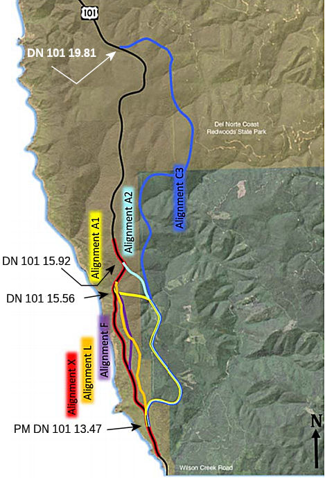 Six alternative alignments were considered in the EBRA. Alternative Alignments
A1, A2, C3, and F were identified previously by Caltrans, and Alternative
Alignments X and L were proposed by BCG. Alternative X was added so that
the alternative alignments outside of the existing right of way could be
compared to one within the right of way. Alternative L was added because
it was recognized as a possible improvement to Alternative X from a
geotechnical perspective, and with potentially less environmental impact
than many other alternatives. The alternatives, in summary, are as
follows:
Six alternative alignments were considered in the EBRA. Alternative Alignments
A1, A2, C3, and F were identified previously by Caltrans, and Alternative
Alignments X and L were proposed by BCG. Alternative X was added so that
the alternative alignments outside of the existing right of way could be
compared to one within the right of way. Alternative L was added because
it was recognized as a possible improvement to Alternative X from a
geotechnical perspective, and with potentially less environmental impact
than many other alternatives. The alternatives, in summary, are as
follows:
The essential conclusion (paraphrased) is that the only stable solution is Alternative F, the tunnel, although it has higher initial cost and higher feasibility risk. As the report noted, the "resistance to cost impact is very low: it is expected that each alternative alignment would move from Condition State A to B within 10 years and is nearly certain to do so within 50 years. The resistance to mobility impact is also low but shows greater differentiation between the alternatives. Within 50 years’ time, only Alternative F is more likely than not to resist the change from Condition State from B to C. For the other alternatives, it is nearly certain. In other words, based on the available information now, the panel believes it is nearly certain that within 50 years this highway will transition into Condition State C, unless it is routed through the tunnel of Alternative F. This means that the level of effort to maintain these other alternatives (other than F) is nearly certain to cost more than average for a coastal highway with similar bridges and structures, and nearly certain to experience impacts to mobility". It notes that L, F, and A1 "are very likely to avoid closure (Condition State D) within 10 years, and more likely than not to avoid closure within 50 years. The other alternatives are very likely to result in closure within this time." Consult the EBRA for the details of the risk assessment; to this engineer's eyes (although I am a software type), it appears to be very thorough.
In February 2019, it was reported that a partnership
including Rep. Jared Huffman, Sen. Mike McGuire and Assemblymember Jim
Wood announced that Caltrans will request the final $40 million needed to
complete the overall Last Chance Grade environmental study. Caltrans plans
for the request to be on the California Transportation Commission's March
agenda. The $40 million would cover the costs for all of the necessary
environmental work, McGuire said. “This final $40 million needed for
the environmental study puts an end to the band-aid approach to fixing the
Last Chance Grade,” said McGuire. “Everyone has been working
together on a permanent fix and we finally have the momentum to get this
job done. We have been grateful to partner with Assemblymember Wood,
Congressman Huffman, the Del Norte Board of Supervisors, Crescent City
Council and Caltrans on this critical project. While this is a day to
celebrate, we know the real work is still ahead.” Significant
geotechnical work is currently underway on the Last Chance Grade and the
funding for the final environmental studies will bring the project to its
next phase, according to McGuire. While there are numerous safety
procedures in place, McGuire says there is no viable alternative route in
the event of a complete failure of the roadway due to a landslide. Without
a detour, he says complete failure would isolate Del Norte County from the
North Coast of California.
(Source: KRCR News, 2/8/2019)
In March 2019, the CTC released a press release
announcing a massive investment in US 101 and the Last Chance Grade.
Senator Mike McGuire, Assemblymember Jim Wood and Congressman Jared
Huffman, in partnership with Caltrans and the California Transportation
Commission (CTC), announced that $40 million in funding to complete the
environmental review of the Last Chance Grade Project was approved by a
vote of the CTC. The funding will allow Caltrans to evaluate each of the
potential routes and ultimately decide on a preferred route alternative.
This project will make US 101’s Last Chance Grade a reliable route
for North Coast communities for generations to come, and today’s
allocation brings the total new state investment for a permanent fix to
Last Chance Grade to $50 million. $10 million in geotechnical work is
currently underway, and this influx of new funding will allow the project
to continue and complete the environmental process. This will include
conducting studies related to environmental, biological, and cultural
resources in addition to traffic impacts.
(Source: Caltrans News Release, 3/14/2019)
To be precise, the CTC allocated an additional $45 million for the State Highway Operation Protection Program (SHOPP) Major Damage (Permanent Restoration) project (PPNO 1112) on US 101, in Del Norte County, to provide the preconstruction component support cost funding to permanently address the active landslide on US 101 at Last Chance Grade. The project is located on US 101 at Last Chance Grade (LCG), in Del Norte County, between Wilson Creek and Crescent City, on the edge of the coast. US 101 at LCG has been progressively shifting westward and downward due to storm events and earth movement. The roadway has shifted horizontally by 50 feet, and portions of the roadway are now located outside of the boundaries of the highway right-of-way that was originally purchased by the Department. The roadway has moved to a position where it is now at the edge of the bluffs that are subject to active coastal erosion. Since 2010, US 101 at LCG has experienced continued movement and deformation resulting in five federal Emergency Repair (ER) project with approved Damage Assessment Forms (DAFs). These DAFs provided a total of $56,000,000 in ER funds for three Emergency Opening contracts and two Permanent Restoration (PR) projects at three locations along the project site. The work associated with these projects is considered temporary due to the deep-seated nature of the landslide. Over $86,000,000 has been spent on capital projects to repair or strengthen LCG since 1997, with these costs continuing to accrue and accelerate in recent years.
To investigate the earth movement caused by storm damage, increased landslide movement, and emergency response and repair efforts at the LCG site, the Department installed a surface monitoring network and multiple slope indicators to measure and collect movement data of LCG since July 2012. Current subsurface investigations reveal that the landslide complex is failing as deep as 260 feet with multiple nesting shallower landslides. Since October 2014, the roadway deformation has accelerated at a much faster rate than previously experienced at the grade. Boring data at the area of greatest roadway deformation reflects movement occurring at approximate depths of 100, 75, 40 and 35 feet. Also, recent photography indicates ocean erosion, at the bluff base, is contributing to instability. US 101 passes through Redwood National and State Parks; which are designated World Heritage Sites. Constructing a route around the slide has the potential to affect an iconic old growth redwood forest. The Department cannot construct a full retreat away from the eroding bluffs without the potential removal of between 275 and 542 old growth redwood trees that are protected in the parks. At the current rate of movement, it is likely that at least a small retreat will be necessary to keep US 101 open while a more permanent solution can be developed. The size, depth, and instability of the known slide planes, combined with the erosion of the bluffs, make maintaining the current roadway alignment difficult and extremely costly to maintain in place. The slide is expected to continue moving with high risk of catastrophic failure at LCG. Keeping the roadway on its current alignment is not a fiscally feasible option, given a landslide complex that is over a mile long and at its deepest, 260 feet deep.
There is a great need for a long-term solution at LCG, as US 101 is a lifeline to Del Norte County and the surrounding region. The ultimate risk of not relocating US 101 away from LCG is a complete loss of the roadway and the continuity of coastal US 101. If there is a full road closure, the alternative route would be a detour of approximately 320 miles. The project proposes five build alternatives. Currently, four of the five proposed alternatives include the realignment of US 101 with the goal of avoiding the unstable portions of LCG. These realignment alternatives vary between 1 and 4 miles in length. The fifth alternative would strengthen the existing alignment in its current location. The improvements for LCG are consistent with the Commission-adopted goals and objectives of the Transportation Asset Management Plan.
The Department is working with four separate
stakeholder groups as well as federal, state, and local agencies to
develop alternatives for repairing LCG. One alternative proposes a
1.1-milelong tunnel that would cost an estimated $1.2 billion in
construction capital. However, this tunnel alternative will require
special expertise, and will impact various sensitive species that live
within the project area. Because of these kinds of impacts, understanding
the underlying geologic conditions is critical to validating and refining
the project alternatives. There is a unique dependency on the preliminary
geotechnical studies to validate and refine the project alternatives
because of the scale, complexity, and severity of the landslide and
challenges with the surrounding geology. Currently, geotechnical
investigations are being performed in stages and will be performed
throughout the first few years. The Department will not be certain which
or if the proposed project alternatives will meet the purpose and need of
the project until these investigations have been completed.
(Source: March 2019 CTC Minutes, Agenda Item
2.5b.(3))
In June 2019, the CTC was informed of the following
emergency allocation: $3,310,000 for 01-DN-101 14.8/15.1 PPNO 01-1127.
ProjID 0118000075. US 101 Near Crescent City, from 1.0 mile to 1.3 miles
north of Rudsill Road. Ongoing slide activity since March 7, 2016 has
continued to cause damage within the Last Chance Grade slide complex. This
project will stabilize the roadway from continuous and increased
landslides. Work includes a minor adjustment to the roadway alignment to
allow for both lanes to be opened to traffic, construct two retaining
walls, replace a failed crossculvert and down drain, and install a
subsurface dewatering system. This supplemental is necessary to address
further damage created by significant storm events on February 25, 2019.
These events resulted in the need to remove additional rockfall, trees,
and debris, repair pavement and guardrail, construct rockfall mitigation
system, and rock scaling. Const. $2,650,000 Const. Engr. $660,000.
(Source: June 2019 CTC Minutes, Agenda Item
2.5f.(1) Item 1)
In August 2019, it was reported that Caltrans has
entered phase two in its preliminary geotechnical studies of Last Chance
Grade and is currently seeking a contractor to see the project through its
environmental phase. The agency began collecting data this week on how
much movement is occurring at the slide-prone area south of Crescent City,
said project manager Jaime Matteoli. The information is necessary to
refine alternatives proposed for a bypass of US 101 around the slide. he
said. Meanwhile, the agency is “reaching out to the world experts in
delivering mega projects,” Matteoli said. Officials expect to have
the $31 million contract executed in late December. Included in the
contract is the preliminary engineering, geotechnical studies, structure
design and environmental studies, he said. The full environmental document
is expected to be finished by 2026, Matteoli said. Construction on the
project is expected to be finished by 2039, he said. Caltrans is
considering six possible routes to bypass US 101 around the slide at Last
Chance Grade. A seventh proposal would leave the current highway alignment
the way it is. The six possible routes vary in length from 1.5 miles to
3.5 miles and range in cost from $300 million to $2 billion. Four
potential alternatives include bridges. Three include tunnels. One
possible alternative route consists of a full tunnel running parallel to
the existing alignment and costs an estimated $1.1 billion to $2 billion
in 2019 dollars. According to Matteoli, Caltrans has currently $50 million
in state and federal dollars allocated for the Last Chance Grade bypass
project’s environmental phase. So far, the agency has spent about
$3.5 million, he said. Earlier this year, the California Transportation
Commission allocated $45 million for the environmental phase of the
project, Congressman Jared Huffman announced in March. This was in
addition to two $5 million allocations the Transportation Commission
approved in 2018 and 2017.
(Source: Wild Rivers Outpost, 8/14/2019)
The 2020 SHOPP, approved in May 2020, included the
following NEW Long Lead Major Damage Restoration item of
interest: 01-Del Norte-101 PM 12.0/15.5 PPNO 1112 Proj ID 0115000099 EA
0F280. US 101 near Crescent City, at Last Chance Grade, from Wilson Creek
Bridge to 3.8 miles north of Wilson Creek Bridge. Permanent roadway
restoration and realignment. Note: Complex and lengthy environmental
consultation and permitting due to significant modification to existing
infrastructure and remote location along the coastline. Due to complex
structural design, longer design time is anticipated. Programmed in
FY30-31, with construction scheduled to start in June 2031. Total project
cost is not fully known; for the 2020 SHOPP, they are allocating $10,000K
in PA&ED and $75K in R/W ONLY. Approximate project estimates:
PA&ED $50,000,000, R/W $89,600,000, Con $1,610,000,000.
(Source: 2020 Approved SHOPP a/o May 2020)
In November 2020, there were reports of town halls in
Del Norte County to discuss the proposed work on the Last Chance Grade. As
noted in the announcements, the Last Chance Grade project seeks to
permanently re-route three miles of US 101 around a landslide about 10
miles south of Crescent City. According to a mailer Caltrans sent to Del
Norte residents over the summer, roadway failure and geographic
instability begins at Wilson Creek. The agency is considering six possible
routes around the landslide and a seventh option to leave the current
alignment as it is. The six potential routes vary in length from 1.5 miles
to 3.5 miles and range in cost from about $300 million to $2 billion. Four
alternatives include bridges. Three include tunnels. One possible route
consists of a full tunnel paralleling the existing alignment and costs an
estimated $1.1 billion to $2 billion. Caltrans began its third year of
geotechnical studies related to the project in September 2020. Those
studies are being paid for with $50 million approved by the California
Transportation Commission. Caltrans crews repaired storm damage at Last
Chance Grade over summer 2020. Crews also corrected a dip in the road
locals have named the ski jump, raising the highway 16 feet and installing
a 600 foot wall. After the town hall, it was reported that after a summer
of flying drill rigs in by helicopter, collecting photogrammetry and LiDAR
data around the Last Chance Grade site, Caltrans will spend next year
refining alternatives for rerouting US 101 around the landslide. While the
planning occurs, the state’s transportation agency received another
$16 million — all the funding it needs — to keep the
road’s current alignment operational. The current work to stabilize
the highway will include having to close the road down at night possibly
next spring. The geotechnical studies will help determine the best
possible alternative, collecting data on rock material, movement and the
role groundwater and rain plays in that movement. The data not only helps
shape the design of US 101’s alternative route, it will help
Caltrans compare alternatives to determine which option will have the
least long-term risk of failure. Caltrans and HNTB will also conduct a
tree survey in 2021, particularly at the north end of the project where
known old-growth areas are located. Armed with the geotechnical data, the
contracted engineering firm and Caltrans will draft an environmental
document in 2022 and conduct a public hearing to help identify an
alternative in 2023. There could be a two-year period to conduct
“ground disturbing activities,” to help find a clear
alternative that would result in minimal impact to sensitive cultural and
natural resources. The agency will obtain needed environmental permits and
prepare final design plans, with public input, and then construction would
begin by 2026. All the proposed alternatives involves putting US 101
through Del Norte Coast Redwoods State Park with some impacting more old
growth redwoods than others. The project could also impact some of the
park’s second-growth redwood stands, but said Caltrans is working
with State Parks and others to determine the most sustainable path with
the least amount of impacts. Broadband as well as non-traditional
transportation options, including bicycling and walking, will be
considered as the new alignment is constructed. Even though many Del Norte
County voters supported a repeal of the gas tax, it provides a significant
portion of the funding necessary to build the highway around Last Chance
Grade, as does funding from counties in the southern portion of the state.
(Source: Wild Rivers Outpost, 11/16/2020; Wild Rivers Outpost 11/20/2020)
In January 2021, the CTC was informed of the following
emergency SHOPP allocation under delegated authority: (1) #1. $19,300,000.
01-DN-101 15.1/15.5. PPNO 01-1128; ProjID 0118000074; EA 0H690. US 101
Near Klamath, from Wilson Creek Road to 1.7 miles north of Rudisill
Road. Due to continuous slope movement and increased landslides
within the limits of Last Chance Grade slide complex, this project will
repair four damaged retaining walls, construct one new retaining wall,
install removable barrier rail, replace a failed culvert, and construct
mechanically stabilized fill. Supplemental: After the necessary
studies and design analysis were completed, it has been identified that
multiple changes in scope are necessary due to increased settlement,
erosion, and slide movement. This supplemental is necessary to move
the roadway to a new alignment, construct an additional 600-ft retaining
wall, replace two existing retaining walls, and place a multi-location
video monitoring system. Allocation: $3,000,000 (Con Eng); $16,300,000
(Const).
(Source: January 2021 CTC Agenda, Agenda Item
2.5f.(1) #1)
In April 2021, it was reported that state and federal
officials have whittled down a long-term fix to two options they say will
save $10 million and shave a year off the project timeline. The two
alternatives are (1) an inland tunnel that avoids the landslide roughly 10
miles south of Crescent City; and (2) permanently shoring up slopes and
hillsides along US 101’s current route. Specifically, (1) will
include an inland tunnel that’s just over a mile long while the
entire route will be about 1.5 miles long. The estimated construction cost
is between $1.1 billion and $2 billion. Option (2) includes
“advancing a landslide mitigation alternative along the current
route”, looking at all available technology along the one-mile long
broken formation area to focus on a large intensive project at once
instead of small reactive fixes as slides occur. Going with Alternative X,
which would keep US 101 within the current alignment, is not an option.
These alternatives were identified based on environmental and engineering
data collected this year. Those studies were paid for by $50 million
allocated through the California Transportation Commission. Caltrans is
currently exploring the feasibility of both options.
(Source: Wild Rivers Outpost, 4/23/2021)
In May 2021, the CTC was informed of the following
emergency SHOPP allocation under delegated authority: (1) #1. $17,000,000.
01-DN-101 12.0/16.5. PPNO 01-1145; ProjID 0121000044; EA 0L040. US 101
Near Crescent City, at Last Chance Grade, from 0.5 mile south to 4.0 miles
north of Wilson Creek Road. On February 13, 2021, a large cold storm
front impacted Del Norte County which resulted in heavy rainfall and
activated a large landslide complex and closed Route 101 in both
directions due to extremely hazardous conditions and slide material
blocking the roadway. These storms brought high surf and caused
damage to the embankment at PM 12.2 and PM 12.5. This project will
stabilize slope, install rock fall barrier and erosion control, repair or
replace guardrail, drainage systems, signs, and pavement, and remove
hazard trees. CON ENG $3,000,000 CONST $14,000,000.
(Source: May 2021 CTC Agenda, Agenda Item 2.5f.(1)
#1)
In June 2021, it was reported that work was being done
on the grade to stabilize the upper slopes, necessitating closures between
8 a.m. and noon, open for three hours, then shut again from 3 p.m. to 7
p.m. Monday to Thursday. On Fridays, the highway will be closed from 8
a.m. to noon. These closures ended in August 2021. What is interesting is
not the closures (as they are transitory) but the detour: when this
stretch is closed, the ONLY way around is a seven hour and 320-mile-long
trip via US 199 to I-5 to Route 299. The detour emphasizes why this
particular stretch of highway is so important to the commerce of the area.
Additionally, in June 2021, the CTC approved the following SHOPP
amendment: 01-DN-101 12.0/15.5 PPNO 01-1112 ProjID 0115000099 EA 0F280. US 101 Near Crescent City, at Last Chance Grade, from Wilson Creek Bridge to
3.8 miles north of Wilson Creek Bridge. Permanent roadway restoration and
realignment. Note: Last Chance Grade is a highly complex and challenging
location. Consequently, additional R/W capital is needed for extensive
best management practices and geotechnical investigation work within the
State Park. Revised numbers: R/W Cap $75K ⇒ $105K; Total $10,075K
⇒ $10,105K.
(Source: North Coast Journal, 6/28/2021; June 2021 CTC Agenda, Agenda Item 2.1a.(2f) #1)
In August 2021, the CTC amended the following project
into the SHOPP: 01-DN-101 15.1/15.5. PPNO 01-1151 ProjID 0121000086 EA
0L230. US 101 Near Crescent City, from 2.6 miles to 3.0 miles north of
Wilson Creek Road. Realign roadway, construct retaining walls, and
place a video monitoring system. Note: Due to continuous slope movement
and increased landslides within the limits of the Last Chance Grade slide
complex, emergency project EA 0H690 was initiated to repair four damaged
retaining walls, construct one new retaining wall, install removable
barrier rail, replace a failed culvert, and construct mechanically
stabilized fill. It has been determined that multiple changes in
scope are necessary due to increased settlement, erosion, and slide
movement. Due to this change in scope, the contractor has requested to be
released from the contract. This new project EA 0L230 will complete
the remaining work which includes moving the roadway to a new alignment,
constructing an additional retaining wall, replacing two existing
retaining walls, and placing a multi-location video monitoring system.
Financials ($ × $1000): PA&ED $0; PS&E $0; R/W Sup $10; Con
Sup $2,500; R/W Cap $10; Const Cap $14,000; Total $16,520. Delivery FY
20-21.
(Source: August 2021 CTC Agenda, Agenda Item
2.1a.(1a) #1)
In August 2021, the CTC was informed of the following
Emergency G-11 Allocation: $16,500,000. 01-DN-101 15.1/15.5. PPNO 01-1151;
ProjID 0121000086; EA 0L230. US 101 Near Crescent City, from 2.6 miles to
3.0 miles north of Wilson Creek Road. Due to continuous slope
movement and increased landslides within the limits of the Last Chance
Grade slide complex, emergency project 0H690 was initiated to repair four
damaged retaining walls, construct one new retaining wall, install
removable barrier rail, replace a failed culvert, and construct
mechanically stabilized fill. It has been determined that multiple
changes in scope are necessary due to increased settlement, erosion, and
slide movement. Due to this change in scope, the contractor has
requested to be released from the contract. This new project 0L230
will complete the remaining work which includes moving the roadway to a
new alignment, constructing an additional retaining wall, replacing two
existing retaining walls, and placing a multi- location video monitoring
system. Initial G-11 Allocation 06/23/2021: $16,500,000 (CON ENG
$2,500,000; CONST $14,000,000) (Additional $10,000 was allocated for right
of way purposes.)
(Source: August 2021 CTC Agenda, Agenda Item
2.5f.(1) #1)
In October 2021, the CTC approved the following SHOPP
Long-Lead Project amendment: 01-DN-101 12.0/15.5. PPNO 01-1112; ProjID
0115000099; EA 0F280. US 101 Near Crescent City, at Last Chance Grade,
from Wilson Creek Bridge to 3.8 miles north of Wilson Creek Bridge.
Permanent roadway restoration and realignment.(Long Lead Project) Note:
Increase in R/W capital is needed to fund a contract with the Yurok tribe
to undertake an ethnographic study required for the environmental
document. Allocation changes ($1000s): R/W Cap $105 ⇒ $205; Total
$10,105 ⇒$10,205.
(Source: October 2021 CTC Agenda, Agenda Item
2.1a.(1f) #1)
In March 2023, the CTC was informed about the following
Emergency G-11 Allocation under Caltrans delegated authority: $5,000,000.
01-DN-101 15.1/15.5. PPNO 01-1151; ProjID 0121000086; EA 0L230. Emergency.
US 101 Near Crescent City, from 2.6 miles to 3.0 miles north of Wilson
Creek Road. Due to continuous slope movement and increased
landslides within the limits of the Last Chance Grade slide complex,
emergency project 0H690 was initiated to repair four damaged retaining
walls, construct one new retaining wall, install removable barrier rail,
replace a failed culvert, and construct mechanically stabilized
fill. It was determined that multiple changes in scope are necessary
due to increased settlement, erosion, and slide movement. Due to
this change in scope, the contractor requested to be released from the
contract. This project 0L230 will complete the remaining work which
includes moving the roadway to a new alignment, constructing an additional
retaining wall, replacing two existing retaining walls, and placing a
multi- location video monitoring system. Due to design challenges
and delays, changes in final design of one of the retaining walls resulted
in a taller wall, needing an additional whaler and pipe pile design
instead of soldier pile. This supplemental is necessary to accommodate a
larger and more robust design for one of the retaining walls. CON ENG $0;
CONST $5,000,000.
(Source: March 2023 CTC Agenda, Agenda Item 2.5f.(1) #1)
In May 2023, the California Coastal Commission received
an informational update on this project. The project site is located along
forested steep bluffs of US 101 in Del Norte County (post mile 12.0 to
15.5) from about 9 miles south of Crescent City at the northern end to
about 6.5 miles north of Klamath at the southern end. For over two
decades, the 3.5-mile-long project area has been subject to frequent
landslides that necessitate emergency repairs and temporary closures of
the roadway. The site is at high risk of a larger landslide that could
shut down the roadway completely, severing regional connectivity with no
convenient alternative route available. The project area is located within
old growth coast redwood forests of Redwood National and State Parks. As
such, studying alternative roadway alignments in this highly sensitive
roadless region is a complicated and lengthy process. Caltrans has
developed seven potential new roadway alternatives based on preliminary
studies and input from local stakeholders, including the National Park
Service, Calfornia State Parks, Tribes, local, state, and federal elected
officials from both California and Oregon, permitting and regulatory
agency staff, local businesses, and local citizen groups.
Alternatives include, but are not limited to, reengineering the existing
roadway, constructing a series of retaining walls, and/or constructing a
10,000-ft.-long tunnel.
(Source: May 2023 California Coastal Commission Agenda)
In October 2023, it was reported that the Last Chance
Grade south of Crescent City was open to two-way traffic for the first
time in approximately nine years. While traffic is flowing freely there
for now, the landslide-prone area remained a top priority for Caltrans to
develop a long-term solution for continued US 101 connectivity in the
area. Caltrans has developed a large list of robust repairs, upgrades, and
analyses. That list includes and is not limited to the removal of tens of
thousands of cubic yards of slide materials, the installation of wire mesh
on slopes, geotechnical investigations, portable signal system
installations, the construction of multiple stability-enhancing walls,
wall repairs, drainage system installations, railing installations,
roadway realignments, paving, striping, the installation of advance
warning beacons, signage installations, and flagging operations. Caltrans
is aiming to begin the construction of a new wall near Wilson Creek in
2027.
(Source: District 1 on FB, 10/5/2023)
 In December 2023, Caltrans released the environmental
document for the Last Chance Grade project. The project proposes two build
alternatives—Alternative X and Alternative F—and a NoBuild
Alternative. Alternative X would involve reengineering and partially
realigning a 1.6-mile-long section of the existing highway to minimize the
risk of landslides. Main project components would include 1.6 miles of
retaining walls along the roadway, an underground drainage system to help
reduce landslide risk by capturing groundwater, and strategic eastward
retreats from the existing roadway. Alternative F would involve
constructing a 6,000-foot (1.1-mile) tunnel east of the existing highway
to avoid the most intense areas of known landslides and geologic
instability. Main components would include a tunnel and associated
portals, a bridge at the northern portal to connect the tunnel
alignment to the existing highway, and an on-site Operations and
Maintenance Center (OMC) for tunnel support. Geotechnical investigations
would be needed for both Alternative X and Alternative F to more fully
inform final project design. Under the No-Build Alternative, no project
work would be done on the existing highway. Existing conditions would
persist, including the indefinite continuation of emergency repairs and
enhanced maintenance which have been ongoing for more than a decade. While
other route alternatives could have resulted in far more destructive
impacts, both remaining plans will still involve removing 129 to 144
large, old trees, including dozens of old-growth redwood trees up to 8.9
feet in diameter. Regrettably, land that will be affected or removed
includes parkland that Save the Redwoods League helped protect, the
Traditional Cultural Landscape, recreational trails, habitat for marbled
murrelets and northern spotted owls and wetland habitat.
In December 2023, Caltrans released the environmental
document for the Last Chance Grade project. The project proposes two build
alternatives—Alternative X and Alternative F—and a NoBuild
Alternative. Alternative X would involve reengineering and partially
realigning a 1.6-mile-long section of the existing highway to minimize the
risk of landslides. Main project components would include 1.6 miles of
retaining walls along the roadway, an underground drainage system to help
reduce landslide risk by capturing groundwater, and strategic eastward
retreats from the existing roadway. Alternative F would involve
constructing a 6,000-foot (1.1-mile) tunnel east of the existing highway
to avoid the most intense areas of known landslides and geologic
instability. Main components would include a tunnel and associated
portals, a bridge at the northern portal to connect the tunnel
alignment to the existing highway, and an on-site Operations and
Maintenance Center (OMC) for tunnel support. Geotechnical investigations
would be needed for both Alternative X and Alternative F to more fully
inform final project design. Under the No-Build Alternative, no project
work would be done on the existing highway. Existing conditions would
persist, including the indefinite continuation of emergency repairs and
enhanced maintenance which have been ongoing for more than a decade. While
other route alternatives could have resulted in far more destructive
impacts, both remaining plans will still involve removing 129 to 144
large, old trees, including dozens of old-growth redwood trees up to 8.9
feet in diameter. Regrettably, land that will be affected or removed
includes parkland that Save the Redwoods League helped protect, the
Traditional Cultural Landscape, recreational trails, habitat for marbled
murrelets and northern spotted owls and wetland habitat.
(Source: Environmental Impact Report/Environmental Impact Statement and Section 4(f) Evaluation 01-0F280 Last Chance Grade Permanent Restoration Project, December 2023; Redheaded Blackbelt, 2/18/2024)
In July 2009, the CTC approved relinquishment of right of way in the city of Crescent City along Route 101 at Elk Creek, consisting of nonmotorized transportation facilities, namely the Harbor Trail Bridge and trailhead (1-DN-101-PM 26.2).
Wilson Creek Bridge Vicinity Improvements (01-DN-101 PM 15.6/16.2)
In January 2022, the CTC approved adding the following
project into the SHOPP: 01-DN-101 PM 15.6/16.2. PPNO 01-1144; ProjID
0121000034; EA 0K950. US 101 Near Crescent City, from 3.0 miles north to
3.6 miles north of Wilson Creek Bridge. Improve cross slope,
widen shoulders, install guardrail, extend passing lane, and construct
retaining walls. Programming ($1,000s; ⸋ indicates phase not
authorized): PS&ED $1,393; PS&E $2,588; R/W Sup $126; ⸋Con
Sup $1,711; ⸋R/W Cap $37; ⸋Const Cap $9,328; TOTAL $15,183.
Begin Const: 9/2/2025.(Concurrent COS allocation under Resolution
FP-21-50; January 2022.)
(Source: January 2022 CTC Agenda, Agenda Item
2.1a.(1a) #12)
In January 2022, the CTC approved the following SHOPP
support phase allocation: $1,393,000. 01-DN-101 15.6/16.2. PPNO 01-1144;
ProjID 0121000034; EA 0K950. US 101 Near Crescent City, from 3.0 miles
north to 3.6 miles north of Wilson Creek Bridge. Improve cross slope,
widen shoulders, install guardrail, extend passing lane, and construct
retaining walls. (Concurrent Amendment under SHOPP Amendment 20H-013;
January 2022.) Allocation: PA&ED $1,393,000.
(Source: January 2022 CTC Agenda, Agenda Item
2.5b.(2a) #1)
Dr. Fine Bridge Replacement (01-DN-101, PM 35.8/36.5)
") In January 2016, the CTC authorized SHOPP funding in Del
Norte County, on Route 101 at Railroad Avenue Overcrossing №
01-0063, Smith River Overflow Bridge № 01-0046, Rowdy Creek Bridge
№ 01-0023; also on Route 199, at Route 199/101 Connector
Overcrossing № 01-0058F. Outcome/Output: Install seismic retrofit
measures on four bridges to maintain bridge structural integrity.
$1,650,000.
In January 2016, the CTC authorized SHOPP funding in Del
Norte County, on Route 101 at Railroad Avenue Overcrossing №
01-0063, Smith River Overflow Bridge № 01-0046, Rowdy Creek Bridge
№ 01-0023; also on Route 199, at Route 199/101 Connector
Overcrossing № 01-0058F. Outcome/Output: Install seismic retrofit
measures on four bridges to maintain bridge structural integrity.
$1,650,000.
In June 2016, the CTC amended a project on US 101 near Crescent City from 0.2 mile north of the Smith River Overflow Bridge. Replace bridge. Completion of environmental studies and consultations with resource and regulatory agencies will take longer than previously anticipated due to the complexities in staging and constructing the new bridge in this sensitive environmental setting in both a coastal zone and over a classified wild and scenic river. Regulatory agencies are asking unexpected questions that require additional efforts to resolve. These items were previously identified in the project risk management plan, but now result in a delay to the project. Right of Way capital and support increases are due to permitting requirements and additional land acquisition for mitigation of wetlands impacts. This will be made a contingency project. These changes add $2,530,000 to the cost of the project and remove $58,848,000 due to contingency conversion, resulting in a net reduction of $56,318,000 to the cost of the program.
In July 2017, it was reported that public comment was
beginning on the EIR covering the replacement of the Dr. Fine Bridge over
the Smith River in Del Norte County (PM 35.8-36.5). The new bridge will be
on the same alignment as the existing bridge, with 8' wide shoulders and a
separated 6' pedestrian path on the western side. The EIR is online at www.dot.ca.gov/dist1/d1projects/dr_fine/.
(Source: Caltrans District 1 FB page, 7/28/2017)
The following project was included in the final adopted 2018 SHOPP in March 2018: PPNO 0100V. 01-Del Norte-101 36.1. Near Crescent City from 0.2 mile north of the Smith River Overflow Bridge. Replace bridge. Begin Con: 12/10/2021. Total Project Cost: $82,390K.
In December 2019, the CTC had on its agenda the
following SHOPP amendment: 01-DN-101 36.1 35.8/36.5 PPNO 0100V
Proj ID 0100000193 EA 43640. Near Crescent City, from 0.2 mile north
of the Smith River Overflow Bridge 0.3 mile south to 0.4
mile north of Smith River (Dr. Ernest M Fine Memorial) Bridge №
01-0020. Replace bridge. Total cost: $82,390 $84,989
due to an increase in R/W costs. Note: Update postmiles and description to
reflect more accurate project location. Increase R/W capital due to the
need to designate a new staging area, which resulted in additional utility
conflicts and mitigation requirements due to impacts to wetlands.
(Source: December 2019 CTC Agenda, Agenda Item
2.1a.(1b) Item 3)
In December 2019, the CTC had the following
supplemental allocation on its agenda: an additional $600,000 in Capital
Outlay Support (COS), for the Smith River Overflow Bridge Project
(01-DN-101 36.1 PPNO 0100V Proj ID 0100000193 EA 43640) on US 101, in Del
Norte County, to complete the Project Approval and Environmental Document
(PA&ED) project phase. This project is located on US 101 near the City
of Crescent City, in Del Norte County. The project will replace the Smith
River Bridge to improve the safety, connectivity, and reliability of the
bridge for hikers, bikers, motorists, commuters, and freight carriers. The
bridge will also improve connectivity for two Northwestern California
tribes (Tolowa Dee-Ni' Nation and Elk Valley Rancheria). This bridge
project is in a high environmental sensitivity area, requiring extensive
coordination with Resource Agencies to discuss concerns regarding bridge
construction methods and the impact of extensive construction work in the
river bed below the bridge. The Smith River is the largest perennial
undammed river in California that flows unobstructed with no manmade
structures to impede water flow or fish migration for its entire course.
As such, the Wild and Scenic Smith River provides year-round critical
habitat for numerous threatened and endangered species including the
Western Yellow-billed Cuckoo, Little Willow flycatcher, Bald Eagle,
Foothill yellow-legged frog, Coho salmon, Chinook salmon, Longfin Smelt,
Pacific Eulachon, and the freshwater Western Pearl Shell Mussel. (Note:
the freshwater Western Pearl Shell Mussel inhabits the south bank of the
river directly under the bridge structure. This will require a
construction trestle to span the mussel bed). Additionally, the river
hosts the most significant Cutthroat Trout population in California with
resident and anadromous forms occurring throughout the watershed, and,
both the Pacific Harbor Seal and California Sea Lion have been observed at
the project site. Additional resources are needed to obtain the required
permits before commencing the next project phase, the Plan, Specification
& Estimate (PS&E) phase, which will enable the Department to
complete the bridge design and prepare all project contracts in time to
meet the planned Ready to List (RTL) date of April 21, 2021.
(Source: December 2019 CTC Agenda, Agenda Item
2.5e.(1))
In March 2020, the CTC approved the following project
for future consideration of funding: US 101 in Del Norte County. Replace
bridge on US 101 (01-DN-101, PM 35.8/36.5) in Del Norte County. (PPNO
0100V). This project is located on US 101 in Del Norte County and proposes
to replace the existing Dr. Fine Bridge; which would improve the safety,
connectivity, and reliability of the bridge for hikers, bikers, travelers,
commuters, and freight carriers. The bridge would be replaced with a
structure that meets current material, geometric, scour, and seismic
design standards. The project is fully funded and currently programmed in
the 2018 State Highway Operation Protection Program (SHOPP) for a total of
$84,989,000 which includes Construction (capital and support) and Right of
Way (capital and support). Construction is estimated to begin in Fiscal
Year 2021-2022. The CTC also approved the following financial allocation:
01-DN-101 PM 35.8/36.5. PPNO 0100V. ProjID 0100000193. EA 43640. US 101 near Crescent City from 0.3 mile south to 0.4 mile north
of Smith River (Dr. Ernest M Fine Memorial) Bridge № 01-0020.
Replace bridge. (Concurrent consideration of funding under Resolution
E-20-21; March 2020.) (Nine month time extension for PS&E approved
under Waiver 19-29; June 2019.) Financial allocation: PS&E $4,200,000.
(Source: March 2020 CTC Agenda, Agenda Item
2.2c.(4), 2.5b.(2b) #1)
The 2020 SHOPP, approved in May 2020, included the
following Bridge Preservation item of interest (carried over from the 2018
SHOPP): 01-Del Norte-101 PM 35.8/36.5 PPNO 0100V Proj ID 0100000193 EA
43640. US 101 Near Crescent City from 0.3 mile south to 0.4 mile north of
Smith River (Dr. Ernest M Fine Memorial) Bridge № 01-0020. Replace
bridge.. Programmed in FY20-21, with construction scheduled to start in
Sept. 2021. Total project cost is $107,047K, with $79,005K being capital
(const and right of way) and $28,042K being support (engineering,
environmental, etc.),
(Source: 2020 Approved SHOPP a/o May 2020)
In January 2021, the California Coastal Commission
approved (with conditions) January 2021 Application № 1-20-0422
(Caltrans, Del Norte County) to demolish and replace existing two-lane US 101 (Dr. Fine) bridge over Smith River with new two lane bridge with
separated pedestrian walkway and construct temporary detour bridge,
relocate utility lines, and replace culverts at US 101 crossing of Smith
River, Del Norte County. Per the application, Project Location: US 101 at
Dr. Fine Bridge, between Lake Earl Drive at post mile (PM) 35.8 and Fred
D. Haight Drive at PM 36.5; with associated development on Assessor Parcel
Numbers …. Project Description: Demolish and replace the existing
two-lane US 101 (Dr. Fine) bridge over the Smith River with a 51-footwide
bridge consisting of two 12-foot-wide lanes, two 8-footwide
shoulders, and a six-foot-wide separated pedestrian walkway along the
western (downriver) side of the bridge. Associated development includes
constructing a temporary detour bridge east of the existing bridge to
carry traffic while the new bridge is completed along the existing
alignment; relocating utility lines; installing temporary stream
crossings; replacing/rebuilding culverts; and invasive species removal.
The new bridge would feature aesthetic elements designed to be visually
compatible with the character of the surrounding area, including fewer
piles in the river, a less obtrusive structural design than the current
bridge, and see-through bridge railings with a cultural design element
created in coordination with the Tolowa Dee‐Ni' Nation and Elk
Valley Rancheria tribes.
(Source: California Coast Commission Minutes,
January 2021 Item Weds 11.a, Application № 1-20-0422)
In June 2021, the CTC approved the following
allocation: $78,032,000. 01-DN-101 35.8/36.5. PPNO 01-0100V; ProjID
0100000193; EA 43640. US 101 Near Crescent City, from 0.3 mile south to
0.4 mile north of Smith River (Dr. Ernest M Fine Memorial) Bridge №
01-0020. Outcome/Output: Replace bridge along the existing
alignment and construct a temporary bridge to be utilized as a detour.
(Future consideration of funding approved under Resolution E-20-21; March
2020.) (SB 1 Baseline Agreement approval under Resolution
SHOPP-P-1920-09B; June 2020.) (Concurrent amendment under SHOPP Amendment
20H-008; June 2021.) (As part of the allocation request, the Department is
requesting to extend CON and CON ENG an additional 18 months beyond the 36
month deadline.). Allocation: CON ENG $11,231,000; CONST $71,476,000
(includes allocation from savings from preliminary engineering phases).
(Source: June 2021 CTC Agenda, Agenda Item 2.5b.(1)
#1)
In June 2021, the CTC approved the following amendment
to the 2020 SHOPP: 01-DN-101 35.8/36.5 PPNO 0100V ProjID 0100000193 EA
01-43640. US 101 Near Crescent City from 0.3 mile south to 0.4 mile north
of Smith River (Dr. Ernest M Fine Memorial) Bridge № 01-0020.
Replace bridge. Note: Split mitigation projects EA 43641/PPNO 01-1147M and
EA 43642/PPNO 01-1148M from parent project EA 43640/PPNO 01-0100V. Con Sup
$12,250K $11,231K; Const Cap $72,506K $71,476K;
Total $107,047K $104,998K.
(Source: June 2021 CTC Agenda/Minutes, Agenda Item
2.1a.(1d) #2)
In June 2022, the CTC approved a request for an
additional $21,889,000 in Construction Capital for the SHOPP Bridge
Rehabilitation project on US 101, in Del Norte County (01-DN-101 35.8/36.5
PPNO 0100V ProjID 0100000193 EA 01-43640), to award the construction
contract. This project is located on US 101 near Crescent City, at the
Smith River (Doctor Ernest M. Fine Memorial) Bridge (№ 01-0020), in
Del Norte County. The project will replace the existing bridge to
improve safety, meet current seismic and design standards, and to improve
accessibility for pedestrians and bicyclists. In September 2006, the
project was programmed for $71,476,000 in Construction Capital in the
SHOPP for allocation in Fiscal Year 2020-21. In June 2021, the project was
allocated for $64,677,000 in Construction Capital. In December 2021, the
project received a 10-month award time extension. Bids were opened in May
2022, and the amount required to award to the lowest bidder exceeded the
amount available from project allocated and G-12 funds. The
Department is requesting supplemental funds in the amount of $21,889,000
to award the construction contract. In March 2022, the Department
advertised the contract and held bid opening in May 2022. The contract
received three bids, of which, the lowest bid is 37.4 percent above the
Engineer’s Estimate (EE). The two remaining bids are 43.8 and 69.3
percent over the EE.The project was originally planned to go to
construction in October 2021. There was a delay to the construction
schedule due to the addition of seismic instrumentation to the project
during the Plans, Specifications, and Estimate phase and the first order
of work to clear vegetation prior to the beginning of the migratory bird
season. This would result in significant delays and would not
provide enough time to perform preparatory work prior to the first
in-water construction season. The project is limited to three
in-water construction seasons by the regulatory agencies. The cost
increases on this project are largely attributed to the current state of
the economy with supply shortages, inflation, and high fuel prices.
The latest consumer price index report showed inflation at 8.3
percent. The construction industry has seen price increase closer to
15-20 percent because of labor shortage and per-diem cost, supply chain
delays, and the direct impact of fuel price increase. The Department
interviewed all bidders to discuss the discrepancy in item unit
costs. The contractors cited uncertainty of material prices as a
major factor impacting the bids for concrete, steel, hot asphalt mix, and
labor supply.
(Source: June 2022 CTC Agenda, Agenda Item
2.5e.(1))
In December 2022, the CTC approved a request for an
additional $67,000 (1.6 percent increase) in Pre-Construction Support,
Plans, Specifications, and Estimate (PS&E) phase, for the SHOPP Bridge
Rehabilitation project on US 101, in Del Norte County. (EA 43640,
PPNO 0100V). This project is located on US 101 near Crescent City, at the
Smith River (Doctor Ernest M. Fine Memorial) Bridge (№ 01-0020), in
Del Norte County. The project will replace the existing bridge to
improve safety, meet current seismic and design standards, and to improve
accessibility for pedestrians and bicyclists. The project realized cost
increases due to the addition of seismic instrumentation, a mandatory
pre-bid meeting, and an environmental task order.
(Source: December 2022 CTC Agenda, Agenda Item
2.5e.(2))
In December 2018, the CTC approved an allocation of $1,141,000 for
Project Support & Engineering and $118,000 for R/W Support for
01-DN-101 39.8. PPNO 1113. Project № 0115000108. US 101 Near the
Smith River community, at Dominie Creek. Replace box culvert with new
bridge and remediate fish passage barrier.
(Source: December 2018 CTC Minutes, Agenda Item 2.5b(2b), Item 1)
In December 2011, the US Department of Transportation approved $2,500,000 in funding to make roadway improvements to address safety concerns on the portion of US 101 that runs through Smith River Rancheria tribal lands in the community of Smith River, a little south of the Oregon County line. TIGER funds will make traffic and pedestrian access improvements, including new signage and innovative highway shoulder treatments on the existing road. Investments will also include lighting and related small-scale improvements to assist pedestrians at intersections.
Commuter LanesIn Marin County, HOV lanes run southbound from N of the Greenbrae pedestrian overcrossing to S of the Strawberry pedestrian overcrossing, for a length of 3.7 mi. Northbound, the HOV lanes run from S of the Richardson Bay Bridge to N of the Corte Madera overcrossing, for a length of 3.5 mi. These were opened in February 1974 (opened to carpools in June 1976). HOV lanes also run from Route 37/S Novato Blvd to N of the San Pedro undercrossing, in both directions. These opened in July 1987, and were extended in February 1991. All require two or more occupants, and operate weekdays during the following hours: 6:30-8:30am (SB), 4:30-7:00pm (NB).
HOV lanes are also planned as follows:
There are also studies for adding an HOV lane between Santa Rosa and Windsor, and between Rohnert Park and Petaluma, in Sonoma County.
Business Routes NamingThe segment from Route 1 at Lake Street and Route 101 in San Francisco to Waldo Point (~ MRN 3.366) to Route 1 (~ MRN 4.147) is named the "Golden Gate Bridge Freeway". It was named by Senate Concurrent Resolution 11, Chapter 39 in 1954. The name comes from the fact that the route crosses the Golden Gate Bridge. The bridge, in turn, was named after the straight, which was named by Frémont in 1846 in analogy to the Golden Horn in Europe. He chose the name because he foresaw the day when riches of the Orient would flow through the gate, but he could not forsee that the discovery of gold in a few years would give the name new significance.
 Route 101 from the Golden Gate Bridge to the Oregon State line is
named the "Redwood Highway". The road travels through the redwood
forests of northern California. Named by Assembly Concurrent Resolution
174, Chapter 269 in 1957. Note that US 199 is also shown on some maps as
the "Redwood" Highway. Widening of the highway to limited access,
four-lane expressway started in 1947; it was mostly completed by 1975.
Route 101 from the Golden Gate Bridge to the Oregon State line is
named the "Redwood Highway". The road travels through the redwood
forests of northern California. Named by Assembly Concurrent Resolution
174, Chapter 269 in 1957. Note that US 199 is also shown on some maps as
the "Redwood" Highway. Widening of the highway to limited access,
four-lane expressway started in 1947; it was mostly completed by 1975.
(Image source: Flikr)
 Route 101 from the Waldo Tunnel in
Sausalito (~ MRN 1.076) to I-580 in San Rafael (~ MRN 9.925) is named the
"William T. Bagley Freeway". William Bagley was a State
legislator and a member of the California Transportation Commission.
Bagley is perhaps best known for the open-meeting law that bears his name.
The Bagley-Keene Act, adopted in 1967, requires state boards and
commission to conduct their business in public and to announce ahead of
time what actions they may take. He was also the author of the California
Public Records Act. Bagley was elected in 1960 to represent Marin and
Sonoma counties as an Assemblyman in the California State Legislature.
Known for his collegiality and willingness to find bipartisan solutions,
Bagley was one of few Republicans to vote for the Rumford Fair Housing Act
to prevent discrimination in housing. After serving in the Assembly,
Bagley continued his career in public service as the first chairman of the
U.S. Commodity Futures Trading Commission and as a member of the
California Transportation Commission and the California Public Utilities
Commission. He also served as a University of California Regent for over a
decade, advocating for the University to better reflect the diversity of
California. Named by Senate Concurrent Resolution 46, Chapter 111 in
1987.
Route 101 from the Waldo Tunnel in
Sausalito (~ MRN 1.076) to I-580 in San Rafael (~ MRN 9.925) is named the
"William T. Bagley Freeway". William Bagley was a State
legislator and a member of the California Transportation Commission.
Bagley is perhaps best known for the open-meeting law that bears his name.
The Bagley-Keene Act, adopted in 1967, requires state boards and
commission to conduct their business in public and to announce ahead of
time what actions they may take. He was also the author of the California
Public Records Act. Bagley was elected in 1960 to represent Marin and
Sonoma counties as an Assemblyman in the California State Legislature.
Known for his collegiality and willingness to find bipartisan solutions,
Bagley was one of few Republicans to vote for the Rumford Fair Housing Act
to prevent discrimination in housing. After serving in the Assembly,
Bagley continued his career in public service as the first chairman of the
U.S. Commodity Futures Trading Commission and as a member of the
California Transportation Commission and the California Public Utilities
Commission. He also served as a University of California Regent for over a
decade, advocating for the University to better reflect the diversity of
California. Named by Senate Concurrent Resolution 46, Chapter 111 in
1987.
(Addl Info: Assemblyman Mark Levine Press Release; Image source: Mock Duck/Happy Trails; Calisphere)
The portion of Route 101 beween Mill Valley and Corte Madera in Marin County, specifically from the old Alto Wye where Blithedale met Route 101 (~ MRN 5.627) is called the "Alto Hill Rise".
The hill on Route 101 between Greenbrae (~ MRN 8.591) and San Rafael (~ MRN 11.089) is called "California Park Hill". California Park was housing development begun about 1910 in this area.
Route 101 from Lucas Valley Road (~ MRN 14.711 - MRN 16.711) N for two miles in San Rafael is named the "Marin County Veterans Memorial Freeway". It was named as a token of gratitude to those veterans who have done so much to preserve the American way of life by the citizens of Marin County. Named by Assembly Concurrent Resolution 5, Chapter 49, filed 23 June 1999. Also named by Assembly Concurrent Resolution 182 in 1998.
 The bike path, formerly known as Pacheco Hill Path, with entrances on the east side of Pacheco Creek
Bridge and the intersection of Marinwood Avenue and Miller Creek Road in
the County of Marin that parallels US 101 from MRN 15.561 to MRN 16.615 is
named the “Jeffrey Stevenson Memorial Bike Path”. It
was named in memory of Jeffrey Stevenson, a doctor for over 32 years in
the Bay Area who served the Marin community in general practice and
occupational medicine. He ran a clinic to treat and advocate for hundreds
of first responders and families. Jeffrey was a veteran, having served in
the United States Army Medical Corps during the United States invasion of
Panama. He volunteered for the infantry, and spent part of his time in the
military racing bicycles in Europe for the Army’s world championship
team. By the end of his service, he had achieved the rank of Captain.
Jeffrey was born in Berkeley, California, and graduated from UC Berkeley
in 1978. He obtained his medical degree from George Washington University
in 1986. Jeffrey was also an avid cyclist and enjoyed working on vintage
cars and motorcycles—he especially loved driving his 1966 Alfa Romeo
Giulia Super. Jeffrey served as president of the Marin Medical Society to
further advocate for injured workers’ access to care, volunteered in
the Rotary Club of Novato Sunrise, founded a nonprofit soccer team for
youth in Marin, and helped start a bike-to-school program in Novato,
California. See here for more information on the path. Named by Senate Resolution SCR 27, Resolution Chapter 64, 07/09/21.
The bike path, formerly known as Pacheco Hill Path, with entrances on the east side of Pacheco Creek
Bridge and the intersection of Marinwood Avenue and Miller Creek Road in
the County of Marin that parallels US 101 from MRN 15.561 to MRN 16.615 is
named the “Jeffrey Stevenson Memorial Bike Path”. It
was named in memory of Jeffrey Stevenson, a doctor for over 32 years in
the Bay Area who served the Marin community in general practice and
occupational medicine. He ran a clinic to treat and advocate for hundreds
of first responders and families. Jeffrey was a veteran, having served in
the United States Army Medical Corps during the United States invasion of
Panama. He volunteered for the infantry, and spent part of his time in the
military racing bicycles in Europe for the Army’s world championship
team. By the end of his service, he had achieved the rank of Captain.
Jeffrey was born in Berkeley, California, and graduated from UC Berkeley
in 1978. He obtained his medical degree from George Washington University
in 1986. Jeffrey was also an avid cyclist and enjoyed working on vintage
cars and motorcycles—he especially loved driving his 1966 Alfa Romeo
Giulia Super. Jeffrey served as president of the Marin Medical Society to
further advocate for injured workers’ access to care, volunteered in
the Rotary Club of Novato Sunrise, founded a nonprofit soccer team for
youth in Marin, and helped start a bike-to-school program in Novato,
California. See here for more information on the path. Named by Senate Resolution SCR 27, Resolution Chapter 64, 07/09/21.
(Image source: Legacy.com)
 The portion of Route 101 known as the “Old Redwood Highway
Interchange,” (~ SON 7.663) located at the north end of the City of
Petaluma, is named the "Police Officer Vilho Ahola Memorial Highway
Interchange". It was named in memory of Vilho Ahola, the son of
Finnish immigrants, who was born in June 1927, in Massachusetts and, at 12
years of age, went to work in the cranberry bogs to assist his family. As
an adult, Mr. Ahola served in the United States Air Force before going to
work for the Scituate Police Department in Massachusetts. Mr. Ahola moved
to California in 1961 and enrolled in the Santa Rosa Junior College law
enforcement training academy where he received his California Peace
Officer Standards and Training Law Enforcement Certificate and later
joined the Petaluma Police Department. Officer Ahola and his wife Marjorie
had two sons, and in 1964 he built his own house in Penngrove, California,
a rural area a short distance from the City of Petaluma. Officer Ahola,
who was a member of the Petaluma Elks Lodge, was an avid outdoorsman and
qualified for the Massachusetts and California state championship rifle
teams and the United States Olympic rifle marksmanship team. On November
7, 1969, Officer Ahola was shot in the neck while responding to a domestic
disturbance as a Petaluma Police Officer and when a bullet became lodged
in his neck against his spine, Officer Ahola was rendered quadriplegic.
After sustaining those serious injuries, Officer Ahola lived an honorable
life and became an inspiration to those who knew him. After he was shot,
Officer Ahola spent more than a year in hospitals undergoing therapy for
his paralysis and, after recovering enough from his injuries, he began
volunteering part time for the Petaluma Police Department records division
where he always had a smile on his face and was a source of inspiration to
everyone who knew him in the police department. Officer Ahola worked in
the records department until 1989 when his fingers became too stiff to
operate a computer keyboard, but he remained active in other community
activities, including the Police Athletic League (PAL). In the early
1970s, Officer Ahola helped to organize the PAL and sought to build
partnerships among youth and police by organizing programs that brought
police officers together with youth in a positive environment. Officer
Ahola was very active in the local PAL chapter teaching rifle marksmanship
and firearms safety and, after his death in 1998, one of Officer
Ahola’s former students said, “I met Vilho Ahola through the
PAL program at the age of fourteen years in junior high school. Raised by
a single working mother I had little ‘fatherly’ influence in
my life. A gentle and giving man reduced to a wheelchair changed that for
me. I credit most of my success, positive attitude and manners to Vilho
Ahola. I am only one of hundreds of ‘Ahola kids’ that are
around today and benefitting from that great man and his program.”.
Officer Ahola’s will to survive and his dedication to youth were an
inspiration to all that knew him and, even after suffering such tragic and
traumatic injuries, Officer Ahola’s positive attitude and desire to
make a difference impacted the people around him far beyond what one would
expect. The Sonoma County Coroner determined that Officer Ahola’s
death was directly related to the injuries he sustained when shot in the
line of duty and ruled that while his death was not immediate, the
shooting sentenced Officer Ahola to a lifetime of pain and complications
related to his paralysis until the time of his eventual death on February
1, 1998. Shortly after his death in 1998, Officer Ahola’s name was
added to the national and California Peace Officer Memorials. Named by
Senate Concurrent Resolution 137, Res. Chapter 179, 9/9/2016.
The portion of Route 101 known as the “Old Redwood Highway
Interchange,” (~ SON 7.663) located at the north end of the City of
Petaluma, is named the "Police Officer Vilho Ahola Memorial Highway
Interchange". It was named in memory of Vilho Ahola, the son of
Finnish immigrants, who was born in June 1927, in Massachusetts and, at 12
years of age, went to work in the cranberry bogs to assist his family. As
an adult, Mr. Ahola served in the United States Air Force before going to
work for the Scituate Police Department in Massachusetts. Mr. Ahola moved
to California in 1961 and enrolled in the Santa Rosa Junior College law
enforcement training academy where he received his California Peace
Officer Standards and Training Law Enforcement Certificate and later
joined the Petaluma Police Department. Officer Ahola and his wife Marjorie
had two sons, and in 1964 he built his own house in Penngrove, California,
a rural area a short distance from the City of Petaluma. Officer Ahola,
who was a member of the Petaluma Elks Lodge, was an avid outdoorsman and
qualified for the Massachusetts and California state championship rifle
teams and the United States Olympic rifle marksmanship team. On November
7, 1969, Officer Ahola was shot in the neck while responding to a domestic
disturbance as a Petaluma Police Officer and when a bullet became lodged
in his neck against his spine, Officer Ahola was rendered quadriplegic.
After sustaining those serious injuries, Officer Ahola lived an honorable
life and became an inspiration to those who knew him. After he was shot,
Officer Ahola spent more than a year in hospitals undergoing therapy for
his paralysis and, after recovering enough from his injuries, he began
volunteering part time for the Petaluma Police Department records division
where he always had a smile on his face and was a source of inspiration to
everyone who knew him in the police department. Officer Ahola worked in
the records department until 1989 when his fingers became too stiff to
operate a computer keyboard, but he remained active in other community
activities, including the Police Athletic League (PAL). In the early
1970s, Officer Ahola helped to organize the PAL and sought to build
partnerships among youth and police by organizing programs that brought
police officers together with youth in a positive environment. Officer
Ahola was very active in the local PAL chapter teaching rifle marksmanship
and firearms safety and, after his death in 1998, one of Officer
Ahola’s former students said, “I met Vilho Ahola through the
PAL program at the age of fourteen years in junior high school. Raised by
a single working mother I had little ‘fatherly’ influence in
my life. A gentle and giving man reduced to a wheelchair changed that for
me. I credit most of my success, positive attitude and manners to Vilho
Ahola. I am only one of hundreds of ‘Ahola kids’ that are
around today and benefitting from that great man and his program.”.
Officer Ahola’s will to survive and his dedication to youth were an
inspiration to all that knew him and, even after suffering such tragic and
traumatic injuries, Officer Ahola’s positive attitude and desire to
make a difference impacted the people around him far beyond what one would
expect. The Sonoma County Coroner determined that Officer Ahola’s
death was directly related to the injuries he sustained when shot in the
line of duty and ruled that while his death was not immediate, the
shooting sentenced Officer Ahola to a lifetime of pain and complications
related to his paralysis until the time of his eventual death on February
1, 1998. Shortly after his death in 1998, Officer Ahola’s name was
added to the national and California Peace Officer Memorials. Named by
Senate Concurrent Resolution 137, Res. Chapter 179, 9/9/2016.
(Image source: Officer Down Memorial Page)
 The US 101 interchange at
Route 12 in the City of Santa Rosa (~ SON 19.452) is named the "Deputy
Frank Trejo Memorial Interchange". It was named in memory of Deputy
Frank Trejo of the Sonoma County Sheriff's Office. Deputy Trejo served the
residents of Sonoma County faithfully as a deputy sheriff for 15 years,
until March 29, 1995, when he was shot and killed in the line of duty
while investigating a suspicious motor vehicle in his beat west of the
City of Santa Rosa. Deputy Trejo was posthumously awarded the Sonoma
County Sheriff's Office highest award, the Gold Medal of Valor, for his
sacrifice. Deputy Trejo loved being a law enforcement officer, protecting
the public, and serving his community. He was a career lawman with a
career spanning 35 years, serving as a police officer for the Cities of
Lompoc and Tiburon prior to joining the Sonoma County Sheriff's Office.
Deputy Trejo was affectionately known as the "old man" in the sheriff's
office and is credited with mentoring many younger officers over the
course of his 35-year career. Named by Senate Concurrent Resolution 34,
Resolution Chapter 93, on September 15, 2011.
The US 101 interchange at
Route 12 in the City of Santa Rosa (~ SON 19.452) is named the "Deputy
Frank Trejo Memorial Interchange". It was named in memory of Deputy
Frank Trejo of the Sonoma County Sheriff's Office. Deputy Trejo served the
residents of Sonoma County faithfully as a deputy sheriff for 15 years,
until March 29, 1995, when he was shot and killed in the line of duty
while investigating a suspicious motor vehicle in his beat west of the
City of Santa Rosa. Deputy Trejo was posthumously awarded the Sonoma
County Sheriff's Office highest award, the Gold Medal of Valor, for his
sacrifice. Deputy Trejo loved being a law enforcement officer, protecting
the public, and serving his community. He was a career lawman with a
career spanning 35 years, serving as a police officer for the Cities of
Lompoc and Tiburon prior to joining the Sonoma County Sheriff's Office.
Deputy Trejo was affectionately known as the "old man" in the sheriff's
office and is credited with mentoring many younger officers over the
course of his 35-year career. Named by Senate Concurrent Resolution 34,
Resolution Chapter 93, on September 15, 2011.
(Image source: Sonoma Sheriff on FB; Officer Down Memorial Page)
 Lucius") Route 101,
from south of Healdsburg (~ SON 34.812) to the Sonoma/Mendocino County
line, is named the "Colonel William R. "Bill" Lucius Highway". Col.
William B. "Bill" Lucius, USMC, Ret., served as the Mayor of Healdsburg, a
member of the Metropolitan Transportation Board (1971-1991) and Chairman
of the California Transportation Commission. Lucius joined the Marines in
1932 and was a decorated veteran of several military campaigns by the time
he retired in 1956 as a colonel. Lucius served as a member of the 4th
Marine Expeditionary Force in Shanghai, China, and also served aboard the
Tulsa, a patrol gunboat cruising the China coast and the
Philippines. Lucius was with the 2nd Marine Air Group in
Hawaii when the Japanese attacked Pearl Harbor on Dec. 7, 1941. He spent
the day protecting civilians around the Ewa Air Station, including his
wife. He was believed to be the last living Marine survivor of the
Japanese attack on Midway Island, where he served as a gunnery
sergeant. Lucius was also involved in the liberation of the
Philippines in 1944. He earned a Bronze Star for valor, an Air Medal, Army
and Navy Presidential Citations, a commendation medal from the Secretary
of the Navy and a presidential citation from the Philippines. After
leaving the military, Mr. Lucius was a consultant for General Foods,
Coca-Cola and American Food Co. In 1972, he was elected mayor of
Healdsburg, his hometown. He was re-elected in 1974 and 1978 and served
another term in 1986 when the incumbent fell ill. He was passionate about
Bay Area transportation and was Sonoma County's representative on the
Golden Gate Bridge, Highway and Transportation District board from 1969 to
1978. In 1973, Gov. Ronald Reagan appointed him to the newly formed
California State Transportation board, which he chaired from 1975 to 1977.
He was a commissioner for the Metropolitan Transportation Commission
starting with its founding in 1971 and was chairman of the board from 1980
to 1983. Lucius also served on two federal transportation
committees. He is remembered as a passionate, enthusiastic advocate
for better transportation. Named by Senate Concurrent Resolution 73,
Chapter 15 in 1990.
Route 101,
from south of Healdsburg (~ SON 34.812) to the Sonoma/Mendocino County
line, is named the "Colonel William R. "Bill" Lucius Highway". Col.
William B. "Bill" Lucius, USMC, Ret., served as the Mayor of Healdsburg, a
member of the Metropolitan Transportation Board (1971-1991) and Chairman
of the California Transportation Commission. Lucius joined the Marines in
1932 and was a decorated veteran of several military campaigns by the time
he retired in 1956 as a colonel. Lucius served as a member of the 4th
Marine Expeditionary Force in Shanghai, China, and also served aboard the
Tulsa, a patrol gunboat cruising the China coast and the
Philippines. Lucius was with the 2nd Marine Air Group in
Hawaii when the Japanese attacked Pearl Harbor on Dec. 7, 1941. He spent
the day protecting civilians around the Ewa Air Station, including his
wife. He was believed to be the last living Marine survivor of the
Japanese attack on Midway Island, where he served as a gunnery
sergeant. Lucius was also involved in the liberation of the
Philippines in 1944. He earned a Bronze Star for valor, an Air Medal, Army
and Navy Presidential Citations, a commendation medal from the Secretary
of the Navy and a presidential citation from the Philippines. After
leaving the military, Mr. Lucius was a consultant for General Foods,
Coca-Cola and American Food Co. In 1972, he was elected mayor of
Healdsburg, his hometown. He was re-elected in 1974 and 1978 and served
another term in 1986 when the incumbent fell ill. He was passionate about
Bay Area transportation and was Sonoma County's representative on the
Golden Gate Bridge, Highway and Transportation District board from 1969 to
1978. In 1973, Gov. Ronald Reagan appointed him to the newly formed
California State Transportation board, which he chaired from 1975 to 1977.
He was a commissioner for the Metropolitan Transportation Commission
starting with its founding in 1971 and was chairman of the board from 1980
to 1983. Lucius also served on two federal transportation
committees. He is remembered as a passionate, enthusiastic advocate
for better transportation. Named by Senate Concurrent Resolution 73,
Chapter 15 in 1990.
(Image source and additional information: SFGate)
 The portion of Route 101 in
Mendocino County, from MEN 32.1 to MEN 33.1, inclusive, is named the "Daniel
Broeske Memorial Highway". This segment was named in memory of
Daniel Broeske, born on September 30, 1948, in Russell, Kansas. He served
in the United States Air Force from 1967 to 1971, inclusive; and graduated
from Sonoma State University with a bachelor of arts degree in 1975. He
began his career with the Department of Transportation (Caltrans) in May
1979 in maintenance and in 1999, he moved to construction as a
Transportation Engineering Technician. He had always loved engineering and
felt this was the profession that he had always wanted to do. His primary
concern on the worksite was safety for the public as well as the highway
workers and he was proud to be a Caltrans worker. In 2004, Daniel Broeske
received a certificate in recognition of his 25 years of faithful public
service with the State of California from Governor Schwarzenegger. He also
received a certificate in recognition of his 25 years of service to the
citizens of California for his service with Caltrans from Senator Wesley
Chesbro and a certificate in recognition and in honor of his 25 years of
service and dedication to improving the safety of California's roadways
from Assembly Member Patty Berg. He dedicated 26 years of service to the
State of California and he spent his life making the roads safer for the
traveler and on July 11, 2005, just 10 days after his son, Ian, received
his commercial pilot's license, he gave his life in that commitment. Named
by Senate Concurrent Resolution (SCR) 90, Resolution Chapter 65, on
6/26/2008.
The portion of Route 101 in
Mendocino County, from MEN 32.1 to MEN 33.1, inclusive, is named the "Daniel
Broeske Memorial Highway". This segment was named in memory of
Daniel Broeske, born on September 30, 1948, in Russell, Kansas. He served
in the United States Air Force from 1967 to 1971, inclusive; and graduated
from Sonoma State University with a bachelor of arts degree in 1975. He
began his career with the Department of Transportation (Caltrans) in May
1979 in maintenance and in 1999, he moved to construction as a
Transportation Engineering Technician. He had always loved engineering and
felt this was the profession that he had always wanted to do. His primary
concern on the worksite was safety for the public as well as the highway
workers and he was proud to be a Caltrans worker. In 2004, Daniel Broeske
received a certificate in recognition of his 25 years of faithful public
service with the State of California from Governor Schwarzenegger. He also
received a certificate in recognition of his 25 years of service to the
citizens of California for his service with Caltrans from Senator Wesley
Chesbro and a certificate in recognition and in honor of his 25 years of
service and dedication to improving the safety of California's roadways
from Assembly Member Patty Berg. He dedicated 26 years of service to the
State of California and he spent his life making the roads safer for the
traveler and on July 11, 2005, just 10 days after his son, Ian, received
his commercial pilot's license, he gave his life in that commitment. Named
by Senate Concurrent Resolution (SCR) 90, Resolution Chapter 65, on
6/26/2008.
(Image source: Ukiah Daily Journal; Willits News)
The portion of Route 101 from 0.5 mi S of the Haehl Overhead (~ MEN R043.35) to 0.5 mi N of Reynolds Highway (~ MEN 51.306) in Mendocino County near Willits is named the "Leo Stanley Hulett Highway". It was named by Senate Concurrent Resolution 61, Chapter 21, in 1990. Leo Stanley Hulett, elected Mayor of Willits in 1956, worked tirelessly for the creation of the US 101 Bypass that bears his memorial.
 The portion of U 101 between Branscomb Road, MEN 69.50, and MEN 74.50, in the County of Mendocino is named the "CHP Officer Paul C. Jarske Memorial Highway".
It was named in memory of Officer Paul Clyde Jarske, who was born December
15, 1934, to Andrew and Mona Jarske, in Hankinson, North Dakota. Officer
Jarske graduated from Hankinson High School in 1952 and joined the United
States Air Force shortly thereafter. Officer Jarske was married to his
best friend, Nancy, on September 27, 1957, and had two wonderful children,
Michael and Andrea. After an honorable discharge from the United States
Air Force in 1963, Officer Jarske joined the California Department of
Corrections at the California Medical Facility in Vacaville until his
induction into the California Highway Patrol in 1964. Officer Jarske
graduated from the California Highway Patrol Academy in 1964 and, upon
graduation, was assigned to the Norwalk (Santa Fe Springs) area for
approximately two years before being transferred to the Concord area,
where he served five years, the Golden Gate Division, where he served
seven years, and finally the Laytonville Resident Post Garberville area,
where he spent the remainder of his career. Throughout that time, Officer
Jarske held several titles, including motor officer, front desk officer,
and member of the auto theft unit. Officer Jarske, badge number 3493, was
killed in the line of duty on February 24, 1981, when his patrol car
veered off the road due to severe weather conditions and plummeted 100
feet before finally coming to rest underwater. An innocent bystander
attempted to save Officer Jarske's life and held his head above water
until help arrived; however, he succumbed to his injuries at Howard
Memorial Hospital. Officer Jarske was a hardworking, dedicated officer who
had the physical strength and mental ability to do his job. He was both
feared and respected, but was one of the most tenderhearted people around.
He was known for being an honest, loyal man with high morals and a great
sense of humor and was deeply in love with his wife. Named by Assembly
Concurrent Resolution 76, Resolution Chapter 114, on September 28, 2011.
The portion of U 101 between Branscomb Road, MEN 69.50, and MEN 74.50, in the County of Mendocino is named the "CHP Officer Paul C. Jarske Memorial Highway".
It was named in memory of Officer Paul Clyde Jarske, who was born December
15, 1934, to Andrew and Mona Jarske, in Hankinson, North Dakota. Officer
Jarske graduated from Hankinson High School in 1952 and joined the United
States Air Force shortly thereafter. Officer Jarske was married to his
best friend, Nancy, on September 27, 1957, and had two wonderful children,
Michael and Andrea. After an honorable discharge from the United States
Air Force in 1963, Officer Jarske joined the California Department of
Corrections at the California Medical Facility in Vacaville until his
induction into the California Highway Patrol in 1964. Officer Jarske
graduated from the California Highway Patrol Academy in 1964 and, upon
graduation, was assigned to the Norwalk (Santa Fe Springs) area for
approximately two years before being transferred to the Concord area,
where he served five years, the Golden Gate Division, where he served
seven years, and finally the Laytonville Resident Post Garberville area,
where he spent the remainder of his career. Throughout that time, Officer
Jarske held several titles, including motor officer, front desk officer,
and member of the auto theft unit. Officer Jarske, badge number 3493, was
killed in the line of duty on February 24, 1981, when his patrol car
veered off the road due to severe weather conditions and plummeted 100
feet before finally coming to rest underwater. An innocent bystander
attempted to save Officer Jarske's life and held his head above water
until help arrived; however, he succumbed to his injuries at Howard
Memorial Hospital. Officer Jarske was a hardworking, dedicated officer who
had the physical strength and mental ability to do his job. He was both
feared and respected, but was one of the most tenderhearted people around.
He was known for being an honest, loyal man with high morals and a great
sense of humor and was deeply in love with his wife. Named by Assembly
Concurrent Resolution 76, Resolution Chapter 114, on September 28, 2011.
(Image source: CHP Garberville on Facebook)
 The portion of US 101 between the intersection of Route 271 to the South Fork of the Eel
River (Postmile MEN 102.00 to Postmile MEN 106.57) in the County of
Mendocino is named the "CHP Officer Thomas R. Adams Memorial Highway".
It was named in memory of California Highway Patrol (CHP) Officer Thomas
Richard Adams, who was born on June 12, 1986, to Bruce and Karen Adams, in
San Francisco. Officer Adams graduated from Fortuna High School in 2004
and attended Humboldt State University in Arcata and the College of the
Redwoods in Eureka, from 2005 to 2006. Officer Adams was employed by a
local tree service in Humboldt County prior to becoming a CHP officer.
Officer Adams graduated from the CHP Academy on January 23, 2009, and,
upon graduation, was assigned to the Oakland area office for one year and
seven months, prior to being transferred to the Garberville area where he
spent the remainder of his career. Officer Adams, Badge № 19365, was
killed in the line of duty on February 15, 2011, when his patrol car
crossed over the center yellow lines of US 101 near Piercy and was struck
by an oncoming pickup truck. Officer Adams was a hardworking, dedicated
officer who took pride in achieving his lifelong dream of becoming a CHP
officer, who was known for being a loyal friend and family member, and who
was always there to lend a helping hand when a friend was in need. Named
by Assembly Concurrent Resolution 76, Resolution Chapter 114, on September
28, 2011.
The portion of US 101 between the intersection of Route 271 to the South Fork of the Eel
River (Postmile MEN 102.00 to Postmile MEN 106.57) in the County of
Mendocino is named the "CHP Officer Thomas R. Adams Memorial Highway".
It was named in memory of California Highway Patrol (CHP) Officer Thomas
Richard Adams, who was born on June 12, 1986, to Bruce and Karen Adams, in
San Francisco. Officer Adams graduated from Fortuna High School in 2004
and attended Humboldt State University in Arcata and the College of the
Redwoods in Eureka, from 2005 to 2006. Officer Adams was employed by a
local tree service in Humboldt County prior to becoming a CHP officer.
Officer Adams graduated from the CHP Academy on January 23, 2009, and,
upon graduation, was assigned to the Oakland area office for one year and
seven months, prior to being transferred to the Garberville area where he
spent the remainder of his career. Officer Adams, Badge № 19365, was
killed in the line of duty on February 15, 2011, when his patrol car
crossed over the center yellow lines of US 101 near Piercy and was struck
by an oncoming pickup truck. Officer Adams was a hardworking, dedicated
officer who took pride in achieving his lifelong dream of becoming a CHP
officer, who was known for being a loyal friend and family member, and who
was always there to lend a helping hand when a friend was in need. Named
by Assembly Concurrent Resolution 76, Resolution Chapter 114, on September
28, 2011.
(Image source: NorCal C.O.P.S.; RedHeaded Blackbird)
 The portion of Route 101 in the area known
as the Redwood Freeway, from Myers Flat (HUM 27.933) to Stafford (HUM
R47.952), in Humboldt County, a distance of approximately 20 miles, is
officially designated the "Sam Helwer Memorial Freeway". Sam
Helwer, a Caltrans engineer from 1936 until his retirement in 1976, was an
acknowledged expert in freeway interchange design. The dedication plaque
reads: "Sam Helwer, the son of German-Russian immigrants, began his life
on a small dairy farm in Russell, Kansas. In 1936 he began his career with
the California Division of Highways as an Engineering Aide. By the 1940's
he was Project Engineer for the world's first four-level freeway
interchange in Los Angeles; and became nationally recognized as State
expert on freeway interchange design. Although eventually promoted to
Deputy State Highway Engineer, Sam Helwer is best remembered for his
leadership role as District Engineer in Eureka when the North Coast was
ravaged by a record 1000-year flood, Christmas week of 1964. His
dedication, compassion, and resourcefulness, contributed significantly to
the reduction of loss of life and suffering. This portion of the
Redwood-Highway is designated the "Sam Helwer Memorial Freeway". " Named
by Assembly Concurrent Resolution № 54, Chapter 114, in 1994.
The portion of Route 101 in the area known
as the Redwood Freeway, from Myers Flat (HUM 27.933) to Stafford (HUM
R47.952), in Humboldt County, a distance of approximately 20 miles, is
officially designated the "Sam Helwer Memorial Freeway". Sam
Helwer, a Caltrans engineer from 1936 until his retirement in 1976, was an
acknowledged expert in freeway interchange design. The dedication plaque
reads: "Sam Helwer, the son of German-Russian immigrants, began his life
on a small dairy farm in Russell, Kansas. In 1936 he began his career with
the California Division of Highways as an Engineering Aide. By the 1940's
he was Project Engineer for the world's first four-level freeway
interchange in Los Angeles; and became nationally recognized as State
expert on freeway interchange design. Although eventually promoted to
Deputy State Highway Engineer, Sam Helwer is best remembered for his
leadership role as District Engineer in Eureka when the North Coast was
ravaged by a record 1000-year flood, Christmas week of 1964. His
dedication, compassion, and resourcefulness, contributed significantly to
the reduction of loss of life and suffering. This portion of the
Redwood-Highway is designated the "Sam Helwer Memorial Freeway". " Named
by Assembly Concurrent Resolution № 54, Chapter 114, in 1994.
(Image source: Find a Grave; Times Standard; Waymarking)
 The portion of Route 101 from Englewood (~ HUM
39.158) to Sylvandale in Humboldt County (near Redcrest, CA, HUM 39.889)
is named the "Frank P. Belotti Freeway". Additionally, the portion
of Route 101 in the area known as the Redwood Freeway, from the Bridge
numbered 04-241 (HUM R005.63), over the South Fork of the Eel River at
Smith Point, to Myers Flat (HUM 27.933), a distance of approximately 22
miles, which includes the Frank P. Belotti Bridge, is officially
designated as the "Frank P. Belotti Memorial Freeway". Frank P.
Belotti, a Eureka mink rancher who served as a Member of the Assembly from
1950 to 1972, was an effective advocate of preserving the unique scenic
beauty of the redwood groves and was instrumental in securing the
legislation that made possible the freeway bypass of the groves and the
preservation of the existing state highway designated as the "Avenue of
the Giants". He also organized efforts to repopulate the Capitol Park with
gray squirrels. The segment from Englewood to Sylvandale was named by
House Resolution 461 in 1961; the other segment was named by Assembly
Concurrent Resolution № 54, Chapter 114, in 1994. Additionally,
Bridge 04-212 (HUM R008.30), over the south fork of the Eel River near
Garberville in Humboldt county, is named the "Frank P. Belotti Memorial
Bridge"
The portion of Route 101 from Englewood (~ HUM
39.158) to Sylvandale in Humboldt County (near Redcrest, CA, HUM 39.889)
is named the "Frank P. Belotti Freeway". Additionally, the portion
of Route 101 in the area known as the Redwood Freeway, from the Bridge
numbered 04-241 (HUM R005.63), over the South Fork of the Eel River at
Smith Point, to Myers Flat (HUM 27.933), a distance of approximately 22
miles, which includes the Frank P. Belotti Bridge, is officially
designated as the "Frank P. Belotti Memorial Freeway". Frank P.
Belotti, a Eureka mink rancher who served as a Member of the Assembly from
1950 to 1972, was an effective advocate of preserving the unique scenic
beauty of the redwood groves and was instrumental in securing the
legislation that made possible the freeway bypass of the groves and the
preservation of the existing state highway designated as the "Avenue of
the Giants". He also organized efforts to repopulate the Capitol Park with
gray squirrels. The segment from Englewood to Sylvandale was named by
House Resolution 461 in 1961; the other segment was named by Assembly
Concurrent Resolution № 54, Chapter 114, in 1994. Additionally,
Bridge 04-212 (HUM R008.30), over the south fork of the Eel River near
Garberville in Humboldt county, is named the "Frank P. Belotti Memorial
Bridge"
(Image source: Political Vintage Postcards)
The portion of this route from Bridge № 4-221 near Rio Dell (HUM R051.99) to Bridge № 4-16 (HUM M053.91) in Humboldt County is dedicated to the memory of Dave Ghilarducci. Fire Chief David Ghilarducci was born and raised in Rio Dell and served the community as a volunteer fireperson for 52 years, including 32 years as fire chief. He was the past President of the Humboldt County Fire Chiefs Association, and served as a State of California Deputy Fire Marshal. He organized and led the construction of the Rio Dell Community Park and community hall. In 1992, the City of Rio Dell recognized Dave Ghilarducci for his years of volunteer service; and in 1998 this community leader was recognized by the Rio Dell School District as outstanding alumnus due to his outstanding accomplishments in life and his support of high standards in education. He died on 22 March 2000. Dedicated by Senate Concurrent Resolution 12, Chapter 92, July 26, 2001.
 The portion of US 101
between HUM 57.19 and 58.19 and the portion of Route 36 between mile posts
0.0 and 0.5, including the Alton Interchange, in Humboldt County, is
officially named the "Roger M. Rodoni Memorial Interchange". This
interchange was named in honor of Roger M. Rodoni, an outspoken and
philosophical rancher and 12-year Humboldt County Supervisor who died on
April 24, 2008. Born in Scotia on August 13, 1940, Supervisor Roger M.
Rodoni was the son of a rancher and a rancher himself, and he was renowned
as one of the most influential voices in the Humboldt County agricultural
community. A rodeo rider, pilot, hunter, historian, and artist, Supervisor
Rodoni attended California Polytechnic State University, San Luis Obispo,
and later taught animal science at the College of the Redwoods for nine
years. Supervisor Rodoni was deeply connected to the land and he believed
that cattle, timber, and dairy were essential elements of the region's
economy. An intelligent, articulate, aware, and involved individual,
Supervisor Rodoni provided leadership and guidance as a member of myriad
committees and associations, including the Humboldt County Association of
Governments, CAL-Trans North District External Advisory Committee,
Eel/Russian River Joint Powers Commission, Hazardous Materials Response
Authority, Integrated Waste Management Hearing Panel, North Coastal
Counties Supervisors Association, Surface Mining and Reclamation Program,
and the Humboldt County Budget Task Force. In addition, he served with
distinction as a member and First Vice President of the Humboldt/Del Norte
Cattlemen's Association and as a member and President of the Local Agency
Formation Commission and a member of the California State Association of
Counties Board of Directors. Named by Assembly Concurrant Resolution (ACR)
182, 9/14/2010, Resolution Chapter 162.
The portion of US 101
between HUM 57.19 and 58.19 and the portion of Route 36 between mile posts
0.0 and 0.5, including the Alton Interchange, in Humboldt County, is
officially named the "Roger M. Rodoni Memorial Interchange". This
interchange was named in honor of Roger M. Rodoni, an outspoken and
philosophical rancher and 12-year Humboldt County Supervisor who died on
April 24, 2008. Born in Scotia on August 13, 1940, Supervisor Roger M.
Rodoni was the son of a rancher and a rancher himself, and he was renowned
as one of the most influential voices in the Humboldt County agricultural
community. A rodeo rider, pilot, hunter, historian, and artist, Supervisor
Rodoni attended California Polytechnic State University, San Luis Obispo,
and later taught animal science at the College of the Redwoods for nine
years. Supervisor Rodoni was deeply connected to the land and he believed
that cattle, timber, and dairy were essential elements of the region's
economy. An intelligent, articulate, aware, and involved individual,
Supervisor Rodoni provided leadership and guidance as a member of myriad
committees and associations, including the Humboldt County Association of
Governments, CAL-Trans North District External Advisory Committee,
Eel/Russian River Joint Powers Commission, Hazardous Materials Response
Authority, Integrated Waste Management Hearing Panel, North Coastal
Counties Supervisors Association, Surface Mining and Reclamation Program,
and the Humboldt County Budget Task Force. In addition, he served with
distinction as a member and First Vice President of the Humboldt/Del Norte
Cattlemen's Association and as a member and President of the Local Agency
Formation Commission and a member of the California State Association of
Counties Board of Directors. Named by Assembly Concurrant Resolution (ACR)
182, 9/14/2010, Resolution Chapter 162.
(Image source: Johanna Rodoni for County Assessor FB Page; Ernie's Place)
 The portion of Route 101 from Kenmar Road (PM HUM 59.503)
to Palmer Blvd (PM HUM 62.229) in the City of Fortuna is named the “Fortuna
Police Officer Raymond Quincy Mills Memorial Highway”. It was
named in memory of Fortuna Police Officer Raymond Quincy Mills, who was
born in July 1934. Officer Mills was a veteran who served in the Korean
War before joining the Fortuna Police Department as an auxiliary officer
in December of 1964, when a flood known as the thousand year flood struck
Northern California. Officer Mills attended the Concord Police Academy and
became a regular full-time member of the Fortuna Police Department on July
1, 1965. In the early morning of Sunday, March 12, 1967, Officer Mills,
32, was tragically killed in the line of duty when he was fatally struck
by a motorist while providing backup during a traffic stop on northbound
US 101. In Rohner Park in the City of Fortuna stands a wooden memorial
plaque donated by the Fortuna Policewomen’s Auxiliary in memory of
Officer Mills. Another memorial stone outside the Fortuna Police station
and Fortuna City Hall bears the inscription, “In memory of Officer
Ray Q. Mills who gave his life in the line of duty March 12, 1967.”
Named by Senate Resolution SCR 98, Res. Chapter 107, 08/01/22.
The portion of Route 101 from Kenmar Road (PM HUM 59.503)
to Palmer Blvd (PM HUM 62.229) in the City of Fortuna is named the “Fortuna
Police Officer Raymond Quincy Mills Memorial Highway”. It was
named in memory of Fortuna Police Officer Raymond Quincy Mills, who was
born in July 1934. Officer Mills was a veteran who served in the Korean
War before joining the Fortuna Police Department as an auxiliary officer
in December of 1964, when a flood known as the thousand year flood struck
Northern California. Officer Mills attended the Concord Police Academy and
became a regular full-time member of the Fortuna Police Department on July
1, 1965. In the early morning of Sunday, March 12, 1967, Officer Mills,
32, was tragically killed in the line of duty when he was fatally struck
by a motorist while providing backup during a traffic stop on northbound
US 101. In Rohner Park in the City of Fortuna stands a wooden memorial
plaque donated by the Fortuna Policewomen’s Auxiliary in memory of
Officer Mills. Another memorial stone outside the Fortuna Police station
and Fortuna City Hall bears the inscription, “In memory of Officer
Ray Q. Mills who gave his life in the line of duty March 12, 1967.”
Named by Senate Resolution SCR 98, Res. Chapter 107, 08/01/22.
(Image source: ODMP)
 Deputy Rich Schlesiger Memorial Highway") The portion of US 101 located between HUM 64.50 near the Ferndale exit and HUM 68.00 near
Hookton Road in the County of Humboldt is named the "Humboldt County
Sheriff’s Office Corporal Rich Schlesiger Memorial Highway"
(signed as "HCSO Deputy Rich Schlesiger Memorial Highway"). It
was named in memory of Rich Schlesiger, who was born in Santa Ana,
California in September 1970; when he was two, his family moved to Loleta,
California, where Rich attended Loleta Elementary School and Fortuna Union
High School. Rich was always recognized as an outstanding athlete and
exceptional person in the Eel River Valley, and his skills on the football
field led Rich to attend College of the Redwoods. Rich, who knew from an
early age that he wanted to get involved in law enforcement, attended the
63rd Police Academy at College of the Redwoods and, in June
1991, Rich began his law enforcement career with the Siskiyou County
Sheriff’s Office as a Deputy Sheriff. In July 1995, Rich returned to
his childhood home to accept a job as a Deputy with the Humboldt County
Sheriff’s Office, and at the time was assigned to the Willow
Creek/Hoopa community, working patrol operations protecting the citizens
of Humboldt County for four years before moving to the superior court as a
bailiff. In August 2001, Rich became a detective with the Sheriff’s
Criminal Investigation Division, where he was assigned to felony assault
and homicide cases, and where, because of his hard and diligent work, he
was promoted to investigator with the division, quickly becoming the
senior investigator taking on the most complex homicide and high profile
felony cases in the county. In April 2013, Rich made the decision to
transfer to patrol operations and work back in the area where he grew up,
Loleta, California. He accepted the Eel River Valley Deputy position which
was funded by the Bear River Tribe, and he worked with the tribe and
citizens of Loleta and Eel River Valley to stop escalating crime that was
reported in the area. In January 2014, Rich was diagnosed with a rare form
of brain cancer, and on December 30, 2014, he was forced to medically
retire at the rank of Corporal. Alas, on his 45th birthday,
surrounded by his loving wife, his three children, and friends, Rich
passed away, Named by Assembly Concurrent Resolution (ACR) 43, 8/30/2017,
Res. Chapter 131, Statutes of 2017.
The portion of US 101 located between HUM 64.50 near the Ferndale exit and HUM 68.00 near
Hookton Road in the County of Humboldt is named the "Humboldt County
Sheriff’s Office Corporal Rich Schlesiger Memorial Highway"
(signed as "HCSO Deputy Rich Schlesiger Memorial Highway"). It
was named in memory of Rich Schlesiger, who was born in Santa Ana,
California in September 1970; when he was two, his family moved to Loleta,
California, where Rich attended Loleta Elementary School and Fortuna Union
High School. Rich was always recognized as an outstanding athlete and
exceptional person in the Eel River Valley, and his skills on the football
field led Rich to attend College of the Redwoods. Rich, who knew from an
early age that he wanted to get involved in law enforcement, attended the
63rd Police Academy at College of the Redwoods and, in June
1991, Rich began his law enforcement career with the Siskiyou County
Sheriff’s Office as a Deputy Sheriff. In July 1995, Rich returned to
his childhood home to accept a job as a Deputy with the Humboldt County
Sheriff’s Office, and at the time was assigned to the Willow
Creek/Hoopa community, working patrol operations protecting the citizens
of Humboldt County for four years before moving to the superior court as a
bailiff. In August 2001, Rich became a detective with the Sheriff’s
Criminal Investigation Division, where he was assigned to felony assault
and homicide cases, and where, because of his hard and diligent work, he
was promoted to investigator with the division, quickly becoming the
senior investigator taking on the most complex homicide and high profile
felony cases in the county. In April 2013, Rich made the decision to
transfer to patrol operations and work back in the area where he grew up,
Loleta, California. He accepted the Eel River Valley Deputy position which
was funded by the Bear River Tribe, and he worked with the tribe and
citizens of Loleta and Eel River Valley to stop escalating crime that was
reported in the area. In January 2014, Rich was diagnosed with a rare form
of brain cancer, and on December 30, 2014, he was forced to medically
retire at the rank of Corporal. Alas, on his 45th birthday,
surrounded by his loving wife, his three children, and friends, Rich
passed away, Named by Assembly Concurrent Resolution (ACR) 43, 8/30/2017,
Res. Chapter 131, Statutes of 2017.
(Image source: Times Standard)
The portion of US 101 in Humboldt County from HUM 68.40 to HUM 71.10 is named the "Veterans' Memorial Highway". This segment was named in honor of all veterans who have served in this country's Armed Forces from the country's birth, both in war and in peacetime, and to pay tribute to the tremendous sacrifices veterans have made to maintain the strength, freedom, and independence of our country. The naming was spurred by Humboldt County veterans groups, assisted by the Board of Supervisors of Humboldt County. Named by Assembly Concurrent Resolution (ACR) 57, Resolution Chapter 113, on 9/10/2007.
 In Humboldt County, Rout 101 from Eureka to Arcata (~ HUM 78.628R to HUM 86.095) is officially named the "Burns Freeway" (signed as "Michael J Burns Memorial
Freeway"). It was named by House Resolution 230 in 1949. It was
named after State Senator Michael J. Burns of Eureka who was a long-time
supporter of State highways and State parks. Senator Burns died in office
on May 1, 1949. The district he represented is the location of the Burns
Freeway. At the time of the naming dedication, the ceremonies marked the
first time a freeway in California has been named for a man. The late
Senator Burns was co-author with Senator Randolph Collier of the
Burns-Collier Act that provided the funding that turned the highways of
California into a modern, planned system.
In Humboldt County, Rout 101 from Eureka to Arcata (~ HUM 78.628R to HUM 86.095) is officially named the "Burns Freeway" (signed as "Michael J Burns Memorial
Freeway"). It was named by House Resolution 230 in 1949. It was
named after State Senator Michael J. Burns of Eureka who was a long-time
supporter of State highways and State parks. Senator Burns died in office
on May 1, 1949. The district he represented is the location of the Burns
Freeway. At the time of the naming dedication, the ceremonies marked the
first time a freeway in California has been named for a man. The late
Senator Burns was co-author with Senator Randolph Collier of the
Burns-Collier Act that provided the funding that turned the highways of
California into a modern, planned system.
(Image source: AARoads; CHPW 1947)
 The portion of US 101 in the County of Humboldt from HUM 85.35 to HUM 86.28 near the City
of Arcata is named the "Kevin R. Ebbert SO1 Navy SEAL Memorial Highway"
(signed as "Keven R. Ebbert Memorial Highway"). Named in memory
of Kevin R. Ebbert, who was born in January 1980, grew up in Arcata,
California, and graduated from Arcata High School. He enjoyed the
outdoors, including backpacking, rafting, and later Ultimate Frisbee. He
also had a passion for music and reading. Kevin graduated from the
University of California, Santa Cruz, with a bachelor’s degree in
music, receiving honors in musical composition. Kevin later became an
active duty Navy SEAL and corpsman. He hoped to build on his training as a
corpsman to pursue a career as a physician. While leading his element on
Saturday, November 24, 2012, in support of stability operations in Uruzgan
Province, Afghanistan, a mountainous area in the center of the country,
Kevin’s team was ambushed from above. Kevin left the security of
cover to radio for air support. In doing so he was killed by a sniper.
Kevin’s actions allowed ground and air personnel to support and
retrieve the remaining team members with no other loss of life. Kevin was
a member of Naval Special Warfare Unit Group 2, on his second deployment
to Afghanistan, and was six weeks from returning to the United States. He
had been accepted at Old Dominion University in Norfolk, Virginia, where
he was to finish his training as a corpsman and become a physician. During
his first deployment, he held medical clinics for Afghan villagers and
found that work to be very rewarding. During this last deployment, Kevin
spent his off-duty time on base serving in the medical center alongside
doctors and surgeons. He had also reached out to Rotary International and
Doctors Without Borders for opportunities to serve in clinics abroad.
Kevin was highly decorated by the United States Navy and received all of
the following awards: two Bronze Stars with “V” Device, the
Purple Heart, the Navy Commendation Medal, the Marine Corps Commendation
Medal, the Navy Achievement Medal, the Marine Corps Achievement Medal, the
Combat Action Ribbon, two Good Conduct Medals, the National Defense
Service Medal, the Afghanistan Campaign Medal, the Global War on Terror
Service Medal, two Sea Service Deployment Ribbons, the NATO ISAF Medal,
the Expert Rifle Marksmanship Medal, and the Expert Pistol Marksmanship
Medal. Kevin was a second generation Navy SEAL, following in the footsteps
of his father Jeffrey Ebbert (deceased) and his uncle James Ebbert. Named
by Assembly Concurrent Resolution (ACR) 54, Res. Chapter 97, Statutes of
2015, on July 9, 2015.
The portion of US 101 in the County of Humboldt from HUM 85.35 to HUM 86.28 near the City
of Arcata is named the "Kevin R. Ebbert SO1 Navy SEAL Memorial Highway"
(signed as "Keven R. Ebbert Memorial Highway"). Named in memory
of Kevin R. Ebbert, who was born in January 1980, grew up in Arcata,
California, and graduated from Arcata High School. He enjoyed the
outdoors, including backpacking, rafting, and later Ultimate Frisbee. He
also had a passion for music and reading. Kevin graduated from the
University of California, Santa Cruz, with a bachelor’s degree in
music, receiving honors in musical composition. Kevin later became an
active duty Navy SEAL and corpsman. He hoped to build on his training as a
corpsman to pursue a career as a physician. While leading his element on
Saturday, November 24, 2012, in support of stability operations in Uruzgan
Province, Afghanistan, a mountainous area in the center of the country,
Kevin’s team was ambushed from above. Kevin left the security of
cover to radio for air support. In doing so he was killed by a sniper.
Kevin’s actions allowed ground and air personnel to support and
retrieve the remaining team members with no other loss of life. Kevin was
a member of Naval Special Warfare Unit Group 2, on his second deployment
to Afghanistan, and was six weeks from returning to the United States. He
had been accepted at Old Dominion University in Norfolk, Virginia, where
he was to finish his training as a corpsman and become a physician. During
his first deployment, he held medical clinics for Afghan villagers and
found that work to be very rewarding. During this last deployment, Kevin
spent his off-duty time on base serving in the medical center alongside
doctors and surgeons. He had also reached out to Rotary International and
Doctors Without Borders for opportunities to serve in clinics abroad.
Kevin was highly decorated by the United States Navy and received all of
the following awards: two Bronze Stars with “V” Device, the
Purple Heart, the Navy Commendation Medal, the Marine Corps Commendation
Medal, the Navy Achievement Medal, the Marine Corps Achievement Medal, the
Combat Action Ribbon, two Good Conduct Medals, the National Defense
Service Medal, the Afghanistan Campaign Medal, the Global War on Terror
Service Medal, two Sea Service Deployment Ribbons, the NATO ISAF Medal,
the Expert Rifle Marksmanship Medal, and the Expert Pistol Marksmanship
Medal. Kevin was a second generation Navy SEAL, following in the footsteps
of his father Jeffrey Ebbert (deceased) and his uncle James Ebbert. Named
by Assembly Concurrent Resolution (ACR) 54, Res. Chapter 97, Statutes of
2015, on July 9, 2015.
(Image sources: Times Standard; Lost Coast Outpost)
 The interchange between US 101 and Route 200 in the County of Humboldt (~ HUM
R90.04) is officially named the "CHP Officer Kenneth E. Marshall
Memorial Interchange." It was named on 9/27/13 by ACR
70,Res. Chapter 144, Statutes of 2013. It was named in memory of
California Highway Patrol Officer Kenneth Edmund Marshall, whowas born in
December 1936, in Vernonia, Oregon. Officer Marshall graduated from Napa
High School, and attended California State University, Sacramento, shortly
thereafter. Officer Marshall was employed in a lumber mill near Burney,
California, prior to becoming a California Highway Patrol Officer. Officer
Marshall married in September 1956, and had two children. Officer Marshall
graduated from the California Highway Patrol Academy in 1963 and, upon
graduation, was assigned to the Los Angeles Area and later transferred to
the San Leandro Area and finally to the Humboldt Area, where he spent the
remainder of his career. Officer Marshall, badge number 3285, was killed
in the line of duty on January 9, 1968, while pursuing a speeding motorist
on US 101 in the County of Humboldt. As Officer Marshall was attempting to
overtake the violator, he lost control of his patrol car on the wet
roadway as he was traversing through a sweeping left curve and his vehicle
slid off the roadway and struck a pole adjacent to the highway.
The interchange between US 101 and Route 200 in the County of Humboldt (~ HUM
R90.04) is officially named the "CHP Officer Kenneth E. Marshall
Memorial Interchange." It was named on 9/27/13 by ACR
70,Res. Chapter 144, Statutes of 2013. It was named in memory of
California Highway Patrol Officer Kenneth Edmund Marshall, whowas born in
December 1936, in Vernonia, Oregon. Officer Marshall graduated from Napa
High School, and attended California State University, Sacramento, shortly
thereafter. Officer Marshall was employed in a lumber mill near Burney,
California, prior to becoming a California Highway Patrol Officer. Officer
Marshall married in September 1956, and had two children. Officer Marshall
graduated from the California Highway Patrol Academy in 1963 and, upon
graduation, was assigned to the Los Angeles Area and later transferred to
the San Leandro Area and finally to the Humboldt Area, where he spent the
remainder of his career. Officer Marshall, badge number 3285, was killed
in the line of duty on January 9, 1968, while pursuing a speeding motorist
on US 101 in the County of Humboldt. As Officer Marshall was attempting to
overtake the violator, he lost control of his patrol car on the wet
roadway as he was traversing through a sweeping left curve and his vehicle
slid off the roadway and struck a pole adjacent to the highway.
(Image source: CHP on Facebook; Calif. Assn. of Highway Patrolmen)
 The portion of this route from Little River near Trinidad (HUM R097.46) in Humboldt County to
Patrick's Point Undercrossing (~ HUM R106.07) is named the "William Z.
Hegy Memorial Highway". It was named by Senate Concurrent Resolution
53, Chapter 39, in 1988. William Z. Hegy began working for the State of
California in 1936 as an Engineering Aid and retired in 1976 as Caltrans
District 1 Director. The dedication plaque states: "A native of Plunkett,
Saskatchewan, Canada. Graduated from Stanford University with a degree in
Civil Engineering, began work with the Division of Highways in 1936. He
worked in many positions and locations throughout his career, becoming
State Maintenance Engineer prior to serving as Caltrans District Director
in Eureka. He was active in the community as President of the Eureka
Rotary Club and the United Way; commissioner of the Boy Scouts of America;
Board Chairman of Humboldt Area Foundation; Interim Manager, President and
Board Member of KEET-TV; Foreman of the Humboldt County Grand Jury;
Charter Member of the Humboldt North Coast Land Trust and a member of the
Trinidad Chamber of Commerce; and was active in St. Alban's Episcopal
Church in Arcata. Following an illustrious career of state and community
service, he retired in 1978. The portion of Highway 101 from Little River
near the City of Trinidad to Patrick's Point undercrossing is designated
the William Z. Hegy Memorial Highway."
The portion of this route from Little River near Trinidad (HUM R097.46) in Humboldt County to
Patrick's Point Undercrossing (~ HUM R106.07) is named the "William Z.
Hegy Memorial Highway". It was named by Senate Concurrent Resolution
53, Chapter 39, in 1988. William Z. Hegy began working for the State of
California in 1936 as an Engineering Aid and retired in 1976 as Caltrans
District 1 Director. The dedication plaque states: "A native of Plunkett,
Saskatchewan, Canada. Graduated from Stanford University with a degree in
Civil Engineering, began work with the Division of Highways in 1936. He
worked in many positions and locations throughout his career, becoming
State Maintenance Engineer prior to serving as Caltrans District Director
in Eureka. He was active in the community as President of the Eureka
Rotary Club and the United Way; commissioner of the Boy Scouts of America;
Board Chairman of Humboldt Area Foundation; Interim Manager, President and
Board Member of KEET-TV; Foreman of the Humboldt County Grand Jury;
Charter Member of the Humboldt North Coast Land Trust and a member of the
Trinidad Chamber of Commerce; and was active in St. Alban's Episcopal
Church in Arcata. Following an illustrious career of state and community
service, he retired in 1978. The portion of Highway 101 from Little River
near the City of Trinidad to Patrick's Point undercrossing is designated
the William Z. Hegy Memorial Highway."
(Image source: Wikimedia)
 The portion of US 101 from Patrick's Point Undercrossing (~ HUM R106.07) to
four miles north of that undercrossing (~ HUM R110.07) in Humboldt County
as the Everett and Louella Thomas Memorial Highway. It was named
in memory of Evertt and Louelle Thomas. Everett Thomas, a native son of
Humboldt County, was born in Shively in 1911 and began his career with the
Department of Public Works, the predecessor of the Department of
Transportation (Caltrans) in 1930 as a survey crew member in the Kings
River Canyon near Fresno. He rose through the ranks at the Fresno office
of the department in District 6, working in construction, materials, and
right-of-way. In 1952, Mr. Thomas was promoted and transferred to the
Stockton office of the department in District 10, where he served as
District Materials Engineer and District Maintenance Engineer. In 1963,
Mr. Thomas returned to the county of his birth, accepting a promotion and
transfer to the Eureka office of the department in District 1, where he
served as a supervising highway engineer in the position of Assistant
District Engineer. Shortly after Mr. Thomas' return to Humboldt County,
the state faced the massive floods of December, 1964, during which Mr.
Thomas became the emergency spokesman for the district and was featured in
countless media reports concerning highway conditions, detours, and road
restoration. His wife, Louella Thomas, was born in Fresno in 1911 and
served as an elementary school teacher both in Fresno and in Humboldt
County until her retirement in 1973. Everett and Louella Thomas
contributed to many civic activities, including the campaign to build a
new Humboldt County Library, the purchase of land for the Azalea State
Reserve now operated by the Department of Parks and Recreation, and
various activities related to the arts. Named by Senate Concurrent
Resolution 69, July 16, 2004, Chapter 120.
The portion of US 101 from Patrick's Point Undercrossing (~ HUM R106.07) to
four miles north of that undercrossing (~ HUM R110.07) in Humboldt County
as the Everett and Louella Thomas Memorial Highway. It was named
in memory of Evertt and Louelle Thomas. Everett Thomas, a native son of
Humboldt County, was born in Shively in 1911 and began his career with the
Department of Public Works, the predecessor of the Department of
Transportation (Caltrans) in 1930 as a survey crew member in the Kings
River Canyon near Fresno. He rose through the ranks at the Fresno office
of the department in District 6, working in construction, materials, and
right-of-way. In 1952, Mr. Thomas was promoted and transferred to the
Stockton office of the department in District 10, where he served as
District Materials Engineer and District Maintenance Engineer. In 1963,
Mr. Thomas returned to the county of his birth, accepting a promotion and
transfer to the Eureka office of the department in District 1, where he
served as a supervising highway engineer in the position of Assistant
District Engineer. Shortly after Mr. Thomas' return to Humboldt County,
the state faced the massive floods of December, 1964, during which Mr.
Thomas became the emergency spokesman for the district and was featured in
countless media reports concerning highway conditions, detours, and road
restoration. His wife, Louella Thomas, was born in Fresno in 1911 and
served as an elementary school teacher both in Fresno and in Humboldt
County until her retirement in 1973. Everett and Louella Thomas
contributed to many civic activities, including the campaign to build a
new Humboldt County Library, the purchase of land for the Azalea State
Reserve now operated by the Department of Parks and Recreation, and
various activities related to the arts. Named by Senate Concurrent
Resolution 69, July 16, 2004, Chapter 120.
(Image source: AARoads)
 The Redwood National Park Bypass (HUM R126.11 to DN M0.228) on Route 101 is officially designated the "Don Clausen Highway".
Donald H. Clausen was a representative to the United States Congress for
the 1st District, from 1963 to 1983. In this role, he was the
senior ranking member of the House Public Works and Transportation
Committee, where he authored legislation and enlisted the support from his
congressional colleagues and the president for a federal appropriation to
provide for the construction of the Redwood National Park Bypass project
as a way to enhance travel on Route 101 and reduce the conflicts between
through traffic and park users. In 1992, the State of California completed
the 12-mile bypass of Prairie Creek Redwoods State Park and the Redwood
National Park on Route 101 in northern Humboldt and southern Del Norte
Counties. Named by Assembly Concurrent Resolution № 92, Chapter 62,
in 1996. Note: There is also a "Congressman Don Clausen Overpass",
located at Bridge 20-235 (SON 013.88), an overcrossing of Route 101 in
Rohnert Park in Sonoma county.
The Redwood National Park Bypass (HUM R126.11 to DN M0.228) on Route 101 is officially designated the "Don Clausen Highway".
Donald H. Clausen was a representative to the United States Congress for
the 1st District, from 1963 to 1983. In this role, he was the
senior ranking member of the House Public Works and Transportation
Committee, where he authored legislation and enlisted the support from his
congressional colleagues and the president for a federal appropriation to
provide for the construction of the Redwood National Park Bypass project
as a way to enhance travel on Route 101 and reduce the conflicts between
through traffic and park users. In 1992, the State of California completed
the 12-mile bypass of Prairie Creek Redwoods State Park and the Redwood
National Park on Route 101 in northern Humboldt and southern Del Norte
Counties. Named by Assembly Concurrent Resolution № 92, Chapter 62,
in 1996. Note: There is also a "Congressman Don Clausen Overpass",
located at Bridge 20-235 (SON 013.88), an overcrossing of Route 101 in
Rohnert Park in Sonoma county.
(Image source: Wikipedia)
 The section of Former US 101
to the west of Prarie Creek Redwoods State Park in Humboldt County (HUM
R126.11 to DN M0.228), which was bypassed in 1993, is named the "Newton
B. Drury Scenic Parkway". He was born in San Francisco on April 19,
1889. He studied literature and rhetoric at the University of California,
Berkeley, where he became student body president and a leader of the
campus progressives. After graduation in 1912, he taught English
literature and forensics at the university and was an assistant to
university president Benjamin Ide Wheeler. In 1919, Drury and his brother,
Aubrey, founded the Drury Brothers Company, an advertising and public
relations agency. Later that year, Save the Redwoods League asked Drury Brothers to manage the League, and Newton became the League’s Executive Secretary, the equivalent of
Executive Director today. He served in that role from 1919 to 1939.
Drury played an integral role in the creation of a centralized state park
system in California: He served as the Secretary to the California State
Park Committee and was charged with gathering public support for the
senate bills that would create a state park commission. In 1927, when the
State Park Commission was established, he was appointed as its Land
Acquisitions Officer. In 1940, Drury was awarded the Cornelius Amory
Pugsley Silver Medal Award for his work at Save the Redwoods League. Under
20 years of Drury’s leadership, the League had preserved nearly
50,000 acres of coast redwoods, as well as the Calaveras Grove of giant
sequoias. In 1940, at the onset of World War II, Drury became the Director
of the National Park Service. His devotion to conservation protected national park resources from being exploited as training sites for mountain warfare and
logged for sitka spruce used in airplane construction. His leadership in
the National Park Service earned him the Pugsley Gold Medal Award in 1950.
n 1951, Drury returned to California to resume work with the Save the
Redwoods League and to accept appointment as the Director of the
California Division of Beaches and Parks. In 1959, Drury left California
State Parks to return to the League as its Executive Director, where he
served as Executive Director from the 1950s to 1971; President from 1971
to 1975; and Chairman of the Board until his death in December 1978.
The section of Former US 101
to the west of Prarie Creek Redwoods State Park in Humboldt County (HUM
R126.11 to DN M0.228), which was bypassed in 1993, is named the "Newton
B. Drury Scenic Parkway". He was born in San Francisco on April 19,
1889. He studied literature and rhetoric at the University of California,
Berkeley, where he became student body president and a leader of the
campus progressives. After graduation in 1912, he taught English
literature and forensics at the university and was an assistant to
university president Benjamin Ide Wheeler. In 1919, Drury and his brother,
Aubrey, founded the Drury Brothers Company, an advertising and public
relations agency. Later that year, Save the Redwoods League asked Drury Brothers to manage the League, and Newton became the League’s Executive Secretary, the equivalent of
Executive Director today. He served in that role from 1919 to 1939.
Drury played an integral role in the creation of a centralized state park
system in California: He served as the Secretary to the California State
Park Committee and was charged with gathering public support for the
senate bills that would create a state park commission. In 1927, when the
State Park Commission was established, he was appointed as its Land
Acquisitions Officer. In 1940, Drury was awarded the Cornelius Amory
Pugsley Silver Medal Award for his work at Save the Redwoods League. Under
20 years of Drury’s leadership, the League had preserved nearly
50,000 acres of coast redwoods, as well as the Calaveras Grove of giant
sequoias. In 1940, at the onset of World War II, Drury became the Director
of the National Park Service. His devotion to conservation protected national park resources from being exploited as training sites for mountain warfare and
logged for sitka spruce used in airplane construction. His leadership in
the National Park Service earned him the Pugsley Gold Medal Award in 1950.
n 1951, Drury returned to California to resume work with the Save the
Redwoods League and to accept appointment as the Director of the
California Division of Beaches and Parks. In 1959, Drury left California
State Parks to return to the League as its Executive Director, where he
served as Executive Director from the 1950s to 1971; President from 1971
to 1975; and Chairman of the Board until his death in December 1978.
(Additional information: Save the Redwoods; Image source: Traveling Twosome; Save the Redwoods)
 The portion of US 101
in the County of Del Norte that is bordered on the south by the county
line separating the Counties of Del Norte and Humboldt and continuing
north for two miles, from DN M0.0 to DN R2.0, is named the "Harold Del
Ponte Memorial Highway". It was named in memory of Harold Del
Ponte, who was born in the City of Crescent City in the County of Del
Norte in December 1916, and spent his life serving the County of Del Norte
and surrounding areas as a leader and public servant in multiple
capacities. Del Ponte received his elementary education in a one-room
schoolhouse in Terwer Valley, attended Del Norte High School in the City
of Crescent City, and earned a degree in forestry from Washington State
University. Del Ponte worked for the United States Forest Service in the
Counties of Del Norte, Trinity, and Plumas before being drafted into the
United States Air Force during World War II. When Del Ponte returned to
the County of Del Norte, he ran the family dairy farm and remained in the
cattle trade for the rest of his working years. Del Ponte was extremely
active in his community, serving with multiple local boards and
organizations during his life. Del Ponte was the longest-running member of
the Del Norte County Board of Supervisors, serving from 1953 to 1973,
where he represented the county during the devastating 1955 and 1964
floods and the 1964 tsunami, and was chairman of the board for five years.
Del Ponte served on the Del Norte Planning Commission for 12 years, on the
Del Norte County Knife and Fork Club for six years, as the director of the
Del Norte County Fair for nine years, as a 4-H community leader for more
than 20 years, and as a director and lifetime member of the Del Norte
County Historical Society. Del Ponte was a former president and member of
the Klamath Chamber of Commerce for more than 50 years, the Del Norte
County Chamber of Commerce for approximately 40 years, the Del Norte
County Farm Bureau for 20 years, and the Kiwanis Club for 48 years, for
which he was also a former Lieutenant Governor. Del Ponte was valued and
honored by his community, receiving the Volunteer of the Year Award from
the Del Norte Unified School District and serving as the Grand Marshal of
the local Fourth of July parade in 1988. Del Ponte also served as a member
of the California Regional Water Quality Control Board for four years, and
was a weather observer for the National Weather Service for 55 years,
which earned him multiple awards, including the National Oceanic and
Atmospheric Administration’s Benjamin Franklin Award for more than
20,075 weather observations over 55 years. In recognition of over 50 years
of service above and beyond the call of duty to the County of Del Norte,
Del Ponte was awarded the Lifetime Achievement Award in 1997 by former
United States Congressman Frank Riggs. Named by Senate Concurrent
Resolution (SCR) 124, Res. Chapter 119, 7/6/2018.
The portion of US 101
in the County of Del Norte that is bordered on the south by the county
line separating the Counties of Del Norte and Humboldt and continuing
north for two miles, from DN M0.0 to DN R2.0, is named the "Harold Del
Ponte Memorial Highway". It was named in memory of Harold Del
Ponte, who was born in the City of Crescent City in the County of Del
Norte in December 1916, and spent his life serving the County of Del Norte
and surrounding areas as a leader and public servant in multiple
capacities. Del Ponte received his elementary education in a one-room
schoolhouse in Terwer Valley, attended Del Norte High School in the City
of Crescent City, and earned a degree in forestry from Washington State
University. Del Ponte worked for the United States Forest Service in the
Counties of Del Norte, Trinity, and Plumas before being drafted into the
United States Air Force during World War II. When Del Ponte returned to
the County of Del Norte, he ran the family dairy farm and remained in the
cattle trade for the rest of his working years. Del Ponte was extremely
active in his community, serving with multiple local boards and
organizations during his life. Del Ponte was the longest-running member of
the Del Norte County Board of Supervisors, serving from 1953 to 1973,
where he represented the county during the devastating 1955 and 1964
floods and the 1964 tsunami, and was chairman of the board for five years.
Del Ponte served on the Del Norte Planning Commission for 12 years, on the
Del Norte County Knife and Fork Club for six years, as the director of the
Del Norte County Fair for nine years, as a 4-H community leader for more
than 20 years, and as a director and lifetime member of the Del Norte
County Historical Society. Del Ponte was a former president and member of
the Klamath Chamber of Commerce for more than 50 years, the Del Norte
County Chamber of Commerce for approximately 40 years, the Del Norte
County Farm Bureau for 20 years, and the Kiwanis Club for 48 years, for
which he was also a former Lieutenant Governor. Del Ponte was valued and
honored by his community, receiving the Volunteer of the Year Award from
the Del Norte Unified School District and serving as the Grand Marshal of
the local Fourth of July parade in 1988. Del Ponte also served as a member
of the California Regional Water Quality Control Board for four years, and
was a weather observer for the National Weather Service for 55 years,
which earned him multiple awards, including the National Oceanic and
Atmospheric Administration’s Benjamin Franklin Award for more than
20,075 weather observations over 55 years. In recognition of over 50 years
of service above and beyond the call of duty to the County of Del Norte,
Del Ponte was awarded the Lifetime Achievement Award in 1997 by former
United States Congressman Frank Riggs. Named by Senate Concurrent
Resolution (SCR) 124, Res. Chapter 119, 7/6/2018.
(Image source: Caltrans District 1 on FB)
The portion of US 101 from Crescent City (DN 26.721L) to the Oregon state line is called the "Oregon Coast Highway".
 This route was part of the "Winnemucca to the Sea Highway". This route was developed to
establish a continuous, improved all-weather highway from US-40 (I-80) at
Winnemucca, Nevada through Medford, Oregon and on to the Pacific coast at
Crescent City, California. The Winnemucca to the Sea Highway Association
proposed this as US 140, but the number was never assigned. Instead,
it is represented by a combination of route numbers: US 95, Nevada
140 (originally Nevada 8A), Oregon 140, US 395, Oregon 62, I-5, US 199,
and US 101. Winnemucca, named after a local Paiute chief, began as a
bridge over the Humboldt River for emigrants taking the Applegate-Lassen
trail into northern California and Oregon, and was a major point on the
transcontinental railroad and is a stop over on the ocean-to-ocean highway
US-40 (I-80).
This route was part of the "Winnemucca to the Sea Highway". This route was developed to
establish a continuous, improved all-weather highway from US-40 (I-80) at
Winnemucca, Nevada through Medford, Oregon and on to the Pacific coast at
Crescent City, California. The Winnemucca to the Sea Highway Association
proposed this as US 140, but the number was never assigned. Instead,
it is represented by a combination of route numbers: US 95, Nevada
140 (originally Nevada 8A), Oregon 140, US 395, Oregon 62, I-5, US 199,
and US 101. Winnemucca, named after a local Paiute chief, began as a
bridge over the Humboldt River for emigrants taking the Applegate-Lassen
trail into northern California and Oregon, and was a major point on the
transcontinental railroad and is a stop over on the ocean-to-ocean highway
US-40 (I-80).
(Source: article by John Ryczkowski; Image source:
Looking for Detachment)
 The portion of US 101 in Del Norte County between the E. M. Fine Memorial Bridge (DN
036.06) and the Oregon state line is named the "CHP Officer Ernest R.
Felio Memorial Highway". This segment was named in memory of CHP
Officer Ernest R. Felio. Ernest R. Felio was a Navy veteran and
courageously served his country during the Korean War. He joined the
California Highway Patrol (CHP) and became an officer in 1962. Officer
Felio was the recipient of the State of California's highest award, the
Medal of Valor. Officer Felio was personally credited with saving the life
of a man who was the victim of electrocution as a result of a traffic
collision involving high voltage electrical transmission lines. Officer
Felio disregarded his own personal safety and rescued the badly injured
motorist by removing the motorist from his electrically charged motor
vehicle. Officer Felio's compassion for his fellow man was again
demonstrated one evening while working his beat. Officer Felio observed a
woman with three girls standing next to a road in an isolated portion of
Del Norte Canyon. Out of compassion and fear for the family's safety,
after learning the family had been victims of abuse and abandonment,
Officer Felio transported the family out of the elements and to his home
until relatives could be summoned. On the evening of September 7, 1980,
Officer Felio's life tragically ended in horrific violence on the side of
a cold dark highway in Del Norte County. Officer Felio was shot and killed
during the course of a routine traffic stop after making contact with the
motorist on Westbrook Lane west of US 101. Officer Felio fulfilled the
CHP's Code of Honor in that he laid down his life rather than swerve from
the path of duty. Officer Felio's conduct was, at all times, above
reproach and projected an exemplary image of one of the finest CHP
officers this state has to offer. Named by Assembly Concurrent Resolution
(ACR) 31, Resolution Chapter 70, on 7/3/2007.
The portion of US 101 in Del Norte County between the E. M. Fine Memorial Bridge (DN
036.06) and the Oregon state line is named the "CHP Officer Ernest R.
Felio Memorial Highway". This segment was named in memory of CHP
Officer Ernest R. Felio. Ernest R. Felio was a Navy veteran and
courageously served his country during the Korean War. He joined the
California Highway Patrol (CHP) and became an officer in 1962. Officer
Felio was the recipient of the State of California's highest award, the
Medal of Valor. Officer Felio was personally credited with saving the life
of a man who was the victim of electrocution as a result of a traffic
collision involving high voltage electrical transmission lines. Officer
Felio disregarded his own personal safety and rescued the badly injured
motorist by removing the motorist from his electrically charged motor
vehicle. Officer Felio's compassion for his fellow man was again
demonstrated one evening while working his beat. Officer Felio observed a
woman with three girls standing next to a road in an isolated portion of
Del Norte Canyon. Out of compassion and fear for the family's safety,
after learning the family had been victims of abuse and abandonment,
Officer Felio transported the family out of the elements and to his home
until relatives could be summoned. On the evening of September 7, 1980,
Officer Felio's life tragically ended in horrific violence on the side of
a cold dark highway in Del Norte County. Officer Felio was shot and killed
during the course of a routine traffic stop after making contact with the
motorist on Westbrook Lane west of US 101. Officer Felio fulfilled the
CHP's Code of Honor in that he laid down his life rather than swerve from
the path of duty. Officer Felio's conduct was, at all times, above
reproach and projected an exemplary image of one of the finest CHP
officers this state has to offer. Named by Assembly Concurrent Resolution
(ACR) 31, Resolution Chapter 70, on 7/3/2007.
(Image source: CHP Crescent City on FB; Calif. Assn. of Highway Patrolmen)
Named Structures The vista point on Rout 101 at the north end of the Golden Gate Bridge (MRN L0.441) is named the "H. Dana Bowers Memorial Vista Point". H. Dana Bowers served as the
Chief of Landscaping for Caltrans. The memorial plaque says: "H. Dana
Bowers (1903-1977) | Supervising landscape architect for the California
Division of Highways. Created and nurtured California's Highway
beautification program from 1936 to 1964. This vista point, designed by
Mr. Bowers, is one of many highway improvements which are the result of
his leadership, innovation and lifelong dedication to attractive highway
design, landscaping, erosion control, and roadside improvements. His work
is quietly reflected in the beauty of many California highways."
The vista point on Rout 101 at the north end of the Golden Gate Bridge (MRN L0.441) is named the "H. Dana Bowers Memorial Vista Point". H. Dana Bowers served as the
Chief of Landscaping for Caltrans. The memorial plaque says: "H. Dana
Bowers (1903-1977) | Supervising landscape architect for the California
Division of Highways. Created and nurtured California's Highway
beautification program from 1936 to 1964. This vista point, designed by
Mr. Bowers, is one of many highway improvements which are the result of
his leadership, innovation and lifelong dedication to attractive highway
design, landscaping, erosion control, and roadside improvements. His work
is quietly reflected in the beauty of many California highways."
(Image source: Wikimapia, Flikr; Additional information: Waymarking)
 Tunnel 27-040, N of the Golden Gate Bridge (MRN 0.885 and MRN 1.074) in Sausalito (Marin county) is named the "Waldo Tunnel". It
was named for Waldo Point along Richardson Bay between Sausalito and Mill
Valley, and because it traverses the Waldo Grade. The tunnels were built
in 1937 and 1954. In 1970 rainbows were painted onto the south side of the
portals on the order of Alan S. Hart, the former director of the San
Francisco District of Caltrans, then known as the state Division of
Highways. Hart was about to retire and made a last-minute decision to skip
permission from his bosses in Sacramento for the paint work. He said the
portal arches reminded him of rainbows. Initially top highway officials
were angry, but calmed when the public embraced the rainbows. William
Waldo ran for Governor of California in 1853's as a Whig. He lost and
moved to Oregon to establish the town of Waldo. He had attempted to
develop the area now known as Waldo Point. Waldo was also known for his
work rescuing immigrants who were stranded by winter storms in the Sierra.
In 2015, an effort to name the tunnel after comedian Robin Williams was
started, owing to the connection between the rainbow on the tunnel and the
rainbow suspenders Williams' wore as Mork in Mork and Mindy.
Tunnel 27-040, N of the Golden Gate Bridge (MRN 0.885 and MRN 1.074) in Sausalito (Marin county) is named the "Waldo Tunnel". It
was named for Waldo Point along Richardson Bay between Sausalito and Mill
Valley, and because it traverses the Waldo Grade. The tunnels were built
in 1937 and 1954. In 1970 rainbows were painted onto the south side of the
portals on the order of Alan S. Hart, the former director of the San
Francisco District of Caltrans, then known as the state Division of
Highways. Hart was about to retire and made a last-minute decision to skip
permission from his bosses in Sacramento for the paint work. He said the
portal arches reminded him of rainbows. Initially top highway officials
were angry, but calmed when the public embraced the rainbows. William
Waldo ran for Governor of California in 1853's as a Whig. He lost and
moved to Oregon to establish the town of Waldo. He had attempted to
develop the area now known as Waldo Point. Waldo was also known for his
work rescuing immigrants who were stranded by winter storms in the Sierra.
In 2015, an effort to name the tunnel after comedian Robin Williams was
started, owing to the connection between the rainbow on the tunnel and the
rainbow suspenders Williams' wore as Mork in Mork and Mindy.
(Image source: More Marin Buzz; Anne T. Kent California Room)
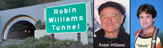 In July 2015, Tunnel 27-040 (on Route 101, located between MRN 0.885 and MRN 1.074
in the County of Marin) was renamed the "Robin Williams Tunnel".
It was named after Robin Williams, a very popular actor who committed suicide. Robin McLaurin Williams was
born in Chicago, Illinois, in July 1951. At 16 years of age Williams moved
with his family to Tiburon, California. He attended Redwood High School in
Larkspur, California, and studied theater at the College of Marin in
Kentfield, California. Williams received a full scholarship to the
Juilliard School in New York City where he pursued his gift as an actor
and comedian. Williams began his career as a comedian doing stand-up
comedy shows in the San Francisco Bay area and continued his work in Los
Angeles where he developed his improvisational style as an actor and a
stand-up comedian. Williams then appeared on several television programs
(including the revival of "Laugh In") and starred in “Mork and
Mindy” in the late 1970s to early 1980s. Many successful film roles
followed, including his role as radio disc jockey Adrian Cronauer in
“Good Morning, Vietnam” in 1987, and teacher John Keating in
“Dead Poets Society” in 1989. Both roles earned him lead actor
Academy Award recognition. In 1997, Robin Williams was voted funniest man
alive by Entertainment Weekly. The next year, in 1998, Entertainment
Weekly listed him as one of the 25 Best Actors of all time. In 2003, he
won the Grammy Award for Best Comedy Album. In 2005, Robin Williams
received the Cecil B. DeMille Award at the Golden Globe Awards. He
dedicated that lifetime achievement award to the memory of his good
friend, fellow actor, and roommate at Juilliard, Christopher Reeve. Along
with his talent to make people laugh, Robin Williams raised funds for
various causes. Robin Williams’ charity work included health care,
human rights, education, environmental protection, the arts, and much
more. In 2010, he gave 100 percent of the proceeds from his shows in New
Zealand to victims of the devastating earthquake in Christchurch. Robin
Williams supported the following foundations and their work: Aid Still
Required, American Foundation for AIDS Research, Amnesty International,
Andre Agassi Foundation for Education, Augie’s Quest, Bob Woodruff
Foundation, Celebrity Fight Night Foundation, Christopher & Dana Reeve
Foundation, Comic Relief, David Foster Foundation, Doctors Without
Borders, Dogs Deserve Better, Dream Foundation, Elizabeth Glaser Pediatric
AIDS Foundation, International Medical Corps, Keep Memory Alive,
LIVESTRONG, Love Our Children USA, Luke Neuhedel Foundation, Muhammad Ali
Parkinson Center, MusiCares, Prince’s Rainforests Project,
Prince’s Trust, Robert F. Kennedy Memorial, Smile Train, St. Jude
Children’s Research Hospital, and UNICEF. One of Robin
Williams’ strongest affiliations with philanthropy was working with
Comic Relief, a nonprofit organization with a mission to raise money for
housing, health care, and the homeless. Robin Williams would help by
hosting events and shows and performing to help raise funds. Robin
Williams also was an active volunteer through the United Service
Organizations where he went on a total of six tours and visited about
89,000 troops in 12 countries, including Iraq and Afghanistan. Regardless
of the challenging circumstances, comedian Robin Williams made troops in
conflict zones smile and laugh. Robin Williams also listened to their
personal experiences. He also funded the Robin Williams Scholarship at his
alma mater, the Juilliard School in New York City. Each year Robin
Williams provided a scholarship to cover the tuition cost for one theater
student. Robin Williams was a friend to the North Bay community of the San
Francisco Bay area. He would often drop in unannounced at comedy nights at
the 142 Throckmorton Theatre in Mill Valley. There he would encourage
young, budding comedians. He did so with kindness and humility and many
comedians aspired to perform with the same level of wit and insight as
Robin Williams. Robin Williams died on August 11, 2014, in his home in
Paradise Cay, Tiburon, California, as a result of suicide. Though he
bravely battled addiction and mental illness, his death was a consequence
of those diseases. So other than the geographical connection, why was the
former Waldo Tunnel chosen for renaming? Another name for the Waldo Tunnel
is the "Rainbow Tunnely, as the archways at the ends of the two bores of
the tunnel were painted in rainbows by a Caltrans employee, Robert
Halligan. Williams was well known for the rainbow suspenders he wore as
the character Mork in his first hit TV show, Mork and Mindy. Named by ACR
1, 7/1/2015, Resolution Chapter 85, Statutes of 2015.
In July 2015, Tunnel 27-040 (on Route 101, located between MRN 0.885 and MRN 1.074
in the County of Marin) was renamed the "Robin Williams Tunnel".
It was named after Robin Williams, a very popular actor who committed suicide. Robin McLaurin Williams was
born in Chicago, Illinois, in July 1951. At 16 years of age Williams moved
with his family to Tiburon, California. He attended Redwood High School in
Larkspur, California, and studied theater at the College of Marin in
Kentfield, California. Williams received a full scholarship to the
Juilliard School in New York City where he pursued his gift as an actor
and comedian. Williams began his career as a comedian doing stand-up
comedy shows in the San Francisco Bay area and continued his work in Los
Angeles where he developed his improvisational style as an actor and a
stand-up comedian. Williams then appeared on several television programs
(including the revival of "Laugh In") and starred in “Mork and
Mindy” in the late 1970s to early 1980s. Many successful film roles
followed, including his role as radio disc jockey Adrian Cronauer in
“Good Morning, Vietnam” in 1987, and teacher John Keating in
“Dead Poets Society” in 1989. Both roles earned him lead actor
Academy Award recognition. In 1997, Robin Williams was voted funniest man
alive by Entertainment Weekly. The next year, in 1998, Entertainment
Weekly listed him as one of the 25 Best Actors of all time. In 2003, he
won the Grammy Award for Best Comedy Album. In 2005, Robin Williams
received the Cecil B. DeMille Award at the Golden Globe Awards. He
dedicated that lifetime achievement award to the memory of his good
friend, fellow actor, and roommate at Juilliard, Christopher Reeve. Along
with his talent to make people laugh, Robin Williams raised funds for
various causes. Robin Williams’ charity work included health care,
human rights, education, environmental protection, the arts, and much
more. In 2010, he gave 100 percent of the proceeds from his shows in New
Zealand to victims of the devastating earthquake in Christchurch. Robin
Williams supported the following foundations and their work: Aid Still
Required, American Foundation for AIDS Research, Amnesty International,
Andre Agassi Foundation for Education, Augie’s Quest, Bob Woodruff
Foundation, Celebrity Fight Night Foundation, Christopher & Dana Reeve
Foundation, Comic Relief, David Foster Foundation, Doctors Without
Borders, Dogs Deserve Better, Dream Foundation, Elizabeth Glaser Pediatric
AIDS Foundation, International Medical Corps, Keep Memory Alive,
LIVESTRONG, Love Our Children USA, Luke Neuhedel Foundation, Muhammad Ali
Parkinson Center, MusiCares, Prince’s Rainforests Project,
Prince’s Trust, Robert F. Kennedy Memorial, Smile Train, St. Jude
Children’s Research Hospital, and UNICEF. One of Robin
Williams’ strongest affiliations with philanthropy was working with
Comic Relief, a nonprofit organization with a mission to raise money for
housing, health care, and the homeless. Robin Williams would help by
hosting events and shows and performing to help raise funds. Robin
Williams also was an active volunteer through the United Service
Organizations where he went on a total of six tours and visited about
89,000 troops in 12 countries, including Iraq and Afghanistan. Regardless
of the challenging circumstances, comedian Robin Williams made troops in
conflict zones smile and laugh. Robin Williams also listened to their
personal experiences. He also funded the Robin Williams Scholarship at his
alma mater, the Juilliard School in New York City. Each year Robin
Williams provided a scholarship to cover the tuition cost for one theater
student. Robin Williams was a friend to the North Bay community of the San
Francisco Bay area. He would often drop in unannounced at comedy nights at
the 142 Throckmorton Theatre in Mill Valley. There he would encourage
young, budding comedians. He did so with kindness and humility and many
comedians aspired to perform with the same level of wit and insight as
Robin Williams. Robin Williams died on August 11, 2014, in his home in
Paradise Cay, Tiburon, California, as a result of suicide. Though he
bravely battled addiction and mental illness, his death was a consequence
of those diseases. So other than the geographical connection, why was the
former Waldo Tunnel chosen for renaming? Another name for the Waldo Tunnel
is the "Rainbow Tunnely, as the archways at the ends of the two bores of
the tunnel were painted in rainbows by a Caltrans employee, Robert
Halligan. Williams was well known for the rainbow suspenders he wore as
the character Mork in his first hit TV show, Mork and Mindy. Named by ACR
1, 7/1/2015, Resolution Chapter 85, Statutes of 2015.
(Image source: Laughing Squid, Wikipedia, Pinterest, Buzzfeed)
In March 2016, it was reported that the signs for the
Robin Williams Tunnel had been installed. The $3,000 signs — one on
each side of the tunnel — were paid for using private donations.
(Source: SF Gate, 3/2/2016)
 Bridge 20-235 (SON 013.88), an overcrossing of Route 101 in Rohnert Park in Sonoma county, is named the "Congressman
Don Clausen Overpass". It was built in 1973, and was named by
Assembly Concurrent Resolution 24, Chapter 57 in 1983. Donald H. Clausen
was a representative to the United States Congress for the 1st
District, from 1963 to 1983. In this role, he was the senior ranking
member of the House Public Works and Transportation Committee, where he
authored legislation and enlisted the support from his congressional
colleagues and the president for a federal appropriation to provide for
the construction of the Redwood National Park Bypass project as a way to
enhance travel on Route 101 and reduce the conflicts between through
traffic and park users. In 1992, the State of California completed the
12-mile bypass of Prairie Creek Redwoods State Park and the Redwood
National Park on Route 101 in northern Humboldt and southern Del Norte
Counties. Note that there is also a "Don Clausen Highway", located
at the Redwood National Park Bypass (HUM R126.11 to DN M0.228) on Route 101.
Bridge 20-235 (SON 013.88), an overcrossing of Route 101 in Rohnert Park in Sonoma county, is named the "Congressman
Don Clausen Overpass". It was built in 1973, and was named by
Assembly Concurrent Resolution 24, Chapter 57 in 1983. Donald H. Clausen
was a representative to the United States Congress for the 1st
District, from 1963 to 1983. In this role, he was the senior ranking
member of the House Public Works and Transportation Committee, where he
authored legislation and enlisted the support from his congressional
colleagues and the president for a federal appropriation to provide for
the construction of the Redwood National Park Bypass project as a way to
enhance travel on Route 101 and reduce the conflicts between through
traffic and park users. In 1992, the State of California completed the
12-mile bypass of Prairie Creek Redwoods State Park and the Redwood
National Park on Route 101 in northern Humboldt and southern Del Norte
Counties. Note that there is also a "Don Clausen Highway", located
at the Redwood National Park Bypass (HUM R126.11 to DN M0.228) on Route 101.
(Image source: Wikipedia)
 The twin viaducts (Tunnel 20-112 (SON 020.09)), spanning 3rd, 4th and 5th
Streets in Santa Rosa, are named the "Robert L. Bishop Memorial Bridge".
Robert L Bishop, after 25 years of executive responsibility with the
national Ford Motor organization, came to California in 1944 to take over
the Ford Motor dealership in Santa Rosa. He immediately became dedicated
to that city and its development sought to strengthen democracy at the
grassroots level by serving as a member of the Santa Rosa City Council for
six years until 1952, serving a term as mayor, serving as president of the
Greater Santa Rosa Chamber of Commerce in 1951 and 1952, and serving as a
member of the California Highway Commission from 1956 to 1960. He also
demonstrated his sense of civic duty by serving as a north coast regional
vice president of the California State Chamber of Commerce, president of
the Santa Rosa Rotary Club, director of Californians for Modern Highways
Inc, member of the Santa Rosa Board of Public Utilities, chairman of the
Sonoma County Industrial Committee, chairman of Citizens Advisory
Committee for Santa Rosa Schools, chairman of a Sonoma Mendocino County
Boy Scout Drive, general chairman of the Santa Rosa United Crusade, and
member of the board. His keen interest in the development of the state
highway system was demonstrated to all through his capable tenure on
the California Highway Commission and his service as director of
Californians for Modern Highways Inc. The viaducts were built in 1968, and
was named by Senate Concurrent Resolution 39, Chapt. 51 in 1971.Signs
reading Robert L Bishop Memorial Bridge were installed on the right of
traffic at the approach to each structure on November 2 1971. A bronze
plaque with this same inscription has been placed on the vertical abutment
wall on the south side of Third Street. A ceremony for the unveiling of
this plaque was held on August 12 1971.
The twin viaducts (Tunnel 20-112 (SON 020.09)), spanning 3rd, 4th and 5th
Streets in Santa Rosa, are named the "Robert L. Bishop Memorial Bridge".
Robert L Bishop, after 25 years of executive responsibility with the
national Ford Motor organization, came to California in 1944 to take over
the Ford Motor dealership in Santa Rosa. He immediately became dedicated
to that city and its development sought to strengthen democracy at the
grassroots level by serving as a member of the Santa Rosa City Council for
six years until 1952, serving a term as mayor, serving as president of the
Greater Santa Rosa Chamber of Commerce in 1951 and 1952, and serving as a
member of the California Highway Commission from 1956 to 1960. He also
demonstrated his sense of civic duty by serving as a north coast regional
vice president of the California State Chamber of Commerce, president of
the Santa Rosa Rotary Club, director of Californians for Modern Highways
Inc, member of the Santa Rosa Board of Public Utilities, chairman of the
Sonoma County Industrial Committee, chairman of Citizens Advisory
Committee for Santa Rosa Schools, chairman of a Sonoma Mendocino County
Boy Scout Drive, general chairman of the Santa Rosa United Crusade, and
member of the board. His keen interest in the development of the state
highway system was demonstrated to all through his capable tenure on
the California Highway Commission and his service as director of
Californians for Modern Highways Inc. The viaducts were built in 1968, and
was named by Senate Concurrent Resolution 39, Chapt. 51 in 1971.Signs
reading Robert L Bishop Memorial Bridge were installed on the right of
traffic at the approach to each structure on November 2 1971. A bronze
plaque with this same inscription has been placed on the vertical abutment
wall on the south side of Third Street. A ceremony for the unveiling of
this plaque was held on August 12 1971.
(Image source: Calisphere)
Bridge 20-061 (SON 030.67), in Sonoma County at Arata Lane is named the "Richard
F. Cavness Memorial Bridge". It was built in 1962, and was named by
Assembly Concurrent Resolution 141, Chapter 105 in 1994. Richard F.
Cavness, a native of Healdsburg, was killed on November 5, 1993, on the
Arata Bridge on US Highway 101 while unselfishly rendering aid to a
stranded motorist. According to Mary Doll in the Healdsburg Tribune, Cavness, by all accounts a big-hearted man, stopped his vehicle by the bridge over Arata Lane south of Healdsburg. He
pulled over so he could help a woman who had car trouble, something
Cavness did often. As he was helping her, a northbound van driven by a
young man lost control and slammed into the young woman’s car,
killing Cavness. Mary said she remembers that the van driver had a carbon
monoxide leak in his van and blacked out for a moment from the fumes.
(Additional information: Healdsburg Tribune)
 Bridge 20-252R (SON R052.06) over First Street in Cloverdale is named the "Gambetta Memorial Bridge". It
was built in 1984, and was named by Assembly Concurrent Resolution 117,
Chapter 101 in 1994. Mr. and Mrs. Albert Gambetta, Sr. were long-time
residents of the City of Cloverdale. Mrs. Dena Gambetta served the City of
Cloverdale as the unofficial "hostess" of the community. Mr. Albert
Gambetta, Sr. was known as the "grandfather of city government" in
Cloverdale. Mr. Gambetta was Cloverdale mayor for three years and council
member for 18 years, Mr. Gambetta was still a member of the city's
planning commission when he died. A native of Gilroy, Calif,, Mr. Gambetta
had been a wineblender for Italian Swiss Colony. He was a union
representative during his employment there. In addition to his
participation in city government, Mr. Gambetta was first president and a
charter member of the Italian Catholic Federation, St. Peter's Catholic
Church in Cloverdale, a member of the Grand Jury for 18 months, past
chairman for the League of California Cities, a Veteran of World War 11,
and captain of the Cloverdale Volunteer Fire Dept. He also was involved in
other organizations, including the American Legion, William Russell
Ledford Post № 293. Mr. Gambetta also owned and operated B&B
Sport Shop in Cloverdale for 23 years, retiring in 1974.
Bridge 20-252R (SON R052.06) over First Street in Cloverdale is named the "Gambetta Memorial Bridge". It
was built in 1984, and was named by Assembly Concurrent Resolution 117,
Chapter 101 in 1994. Mr. and Mrs. Albert Gambetta, Sr. were long-time
residents of the City of Cloverdale. Mrs. Dena Gambetta served the City of
Cloverdale as the unofficial "hostess" of the community. Mr. Albert
Gambetta, Sr. was known as the "grandfather of city government" in
Cloverdale. Mr. Gambetta was Cloverdale mayor for three years and council
member for 18 years, Mr. Gambetta was still a member of the city's
planning commission when he died. A native of Gilroy, Calif,, Mr. Gambetta
had been a wineblender for Italian Swiss Colony. He was a union
representative during his employment there. In addition to his
participation in city government, Mr. Gambetta was first president and a
charter member of the Italian Catholic Federation, St. Peter's Catholic
Church in Cloverdale, a member of the Grand Jury for 18 months, past
chairman for the League of California Cities, a Veteran of World War 11,
and captain of the Cloverdale Volunteer Fire Dept. He also was involved in
other organizations, including the American Legion, William Russell
Ledford Post № 293. Mr. Gambetta also owned and operated B&B
Sport Shop in Cloverdale for 23 years, retiring in 1974.
(Image source: Cloverville Reveille)
 Bridge 10-273 (MEN R000.48), 0.4 mi N of the Sonoma county line on the Russian River in Mendocino county, is named
the "F. Walter Sandelin Memorial Bridge" . It was built in 1988,
and was named by Assembly Concurrent Resolution 76, Chapter 144, in 1989.
F. Walter Sandelin was a member of the California Highway Commission from
1943 to 1956 and was instrumental in achieving the widening of US 101 to
four lanes.
Bridge 10-273 (MEN R000.48), 0.4 mi N of the Sonoma county line on the Russian River in Mendocino county, is named
the "F. Walter Sandelin Memorial Bridge" . It was built in 1988,
and was named by Assembly Concurrent Resolution 76, Chapter 144, in 1989.
F. Walter Sandelin was a member of the California Highway Commission from
1943 to 1956 and was instrumental in achieving the widening of US 101 to
four lanes.
(Image Source: California Highways and Public Works Nov-Dec 1954)
 Bridge 10-0165 (MEN R046.37), located on the US 101 Willits Bypass in the County of
Mendocino, is named the "Jesse D. Pittman SO1 Navy SEAL Memorial
Bridge". It was named after Jesse D. Pittman, who was born in
Arcata, California and raised in the town of Willits, California. After
graduating from Willits High School in 2002, Jesse spent two seasons as a
wild land firefighter with CAL-FIRE before he joined the United States
Navy in 2005 to become a SEAL commando. Jesse was as renowned for his
practical jokes as he was for his bravery and discipline. As a Navy SEAL,
Jesse went on missions both dangerous and top secret. Pittman died August
6, 2011, in Taliban territory when the Chinook helicopter that carried him
and 30 other American troops was shot down. It was the deadliest incident
for United States Armed Forces since the war in Afghanistan began a decade
ago. He was 27 years of age when he died, a Navy petty officer first class
and a member of the San Diego-based SEAL Team 5. Jesse had a saying among
his Navy SEAL teammates, “I don’t run, I charge,” which
is exactly how he lived his life. He embodied the Navy SEAL creed that
SEALs are common men with an uncommon desire to succeed. Pittman was
highly decorated by the United States Navy, receiving all of the following
awards: the Joint Service Commendation Medal with “V” device
for valor, the Navy Commendation Medal, the Navy Achievement Medal (2),
the Combat Action Ribbon, the Afghanistan Campaign Medal, the Iraq
Campaign Medal, the Global War on Terrorism Service Medal, the Navy Good
Conduct Medal, the National Defense Service Medal, the Sea Service
Deployment Ribbon, the Rifle Marksmanship Medal, the Pistol Marksmanship
Medal, the Purple Heart, and the Bronze Star with Valor. Named by Assembly
Concurrent Resolution (ACR) 8, August 11, 2015, Res. Chapter 132, Statutes
of 2015.
Bridge 10-0165 (MEN R046.37), located on the US 101 Willits Bypass in the County of
Mendocino, is named the "Jesse D. Pittman SO1 Navy SEAL Memorial
Bridge". It was named after Jesse D. Pittman, who was born in
Arcata, California and raised in the town of Willits, California. After
graduating from Willits High School in 2002, Jesse spent two seasons as a
wild land firefighter with CAL-FIRE before he joined the United States
Navy in 2005 to become a SEAL commando. Jesse was as renowned for his
practical jokes as he was for his bravery and discipline. As a Navy SEAL,
Jesse went on missions both dangerous and top secret. Pittman died August
6, 2011, in Taliban territory when the Chinook helicopter that carried him
and 30 other American troops was shot down. It was the deadliest incident
for United States Armed Forces since the war in Afghanistan began a decade
ago. He was 27 years of age when he died, a Navy petty officer first class
and a member of the San Diego-based SEAL Team 5. Jesse had a saying among
his Navy SEAL teammates, “I don’t run, I charge,” which
is exactly how he lived his life. He embodied the Navy SEAL creed that
SEALs are common men with an uncommon desire to succeed. Pittman was
highly decorated by the United States Navy, receiving all of the following
awards: the Joint Service Commendation Medal with “V” device
for valor, the Navy Commendation Medal, the Navy Achievement Medal (2),
the Combat Action Ribbon, the Afghanistan Campaign Medal, the Iraq
Campaign Medal, the Global War on Terrorism Service Medal, the Navy Good
Conduct Medal, the National Defense Service Medal, the Sea Service
Deployment Ribbon, the Rifle Marksmanship Medal, the Pistol Marksmanship
Medal, the Purple Heart, and the Bronze Star with Valor. Named by Assembly
Concurrent Resolution (ACR) 8, August 11, 2015, Res. Chapter 132, Statutes
of 2015.
(Image source: Times Standard)
 Stoddard Lilley Memorial Bridge") The new South Fork Eel Bridge (Bridge number 10-0299, MEN R099.51, Kilometer Post 160.03), located on Route 101 in the County of Mendocino,
is named the Mignon "Minnie" Stoddard Lilley Memorial Bridge. This
bridge was named in memory of Mignon "Minnie" Stoddard Lilley, a woman of
many facets and dimensions: courageous, intelligent, creative, kind,
stern, hard working, musically inclined, honest, religious, impetuous,
practical, and also, by all accounts, quite an attractive woman. She was a
teacher, environmentalist, homesteader, entrepreneur, healer, visionary,
and a true pioneer in every sense of the word. Minnie lived in a time when
a person was required to deal with the harsh realities of living on the
"frontier." As a teacher, Minnie offered the community something that was
important to them and as a person she set a positive example for all by
her unselfish concern for all those around her. From 1904 to 1936, Minnie
taught in the one room schoolhouses of the Andersonia/Piercy area. Minnie
spent her entire teaching career in the County of Mendocino teaching at
Usal, Moody, Bear Harbor, Alder Glen, Franklin, and Buck Mountain before
settling down and staying in the Andersonia/Piercy area. Minnie can also
lay claim to being the first school bus driver in the area because around
1919, having acquired a horse-drawn buggie, she would pick up some of her
students and give them a ride to school. Minnie met William G. Lilley
while she was teaching at Andersonia and they were married January 25,
1905, at the Grand Hotel in San Francisco. In the spring of 1904, Minnie
set out to homestead a claim up the Eel River in the redwoods. For many
years Minnie had walked over 5 miles to the schoolhouse so a solitary hike
up the South Fork of the Eel River through some "darn tough country" was
no big deal to her. A quote from a 1950 Humboldt Times article reads "as
soon as the spring rains had subsided enough so that the Eel River could
be crossed safely, she went into the depths of the redwood forest, fording
on a homemade raft the turbulent waters, and set up her location markers".
Minnie then hired a man to build her a simple one room cabin on the
property. Minnie loved telling people about her first night in the cabin,
all alone way out there in the forest which she spent "with prayer on my
lips and a pistol in my hand". Around 1925, Minnie and William bought a 55
acre parcel adjoining the homestead and that property included a
particular tree Minnie lovingly called "The Fraternal Monarch." This
amazing redwood tree stands over 250 feet tall, is 101 feet in
circumference, and has had the center burned out by a fire some 300 years
ago. Today this tree is known as "The World Famous Tree House". In 1919,
construction of the Redwood Highway through the canyon of the South Fork
of the Eel River began; and in 1929, Minnie and William started building a
few small cabins near The World Famous Tree House. On May 14, 1931, for
the sum of $10, the Lilley's deeded enough land to the State of California
to make improvements to the new road that ran through their property.
During construction of the highway, the tree house was a camp for the
convict labor that was used to work on the road. These men actually used
the old burned out tree as a shelter to sleep in. Now that tourists were
visiting the redwoods, William and Minnie were in a great position to
benefit from this new situation, and one day, Minnie decided to put a gift
shop inside The World Famous Tree House and she had a floor, windows, and
a door fitted to the measurements of the burned out hole in the redwood.
This was one of the very first gift shops on the Redwood Highway. On March
8, 1947, Minnie, a remarkable pioneering woman, passed away and according
to her wishes to be with her beloved trees through eternity she was
interred in her mausoleum right near The Fraternal Monarch. Named by
Senate Concurrent Resolution (SCR) 114, Resolution Chapter 140, on
9/8/2006.
The new South Fork Eel Bridge (Bridge number 10-0299, MEN R099.51, Kilometer Post 160.03), located on Route 101 in the County of Mendocino,
is named the Mignon "Minnie" Stoddard Lilley Memorial Bridge. This
bridge was named in memory of Mignon "Minnie" Stoddard Lilley, a woman of
many facets and dimensions: courageous, intelligent, creative, kind,
stern, hard working, musically inclined, honest, religious, impetuous,
practical, and also, by all accounts, quite an attractive woman. She was a
teacher, environmentalist, homesteader, entrepreneur, healer, visionary,
and a true pioneer in every sense of the word. Minnie lived in a time when
a person was required to deal with the harsh realities of living on the
"frontier." As a teacher, Minnie offered the community something that was
important to them and as a person she set a positive example for all by
her unselfish concern for all those around her. From 1904 to 1936, Minnie
taught in the one room schoolhouses of the Andersonia/Piercy area. Minnie
spent her entire teaching career in the County of Mendocino teaching at
Usal, Moody, Bear Harbor, Alder Glen, Franklin, and Buck Mountain before
settling down and staying in the Andersonia/Piercy area. Minnie can also
lay claim to being the first school bus driver in the area because around
1919, having acquired a horse-drawn buggie, she would pick up some of her
students and give them a ride to school. Minnie met William G. Lilley
while she was teaching at Andersonia and they were married January 25,
1905, at the Grand Hotel in San Francisco. In the spring of 1904, Minnie
set out to homestead a claim up the Eel River in the redwoods. For many
years Minnie had walked over 5 miles to the schoolhouse so a solitary hike
up the South Fork of the Eel River through some "darn tough country" was
no big deal to her. A quote from a 1950 Humboldt Times article reads "as
soon as the spring rains had subsided enough so that the Eel River could
be crossed safely, she went into the depths of the redwood forest, fording
on a homemade raft the turbulent waters, and set up her location markers".
Minnie then hired a man to build her a simple one room cabin on the
property. Minnie loved telling people about her first night in the cabin,
all alone way out there in the forest which she spent "with prayer on my
lips and a pistol in my hand". Around 1925, Minnie and William bought a 55
acre parcel adjoining the homestead and that property included a
particular tree Minnie lovingly called "The Fraternal Monarch." This
amazing redwood tree stands over 250 feet tall, is 101 feet in
circumference, and has had the center burned out by a fire some 300 years
ago. Today this tree is known as "The World Famous Tree House". In 1919,
construction of the Redwood Highway through the canyon of the South Fork
of the Eel River began; and in 1929, Minnie and William started building a
few small cabins near The World Famous Tree House. On May 14, 1931, for
the sum of $10, the Lilley's deeded enough land to the State of California
to make improvements to the new road that ran through their property.
During construction of the highway, the tree house was a camp for the
convict labor that was used to work on the road. These men actually used
the old burned out tree as a shelter to sleep in. Now that tourists were
visiting the redwoods, William and Minnie were in a great position to
benefit from this new situation, and one day, Minnie decided to put a gift
shop inside The World Famous Tree House and she had a floor, windows, and
a door fitted to the measurements of the burned out hole in the redwood.
This was one of the very first gift shops on the Redwood Highway. On March
8, 1947, Minnie, a remarkable pioneering woman, passed away and according
to her wishes to be with her beloved trees through eternity she was
interred in her mausoleum right near The Fraternal Monarch. Named by
Senate Concurrent Resolution (SCR) 114, Resolution Chapter 140, on
9/8/2006.
(Image source: WomansWest; Find a Grave; Mendocino History)
 The northern span of the Eel River Bridge (MEN R100.02), located on US 101 in the
County of Mendocino is named the "Elizabeth Jane Rosewarne Memorial
Bridge". This structure was named in memory of Elizabeth Jane
Rosewarne. Elizabeth Jane Rosewarne was born to William and Elizabeth
Sandow on July 12, 1866, in Eagle River, Michigan. Elizabeth met Nicholas
Rosewarne, who was born in England, in Nevada City, and they married in
1884. Elizabeth and Nicholas moved to San Francisco, where Nicholas was a
cable car conductor, and Elizabeth was a professional seamstress.
Elizabeth and Nicholas had three children, Edna, Ray, and Myrtle. Due to
Elizabeth's poor health, the doctor recommended she move from the foggy
air of San Francisco to a warmer climate. Nicholas traveled by boat to
Usal and set out in search of land, selecting a 160-acre parcel bordering
on the South Fork of the Eel River, across from Confusion Hill, which he
purchased in May of 1896. The following May, Elizabeth and the children
boarded one of the vessels of the (Robert) Dollar Steamship Company,
sailed to Usal, and from there, traveled by mule over a 10-mile backwoods
trail to the homestead carrying essential belongings, including a
child-size rocking chair that is still in the family today, strapped
between two mules. Elizabeth thrived in the new climate, taking the chores
of a pioneer woman in stride and, while a petite woman, could work with a
cross cut saw, fish the Eel River for salmon and trout, smoke salmon in
the smokehouse, and pack a mule and haul wood on the family horse named
Queen. With Nicholas working on the Henry Neff Anderson's railroad between
Andersonia (Piercy) and Usal during the week, Elizabeth traveled by
horseback with both children strapped on the horse on the mountain trail
to Usal, to pick up mail and supplies. On one unforgettable trip to Usal,
Elizabeth, carrying a sack of fresh meat, was followed closely by a
shrieking panther, and although her horse spooked and jumped over a gate,
she and the children managed to hold on tight and make it back safely to
the homestead. Elizabeth was an expert at baking her own bread, making her
own butter and cream, and growing prized heirloom tomatoes that she traded
to her neighbors, and in addition she canned over 400 jars of fruit during
the summer from the Rosewarne homestead orchard. She was also an expert
seamstress and made all the clothes for her family and also loved to
quilt, spending many evenings working on her latest quilt. She loved to
fish and kept a daily count of her impressive catch, and her favorite
fishing hole was in the eddy of the Eel River, which is the proposed
bridge site for the northern span of the Eel River Bridge. After a long
day of chores, Elizabeth would hitch up the horse and take her daughter,
Myrtle, to visit the neighbors, and in the evenings, the family would use
a Parcheesi Board circle Elizabeth made on the back of her round oil cloth
to play the game. After Nicholas lost his vision in one eye from a logging
accident and then in the other eye from glaucoma, Elizabeth cared for him
until his death on May 3, 1922, at age 69. After Nicholas' death,
Elizabeth moved across the Eel River to the north end of the Rosewarne
Homestead, operating a Texaco Star gas station and a country store to
support herself and her youngest daughter, Myrtle. Elizabeth Jane
Rosewarne died on January 7, 1949, and is buried in the family plot in
Piercy Cemetery in Mendocino County, beside her son, Ray. Elizabeth and
Nicholas Rosewarne's homestead is the location for both the southern and
northern spans of the Eel River Bridge. The southern span of the Eel River
Bridge will be named the Minney Lilley Memorial Bridge, and Minney Lilley
and Elizabeth Rosewarne were friends, with Minney being mentioned in
Elizabeth's diary and the teacher for Elizabeth's daughter, Myrtle, as
well as several of Elizabeth's grandchildren and a greatgrandson. These
bridge spans are named after two pioneer women, inspiring women and young
girls growing up, or traveling to and from the area, to know that pioneer
women played a key role in the history of Mendocino County. Named by
Assembly Concurrent Resolution (ACR) 30, Resolution Chapter 69, on
7/3/2007.
The northern span of the Eel River Bridge (MEN R100.02), located on US 101 in the
County of Mendocino is named the "Elizabeth Jane Rosewarne Memorial
Bridge". This structure was named in memory of Elizabeth Jane
Rosewarne. Elizabeth Jane Rosewarne was born to William and Elizabeth
Sandow on July 12, 1866, in Eagle River, Michigan. Elizabeth met Nicholas
Rosewarne, who was born in England, in Nevada City, and they married in
1884. Elizabeth and Nicholas moved to San Francisco, where Nicholas was a
cable car conductor, and Elizabeth was a professional seamstress.
Elizabeth and Nicholas had three children, Edna, Ray, and Myrtle. Due to
Elizabeth's poor health, the doctor recommended she move from the foggy
air of San Francisco to a warmer climate. Nicholas traveled by boat to
Usal and set out in search of land, selecting a 160-acre parcel bordering
on the South Fork of the Eel River, across from Confusion Hill, which he
purchased in May of 1896. The following May, Elizabeth and the children
boarded one of the vessels of the (Robert) Dollar Steamship Company,
sailed to Usal, and from there, traveled by mule over a 10-mile backwoods
trail to the homestead carrying essential belongings, including a
child-size rocking chair that is still in the family today, strapped
between two mules. Elizabeth thrived in the new climate, taking the chores
of a pioneer woman in stride and, while a petite woman, could work with a
cross cut saw, fish the Eel River for salmon and trout, smoke salmon in
the smokehouse, and pack a mule and haul wood on the family horse named
Queen. With Nicholas working on the Henry Neff Anderson's railroad between
Andersonia (Piercy) and Usal during the week, Elizabeth traveled by
horseback with both children strapped on the horse on the mountain trail
to Usal, to pick up mail and supplies. On one unforgettable trip to Usal,
Elizabeth, carrying a sack of fresh meat, was followed closely by a
shrieking panther, and although her horse spooked and jumped over a gate,
she and the children managed to hold on tight and make it back safely to
the homestead. Elizabeth was an expert at baking her own bread, making her
own butter and cream, and growing prized heirloom tomatoes that she traded
to her neighbors, and in addition she canned over 400 jars of fruit during
the summer from the Rosewarne homestead orchard. She was also an expert
seamstress and made all the clothes for her family and also loved to
quilt, spending many evenings working on her latest quilt. She loved to
fish and kept a daily count of her impressive catch, and her favorite
fishing hole was in the eddy of the Eel River, which is the proposed
bridge site for the northern span of the Eel River Bridge. After a long
day of chores, Elizabeth would hitch up the horse and take her daughter,
Myrtle, to visit the neighbors, and in the evenings, the family would use
a Parcheesi Board circle Elizabeth made on the back of her round oil cloth
to play the game. After Nicholas lost his vision in one eye from a logging
accident and then in the other eye from glaucoma, Elizabeth cared for him
until his death on May 3, 1922, at age 69. After Nicholas' death,
Elizabeth moved across the Eel River to the north end of the Rosewarne
Homestead, operating a Texaco Star gas station and a country store to
support herself and her youngest daughter, Myrtle. Elizabeth Jane
Rosewarne died on January 7, 1949, and is buried in the family plot in
Piercy Cemetery in Mendocino County, beside her son, Ray. Elizabeth and
Nicholas Rosewarne's homestead is the location for both the southern and
northern spans of the Eel River Bridge. The southern span of the Eel River
Bridge will be named the Minney Lilley Memorial Bridge, and Minney Lilley
and Elizabeth Rosewarne were friends, with Minney being mentioned in
Elizabeth's diary and the teacher for Elizabeth's daughter, Myrtle, as
well as several of Elizabeth's grandchildren and a greatgrandson. These
bridge spans are named after two pioneer women, inspiring women and young
girls growing up, or traveling to and from the area, to know that pioneer
women played a key role in the history of Mendocino County. Named by
Assembly Concurrent Resolution (ACR) 30, Resolution Chapter 69, on
7/3/2007.
(Image source: WomansWest)
 Bridge № 10-218 (MEN R106.57) on US 101 (over the South Fork of the Eel River), between MEN
106.574 and 106.670, in the County of Mendocino as the "Lowell C.
Allen Memorial Bridge". It was named in memory of Lowell C. Allen,
a licensed professional engineer and widely respected bridge construction
engineer who enjoyed a 39-year career with the California Department of
Transportation (Caltrans), Division of Highways Bridge Department. As the
senior bridge construction engineer for Caltrans District 1, from 1973
through his retirement in 1990, Mr. Allen was responsible for bridge
construction throughout the Counties of Del Norte, Humboldt, Lake, and
Mendocino, including those bridges constructed by counties and other local
agencies. During his working days and in retirement, Mr. Allen donated
many hours to help build structures up and down the North Coast. Mr. Allen
was a lifelong member of the American Society of Civil Engineers. Mr.
Allen died on December 2, 2014, leaving a legacy throughout the region.
Named by Senate Concurrent Resolution 73, Resolution Chapter 178,
9/18/2015.
Bridge № 10-218 (MEN R106.57) on US 101 (over the South Fork of the Eel River), between MEN
106.574 and 106.670, in the County of Mendocino as the "Lowell C.
Allen Memorial Bridge". It was named in memory of Lowell C. Allen,
a licensed professional engineer and widely respected bridge construction
engineer who enjoyed a 39-year career with the California Department of
Transportation (Caltrans), Division of Highways Bridge Department. As the
senior bridge construction engineer for Caltrans District 1, from 1973
through his retirement in 1990, Mr. Allen was responsible for bridge
construction throughout the Counties of Del Norte, Humboldt, Lake, and
Mendocino, including those bridges constructed by counties and other local
agencies. During his working days and in retirement, Mr. Allen donated
many hours to help build structures up and down the North Coast. Mr. Allen
was a lifelong member of the American Society of Civil Engineers. Mr.
Allen died on December 2, 2014, leaving a legacy throughout the region.
Named by Senate Concurrent Resolution 73, Resolution Chapter 178,
9/18/2015.
(Image source: Redwood Times)
Bridge 04-241 (HUM R005.63), at Smith Point on the Eel River in Humboldt county, is named the "Charles Edward Wagner Memorial Bridge". It was built in 1980, and named by Assembly Concurrent Resolution 132 the same year. Charles Edward Wagner established the first tanbark extraction plant in Humboldt County in 1900 and was a leader in the building of the town of Garberville.
 Bridge 04-155 (HUM R007.87), over the south fork of the Eel River, is named the "Malcolm G. Coombs Memorial
Bridge". It was built in 1969, and named by Assembly Concurrent
Resolution 86, Chapter 92. Malcolm G. Coombs, who settled in Humboldt
County in 1946, was a benefactor to the county and a member of the
California State Water Commission.
Bridge 04-155 (HUM R007.87), over the south fork of the Eel River, is named the "Malcolm G. Coombs Memorial
Bridge". It was built in 1969, and named by Assembly Concurrent
Resolution 86, Chapter 92. Malcolm G. Coombs, who settled in Humboldt
County in 1946, was a benefactor to the county and a member of the
California State Water Commission.
(Image source: Roots of Motive Power)
 Bridge 04-212 (HUM R008.30), over the south fork of the Eel River near Garberville in
Humboldt county, is named the "Frank P. Belotti Memorial Bridge" .
Frank P. Belotti, a Eureka mink rancher who served as a Member of the
Assembly from 1950 to 1972, was an effective advocate of preserving the
unique scenic beauty of the redwood groves and was instrumental in
securing the legislation that made possible the freeway bypass of the
groves and the preservation of the existing state highway designated as
the "Avenue of the Giants". He also organized efforts to repopulate the
Capitol Park with gray squirrels. It was built in 1969, and was named by
Senate Concurrent Resolution 41, in Chapter 101 in 1972.Additionally, the
portion of Route 101 from Englewood (~ HUM 39.158) to Sylvandale in
Humboldt County (near Redcrest, CA, HUM 39.889) is named the "Frank P.
Belotti Freeway".
Bridge 04-212 (HUM R008.30), over the south fork of the Eel River near Garberville in
Humboldt county, is named the "Frank P. Belotti Memorial Bridge" .
Frank P. Belotti, a Eureka mink rancher who served as a Member of the
Assembly from 1950 to 1972, was an effective advocate of preserving the
unique scenic beauty of the redwood groves and was instrumental in
securing the legislation that made possible the freeway bypass of the
groves and the preservation of the existing state highway designated as
the "Avenue of the Giants". He also organized efforts to repopulate the
Capitol Park with gray squirrels. It was built in 1969, and was named by
Senate Concurrent Resolution 41, in Chapter 101 in 1972.Additionally, the
portion of Route 101 from Englewood (~ HUM 39.158) to Sylvandale in
Humboldt County (near Redcrest, CA, HUM 39.889) is named the "Frank P.
Belotti Freeway".
(Image source: Political Vintage Postcards)
Bridge 04-006 (HUM R014.31), at Dean Creek in Humboldt county, is named the "Elmer Hurlbut Memorial Bridge". It was bult in 1967, and named by Assembly Concurrent Resolution 38, Chapter 115. Humboldt County pioneer and rancher Elmer Hurlbutt, (1882-1967), helped to develop the Garberville Water Company.
 Bridge 04-065 (HUM R017.89) over the south fork of the Eel River, S of Phillipsville, is
named the "Charles R. Barnum Memorial Bridge". Charles R. Barnum
pioneered the use of fir trees to produce lumber in California. Mr. Barnum
was a realtor and insurance broker in Eureka. Barnum had extensive timber
holdings in all parts of Humboldt County and was active not only in
business, but in politics as well. He was a U.S. Navy veteran, a former
chairman of the Humboldt County Republican Central Committee and a member
of the California Forest Practices committee and Humboldt State College
Advisory Board. Barnum also worked for a while in the news and sports
departments of the Humboldt Times newspaper and was also once a salesman
for the Humboldt Paper Company. For several years, he had been a state
inheritance tax appraiser for Humboldt County. Barnum had introduced
plywood production techniques to the Eureka area. He was very
interested in local history and was, for many years, active with the
Humboldt County Historical Society, as well as being involved in other
business and community endeavors. He was a member of the Humboldt State
College Advisory Board from March 1946 until his death in February
1953. It was built in 1964, and was named by Senate Concurrent
Resolution 94, Chapter 229, in 1965. The bridge cost $1.24 million to
construct and, after its completion, was named the most beautiful bridge
constructed of steel in the U.S. by the American Institute of Steel
Construction.
Bridge 04-065 (HUM R017.89) over the south fork of the Eel River, S of Phillipsville, is
named the "Charles R. Barnum Memorial Bridge". Charles R. Barnum
pioneered the use of fir trees to produce lumber in California. Mr. Barnum
was a realtor and insurance broker in Eureka. Barnum had extensive timber
holdings in all parts of Humboldt County and was active not only in
business, but in politics as well. He was a U.S. Navy veteran, a former
chairman of the Humboldt County Republican Central Committee and a member
of the California Forest Practices committee and Humboldt State College
Advisory Board. Barnum also worked for a while in the news and sports
departments of the Humboldt Times newspaper and was also once a salesman
for the Humboldt Paper Company. For several years, he had been a state
inheritance tax appraiser for Humboldt County. Barnum had introduced
plywood production techniques to the Eureka area. He was very
interested in local history and was, for many years, active with the
Humboldt County Historical Society, as well as being involved in other
business and community endeavors. He was a member of the Humboldt State
College Advisory Board from March 1946 until his death in February
1953. It was built in 1964, and was named by Senate Concurrent
Resolution 94, Chapter 229, in 1965. The bridge cost $1.24 million to
construct and, after its completion, was named the most beautiful bridge
constructed of steel in the U.S. by the American Institute of Steel
Construction.
(Image source and additional information: Times Standard)
 The Salmon Creek Bridge on U 101 in Humboldt County (HUM 023.89) is named the “James F. McManus Memorial Bridge”. This bridge was named in memory of
James F. McManus, who had an exemplary career with the Department of
Transportation (Caltrans) for nearly 40 years, McManus was born on May 29,
1929, in Oakland, California. His love for engineering and flying was
stimulated by his father's work with the Univac Supercomputer, which was
used to schedule the B-19 Bomber project during World War II. McManus
attended City College of San Francisco, until he joined the United States
Marine Corps during the Korean War. He later returned to college at San
Jose State University. In 1954, McManus began his career at Caltrans as a
junior civil engineer and immediately impressed his supervisors with his
engineering abilities. During his 18-year tenure in District 1 of
Caltrans, McManus moved from construction to the laboratory, where he
tested materials for roadways, and ultimately into design, planning, and
project management, where he worked on the design of numerous highway and
freeway projects. After the 1964 flood incident in northern California,
McManus worked on the US 101 freeway project and designed a five-mile
stretch of the Redwood Freeway south of Myers Flat. He was particularly
proud of this project because, in addition to bypassing Myers Flat and
avoiding impact to the old growth redwoods and parks south of the Eel
River, he successfully convinced the district leadership to change the
original alignment of the highway to create his vision of a panoramic view
of the magnificent Eel River. The Myers Flat Bypass included five bridges
across the Eel River and its tributaries, including the Salmon Creek
Bridge. As a leader of the district computer section, McManus developed a
revolutionary computer program called MANSCAN, which scheduled the
manpower across the many professional disciplines required to design and
construct each major project and thereby allowed projects to be more
efficiently tracked and planned. This program was renamed PYPSCAN and was
used for purposes of program management for many decades. Following his
many achievements in District 1, McManus was promoted in 1972 to work in
the department's headquarters in Sacramento, California, as a senior
transportation engineer. He became a principal engineer in 1982, and was
promoted to Deputy Director of District 7 in Los Angeles in 1984, where he
oversaw the planning, design, and construction of the monumental Century
Freeway project and won Engineer of the Year for Caltrans as a result. In
1986, McManus moved back to Sacramento, California, and was promoted to
Career Executive, Level 3. He finished his career as Deputy Chief Engineer
and managed programs for the entire state from 1988 until his retirement
in 1992 after 38 years of service. James F. McManus died on December 2,
2006. Named by Senate Concurrent Resolution (SCR) 9, Resolution Chapter
71, on 7/14/2009.
The Salmon Creek Bridge on U 101 in Humboldt County (HUM 023.89) is named the “James F. McManus Memorial Bridge”. This bridge was named in memory of
James F. McManus, who had an exemplary career with the Department of
Transportation (Caltrans) for nearly 40 years, McManus was born on May 29,
1929, in Oakland, California. His love for engineering and flying was
stimulated by his father's work with the Univac Supercomputer, which was
used to schedule the B-19 Bomber project during World War II. McManus
attended City College of San Francisco, until he joined the United States
Marine Corps during the Korean War. He later returned to college at San
Jose State University. In 1954, McManus began his career at Caltrans as a
junior civil engineer and immediately impressed his supervisors with his
engineering abilities. During his 18-year tenure in District 1 of
Caltrans, McManus moved from construction to the laboratory, where he
tested materials for roadways, and ultimately into design, planning, and
project management, where he worked on the design of numerous highway and
freeway projects. After the 1964 flood incident in northern California,
McManus worked on the US 101 freeway project and designed a five-mile
stretch of the Redwood Freeway south of Myers Flat. He was particularly
proud of this project because, in addition to bypassing Myers Flat and
avoiding impact to the old growth redwoods and parks south of the Eel
River, he successfully convinced the district leadership to change the
original alignment of the highway to create his vision of a panoramic view
of the magnificent Eel River. The Myers Flat Bypass included five bridges
across the Eel River and its tributaries, including the Salmon Creek
Bridge. As a leader of the district computer section, McManus developed a
revolutionary computer program called MANSCAN, which scheduled the
manpower across the many professional disciplines required to design and
construct each major project and thereby allowed projects to be more
efficiently tracked and planned. This program was renamed PYPSCAN and was
used for purposes of program management for many decades. Following his
many achievements in District 1, McManus was promoted in 1972 to work in
the department's headquarters in Sacramento, California, as a senior
transportation engineer. He became a principal engineer in 1982, and was
promoted to Deputy Director of District 7 in Los Angeles in 1984, where he
oversaw the planning, design, and construction of the monumental Century
Freeway project and won Engineer of the Year for Caltrans as a result. In
1986, McManus moved back to Sacramento, California, and was promoted to
Career Executive, Level 3. He finished his career as Deputy Chief Engineer
and managed programs for the entire state from 1988 until his retirement
in 1992 after 38 years of service. James F. McManus died on December 2,
2006. Named by Senate Concurrent Resolution (SCR) 9, Resolution Chapter
71, on 7/14/2009.
(Image source: Heather McManus Obit)
Bridge 04-072 (HUM 027.07), at the Eagle Point Viaduct in Humboldt county, is named the "Hod Benedict Bridge". Harold "Hod" Wilson Benedict served as the resident engineer for over 40 projects in Humboldt and Mendocino Counties from 1952 to 1975 and was responsible for the completion of the Redwood Highway. It was built in 1963, and was named by Assembly Concurrent Resolution 137, Chapter 127, in 1984.
Bridge 04-123 (HUM 027.71), over the south fork of the Eel River, is named the "George
J. Cole Memorial Bridge". It was built in 1962, and was named by
Senate Concurrent Resolution 5, Chapter 41, in 1963. George J. Cole served
as a member of the Humboldt County Commission, as Mayor of Eureka, and as
President of the County Supervisor's Association of California. Cole died
in Eureka in September 1961 at the age of 82. Cole gave more than 40 years
to city and county public service during his life. At the time of his
death, he was president of the Humboldt County Board of Trade. He was also
a member of the Masonic Lodge, Odd Fellows and Freshwater Grange and
supported Boy Scouts of America and DeMolay fraternal organization.
(Addl information: Times Standard)
Bridge 04-076 (HUM 035.75), at the Eel River in Humboldt county, is named the "George M. Leatherwood Memorial Bridge". It was built in 1958, and was named by Assembly Concurrent Resolution 66, Chapter 197 in 1957. George Leatherwood (1904-1956) was a career Caltrans engineer and pioneer aerial surveyor.
 Bridge Number # 04-0208 over the Jordan Creek on US 101 (HUM 46.19) in the County of Humboldt is named the Annette
Brooks Memorial Bridge. It was named in memory of Annette
Kaleialoha Brooks, a 36-year veteran of the Department of Transportation
(Caltrans), who served as a toll booth collector for eight and one-half
years before becoming a steel structural painter and moving up the ranks
to Steel Structural Painter Supervisor in Rio Dell in the southern part of
the County of Humboldt. Brooks was murdered at the Caltrans facility on
April 24, 2017, while she was working at her job. Annette Brooks of
Carlotta, California, who was 61 years of age, and who moved to Rio Dell
after working in the San Francisco Bay area, rose up through the ranks
over her 36-year career and was well-liked among her longtime colleagues
at Caltrans, as well as her friends in the County of Humboldt. Annette
Brooks was born in Houston, Texas, in June 1955, and graduated in 1973
from Vintage High School in the City of Napa, California. Named by Senate
Concurrent Resolution 56, Res. Chapter 163, 09/20/19.
Bridge Number # 04-0208 over the Jordan Creek on US 101 (HUM 46.19) in the County of Humboldt is named the Annette
Brooks Memorial Bridge. It was named in memory of Annette
Kaleialoha Brooks, a 36-year veteran of the Department of Transportation
(Caltrans), who served as a toll booth collector for eight and one-half
years before becoming a steel structural painter and moving up the ranks
to Steel Structural Painter Supervisor in Rio Dell in the southern part of
the County of Humboldt. Brooks was murdered at the Caltrans facility on
April 24, 2017, while she was working at her job. Annette Brooks of
Carlotta, California, who was 61 years of age, and who moved to Rio Dell
after working in the San Francisco Bay area, rose up through the ranks
over her 36-year career and was well-liked among her longtime colleagues
at Caltrans, as well as her friends in the County of Humboldt. Annette
Brooks was born in Houston, Texas, in June 1955, and graduated in 1973
from Vintage High School in the City of Napa, California. Named by Senate
Concurrent Resolution 56, Res. Chapter 163, 09/20/19.
Bridge 04-014 (HUM R048.69), S of Scotia at the Eel River in Humboldt county, is named the "Richard Fleisher Memorial Bridge". It was built in 1965, and named by Senate Concurrent Resolution 7, Chapter 42, in 1962. Richard Fleisher (d. 1962), realtor and civic leader, was the organizer of the Humboldt County Crab Feed held annually in Sacramento for the California Highway Commission and the State Department of Public Works.
 The Rio Dell/Eel River Bridge (Bridge 04-221R, HUM R051.99) is named the "Stanwood A. Murphy Memorial
Bridge". It was named by Assembly Concurrent Resolution 23, Chapter
91 in 1977. Stanwood A. Murphy (d. 1972), son of Albert Stanwood Murphy,
served as the President of the California Redwoods Association and was the
fourth generation of his family to head Pacific Lumber Company, founded in
Scotia, Humboldt County, in 1869.
The Rio Dell/Eel River Bridge (Bridge 04-221R, HUM R051.99) is named the "Stanwood A. Murphy Memorial
Bridge". It was named by Assembly Concurrent Resolution 23, Chapter
91 in 1977. Stanwood A. Murphy (d. 1972), son of Albert Stanwood Murphy,
served as the President of the California Redwoods Association and was the
fourth generation of his family to head Pacific Lumber Company, founded in
Scotia, Humboldt County, in 1869.
(Image source: North Coast Journal)
Bridge 04-016 (HUM M053.91), the Robinson Ferry Bridge over the Eel River in Humboldt county, is named the "Paul E. Mudgett Memorial Bridge". It was built in 1941, and was named by Senate Concurrent Resolution 6, Chapter 47, in 1963. Paul E. Mudgett, a member of the Humboldt County Board of Trade for 35 years, died in an automobile accident on US 101 on August 16, 1962.
Bridge 04-016L (HUM M053.97), the Rio Dell Bridge over the Eel River in Humboldt
county, is named the "Nello J. Barsanti Memorial Bridge". Nello J.
Barsanti (1916-1976) was a lifetime resident of the Scotia-Rio Dell area,
community leader, education advocate and member of the Fortuna Unified
High School Board of Trustees. Mr. Barsanti was a native of Scotia, age 56
years. He lived all his life in the Scotia-Rio Dell area. He was a member
of the St. Patrick Catholic church of Scotia, a member of the Fortuna
Union High School trustee, member of the Fortuna Union Booster Club,
honorary member of the Rio Dell Fire Department. He was a veteran of World
War II, serving in the U.S. Army. A member of Victor Soarer, Post №
756, American Legion of Rio Dell; member of Sunset Post № 2297 of
Fortuna. Mr. Barsanti had been manager of the Barsanti Mobile station in
Rio Dell for 32 years. It was built in 1974, and named by Assembly
Concurrent Resolution 231, Chapter 91, in 1977.
(Addl info: Find a Grave)
Bridge 04-017R (HUM 056.84), the northbound bridge over the Van Duzen River in
Humboldt county, is named the "Harold W. Comfort Memorial Bridge".
Harold W. Comfort, M.D. spent his life as a country doctor, serving the
Fortuna and Scotia communities for many years, and going "above and beyond
the call of duty." Dr. Comfort came to the Fortuna area in the late
1920's, and he practiced there for almost three decades: from 1926 until
his untimely passing in 1954. He was a graduate of the University of
California Medical School, and first opened practice in Rio Dell. However,
within a couple of months he relocated to Fortuna, in a Medical Office
over the Bryan Building. He stayed in this office until he built a large 2
story home on 7th and Main Street. The "office" was located in
the front section of his home: with a reception room, 3 exam rooms and a
small lab; the back part of the home was his living quarters. Before the
Redwood Memorial Hospital was built, his practice served all Southern
Humboldt. He was a Veteran of World War I, and served with the Army in
France. Dr. Comfort was very active in the community, and was a member of
the Fortuna Rotary Club, the Methodist Church, and served several terms as
a Trustee on the Fortuna High School Board of Education.. His community
involvement led him to sponsor Dr. Garvin Goble as a medical student. He
was a very dedicated, wonderful, caring, kind, warm hearted, and
understanding person who was loved by all who knew him. Dr. Comfort was a
typical small town doctor, spending long days, and often long nights,
caring for his patients. He often worked an 18–20 hour day, usually
6, and sometimes 7, days a week. There were many nights when he was up all
night and got no sleep at all. If a patient could not come to him, he went
to them. He often made house calls—sometimes many miles away and
late at night, to the smaller communities of the Southern Humboldt County
area: such as Ferndale, Petrolia, Loleta, Bridgeville, Ruth, Garberville,
Alderpoint, Zenia, etc. He performed the majority of his surgeries and
delivered most of the more than 5,000 babies (reportedly) at the Scotia
hospital, where most of his other hospital patients went. Making thousands
of trips from Fortuna to Scotia on US 101 over the Van Duzen river bridge,
Dr. Comfort crossed the old bridge that was built in 1924. The narrow
structure was a beauty when viewed from a distance. However, the old
bridge design caused visibility problems to drivers crossing it .The 1992
earthquakes that ravaged the Eel River Valley severely damaged the bridge,
forcing its ultimate closure. The new Harold W. Comfort, M.D.
Memorial Bridge, a concrete arch 810 feet in length and 39-feet
wide, replacing the old structure, was formally dedicated on May 31,
1996. Named by Assembly Concurrent Resolution № 22, Chapter
55, in 1995.
(Addl Info: Humboldt Del Norte Medical Society)
Bridge 04-017L (HUM 056.84), the southbound Route 101 bridge over the Van Duzen River in Humboldt County, is named the "James Van Duzen Memorial Bridge". The Van Duzen River is named for one of the county's first settlers, James Van Duzen, formerly of Schyler, New York, who arrived in the area with the Gregg-Wood party in 1849. He established a farm on land at the mouth of the Van Duzen river in 1850. It was built in 1952, and named by Assembly Concurrent Resolution № 22, Chapter 55 the same year.
Bridge 04-028 (HUM 121.09), over Redwood Creek in Humboldt county, is named the "Ralph A. Miller Bridge". It was built in 1982, and named by Senate Concurrent Resolution 99, Chapter 162, in 1986. Ralph A. Miller (b. 1904) was employed as a civil engineer by the Division of Highways for 41 years.
The Boyes Creek Viaduct on the Redwood National Park Bypass in Del Norte County (HUM R128.97) is named the Delbert A. Brown Memorial Bridge. It was named by Senate Concurrent Resolution 72, Chapter 95 in 1998. Delbert A. Brown (b. 1931) was a Deputy District Director of the California Department of Transportation and a tireless worker for the creation of the Redwood National Park Bypass.
 Bridge 01-028 (DN R004.04), at the Klamath River in Del Norte county, is named the "G H. Douglas Memorial Bridge".
It is a replacement bridge built in 1965, and was named by Resolution
Chapter 223 in 1923. Dr. G.H. Douglas, Crescent City physician and State
Assembly Member, worked diligently for the construction of the bridge that
bears his memorial, but died in 1923, before its completion. The Klamath
River Bridge is well known for its two golden bears. According to the Klamath Chamber of Commerce , the Golden Bears on the Klamath River Bridge weren't always golden. The gold first appeared sometime in the late 50's or early
60's. The bears were originally pained by a group of local businessmen
(Herb Fehley , John Menary , Ray Thompson , Pat Murphy, Ward Berg, Johnny
Rycraft and Bud Harper to name a few) who decided to give Klamath a face
lift. Whenever the Highway Department would restore the bears to their
natural state, "The Golden Bear Club" would meet again to restore their
trademark "Golden Bears" on the Klamath Bridge. It didn't take too long
before the Highway Department realized Klamath liked those Bears golden,
and the new Memorial Bridge completed in 1965 greets visitors from around
the world with its landmark California Golden Bears.
Bridge 01-028 (DN R004.04), at the Klamath River in Del Norte county, is named the "G H. Douglas Memorial Bridge".
It is a replacement bridge built in 1965, and was named by Resolution
Chapter 223 in 1923. Dr. G.H. Douglas, Crescent City physician and State
Assembly Member, worked diligently for the construction of the bridge that
bears his memorial, but died in 1923, before its completion. The Klamath
River Bridge is well known for its two golden bears. According to the Klamath Chamber of Commerce , the Golden Bears on the Klamath River Bridge weren't always golden. The gold first appeared sometime in the late 50's or early
60's. The bears were originally pained by a group of local businessmen
(Herb Fehley , John Menary , Ray Thompson , Pat Murphy, Ward Berg, Johnny
Rycraft and Bud Harper to name a few) who decided to give Klamath a face
lift. Whenever the Highway Department would restore the bears to their
natural state, "The Golden Bear Club" would meet again to restore their
trademark "Golden Bears" on the Klamath Bridge. It didn't take too long
before the Highway Department realized Klamath liked those Bears golden,
and the new Memorial Bridge completed in 1965 greets visitors from around
the world with its landmark California Golden Bears.
(Image source: Douglas Archives)
Each of the Mad River Bridges on US 101, Bridge № 4-0025R (northbound) and Bridge 4-0025L (southbound) (DN 008.34), in the County of Humboldt, are named the "Bicyclist John Mello Memorial Bridge". They were named in memory of John Mello,the kind of man that forms the backbone and fabric of a community. John was a skilled heavy equipment mechanic whose life was tragically cut short while pursuing one of his many interests, long distance bicycling. He was fatally struck by a truck on Sunday, February 23, 2013. The memory of John Mello serves as an inspiration to everyone that it is the little things in life that we do for each other that are often the most meaningful. Named by Senate Concurrent Resolution 113, Resolution Chapter 112, on August 13, 2014.
Bridge 01-005 (DN 012.64), at Wilson Creek in Del Norte county, is named the "Louis De Martin Sr. Memorial Bridge". It was built in 1957, and named by Senate Concurrent Resolution 521, Chapter 181 in the same year. Louis De Martin, Sr., settled in Del Norte County in 1875 where he fathered 17 children and built the first bridge over Wilson Creek on what is now Route 1.
 Bridge 01-020 (DN 036.06), at the Smith River in Del Norte county, is named the "Dr. Ernest Fine
Memorial Bridge". It was built in 1940, and was named by Senate
Concurrent Resolution 19, Chapter 40, in 1941. Dr. Ernest M. Fine
(1873-1939) was a Del Norte County country doctor who never sent a bill to
a patient. Dr. Fine was considered a pioneer Del Norte County
physician.Dr. Ernest M. Fine was born in Monterey County, moved to Ukiah
as a youth, and graduated from the Cooper Medical College in San Francisco
in 1898. He served his internship at Lane Hospital, and in 1899, moved to
Crescent City to begin general practice. This was at a time that there
were no paved roads in Del Norte County, and often, in winter the roads
were so bad that they were all but impassable. It was in those primitive
conditions that Dr. Fine made house and farm calls. He was on call 24
hours a day, seven days a week for everything from delivering a baby to
setting a broken bone. Despite the terrible conditions of the roads, he
never missed a house call. He usually used a horse and buggy from a local
livery stable, but in an emergency he might use just a saddle horse. Dr.
Fine did maintain an office in Crescent City, but he did make calls from
the Klamath to the Smith rivers.In 1905, Dr. Fine bought a new Ford
roadster. This car, pre-dating the Model T, was a single seat, doorless
red, crank started, rickety, temperamental contraption. It had a four
cylinder engine that was serviced by the doctor himself. He was his own
mechanic, and every once in a while he would tear the engine down and make
the necessary adjustments. Occasionally, on a call, he would run out of
fuel, and since gas wasn't always available from farmers he would borrow a
few gallons of kerosene, and limp home on that. His home was about 3
blocks from his office, so he invested in an early Harley-Davidson
motorcycle to drive the short distance from home to office.He had no
special price for his services but charged according to what he judged to
be the complexity of the problem. For minor services that took up very
little time he would often make no charge. However, on distant house calls
he would charge a fixed fee: a house call down to Klamath cost the patient
$25.When injured men came in to be treated, especially men form the
logging camps or the mill, they were taken to the American Hotel on Front
Street. As the population grew there was a growing need for a hospital,
where injured and sick patients could be taken care of properly. The first
building used for a hospital was at 3rd and J, but it was too
small. When the Bertch family moved away, Dr. Fine purchased their large
home and turned it into a hospital. This was the first true hospital in
Crescent City. It became known as the Dr. Fine hospital, and served the
residents of Crescent City until the 1920's when it was destroyed by
fire.Dr. Fine practiced when this part of the state was still "frontier"
and medicine itself was still quite primitive, but many elderly residents
owe their physical well-being and lives to Dr. Fine's skill, and he
personifies the spirit of the rough and tumble settlers who came up here
in the early years of this century.
Bridge 01-020 (DN 036.06), at the Smith River in Del Norte county, is named the "Dr. Ernest Fine
Memorial Bridge". It was built in 1940, and was named by Senate
Concurrent Resolution 19, Chapter 40, in 1941. Dr. Ernest M. Fine
(1873-1939) was a Del Norte County country doctor who never sent a bill to
a patient. Dr. Fine was considered a pioneer Del Norte County
physician.Dr. Ernest M. Fine was born in Monterey County, moved to Ukiah
as a youth, and graduated from the Cooper Medical College in San Francisco
in 1898. He served his internship at Lane Hospital, and in 1899, moved to
Crescent City to begin general practice. This was at a time that there
were no paved roads in Del Norte County, and often, in winter the roads
were so bad that they were all but impassable. It was in those primitive
conditions that Dr. Fine made house and farm calls. He was on call 24
hours a day, seven days a week for everything from delivering a baby to
setting a broken bone. Despite the terrible conditions of the roads, he
never missed a house call. He usually used a horse and buggy from a local
livery stable, but in an emergency he might use just a saddle horse. Dr.
Fine did maintain an office in Crescent City, but he did make calls from
the Klamath to the Smith rivers.In 1905, Dr. Fine bought a new Ford
roadster. This car, pre-dating the Model T, was a single seat, doorless
red, crank started, rickety, temperamental contraption. It had a four
cylinder engine that was serviced by the doctor himself. He was his own
mechanic, and every once in a while he would tear the engine down and make
the necessary adjustments. Occasionally, on a call, he would run out of
fuel, and since gas wasn't always available from farmers he would borrow a
few gallons of kerosene, and limp home on that. His home was about 3
blocks from his office, so he invested in an early Harley-Davidson
motorcycle to drive the short distance from home to office.He had no
special price for his services but charged according to what he judged to
be the complexity of the problem. For minor services that took up very
little time he would often make no charge. However, on distant house calls
he would charge a fixed fee: a house call down to Klamath cost the patient
$25.When injured men came in to be treated, especially men form the
logging camps or the mill, they were taken to the American Hotel on Front
Street. As the population grew there was a growing need for a hospital,
where injured and sick patients could be taken care of properly. The first
building used for a hospital was at 3rd and J, but it was too
small. When the Bertch family moved away, Dr. Fine purchased their large
home and turned it into a hospital. This was the first true hospital in
Crescent City. It became known as the Dr. Fine hospital, and served the
residents of Crescent City until the 1920's when it was destroyed by
fire.Dr. Fine practiced when this part of the state was still "frontier"
and medicine itself was still quite primitive, but many elderly residents
owe their physical well-being and lives to Dr. Fine's skill, and he
personifies the spirit of the rough and tumble settlers who came up here
in the early years of this century.
(Addl Info: Humboldt Del Norte Medical Society; Image source: Waymarking)
This route also has the following Safety Roadside Rest Areas:
Double Fine ZonesThe five-mile segment between the Eureka Slough Bridge № 4-22 to the Gannon Slough Bridge № 4-24 in Arcata. Authorized by SB 1349, Chapter 378, 9/5/2002.
Scenic Route[SHC 263.6] From a point in Marin County opposite San Francisco to Route 1 near Marin City; and from Route 37 near Ignacio to Route 37 near Novato; and from Route 20 near Calpella to Route 20 near Willits; and from Route 1 near Leggett to Route 199 near Crescent City; and from Route 197 near Fort Dick to the Oregon state line.
Classified Landcaped FreewayThe following segments are designated as Classified Landscaped Freeway:
| County | Route | Starting PM | Ending PM |
| Marin | 101 | 3.33 | 3.68 |
| Marin | 101 | 5.57 | 6.02 |
| Marin | 101 | 6.30 | 6.85 |
| Marin | 101 | 7.18 | 7.46 |
| Marin | 101 | 7.76 | 8.11 |
| Marin | 101 | 9.77 | 10.11 |
| Marin | 101 | 10.66 | 11.33 |
| Marin | 101 | 11.43 | 12.19 |
| Marin | 101 | 12.49 | 14.18 |
| Marin | 101 | 15.34 | 15.90 |
| Marin | 101 | 19.72 | 19.95 |
| Marin | 101 | 20.09 | 20.30 |
| Sonoma | 101 | 3.86 | 5.17 |
| Sonoma | 101 | 13.67 | 14.02 |
| Sonoma | 101 | 18.83 | 19.10 |
| Sonoma | 101 | 19.10 | 19.27 |
| Sonoma | 101 | 19.27 | 20.09 |
| Sonoma | 101 | 20.24 | 22.81 |
| Sonoma | 101 | 34.41 | 34.80 |
| Sonoma | 101 | 36.03 | 36.45 |
| Sonoma | 101 | 50.00 | 52.06 |
| Sonoma | 101 | 53.34 | 53.53 |
| Humboldt | 101 | 86.12 | 87.83 |
| Humboldt | 101 | 88.22 | 88.39 |
| Humboldt | 101 | R92.89 | R93.11 |
| Del Norte | 101 | R27.80 | R28.00 |
| Del Norte | 101 | R28.19 | R28.54 |
| Del Norte | 101 | R30.56 | R30.87 |
| Del Norte | 101 | R31.01 | R31.19 |
Freeway[SHC 253.5] Entire portion. Added to the Freeway and Expressway system in 1959.
Interstate SubmissionsThe portion from San Francisco to Route 37 was submitted for inclusion in the interstate system in 1947 and 1956; it was not accepted both times.
National Trails The portion of this route between the northern California border and Los Angeles appears to have been part of the "California-Banff
"B"
Line".
The portion of this route between the northern California border and Los Angeles appears to have been part of the "California-Banff
"B"
Line".
This route appears to have been part of the "Pacific" highway.
 Exit Information
 Other WWW Links Historical Route
Assembly Concurrent Resolution 92, 1998, designated those portions of US 101 that are still publically maintained and not already designated as part of Historic US 101 as "Historic US 101".
 Blue Star Memorial Highway
This route (post-1964 US 101) was designated as a "Blue Star Memorial Highway" by Senate Concurrent Resolution 41, Ch. 24 in 1984.
In May 2021, it was announced that the new segment of US 101 near
Carpinteria and Summerland will be dedicated in honor or World War I
veterans. It will be called the Blue Star Memorial Highway and will
represent all branches of the armed forces. 108 new oak trees will be
planted in their honor. Congressman Salud Carbajal (D-California) said in
the 1930's, local Boy Scouts planted oak trees and laid plaques for World
War I Veterans. He said over the years the trees perished and the plaques
went missing. The replacement trees and plaques will also come with a
special designed median barrier with oak leaves and blue star plaques.
Signs will be installed denoting the area for drivers. Members of the Blue
Star Mothers of America were on hand for the event, along with the Channel
Islands Garden Club and Carpinteria Valley Historical Museum.
(Source: KEYT, 5/24/2021)
 Interregional Route
[SHC 164.15] Entire route.
 Statistics
Overall statistics for US 101:
 Pre-1964 Legislative Route
In 1933, Chapter 767 added the route from "[LRN 53] to [LRN 7] near Dixon" to the highway system. In 1935, it was added to the highway code with that definition as LRN 101. It ran from Route 12 to US 40 near Dixon. This is present-day Route 113.
© 1996-2020 Daniel P. Faigin.
Maintained by: Daniel P. Faigin
<webmaster@cahighways.org>.
 Route 100
 Route 102