
 California Highways:
Click here for a key to the symbols used. An explanation of acronyms may be found at the bottom of the page.
 Routing
 Post 1964 Signage History
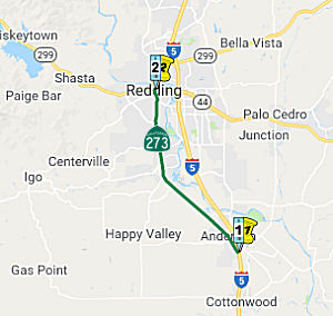
In 1967, Chapter 1584 created Route 273 via transfer from I-5, defining it as “Route 5 near Anderson to Route 5 northeast of Redding via Redding.”
In 1968, Chapter 282 split the route within Redding: “(a) Route 5 near Anderson to Route 299 in Redding. (b) From Route 299 in Redding to Route 5 northeast of Redding.”
During February of 1972, the City of Redding closed Market Street between
Tehama Street and Placer Street to traffic. This segment of
Market Street was subsequently converted into a pedestrian mall that
required Route 273 to be rerouted onto a pair of one-way alignments around
downtown Redding. In 2020, the City of Redding has been working to
reopen Market Street between Tehama Street and Placer Street to traffic.
The impact on Route 273 is unknown at this time.
(Source: Gribblenation Blog (Tom Fearer), "California State Route 273; former US Route 99 through Redding and Anderson", September 2020)
I-5 almost bypassed Redding entirely. Early plans would have had the freeway skirt the town near what is now Redding Municipal Airport. News reports from 1962 say that as many as four routes originally were considered, but residents, city leaders and business owners chose the one nearest to Redding. Cypress Avenue and Hilltop Drive soon became the main pit stops for travelers, leaving many businesses on former Route 99 in south Redding, downtown and the Miracle Mile to wither away.
In 2002, a highway location routing for Route 299 was adopted along Lake Boulevard from Route 273 to I-5. Concurrent with this action, the segment of Route 273 from Route 299 at Market Street to Route 273 at Lake Boulevard will be cosigned Route 273/Route 299.
 Pre 1964 Signage History
This is an original routing for US 99. I-5 is a freeway bypass. This was part of the original LRN 3, defined in 1909.
The original routing of LRN 3 primarily used the routing of the Central
Pacific Railroad frontage roads. Within Redding, the implied route
of LRN 3 bypassed downtown as it crossed the Sacramento River from what is
now Henderson Open Space Park via the 1908 Redding Free Bridge to Smile
Place. From Smile Place, LRN 3 continued west on Parkview Avenue and
turned south on Market Street. During this time, LRN 20 traversed
downtown Redding north on Market Street and west on Eureka Way towards
Weaverville. Within Anderson, LRN 3 followed current Route 273,
Barney Road, and Rhonda Road towards Cottonwood. By 1918, LRN 3 crossing
the Sacramento River on what is Market Street into downtown Redding.
The shift in LRN 3 took the 1908 Redding Bridge out of the State Highway
System for the time and truncated LRN 20 out of downtown Redding.
The new alignment over the Sacramento River departed Market Street north
of downtown Redding and swung westward to a crossing via Riverside Drive.
US 99 was signed over LRN 3 in 1926. In 1938, there was a three phase
project to improve US 99/US 299 (original Route 44)/LRN 3 north of
downtown Redding and the Sacramento River. Phase 1 included the
completion of the 795 foot long plate girder 1935 Sacramento River
Bridge. Phase 2 included a new direct alignment of US 99/US 299/LRN 3 on Market Street from the north bank of the Sacramento River to Sulpur
Creek that was completed in December 1935. Phase 3, completed during
July 1937 between Sulpur Creek and Boulder Hill, included a new
interchange where US 299/LRN 28 split towards Alturas. In 1950, a new four
lane expressway alignment of US 99/LRN 3 between Cottonwood and Anderson
replaced what is now Main Street, Rhonda Road, and Barney Road between
Cottonwood north to Anderson with a grade that lines up with I-5 between
Exits 665 north to Exit 667 and modern Route 273 north to Anderson Creek.
In 1964, planning began for a bypass around Redding that would be part of
I-5; this was budgeted for 1965-1967.
(Source: Gribblenation Blog (Tom Fearer), "California State Route 273; former US Route 99 through Redding and Anderson", September 2020)
In 2007, an effort was begun to have this segment signed as "Historic Route 99". The groups hope to have the black-and-white historical Route 99 signs up by October. They'll be placed from North Market Street in Redding down to where Interstate 5 meets Highway 273 south of Anderson.
 Status
Envision 273
In January 2017, it was reported that Route 273 is
getting another close look from the California Department of
Transportation. Officials have been talking to local transportation,
police, fire and public health departments, hospitals, schools and the
Good News Rescue Mission. They also want to hear from the public and will
hold three workshops to get feedback on how to make the route better for
anyone who drives, walks or bikes. This comes after preliminary collision
figures show 2015 — the most recent available — was the
deadliest year for people who traveled on Route 273. Of 28 reported
collisions on the corridor stretching from north Redding to Anderson,
seven people were killed and 37 were injured, according to data compiled
by the University of California, Berkeley Transportation Injury Mapping
System. Alcohol and unsafe speed played a role in more than half of the
collisions in 2015. Poor lighting was a factor in a quarter of the cases.
Two pedestrians were killed crossing the street and a third was killed
while walking on the road and its shoulder, perhaps highlighting the lack
of sidewalks in parts of the corridor and the prevalence of pedestrians
who dart from one side of the road to the other, particularly in south
Redding. Over the past three years, three safety projects on Route 273
caught the attention of those who use the corridor. It started with the
reduction in southbound lanes and addition of bike lanes in downtown
Redding. Caltrans also added a crosswalk for pedestrians trying to get to
the Rescue Mission. Last year, crews put in sidewalks on the east side of
the road from Parkview Avenue to Grange Street.
(Source: Redding Record Searchlight, 1/23/2017)
In April 2023, it was reported that public open houses
were being held for Envision 273. Envision 273 is a
collaborative, multi-year planning effort to develop recommendations for
infrastructure improvements that support safety and mobility for everyone,
beginning with an understanding of our local challenges, and needs. The
Route 273 corridor connects the cities of Redding and Anderson and serves
numerous outlying rural communities through feeder streets and roads.
Despite significant changes in land use and population along the corridor
over the decades, the transportation facility remains largely unchanged
since it was renumbered from US 99 following completion of I-5. The formal
project was initiated in February 2023, and as of April 2023, was in the
data collection and public engagement phase. The intent is to adopt some
complete street notions along the corridor. Complete Streets improvements
aim to accommodate mobility options for people of all ages and abilities
and for all modes of travel, including driving, walking, biking, and
taking transit.
(Source: Envision 273 Project Page, 5/14/2023)
In June 2021, it was reported that CalTrans has begun work on a project
at the intersection of Route 273 and Girvan Road (SHA 11.565). CalTrans
plans to create a flat railroad crossing that will also include a new bus
stop, removal of the sidewalk gap on Eastside Road, improving the
intersection, and widening the lanes to current standards. They will also
install a trail between Westside Road and Canyon Road. The traffic signal
will be deactivated and access to Girvan and Westside roads will be
blocked. The total cost of the project is $5.6 million.
(Source: Action News Now, 6/14/2021)
 Named Structures
 In the right of way for Route 273 in Shasta County is
the "CHP Officer George W. Redding Memorial". On August 17, 1988,
CHP Officer George W. Redding, died in the line of duty as a result of
injuries sustained when struck by a utility pole guy wire while
investigating a traffic collision on Route 273. Officer Redding joined the
CHP in January 1966, graduated from the patrol academy and was assigned to
the San Leandro area on May 25, 1966. He transferred to the Redding area
on September 15, 1969. He demonstrated steadfast and selfless dedication
to the citizens of the State of California, and was commiteed to the
safety of the motoring public. Named by Senate Concurrent Resolution 86,
Chapter 126, on August 21, 2002.
In the right of way for Route 273 in Shasta County is
the "CHP Officer George W. Redding Memorial". On August 17, 1988,
CHP Officer George W. Redding, died in the line of duty as a result of
injuries sustained when struck by a utility pole guy wire while
investigating a traffic collision on Route 273. Officer Redding joined the
CHP in January 1966, graduated from the patrol academy and was assigned to
the San Leandro area on May 25, 1966. He transferred to the Redding area
on September 15, 1969. He demonstrated steadfast and selfless dedication
to the citizens of the State of California, and was commiteed to the
safety of the motoring public. Named by Senate Concurrent Resolution 86,
Chapter 126, on August 21, 2002.
(Image source: California Assn of Highway Patrolmen)
 Lyon") The Sacramento River Bridge (06-0014, SHA 017.08) located on Route 273 as it crosses the Sacramento River into downtown in
the City of Redding is named the Redding Police Officer Owen
“Ted” Lyon Memorial Bridge. It was named in memory of
Police Officer Owen “Ted” Lyon,born in 1931, in Socorro, New
Mexico. He graduated from Red Bluff High School in 1949 and went on to
junior college for one and one-half years to study electrical engineering.
He worked for the Paul Bunyan Lumber Company in Anderson, California, from
April 1957 to September 1961, inclusive. On September 7, 1961, he joined
the Redding Police Department. Officer Lyon was killed in the line of duty
on May 18, 1967. He and his partner, Jon Kelbaugh, had responded to the
address of 1047 Gilbert Street in the City of Redding on a domestic
violence incident where it had been reported that a drunk man had been
fighting with his wife in an apartment and had threatened her with a gun.
As both officers approached the front door on foot, a man stepped out from
behind the door firing a .32 caliber handgun and Officer Lyon was shot in
the abdomen by the suspect and fell to the ground still holding his
service weapon and Officer Kelbaugh was also shot in the abdomen and the
back. After retreating, Officer Kelbaugh, who survived the assault engaged
the suspect in a gun battle using a shotgun and the suspect was killed.
Officer Kelbaugh loaded Officer Lyon into a police unit and drove him to
the Redding Medical Center where he died approximately 24 hours later.
Officer Lyon was 35 years of age, had six years of service with the
Redding Police Department. Many officers from the Redding Police
Department and the Shasta County Sheriff’s Department responded to
the hospital to donate blood and nearly 60 pints of blood were collected
in an effort to save the life of Officer Lyon. On September 18, 2012, the
Redding City Council unanimously approved authorization for the Redding
Police Department to proceed with this request to create the Redding
Police Officer Owen “Ted” Lyon Memorial Bridge. Named by
Senate Concurrent Resolution 13, August 29, 2013. Resolution Chapter 86.
The Sacramento River Bridge (06-0014, SHA 017.08) located on Route 273 as it crosses the Sacramento River into downtown in
the City of Redding is named the Redding Police Officer Owen
“Ted” Lyon Memorial Bridge. It was named in memory of
Police Officer Owen “Ted” Lyon,born in 1931, in Socorro, New
Mexico. He graduated from Red Bluff High School in 1949 and went on to
junior college for one and one-half years to study electrical engineering.
He worked for the Paul Bunyan Lumber Company in Anderson, California, from
April 1957 to September 1961, inclusive. On September 7, 1961, he joined
the Redding Police Department. Officer Lyon was killed in the line of duty
on May 18, 1967. He and his partner, Jon Kelbaugh, had responded to the
address of 1047 Gilbert Street in the City of Redding on a domestic
violence incident where it had been reported that a drunk man had been
fighting with his wife in an apartment and had threatened her with a gun.
As both officers approached the front door on foot, a man stepped out from
behind the door firing a .32 caliber handgun and Officer Lyon was shot in
the abdomen by the suspect and fell to the ground still holding his
service weapon and Officer Kelbaugh was also shot in the abdomen and the
back. After retreating, Officer Kelbaugh, who survived the assault engaged
the suspect in a gun battle using a shotgun and the suspect was killed.
Officer Kelbaugh loaded Officer Lyon into a police unit and drove him to
the Redding Medical Center where he died approximately 24 hours later.
Officer Lyon was 35 years of age, had six years of service with the
Redding Police Department. Many officers from the Redding Police
Department and the Shasta County Sheriff’s Department responded to
the hospital to donate blood and nearly 60 pints of blood were collected
in an effort to save the life of Officer Lyon. On September 18, 2012, the
Redding City Council unanimously approved authorization for the Redding
Police Department to proceed with this request to create the Redding
Police Officer Owen “Ted” Lyon Memorial Bridge. Named by
Senate Concurrent Resolution 13, August 29, 2013. Resolution Chapter 86.
(Image source: Redding PD on Facebook)
 Business Routes
 Some reports indicate that this route was once signed as Business Route I-5 in its entirety. Recent reports indicate it is signed as Route 273.
 Other WWW Links
 Statistics
Overall statistics for Route 273:
 Pre-1964 Legislative Route
In 1959, Chapter 1062 defined LRN 273 as “[LRN 60] near Huntington Beach to [LRN 179] near Santa Ana”. This is the part of present-day Route 57 from Route 1 near Huntington Beach to Route 22 near Santa Ana.
© 1996-2020 Daniel P. Faigin.
Maintained by: Daniel P. Faigin
<webmaster@cahighways.org>.
 From Route
 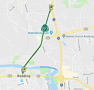 From Route
  Route 272
 Route 274