
 California Highways:
Click here for a key to the symbols used. An explanation of acronyms may be found at the bottom of the page.
 Routing
 Post 1964 Signage History
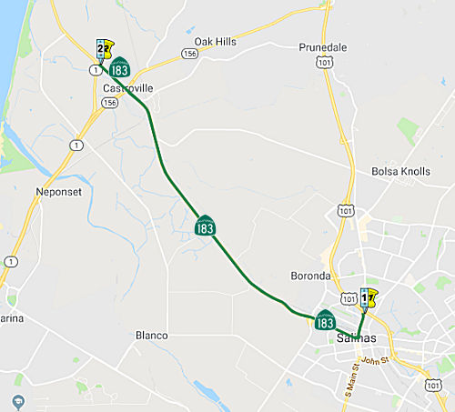
▸As defined in 1963, this route was "Route 101 near Salinas to Route 1 near Castroville." It may not have been signed until 1969.
 In 1974, the CHC declared its intention to rescind the freeway adoption of Route 183: a
8.4 mi segment from Route 1 near Castroville to US 101 near Salinas.
In 1974, the CHC declared its intention to rescind the freeway adoption of Route 183: a
8.4 mi segment from Route 1 near Castroville to US 101 near Salinas.
(Source: The Californian, 9/23/1974 via Joel Windmiller, 2/25/2023)
Until the early 1980s, Route 1 entered Castroville from the south via Route 156 eastbound (the current freeway), then exited at the diamond interchange for Merritt Street and continued northwest via Merritt. However, by the mid-1980s, the current Castroville bypass was constructed; as a consequence, the portion of freeway on Route 1 between Merritt Street and the bypass became an extension of Route 156, and Merritt Street became part of Route 183.
▸In 1992, Chapter 1243 clarified the definition "Route 101 near
in Salinas to Route 1 near Castroville."
▸In 2020, Chapter 83 authorized relinquishment to the City of Salinas the portion of Route 183 within its jurisdiction by renumbering the route definition as clause (a), and adding the following:
 Pre 1964 Signage History
This route (up to old US 101, now Business Route 101) was LRN 118, defined in 1933. It appears to have been unsigned before 1964. The portion along Main Street in Salinas is former US 101 (Business Route 101), and was LRN 2.
Route 183 was not defined as part of the initial state signage of routes in 1934. It is unclear what (if any) route was signed as Route 183 between 1934 and 1964.
Originally Route 1/LRN 56 northbound entered Castroville via Preston Road
where it turned left at Merritt Street. Route 156/LRN 22 westbound entered
Castroville by way of an at-grade crossing of the Southern Pacific
Railroad from Castroville Boulevard onto Salinas Street. Route 156/LRN 22
made a right had turn on Merritt Street and met Route 1/LRN 56 at Preston
Road. Route 183/LRN 118 northbound entered Castroville on Merritt Street
and terminated at Route 156/LRN 22 at Salinas Street.
(Source: Gribblenation Blog: Historic Highway Alignments in Castroville (CA 1, CA 156 and CA 183))
 Naming
 The portion of Route 183 from US 101 (183 MON 0.0) to
Davis Road (approx 183 MON R1.908) in the City of Salinas in the County of
Monterey as the "United States Army Specialist Vilmar Galarza
Hernandez Memorial Highway". It was named in memory of United
States Army Specialist Vilmar Galarza Hernandez, 21 years of age, from
Salinas, California, and an Everett Alvarez High School graduate, who was
killed in action in Kandahar Province, Afghanistan, on May 26, 2012, and
received the Purple Heart and the Bronze Star. Named by Senate Concurrent
Resolution (SCR) 57, Res. Chapter 21, 3/9/2018.
The portion of Route 183 from US 101 (183 MON 0.0) to
Davis Road (approx 183 MON R1.908) in the City of Salinas in the County of
Monterey as the "United States Army Specialist Vilmar Galarza
Hernandez Memorial Highway". It was named in memory of United
States Army Specialist Vilmar Galarza Hernandez, 21 years of age, from
Salinas, California, and an Everett Alvarez High School graduate, who was
killed in action in Kandahar Province, Afghanistan, on May 26, 2012, and
received the Purple Heart and the Bronze Star. Named by Senate Concurrent
Resolution (SCR) 57, Res. Chapter 21, 3/9/2018.
(Image source: The Californian)
 The portion of Route 183 from Davis Road (approx 183 MON R1.908)
to Espinosa Road (approx 183 MON R7.642) in the City of Salinas in the
County of Monterey is named the "United States Army Chief Warrant
Officer 2 Edward Balli Memorial Highway". It was named in memory of
United States Army Chief Warrant Officer 2 Edward Balli, 42 years of age,
from Salinas, California, and a North Salinas High School graduate, who
was killed in action in Kandahar Province, Afghanistan, on January 20,
2014, and received two Bronze Stars for his service in Iraq and
Afghanistan. Named by Senate Concurrent Resolution (SCR) 57, Res. Chapter
21, 3/9/2018.
The portion of Route 183 from Davis Road (approx 183 MON R1.908)
to Espinosa Road (approx 183 MON R7.642) in the City of Salinas in the
County of Monterey is named the "United States Army Chief Warrant
Officer 2 Edward Balli Memorial Highway". It was named in memory of
United States Army Chief Warrant Officer 2 Edward Balli, 42 years of age,
from Salinas, California, and a North Salinas High School graduate, who
was killed in action in Kandahar Province, Afghanistan, on January 20,
2014, and received two Bronze Stars for his service in Iraq and
Afghanistan. Named by Senate Concurrent Resolution (SCR) 57, Res. Chapter
21, 3/9/2018.
(Image source: The Californian)
 Freeway
[SHC 253.1] Entire route. Added to the Freeway and Expressway system in 1959. This routing would've begun near the current US 101/Boronda Road interchange and headed north. This routing would have been to the opposite shore of the Salinas River as the current Route 183; it would've split outside of Salinas (unlike the current route, which begins along Business Route 101) and intersected Castroville north of town after crossing the Tembladero Slough, going over the Southern Pacific tracks northwest of Route 156.
 Other WWW Links
 Statistics
Overall statistics for Route 183:
 Pre-1964 Legislative Route
In 1933, Chapter 767 added the route from "[LRN 60] near Seal Beach to [LRN 2] near Santa Ana" to the state highway system. In 1935, this was added to the highway code with that definition. This may have been a routing along Westminster Avenue.
In 1951, Chapter 1562 deleted this route.
In 1961, Chapter 1247 added a new definition of LRN 183: "[LRN 83] near Canyon Dam to [LRN 29] near Westwood"
This route ran from Route 89 near Canyon Dam to Route 36 near Westwood. This is present-day Route 147.
© 1996-2020 Daniel P. Faigin.
Maintained by: Daniel P. Faigin
<webmaster@cahighways.org>.
 From Route
  Route 182
 Route 184