
 California Highways:
Click here for a key to the symbols used. An explanation of acronyms may be found at the bottom of the page.
 Routing
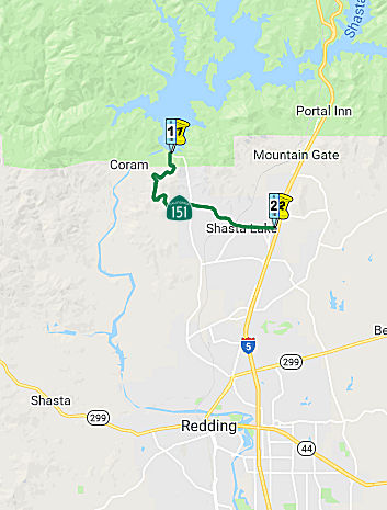 From Shasta Dam to Route 5 near the City of Shasta Lake..
 Post 1964 Signage History
In 1964 Toyon (one of the company towns established during the construction of Shasta Dam) disbanded and was turned over to the Job Corps. In 1993 the communities of Central Valley, Pine Grove, Project City, and Summit City consolidated into the incorporated City of Shasta Lake.
In 2010, SB 1318, Chapter 421, 9/29/10, changed the terminus of the definition to "Route 5 near the City of Shasta Lake."
 Pre 1964 Signage History
This route was first defined in 1939; it was not formally assigned a legislative route number until 1943. It was not signed before 1964.
Route 151 was not defined as part of the initial state signage of routes in 1934.
The highway was added to accommodate heavy truck traffic to Shasta Dam,
and first appears as LRN 209 on the 1940 Division of Highways Map.
LRN 209 would not be formalized as a Legislative Route until 1943
Legislative Chapter 964. Note; the 1940 Division of Highways Map
shows LRN 209 ending at the site of Shasta Dam but the road continuing to
the site of Kennett on the Sacramento River.
(Source: Gribblenation Blog, "California State Route 151", September 2020)
The Gribblenation Blog "California State Route 151" provides a detailed history of Shasta Dam.
It is unclear what (if any) route was signed as Route 151 between 1934 and 1964.
 Scenic Route
[SHC 263.1] Entire route.
 Other WWW Links
 Statistics
Overall statistics for Route 151:
 Pre-1964 Legislative Route
In 1933, Chapter 767 defined the route from "[LRN 2] near Rincon to [LRN 79] near Santa Paula" as part of the highway system. In 1935, this route was added to the highway code as LRN 151 with that definition. The definition remained unchanged until the 1963 renumbering.
The route ran from US 101 near Rincon (roughly Rincon Beach Park, just below Carpinteria) to Route 126 near Santa Paula. This is present-day Route 150.
© 1996-2020 Daniel P. Faigin.
Maintained by: Daniel P. Faigin
<webmaster@cahighways.org>.
 Route 150
 Route 152