
 California Highways:
Click here for a key to the symbols used. An explanation of acronyms may be found at the bottom of the page.
 Routing
 Post 1964 Signage History
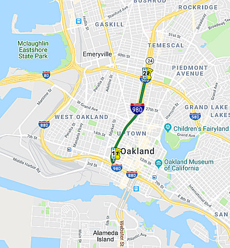
▸In 1981, Chapter 292 defined this route by transfer from Route 24: "Route 17 in Oakland to Route 580."
▸In 1986, Chapter 928 changed "Route 17" to "Route 880"
▸In 1988, Chapter 106 clarified the routing: "Route 880 in
Oakland to Route 580 in Oakland".
 Chris Sampang indicated that this might have originally been a possible
connector to the Southern Crossing. This is confirmed by the map to the
right (click on the map for a larger image). The map, from The
Southern Crossing: A Brief Report (more photos on the photostream) shows Route 980 continuing south to connect with the
I-280/I-380 Southern Crossing. See the page on I-380 for details on the
Southern Crossing
Chris Sampang indicated that this might have originally been a possible
connector to the Southern Crossing. This is confirmed by the map to the
right (click on the map for a larger image). The map, from The
Southern Crossing: A Brief Report (more photos on the photostream) shows Route 980 continuing south to connect with the
I-280/I-380 Southern Crossing. See the page on I-380 for details on the
Southern Crossing
 Pre 1964 Signage History
This route was LRN 226, defined in 1959, and was signed as part of Route 24 between 1964 and 1984.
There are two aspects to the freeway: The connection through Oakland proper (between I-580 and I-880), and the potential connection to a bridge connecting the East Bay to San Francisco.
With respect to the bridge aspects, the impetus for the freeway first emerged in 1927, when engineers identified a number of routes for a possible bridge connecting the East Bay to San Francisco, according to Connect Oakland, a group that formed in 2014 to advocate for the freeway’s removal. Although planners ultimately chose the current alignment, which knits West Oakland to Yerba Buena Island and San Francisco, planners began considering a second crossing almost as soon as the Bay Bridge opened. By 1948, municipal leaders were mulling a second transbay crossing connecting Castro and Grove streets in Oakland with Army Street in San Francisco. The idea was to build a connection from the Grove-Shafter Freeway, known today as Route 24, with a new bridge. That bridge never materialized.
As for the crossing in Oakland: there is a connection to a historic use
of freeways to divide and segregate communities. The Federal Housing
Administration, created in 1934, insured mortgages covering eighty percent
of the cost of a house — but only in all-white neighborhoods. They
judged as risky -- and used a practice known as red-lining -- for
properties in racially mixed neighborhoods or even in white neighborhoods
near black ones that might possibly integrate in the future. An FHA
underwriting manual notes that highways were “effective in
protecting a neighborhood and the locations within it from …
inharmonious racial groups.” Miami, Los Angeles, and other big
cities routed freeways to cordon off, or pave over, minority
neighborhoods. The double-decker Cypress Freeway plowed through the middle
of West Oakland in the 1950s, and another freeway was planned (but not
constructed) that would mark a firm line between white Oakland, and black
West Oakland — I-980. But by the time construction started in the
1960s, things were starting to change. The Civil Rights Movement was
gaining traction, the courts were ruling that segregation could no longer
be government policy, and the Black Panther Party was rising up in West
Oakland. The freeway would no longer divide white and black residents
because black people had already moved into the rest of Oakland at that
point. Construction started in 1962, and soon bulldozers began clearing a
path through Oakland. Demolition crews knocked down houses, setting off
protests, but there wasn’t much activists could do. However, in
1972, a young lawyer named Stephen Berzon, funded by President
Johnson’s Legal Services Program, came up with an idea for a
lawsuit. It wasn’t enough to relocate people, he argued; the
California Department of Transportation also needed to replace the housing
it tore down. A federal judge agreed with Berzon and gave him the
injunction he sought, stopping the earth movers. The project sat in limbo
for years, with the construction site acting as a parking lot for heavy
equipment. People from the neighborhood told Berzon they didn’t
necessarily want to stop the freeway, they just wanted decent homes. A
freeway would be better than what the earth movers left behind. In
1973, Roger Clay Jr., a young attorney living in West Oakland, began
working with Berzon. Berzon worked to make sure that the government built
new housing and honored the city’s promises to keep his
clients’ rents low. This led to the community shaping the design of
the freeway, and is why the freeway was constructed as an depressed
roadway instead of elevated. That way, it wouldn’t form as much of a
barrier and so that the earthen sidewalls would contain some of the noise
and pollution. It is also why the first two miles are elevated (pre-1972
construction), and the end is elevated (to connect with I-880).
(Source: SF Streetsblog, 4/17/2019)
In the end, Oakland removed 503 homes, 22 businesses, four churches and
155 trees to make way for a speedier connection to downtown.
(Source: Connect Oakland)
 Status
Removal of I-980
In November 2015, a community movement surfaces that
wants to remove I-980. The argument is that I-980 is the lowest traffic
segment of urban freeway in Oakland, and the most valuable land (whether
from a community or commercial perspective) taken up by a freeway.
Removing it will reunite historic West and downtown Oakland. The cause is
being chapioned by "Connect Oakland" and John King, the urban design
critic of the SF Chronicle. According to King, the plan would replace the
freeway with "a boulevard lined with housing at all price levels,
reknitting the urban landscape." The proposal could also "include space
for BART beneath the boulevard, a tunnel that could connect to a second
BART tube from Oakland to San Francisco." King describes Octavia Boulevard
in San Francisco, for example, as a comparable example for the future
direction of Connect Oakland. The proposal has been pressed "for the past
year by a handful of local architects and planners with good intentions
but little clout," reports King, but city recently moved the idea into a
new level of legitimacy when it requested "requested $5.2 million from the
Alameda County Transportation Authority to begin planning studies of an
I-980 conversion and a second BART tube."
(Sources: Planetzen, 11/17/2015; Neighborland; SF Chronicle, 11/14/2015 (paywalled))
In January 2017, it was reported that the Congress for
the New Urbanism had released a report highlighting I-980 on its
“top 10” list of urban freeways across the country that they
say serve as a blight to the communities they bisect. The call echoes
those of local advocacy groups, as well as the city of Oakland, which is
studying the freeway’s conversion to a boulevard as part of its
$2.35 million downtown specific plan. The plan will create guidelines for
future development in the heart of the city. Completed in 1985, the
roughly two-mile stretch of freeway runs from its intersection with
Interstate 880 near Jack London Square to its nexus with Highway 24 near
the I-580 interchange, blanketing more than 40 city blocks. As in many
communities across the country, the construction of urban freeways
devastated West Oakland, severing neighborhoods, isolating communities and
plunging the neighborhood into several decades of decline. But some social
justice advocates have mixed views about whether removing the freeway now
would heal the economic wounds of decades past. As of 2017, the highway is
underutilized, reaching only 41.9 percent capacity at its peak, with
average levels much lower, according to a UC Berkeley study of the
corridor. Connect Oakland, along with the city of Oakland, proposes
removing the freeway to its intersection with Grand Avenue, where traffic
volumes peak at just over 27 percent of the roadway’s intended
capacity. The freeway carries no freight traffic and does little to
augment the regional freeway network. Transforming the freeway into a
boulevard could net the city 17 new acres of publicly-controlled land,
creating a dozen connections between West Oakland and downtown where there
are currently five. Removing the freeway would remove a barrier to Jack
London Square, better connecting that neighborhood with both downtown and
West Oakland, said Chris Sensenig, the founder of Connect Oakland. City
officials also see the corridor as a possible route for a second transbay
tube crossing for BART, Caltrain and high-speed rail, Sensenig said. The
below-grade route could be built at the same time the freeway is converted
into a boulevard, or, because that project is likely decades away, it
could create a space underground for the transit lines, when and if that
project comes to fruition. BART included funds in its $3.5 billion bond
measure, which voters approved in November 2016, for a possible study of a
second transbay tube, an idea that has germinated in regional
transportation circles for decades.
(Source: Mercury News, 1/30/2017)
However, the community is not completely on-board with
removal of I-980. The historical argument for getting rid of it assumes
the freeway is a legacy of mid-century attempts to build barriers around
white middle-class neighborhoods, or as a wrecking ball to replace
“urban blight.” That’s true of several major freeways,
but the story of I-980 isn’t so clear cut. By the time the state of
California finally finished building it in 1985, the residents of West
Oakland had come on board. At that point, the community wanted this
freeway. Today, some of those same residents find themselves wary of
another major public works project in their backyard. And that means
activists’ best intentions are colliding with a community that might
prefer to be left alone. In West Oakland, reactions ranged from skepticism
to outright scorn. To comprehend why old timers from this historically
black neighborhood are so dubious, you have to understand two seemingly
conflicting things: that West Oakland has been repeatedly screwed over by
infrastructure projects and that the history of I-980 freeway deviates
from that pattern. Some of the people who initially balk at the idea of
tearing up the freeway become more interested after they consider what
could replace it. Over the past few years, Oakland’s city government
has been holding meetings on the future of the 980 corridor to capture
what residents want. Residents have turned up at the meetings with lots of
ideas for better uses of the land, like bus lanes, parks, and affordable
housing. Some see the response as an encouraging sign: People in the
community may embrace the idea of replacing the freeway, if they get to
choose what comes next.
(Source: SF Streetsblog, 4/17/2019)
In May 2021, it was reported that, the $2.3 trillion
infrastructure proposal President Joe Biden rolled out in Spring 2021
includes $20 billion in funding for projects to “reconnect
neighborhoods cut off by historic investments,” which his
administration argues would be a step toward correcting the Interstate system’s history of tearing through and segregating Black and Latino
neighborhoods in cities across the country. Additionally, Congress is also
considering funding for freeway removal projects as part of a separate
federal highway bill. Further, Senate Democrats have proposed legislation
to create a federal grant program that would award money to those
projects; in a statement touting the bill, California Sen. Alex Padilla
singled out I-980 as a potential candidate. In 2017 the freeway was named
in the top 10 list of urban freeways to tear down in a report by the The
Congress for the New Urbanism, which described I-980 as a blight on the
community. Caltrans, which hasn’t taken a position on the
freeway’s future, is seeking funding for a study that would consider
turning it into a surface street, among other potential changes. The
short, sunken 2-mile I-980 was completed in 1985 and bisects Oakland's
downtown, separating the city’s busy Broadway and Telegraph
corridors from the largely Black and working-class neighborhoods of West
Oakland. The freeway has long been criticized for ruining West Oakland,
isolating the historic neighborhood, and sending it into several decades
of decline. The concern is acute in West Oakland, which was split in two
for decades by both I-980 and the double-decker Cypress freeway section of
I-880. There are no exact plans for what would be built on the I-980 site
at this point. How the project unfolds also depends on BART, which
envisions building a second transbay crossing that could use the freeway
route for a path through Oakland. If removal is approved (and that's a
large "if"), it will take a decade — if not much longer — for
a new streetscape to take the freeway’s place. The plan endorsed by
Oakland Mayor Libby Schaaf and Connect Oakland would convert the southern
half of I-980 — between I-880 and Grand Avenue — from a
freeway to a four-lane surface street, much like Octavia Boulevard along
San Francisco’s former Central Freeway route. The northern half of
I-980 above Grand Avenue would stay essentially the same. But the ultimate
question is: who would benefit from this change? Reconnecting the
community would not necessarily benefit the black residents of Oakland. As
more White and well-off residents move into new apartment buildings
downtown and historic Victorians in West Oakland — and while many
long-time Black residents struggle to stay amid the Bay Area’s
housing crisis — there is deep skepticism about the plans.
“It’s going to appear like now you’re doing this to
bring new people to Oakland, who are going to be White,” said Roger
Clay Jr., a retired attorney who filed a federal lawsuit that held up the
freeway’s construction in the 1970s. “You’re not doing
this for people who live here now.” Clay represented the people who
lived in the 503 homes that were torn down or moved to make room for the
freeway. His lawsuit delayed construction until Caltrans agreed to build
replacement housing for people being displaced and to change the
freeway’s design from an elevated structure that would roar overhead
to the trench drivers pass through today, limiting noise in the
surrounding neighborhoods. He said the neighbors were mostly satisfied
with the compromise. Clay also worries about the question that faces every
freeway removal effort: More than 100,000 cars passed through Interstate 980 per day before the pandemic, according to Caltrans – can a
surface street handle that many drivers? [And, if one looks at the
concerns coming from the I-710 corridor efforts, there will be
environmental issues related to particulate matter from the removal as
well]
(Source: $Mercury News, 5/11/2021; SFGate, 5/12/2021)
In February 2023, it was reported that the city of
Oakland and Caltrans received $680,000 in federal money to study ways to
reconnect areas divided by I-980. A range of options will be considered
for using or crossing the I-980 corridor. Caltrans officials said all
options are on the table including demolishing the freeway. Caltrans plans
to hire a consultant this year to study the options for crossing or using
the corridor it expects the study will take two to four years to complete.
The funding is part of the Reconnecting Communities Pilot program through
the U.S. Department of Transportation. The other cities receiving funds
are San Jose, Long Beach, Pasadena and Fresno. The pilot program was
established in the nation's Bipartisan Infrastructure Law, which passed in
2021. Construction on I-980 began in the 1960s, but wasn’t completed
until 1985. The roughly 2-mile stretch was meant to provide East Bay
motorists taking I-580 and Route 24 with a direct connection to I-880,
past the Oakland airport to San Jose. For many, I-980 is the quickest
route to Jack London Square. But the highway project led to the
destruction of over 500 homes, nearly two dozen businesses and several
churches. While planners had envisioned a connection to a second transbay
bridge linking San Francisco to Route 24, that span was never built. Past
efforts to convert the highway to a tree-laden city street have
consistently fallen short. Even a project included in President Joe
Biden’s $2.3 trillion infrastructure proposal in 2021 was later left
out of the approved spending package.
(Source: CBS Bay Area, 2/24/2023; East Bay Times, 2/28/2023)
In October 2023, it was reported that Caltrans plans to
start holding public information meetings in January 2024 to
“identify a new concept and vision for transportation and land
use” of the freeway. Once they’ve gotten input from the
public, Caltrans will study the viability of different ideas. This is
expected to happen in the fall of 2026. There are many options for the
I-980’s future. It could be ripped out entirely, kept as is, or even
capped and turned into a bigger version of New York’s High Line
park. At this stage, Caltrans’ Vision 980 team said they
don’t want to influence the public about what kinds of ideas are
more realistic or what would be a better use for the freeway. I-980 was
built as a potential connector to a second Bay Bridge, but a second
crossing was never constructed. Oakland residents were divided from the
start about the freeway, with many people who lived in downtown and West
Oakland opposing it. Many people have said for decades that it was a
mistake to build it. Some Oakland residents do not support the removal of
I-980. They say new housing development near downtown would reinforce
gentrification. Many Black residents generally mistrust the impacts that
changes to major infrastructure can have on their communities.
(Source: Oaklandside, 10/30/2023)
 Exit Information
 Other WWW Links
 Naming
 Route 980 from Route 880 to 17th Street in Oakland
is named the "John B. Williams Freeway". John B. Williams (1917
– October 13, 1976) was a city planner for Oakland in the 1960s and
1970s. He was head of the Oakland Redevelopment Agency and Oakland's
Office of Community Development from 1964 to 1976. Mr. Williams was
responsible for the redevelopment of Oakland's downtown business district,
including the creation of the City Center project. The plaza connecting
City Center with the 12th Street BART station is named for him. Mr.
Williams died of cancer on October 13, 1976, at the age of 59. Named
by Assembly Concurrent Resolution 52, Chapter 61 in 1977.
Route 980 from Route 880 to 17th Street in Oakland
is named the "John B. Williams Freeway". John B. Williams (1917
– October 13, 1976) was a city planner for Oakland in the 1960s and
1970s. He was head of the Oakland Redevelopment Agency and Oakland's
Office of Community Development from 1964 to 1976. Mr. Williams was
responsible for the redevelopment of Oakland's downtown business district,
including the creation of the City Center project. The plaza connecting
City Center with the 12th Street BART station is named for him. Mr.
Williams died of cancer on October 13, 1976, at the age of 59. Named
by Assembly Concurrent Resolution 52, Chapter 61 in 1977.
(Image source: East Bay Yesterday)
I-980 is also known as the "Grove-Shafter Freeway". This name comes from the streets that the freeway paralleled between the Nimitz Freeway (I-880) and the Warren Freeway (Route 13). In the 1980s, Grove Street was renamed Martin Luther King, Jr. Way. Shafter Street runs from MacArthur Boulevard to the Rockridge BART station.
 Interstate Submissions
Approved as 139(a) non-chargeable interstate in July 1976; Freeway.
 Classified Landcaped Freeway
The following segments are designated as Classified Landscaped Freeway:
| County | Route | Starting PM | Ending PM |
| Alameda | 980 | 0.33 | 1.13 |
| Alameda | 980 | 1.17 | 2.04 |
 Freeway
[SHC 253.1] Entire route. Added to the Freeway and Expressway system in 1959.
 Statistics
Overall statistics for Route 980:
 Route 905
 Return to State Routes
© 1996-2020 Daniel P. Faigin.
Maintained by: Daniel P. Faigin
<webmaster@cahighways.org>.
 From Route