
 California Highways:
Click here for a key to the symbols used. An explanation of acronyms may be found at the bottom of the page.
 Routing
 Post 1964 Signage History
In 1963, this route was defined as running “(a) Route 1 near Corona Del Mar to Route 405. (b) Route 405 to Route 5 in Santa Ana via Main Street.”
In 1965, Chapter 1372 deleted segment (b), thus terminating the route at I-405.
Until 1983, this route ran from Route 1 to MacArthur Blvd, and then along MacArthur Boulevard from Route 1 near Corona del Mar to San Diego Creek in Irvine.
In 1983, Chapter 849 changed the origin of the route and modified the routing to be "Route 5 near San Juan Capistrano to Route 405 via the San Joaquin Hills." It also noted that "MacArthur Boulevard from Route 1 near Corona del Mar to San Diego Creek in Irvine shall cease to be a state highway when the Route 73 freeway as described above is completed." This reflected the planned construction of the San Joaquin Hills Toll Road. A 1986 map does show the proposed tollway.
In 2003, Chapter 525 removed the text about the former portion of the route.
 Pre 1964 Signage History
Much of the present routing was defined post-1964. The portion of the current routing from near UC Irvine to I-405 was LRN 184, defined in 1933 (as was the remainder of the since deleted 1963 routing)
By 1934, LRN 184 was state maintained from US 101/LRN 2 in Santa Ana
south via Main Street to LRN 43/Newport Road. LRN 184 was
unconstructed south of Newport Road/LRN 43 over the San Joaquin Hills to
US 101A (future Route 1)/LRN 60 in Corona del Mar. In 1940, funding was
authorized for the "Main Street Extension" of LRN 184 from LRN 43 south to
LRN US 101A/LRN 60. Construction was completed in 1942.
(Source: Gribblenation Blog (Tom Fearer), "California State Route 73", October 2021)
Route 73 was not defined as a signed state route as part of the initial state signage of routes in 1934. It is unclear what (if any) route was signed as Route 73 between 1934 and 1964.
In 1960, it was noted that LRN 184 needed realignment to connect to the
construction of the San Diego Freeway (I-405). The Main Street Extension
of LRN 184 had been adopted as what was considered once a "freeway" by the
California Highway Commission on January 26th, 1940 which led to the
corridor being retained as part of the Freeways and Expressway System.
(Source: Gribblenation Blog (Tom Fearer), "California State Route 73", October 2021)
 Status
In March 2016, the CTC allocated additional funds for a project on Route 73 in Laguna Beach in Orange County at the northbound collector/distributor from the El Toro Road on-ramp to the Laguna Canyon Road (Route 133) offramp (~ ORA 16.356 to ORA 16.796). The project will widen the ramp and modify signals.
The 2020 Capital Improvement Plan for the Transportation Corridor
includes a study for the Glenwood Interchange Project, Phase 2 (~ ORA
15.258), which completes the interchange movements with ramps to and from
Route 73 to the south. The future Phase 3 is an expansion and
reconfguration of the northbound on-ramp from Glenwood and provides for
more intersection and mainline capacity by braiding the northbound on-ramp
with the El Toro Road off-ramp.
(Source: 2020 Fiscal Capital Improvement Plan, 6/13/2019)
In September 2011, it was reported that a request by the California
Department of Transportation (Caltrans) to sign a freeway agreement
related to the road that connects Aliso Viejo to Newport Beach was delayed
at the Sept. 6, 2011 Laguna Beach City Council meeting (~ ORA 16.356 to
ORA 16.796). Laguna Beach officials opposed construction of the roadway
and much of the sentiment against it remains. Route 73 was inherited by
Caltrans from the Transportation Corridor Agency, which constructed it,
but the standard freeway agreement was overlooked in the process,
according to a Laguna Beach staff report. Now, the toll road is being
termed a freeway because it is under Caltrans control. The proposed
agreement imposes no future obligations on the city, according to the
analysis by the city staff. However, there were had questions about
references in the agreement to obligations for future funding and
construction to be dealt with in a separate cooperative agreement, as well
as the acquisition of city streets, frontage roads and other local roads
required for the construction, reconstruction or alteration of the toll
road. Further, the agreement states that the city agreed to the
construction that traverses through the city's jurisdiction from the Aliso
Viejo city limits to the Newport Beach city limits. In fact, Laguna Beach
did not agree to either the construction or the design of the toll road
and was the only city through which Route 73 ran that was not a member of
the TCA. The corridor agency and Caltrans signed an agreement dated April
7, 1995, that said Caltrans would assume maintenance of Route 73 when it
was completed. In May of 1996, the California Transportation Commission
declared the toll road a "freeway."
(Source: LA Times)
MacArthur Offramp Widening (12-Ora-73 23.7/24.1)
In May 2018, the CTC approved for future consideration
of funding the following project for which a Mitigated Negative
Declaration (MND) has been completed: Route 73 in Orange County. Construct
roadway improvements on Route 73 and MacArthur Boulevard in the city of
Newport Beach. (PPNO 4096R) (12-Ora-73, PM 23.95/24.15) This project is
located on Route 73 in the city of Newport Beach in Orange County. The
project proposes to widen the Route 73 southbound off-ramp to MacArthur
Boulevard from one lane to two lanes. Also included in the proposed
project are upgrading bridge rail, construction of retaining walls and/or
guardrails, installation of overhead traffic signals, drainage
improvements, and modification of lighting, ramp metering and the existing
overhead signage. The project proposes to reduce the higher than average
number of collisions on the off-ramp. The proposed project is estimated to
cost $6.5 million in capital construction. The project is fully funded and
is currently programmed in the 2018 SHOPP for $11.4 million which includes
Construction (capital and support) and Right- of-Way (capital and
support). The project is estimated to begin construction in 2020. The
scope, as described for the preferred alternative, is consistent with the
project scope programmed by the Commission in the 2016 and 2018 SHOPP.
(Source: CTC Agenda, May 2018 Agenda Item 2.2c(1))
In May 2020, the CTC was informed of the following
SHOPP safety allocation the occurred in March 2020: $8,878,000 12-Ora-73
23.7/24.1. PPNO 12-4096R ProjID 1214000123 EA 0N860. Route 73 in Newport
Beach, on the Route 73 southbound offramp to MacArthur Boulevard.
Outcome/Output: Improve safety by widening offramp, installing traffic
signal, and upgrading guardrail. This project will reduce the number and
severity of collisions. (Future consideration of funding approved under
Resolution E-18-45; May 2018.) Allocation Date: 03/10/20.
(Source: May 2020 CTC Agenda, Agenda Item 2.5f.(3)
#10)
The 2020 Capital Improvement Plan for the Transportation Corridor
includes a study for study the option of adding one HOV lane in each
direction from MacArthur Boulevard (~ ORA 23.817) to I-405 (~ ORA
R27.902R). TCA as a stakeholder will coordinate with OCTA on this study
including the potential option to add managed lanes on Route 73 between
Bison Avenue (~ ORA 23.423) and Bear Street (~ ORA R27.3) with a tie-in to
the Route 73/I-405 Express Connector to provide managed lane continuity
between the 73 Toll Road and the 405 Express Lanes.
(Source: 2020 Fiscal Capital Improvement Plan, 6/13/2019)
In August 2005, the CTC considered relinquishment of right of way in the City of Irvine, at University Drive South, consisting of reconstructed and relocated city streets (~ ORA 24.325).
In July 2005, the CTC considered relinquishment of right of way in the City of Newport Beach, along Bristol Street and North Bristol Street, from Jamboree Road to Irvine Avenue/Campus Drive (~ ORA R25.592 to ORA 24.763), consisting of frontage roads. It also considered relinquishment of right of way in the County of Orange, along Bristol Street and North Bristol Street, consisting of frontage roads.
In July 2007, the CTC relinquished right of way in the city of Costa Mesa, from 0.4 mile North of Red Hill Avenue (~ ORA R26.093) to the South City Limit (~ ORA R25.829), consisting of reconstructed and relocated city streets. The City, by relinquishment cooperative agreement dated June 4, 2007, waived the 90-day notice requirement and agreed to accept title upon relinquishment by the State.
 Naming
 *TRANSCORR* The portion of this freeway between I-5 and MacArthur
Blvd (~ ORA 10.579 to ORA 23.79) is named the "San Joaquin Hills
Transportation Corridor". It is named because it traverse the San
Jaoquin Hills. San Joaquin is the Spanish pronunciation of Saint Joachim -
the Father of the Virgin Mary.
*TRANSCORR* The portion of this freeway between I-5 and MacArthur
Blvd (~ ORA 10.579 to ORA 23.79) is named the "San Joaquin Hills
Transportation Corridor". It is named because it traverse the San
Jaoquin Hills. San Joaquin is the Spanish pronunciation of Saint Joachim -
the Father of the Virgin Mary.
(Image source: AARoads)
The pre-1983 routing (from Route 1 to Route 405 along MacArthur Blvd) was named the "Veterans Memorial Freeway". It was named by Senate Concurrent Resolution 2 in 1967. This segment is no longer in the state highway system.
The portion of this freeway between MacArthur Blvd and Route 405 (~ ORA 23.79 to ORA R27.735) was named by the "Corona Del Mar Freeway" by the local Caltrans District. The first freeway segment opened in 1977; the last segment in 1996. The named segment traverses the community of Corona Del Mar.
 Classified Landcaped Freeway
The following segments are designated as Classified Landscaped Freeway:
| County | Route | Starting PM | Ending PM |
| Orange | 73 | 10.00 | 10.25 |
| Orange | 73 | 10.75 | 12.15 |
| Orange | 73 | 12.50 | 14.61 |
| Orange | 73 | 15.64 | 17.08 |
| Orange | 73 | 22.24 | 22.56 |
| Orange | 73 | 23.36 | 24.31 |
| Orange | 73 | 24.58 | 27.77 |
 Exit Information
 Other WWW Links
 Freeway
[SHC 253.1] Entire route. Added to the Freeway and Expressway system in 1959.
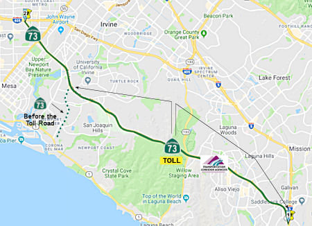
This highway is freeway (no toll) between MacArthur Blvd and I-405.
 This highway is a toll road between MacArthur Blvd and I-5. The
first segment of the tollway, running from Greenfield Drive in Laguna
Niguel to Laguna Canyon road, opened on 24 July 1996. The reminder of the
tollway (between Jamboree Road and Laguna Canyon Road (Route 133) and
between Greenfield Drive and I-5, opened on 21 November 1996. There are
plans to merge the operation of this route with the Foothill Toll Roads
such as Route 241.
This highway is a toll road between MacArthur Blvd and I-5. The
first segment of the tollway, running from Greenfield Drive in Laguna
Niguel to Laguna Canyon road, opened on 24 July 1996. The reminder of the
tollway (between Jamboree Road and Laguna Canyon Road (Route 133) and
between Greenfield Drive and I-5, opened on 21 November 1996. There are
plans to merge the operation of this route with the Foothill Toll Roads
such as Route 241.
 Statistics
Overall statistics for Route 73:
 Pre-1964 Legislative Route
The route that would become LRN 73 was first defined in 1931 by Chapter 82 as the route from Alturas to Oregon State Line near New Pine Creek. In 1933, it was extended from [LRN 28] at Alturas to [LRN 29]. In 1935, it was codified into the highway code as the following route:
“[LRN 29] to the Oregon State Line near New Pine Creek via Alturas”
This definition remained unchanged until the 1963 renumbering. The route was (and is) signed as US 395.
© 1996-2020 Daniel P. Faigin.
Maintained by: Daniel P. Faigin
<webmaster@cahighways.org>.
 From Route
  Route 72
 Route 74