
 California Highways:
Click here for a key to the symbols used. An explanation of acronyms may be found at the bottom of the page.
 Routing
 Post 1964 Signage History
In 1963, this route was defined as "Route 70 near Wicks Corner to Route 99 near Chico."
In 1984, Chapter 409 clarified the terminus to be "… to Route 99 south
of near Chico."
Note that the original plans were for there to be an "East Valley"
corridor, consisting of Route 99 from I-5 north to Route 70, Route 70
north to Route 149, all of Route 149, and Route 99 north through Chico
probably reconnecting to I-5 (although plans north of Chico were shelved
in the 1990s). This was for a Midwest-style expressway with freeway
segments through the significant towns and interchanges at major
intersecting highways. This would have included a freeway bypass of
Marysville, the site of the last in-town surface street routing.
Unfortunately only the segments at the ends of the corridor -- I-5 to
Olivehurst and Oroville to just north of Chico -- were completed as
planned; everything else was cut back to conventional 4-lane commercial
standards (although a largely at-grade bypass of Marysville via the
Feather River berm and making use of the present Yuba River Route 70
bridge is under study as of 2018) due to lack of the funding needed to
acquire significant property between Marysville and Oroville for even an
expressway upgrade.
(Source: Scott Parker (SParker) on AAroads, 3/28/2018)
 Pre 1964 Signage History
This was LRN 87, defined in 1933. It was not signed before 1967.
Route 149 was not defined as part of the initial state signage of routes in 1934. It is unclear what (if any) route was signed as Route 149 between 1934 and 1964.
 Status
Route 149 Freeway Upgrade
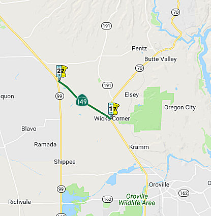
![[Rte 70 near Rte 149 and Rte 191]](maps/070-elsey.jpg) This route is not currently constructed as freeway, but
studies are underway to upgrade it to freeway. Specifically, Route 149 has
been upgraded in Butte County to a four-lane expressway, with interchanges
at the Route 70/Route 149 (~ BUT M0.335) and the Route 99/Route 149 (~ BUT
R4.822) intersections, and a reconstructed Route 70/Route 191
intersection.
This route is not currently constructed as freeway, but
studies are underway to upgrade it to freeway. Specifically, Route 149 has
been upgraded in Butte County to a four-lane expressway, with interchanges
at the Route 70/Route 149 (~ BUT M0.335) and the Route 99/Route 149 (~ BUT
R4.822) intersections, and a reconstructed Route 70/Route 191
intersection.
According to Dominic Ielati, as of July 2006 they were well underway. The worst part of the project, is the destruction of some of the original pavement of the Oroville-Chico Highway, just NE of the Route 99/Route 149 intersection. The Oroville-Chico Highway preceded the current routings of Route 99, Route 149, Route 70 and Table Mountain Blvd as the main route between Chico & Oroville. The Oroville-Chico Highway still exists in name and asphalt between Durham Dayton Highway & Midway (old US 99E). It may be integrated into Openshaw Road (the new section of frontage road on the east side of Route 149) but that section of pavement has sat isolated and disconnected from the road network for probably the last forty years.
By July 2007, some of the fly-overs for the interchanges were nearing completion. Traffic on Route 149 is currently on the newly added lanes as the construction team tears up the 1975 lanes and rebuilds them. One peculiarity is the so-called "Warren-Brown Overcrossing", a one-lane overpass that allows private road access to properties on the south side of Route149.
By November 2007, construction was progressing on the Route 70/Route 149 junction. All four lanes are built and paved for the entire length of the route. On the eastern section of Route 149, all traffic utilizes the future westbound lanes and on the western section, all traffic utilizes the eastbound lanes. The parts of signbridges are sitting near each end of the project on Route 149. They are not assembled and actual signage has not arrived yet. The junction of Route 99 and Route 149 is more complete in terms of the flyovers and new sections of roadway. Left turns are no longer permitted from Route 149 west to Route 99 south, and all Route 99 traffic is now utilizing the new sections of roadway. On SB Route 99, signs and sign bridges are up—thru lanes are marked for Route 149 & "To Route 70". Route 99 south to Yuba City is a two-lane exit including an auxilary lane. On NB Route 99, there is a flyover ramp over the old alignment, with a merge onto that old alignment to continue north. There are no signbridges up on NB Route 99 at this time.
By November 2008, the project was completed well ahead of schedule. The project moves traffic in four lanes on Route 149 between Route 70 and Route 99 with interchanges that funnel traffic onto and off the two highways seamlessly. The widening and interchanges cost $90 million There are also plans to widen Route 70 to 4 lanes from Marysville to the junction of Route 99 in Sutter County. It will also be 4 lanes in the Oroville area and north to the junction of Route 191. About 2 more miles will be widened to 4 lanes immediately south of Oroville.
In July 2010, the CTC authorized relinquishment of right of way on Route 149 on Shippee Road (~ BUT R2.211), consisting of superseded highway and collateral facilities.
 Naming
 The junction between Route 70 and
Route 149 near the City of Oroville, in the County of Butte (~ BUT
M0.335), is named the "Wick's Corner Interchange". This segment was
named in memory of Moses Wick, born in Ohio in 1822. Moses Wick served in
the Mexican War under the command of General Zachary Taylor, who
eventually became President of the United States. In 1852, Moses Wick
moved to California with his wife Maria in a wagon train pulled by his
team of oxen on a journey that took six months. The land in the area of
the current cloverleaf junction between Route 70 and Route 149 was deeded
in 1852 to Moses Wick as a reward for his military service. On September
3, 1852, Moses Wick made a homestead of the 160 acre territory and began
raising cattle as a pioneer cattle rancher. Through purchases and other
land grants, he eventually owned about 800 acres adjacent to "Wick's
Corner". Wick made a modest living as a butcher by selling and supplying
beef to gold miners and merchants in the area. He also used his faithful
team of oxen to haul freight and cargo back and forth to the mines between
Oroville and Sacramento. Moses Wick died in 1888 at the age of 66 years
and was survived by his second wife Roxie Ann, his son Charles, and
daughter Ella Wick Crum. He cattle ranch was operated until his son
Charles sold most of the ranch to Senator Thomas Rockhill in 1906 for
$25,000. The cattle ranch became a tavern and an early stagecoach stop for
the Central Pacific Railroad. Although Wick's historic home was demolished
in 1947, this area continues to be known as "Wick's Corner". The modern
Route 70 was constructed in the 1960s when the former highway was
submerged beneath the rising waters of Lake Oroville. Mrs. Merle
McAndrews, the great granddaughter of both Moses Wick and Senator Thomas
Rockhill, still lives on the property in a portion of one of the original
ranches that was built more than 70 years ago. Named by Assembly
Concurrent Resolution (ACR) 39, Resolution Chapter 71, on 7/3/2007.
The junction between Route 70 and
Route 149 near the City of Oroville, in the County of Butte (~ BUT
M0.335), is named the "Wick's Corner Interchange". This segment was
named in memory of Moses Wick, born in Ohio in 1822. Moses Wick served in
the Mexican War under the command of General Zachary Taylor, who
eventually became President of the United States. In 1852, Moses Wick
moved to California with his wife Maria in a wagon train pulled by his
team of oxen on a journey that took six months. The land in the area of
the current cloverleaf junction between Route 70 and Route 149 was deeded
in 1852 to Moses Wick as a reward for his military service. On September
3, 1852, Moses Wick made a homestead of the 160 acre territory and began
raising cattle as a pioneer cattle rancher. Through purchases and other
land grants, he eventually owned about 800 acres adjacent to "Wick's
Corner". Wick made a modest living as a butcher by selling and supplying
beef to gold miners and merchants in the area. He also used his faithful
team of oxen to haul freight and cargo back and forth to the mines between
Oroville and Sacramento. Moses Wick died in 1888 at the age of 66 years
and was survived by his second wife Roxie Ann, his son Charles, and
daughter Ella Wick Crum. He cattle ranch was operated until his son
Charles sold most of the ranch to Senator Thomas Rockhill in 1906 for
$25,000. The cattle ranch became a tavern and an early stagecoach stop for
the Central Pacific Railroad. Although Wick's historic home was demolished
in 1947, this area continues to be known as "Wick's Corner". The modern
Route 70 was constructed in the 1960s when the former highway was
submerged beneath the rising waters of Lake Oroville. Mrs. Merle
McAndrews, the great granddaughter of both Moses Wick and Senator Thomas
Rockhill, still lives on the property in a portion of one of the original
ranches that was built more than 70 years ago. Named by Assembly
Concurrent Resolution (ACR) 39, Resolution Chapter 71, on 7/3/2007.
(Image sources: Enterprise Record)
 Estes and Deputy William R. (Bill) Hunter") The portion of Rout 149 in Butte County (i.e., the entire route) is named the "Lt. Leonard
B. "Larry" Estes and Deputy William R. "Bill" Hunter Memorial Highway"
This segment was named in honor of Butte County Sheriff's Department Lt.
Leonard B. "Larry" Estes and Deputy William R. "Bill" Hunter. Lieutenant
Leonard B. "Larry" Estes was born June, 10, 1940 and died in the line of
duty July 26, 2001. Lt. Estes joined the Butte County Sheriff's Department
in 1973, worked in patrol for 12 years, and at the Butte Interagency
Narcotics Task Force for four years. He was promoted to sergeant in 1991
and transferred to investigation in 1994. A year later he was promoted to
lieutenant and named chief deputy coroner. In 1998, Lt. Estes was promoted
to assistant sheriff; the highest nonelected position in the department.
Deputy William R. "Bill" Hunter was born November 10, 1974 and also died
in the line of duty on July 26, 2001. Deputy Hunter joined the Butte
County Sheriff's Department in 1998 and had been selected to join the K-9
team. These officers were tragically killed by gunfire in the line of duty
on July 26, 2001, when they were ambushed by a suspect in the Inskip area
of Paradise Ridge. Named by Assembly Concurrent Resolution (ACR) 63,
Resolution Chapter 14, on 4/4/2008.
The portion of Rout 149 in Butte County (i.e., the entire route) is named the "Lt. Leonard
B. "Larry" Estes and Deputy William R. "Bill" Hunter Memorial Highway"
This segment was named in honor of Butte County Sheriff's Department Lt.
Leonard B. "Larry" Estes and Deputy William R. "Bill" Hunter. Lieutenant
Leonard B. "Larry" Estes was born June, 10, 1940 and died in the line of
duty July 26, 2001. Lt. Estes joined the Butte County Sheriff's Department
in 1973, worked in patrol for 12 years, and at the Butte Interagency
Narcotics Task Force for four years. He was promoted to sergeant in 1991
and transferred to investigation in 1994. A year later he was promoted to
lieutenant and named chief deputy coroner. In 1998, Lt. Estes was promoted
to assistant sheriff; the highest nonelected position in the department.
Deputy William R. "Bill" Hunter was born November 10, 1974 and also died
in the line of duty on July 26, 2001. Deputy Hunter joined the Butte
County Sheriff's Department in 1998 and had been selected to join the K-9
team. These officers were tragically killed by gunfire in the line of duty
on July 26, 2001, when they were ambushed by a suspect in the Inskip area
of Paradise Ridge. Named by Assembly Concurrent Resolution (ACR) 63,
Resolution Chapter 14, on 4/4/2008.
(Image source: Butte County Sheriff FB Page)
 Freeway
[SHC 253.1] Entire route. Added to the Freeway and Expressway system in 1959.
 Interregional Route
[SHC 164.17] Entire route.
 Other WWW Links
 Statistics
Overall statistics for Route 149:
 Pre-1964 Legislative Route
In 1933, Chapter 767 defined the route from "Surf to [LRN 80] near Santa Ynez" as part of the highway system. In 1935, this route was added to the highway code as LRN 149, with the same routing. The routing remained unchanged until the 1963 renumbering. This was originally signed as Route 150; in 1961, it was signed as part of Route 154. It is present-day Route 246 between Surf (10 mi W of Lompoc) and Route 154 near Santa Ynez.
© 1996-2020 Daniel P. Faigin.
Maintained by: Daniel P. Faigin
<webmaster@cahighways.org>.
 From Route
  Route 148
 Route 150