
 California Highways:
Click here for a key to the symbols used. An explanation of acronyms may be found at the bottom of the page.
 Routing
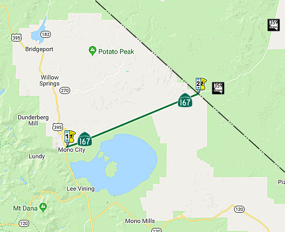 From Route 395 north of Mono Lake to the Nevada state line in the vicinity of the
Pole Line Road.
From Route 395 north of Mono Lake to the Nevada state line in the vicinity of the
Pole Line Road.
 Post 1964 Signage History
This definition is unchanged from the original 1963 routing.
One of the most arrow-straight highways out there is Route 167, from US 395 to the Nevada border north of Mono Lake. Besides its linearity, a
couple of other things about this route are unusual. Originally, it was a
spur route of LRN 40, which comprised Route 120 from Route 108 east to the
Yosemite Park boundary, and then from the Tioga Pass park boundary to US 395, plus the section from US 395 to US 6 (Benton Jct.). About 1953 or so
the "Pole Line" highway was added to the state highway system as an access
road into Nevada (and the U.S. ordinance storage facility at Hawthorne,
NV), connecting with (now) NV 359. What is unusual is that the Division of
Highways, rather than just picking the next number available (in the 200's
by that time) for this route, designated it another section of LRN 40 --
as if they were planning to reroute Route 120 onto that route rather than
the US 395-to-US 6 section, which featured regular winter closures. Of
course, the 1964 renumbering undid such a designation; in their
pull-it-out-of-a-hat '64 style, they renumbered it as Route 167. Recently
the route has been touted as part of the most efficient Los
Angeles-to-Boise route for commercial and recreational traffic -- although
it has not been included in the NHS; a STRAHNET route accomplishing the
same function diverges from US 395 onto US 6 at Bishop, using that route
to NV 360, which functions as a "cutoff" to north US 95, which backtracks
into Hawthorne. But there are more services along US 395 between Bishop
and the Route 167 intersection; probably the reason the Route 167
alternative has gained popularity for regular drivers between L.A. and the
Boise area.
(Source: Scott Parker (SParker) at AAroads, 8/2/2016)
 Pre 1964 Signage History
This route was LRN 40, defined in 1953. It appears not to have been signed by 1963.
Route 167 was not defined as part of the initial state signage of routes in 1934. It is unclear what (if any) route was signed as Route 167 between 1934 and 1964.
 Other WWW Links
 Statistics
Overall statistics for Route 167:
 Pre-1964 Legislative Route
In 1933, the route from "Long Beach via Atlantic Boulevard to [LRN 26] near Monterey Park" was added to the state highway system. In 1935, it was added to the highway code as LRN 167, with the same routing.
In 1947 (1st ex. sess.), Chapter 11 kept the same endpoints, but introduced a discontinuity at (former) Route 245/US 101: "(a) Long Beach to [LRN 166]; (b) (a) above, near Los Angeles River to [LRN 26] via Atlantic Boulevard"
In 1949, Chapter 1467 combined the segments and extend the route to [LRN 205] (Pasadena Freeway): "Long Beach to [LRN 205] in South Pasadena"
In 1951, Chapter 1562 truncated the terminus to Huntington Drive: "… to Huntington Drive."
In 1957, Chapter 1911 extended the origin to [LRN 165] (Harbor Freeway):
“[LRN 165] in San Pedro Long Beach to
Huntington Drive via Long Beach”.
In 1958, Chapter 74 added the San Pedro-Terminal Island Bridge: "[LRN 165] in San Pedro to Huntington Drive via Long Beach, and including a bridge with at least four lanes from San Pedro at or near Boschke Slough to Terminal Island"
In 1959, Chapter 1062 extended to LRN 9: "[LRN 165] in San Pedro to Huntington
Drive [LRN 9] in Pasadena via Long Beach, and
including a bridge with at least four lanes from San Pedro at or near
Boschke Slough to Terminal Island"
This is the route from US 6/Route 11, now I-110, in San Pedro to I-210 in Pasadena via Long Beach. This is present-day I-710 (former post-1964 Route 7; former pre-1964 Route 15) to Pasadena, as well as portions of present-day Route 47 ("Route 167 Freeway-Seaside Freeway").
© 1996-2020 Daniel P. Faigin.
Maintained by: Daniel P. Faigin
<webmaster@cahighways.org>.
 Route 166
 Route 168