
 California Highways:
Click here for a key to the symbols used. An explanation of acronyms may be found at the bottom of the page.
 Routing
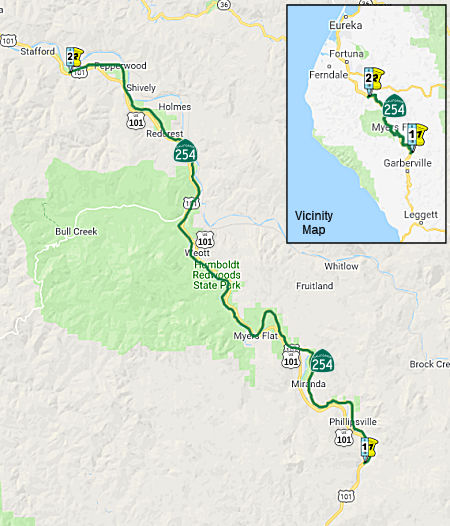 A portion of the former Redwood Highway through and connecting a number of state park
units, from Route 101 near the Sylvandale interchange to Route 101 south
of Stafford.
A portion of the former Redwood Highway through and connecting a number of state park
units, from Route 101 near the Sylvandale interchange to Route 101 south
of Stafford.
 Post 1964 Signage History
This route was added in 1963 by Chapter 890 as “the Avenue of the Giants, comprising a portion of the former Redwood Highway through and connecting a number of state parks, from Route 101 near the Sylvandale interchange to Route 101 near the Redcrest interchange.” A duplication section defining this was added by 1963 Chapter 901, but repealed by 1965 Chapter 155. Note that these chapters also added this route as LRN 296, but that definition did not take effect.
In 1967, Chapter 1331 extended the definition: “the Avenue of the
Giants, comprising a portion of the former Redwood Highway through and
connecting a number of state parks, from Route 101 near the Sylvandale
interchange to Route 101 near the Redcrest interchange one-tenth
of a mile north of Jordan Creek.” This change added the
portion from the Redcrest interchange to one-tenth of a mile north of
Jordan Creek.
In 1968, Chapter 282 relaxed the definition: “the Avenue of the
Giants, comprising a portion of the former Redwood Highway through and
connecting a number of state parks, from Route 101 near the Sylvandale
interchange to Route 101 one-tenth of a mile north of
Jordan Creek.
In 1990, Chapter 1187 clarified the definition: “the Avenue of the Giants, comprising a portion of the former Redwood Highway through and connecting a number of state park units, from Route 101 near the Sylvandale interchange to one-tenth of a mile north of Jordan Creek south of Stafford.” This change added the portion from one-tenth mile north of Jordan Creek to Route 101 south of Stafford.
In 1992, Chapter 1243 relaxed the definition: “the Avenue of the
Giants, comprising a portion of the former Redwood Highway through and
connecting a number of state park units, from Route 101 near the
Sylvandale interchange to Route 101 one-tenth of a mile
north of Jordan Creek south of Stafford.”
This route is a former segment of US-101 that has been bypassed by freeway.
 Pre 1964 Signage History
This was part of LRN 1, defined in 1909.
The Gribblenation Blog "California State Route 254; Avenue of the Giants and former US Route 101" provides more details on this segment. The following is condensed from that presentation:
The July 1916 California Highway Bulletin discusses the construction of 14 miles of the Redwood Highway/LRN 1 from Miranda north to Dyerville. This segment of the Redwood Highway would in decades become part of Route 254/Avenue of the Giants. When US 101 was designated in 1926, it was largely planned to follow the Redwood Highway south from Crescent City towards San Francisco, and US 101 appears on the 1925 Rand McNally Map of California as being routed over the Redwood Highway of Humboldt County. The July 1931 California Highways & Public Works announced the purchase of Coastal Redwoods by the Save the Redwoods League from the Bull Creek and Dyerville Groves which were to be incorporated into Humboldt Redwoods State Park. Humboldt Redwoods State Park had been established previously in 1921. US 101 was stable for many years, modulo storm damage. The March/April 1957 California Highways & Public Works discusses the modernization of US 101/LRN 1 in Humboldt County. The first segment of the Redwood Freeway slated to be constructed was a segment from Englewood south to the vicinity of Dyerville. The Redwood Freeway was planned to continue south from Dyerville to the Mendocino County Line.
By 1959, it was reported that the "Redwood Parks Freeway" recently had a second segment completed from Myers Flat 7.5 miles north to the vicinity of Dyerville. This second segment of the Redwood Parks Freeway connected with the first completed segment that continued another 4.4 miles northward. The recently bypassed portions of US 101 from Myers Flat to the vicinity of Englewood were retained under State Control as a spur of LRN 1, and would form the basis for Avenue of the Giants. In 1960, it was announced that 25 miles of former US 101/LRN 1 north from Miranda would be maintained by the State Division of Parks and Beaches as Avenue of the Giants. Avenue of the Giants was announced on August 27th, 1960 by then Governor Edmund G. Brown. In 1963, Avenue of the Giants was added formally to the State Highway System by Chapter 890 which was duplicated by Chapter 901. Avenue of the Giants was assigned LRN 296, which was replaced by Route 254 for the 1964 Highway Renumbering.
 Status
In August 2016, the CTC approved for future consideration of funding a project on Route 254 in Humboldt County that will upgrade the railings on four bridges on Route 254 near Humboldt Redwoods State Park. Specifically, this project in Humboldt County will upgrade the railings on Ohman Creek Bridge (HUM 000.88), Elk Creek Bridge (HUM 010.43), Bridge Creek Bridge (HUM 010.80), and Bear Creek Bridge (HUM 043.02). The project is programmed in the 2014 State Highway Operation and Protection Program. The total programmed amount is $7,509,000 for capital and support. Construction is estimated to begin in Fiscal Year 2016-17. The scope, as described for the preferred alternative, is consistent with the project scope programmed by the Commission in the 2014 State Highway Operation and Protection Program.
Fish Creek Fish Passage Project (01-Hum-254, PM 4.18)
In March 2021, notice was given of a draft EIR on the
Fish Creek Culvert project. The Fish Creek reinforced concrete box (RCB)
culvert was originally constructed in 1919. In 1929 the culvert inlet and
outlet were extended and in 1981 twelve concrete ramp-style baffles were
constructed to improve fish passage. This fish passage improvement effort
was largely unsuccessful. After the final retrofit, the culvert provided
only partial migration to adult steelhead during ideal creek flows. In
2005, the culvert was ranked as the highest priority location for fish
passage barrier mitigation in the California Department of Transportation
(Caltrans) District 1 Pilot Fish Passage Assessment Study (Caltrans 2005).
A stream inventory conducted by CDFW during the summer of 1999 identified
approximately 3.0 miles of blue line stream upstream of the confluence
with the South Fork Eel River, and the culvert was noted as the only
barrier. From 2006 to present, several projects were initiated to improve
fish passage at Fish Creek. Most notably was a 2011-2016 multi-agency
effort including Trout Unlimited, CDFW, California State Coastal
Conservancy, Caltrans, and State Parks to replace the undersized RCB
culvert with a larger 20-foot-wide by 10-foot-tall pre-cast concrete arch
culvert constructed over a cast-in-place concrete fishway. Concerns over
impacts to large Coast redwood trees due to foundation excavation and
potential stream bank erosion hindered project development. The team also
became concerned that upstream aggraded sediment would transport and fill
the constructed fishway pools, reducing fish passage effectiveness and
increasing the potential for large woody debris which could plug the arch
culvert. Ultimately, the arch culvert fish passage project was abandoned
due to lack of agency support.
(Source: FISH CREEK FISH PASSAGE PROJECT INITIAL STUDY with Proposed Negative Declaration and Proposed Section 4(f) Evaluation, February 2021)
The project proposes to remove the existing undersized
reinforced concrete box (RCB) culvert and replace it with a 32-foot-wide
by 42-foot-long bridge to remediate the fish passage barrier. The project
would include retaining wall installation, construction of a 42-foot-long
bridge that fully spans Fish Creek, and stream channel restoration. The
project location is the Fish Creek stream crossing on Route 254 (Avenue of
the Giants) at post mile 4.18, located near Miranda in Humboldt County,
California. Fish Creek bridge construction preparation would begin with
construction excavations beginning in the early summer and extending
through the summer and fall season. Approximately 0.29 mile of Route 254
at Fish Creek would be temporarily closed during construction. Motorists
and bicyclists would be detoured using US 101 between the Miranda and
Phillipsville exits. Access to the parking areas in the project vicinity
would be closed to the public during construction. However, access to the
Avenue of the Giants would be accessible to the public on either side of
the closure. No access roads are proposed as the work can occur from the
roadway and creek channel. Staging would occur on the roadway, existing
turnouts and parking areas in the project area. Large materials that
cannot be staged may include pre-cast forms, slabs, and backfill material
that would be trucked to the work area as needed. Due to their proximity
to the excavation of the existing RCB, three trees would need to be
removed prior to construction. The proposed bridge would be a single span
structure approximately 32-feet-wide and 42-feet-long and would be placed
on the proposed secant wall. The superstructure would be a 15-inch-deep,
precast, pre-stressed voided slab with a 6-inch-thick cast-in-place
concrete composite deck. The proposed bridge would have two 11-foot lanes,
a 4-foot southbound shoulder, and 2-foot northbound shoulder. The railing
would be a California ST-85 bridge railing. The ST-85 bridge rail is a
42-inch tall railing (36-inches for vehicular railing and 6-inches for
bicycle railing), which consists of concrete posts spaced at 10-foot
centers and a single horizontal 12-inch deep concrete beam. The bridge
rail would include architectural treatment on the face (front, top, and
back) of the rail that mimics wood and/or rock. Reusable crash cushions
would be installed at the ends of the bridge.
(Source: FISH CREEK FISH PASSAGE PROJECT INITIAL STUDY with Proposed Negative Declaration and Proposed Section 4(f) Evaluation, February 2021)
More detail was in a withdrawn item in the June 2021
CTC minutes. The Fish Creek Fish Passage Project: will replace
an existing culvert with a bridge at Fish Creek on Route 254 in Humboldt
County. (01-Hum-254, PM 4.18, PPNO 2403) This project is located on Route 254 at post mile 4.18, in Humboldt County. The Department proposes to
remove the undersized reinforced concrete box and replace it with a
32-foot wide by 42-foot long bridge to remediate the fish passage barrier.
The project would include installation of retaining wall, construction of
a 42-foot bridge to span over Fish Creek, and restoration of stream
channel. This project is currently programmed in the 2020 State Highway
Operation and Protection Program (SHOPP) for a total of $17,299,000, which
includes Construction (capital and support) and Right of Way (support).
Construction is estimated to begin in 2022. The scope, as described for
the preferred alternative, is consistent with the project scope as
programmed by the Commission in the 2020 SHOPP.
(Source: June 2021 CTC Agenda, Agenda Item
2.2c.(1))
In August 2022, the CTC approved the following
construction phase allocation: $6,650,000. 01-Hum-254 4.2. PPNO 01-2403;
ProjID 0115000021; EA 0E790. Route 254 Near Phillipsville, at 0.7 mile
south of Maple Hills Road. Outcome/Output: Replace existing Fish
Creek concrete box culvert with a bridge to eliminate fish passage barrier
and decrease sediment loads to achieve compliance unit (CU) credits
towards statewide National Pollutant Discharge Elimination System (NPDES)
permit mandate goals. Five million dollars from Assembly Bill (AB)
95 are designated for this project. Programmed Allocation: CON ENG
$1,950,000; CONST $7,204,000. CEQA - ND, 5/12/2021; Re-validation
6/27/2022. NEPA - CE, 5/21/2021; Re-validation 6/27/2022. Future
consideration of funding approved under Resolution E-21-47; June 2021. Two
month time extension for CONST and CON ENG approved under Waiver 22-73;
June 2022. Concurrent Amendment under SHOPP Amendment 22H-003; August
2022.
(Source: August 2022 CTC Agenda, Agenda Item
2.5b.(1) #7)
In October 2021, the CTC approved the following allocation for
preconstruction project phases: $1,354,000. 01-Hum-254 4.4/4.6. PPNO
01-2502; ProjID 0118000110; EA 0H800. Route 254 Near Miranda, from 0.4
mile to 0.2 mile south of Maple Hills Road. Stabilize slope and existing
roadway by constructing a retaining wall and improving drainage.
Allocation: PS&E $1,242,000; R/W Sup $112,000.
(Source: October 2021 CTC Agenda, Agenda Item
2.5b.(2a) #1)
In July 2010, the CTC vacated right of way in the county of Humboldt along Route 254 at 0.15 miles north of Trouble Lane near Miranda (~ HUM 6.585), consisting of highway right of way no longer needed for State highway purposes. The County of Humboldt was given a 90-day notice of intent to vacate, without protesting such action.
In August 2011, the CTC approved $729,000 in SHOPP funding to repair slipout and failed drainage facilities damaged by heavy rainfall near Redcrest, 1.7 miles north of South Fork Eel River Bridge and at 2.9 miles south of Bear Creek Bridge (~ HUM 022.34). They also approved $1,662,000 to reconstruct embankment, construct Tie- Back Slope Protection wall, repair drainage system and dewater and fill the voids in the roadway prism at 1 location to repair washed out embankment cause by heavy rain near Miranda, 0.6 mile south of Post Office.
 Naming
 This segment is named the "Avenue of the Giants". It was named by Assembly Concurrent Resolution 10 in 1960.
The highway is named for the Coast Redwoods that overshadow the road and
surround the area. The road winds alongside the scenic Eel River, and
connects several small towns such as Phillipsville, Miranda, Myers Flat,
Burlington, Weott, Englewood, Redcrest and Pepperwood. According to the Save the Redwoods League, "On August 27, 1960, Governor Edmund G. “Pat” Brown stood beside some of the tallest trees in the
world. His mission: to dedicate the “Avenue of the Giants
Parkway.” The 32-mile-long road was not new—it had been around
since the days when stagecoaches wended their way through these
spectacular redwoods 200 miles north of San Francisco. What was new was a
nearby high-speed highway, which made it possible for the old road to
become “a serene drive,” Brown said proudly, “where kids
and families can cross the road at will, where traffic moves at a far
slower pace than on the bypass which is just a few hundred feet
away.”" The road started in 1917, when Save the Redwoods League
founders John C. Merriam, Madison Grant, and Henry Fairfield Osborn visit
the site of what is now Humboldt Redwoods State Park. In 1918, the League
was founded; by 1920, with funds from private donors, including
Congressman William Kent and National Park Service Director Stephen
Mather, the League acquires the first redwood groves along what is now the
Avenue of the Giants Parkway. In 1921, the League and other civic groups
convince the state legislature to appropriate “$300,000 to establish
“Humboldt State Redwood Park" From 1926 on, the League and the state
slowly acquired more lands for the park, thanks to many donors and hard
work."
This segment is named the "Avenue of the Giants". It was named by Assembly Concurrent Resolution 10 in 1960.
The highway is named for the Coast Redwoods that overshadow the road and
surround the area. The road winds alongside the scenic Eel River, and
connects several small towns such as Phillipsville, Miranda, Myers Flat,
Burlington, Weott, Englewood, Redcrest and Pepperwood. According to the Save the Redwoods League, "On August 27, 1960, Governor Edmund G. “Pat” Brown stood beside some of the tallest trees in the
world. His mission: to dedicate the “Avenue of the Giants
Parkway.” The 32-mile-long road was not new—it had been around
since the days when stagecoaches wended their way through these
spectacular redwoods 200 miles north of San Francisco. What was new was a
nearby high-speed highway, which made it possible for the old road to
become “a serene drive,” Brown said proudly, “where kids
and families can cross the road at will, where traffic moves at a far
slower pace than on the bypass which is just a few hundred feet
away.”" The road started in 1917, when Save the Redwoods League
founders John C. Merriam, Madison Grant, and Henry Fairfield Osborn visit
the site of what is now Humboldt Redwoods State Park. In 1918, the League
was founded; by 1920, with funds from private donors, including
Congressman William Kent and National Park Service Director Stephen
Mather, the League acquires the first redwood groves along what is now the
Avenue of the Giants Parkway. In 1921, the League and other civic groups
convince the state legislature to appropriate “$300,000 to establish
“Humboldt State Redwood Park" From 1926 on, the League and the state
slowly acquired more lands for the park, thanks to many donors and hard
work."
(Image source: The Bill Beaver Project)
 Scenic Route
[SHC 263.1] Entire route.
 Blue Star Memorial Highway
This route was designated as a "Blue Star Memorial Highway" by Assembly Concurrent Resolution 61, Chapter 61 in 1996.
 Other WWW Links
 Statistics
Overall statistics for Route 254:
 Pre-1964 Legislative Route
In 1959, Chapter 1062 defined LRN 254 as:
This was all signed as part of proposed Route 93.
© 1996-2020 Daniel P. Faigin.
Maintained by: Daniel P. Faigin
<webmaster@cahighways.org>.
 Route 253
 Route 255