
 California Highways:
[Click here for a key to the symbols used. Some county routes were constructed with federal funds. These routes are indicated as FAP (Federal Aid Primary), FAU (Federal Aid Urban), or FAS (Federal Aid Secondary). If no funding source is shown, no federal funds were used. Note that while some segments seem to have the same attributes, they may differ in the county-local road number assigned to the segment, or in the Caltrans Map Sheet number.]
 Routing
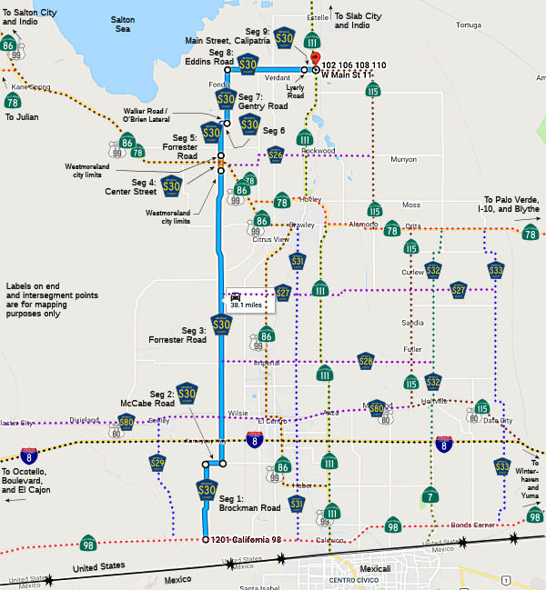 Brockman Road from Route 98 to McCabe Road (FAS, 5.20 mi)
McCabe Road from Brockman Road to Forrester Road (FAS, 0.98 mi)
Forrester Road from McCabe Road to the Westmoreland city limits (FAS, 19.39 mi)
Center Street in Westmoreland (FAS, 0.76 mi)
Forrester Road from the Westmoreland city limits to Walker Road / O'Brien Lateral (FAS, 2.27 mi)
Walker Road / O'Brien Lateral from Forrester Road to Gentry Road (FAS, 0.40 mi)
Gentry Road from Walker Road / O'Brien Lateral to Eddins Road (FAS, 3.50 mi)
Eddins Road from Gentry Road to Lyerly Road (FAS, 5.11 mi)
Main Street in Calpatria from Lyerly Road to Route 111 (FAS, 0.81 mi)
 History and Signage Information
This route was defined in 1970.
 Status
Total mileage: 38.42 mi.
© 1996-2020 Daniel P. Faigin.
Maintained by: Daniel P. Faigin
<webmaster@cahighways.org>.
 CR S29
 CR S31